
Kentucky 9 - AA Highway


The AA Highway overlays all of Kentucky 9 southeast from Wilder to Vanceburg. The highway separates into branches with the eastern spur overlapping with Kentucky 10 to Quincy and U.S. 23 at Ashland and the southern spur extending Kentucky 9 southeast to Kentucky 1 & 7 at Grayson. The 137 mile highway system varies as an expressway or arterial with four lanes or two lane stretches coupled with truck climbing lanes.
The northernmost section of KY 9 follows Licking Pike from I-275 to 12th Street and Central Avenue to KY 8 in Newport. The state route formerly traveled southward along all of Licking Pike to U.S. 27 south of Aspen Grove, with the section south of KY 10 representing the 1930s alignment of U.S. 27. KY 9 was reassigned in place of KY 546 over the AA Highway between Wilder and Grayson by November 1994. The renumbering of the AA Highway was based upon a single digit route holding more importance over a three-digit route.7
First named the Ashland to Alexandria Highway, the AA Highway is named for Governor John Y. Brown, Jr, proponent for the highway. The 93.5 mile highway was envisioned to run southeast from Campbell County to Quincy in Lewis County. Costing $310 million, the new route would only incorporate ten miles of existing roadway.2
Governor Brown proposed in the early 1980s that the AA Highway start at KY 8 and follow the Ohio River to an interchange with I-275 at Brent. Federal highway officials rejected that plan due to the steep grade of the freeway. Brown then shifted the AA Highway west end to the KY 9 interchange (Exit 77) with I-275, where work broke ground in 1983.2
Concerns from Campbell County residents followed, halting road work and gaining the attention of Governor Martha Layne Collins. She decided that the route should begin at I-275 and KY 8, but federal officials again nixed the proposed ramps due to safety concerns. The Collins administration opted for the former route to KY 9.2
Construction on the AA Highway in Bracken County was underway in November 1985 and work resumed in Campbell County in June 1986. The highway opened between KY 1996 (Carthage Road) and KY 547 (Four Mile Road) on November 27, 1990. The final five mile link between Four Mile Road and KY 9 (now KY 915) near Wilder opened on December 11, 1990. Led by Governor Wallace Wilkinson and Kentucky Transportation Secretary Milo D. Bryan, a caravan from Vanceburg to the interchange with U.S. 27 in Campbell County celebrated the completion of the 91 mile route. It was designated as Kentucky 5463
The AA Highway replaced Kentucky 10 as the main route linking Alexandria with Maysville. The state route was originally dedicated on October 3, 1929 with a motorcade traveling southeast from Newport to Maysville with ceremonies held along the way.1
As the section to Quincy was complete, progress was made on expanding the AA Highway south and eastward. Ground was broke on November 29, 1990 for a 16 mile branch of the AA Highway from Quincy to Greenup Dam. The $53 million eastern spur provides a direct link between the AA highway and U.S. 23 at Ashland.26
Separated in five phases, the $72 million south spur of the AA Highway from Vanceburg to Grayson went to bid in 1991.2 It was designated as Kentucky 690 when the first seven miles opened from Grayson north to Iron Hill.6
Both spurs for the AA Highway were finished in 1994. KY 10 was assigned to the Ashland spur while KY 690 was renumbered as an eastern extension of KY 9. A formal dedication ceremony took place to commemorate the finished route on December 15, 1994.7
The AA Highway was named to honor Governor John Y. Brown, Jr. by Governor Brereton Jones in October 1995. Costing $428 million, the AA Highway was the largest state-funded highway in Kentucky history when it was completed.4
Subsequent work at the north end of the AA Highway expanded and relocated Kentucky 9 at Wilder. A $9.4 million project on the state route previously began in 1992 but was stopped in July 1993 due to an embankment slipping. With stabilization options for the roadbed studied, costs increases to $24.4 million for the relocation and widening of a 2.3 mile section of KY 9 alongside the Licking River.8,9
Further realignment of Kentucky 9 north in Newport is underway as part of a three phase project. Work commenced in August 2014 on the Lowell Street section between 9th and 12th Streets. The second phase, started in February 2016, reconstructs 5th Street and adds roundabouts for the new KY 9 alignment and the Taylor Southgate Bridge (U.S. 27). It commenced in February 2016. The third phase, anticipated for 2017, will link the two segments.10
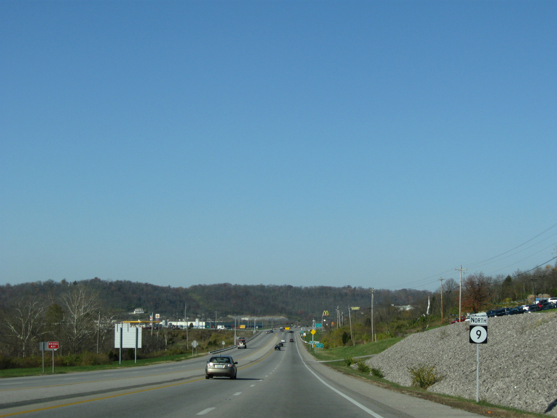
KY 9 reassurance marker posted along the AA Highway northbound after KY 915 (Licking Pike) and milepost 16.
11/08/09
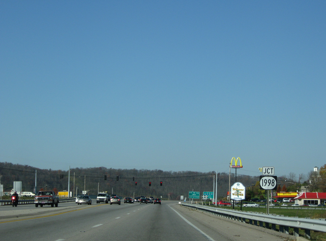
KY 1998 (Pooles Creek Road) follows the course of Pooles Creek west from the commercial corridor of U.S. 27 (Alexandria Pike) to end at the AA Highway.
11/08/09
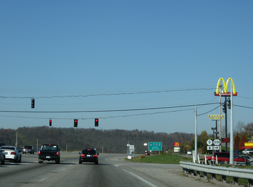
The signal at KY 1998 (Pooles Creek Road) serves Gloria Terrell Drive, a west side frontage road to an adjacent business and industrial park area.
11/08/09
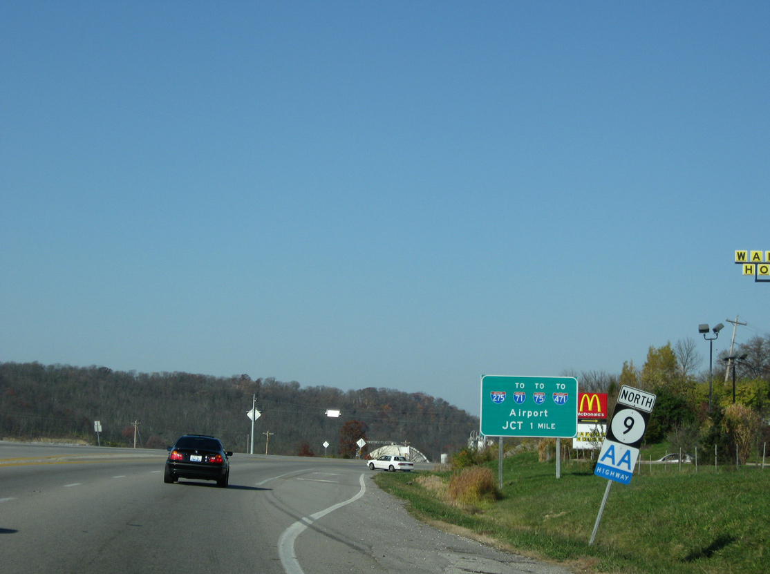
The last shield for the AA Highway northbound appears north of KY 1998.
11/08/09
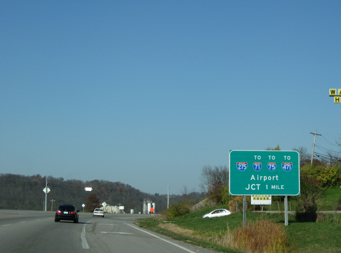
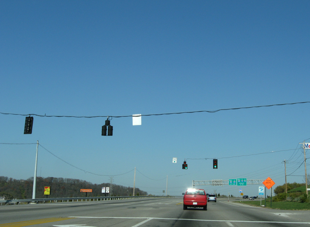
Forthcoming Interstate 275 connects the AA Highway terminus with I-71/75 to the west at Erlanger and I-471 to the east at Highland Heights.
11/08/09

Although an access controlled route, several traffic signals precede the AA Highway junction with Interstate 275. This array operates at Rosewood Drive.
11/08/09
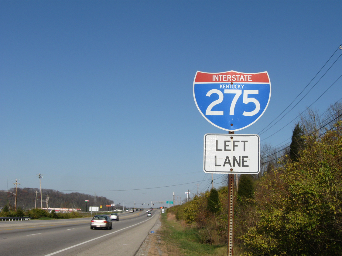
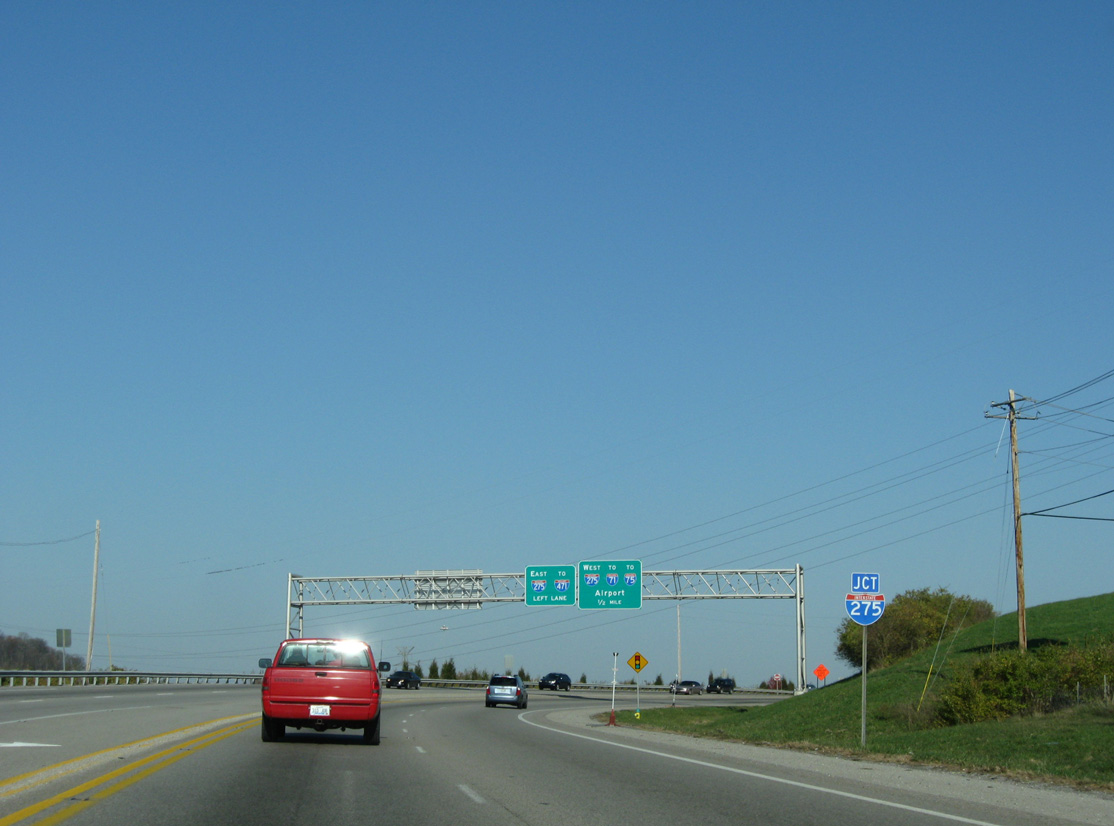
The folded diamond interchange with Interstate 275 sandwiches between the adjacent hillside and parallel Licking River. All ramp movements tie into the west side of KY 9.
11/08/09
Town Drive links the AA Highway with the City of Wilder - Town Drive Business District, an array of traveler services, industrial businesses and a movie theater.
11/08/09
Turning northeast, KY 9 transitions from the AA Highway to Licking Pike. This stretch was straightened out and widened during the mid-1990s.
11/08/09
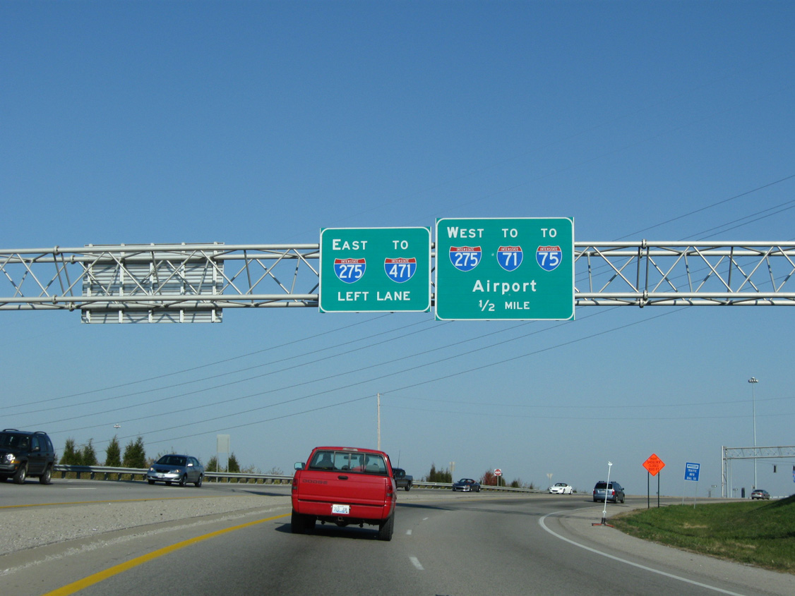
The succeeding turn takes motorists from KY 9 north onto I-275 east to Interstate 471 north to Southgate, Newport and Cincinnati. Interstate 275 west traverses suburban areas of Erlanger and Fort Mitchell to Cincinnati / Northern Kentucky International Airport (CVG).
11/08/09
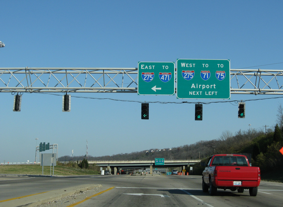
Interstate 275 arcs northeast by Northern Kentucky University (NKU) to I-471. The beltway crosses the Ohio River Bridge east from there to California in southeast Cincinnati.
11/08/09
The AA Highway begins at I-275 in the city of Wilder. The controlled access highway travels southeast 84 miles to the split into the Ashland and Grayson spurs.
11/08/09
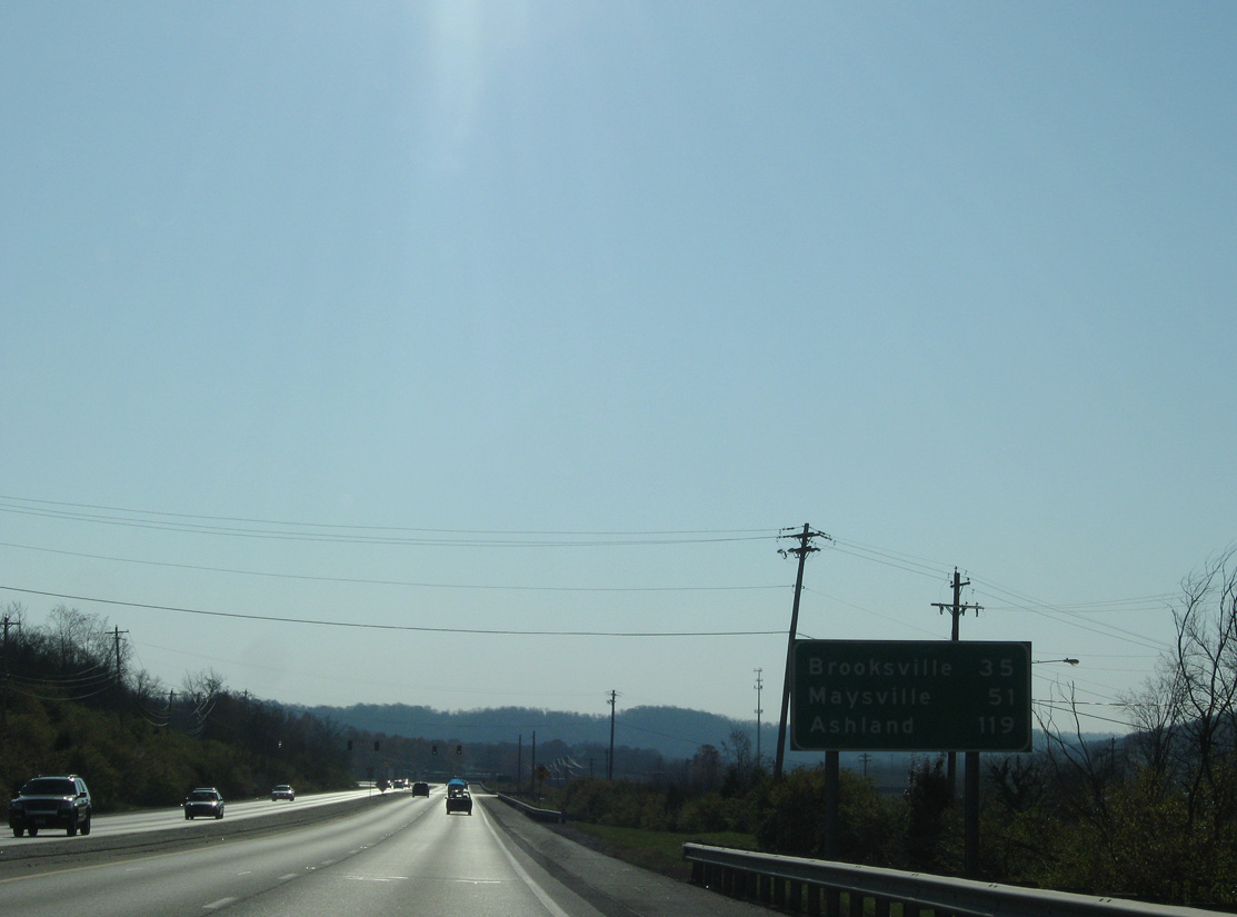
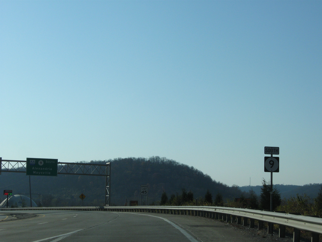
KY 9 / AA Highway angle southeast from Wilder to the city of Alexandria. The expressway joins Northern Kentucky with the Bracken County seat of Brooksville in 35 miles and the Ohio River city of Maysville in 51 miles.
11/08/09
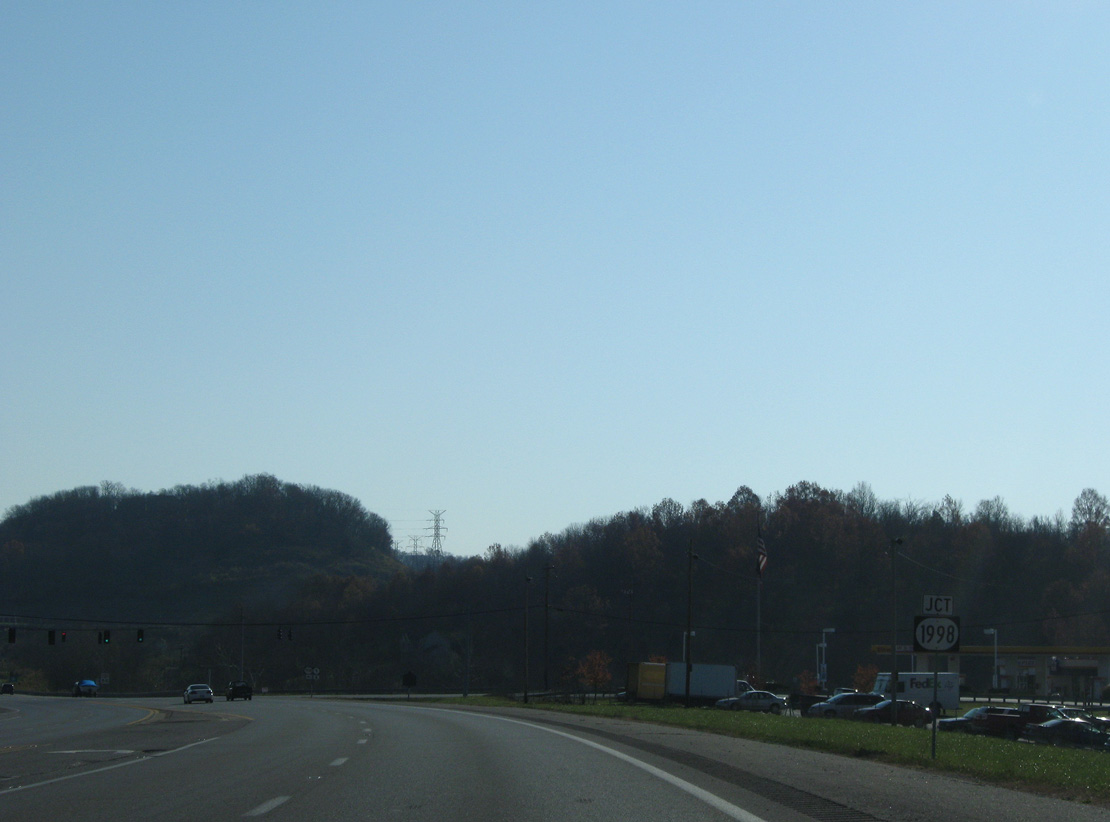
Continuing beyond the Town Drive Business District, KY 9 (AA Highway) curves east toward the signalized intersection with KY 1998 (Pooles Creek Road) east and Gloria Terrell Drive west.
11/08/09
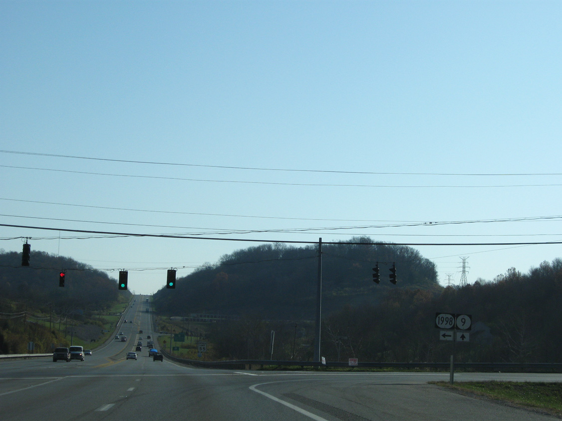
KY 1998 traverses the adjacent hills northeast to U.S. 27 (Alexandria Pike) through the city of Cold Spring. The 3.94 mile route ends at KY 8 (Mary Ingles Highway) south of Brent on the Ohio River.
11/08/09
Confirming markers for the AA Highway and KY 9 posted after KY 1998.
11/08/09
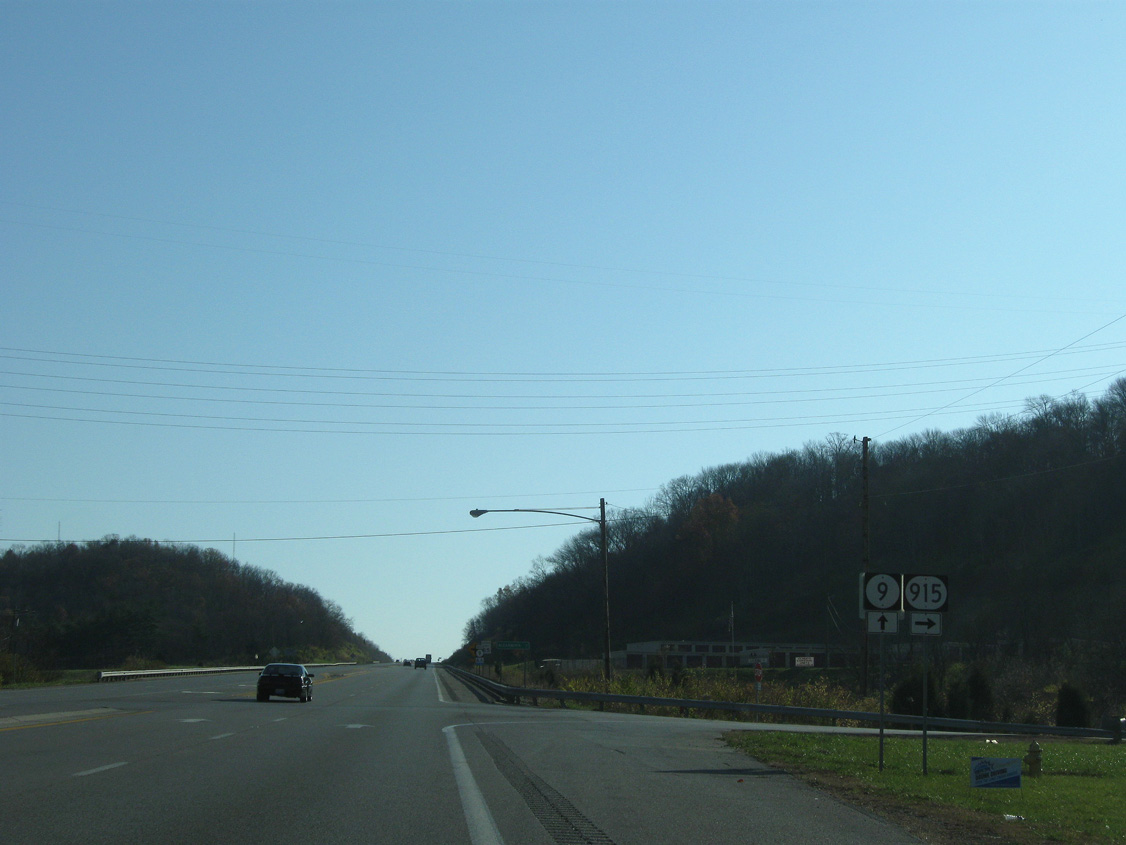
Entering the city of Cold Spring, KY 9 next meets the north end of KY 915 (Licking Pike).
11/08/09

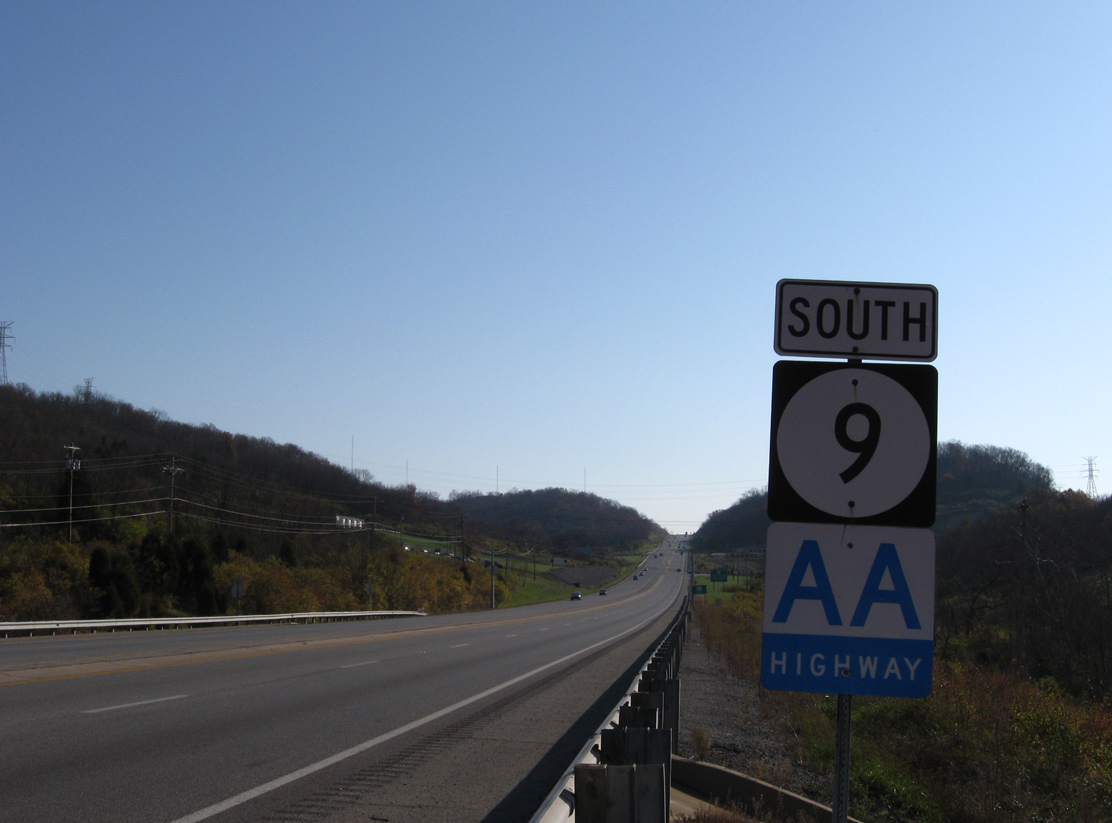
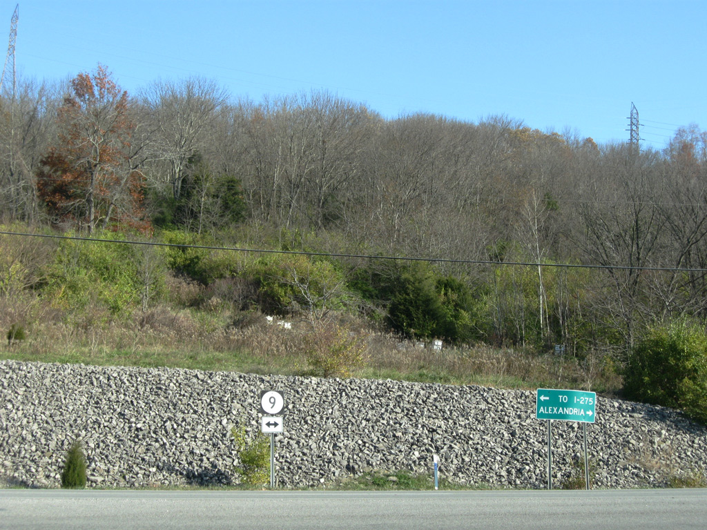
KY 915 south from Pools Creek represents the former alignment of KY 9 to U.S. 27 at Claryville. It was designated in 1994 when KY 9 shifted east onto the AA Highway.
11/08/09
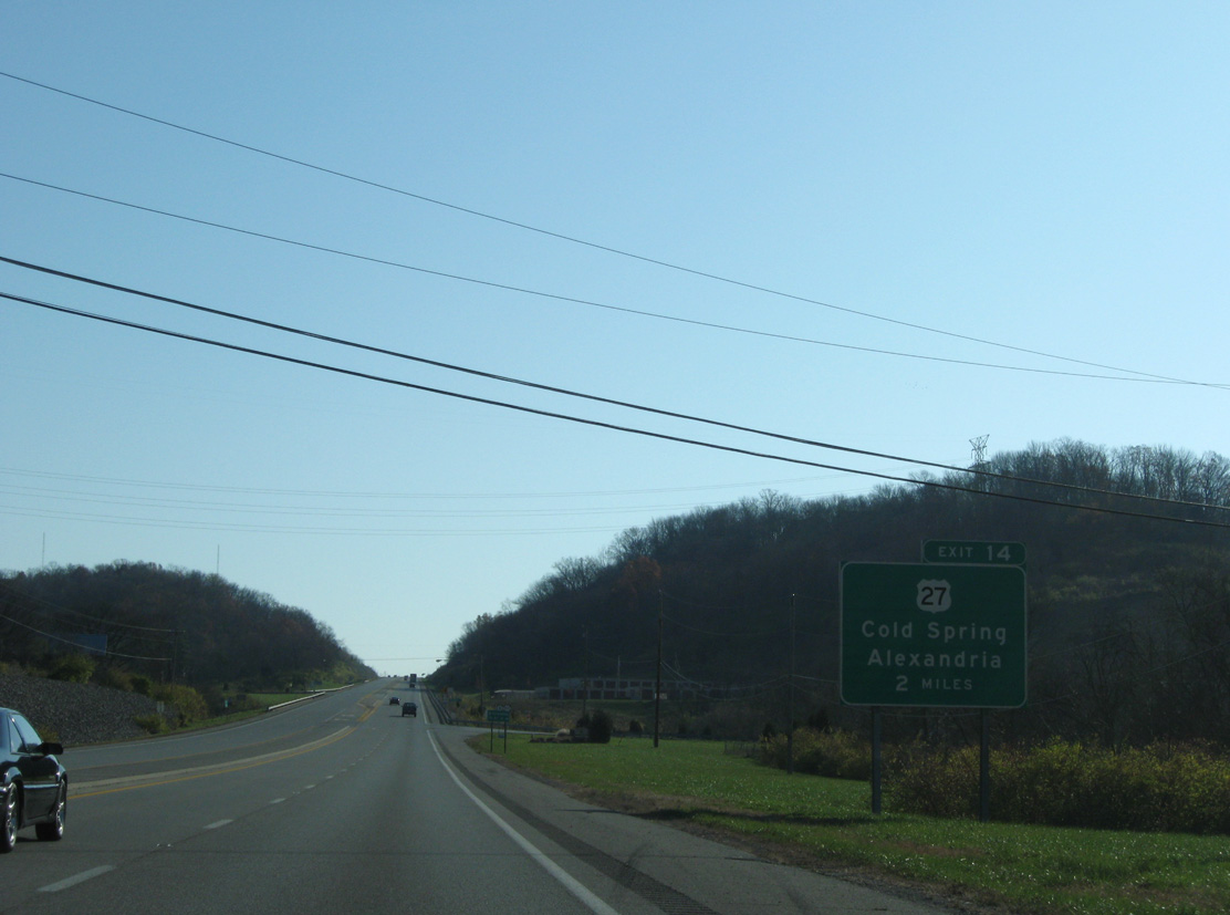
A parclo A2 interchange (Exit 14) joins the AA Highway with U.S. 27 (Alexandria) two miles beyond KY 915 in south Cold Spring.
11/08/09
The 9.30 mile route of KY 915 navigates along a winding course through hills paralleling the Licking River.
11/08/09
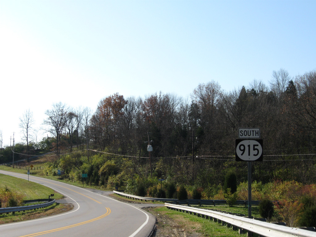
The first reassurance marker for KY 915, the former alignment of KY 9 south from Cold Spring.
11/08/09
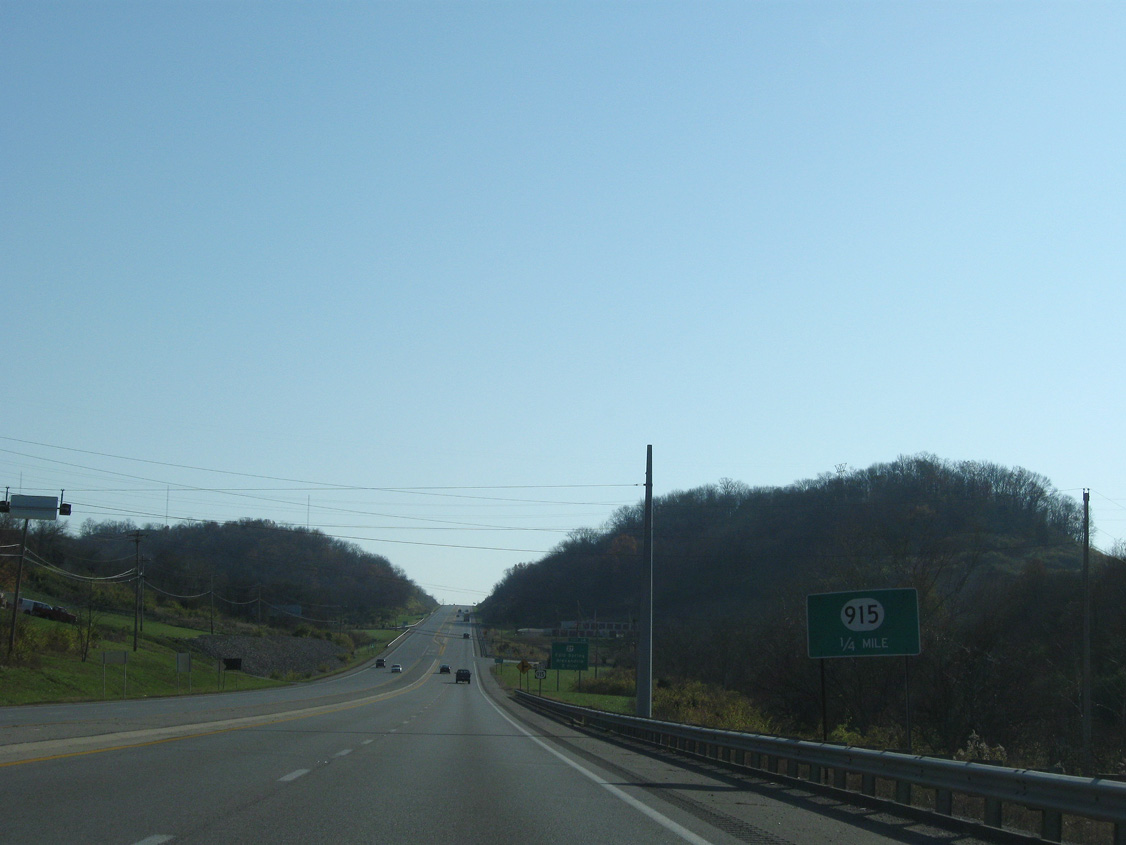
KY 915 (Licking Pike) ends at KY 9 / AA Highway, 1.6 miles south of I-275. Construction of the AA Highway replaced the old alignment of Licking Pike northward to Wilder. Two stretches of old KY 9 remain in use nearby along Saint Johns and Steffen Lanes.
11/08/09
References:
- "Road construction in Northern Kentucky accelerated in 1929." The Kentucky Post, September 27, 1990.
- "AA Highway Nearly Ready for Traffic - Ribbon Cutting Within 2 Weeks." Kentucky Post, The (Covington, KY), November 29, 1990.
- "Dignitaries Roll Out Praise for the 'AA' - Caravan Opens Highway Link to East." Kentucky Post, The (Covington, KY), December 12, 1990.
- "Brown credited for AA Highway." The Kentucky Post, November 7, 1995.
- "AA Highway construction ahead of schedule." The Kentucky Post, October 18, 1993.
- "Road clear, number not - It was Ky. 546 - now it's Ky. 9." The Kentucky Post, November 30, 1994.
- "Licking Pike work to resume." The Kentucky Post, October 6, 1994.
- "Rebuilding Ky. 9 to cost $24.4 million - Sliding Campbell County road needs bridge, retaining walls." The Kentucky Post, December 7, 1994.
- "Second phase of KY-9 expansion in Newport begins construction." Campbell County, Kentucky, news release. February 11, 2016.
Photo Credits:
- ABRoads: 11/08/09
Connect with:
Page Updated Friday September 23, 2016.