
Route 18
New Jersey Route 18 originates in Wall township in Monmouth County as a freeway. The limited access portion leads north through Neptune and Ocean townships to Eatontown and a western turn to Tinton Falls, Coits Neck township and Marlboro township. Route 18 downgrades to an at-grade highway through Old Bridge township northwest to East Brunswick township. The state route culminates as an expressway through the city of New Brunswick, along the Raritan River, and as a freeway into Piscataway township. The 40.16 mile route concludes at the freeway end at Buckingham Drive.
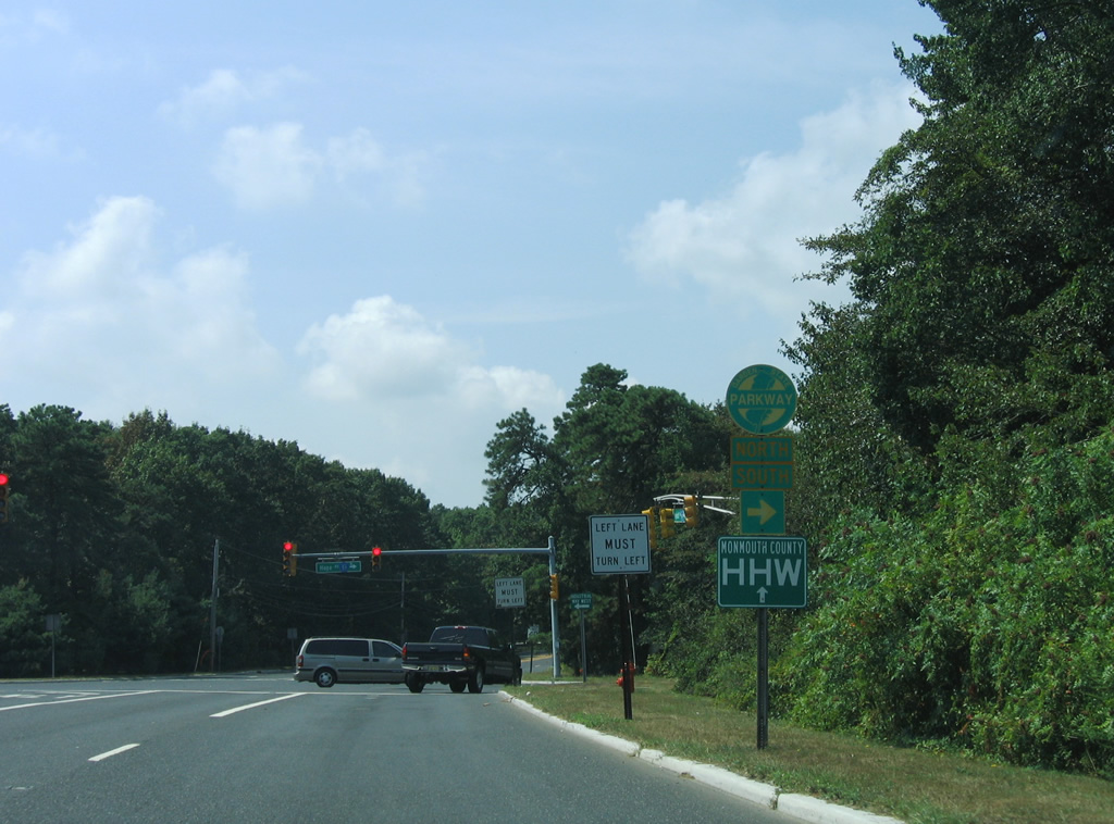
The end of the freeway along Route 18 at Route 138 in Wall Township included provisions for an extension southward to the borough of Brielle. The unconstructed portion of Route 18 was planned to run south to the junction of Route 34, Route 35 and Route 70. The loop ramp from Route 138 east to Route 18 however was closed when the former cloverleaf interchange was modified into a trumpet interchange in 2003 (Anderson, n.d.).
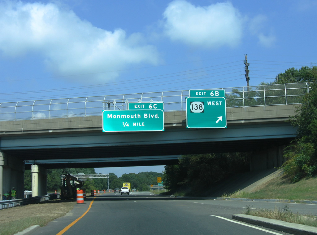
Passing under Route 138, the northbound beginning of Route 18 has a loop ramp (Exit 6 B) for Route 138 west. This is a leftover from the unconstructed alignment of Route 18 north from Brielle. Roadway stubs remain just south of the former three quarter cloverleaf interchange.
08/29/05

A half diamond interchange (Exit 6 C) follows with Monmouth Boulevard at the New Bedford residential street grid.
08/29/05
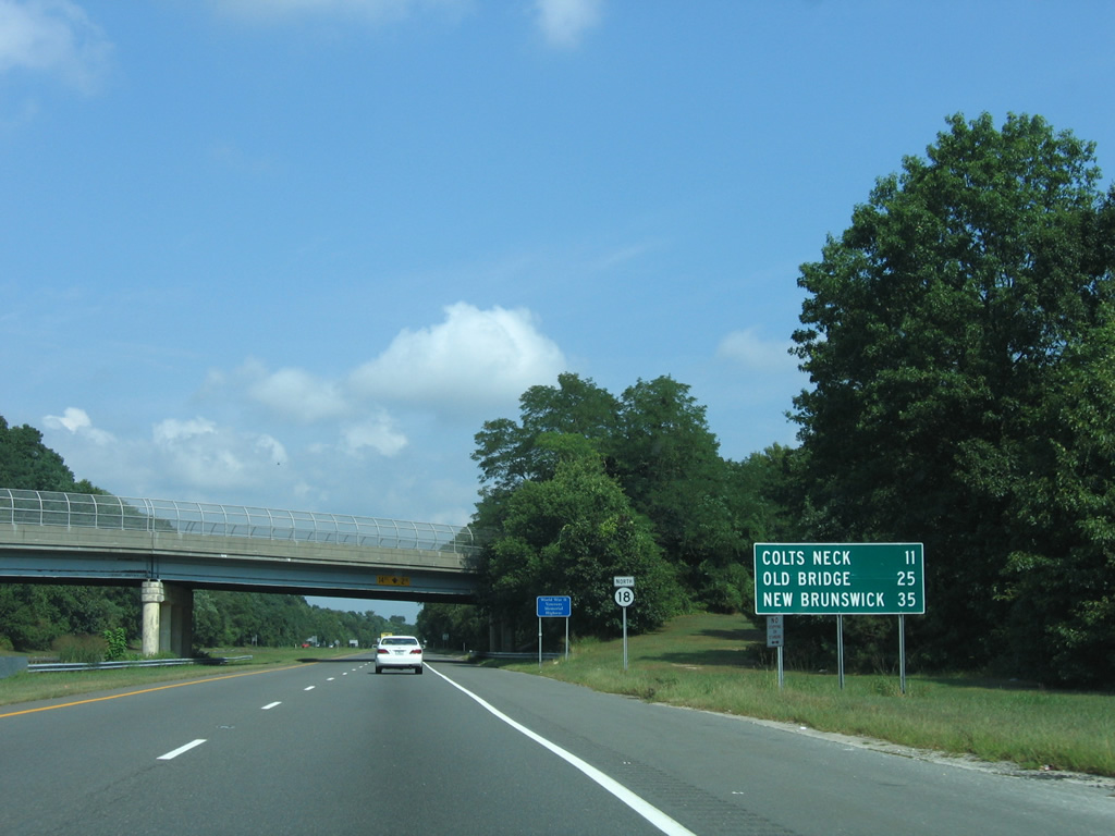
A distance sign appears ahead of the Monmouth Boulevard overpass for Colts Neck Township (11 miles), Old Bridge Township (25 miles) and the city of New Brunswick (35 miles).
08/29/05
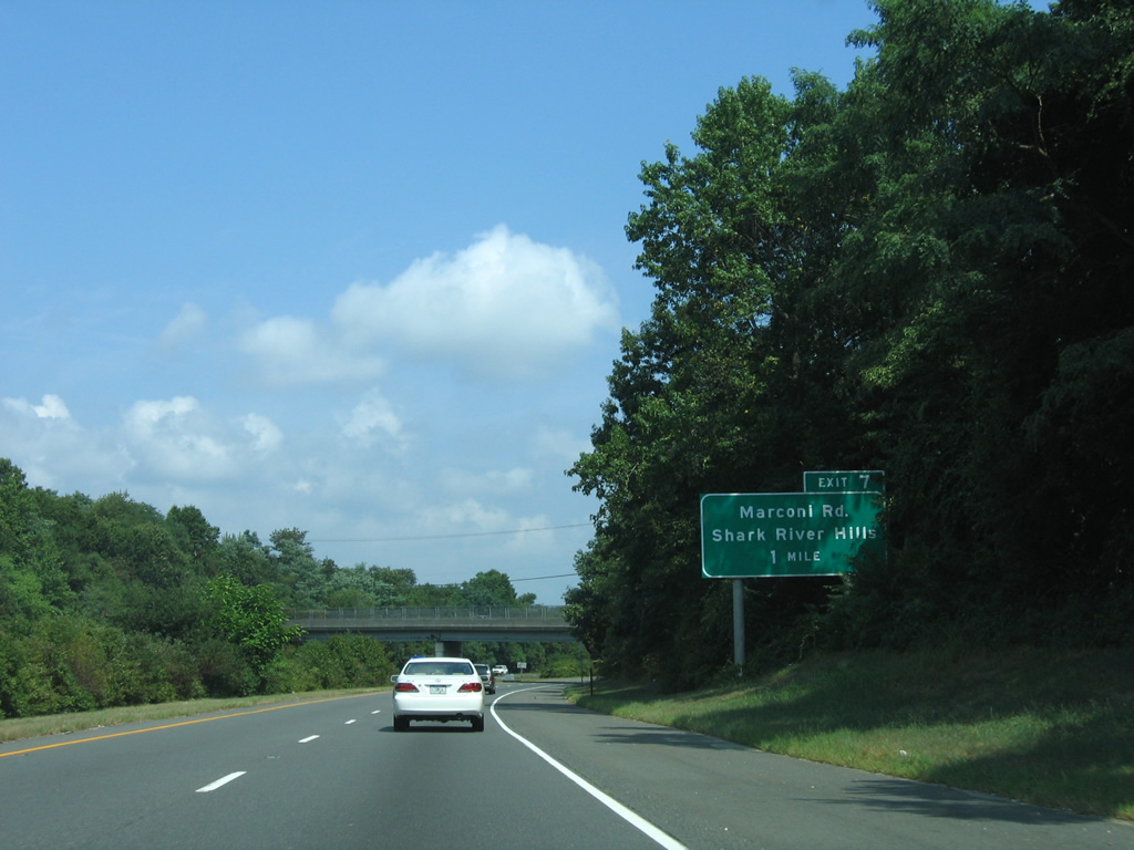
The Route 18 freeway has a 65 mile per hour speed limit where it curves northeast toward a parclo interchange (Exit 7) with Brighton Avenue and Marconi Road.
08/29/05
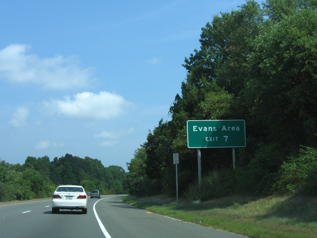
The Evans Area of Fort Monmouth, a former military installation east of Route 18 and south of Brighton Avenue, became part of Brookdale Community College and the Camp Evans National Historic Landmark.
08/29/05
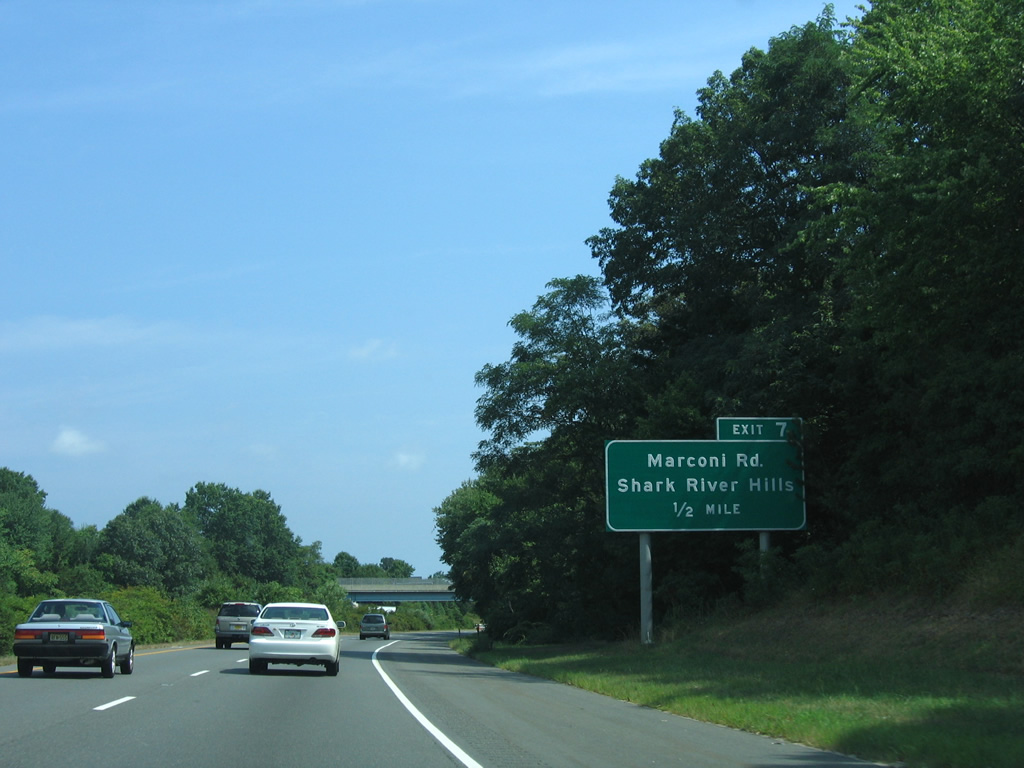
Brighton Avenue passes over Route 18 east from Glendola to cross the Shark River into the Shark River Hills community of Neptune Township.
08/29/05
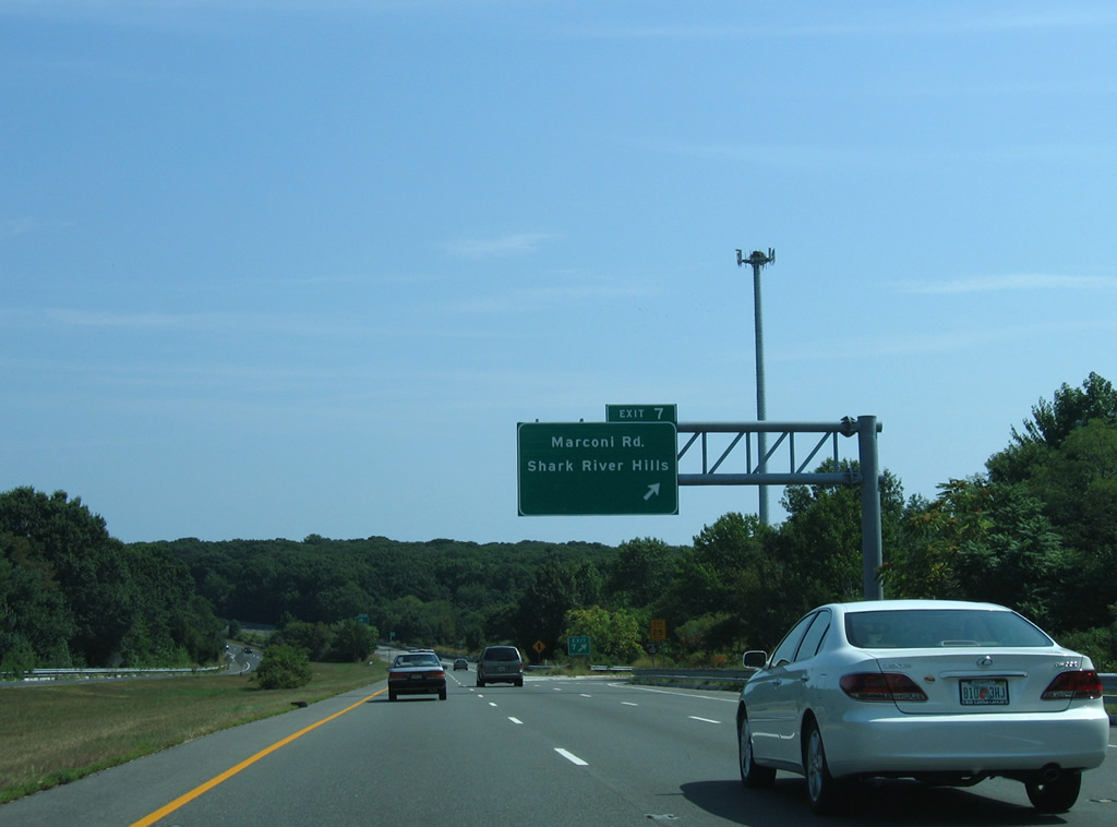
Marconi Road stems south from Exit 7 and Brighton Avenue through residential areas west of the Shark River and north of Route 138.
08/29/05
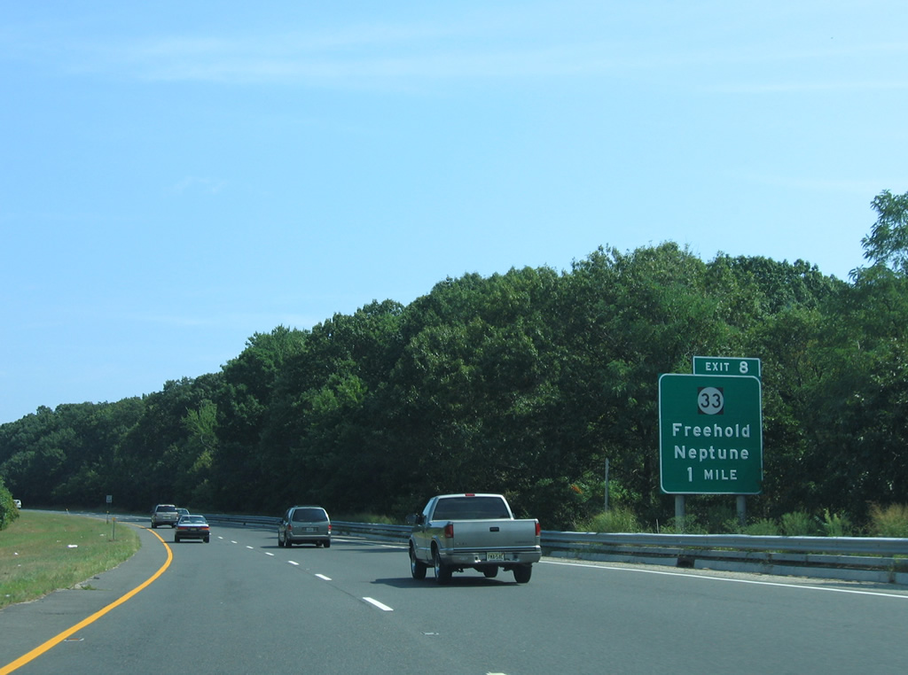
Route 18 north crosses the Shark River into Neptune Township ahead of a three quarter cloverleaf interchange (Exit 8) with Route 33 (Corlies Avenue).
08/29/05
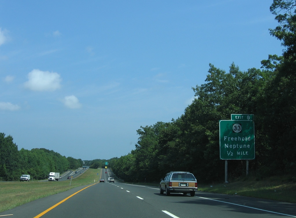
Route 33 runs 42.03 miles west from Route 71 at Ocean Grove to U.S. 1 outside Downtown Trenton. The state route links Neptune Township and borough with Tinton Falls and Freehold to the west.
08/29/05
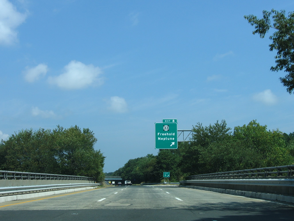
Exit 8 loops away from Route 18 north to Route 33 (Corlies Avenue) and Brighton Avenue south. Route 33 heads east to Route 71 outside Asbury Park while Brighton Avenue connects Exit 8 with Sylvania Avenue (CR 17) east into the borough of Neptune.
08/29/05
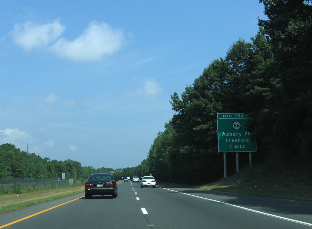
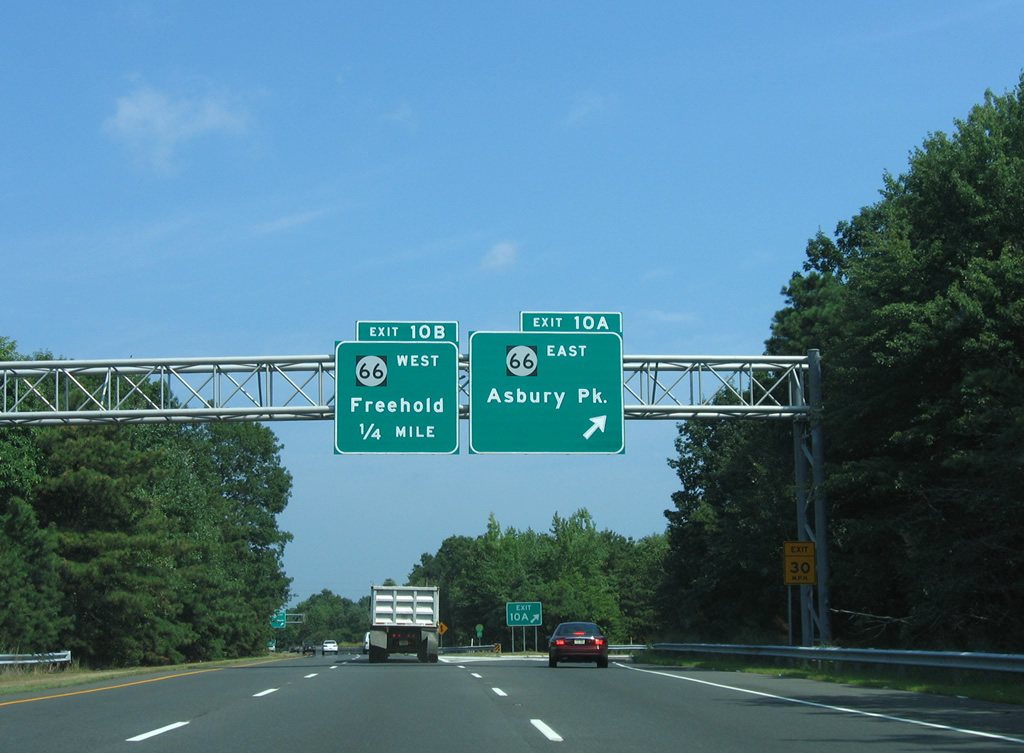
Continuing north, Route 18 passes between two neighborhood areas en route to a cloverleaf interchange (Exit 10) with Route 66 (Asbury Avenue).
08/29/05
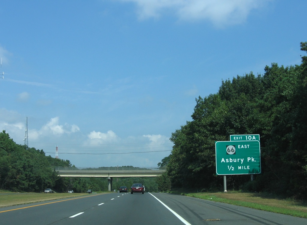
Exit 10 A departs one half mile north of the Bangs Avenue (CR 17) overpass for Route 66 (Asbury Avenue) east. Route 66 travels 3.62 miles east from Route 33 at Tinton Falls to Route 35 outside Asbury Park.
08/29/05
Route 66 passes by the former Seaview Square Mall to end nearby at Route 35 opposite CR 16 (Asbury Avenue) east into Asbury Park.
08/29/05
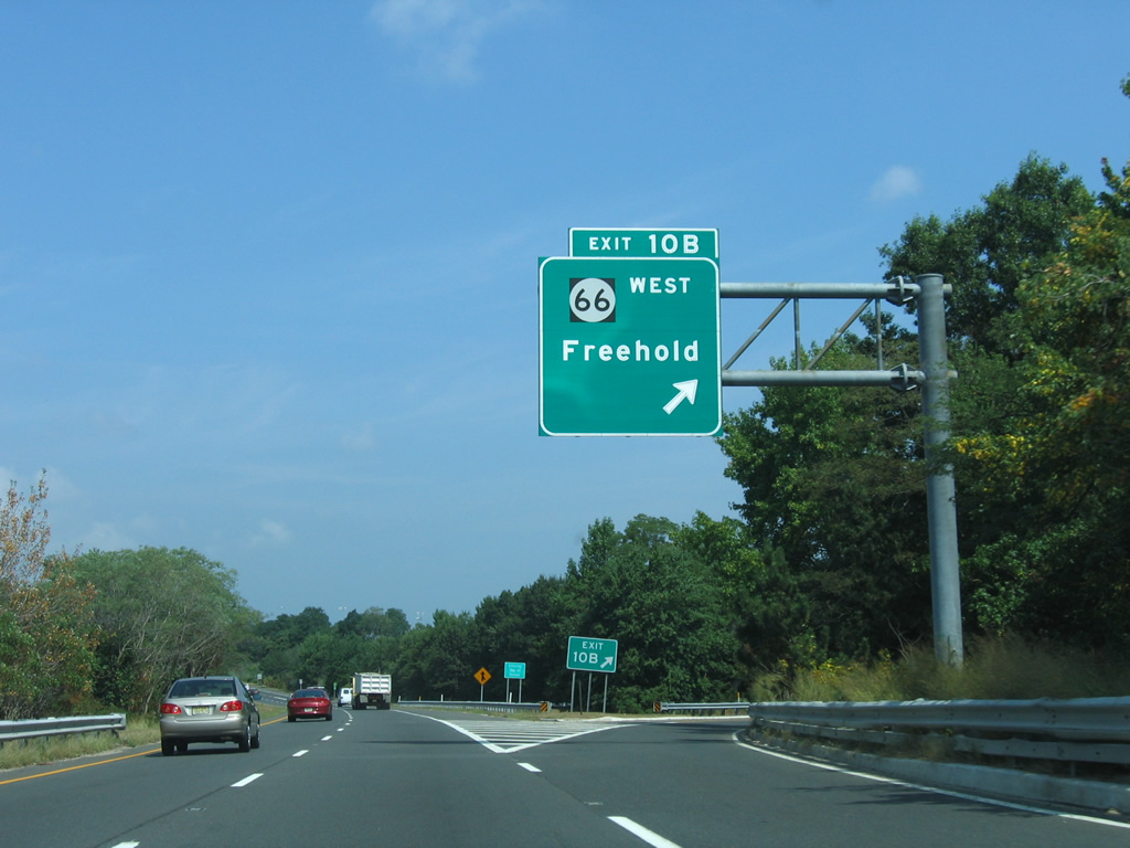
Exit 10 B leaves Route 18 north for Route 66 (Asbury Avenue) west. Route 66 splits with Asbury Avenue (CR 16) for a southward turn to Route 33 ahead of Freehold.
08/29/05
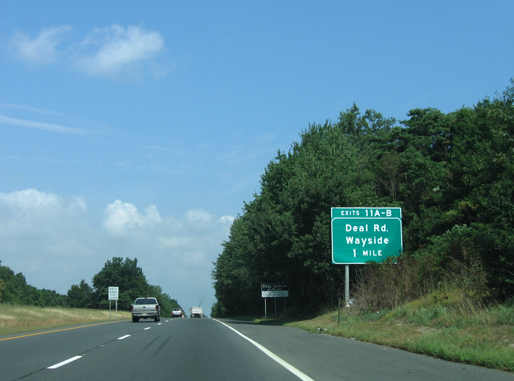
Route 18 enters Ocean Township north of Route 66 ahead of Exits 11 A/B to Deal Road.
08/29/05
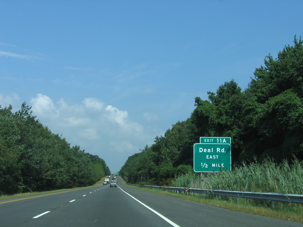
Deal Road east from Exit 11 A heads to Route 35 at Wertheins Corner and Monmouth Road (CR 15) at Deal Park.
08/29/05
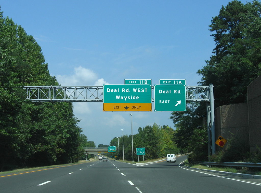
Partial interchanges join Route 18 with Deal Road and Park Avenue in Ocean Township. Poplar Road joins the two residential roads to the east.
08/29/05
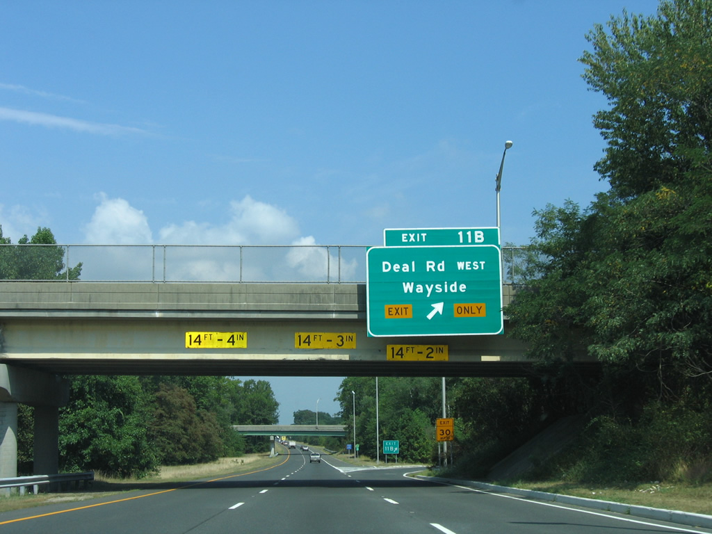
The directional ramp at Exit 11 B leads westward from Route 18 north onto Deal Road west near Cold Indian Springs. Deal Road ties into Green Grove Road on the Tinton Falls borough line.
08/29/05

A northbound shield assembly for Route 18 precedes the Park Avenue overpass and on-ramps.
08/29/05
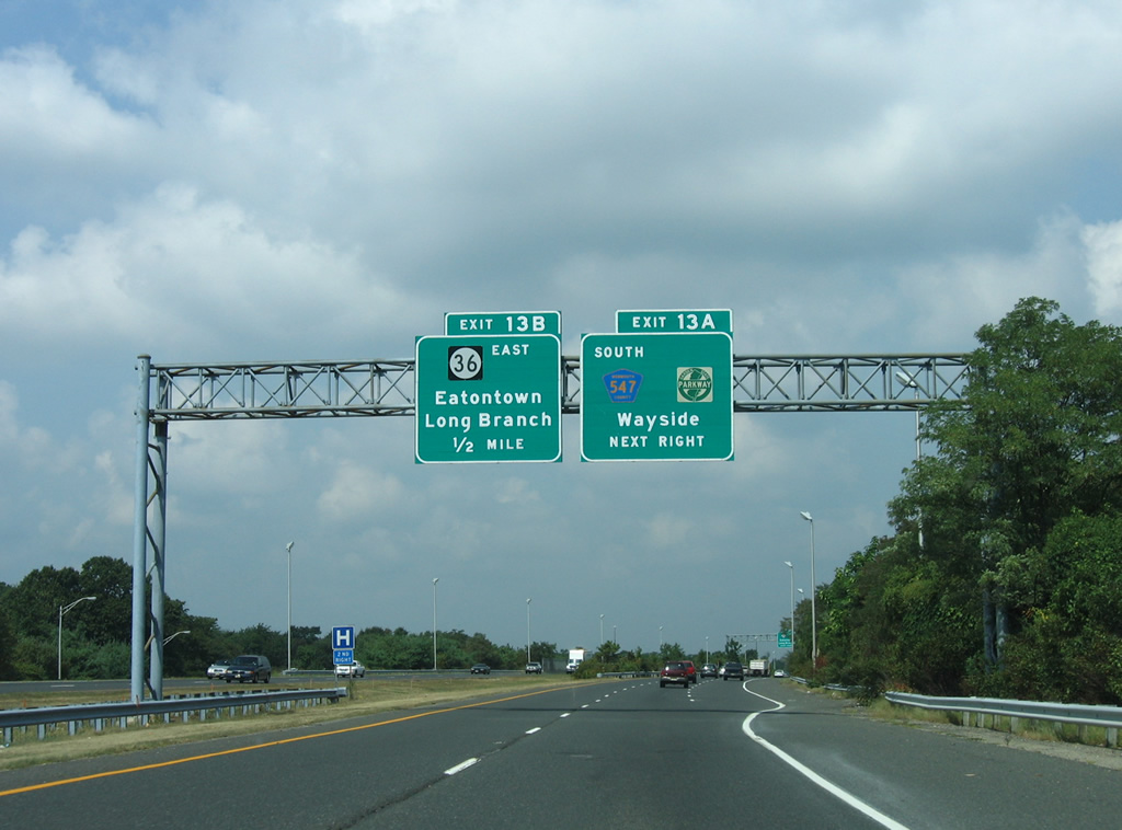
Route 18 curves northwest to cross Cranberry Brook into the borough of Eatontown. A loop ramp follows onto CR 547 south to CR 51 (Hope Road) at Wayside. There is no direct access from Route 18 to the Garden State Parkway (GSP); Hope Road north to Route 36 provides the connection.
08/29/05
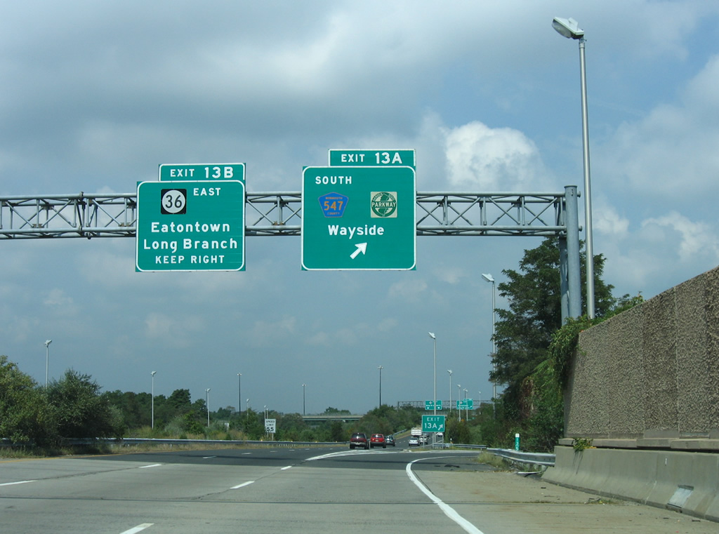
Exit 13 A loops onto County Route 547 south to Wayside and Tinton Falls. The 28.29 mile long route angles southwest from Route 71 in Eatontown to Route 70 at Lakehurst.
08/29/05

Route 18 commences eastbound along Centennial Avenue from the southbound ramps with Interstate 287 at Exit 8 in Piscataway Township.
10/10/14

Possumtown Road connects the west end of Route 18 and Centennial Avenue with northbound Interstate 287.
10/10/14

Route 18 (Centennial Avenue) curves eastward across Ambrose Brook from Possumtown Road.
10/10/14

Route 18 (Centennial Avenue) continues east to Old New Brunswick Road north and Hoes Lane south.
10/10/14

Route 18 turns south across Ambrose Brook again along Hoes Lane toward the Rutgers University Busch Campus.
10/10/14
Knightsbridge Road arcs 0.6 miles southeast from the ramps connecting I-287 southbound with Route 18 at Centennial Avenue to Hoes Lane across from Behmer Road to Piscataway High School.
10/10/14

Route 18 (Hoes Lane) south at Ericsson Drive.
10/10/14

Hoes Lane south at the formerly signalized intersection with Park Avenue west.
10/10/14

Morris Avenue west and Hoes Lane W come together at Route 18 (Hoes Lane) by a pedestrian bridge built in 2014/15.
10/10/14

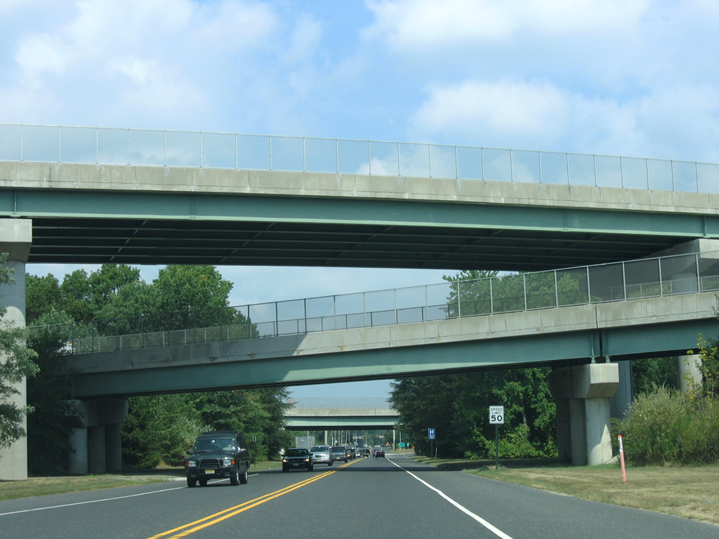
Route 18 upgrades to an expressway bypassing the Rutgers University Busch Campus. Parallel Davidson Road meets Route 18 at the ensuing exit in a half mile.
10/10/14

Davidson Road east crosses Route 18 to become Avenue E to the Rutgers University Livingston Campus at Metlars Lane north.
10/10/14

Buckingham Drive ties into the northbound lanes of Route 18 (Hoes Lane E) at a RIRO intersection just ahead of the exit for Davidson Road.
10/10/14

Metlars Lane (CR 609) heads 2.45 miles north from Route 18 and Davidson Road to CR 529 (Stelton Road) along the South Plainfield borough line.
10/10/14

Avenue E extends 1.17 miles east from Davidson Road and the parclo interchange with Route 18 to Road 3 in the Rutgers University Livingston Campus.
10/10/14

The expressway along Route 18 curves southward from Davidson Road between the Busch and Livingston Campus of Rutgers University.
10/10/14

Campus Road stems west from a trumpet interchange with Route 18 southbound in a half mile.
10/10/14

Campus Road ties into a roundabout with Scarlet Knight Way south, Bartholomew Road north, and Frelinghuysen Road north, 0.42 miles from Route 18.
10/10/14

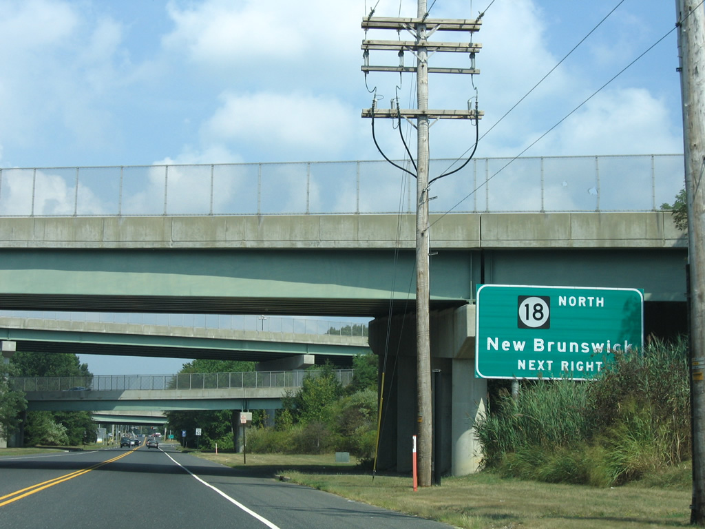
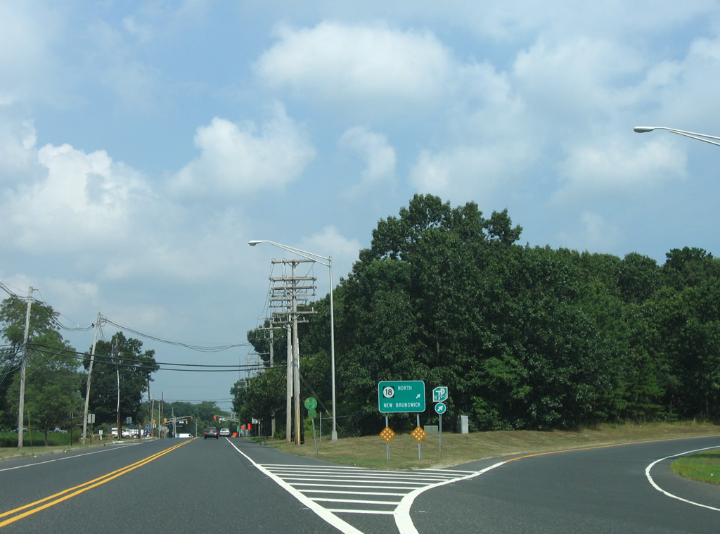
River Road (CR 622) joins Route 18 with the borough of Highland Park. A parclo interchange links the two routes north of the Raritan River.
10/10/14
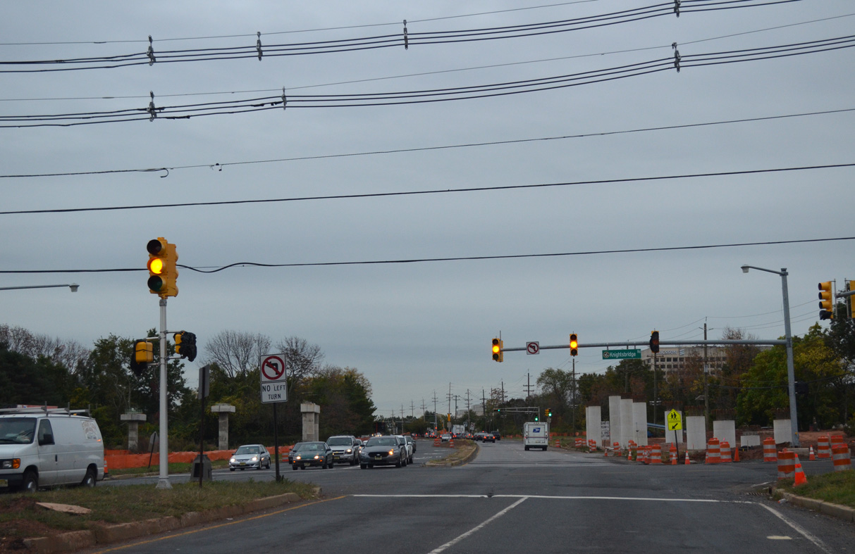
Route 27 (Albany Street / Raritan Avenue) crosses Route 18 by Downtown New Brunswick. There is no direct access to Route 27 from the expressway southbound.
10/10/14

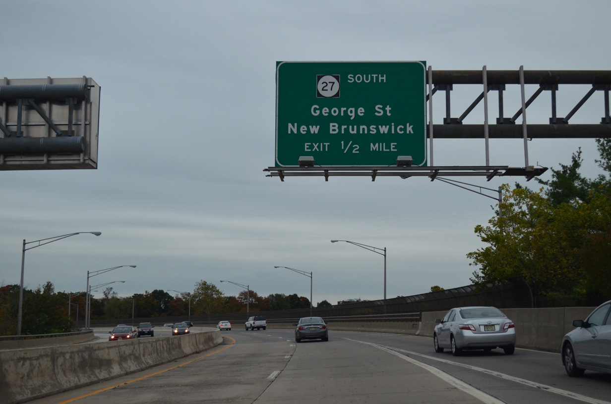
The exit for Route 27 south connects with adjacent George Street (CR 672), 0.82 miles north of Route 27 along Albany Street.
10/10/14

George Street runs along the College Avenue Campus of Rutgers University south to Route 27 (Albany Street) ahead of Downtown New Brunswick. Route 27 heads northeast to Metuchen and southwest to Princeton.
10/10/14
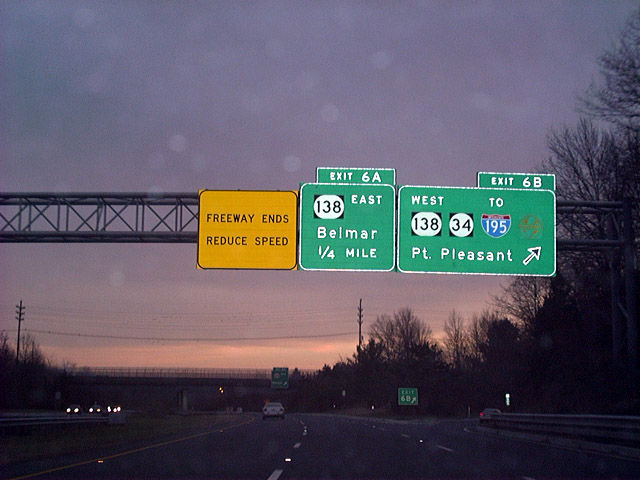
Route 18 southbound concludes at a trumpet interchange with Route 138 in Wall township. Route 138 constitutes a four lane highway west to the Garden State Parkway and I-195 and east to Route 35.
Incomplete plans for Route 18 south took the freeway to Route 34, Route 35 and Route 70 outside the borough of Brielle. Route 138 west to Route 34 leads motorists along that planned route toward Point Pleasant.
12/23/01
Route 18 turns west at Eatontown through Tinton Falls and Colts Neck Township after CR 547. The freeway passes over the Garden State Parkway along this stretch, but without direct access. Ramps join the GSP with the west end of Route 36 instead, with Hope Road (CR 51) connecting them with Route 18. This scene looks at CR 547 south between Exit 13 A and Hope Road north.
08/29/05
Hope Road (CR 51) leads north from CR 547 to a loop ramp for Route 18 north to New Brunswick.
08/29/05
A three-wye interchange above Hope Road joins Route 18 with ramps to Route 36 from the city of Long Branch.
08/29/05
The ramp to Route 18 joins the ramp from Route 36 west ahead of the freeway across the Garden State Parkway into Tinton Falls. A New Jersey Turnpike trailblazer appears here for the Route 18 interchange at New Brunswick.
08/29/05
A short distance further north along Hope Road (CR 51) is the signalized intersection with Route 36. Route 36 concludes a circuitous 24.40 mile long course at the Garden State Parkway to the west.
08/29/05
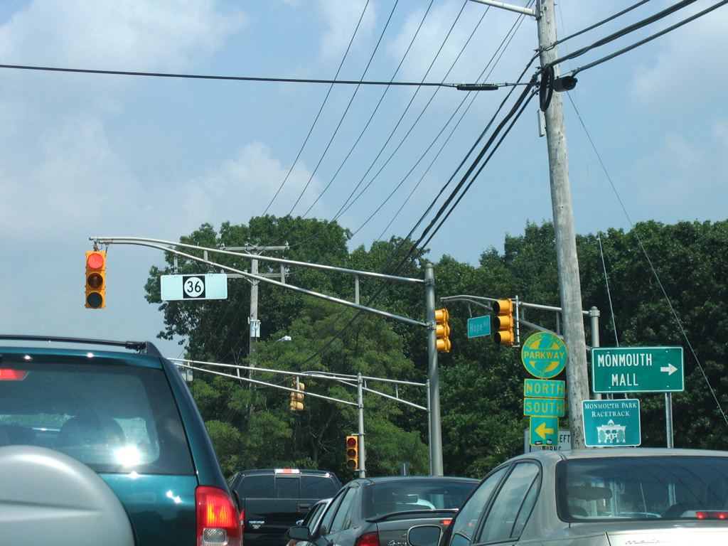
Route 36 west provides access to the Garden State Parkway north to Woodbridge and Newark and south to Atlantic City and Cape May. Route 36 east continues through Eatontown to Monmouth Mall and the borough of West Long Branch.
08/29/05
References:
Anderson, S. (n.d.). NJ 18 Freeway. NYCRoads.com. http://www.nycroads.com/roads/NJ-18/
Photo Credits:
- AARoads: 08/29/05
- Alex Nitzman: 12/23/01, 10/10/14
Connect with:
Page Updated Thursday April 24, 2014.