
State Route 264
Nevada State Route 264 extends 33.6 miles north from the end of California State Route 266 in Fish Lake Valley to U.S. 6 in Esmeralda County. Traveling through a mix of open desert and agriculural areas, SR 264 takes a fairly linear route north from Mono County, California to the unincorporated town of Dyer. Beyond the lone population center on SR 264, the highway turns north, paralleling the eastern foothills of the White Mountains.
Heading out of Fish Lake Valley, SR 264 meets SR 773, which branches 10.5 miles northeast to connect with U.S. 6 east to Coaldale and U.S. 95. SR 264 angles northwest across the Volcanic Hills to connect with U.S. 6 a mile and a half east of the Mineral County line.
 North
North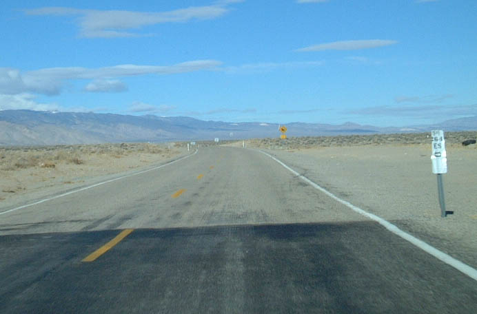
Postmile 0.0 for SR 264 in Esmeralda County, Nevada accompanies the pavement change where SR 266 in Mono County, California ends.
01/19/02
SR 264 proceeds north through Fish Lake Valley toward the Volcanic Hills. The only town in the valley is Dyer, which is billed as a tourist destination and gateway to Yosemite National Park. An older billboard along SR 264 advertised the notion of Dyer as a gateway. However, there is no true direct route from there to Yosemite.
01/19/02
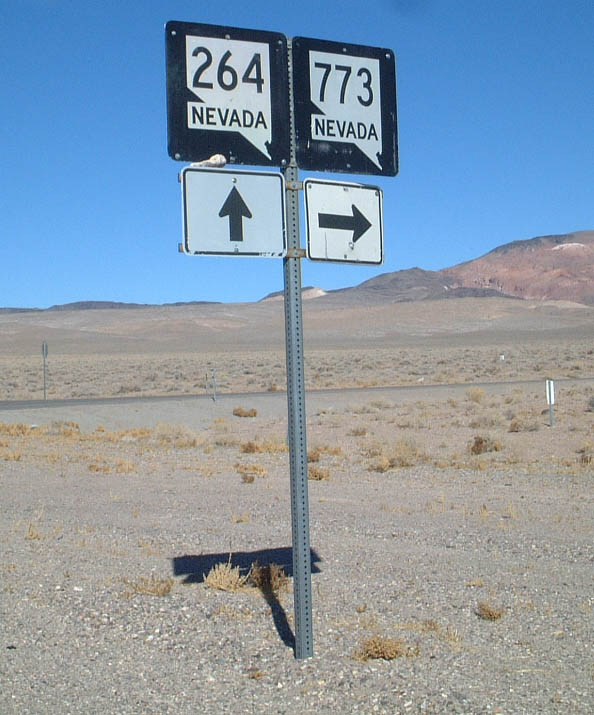
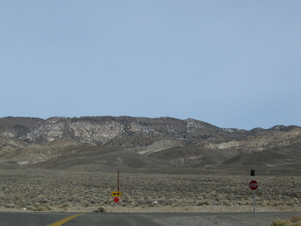
Northbound SR 264 partitions with SR 773 ahead of the Volcanic Hills. SR 264 turns northwest from this point to connect with U.S. 6 west to Bishop, California. SR 773 leads northeast to connect with U.S. 6 east to U.S. 95 and Tonopah.
01/19/02
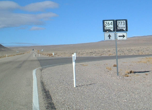
SR 773 circumvents the Volcanic Hills northeast along a 10.49 mile course to U.S. 6.
01/19/02
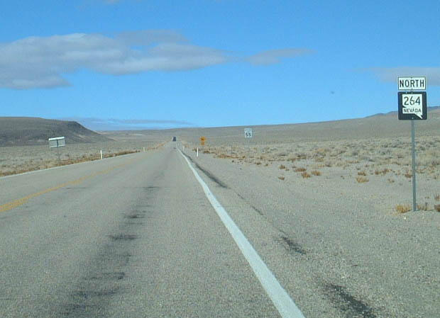
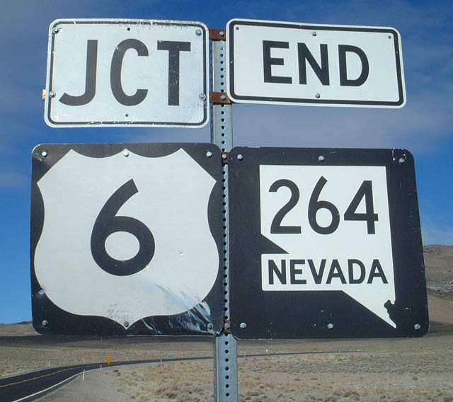
The final reassurance marker for SR 264 north appears as the highway shifts northwest 8.2 miles to U.S. 6.
01/19/02
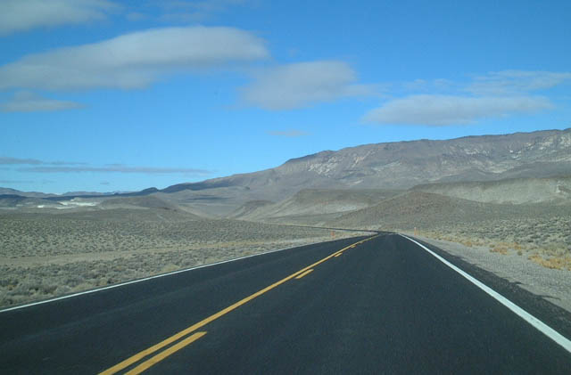
A wide open stretch of SR 264 unfolds on the drive north from Fish Lake Valley across the Volcanic Hills.
01/19/02
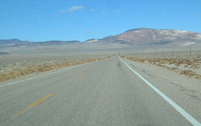
SR 264 lowers into a valley from the Volcanic Hills ahead of U.S. 6.
11/11/08
01/19/02
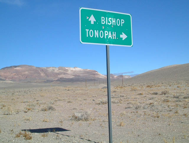
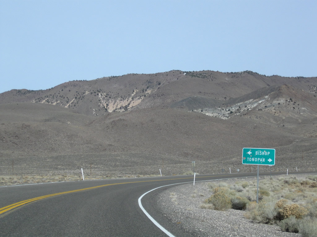
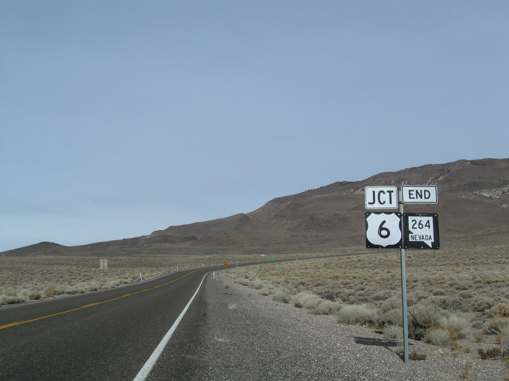
U.S. 6 arcs southwest from SR 264 to SR 360 north to Hawthorne, and Montgomery Pass to Queen Valley. The route continues south into Mono County, California, traveling from Benton to U.S. 395 at Bishop.
11/11/08
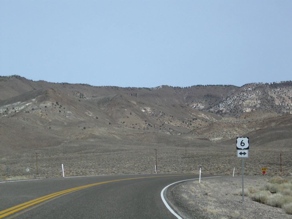
East from SR 264, U.S. 6 parallels Pinchot Creek through a valley separating the south slope of Miller Mountain with the Volcanic Hills en route to Coaldale. Tonopah lies 57 miles to the east via the U.S. 6/95 overlap.
11/11/08
Miller Mountain (el. 8,729 feet) rises beyond the stop sign intersection where SR 264 ends.
11/11/08
South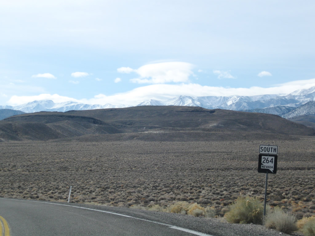
Leaving the intersection with U.S. 6 (Grand Army of the Republic Highway), SR 264 proceeds southeast and traverses the west side of the Volcanic Hills. Rising to the south is massive Boundary Peak (el. 13,145 ft).
11/11/08
Photo Credits:
- Andy Field: 01/19/02
- AARoads: 11/11/08
Connect with:
Page Updated Tuesday June 26, 2018.