
Route 217 North - Beaverton-Tigard Freeway

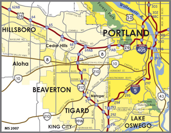
Oregon 217 constitutes a 7.7 mile long commuter freeway joining Interstate 5 and U.S. 26 (Sunset Highway) through the western Portland suburbs. The Beaverton-Tigard Freeway also provides a bypass of Downtown Portland for points south along I-5 to Salem and west along U.S. 26 to the Oregon Coast.
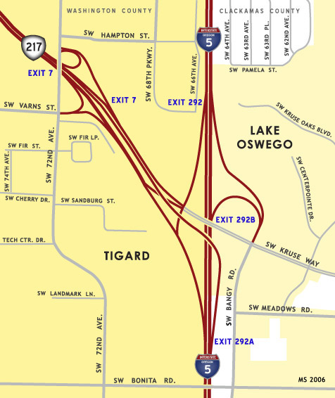
The south end of Oregon 217 at Interstate 5 along the Tigard and Lake Oswego city line.
The north end of Oregon 217 at U.S. 26 in Beaverton.
OR 217 branches from I-5 northbound at a wye interchange (Exit 292A). The two lane flyover combines with traffic from Kruse Way beyond the exit for SW 72nd Avenue.
05/22/06
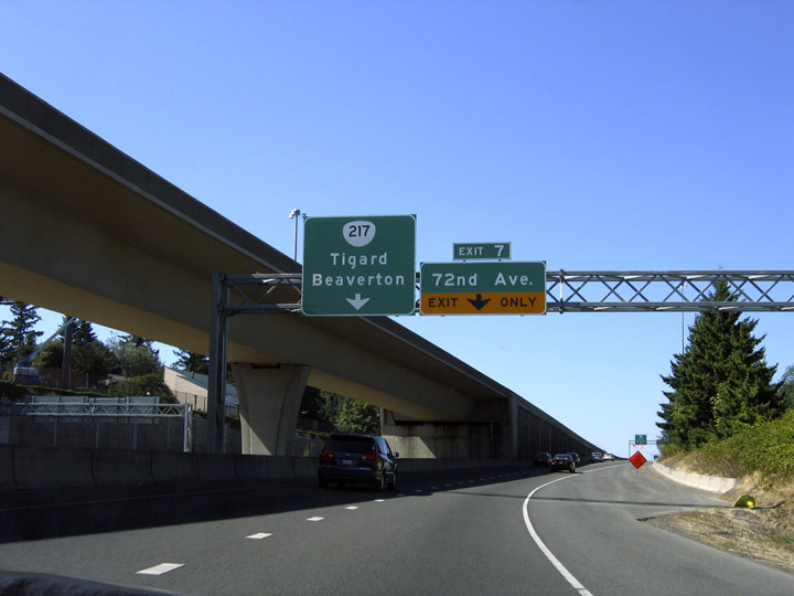
Traffic from I-5 south to OR 217 north utilizes the ramp from Kruse Way westbound to join the freeway north ahead of Exit 7 with SW 72nd Avenue.
08/27/06
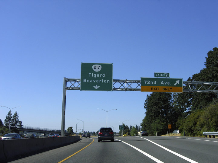
The ramp from Kruse Way partitions into single lanes for the OR 217 northbound mainline and Exit 7 to east Tigard.
08/27/06
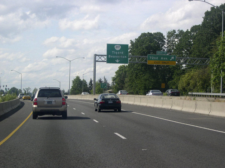
Traffic from I-5 north and Kruse Way combines within the folded diamond interchange (Exit 7) at SW 72nd Avenue. Three lanes proceed northwest to a lane drop at Exit 6 for OR 99W to Tigard and McMinnville.
08/27/06
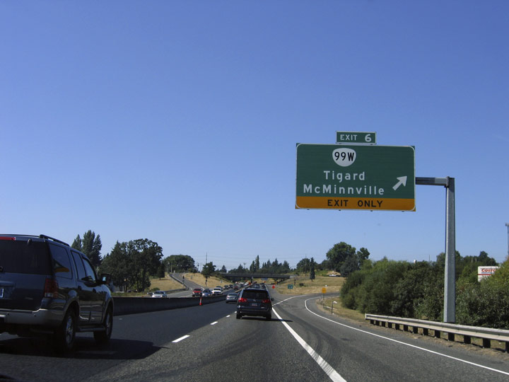
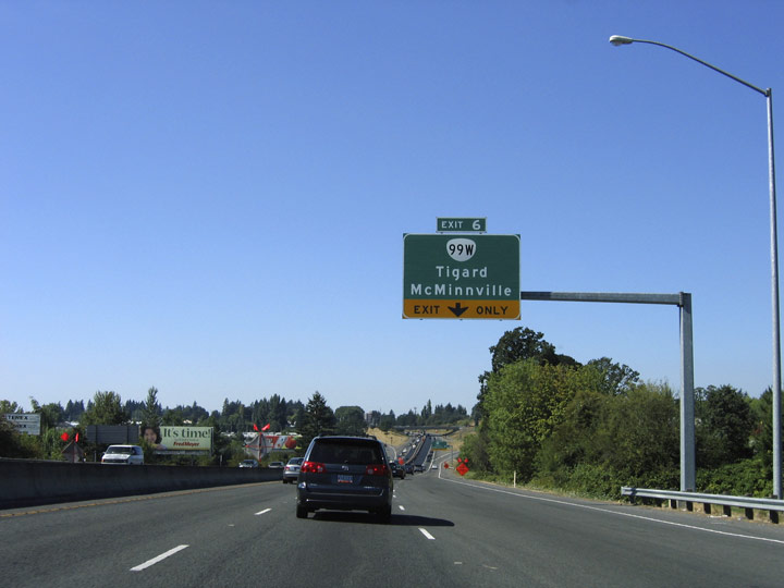
OR 99W (Pacific Highway West) angles northeast through the city of Tigard, meeting OR 217 at a parclo interchange (Exit 6). McMinnville lies 29 miles to the southwest along OR 99W, but the highway passes through the cities of Sherwood and Newberg first.
08/27/06
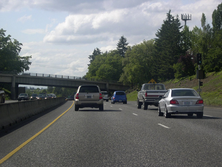
OR 217 is often jammed during peak commute hours, and ramp meters operate at various entrance ramps, including the ramp from OR 99W at Exit 6.
05/22/06
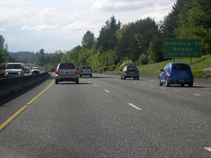
Advancing northwest, OR 217 approaches Greenburg Road to the Tigard neighborhood of Metzger and Washington Squall mall.
05/22/06

Entering the commercialized diamond interchange (Exit 5) with Greenburg Road along OR 217 northbound.
05/22/06
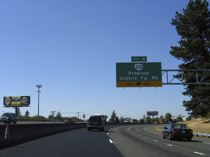
Curving northward by Washington Square mall, an auxiliary lane opens from Greensburg Road to Exit 4 with OR 210 (Scholls Ferry Road).
08/27/06
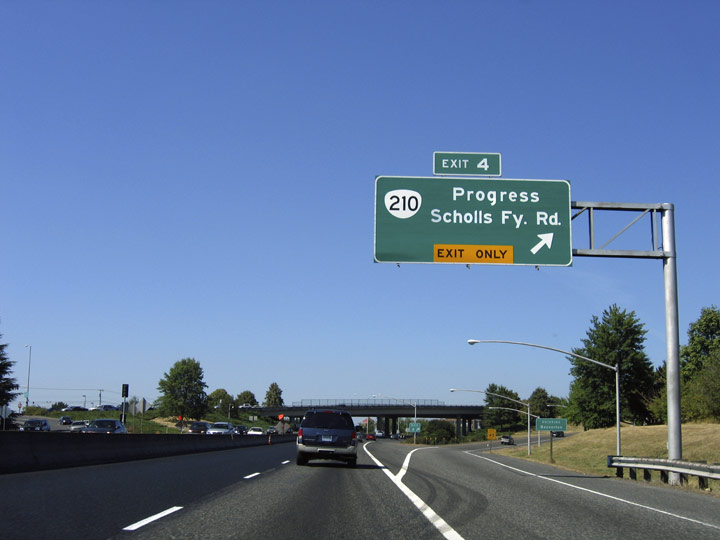
Northbound OR 217 at Exit 4 to OR 210 (Scholls Ferry Road) in Progress. A former unincorporated neighborhood, Progress lies partially within Tigard and partially within the Beaverton corporate limits. Beaverton, home to Nike, Inc., has an estimated population of nearly 100,000.
08/27/06
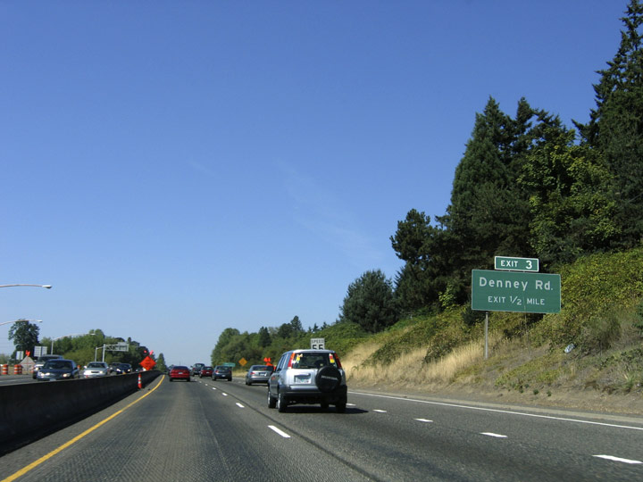
Exit 3 follows the SW Hall Boulevard overpass with Denney Road in a half mile.
08/27/06
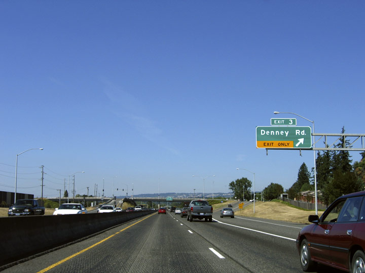
A 1.3 mile long arterial in Beaverton, Denney Road runs east from the diamond interchange (Exit 3) with OR 217 to OR 210 (Scholls Ferry Road) and west to Hall Boulevard.
08/27/06
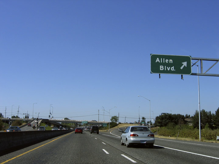
OR 217 continues a half mile north from the Denney Road to Exit 2B with Allen Boulevard.
05/22/06
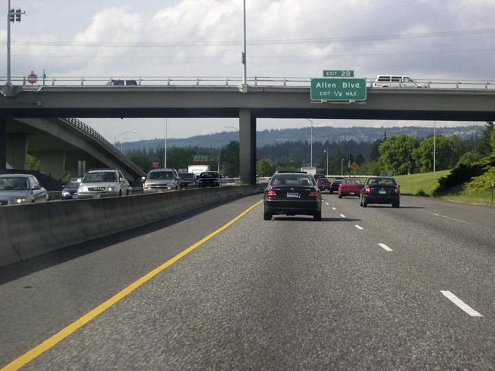
The entrance ramp from Denney Road forms an auxiliary lane north across Fanno Creek to the diamond interchange (Exit 2B) with Allen Boulevard.
08/27/06
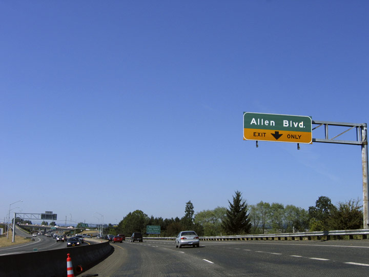
Exit 2B departs OR 217 north for Allen Boulevard west to residential areas and east to several industrial parks.
08/27/06

A split diamond interchange (Exit 2A) joins OR 217 with OR 10 (Beaverton-Hillsdale Highway) and OR 8 (Canyon Road) along the east side of the Beaverton Town Square retail complex in Beaverton.
08/27/06
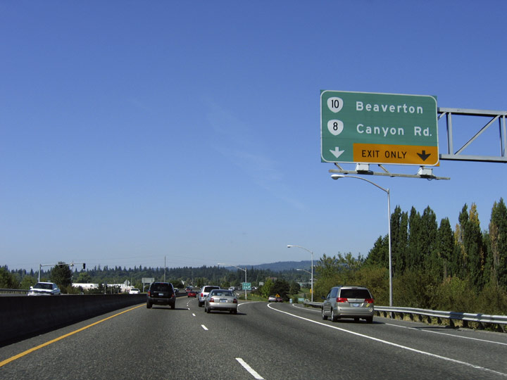
A two lane off-ramp (Exit 2) connects OR 217 with OR 10 (Beaverton-Hillsdale Highway) and OR 8 (Canyon Road). The two routes parallel one another closely through Beaverton, but never intersect.
08/27/06

OR 217 continues north to Exit 1 with Walker Road.
08/27/06
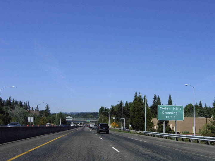
Cedar Hills Crossing is a shopping complex that lies along Cedar Hills Boulevard south of Walker Road in Beaverton.
08/27/06
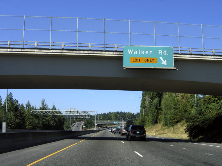
Walker Road arcs northwest from OR 8 (Canyon Road) to a diamond interchange (Exit 1) with OR 217 north of the Cabot Street overpass.
08/27/06
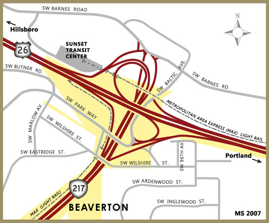
OR 217 bends to the northeast on the half mile approach to its north end at U.S. 26 in Cedar Hills, an unincorporated and heavily populated area north of Beaverton.
08/27/06
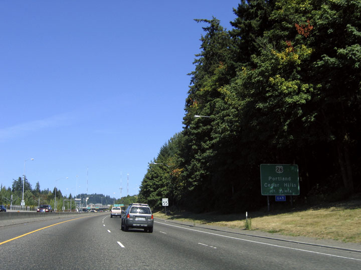
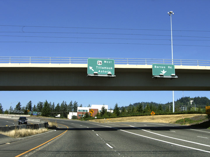
OR 217 concludes with ramps departing for U.S. 26 east to Cedar Hills and Portland, Barnes Road along the north side of Sunset Highway and U.S. 26 west to Tillamook and Astoria.
05/22/06
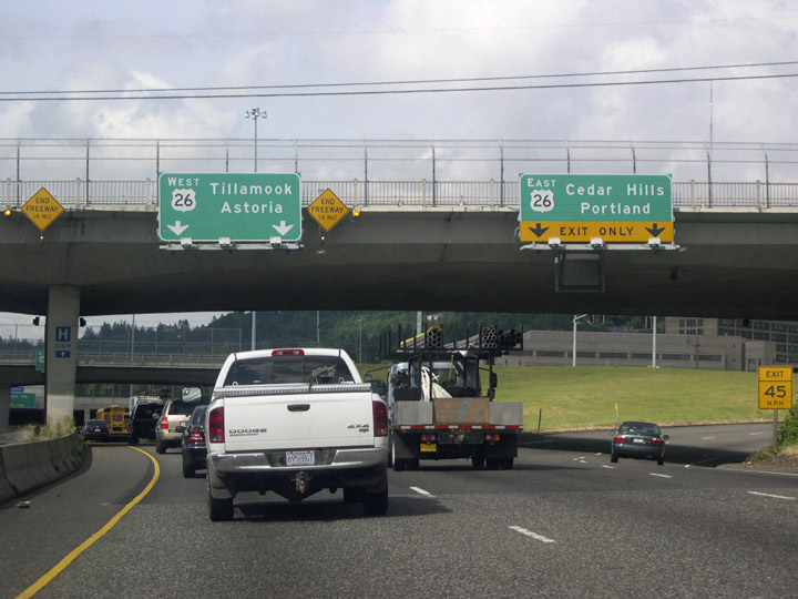
Entering the directional cloverleaf interchange with U.S. 26 (Sunset Highway) along OR 217 north at the Wilshire Street overpass. Sunset Highway is a limited access highway east from OR 217 to I-405 at Downtown Portland.
05/22/06
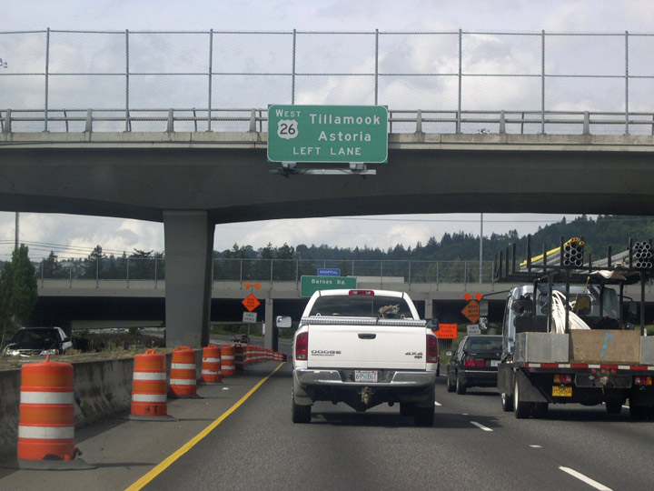
Two lanes separate from OR 217 north for U.S. 26 (Sunset Highway) west and Barnes Road. U.S. 26 extends west as a freeway another 15.5 miles to OR 6 outside Wilkesboro.
05/22/06
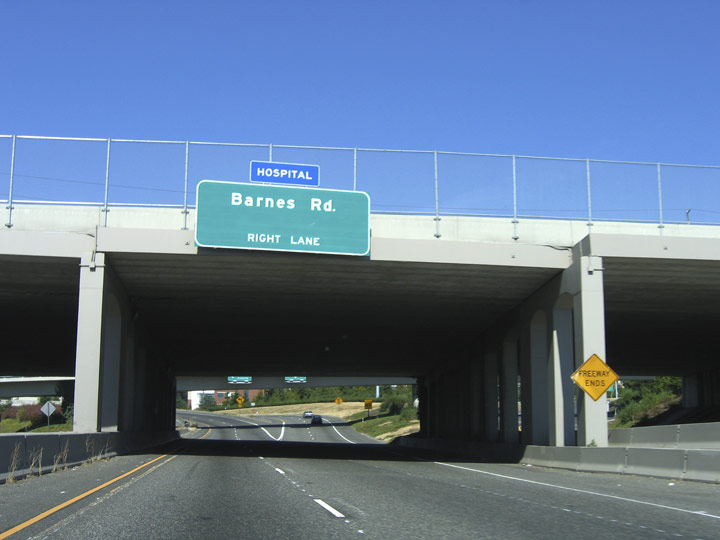
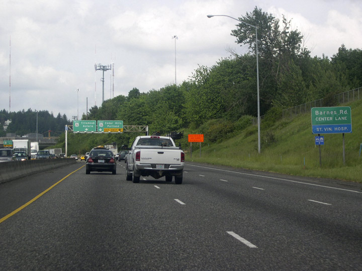
Barnes Road parallels U.S. 26 (Sunset Highway) to the north by an array of retail and office buildings through the community of Cedar Mill.
08/27/06
U.S. 26 originates 69 miles to the west at a trumpet interchange with U.S. 101 near the Oregon Coast.
08/27/06
Photo Credits:
- Matt Strieby: 05/22/06
- AARoads: 08/27/06
- Alex Nitzman: 08/27/06
Connect with:


Page Updated Thursday April 04, 2019.