
Original Overseas Highway
Some portions of the old Overseas Highway are signed as County Road 905 on street blades or retain older state road shields for C-905. Two portions of the route are located on Plantation and Windley Keys.
Overseas Highway Sections

20th Street - Marathon - 17 photos
Sombrero Beach Boulevard - Marathon - 6 photos
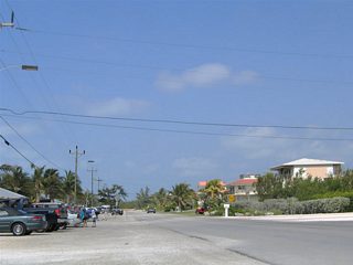
Watson Boulevard - 16 photos
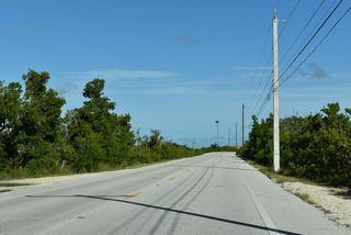
State Road 4A - Little Torch Key - 5 photos
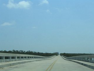
U.S. 1 - Bahia Honda Bridges
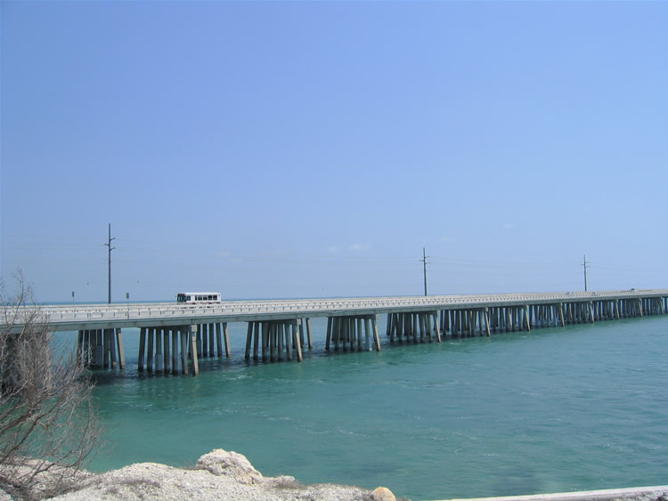
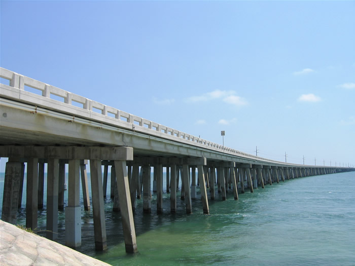
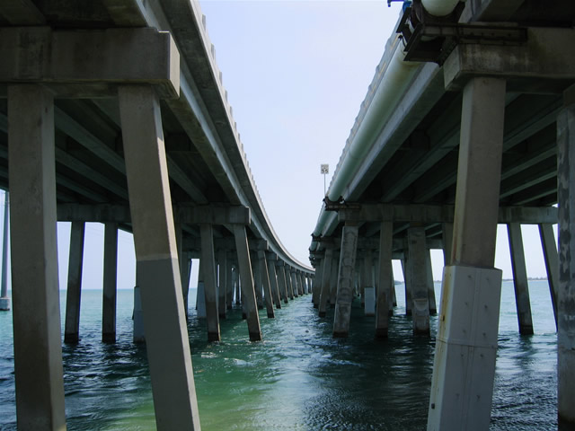
The modern Overseas Highway travels over Bahia Honda Channel along a pair of two-lane concrete bridges. The four-lane section offers weary motorists the opportunity to pass slower moving vehicles, as a break from the two-lane sections east and west of Spanish and Bahia Honda Keys. The current bridges opened to traffic in 1972.1
Adjacent to the Overseas Highway along the south is the original Bahia Highway road and railroad bridge. After the destruction of the Florida East Coast Railway due to the Labor Day Hurricane of 1935, officials shifted the focus from rebuilding the line to constructing an overseas highway. The state purchased the railroad right-of-way for the new road, and in some cases utilized existing infrastructure to accommodate the new road. At Bahia Honda, this is the case.
Since the existing truss bridge over the Bahia Honda Channel was too narrow to support vehicular traffic, contractors instead opted to build a road deck on top of the existing street structure. The result was an odd truss bridge with an abandoned railroad line below and a narrow two-lane concrete deck above. The original Overseas Highway opened to traffic on July 4, 1938.1
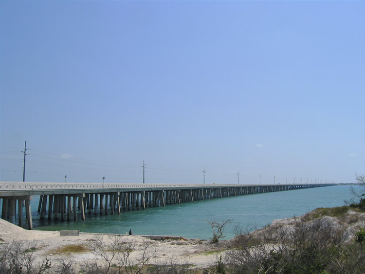
Viewing the 1972-built Bahia Honda Bridges from the original Overseas Highway alignment to the south along the eastern shore of Spanish Harbor Keys.
05/07/06
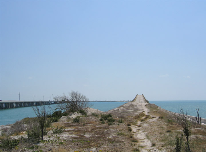
Walking along the old Overseas Highway alignment from the south. There is not much left of it here, other than a dirt trail and scrub brush overlaying the original road bed.
05/07/06
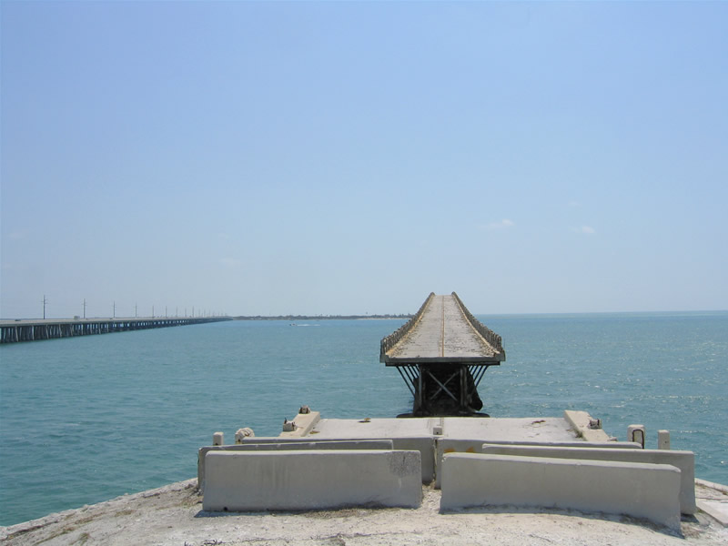
A short stub of concrete remains at the west end of the severed Bahia Honda Bridge. A cut in the span was made between the western abutment and the truss bridge. This prevents access to the bridge, but also allows unrestricted passagefor vessels below.
05/07/06
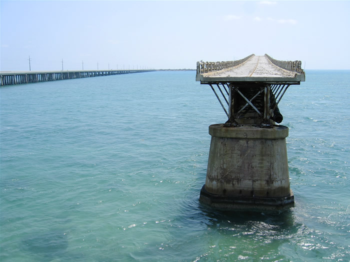
The edge of the railroad truss and concrete road deck at the west end of the Bahia Honda Bridge. Concrete fragments from the crumbling guard rail covers the original two lane roadway. Paint striping, albeit faded, remained on the road as well.
05/07/06
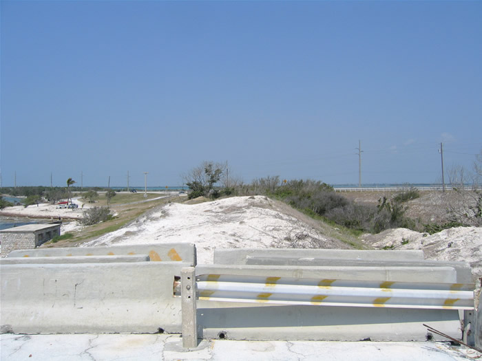
Turning around, the view looking west at the barricade between the original Overseas Highway concrete stub and approach.
05/07/06
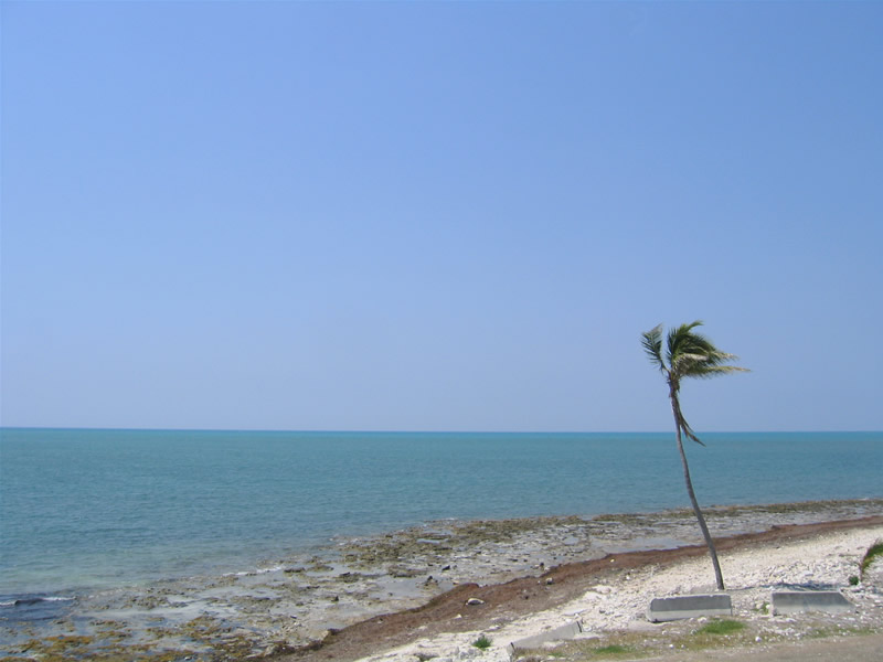
A lone palm tree sways in the breeze south of the abandoned Bahia Honda Bridge. 90 miles separate the Florida Keys from the island country of Cuba.
05/07/06
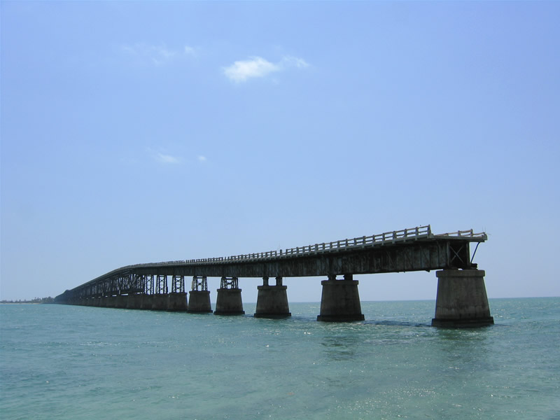
Walking along the Bahia Honda Channel seawall, the side profile of the bridge comes into view. The railroad truss rises 65 feet on the approach to Bahia Honda Key.1
05/07/06
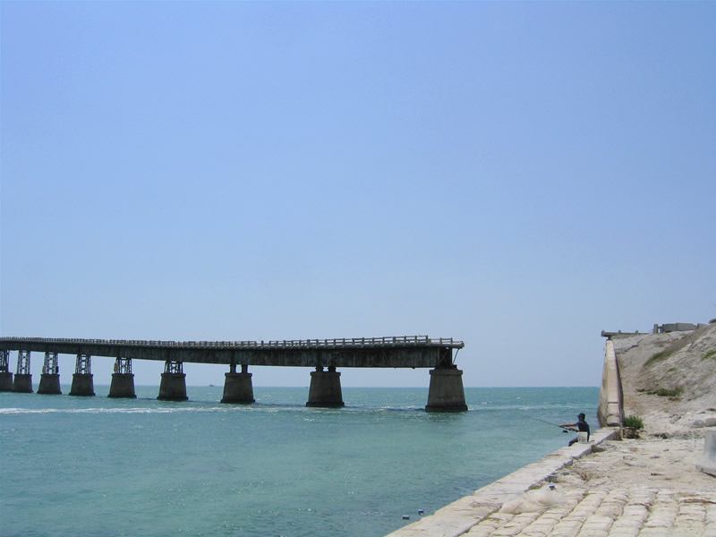
Looking south again at the cut in the Bahia Honda Bridge and western approach. Water flowing between the keys separates the Florida Straits from Florida Bay.
05/07/06
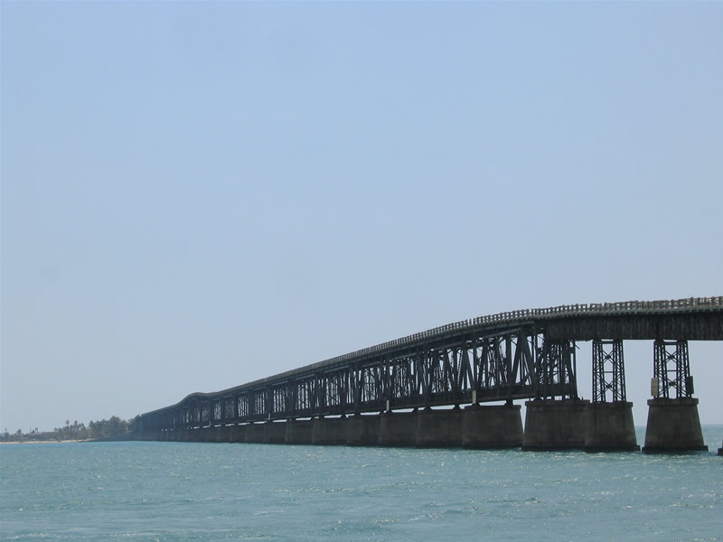
A closer look at the Bahia Honda Bridge truss work and overall span.
05/07/06
References:
- History Of Overseas Highway. Florida Keys History Museum.
Photo Credits:
- Alex Nitzman, Justin Cozart: 05/07/06
Connect with:
Page Updated Tuesday August 13, 2024.