
Seattle

The Downtown Seattle Skyline, the Space Needle and Mount Rainier. Photo by Jeff Royston. - 07/28/2007

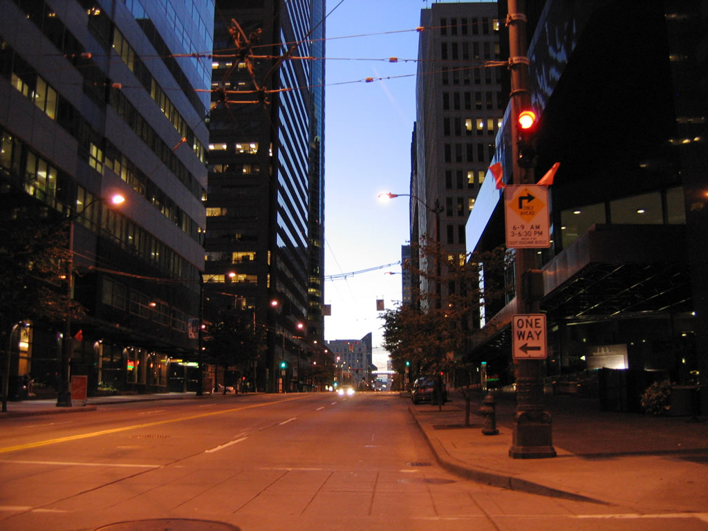
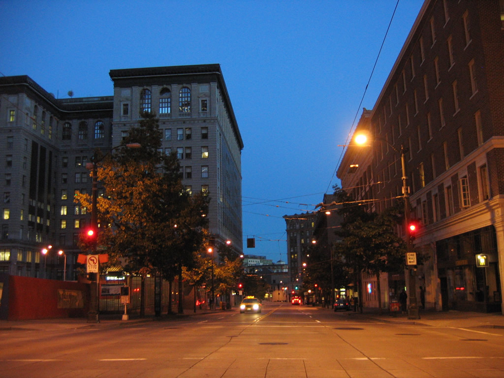
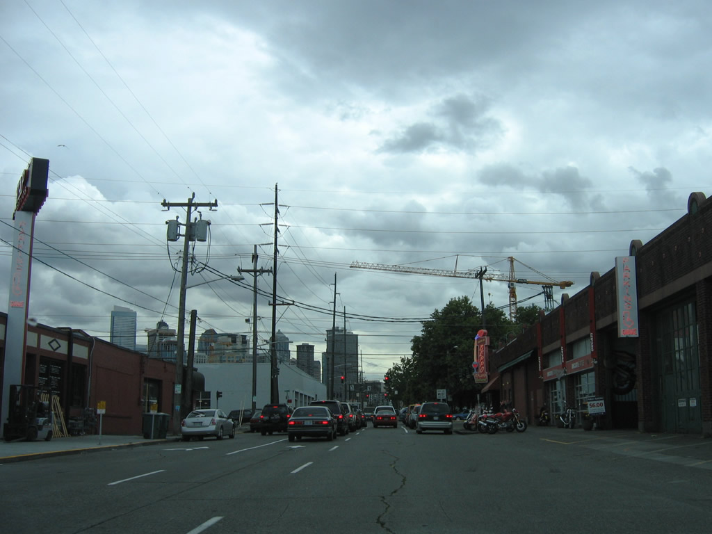
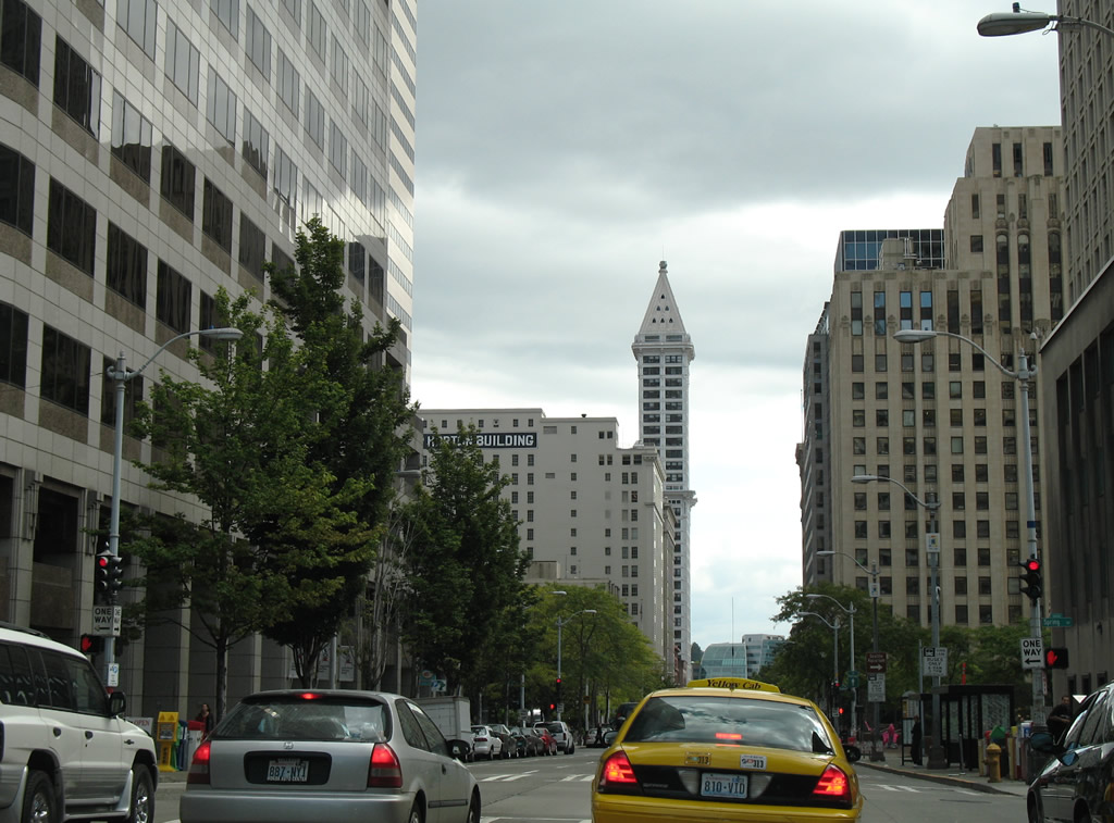
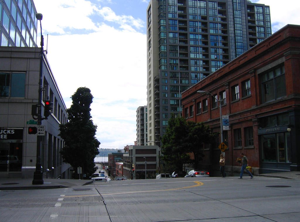
2nd Avenue flows southbound through the Seattle central business district. Ground level traffic lights are common at area intersections. Facing southbound in this scene at Seneca Street is a traffic light acting as a pedestrian signal. - 08/29/2006

Downtown Seattle and the former Alaskan Way Viaduct (SR 99) from Waterfront Park on Elliott Bay. Waterfront Park occupies 4.8 acres between Piers 57 and 59 along the west side of Alaskan Way. - 08/28/2006

The Seattle skyline from the skywalk above Alaskan Way at Pier 66. - 08/28/2006

Pike Place Market started on August 17, 1907 as a conventional farmers market where growers would sell their goods to the public. From humble beginnings to international recognition, Pike Place Market grew to become a tourist destination and a place to shop, play and live. - 08/28/2006

Lumen Field rises to the south of Downtown Seattle. Home of the Seattle Seahawks and Seattle Sounders FC, the stadium opened on July 28, 2002 and regularly seats 67,000. - 08/28/2006
Photographs of various boulevards and streets in Seattle.
Broad Street
Broad Street travels northeast from Alaskan Way at Belltown near Elliott Bay to Seattle Center and the Mercer Street connection with Interstate 5. The boulevard included an expressway section built in the 1950s between 5th Avenue N and 9th Avenue N. This changed with the Mercer Corridor Project, which revamped the South Lake Union street grid, focusing on Mercer Street as a six-lane boulevard toward Seattle Center from Interstate 5. Work included the removal of the below grade section of Broad Street from the Seattle Center area to Mercer Street at 8th Avenue N.
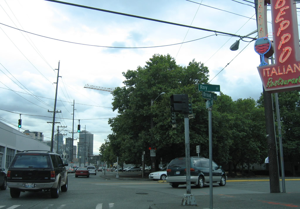
Leaving the intersection with 9th Avenue N and Roy Street west along a former section of Broad Street. Began in 2010, the Mercer Corridor Project removed the four lane expressway portion of Broad Street south to 5th Avenue N.
08/30/06
Mercer Street meets Dexter Avenue North at an elevated intersection above Broad Street west in this scene.
08/30/06
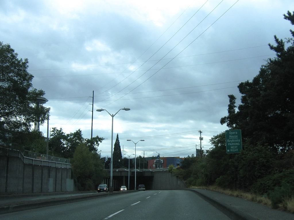
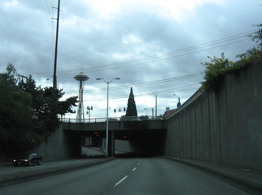
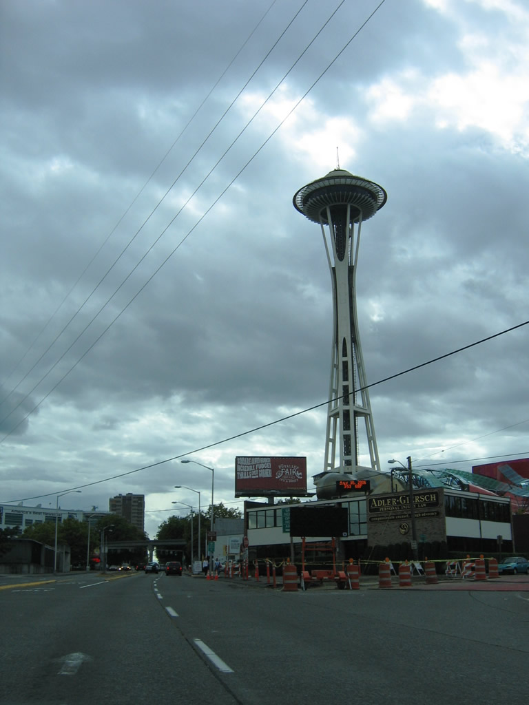
Passing under Aurora Avenue North (SR 99) along Broad Street south with the Space Needle rising from Seattle Center in the background. The bored tunnel of SR 99 brings the state route out just south of this grade separation with Broad Street. Aurora Avenue North splits with SR 99 as an at-grade route to Denny Way.
08/30/06
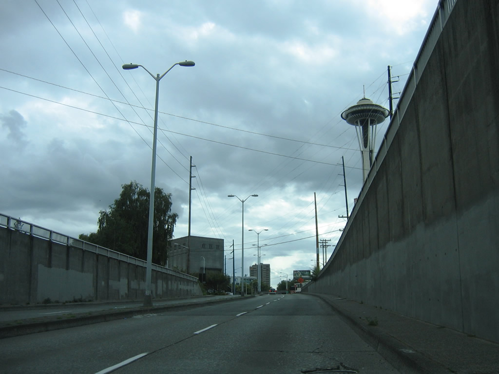
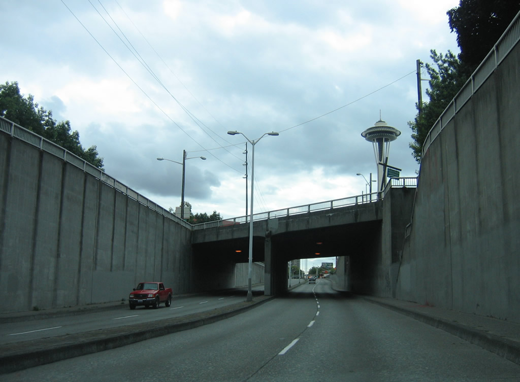
Emerging from the Aurora Avenue N subway on Broad Street west.
08/30/06
Broad Street returns to grade at Harrison Street and Taylor Avenue N.
08/30/06
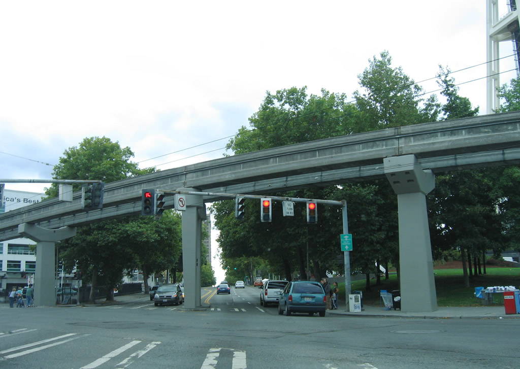
Broad Street at 5th Avenue and the western extent of the roadway removed in the Mercer Corridor Project. Passing above the intersection is the Seattle Center Monorail. The elevated rail line connects the fairgrounds and park area with Westlake Center Mall.
08/30/06
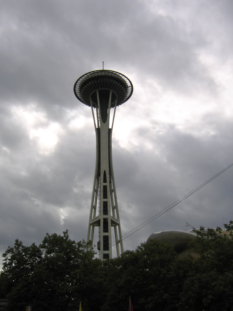
The Space Needle as seen from Broad Street and 5th Avenue N.
08/30/06
Broad Street passes by the Space Needle and Seattle Center at 4th Avenue N.
08/30/06
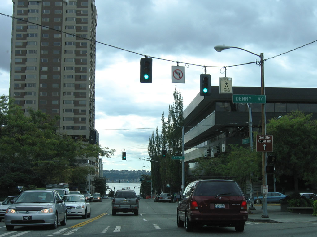
Denny Way lines the south side of Seattle Center by the Pacific Science Center.
08/30/06
Elliott Bay comes into view as Broad Street enters the Belltown section of Seattle north of Downtown.
08/30/06

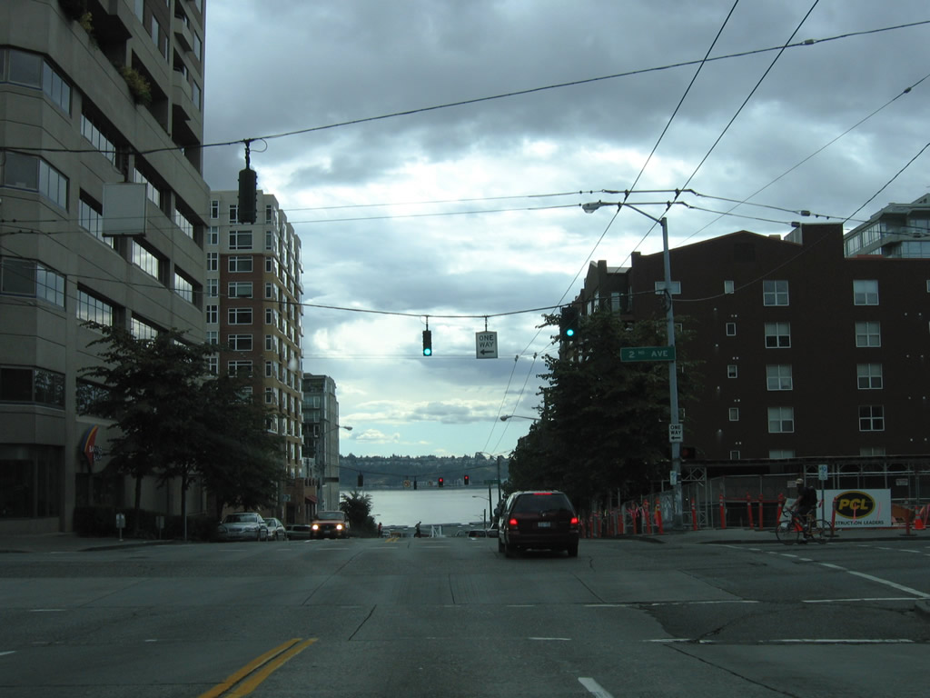
One block further south on Broad Street south at 1st Avenue.
08/30/06
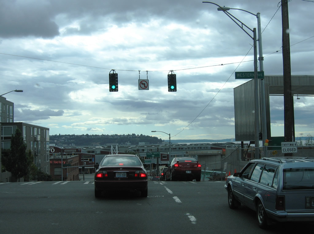
Broad Street reaches Western Avenue and Olympic Sculpture Park (shown here under construction).
08/30/06
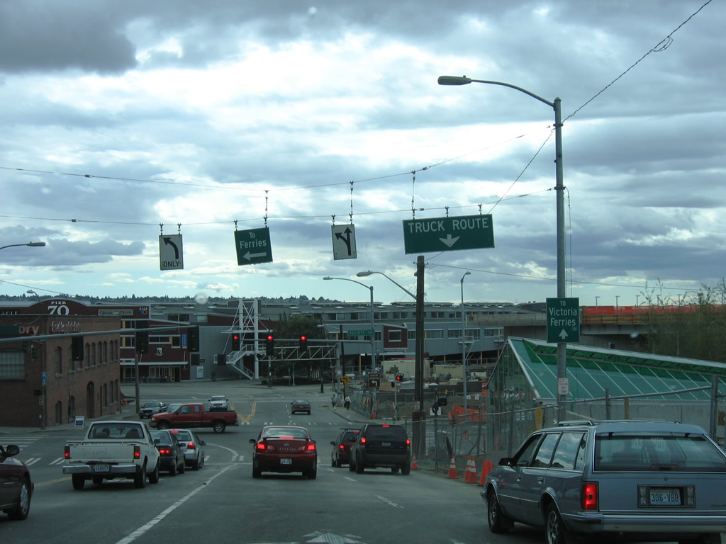
Descending to Elliott Avenue, one block from the turn onto Alaskan Way at Pier 70.
08/30/06
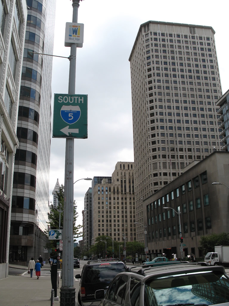
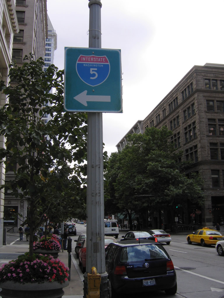
Spring Street provides a direct ramp onto Interstate 5 south at 6th Avenue. A small guide sign directs motorists onto Spring Street from 2nd Avenue south in this scene.
08/29/06
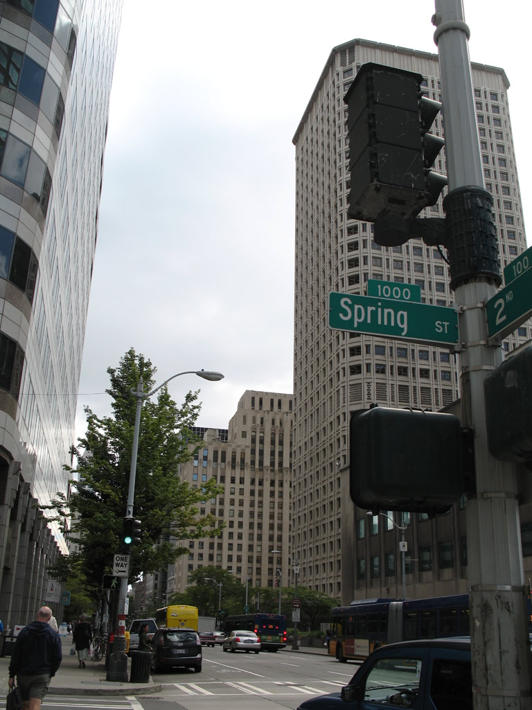
Older one-piece Eagle and Crouse Hinds type D signals positioned at ground level govern the traffic flow at many downtown area intersections, such as the one at 2nd Avenue and Spring Street here.
08/29/06
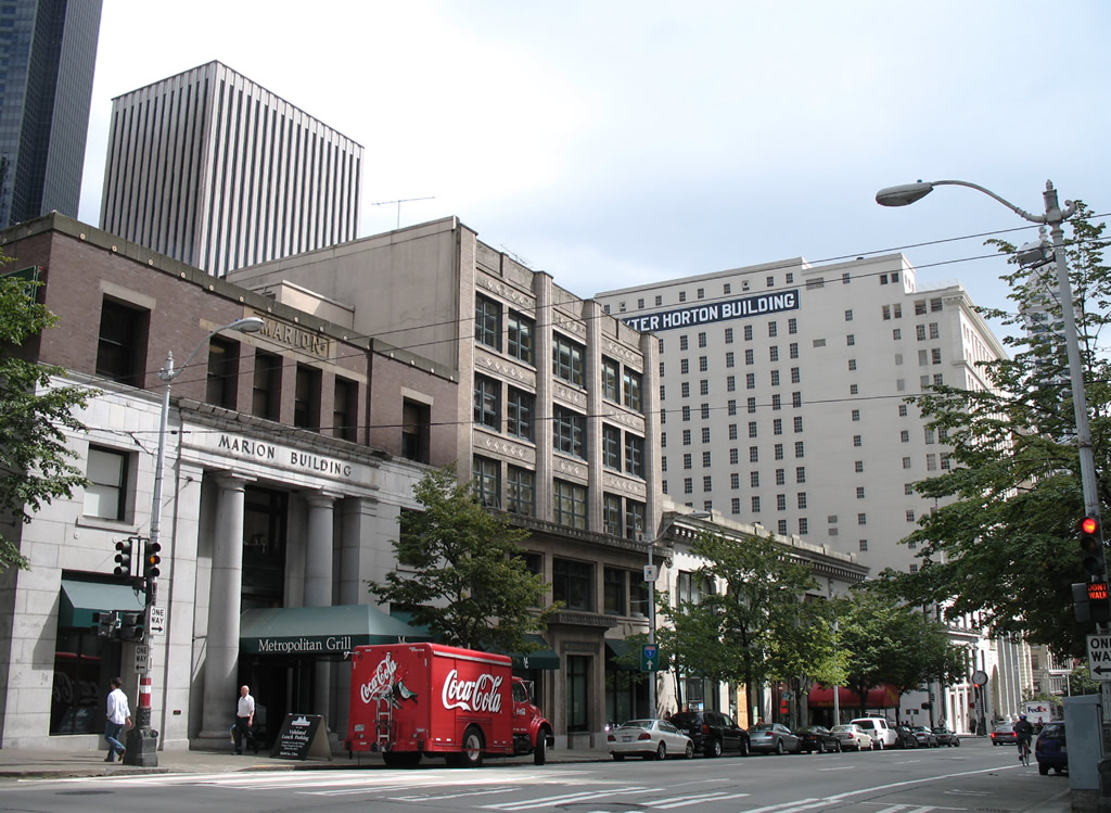
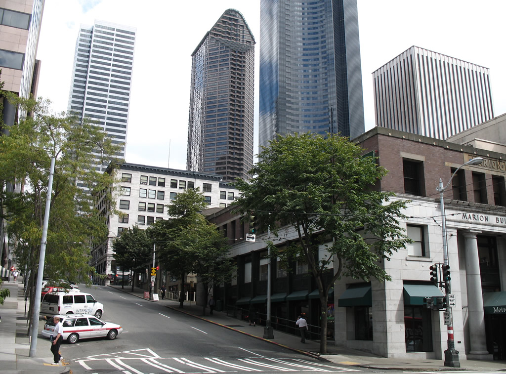
2nd Avenue south at Marion Street.
08/29/06
Three blocks south of Spring Street is Columbia Street, which connects to SR 99 south to the Duwamish Industrial Area. Interstate 5 bound travelers should continue another block to Cherry Street.
08/29/06
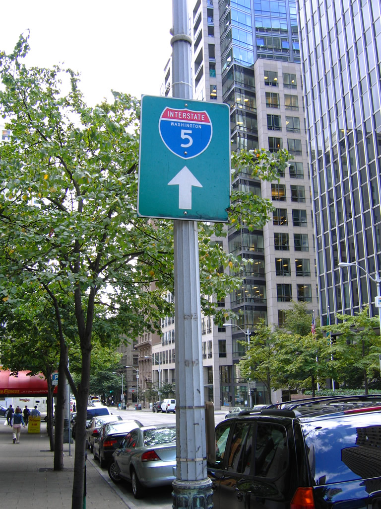
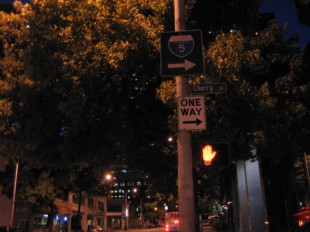
Another Interstate 5 guide sign posted on 2nd Avenue points toward Cherry Street north for its connections with 6th and 7th Avenues, frontage roads of Interstate 5 with respective on-ramps.
08/29/06

Interstate 5 southbound trailblazer posted ahead of the 2nd Avenue south intersection with James Street. James Street provides access to the freeway via the 6th Avenue on-ramp. The shield pictured here may well have been removed or replaced by 2010.
08/28/06
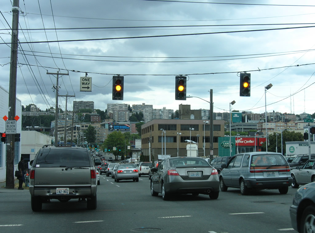
While 2nd Street flows southbound, traffic lights also face southward and act as pedestrian signals. Posted at Spring Street is an older one-piece Eagle Signal.
08/29/06
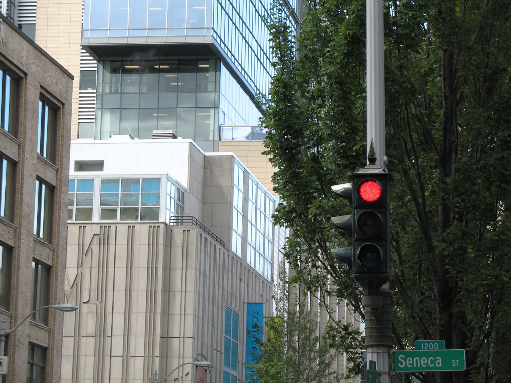
Walking one block northward, a Crouse Hinds type D signal faces southward at Seneca Street.
08/29/06
3rd Avenue carries two way traffic through downtown Seattle. Pictured here is the intersection with Madison Street.
08/28/06
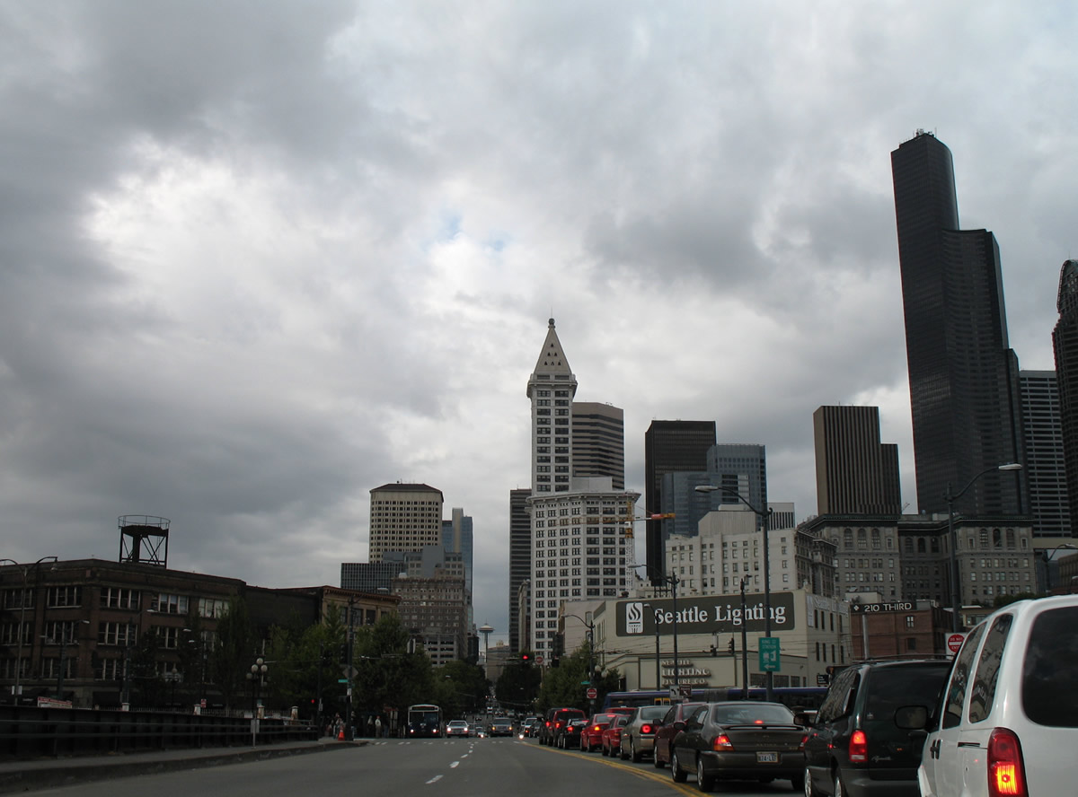
Southward view of 3rd Street at Cherry Street within the central business district of Seattle.
08/28/06
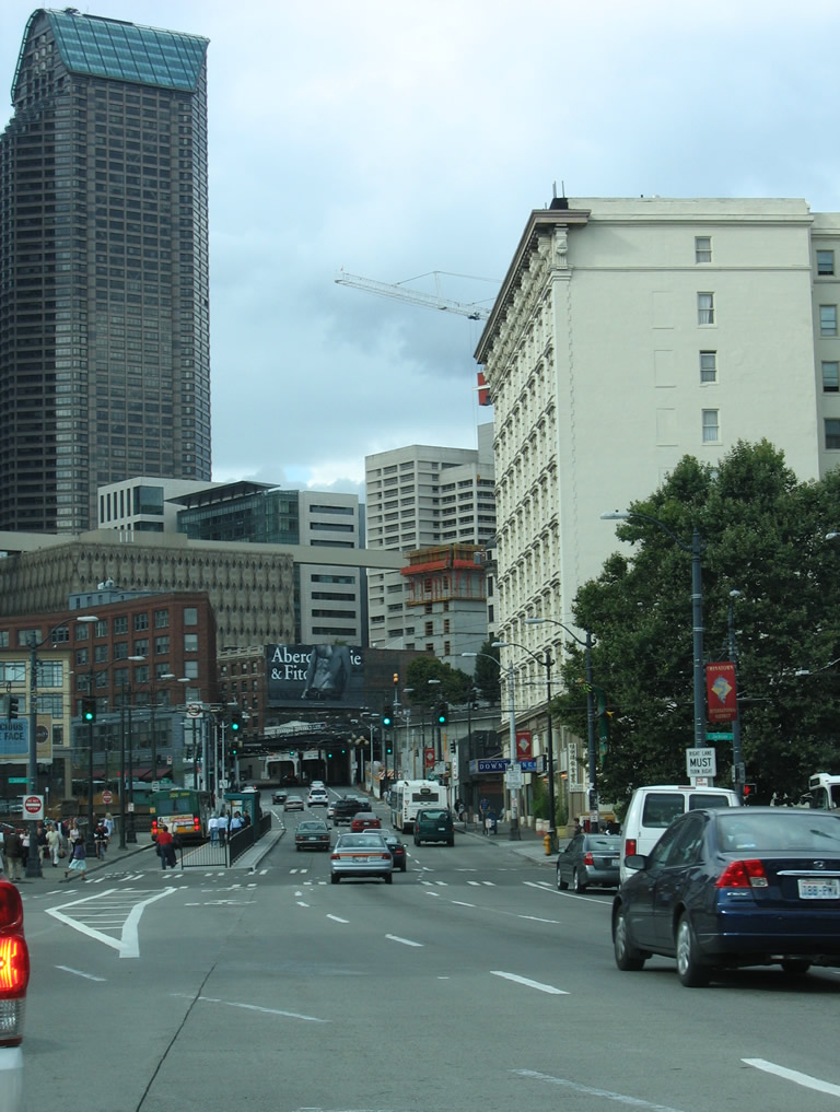
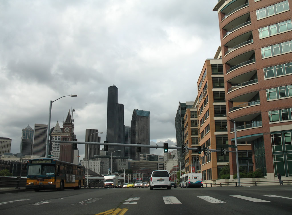
4th Avenue South leaves the ramps for Interstate 90 and CenturyLink Field and meets the north end of Airport Way South. Airport Way leads southward to King County International Airport / Boeing Field.
08/30/06
08/28/06
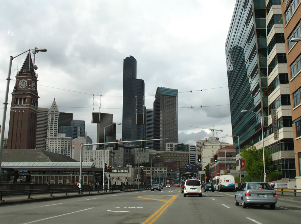
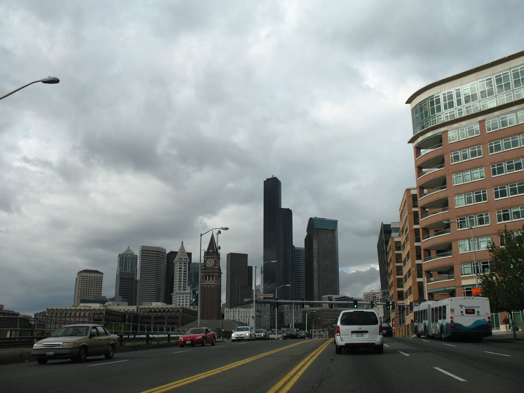
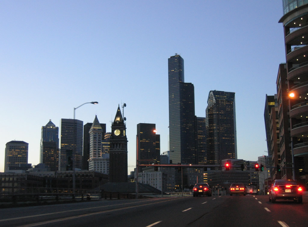
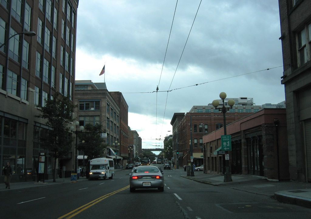
Columbia Center and Seattle Municipal Tower and other skyscrapers dominate the view of 4th Avenue South north at the parking garage exit of 505 Union Station. King Street Station lies to the left.
08/30/06
2nd Avenue South Extended splits from 4th Avenue South.
08/30/06
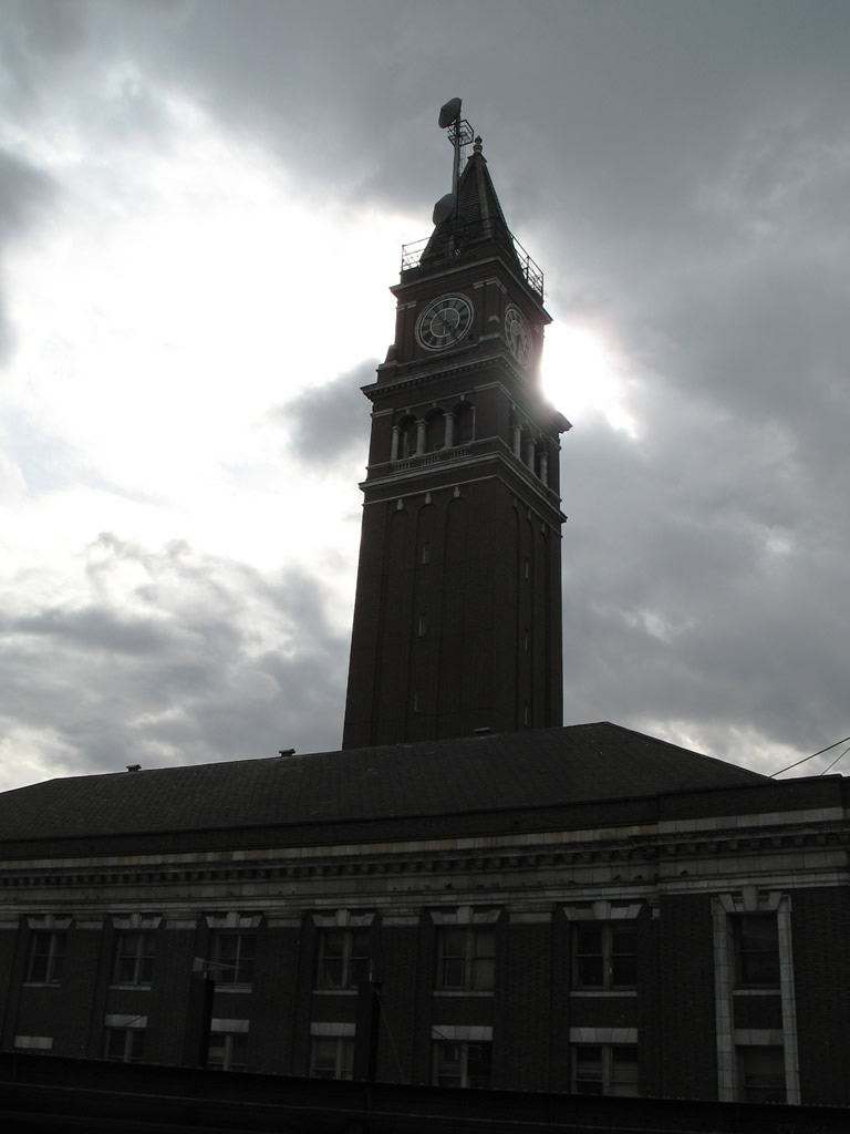
King Street Station provides transit options for area commuters and also long distance travelers via Amtrak. The historic station opened in 1906 and was added to the National Register of Historic Places in 1973.
08/30/06
4th Avenue angles northwest from Yesler Way and reaches Cherry Street in three blocks. Cheery Street provides connections to both south and north Interstate 5 via 6th and 7th Avenues (frontage streets of the freeway).
08/28/06
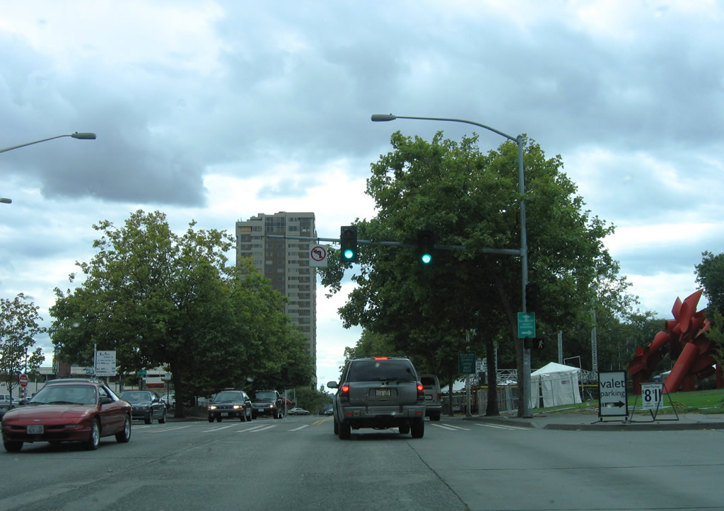
Heading south along 9th Avenue North toward the intersection with Broad Street and Roy Street west. Construction associated with the Mercer Corridor Project will eliminate Broad Street between 9th Avenue North and the new Mercer Street parkway. Green space will replace the current paved area between Roy Street to 8th Avenue South.
08/30/06
Roy Street will carry two-way traffic west from 9th Avenue North and tie directly into Valley Street to the east. Valley Street will be downgraded from a multi-lane arterial into a two lane local street.
08/30/06

A historical look at Mercer Street eastbound between 8th and 9th Avenues North. What was previously a congested one way street leading east to Interstate 5 received $30 million in ARRA funds on February 16, 2010 to rebuild the corridor as gateway to the South Lake Union neighborhood of Seattle.
08/30/06
Eastbound Mercer Street at 9th Avenue North. Buildings along the north side of Mercer Street were demolished to make way for a new six lane parkway. Dubbed the Mercer Corridor Project, the parkway project is part of an overall plan to link Seattle Center with Interstate 5 and SR 99 with a two-way Mercer Street. Valley Street, the original westbound gateway to Seattle Center, will be downgraded to a local street with an improved Mercer corridor.
08/30/06
Mercer Street east at Westlake Avenue. The Mercer Street east and Valley Street westbound couplet from Interstate 5 to Broad Street was constructed in the 1950s.
08/30/06
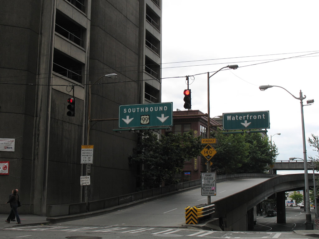
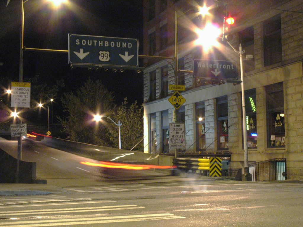
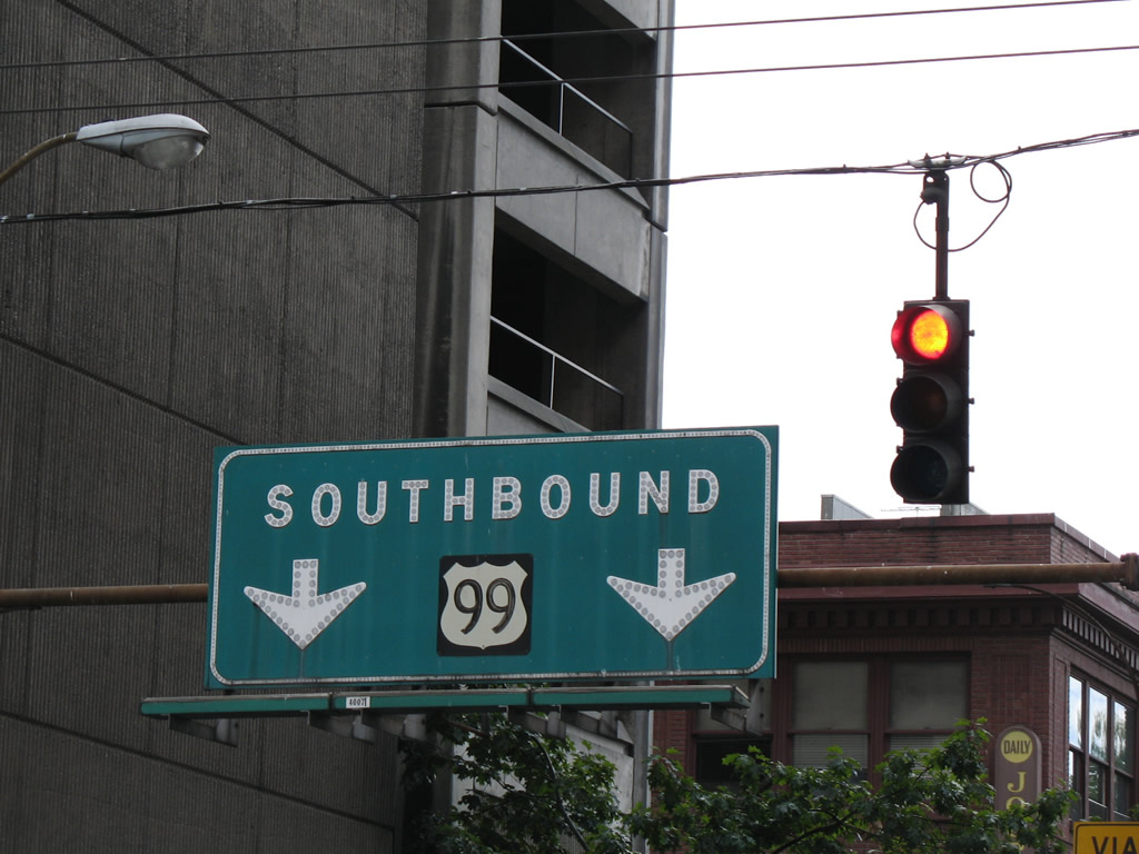
Famous in the road enthusiast community, the hand painted U.S. 99 sign posted at the Columbia Street southbound on-ramp to the Alaskan Way Viaduct. U.S. 99 was vastly replaced by Interstate 5 in Washington and officially decommissioned from the state in 1964. SR 99 follows a portion of the original alignment between Tukwila and Everett.
08/29/06
08/28/06

Jackson Street westbound at 3rd Avenue North opposite King Street Station.
08/30/06
2nd Avenue South travels one block from Jackson Street to the CenturyLink Field parking area. Jackson Street continues three blocks to an end at SR 519 (Alaskan Way) beyond the Alaskan Way Viaduct.
08/30/06
Marion Street rises from 2nd Avenue in this scene.
08/29/06
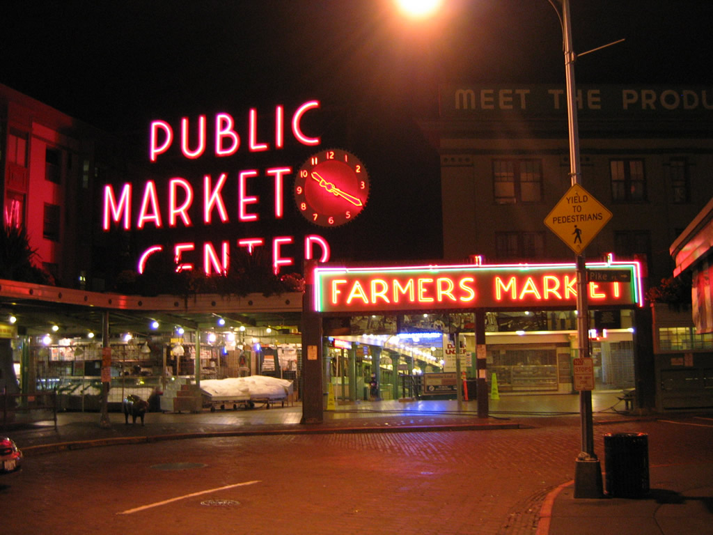
Pike Place south becomes Pike Street east at Pike Place Market. The street carries vehicular traffic at the market but also doubles more or less as a pedestrian mall during busy periods.
08/28/06
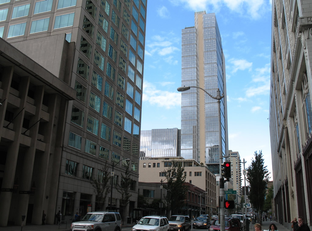
Seneca Street provides a direct route from SR 99 north and interstate 5 north into downtown Seattle. Pictured here is intersection with 2nd Avenue.
08/29/06
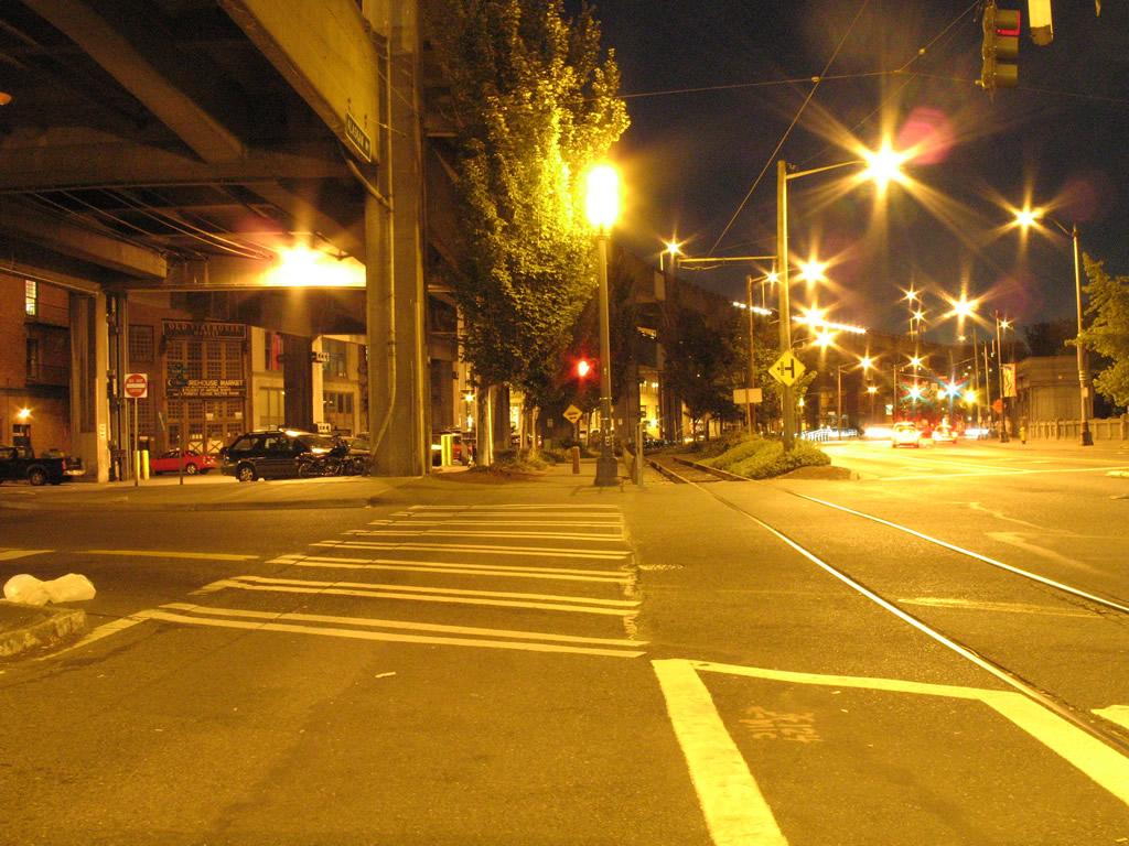
Southward scene showing the Alaskan Way Viaduct, Waterfront Streetcar Line, and Alaskan Way (SR 519) at Yesler Way.
08/28/06
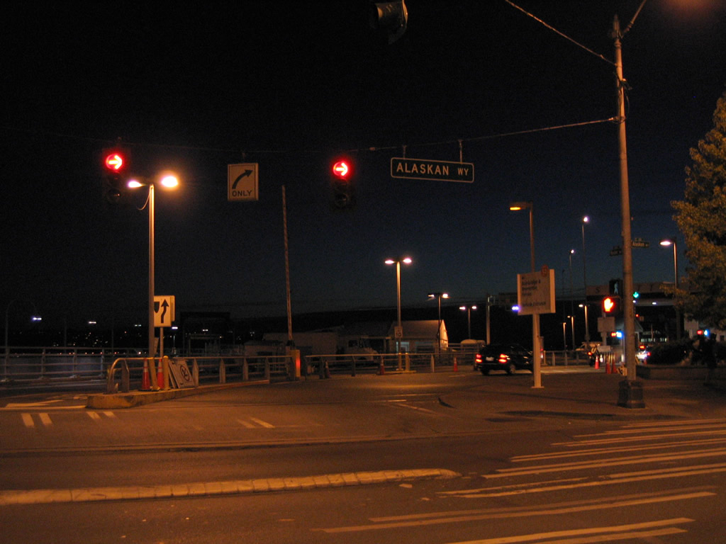
Yesler Way straddles the street grid shift between Interstate 5 and SR 519 (Alaskan Way), ending opposite the WSDOT Seattle Ferry Terminal.
08/28/06
Approaching the three-quarter cloverleaf interchange between Northgate Way west and Interstate 5 adjacent to Northgate Mall.
08/29/06
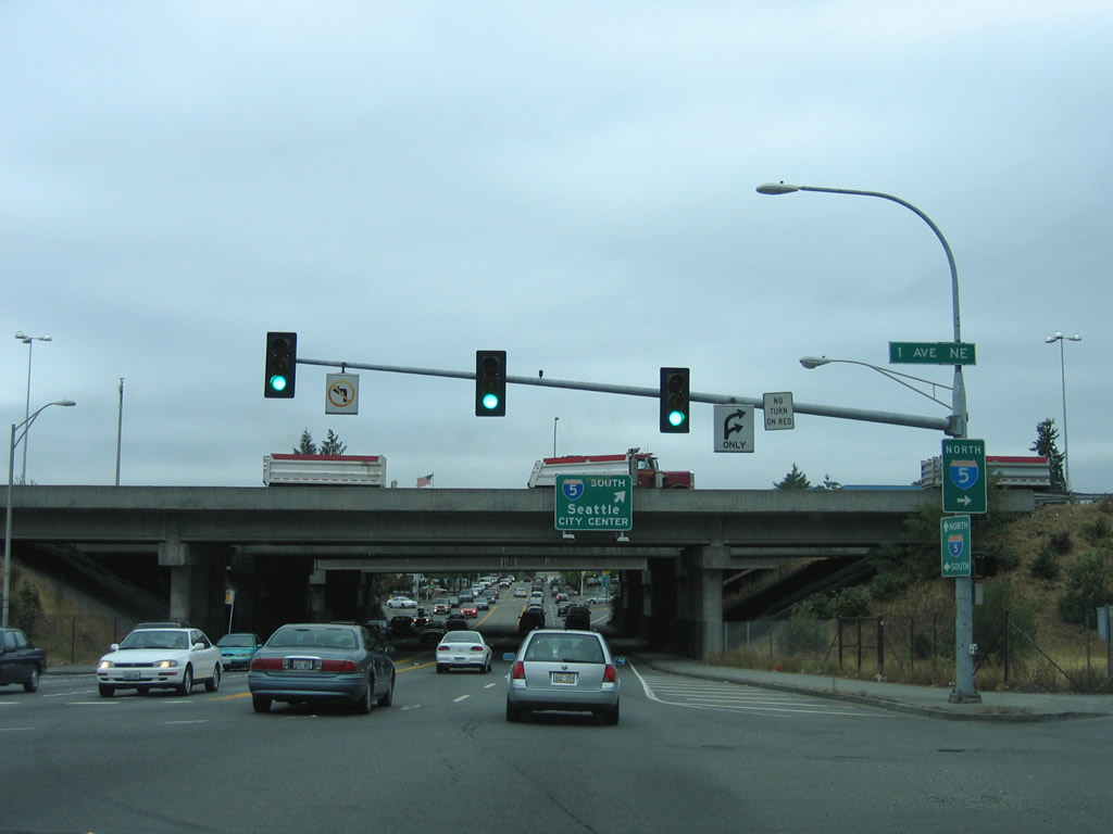
1st Avenue NE lines the northbound side of Interstate 5 and yields the northbound on-ramp to Shoreline and Everett from NE Northgate Way.
08/29/06
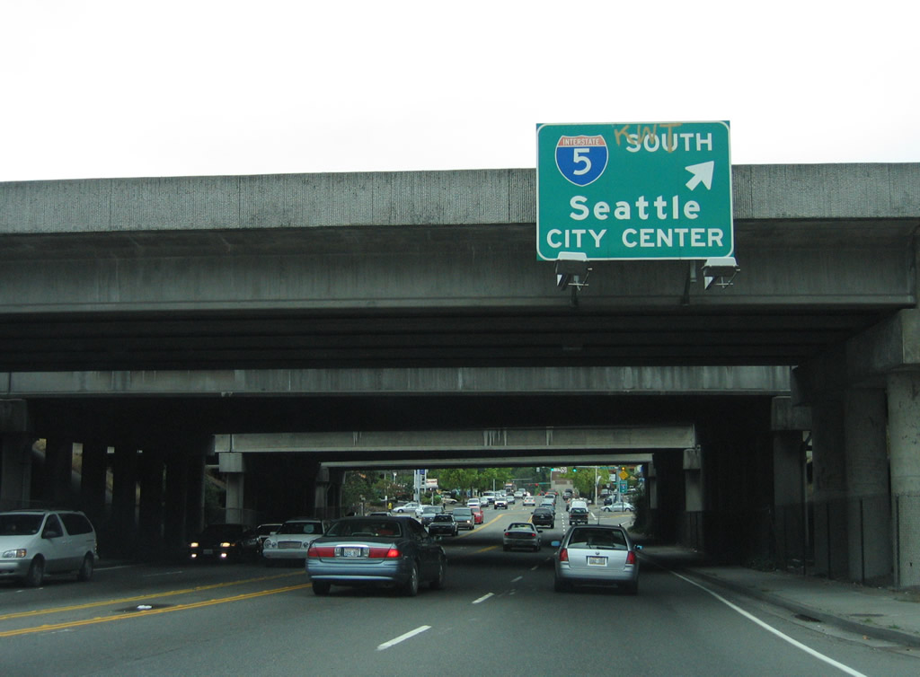
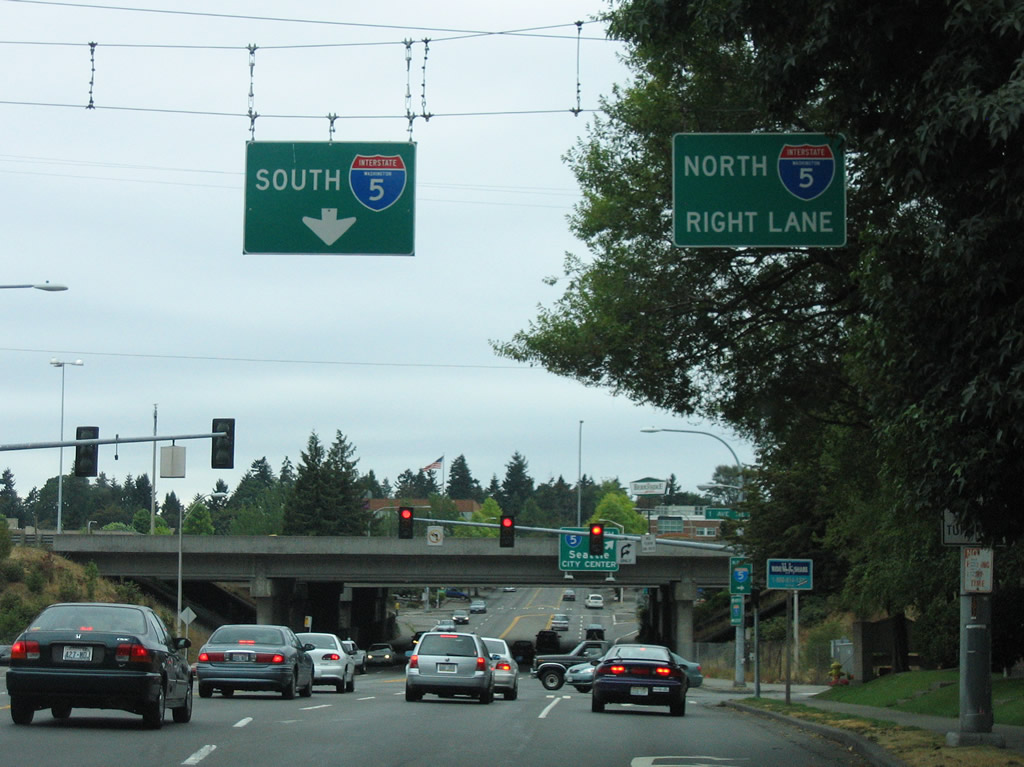
A loop ramp shuttles drivers from the Northgate area of Seattle onto Interstate 5 south to the city center.
08/29/06
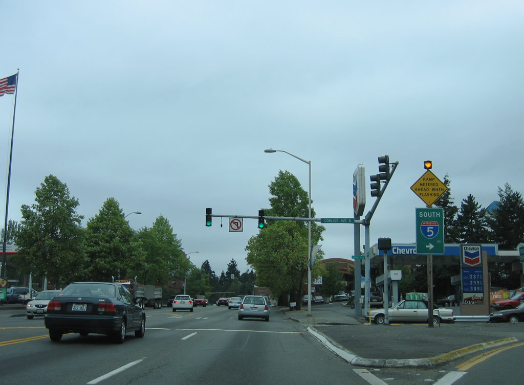
Ramps of Interstate 5 south at Exit 173 meet at North Northgate Way and Corliss Avenue North. The Express roadway system of Interstate 5 commences at Northgate and leads south to downtown.
08/29/06

Northgate Way angles southwest and meets SR 99 (Aurora Avenue) at the North Park section of Seattle. SR 99 follows Aurora Avenue south to Green Lake and north to Richmond Highlands.
08/29/06
Photo Credits:
- AARoads: 08/28/06, 08/29/06, 08/30/06
Page Updated Tuesday September 27, 2011.