
State Highway 358 West

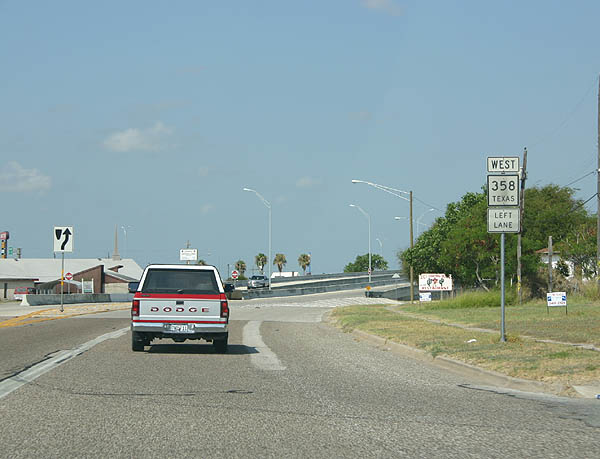
SH 358 turns west from NAS Drive to overtake Park Road 22 along the South Padre Island Drive (SPID) freeway west at Flour Bluff.
07/11/05
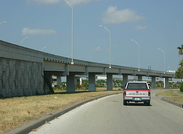
A flyover takes SH 358 west above the Flour Drive ramp and S Padre Island Drive frontage road onto the freeway at the north end of PR 22.
07/11/05
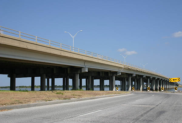
SH 358 (South Padre Island) spans Flour Bluff Drive through an S-curve preceding the causeway across Oso Bay.
07/11/05
Westbound SH 358 at the exit for the Oso Bay Turnaround.
07/11/05
Looking at the Oso Bay Causeway bridge from the turnaround. The span joins Encinal Peninsula with the Nueces County mainland.
07/11/05
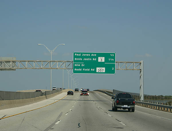
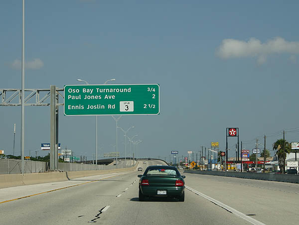
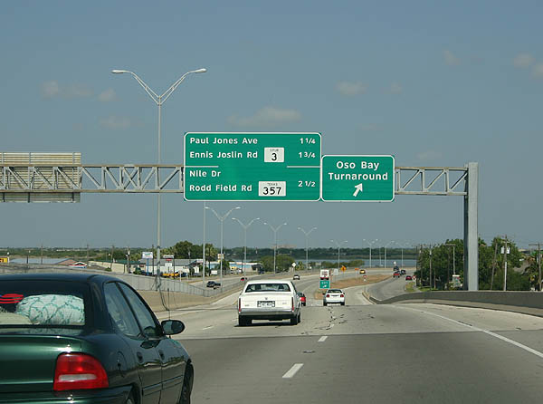
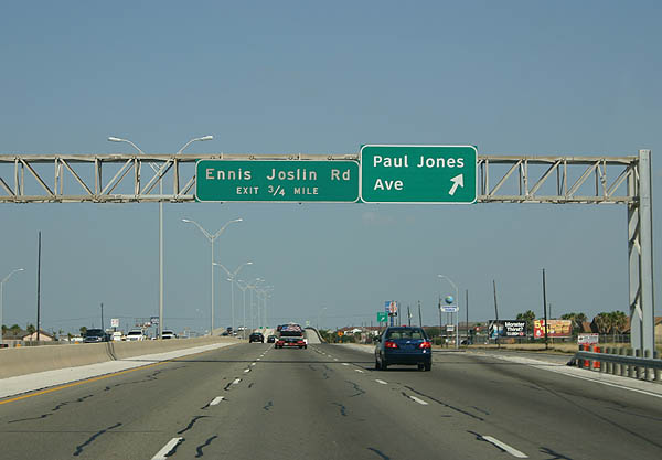
Continuing across Oso Bay, the succeeding exits along SH 358 are for Paul Jones Avenue and SS 3 (Ennis Joslin Road).
07/11/05
Paul Jones Avenue links South Padre Island Drive with an adjacent subdivision and apartment complex off Oso Bay.
07/11/05
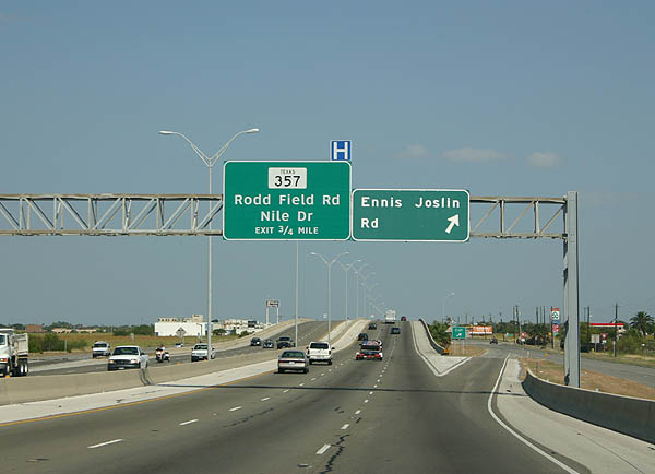
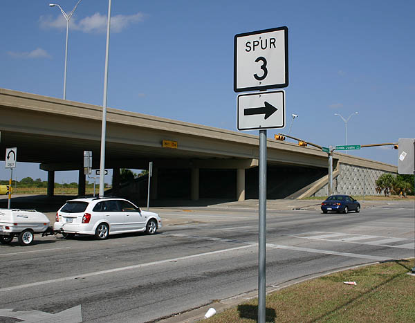
Spur 3 encircles northern reaches of Oso Bay along Ennis Joslin Road from SH 358 to Ocean Drive. The 3.32 mile long route follows Ocean Drive to Ward Island and Texas A&M University - Corpus Christi.
07/11/05
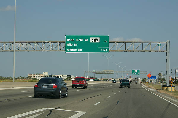
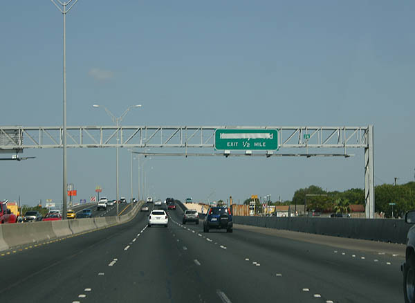
Commercialized frontage lines the bulk of South Padre Island Drive west from Spur 3 into Corpus Christi. The ensuing exit is with SH 357 (Rodd Field Road) west.
07/11/05
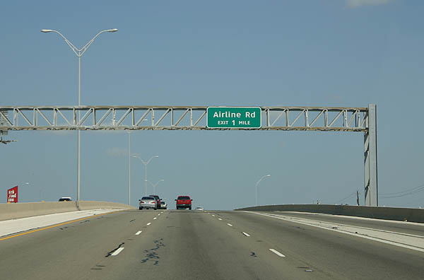
Continuing beyond SH 357, SH 358 (S Padre Island Drive) meets Airline Road in one mile.
07/11/05

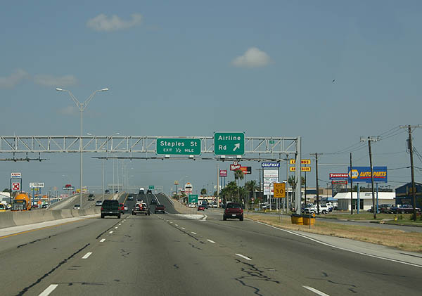
Airline Road and Staples Street serve the Sunrise Mall and La Palmera mall area. Numerous big box stores outside the malls are located in the immediate vicinity.
07/11/05
Airline Road extends 5.36 miles beyond the retail corridor along SH 358 north to residential areas along Ocean Drive and south to Rodd Field Road.
07/11/05
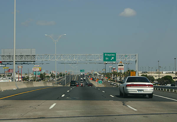
Staples Street comprises a commercial arterial south to SH 357 (Saratoga Boulevard), where it becomes a part of FM 2444. Staples Street north leads eventually to Downtown Corpus Christi.
07/11/05
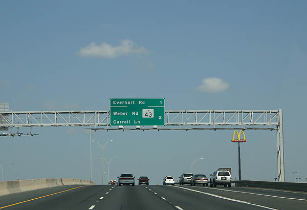
The ensuing ramps along SH 358 westbound depart over the course of two miles for Everhart Road and FM 43 (Weber Road).
07/11/05
Everhart Road represents another major retail corridor in Corpus Christi.
07/11/05

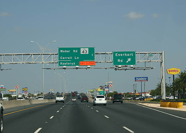
SH 358 reaches the off-ramp for FM 43 (Weber Road) and Carroll Lane just beyond the Everhart Road underpass.
07/11/05
FM 43 (Weber Road) begins at SH 358 and arcs southwest to SH 286 (Chapman Ranch Road). The 10.77 mile highway joins Corpus Christi with FM 665 west to Petronila and Driscoll.
07/11/05
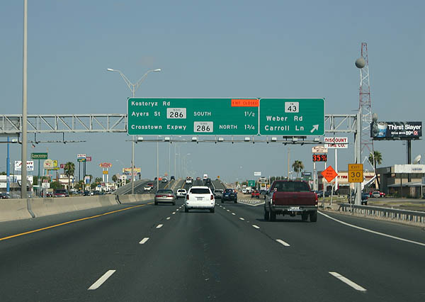
A diamond interchange follows along SH 358 westbound with Kostoryz Road.
07/11/05
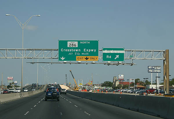
SH 358 continues 1.5 miles from Koystoryz Road to SH 286 (Crosstown Expressway).
07/11/05
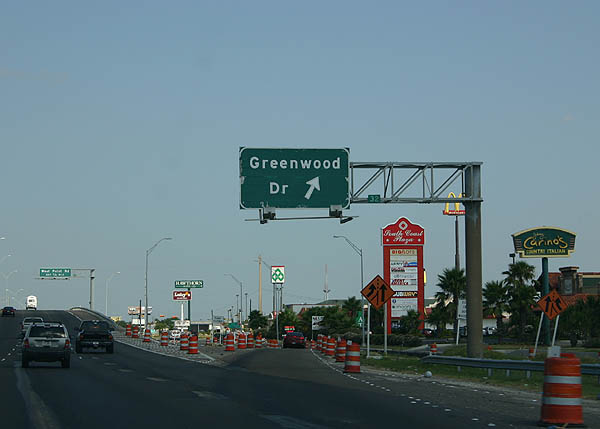
The off-ramp to Greenwood Drive leaves SH 358 northbound within the cloverstack interchange at SH 286 (Crosstown Expressway).
07/11/05
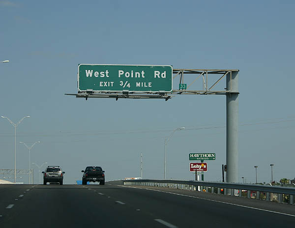
Making a gradual northern turn, SH 358 (S Padre Island) progresses from Greenwood Drive to West Point Drive.
07/11/05
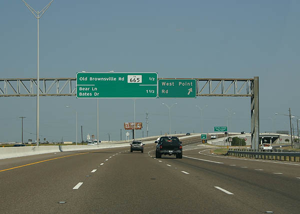
West Point Drive constitutes a 1.98 mile long collector west from Greenwood Drive to Old Brownsville Road (FM 665).
07/11/05
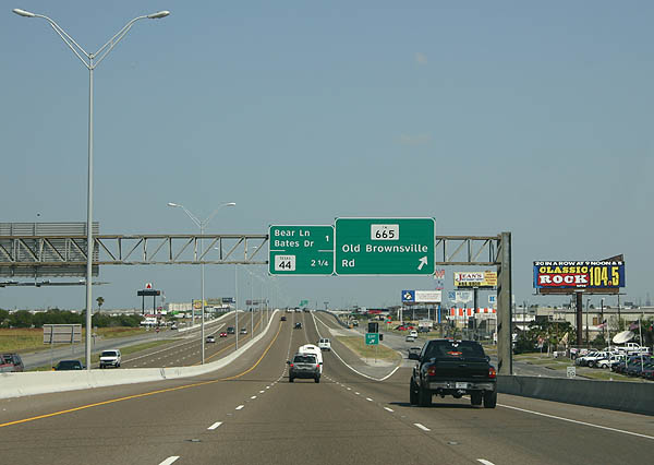
FM 665 (Old Brownsville Road) crosses paths with SH 358 headed northeast to Central City and Agnes Street (SS 544)
07/11/05
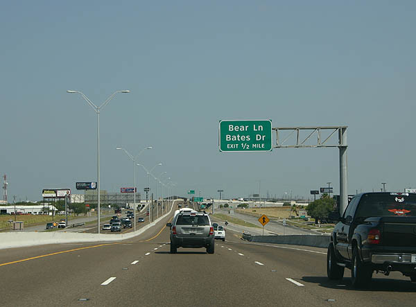
Bear Lane branches west from FM 665 (Old Brownsville Road) to meet SH 358 west at the succeeding exit.
07/11/05
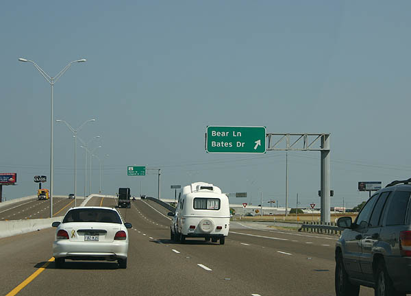
Bear Lane continues west from SH 358 to FM 768 (Joe Mireur Road) on the perimeter of Corpus Christi International Airport (CRP). Bates Drive is a local road east to Flato Road.
07/11/05
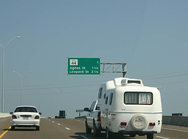
Forthcoming SH 44 is a freeway west to Corpus Christi International Airport (CRP) and the Clarkwood community.
07/11/05
A 133.60 mile highway to U.S. 83 west of Encinal, SH 44 travels from Corpus Christi to IH 69E and U.S. 77 at Robstown and U.S. 281 and the IH 69C corridor at Alice.
07/11/05
Advance north through an area populated by industrial businesses, SH 358 meets SS 407 (Leopard Street). SS 407 parallels IH 37 east to Downtown and northwest to Calallen in Corpus Christi.
07/11/05
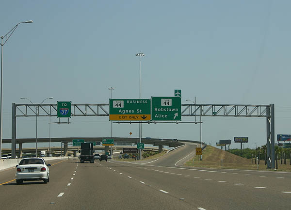
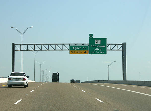
Entering the directional T interchange with the SH 44 freeway on SH 358 (Padre Island Drive) north. SH 44 is part of the IH 69 corridor with further upgrades planned.
07/11/05
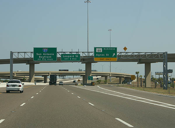
The exit for Agnes Street (Business SH 44) departs from within the exchange at SH 44. While signed as Business SH 44, TxDOT classifies Agnes Street as SS 544. SS 544 measures 6.61 miles east from SH 44 nearby to the IH 37 boulevard to the Corpus Christi Bayfront.
07/11/05
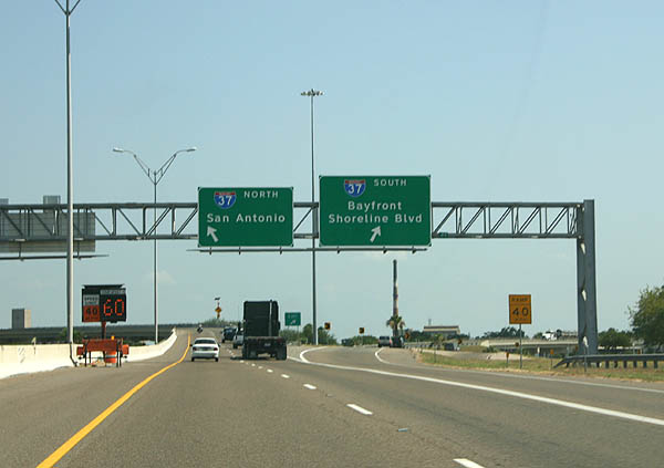
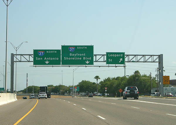
SH 358 concludes at a full wye interchange with IH 37. IH 37 heads east to U.S. 181 north to Portland and the Corpus Christi Bayfront and northwest to Mathis and San Antonio.
07/11/05
Photo Credits:
- Kevin Trinkle: 07/11/05
Connect with:
Page Updated Thursday July 25, 2019.