
U.S. 6
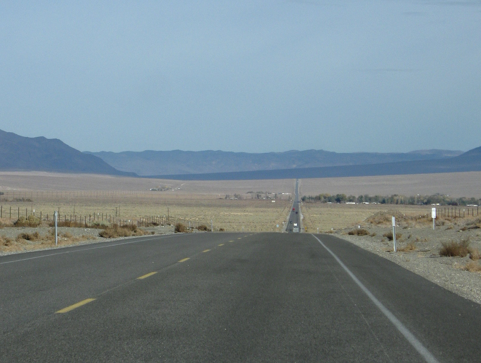
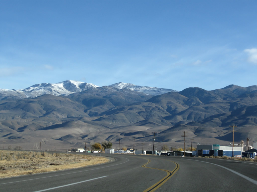
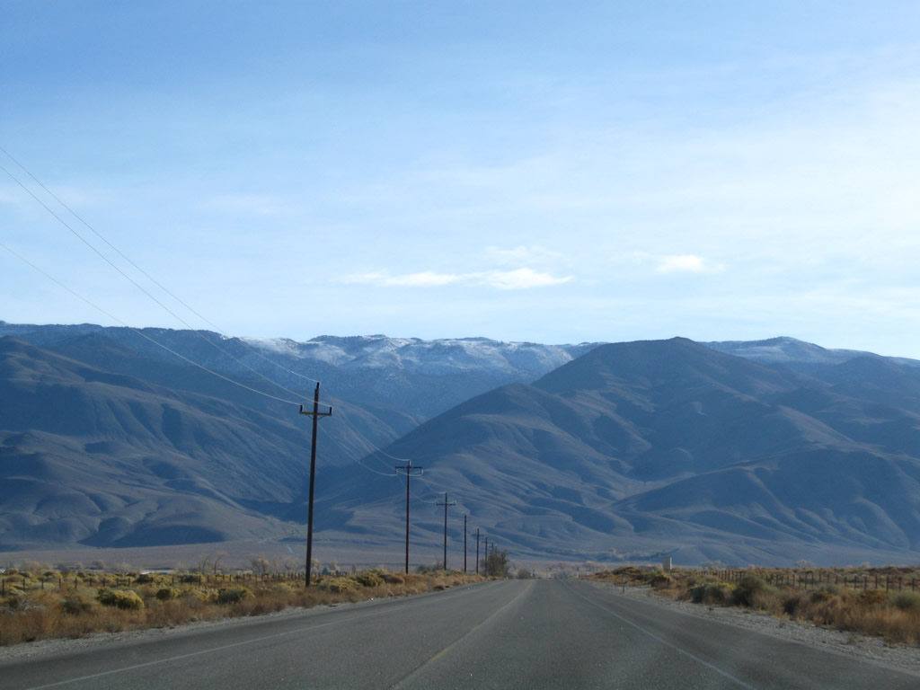
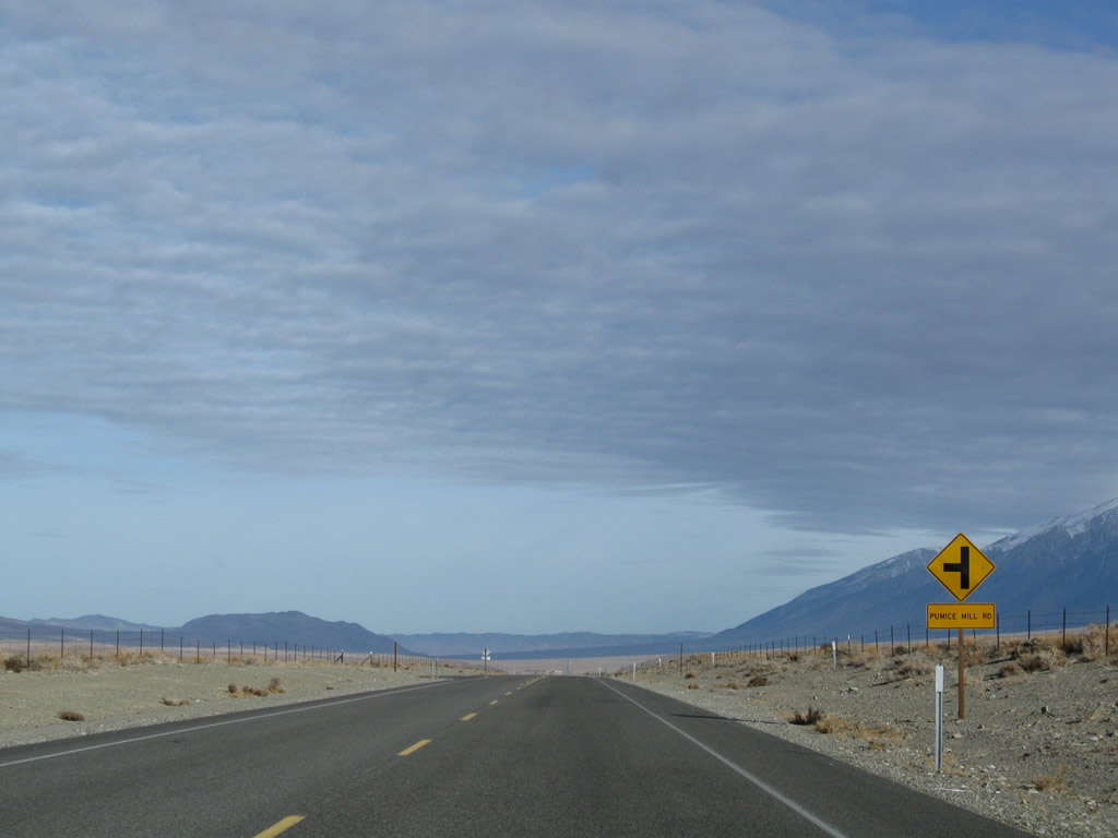
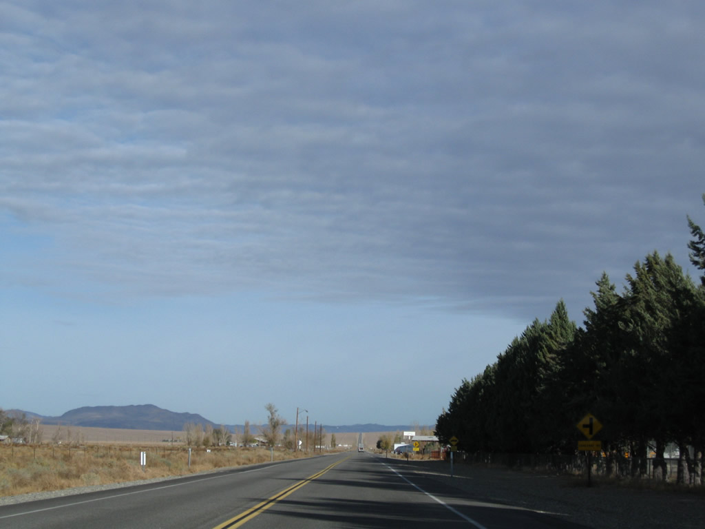
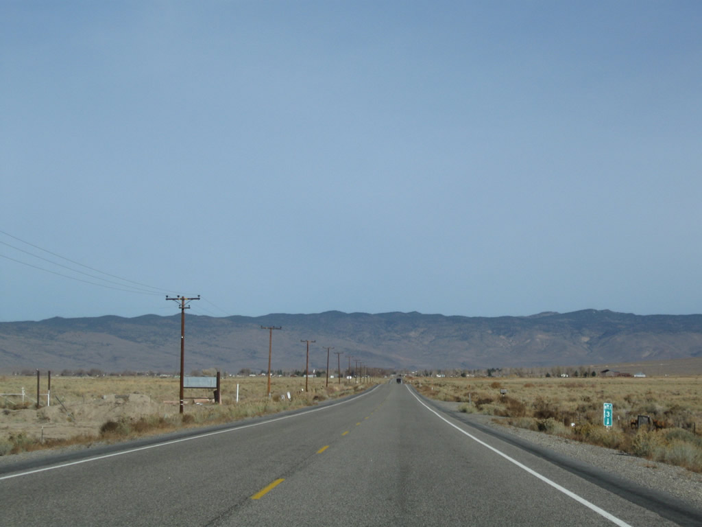
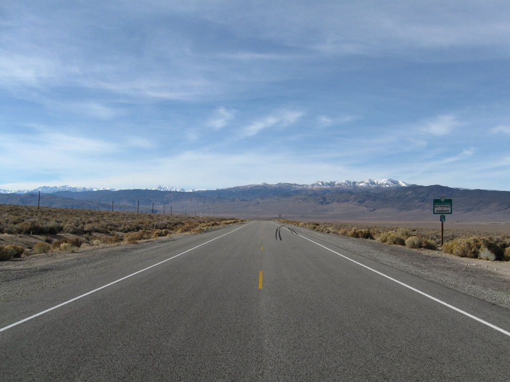
U.S. 6 (Grand Army of the Republic Highway) lowers toward the unincorporated community of Chalfant Valley north beyond Pumice Mill Road. - 11/11/2008
U.S. 6 travels nearly 3,200 miles from Bishop, California, east to Provincetown out on Cape Cod, Massachusetts. The route is known as the Grand Army of the Republic Highway. Within the Golden State, U.S. 6 travels 40.64 miles north from Bishop to the Nevada state line at Queen Valley.
Prior to 1964, U.S. 6 was the longest highway in the United States. U.S. 6 originally started in Long Beach and traveled northeast to Bishop, including a long overlap with U.S. 395. Separating from U.S. 395 at Bishop, U.S. 6 heads northeast into the Owens Valley and then north through the Chalfant Valley, Hammil Valley and Benton Valley to Benton. U.S. 6 angles northeast toward Montgomery Pass in Nevada. U.S. 6 crosses with width of the Silver State, traversing the Great Basin en route to the Rocky Mountains and Denver, Colorado. U.S. 6 proceeds east across the Great Plains and Midwest en route to the Chicago area and eventually into the Northeast, ending on Cape Cod.
U.S. 6 was truncated in 1964 to Bishop in the Eastern Sierra. The former route south is part of U.S. 395, SR 14, Interstate 5, I-110 and SR 1. Originally, U.S. 6 ended at the intersection of SR 1 (former U.S. 101 Alternate) and Atlantic Avenue (former SR 15) in Long Beach.
The former route of U.S. 6 between Sylmar and Inyokern was recommissioned as California State Route 14. Originally following the historic U.S. route along Sierra Highway, SR 14 was largely realigned or upgraded into a freeway alignment, bypassing Santa Clarita, Palmdale, Lancaster and Rosamond. Old U.S. 6, which follows Sierra Highway, is signed with occasional historic U.S. 6 route markers in Los Angeles County.
Sierra Highway is a long roadway that extends from Los Angeles north to Lake Tahoe via SR 14, U.S. 395 and SR 89. However, much of the original Sierra Highway remains separate and distinct from the freeway segment of SR 14, especially between Newhall Pass and Lancaster. While most of Sierra Highway (Historic U.S. 6) is maintained by the county or cities through which it passes, an unrelinquished component of SR 14 (Sierra Highway) remains in the state highway system in Santa Clarita.
Designated as SR 14U, this state route begins at Via Princessa and extends southwest to Newhall Avenue (former San Fernando Road). The "U" means "unrelinquished," i.e. not removed from the state highway system. Signs are posted on SR 14U, which makes it one of the few state routes in California to have a alphanumeric designation along with SR 86S in the Coachella Valley.
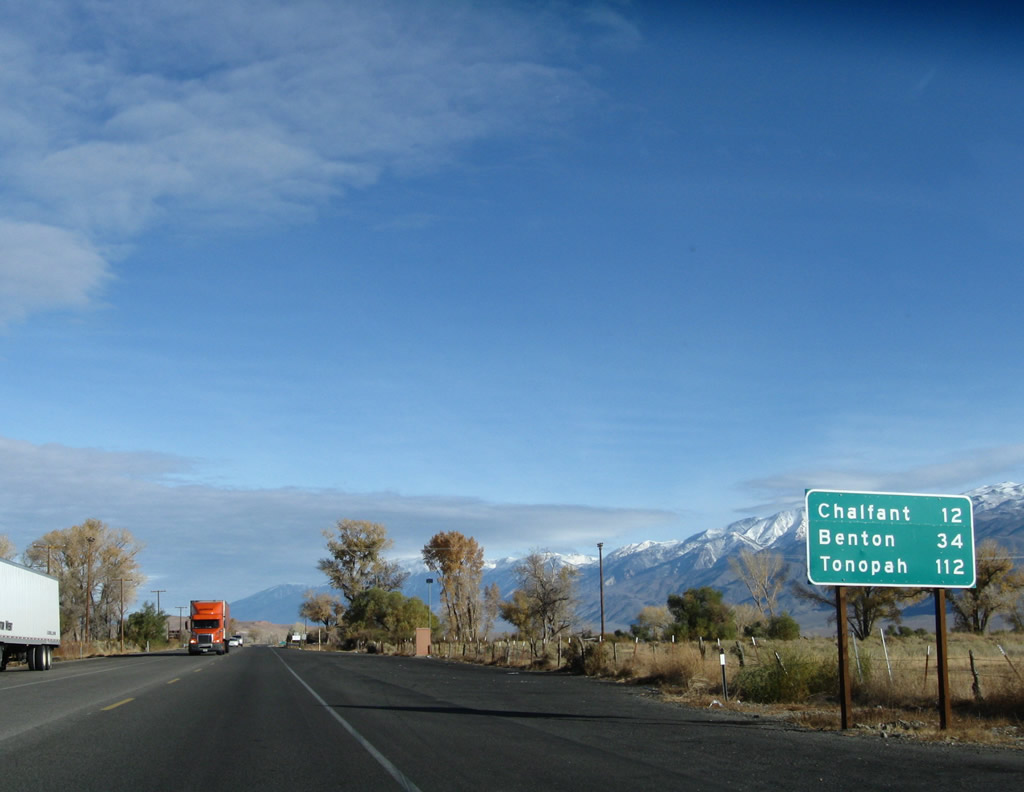
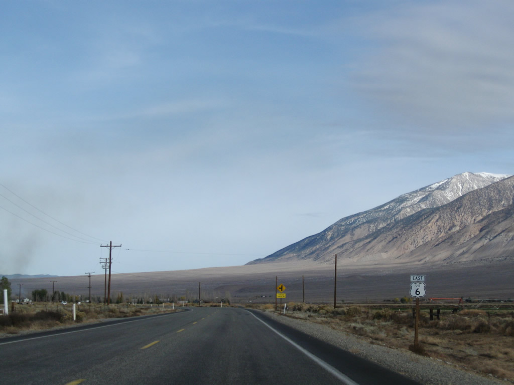
After departing from U.S. 395 within the city of Bishop, eastbound (northbound) U.S. 6 proceeds past this mileage sign, which provides the distance to Chalfant (12 miles), Benton (California 120, 34 miles), and Tonopah (112 miles). U.S. 6 was signed as north-south in California until the early 2000s, when it was changed to east-west to match the primary orientation of the national route. However, it is primarily north-south in California, even its remaining segment northeast of Bishop.
11/10/08
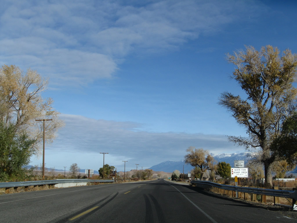
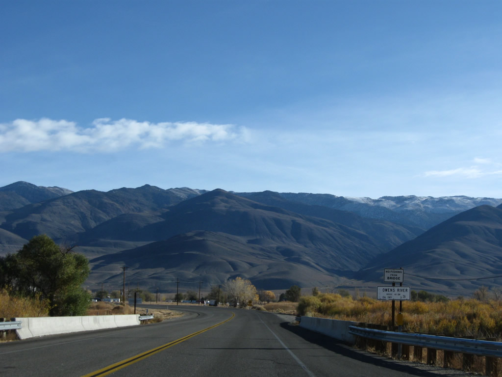
U.S. 6 crosses over the North Fork of Bishop Creek. The creek flows toward the Owens River, which in turn flows south toward Owens Lake.
11/10/08
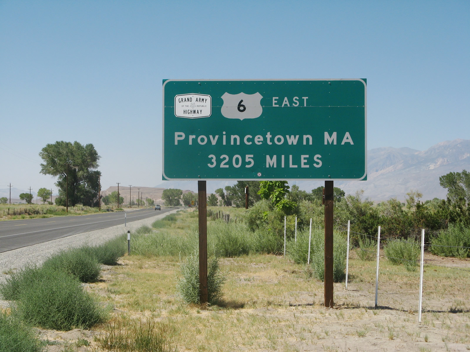
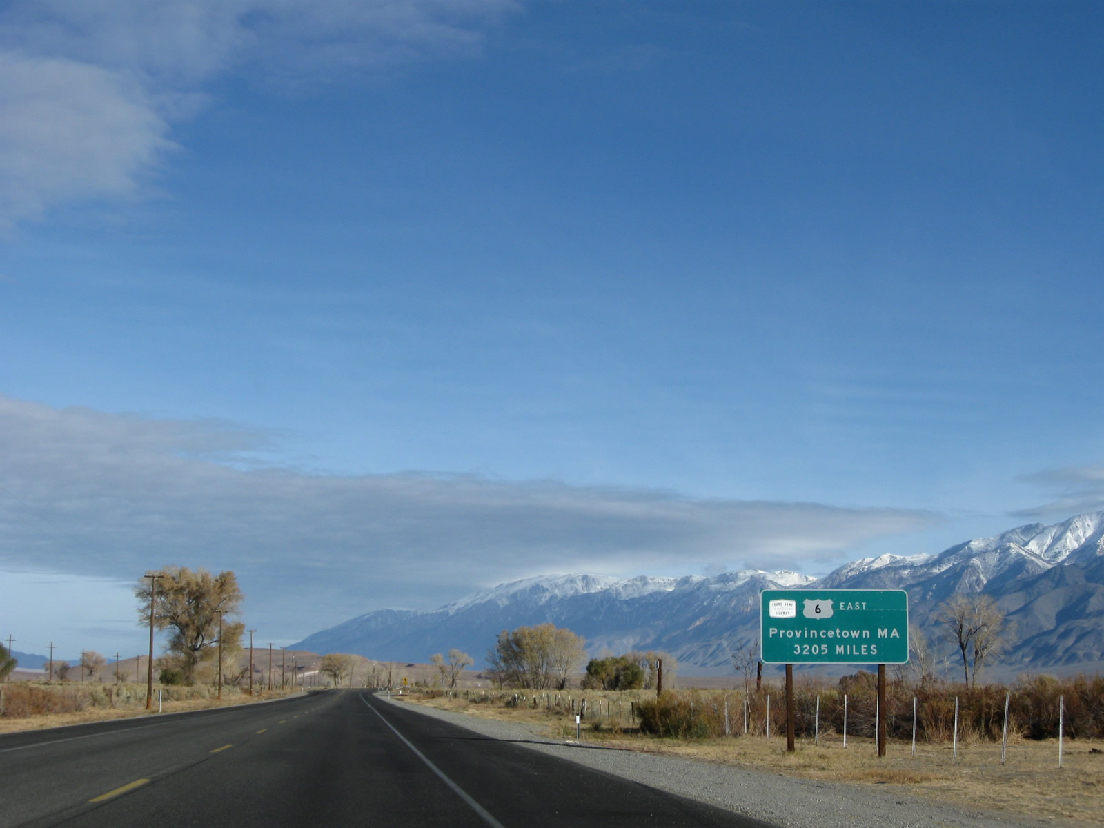
This U.S. 6 mileage sign is posted in Bishop as U.S. 6 begins its journey east across the country. Between Bishop and Benton, U.S. 6 was signed north-south until around 2005, when signs were changed to match the general direction of the route east to Massachusetts. Nevertheless, U.S. 6 travels almost due north-south while in California. From Bishop, it is a long way to Provincetown, Massachusetts!
11/10/08
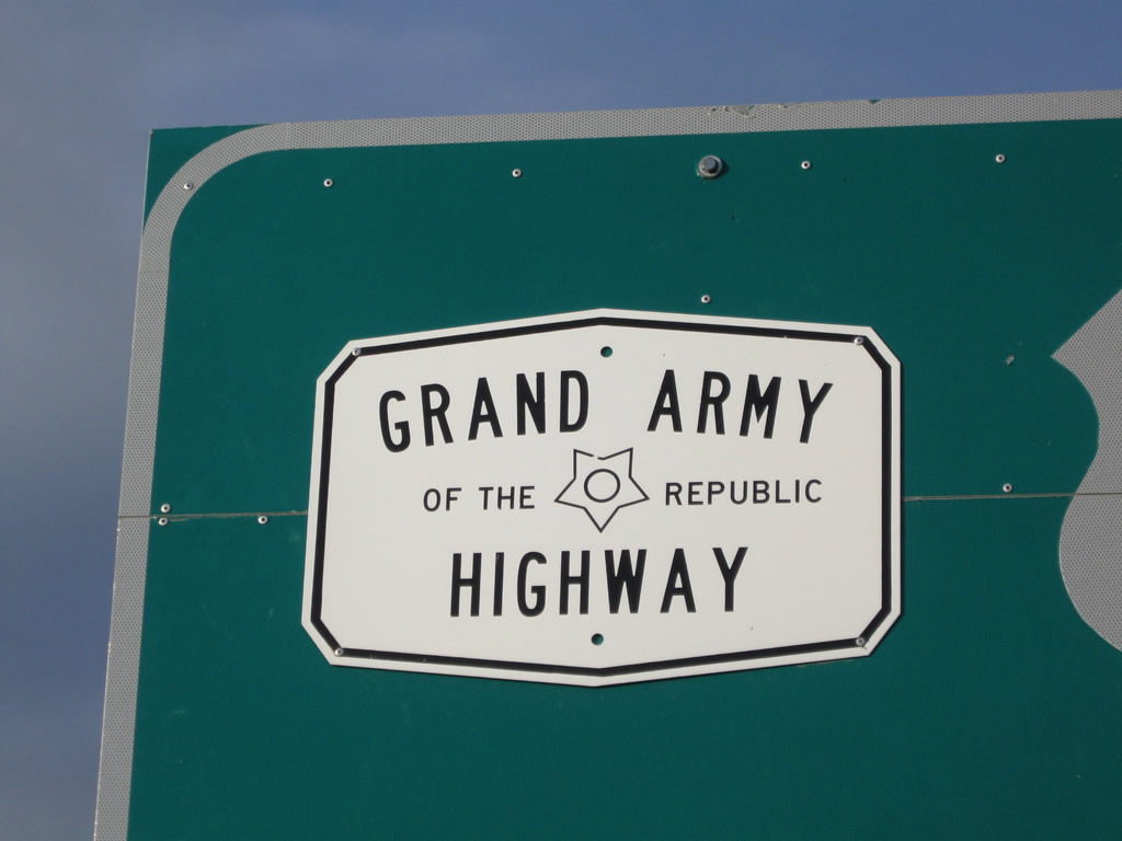
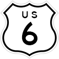
U.S. 6 is the Grand Army of the Republic Highway, which is signed with an almost-hexagonal shield such as this one affixed to the Provincetown mileage sign. (Look closely, and you'll see the shield actually has ten sides rather than six, but from a distance it looks like a six-sided sign.) U.S. 6 is also known as the Midland Trail across eastern California and Nevada.
11/10/08
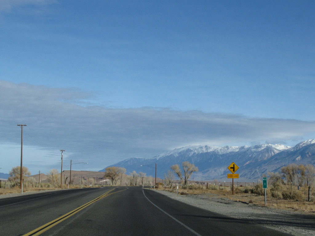
U.S. 6 is among the first of California's highways to receive green milepost markers similar to those found in most other states. The MILE 1 post is located prior to the left turn to Dixon Lane.
11/10/08
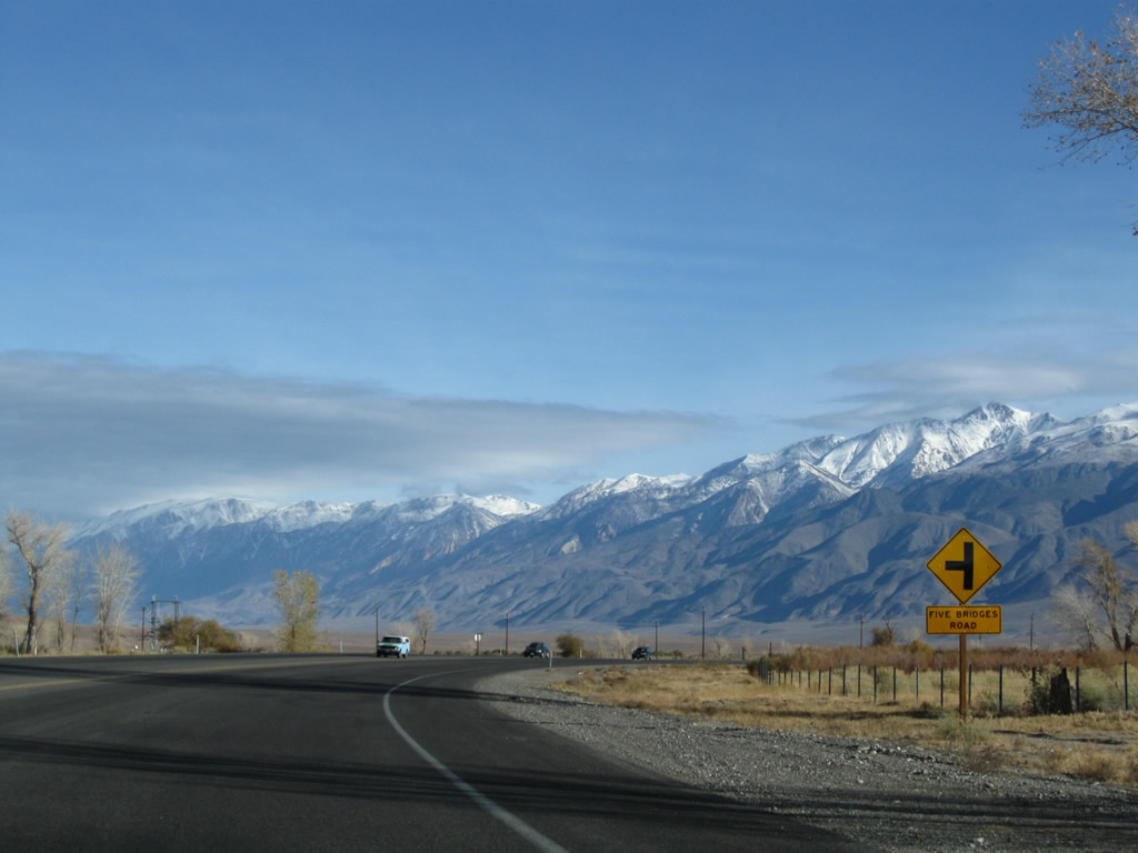
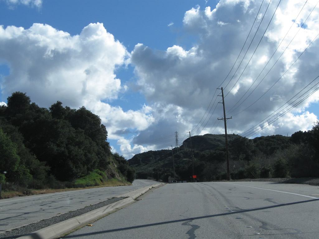
U.S. 6 (Grand Army of the Republic Highway) approaches Five Bridges Road, then turns east toward Laws. This curve was realigned; it used to feature a sharp right turn at the intersection between Five Bridges Road and Riverside Road. The modern curve allows for faster travel through this intersection. Five Bridges Road travels due from here and connects to Riverside Road. The scenic White Mountains dominate the view the east and also keep U.S. 6 from traveling east for long; it soon must turn north through the Chalfant Valley toward Benton.
11/10/08
Eastbound (northbound) U.S. 6 passes through Laws (el. 4,113 feet) near the foot of the White Mountains. At this point, U.S. 6 again turns north.
11/10/08
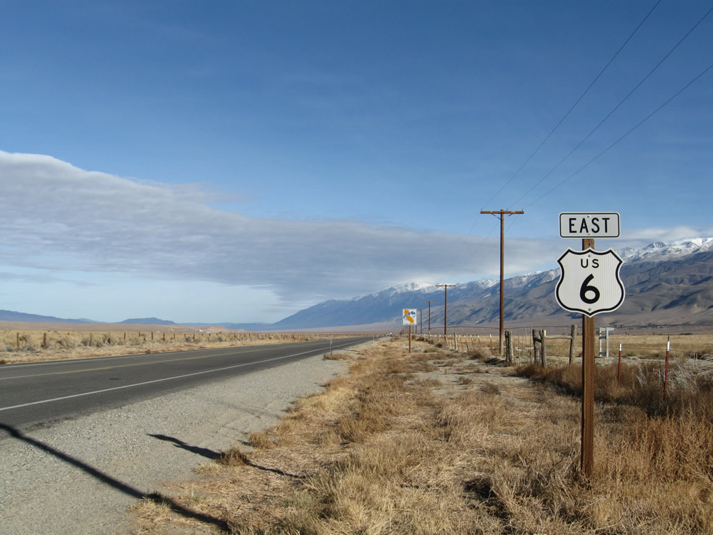
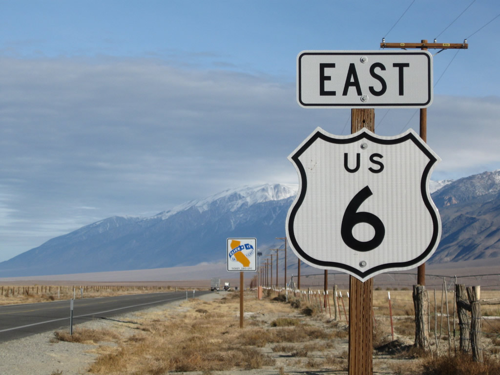
The first U.S. 6 east reassurance shield is posted shortly thereafter. Back in 1998, the cardinal direction for U.S. 6 was north; it was changed to east at some point in the ensuing decade.
11/10/08
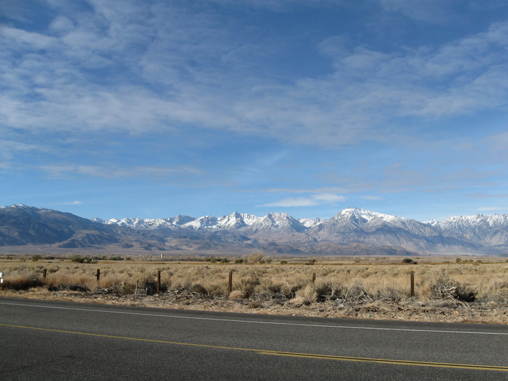
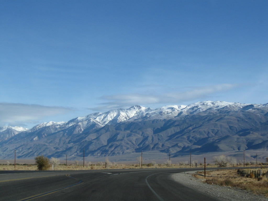
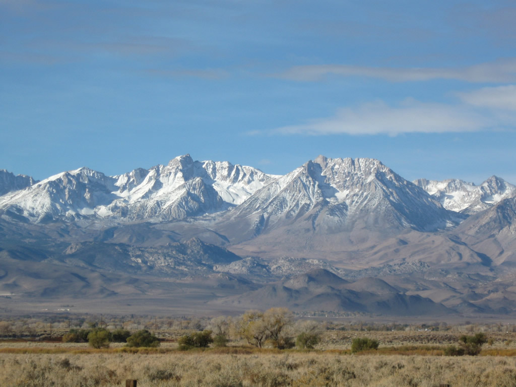
The scenic White Mountains rise above U.S. 6 and the Chalfant Valley. The White Mountains, which are part of the Inyo National Forest, feature the Ancient Bristlecone Pine Forest and some of the oldest living things on the planet. Blanco Mountain (el. 11,278 feet) and other similar peaks are visible from U.S. 6.
11/10/08
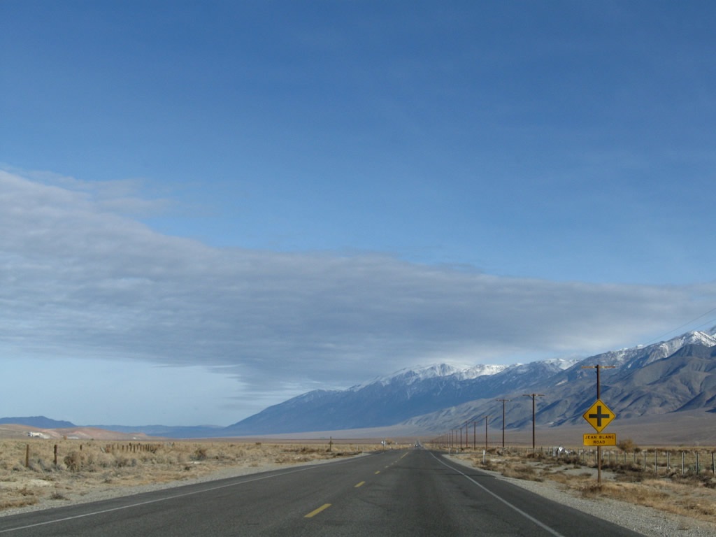
Northbound (eastbound) U.S. 6 approaches Jean Blanc Road after the MILE 5 marker.
11/10/08
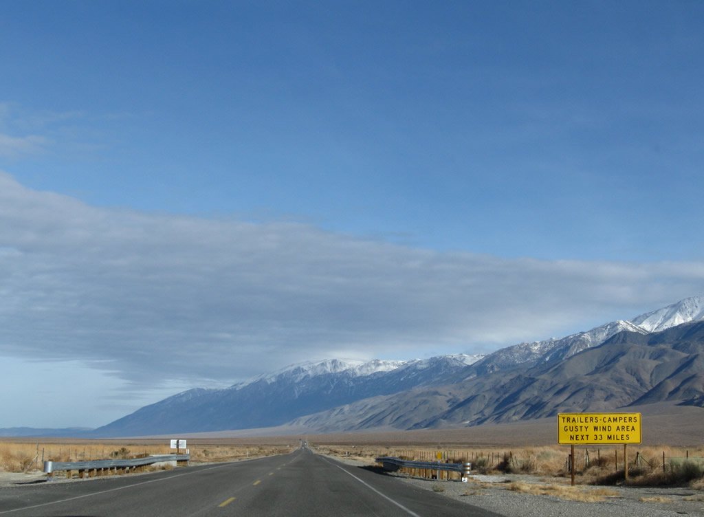
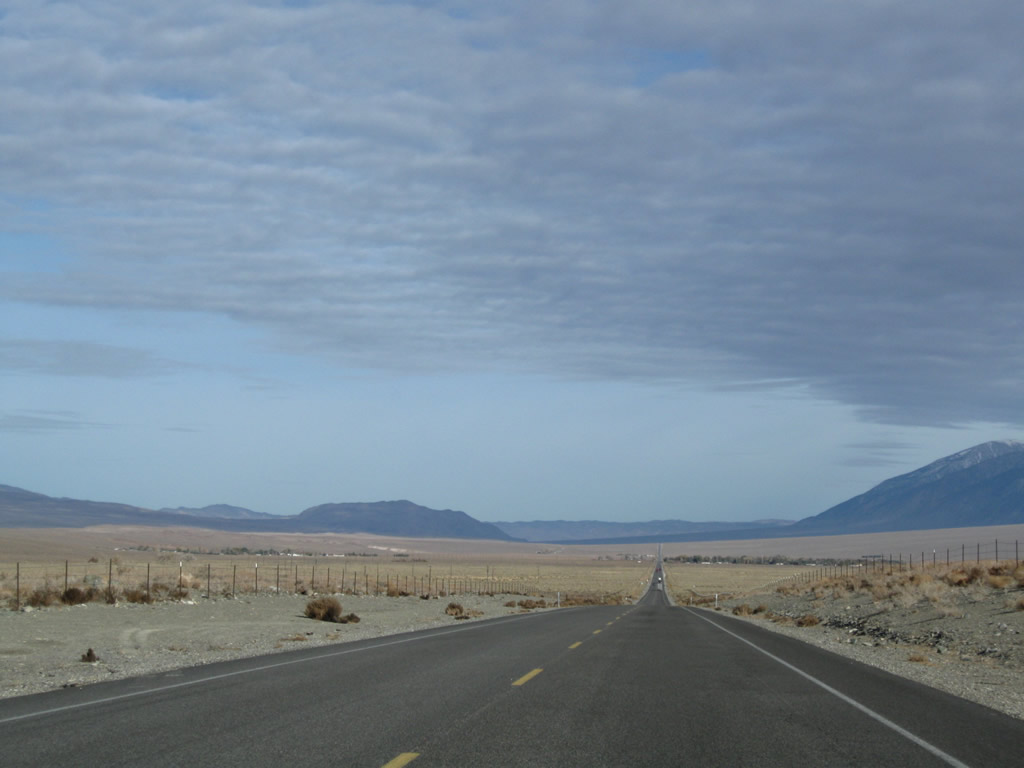
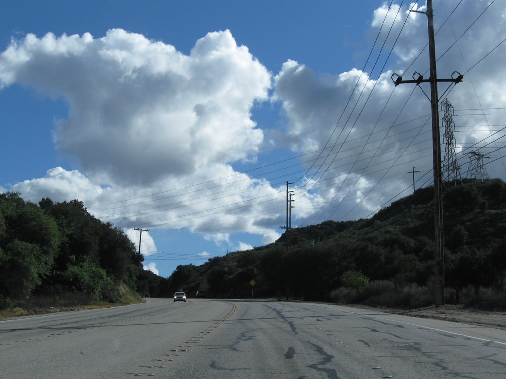
High winds are common in the Eastern Sierra, and U.S. 6 is no exception as it traverses the Chalfant Valley, Hammil Valley, and Benton Valley. High profile vehicles including trucks should watch their speed and note changing weather conditions that could bring damaging winds through the valleys.
11/10/08
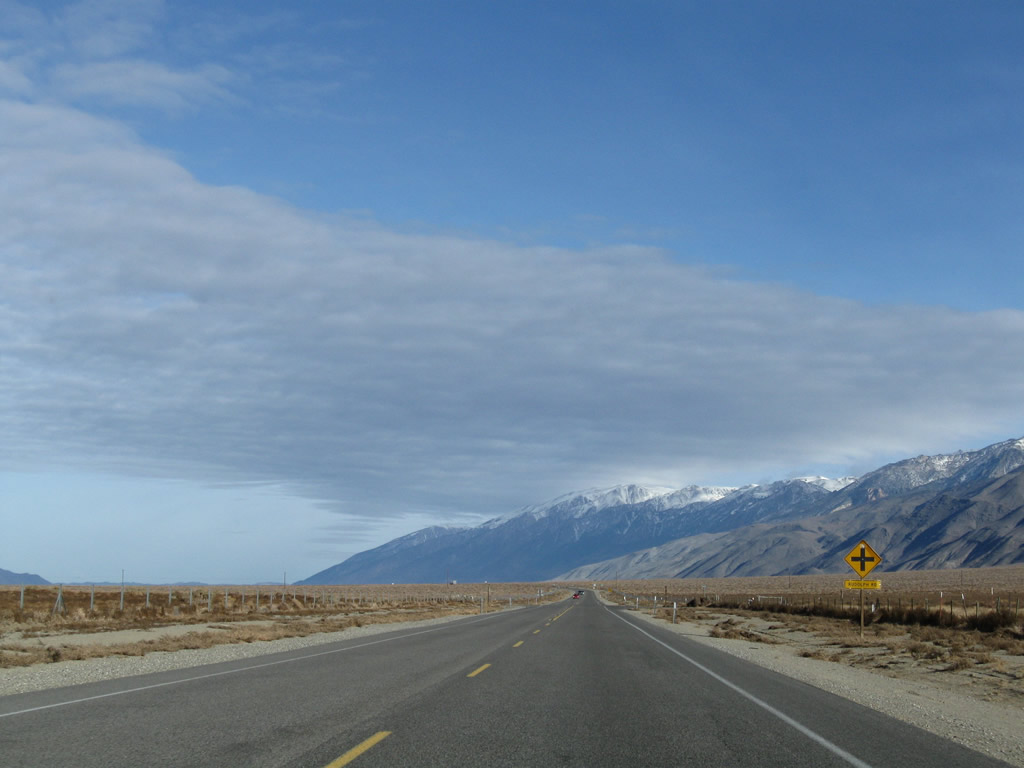
Northbound (eastbound) U.S. 6 approaches Rudolph Road.
11/10/08
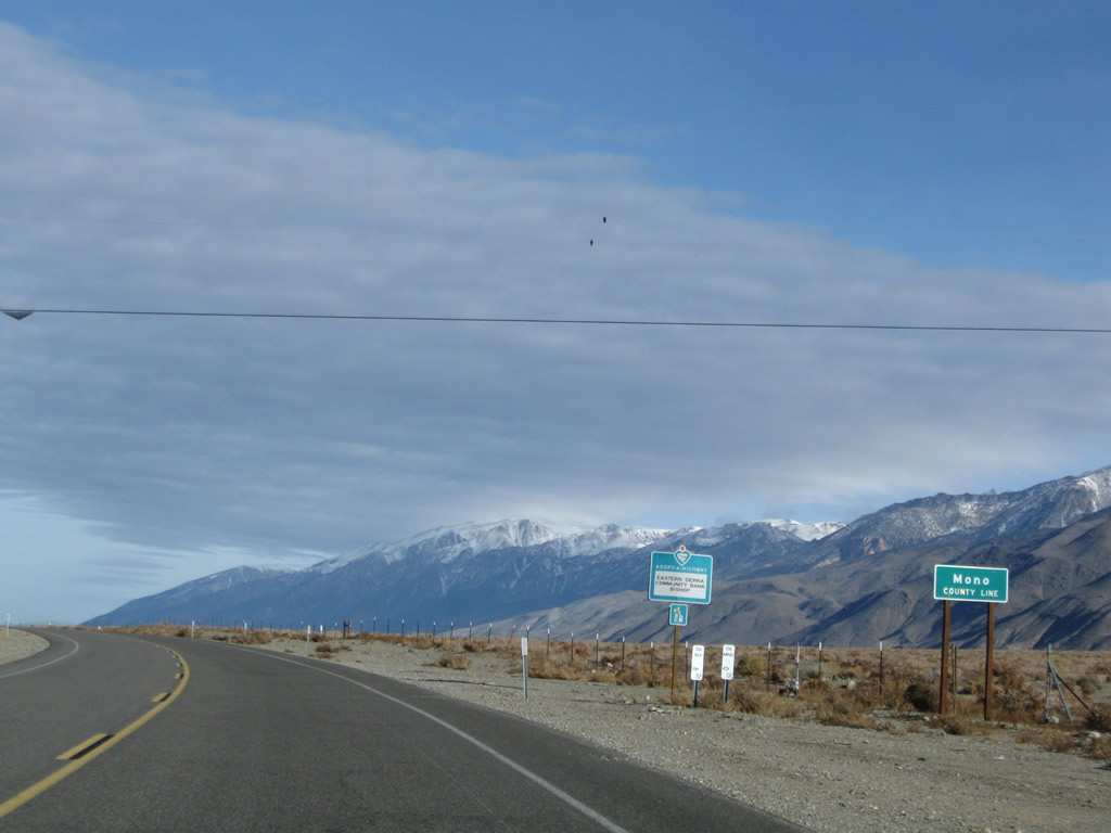
U.S. 6 leaves Inyo County and enters Mono County about eight miles north of Bishop.
11/10/08
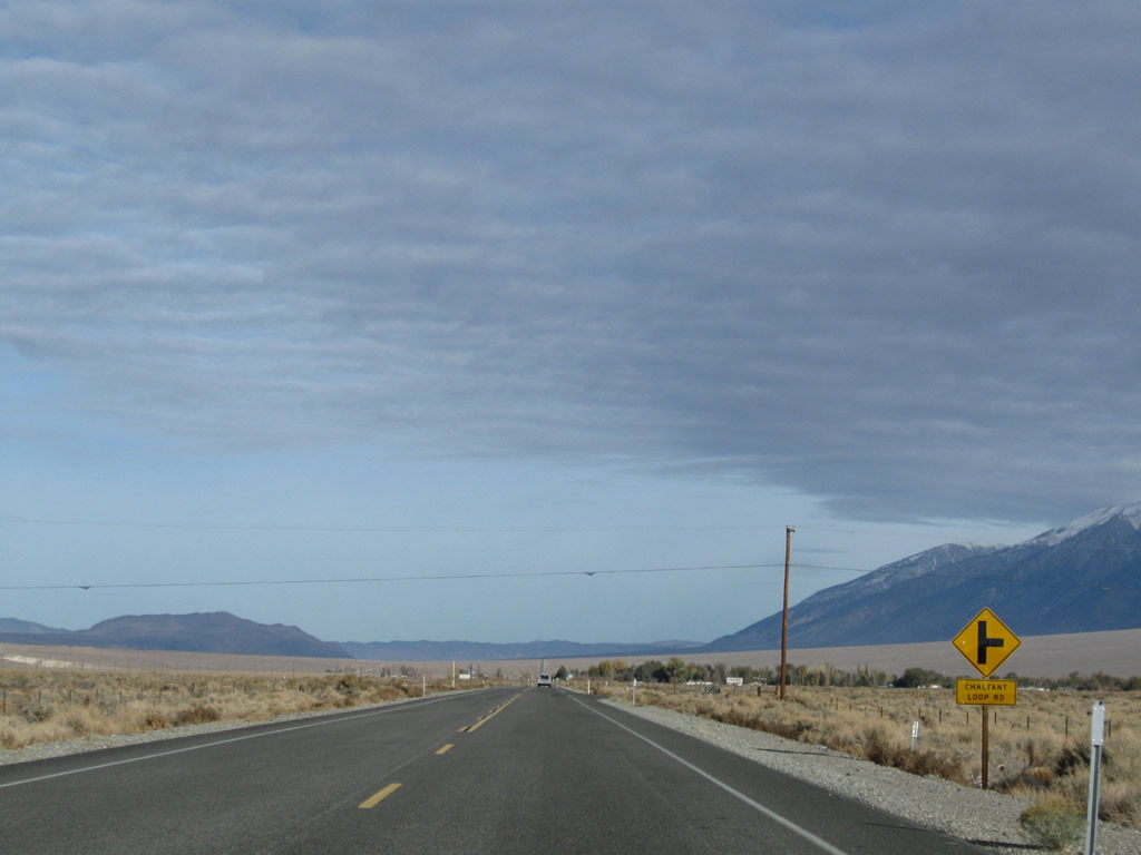
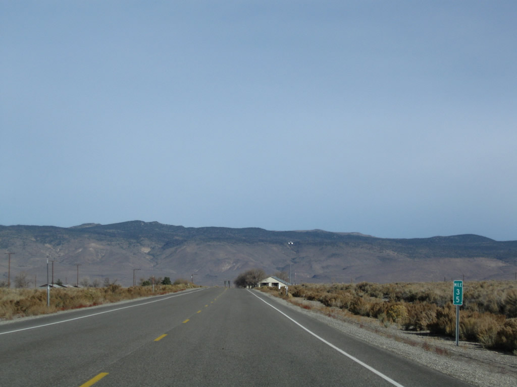
The next major intersection along U.S. 6 is with Pumice Mill Road. Due to the geologically active nature of the area, remnants of a more volcanic past are evident throughout the Eastern Sierra, especially near Bishop and Mammoth Lakes. The overlook in the third photo looks north after the MILE 9 marker.
11/10/08
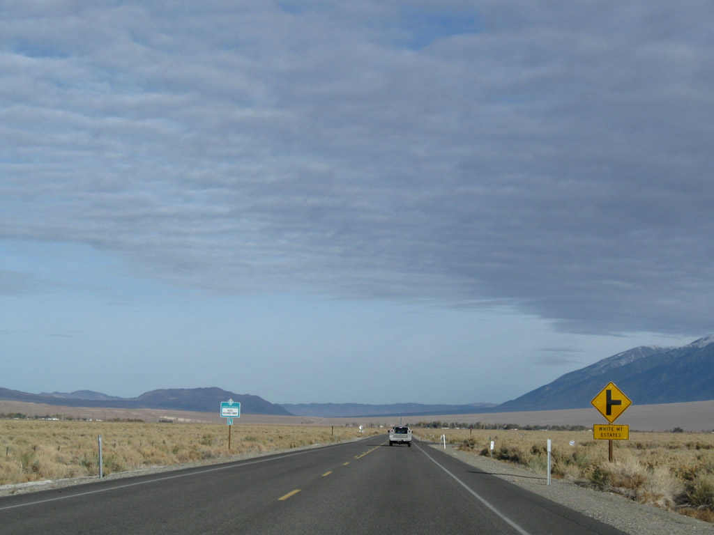
White Mountain Estates is a small settlement located off the east side of U.S. 6. No motorist services are available here.
11/10/08
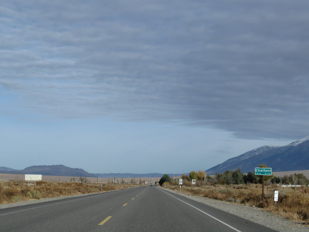
U.S. 6 next approaches and enters the unincorporated community of Chalfant (el. 4,258 feet, with a listed population of 530 on the Caltrans sign) in the Chalfant Valley.
11/10/08
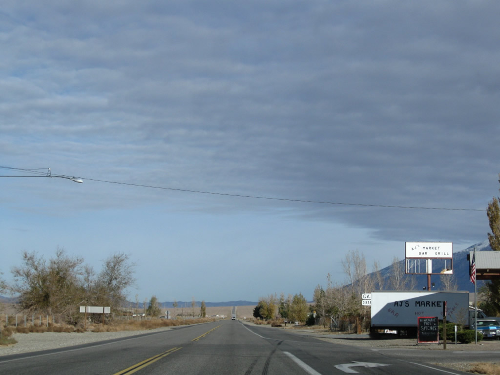
Motorist services (gas, food) are available in Chalfant at the intersection with Brown Subdivision Road. Ahead, U.S. 6 resumes its northerly course through Chalfant Valley.
11/10/08
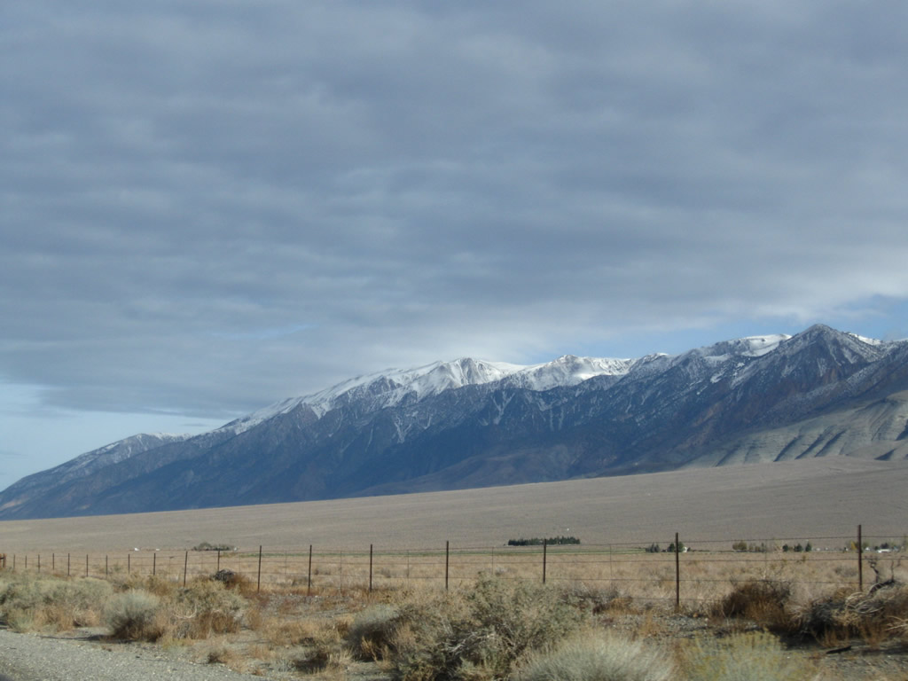
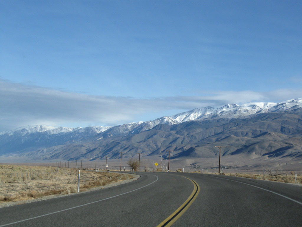
The snow-capped White Mountain line the west side of the Chalfant Valley and are readily visible from U.S. 6 on clear days. Continuing straight ahead, a mileage sign along U.S. 6 north provides the distance to Benton (16 miles), Tonopah (94 miles), and Ely (261 miles). The metric distances were kept on this newer, reflective mileage sign.
11/10/08
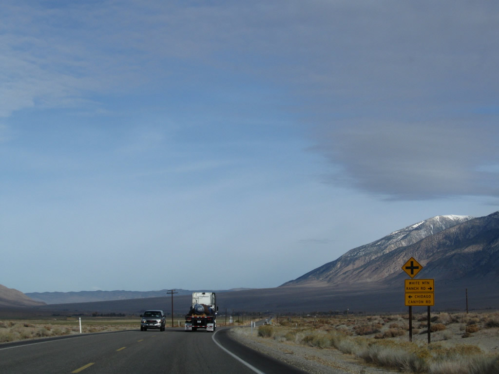
Northbound (eastbound) U.S. 6 approaches White Mountain Ranch Road (east to White Mountain Ranch and Millner Falls Creek) and Chicago Canyon Road (northwest to the Red Canyon Petroglyphs). After this area, U.S. 6 leaves Chalfant Valley and enters Hammil Valley.
11/10/08
A U.S. 6 reassurance marker precedes Dawson Ranch Road. This sign was posted with a north cardinal direction banner in the 1990s. Continuing northward, U.S. 6 enters the unincorporated community of Hammil. Some agriculture is practiced in Hammil, and an old alignment of U.S. 6 (Hammil Road) can be accessed via Crestview Drive.
11/10/08
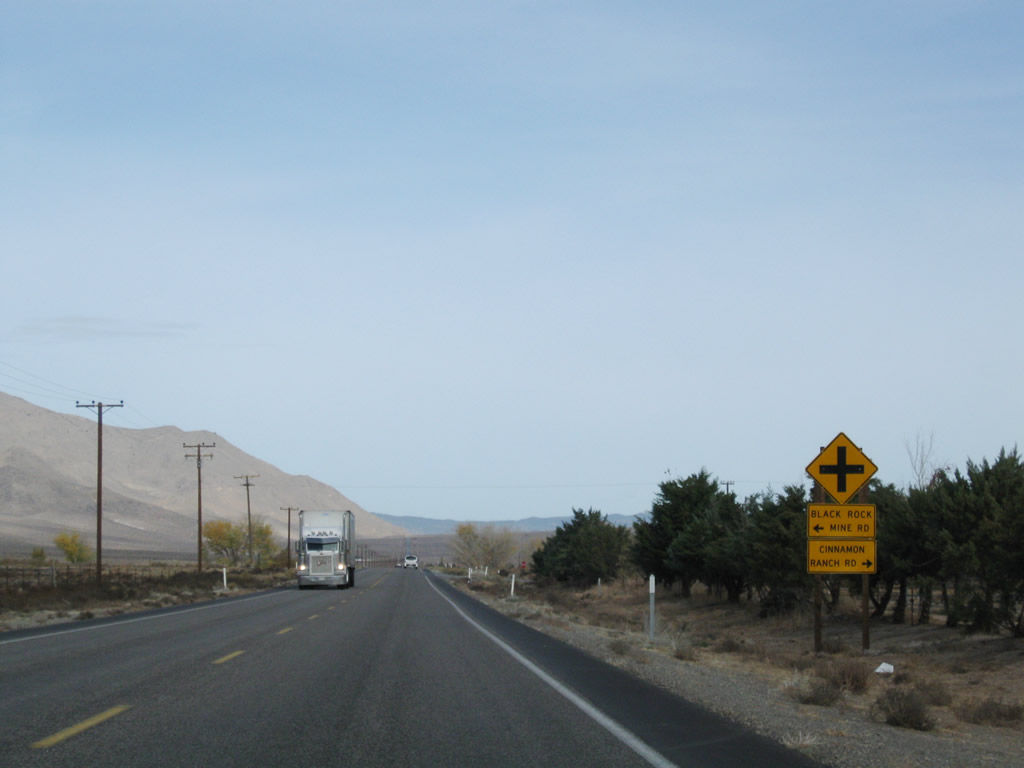
After the intersection with Crestview Drive, eastbound U.S. 6 approaches Black Rock Mine Road and Cinnamon Ranch Road in Hammil. Ahead, U.S. 6 will leave Hammil and again enter open country. The U.S. route continues to generally go north from here, and even slightly northwest as it approaches Benton.
11/10/08
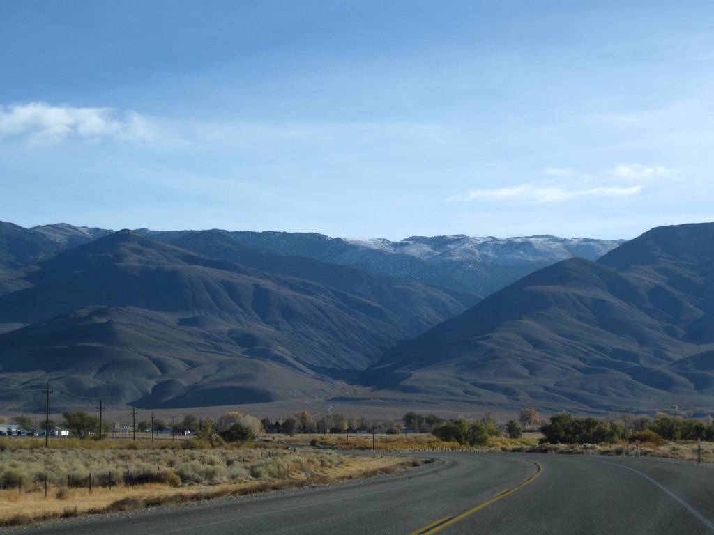
As U.S. 6 leaves the Hammil Valley and passes near Anderson Peak before descending into Benton Valley.
11/10/08
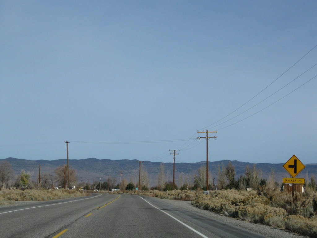
U.S. 6 (Grand Army of the Republic Highway) eastbound approaches Walker Place and nears the unincorporated community of Benton.
11/10/08
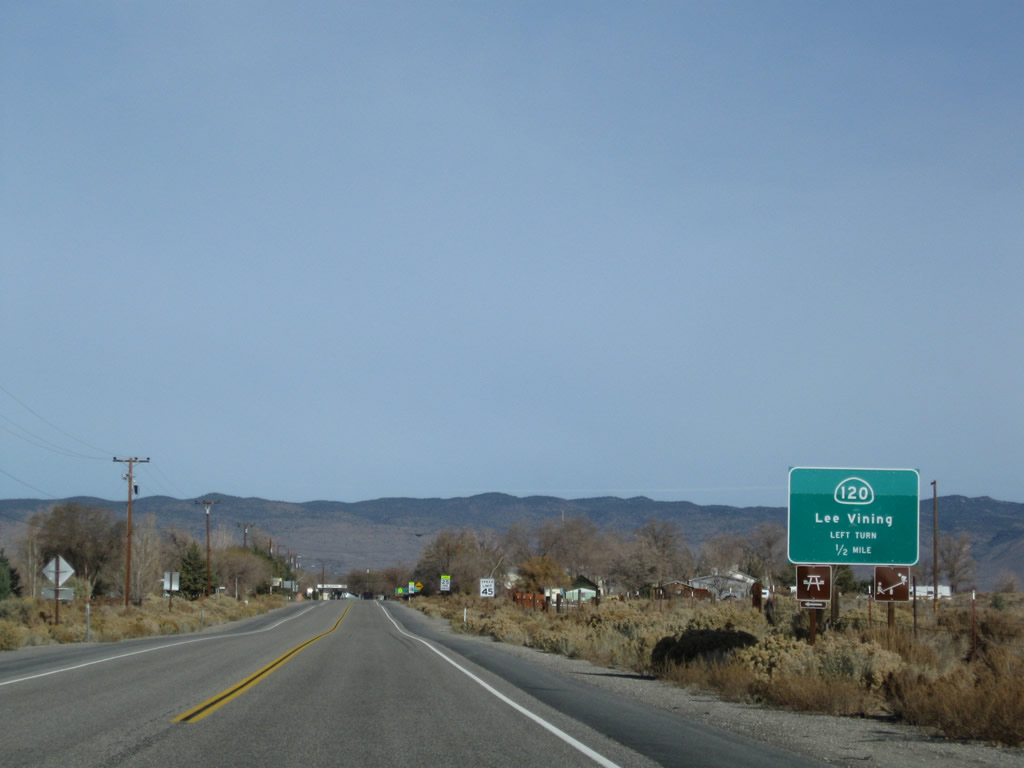
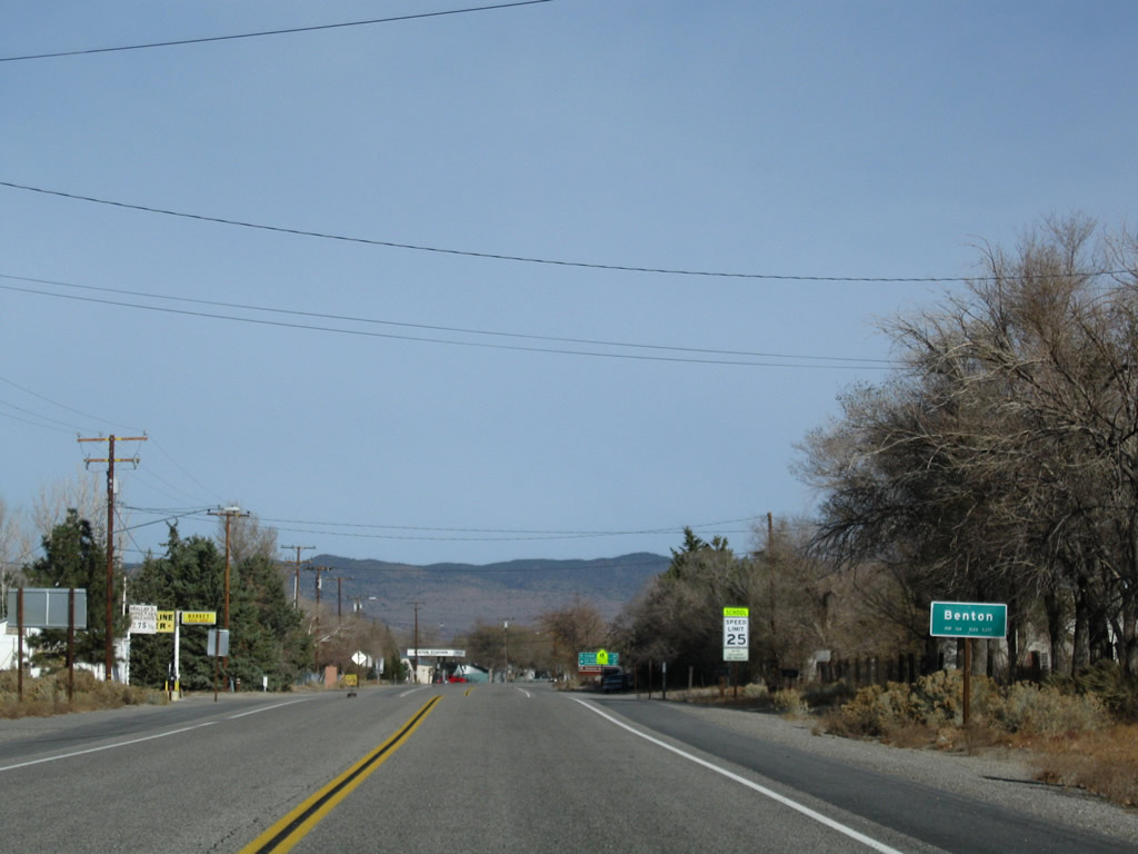
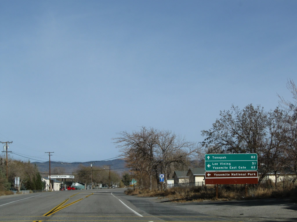
U.S. 6 enters the unincorporated community of Benton (el. 5,377 feet, population 164 per the Caltrans entry sign), which was founded primarily due to its location near Benton Hot Springs. The area was settled in the 1850s as part of the mining boom of that era (with the ghost town of Bodie an example of mining towns from that era). In downtown Benton, U.S. 6 meets California 120, which travels west to Black Lake, Adobe Valley, Sagehen Summit (el. 8,139 feet), Mono Valley, the South Tufa formations along Mono Lake, and Lee Vining. During winter, California 120 over the Sagehen Summit is closed. West of U.S. 395 at Lee Vining, California 120 ascends to Tioga Pass (also closed in winter) and enters Yosemite National Park before passing through Gold Country and entering the Central Valley. The state route ends at Interstate 5 in Lathrop near Manteca.
11/10/08
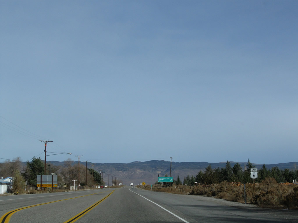
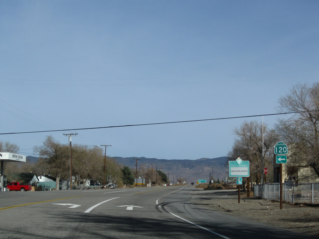
A U.S. 6 east reassurance shield is posted along the Grand Army of the Republic Highway in Benton after the California 120 junction. From here, U.S. 6 will bend northeast through the Benton Valley toward the California-Nevada state line.
11/10/08
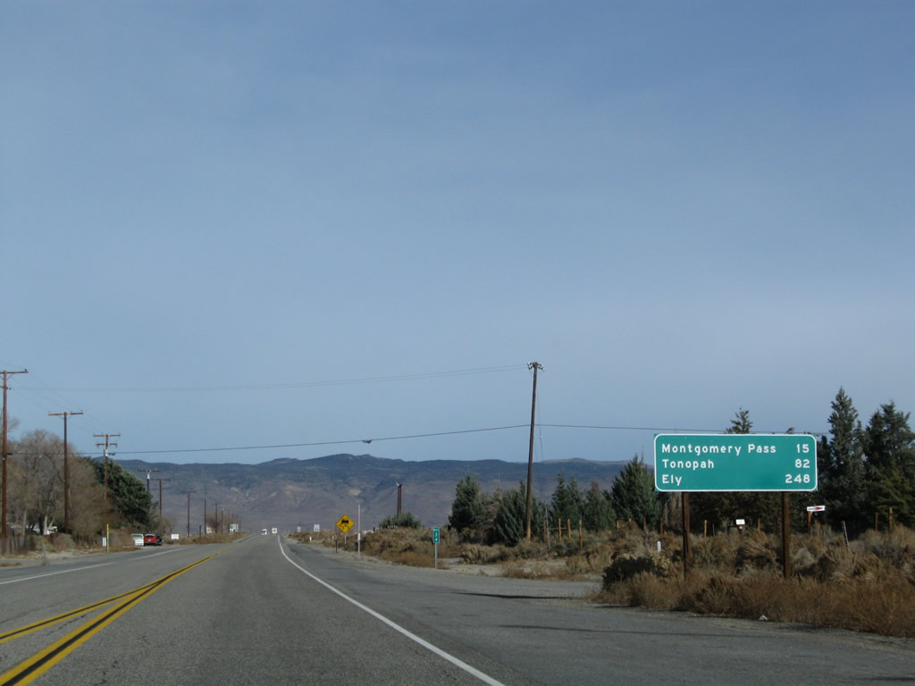
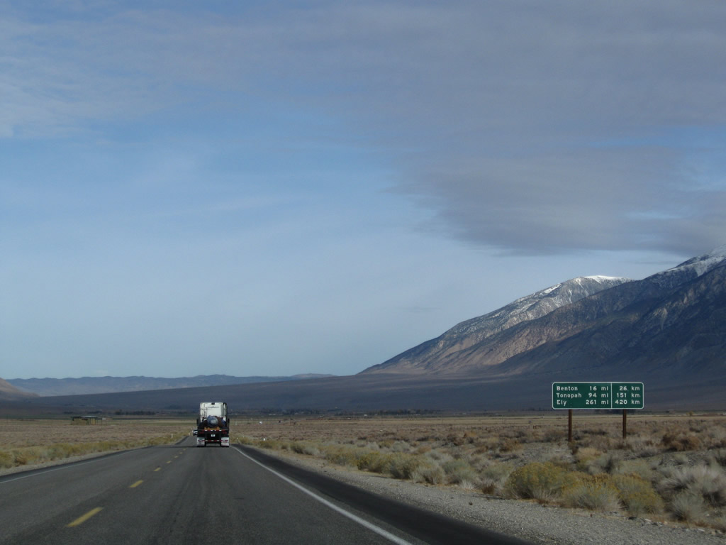
This mileage sign along U.S. 6 east provides the distance to Montgomery Pass (15 miles), Tonopah (82 miles), and Ely (248 miles).
11/10/08
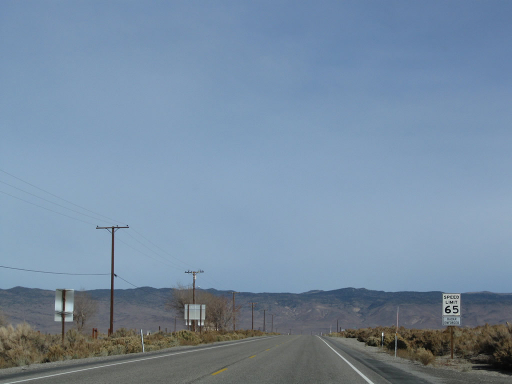
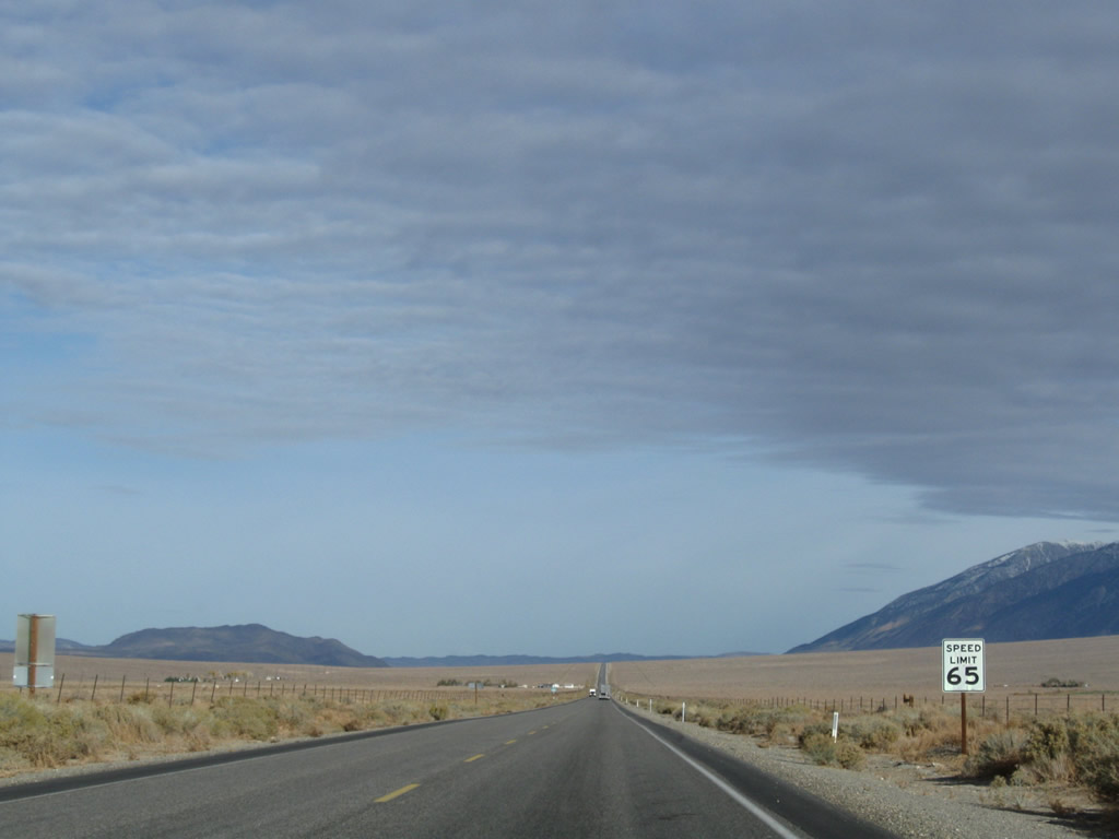
U.S. 6 resumes its two-lane "freeway" configuration, with limited access points onto the two-lane rural highway. The speed limit rises to 65 miles per hour.
11/10/08
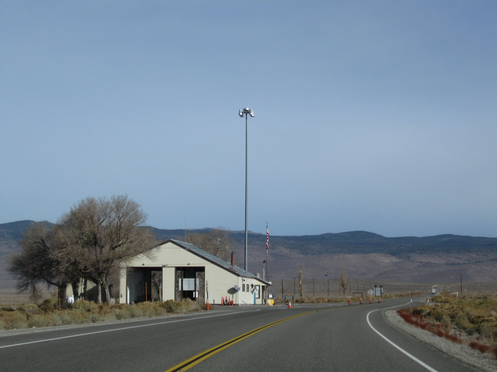
A California Agricultural Inspection Station is located outside of Benton; the inspection station stops all westbound/southbound traffic on U.S. 6 to ensure fruit and vegetable quarantines are observed. Eastbound traffic does not need to stop.
11/10/08
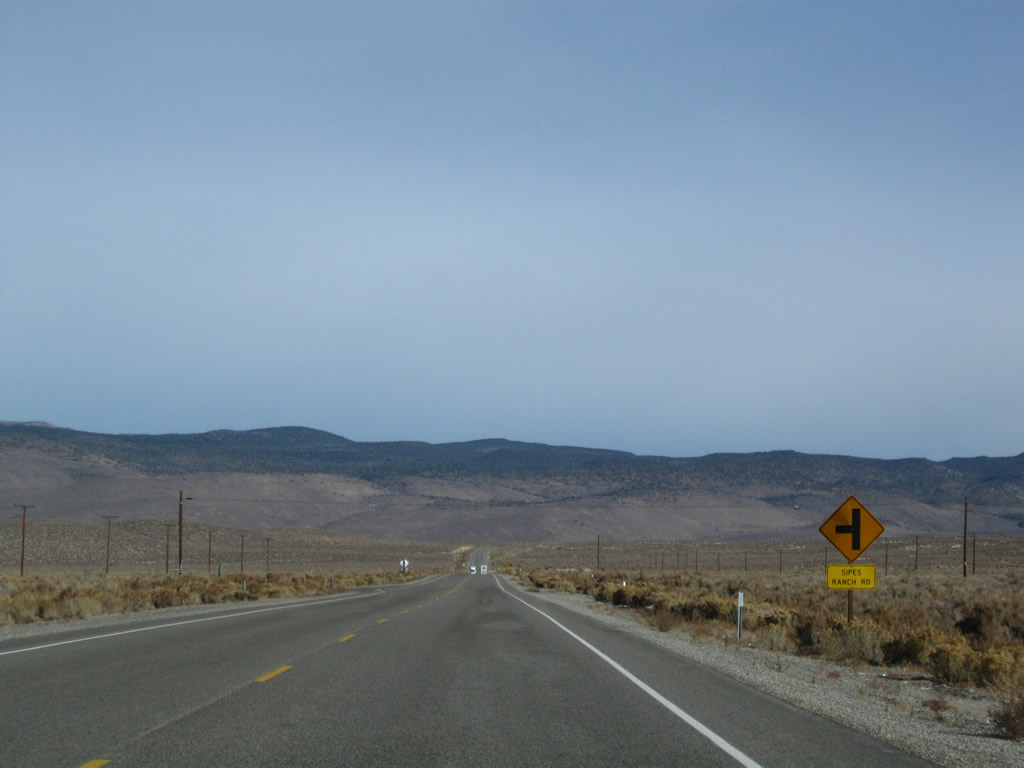
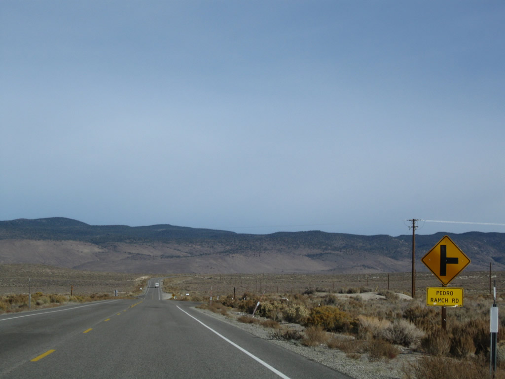
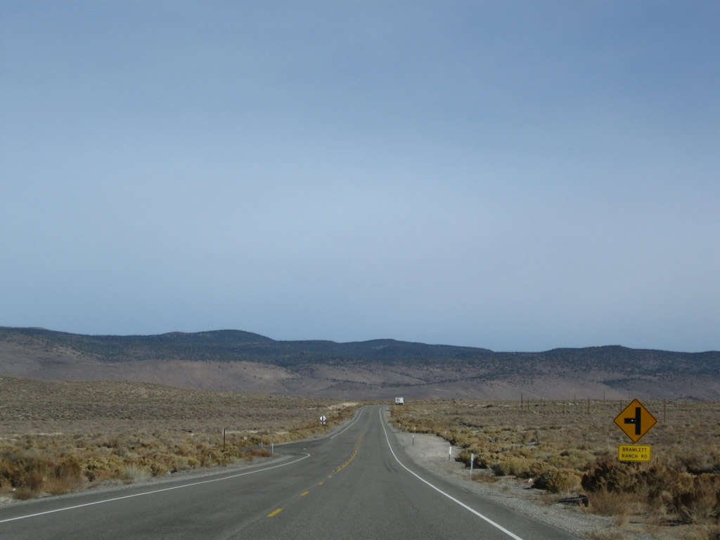
In quick succession, eastbound U.S. 6 approaches Sipes Ranch Road, Pedro Ranch Road, and Bramlett Ranch Road.
11/10/08
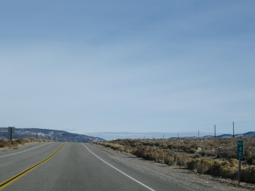
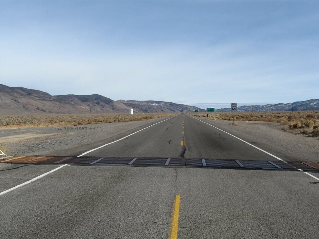
The last milepost along U.S. 6 east (north) in California is MILE 40. The state line lies just ahead. 11/10/08
11/10/08
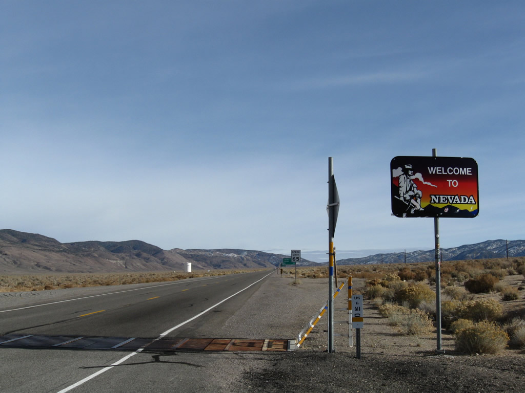
A Welcome to Nevada sign and cattle guard crossing are found along U.S. 6 at the point where U.S. 6 leaves the Golden State of California and enters the Silver State of Nevada.
11/10/08
U.S. 6 leaves Mono County in California and enters Mineral County (population 5,071 as of 2000 Census) in Nevada.
11/10/08
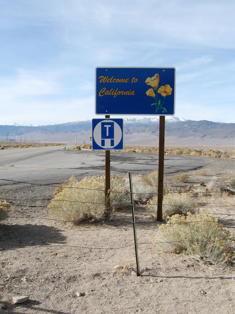
A Welcome to California sign and cattle guard crossing are found along U.S. 6 at the point where U.S. 6 leaves the Silver State of Nevada (Mineral County) and enters the Golden State of California (Mono County).
11/10/08
This view looks southwest along U.S. 6 at the Nevada-California state line. From here, U.S. 6 travels southwest to Benton, then almost due south to Bishop and U.S. 395.
11/10/08
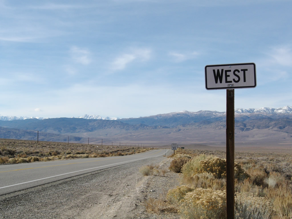
The first westbound U.S. 6 reassurance shield in California.
11/10/08
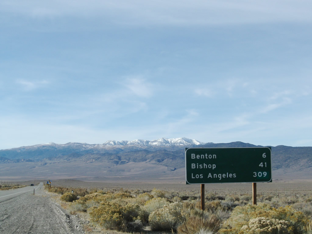
A mileage sign shortly thereafter provides the distance to Benton (six miles), Bishop (41 miles), and Los Angeles (309 miles via U.S. 395 and California 14 south).
11/10/08
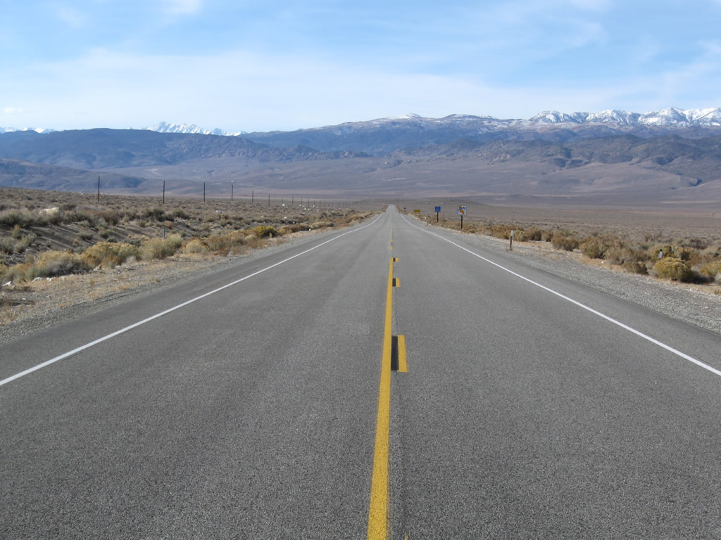
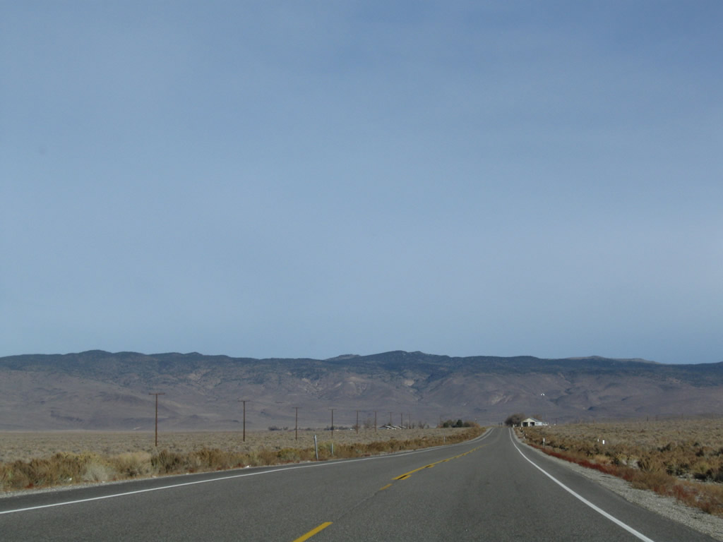
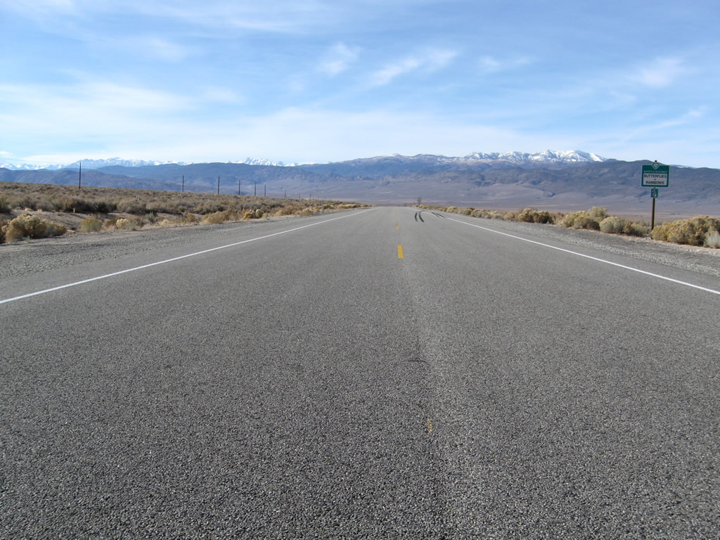
It's mostly open road along U.S. 6 southwest through the Benton Valley, Hammil Valley, and Chalfant Valley en route to Bishop and U.S. 395.
11/10/08
Some distance south of there, westbound (southbound) U.S. 6 crosses the North Fork of Bishop Creek.
07/09/07
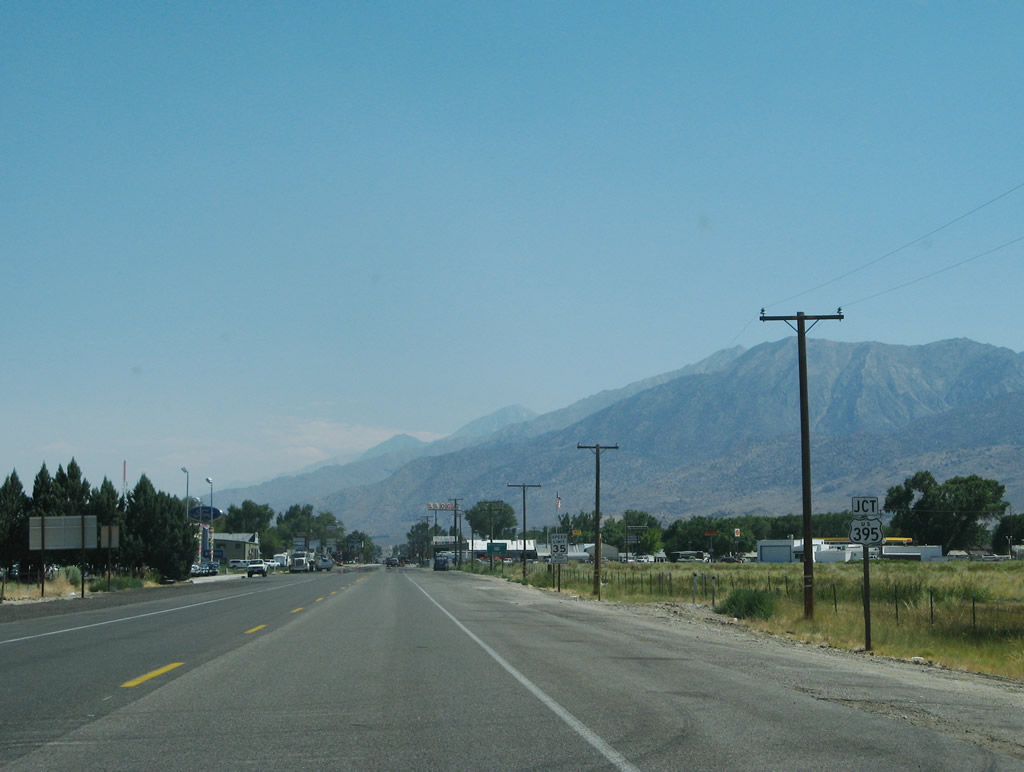
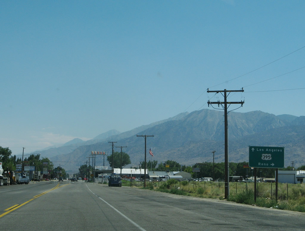
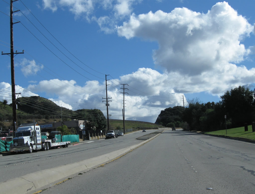
Westbound U.S. 6 (Grand Army of the Republic Highway) approaches U.S. 395 in Bishop. Turn right on Wye Road to follow U.S. 395 north to Lee Vining, Mono Lake, Yosemite National Park, and Bridgeport. Turn left to follow U.S. 395 south to Independence, Death Valley, and all points south, including Los Angeles, San Bernardino, Riverside, Santa Ana, and San Diego.
07/09/07
U.S. 395 follows the Eastern Sierra from Hesperia north to Reno via Ridgecrest, Independence, Lone Pine, Bishop, and Bridgeport. While much of the route is two lanes, a significant amount of highway south of Mammoth Lakes is expressway or freeway grade. Ongoing construction will ultimately bring U.S. 395 to a minimum of four-lane expressway standards pending funding identification.
07/09/07
The connection from U.S. 6 west to U.S. 395 is afforded by westbound Wye Road. U.S. 6 is generally traveling in a southwestern direction as it enters the city of Bishop, and it will swing south to join with U.S. 395. Northbound U.S. 395 actually travels west for a good distance as it leaves Bishop, and Wye Road makes the most direct connection between the two routes.
07/09/07
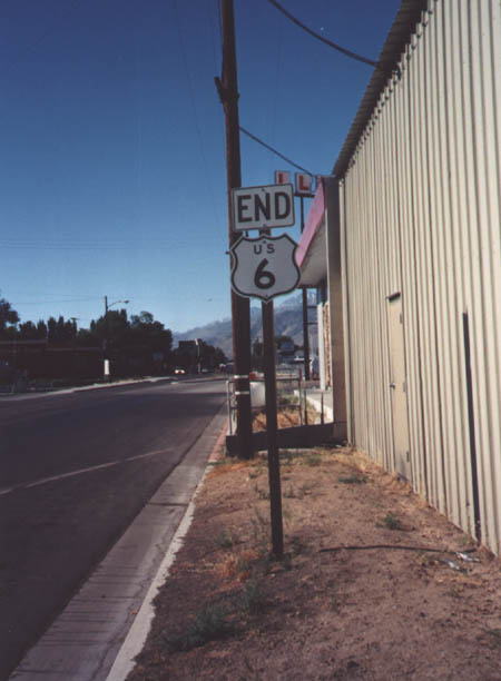
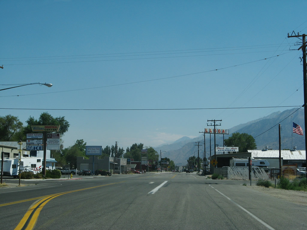
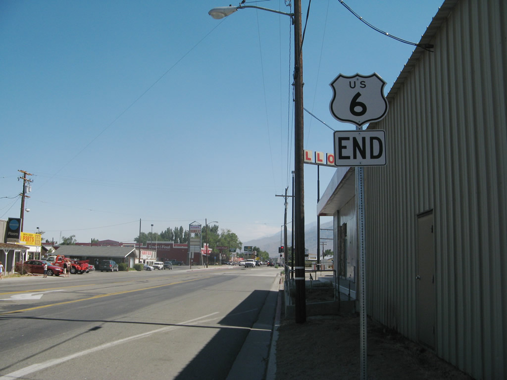
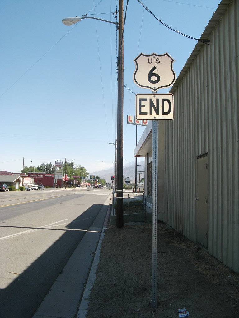
This U.S. 6 end shield assembly is posted in downtown Bishop as U.S. 6 east (south) approaches U.S. 395 (after the Wye Road intersection). The route marker and end shields were replaced between 1998 and 2007; you can see the inverted location of the end plate. When we visited this area again in September 2009, the entire end shield assembly was gone, with evidence it had been knocked down.
August 1998
07/09/07
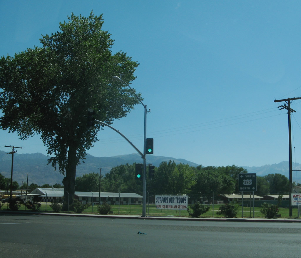
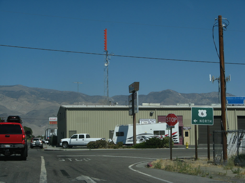
Westbound U.S. 6 meets U.S. 395 at this traffic signal; historically U.S. 6 turned south here to follow U.S. 6-395 along the Eastern Sierra to a split near Inyokern (now California 14). The Grand Army of the Republic Highway turns south onto U.S. 395 (Three Flags Highway) en route to Los Angeles. At the California 14 split near Inyokern, the Grand Army of the Republic Highway and Historic U.S. 6 travel southwest toward Lancaster, Palmdale, Santa Clarita, and Los Angeles, while U.S. 395 (Three Flags Highway) aims southeast toward Hesperia and San Bernardino.
07/09/07
Eastbound Wye Road approaches its intersection with U.S. 6. Turn left to follow U.S. 6 northeast to Tonopah or right to meet U.S. 395. Note the use of the cardinal direction of NORTH; this is one of the few remaining signs to use NORTH rather than EAST.
07/09/07
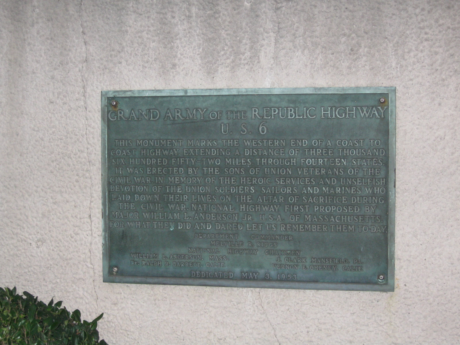
In downtown Long Beach, a plaque commemorating the Grand Army of the Republic Highway and U.S. 6 is placed on the south side of Ocean Boulevard at the intersection with Long Beach Avenue near Long Beach Convention and Entertainment Center. The plaque, which was placed in 1953, indicates that U.S. 6 traveled 3,652 miles from Provincetown, Massachusetts, west to Long Beach, California. Of course, with the retraction of U.S. 6 to Bishop, the route ceased to be a coast-to-coast route. But with the advent of historical U.S. 6 signs, it is possible to trace many of the old alignments along this important route.
11/08/08
In downtown Long Beach, a plaque commemorating the Grand Army of the Republic Highway and U.S. 6 is placed on the south side of Ocean Boulevard at the intersection with Long Beach Avenue near Long Beach Convention and Entertainment Center. The plaque, which was placed in 1953, indicates that U.S. 6 traveled 3,652 miles from Provincetown, Massachusetts, west to Long Beach, California. Of course, with the retraction of U.S. 6 to Bishop, the route ceased to be a coast-to-coast route. But with the advent of historical U.S. 6 signs, it is possible to trace many of the old alignments along this important route. 11/08/08
11/08/08
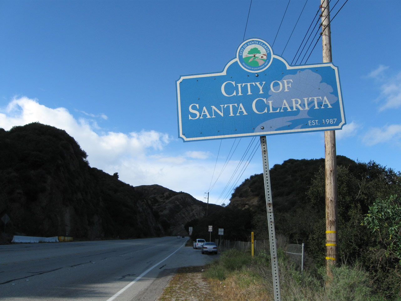
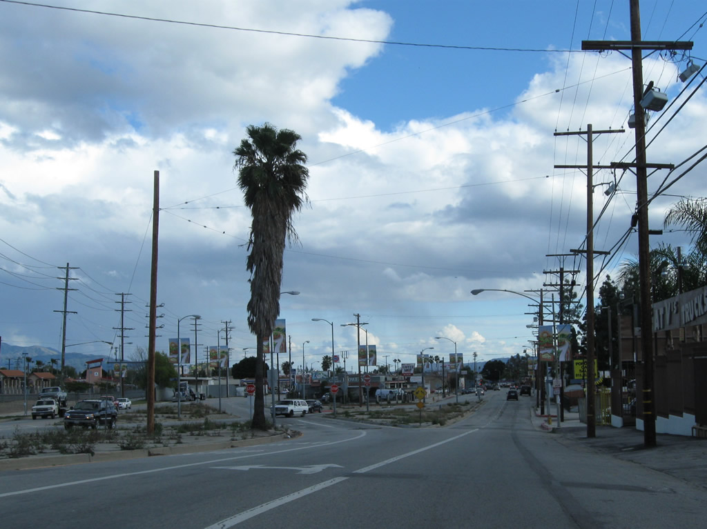
Northbound Sierra Highway (old U.S. 6) enters the city of Santa Clarita. Incorporated on December 15, 1987, Santa Clarita had a population of 151,088. The city incorporates Valencia, Newhall, Saugus, and Canyon Country. As a result of explosive development in the 1990s and 2000s, Santa Clarita saw significant population gains.
02/26/11
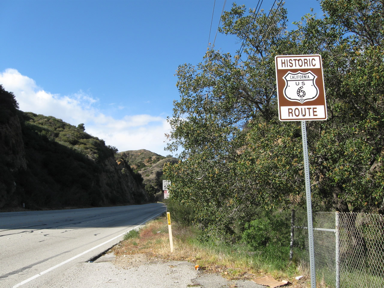
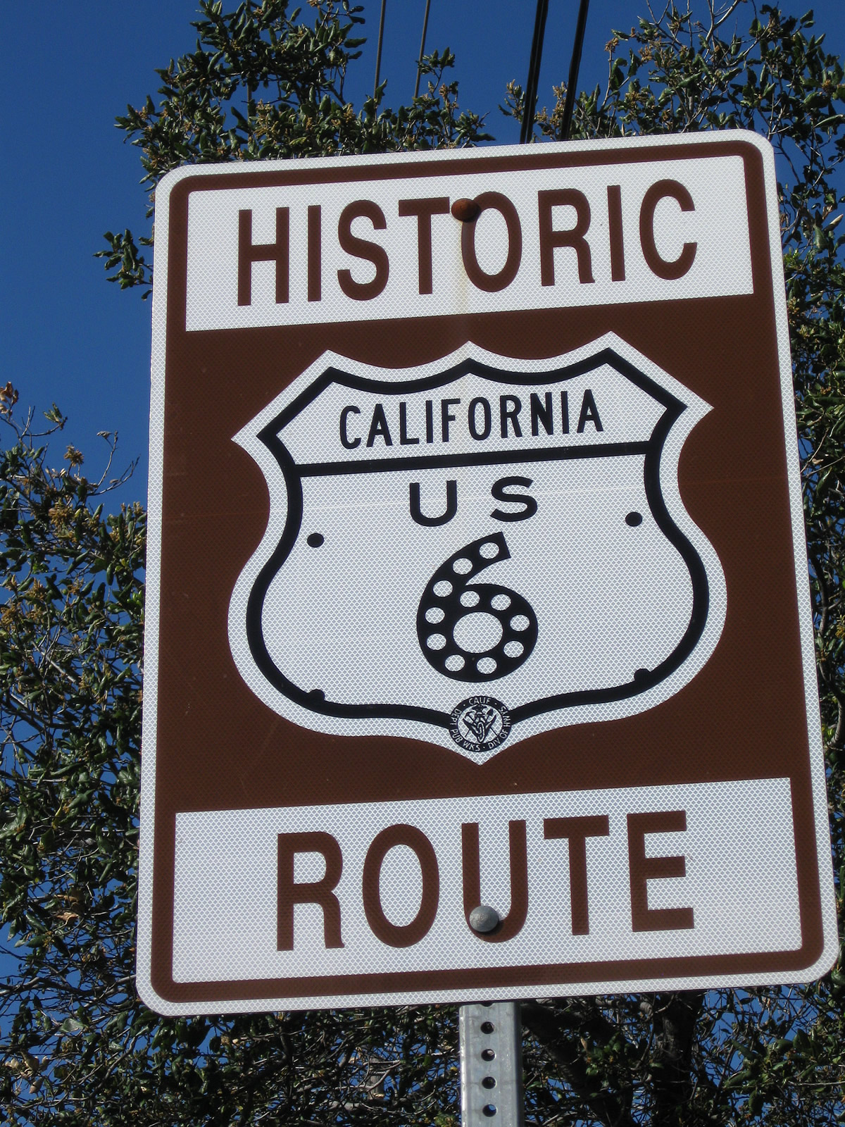
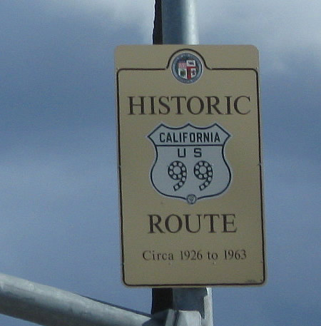
A Historic U.S. 6 shield is posted just north of the city limits sign in Santa Clarita near an abandoned rest area on the east side of Sierra Highway. These historic route marker signs were largely placed in 2009. Ahead, Sierra Highway (old U.S. 6) parallels California 14 en route to its junction with Newhall Avenue, where the state resumes maintenance of the route as part of California 14U.
02/26/11
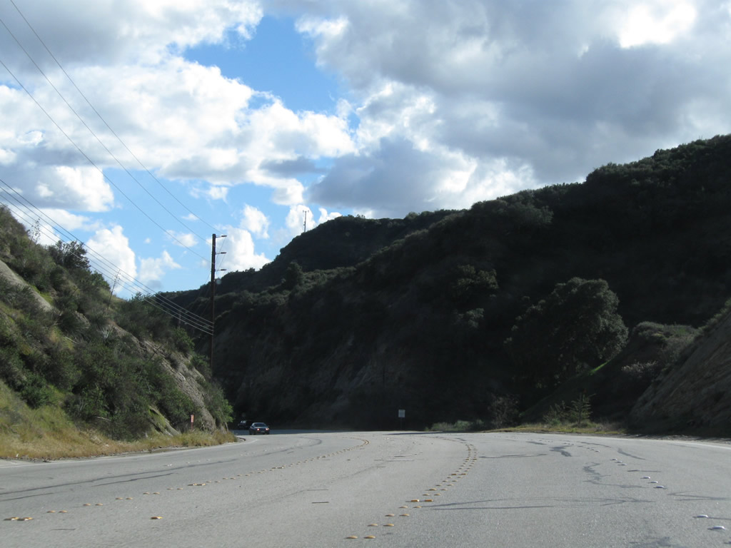
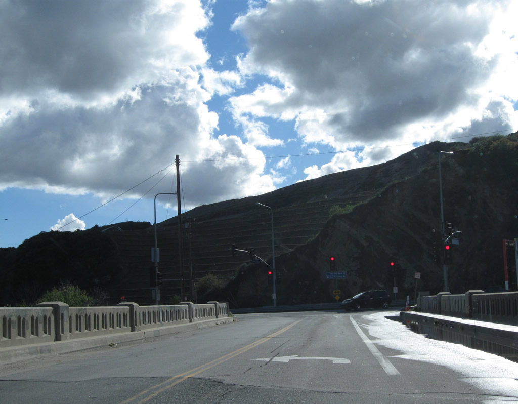
Reverting to a local road after the Newhall Avenue intersection, southbound Historic Sierra Highway (old U.S. 6) continues on a southwesterly alignment toward Newhall Pass. Between 1926 and 1930, this section of Sierra Highway was U.S. 99, but in 1930, U.S. 99 was relocated to what is now The Old Road (built as the Newhall Alternate through Weldon Canyon on what is now primarily Interstate 5). Since U.S. 6 did not extend this far southwest until 1937, the split between U.S. 6 and U.S. 99 has always been at Tunnel Station (named for a now-gone Newhall Pass Tunnel). The split at Tunnel Station is now situated at the intersection between The Old Road and Sierra Highway in the shadow of the Newhall Pass Interchange between Interstate 5 (Golden State Freeway) and California 14 (Antelope Valley Freeway). Interstate 5 (Golden State Freeway) was built through here in 1954.
02/26/11
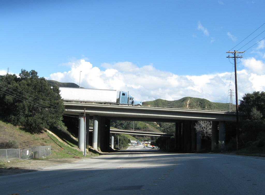
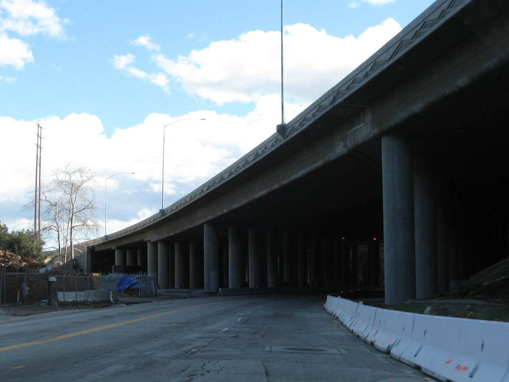
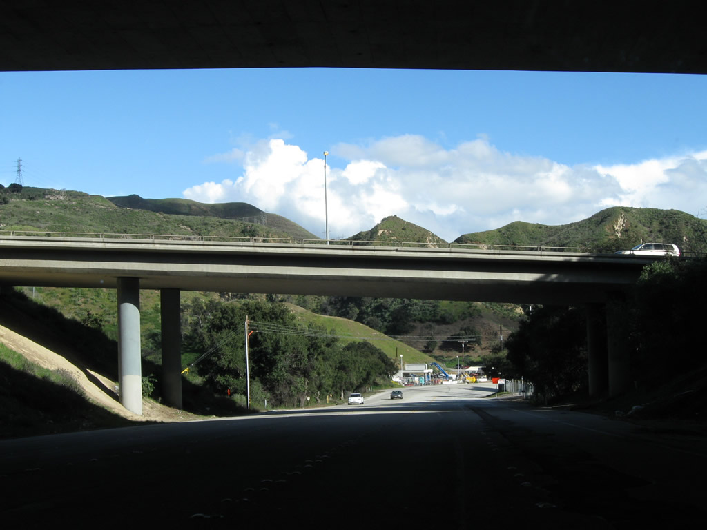
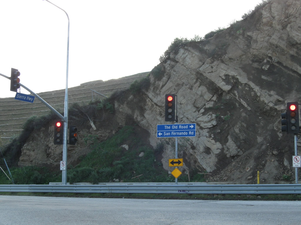
Historic Sierra Highway (old U.S. 6) proceeds southwest under California 14 (Antelope Valley Freeway), then curves southwest to meet Foothill Boulevard , then pass under the Interstate 5 (Golden State Freeway) Truck Bypass (but not the main lanes). At the intersection with The Old Road, U.S. 6 and U.S. 99 will turn south onto San Fernando Road en route to Sylmar and San Fernando. As this section of Sierra Highway was built originally as part of the Ridge Route, which later became and was replaced by U.S. 99, this section of U.S. 6 is quite old. The bridge at Tunnel Station was built in 1911 and widened in 1936; it spans over a railroad. Turn right here for U.S. 99/Newhall Alternate (built 1930, now called The Old Road) north toward Saugus or left for San Fernando Road (old U.S. 6-99) south to Los Angeles. Above, the massive Interstate 5 and California 14 interchange takes up most of this narrow valley. Trucks and cars scream or creep by depending on the severity of traffic congestion. San Fernando Road (old U.S. 6-99) is situated between the main lanes and truck bypass of Interstate 5 until it passes under the main lanes south of here.
02/26/11
Leaving Tunnel Station, U.S. 6 and U.S. 99 shared alignment along San Fernando Road from Sierra Highway south toward downtown Los Angeles. For its initial shared alignment, the two routes follow San Fernando Road between the truck lanes of Interstate 5 on the east and main lanes of Interstate 5 on the west.
02/26/11
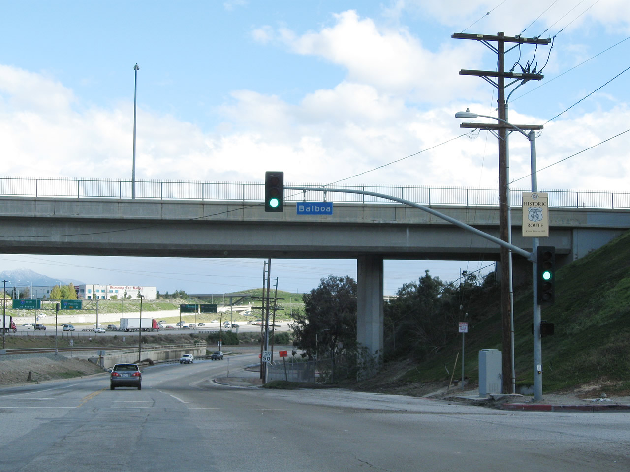
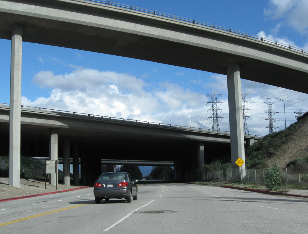
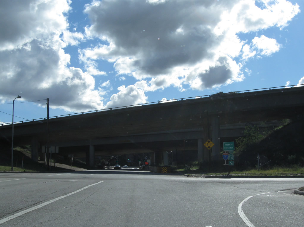
Passing under the main lanes of Interstate 5, U.S. 6 and U.S. 99/San Fernando Road enters the city of Los Angeles. This section of San Fernando Road was briefly known as U.S. 6-99 Business after the Golden State Freeway was built (as U.S. 6 and U.S. 99 were moved to the then-new freeway). After U.S. 6 and 99 were eliminated, the old route was designated as Business Loop I-5 until the 1980s. Now it is known as the historic route of U.S. 6 and U.S. 99. Here, southbound San Fernando Road meets a connecting ramp to Balboa Boulevard, which passes over San Fernando Road ahead. A Historic U.S. 99 (but not Historic U.S. 6) sign is posted on the mast arm for the ramp to Balboa Boulevard. Interstate 5 is visible to the left in this picture.
02/26/11
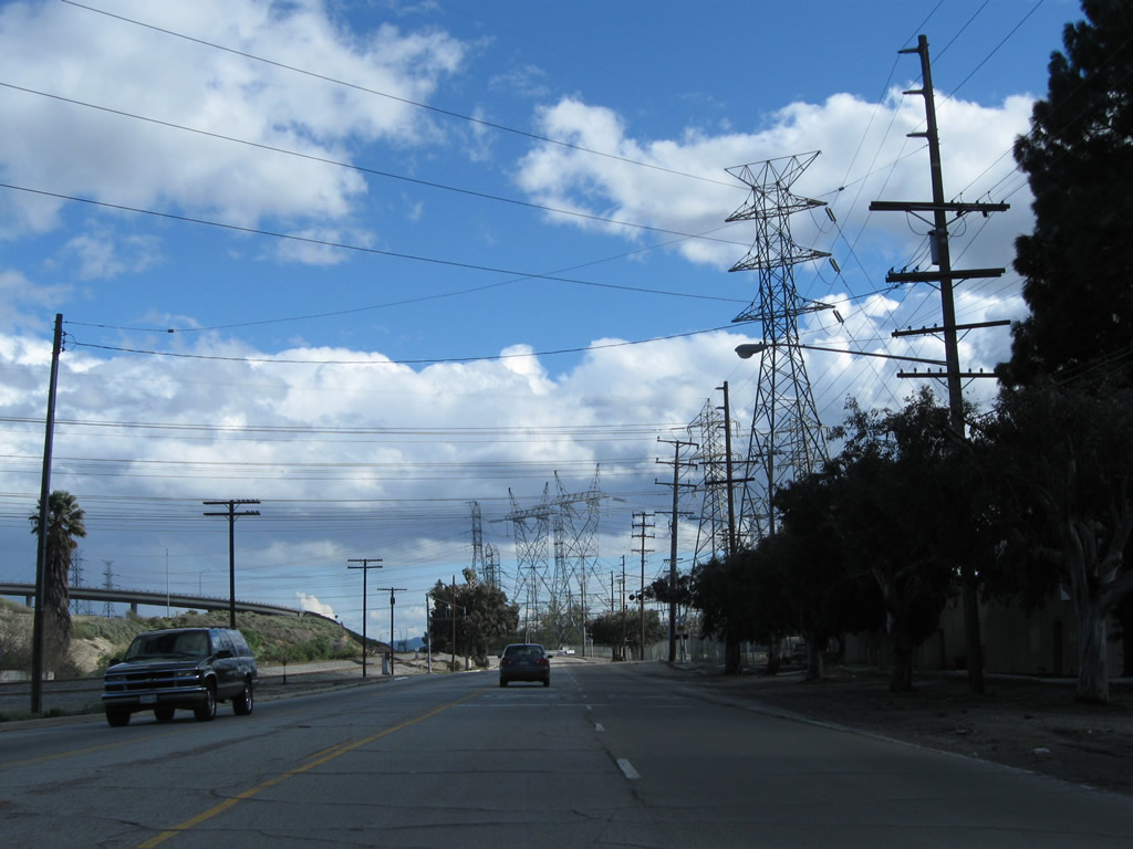
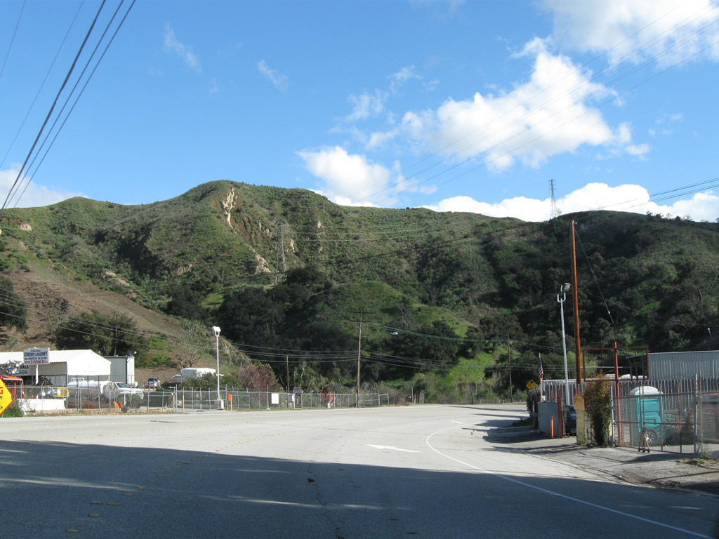
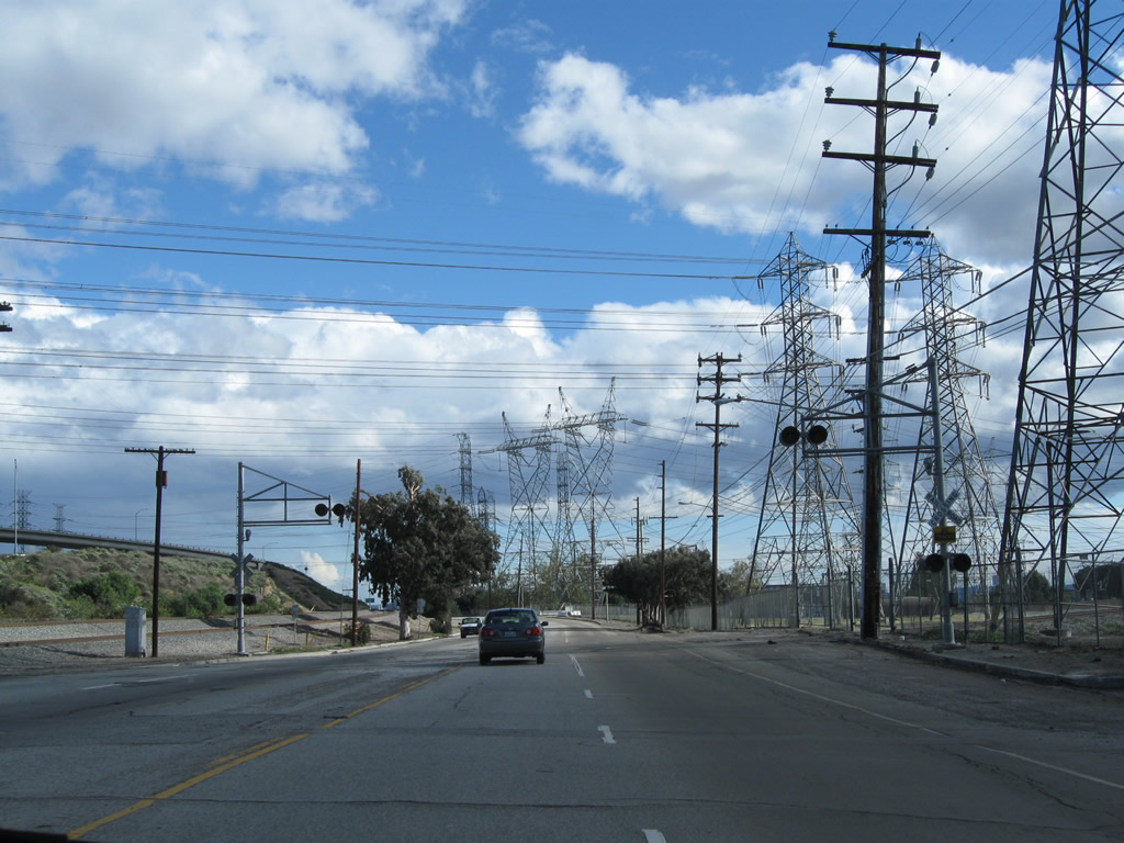
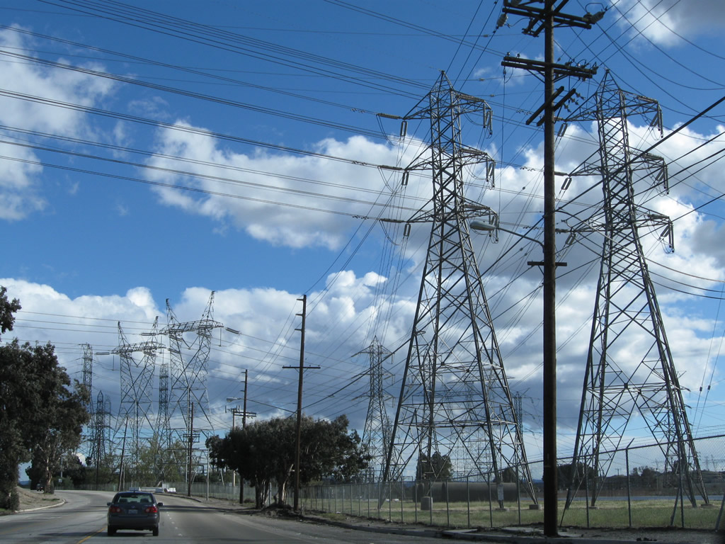
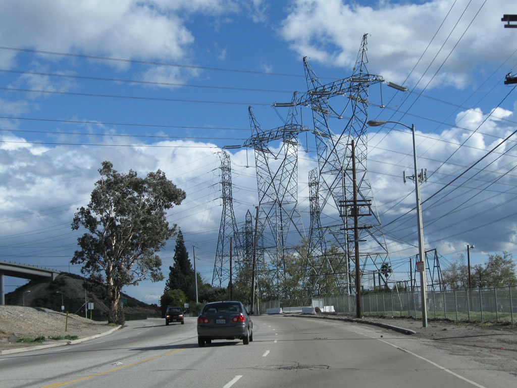
San Fernando Road passes below a slew of power lines that converge to the substations in the vicinity of Sylmar, including a pair of 500kV Los Angeles Department of Water and Power lines and Path 65, which had paralleled U.S. 6 south from the Eastern Sierra.
02/26/11
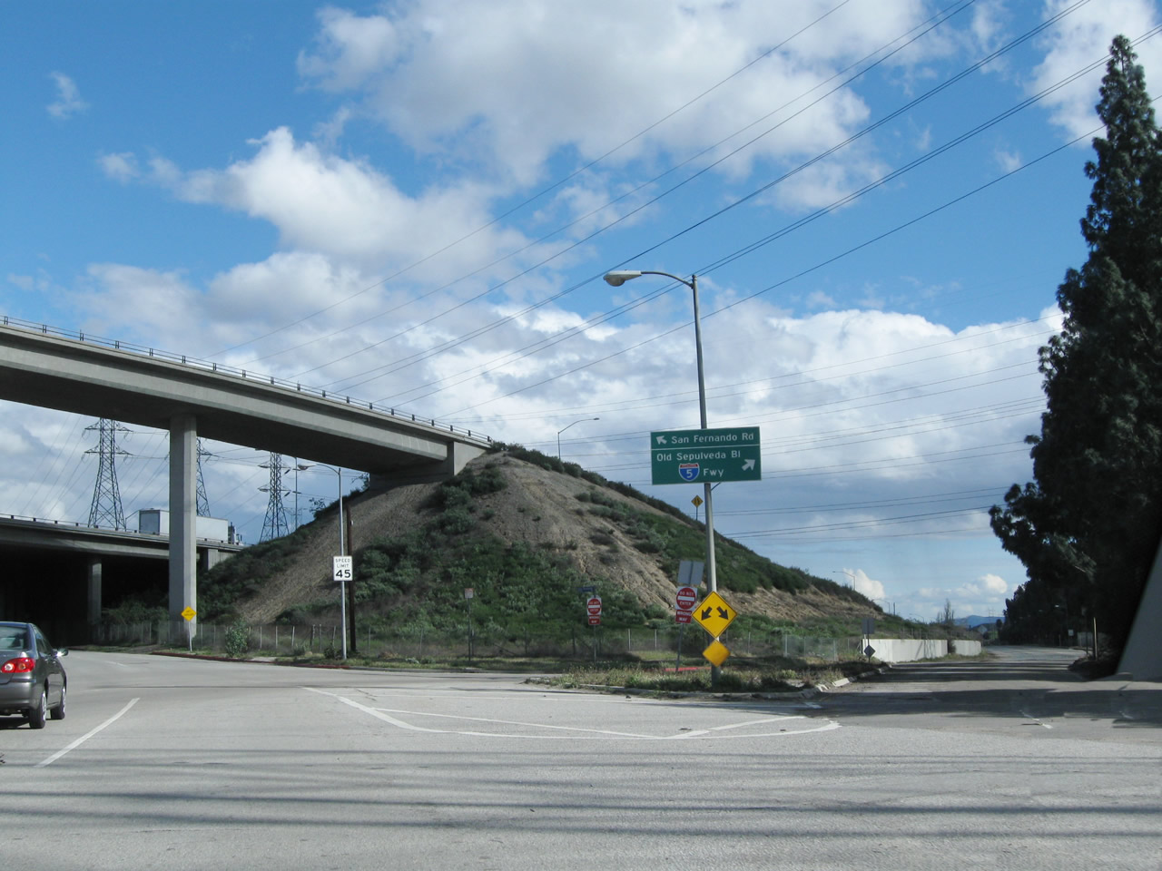
The former split of U.S. 6-99 with California 7. From this point, California 7 used to travel south on Sepulveda Boulevard parallel to Interstate 405 toward West Los Angeles and Los Angeles International Airport (LAX). California 7 was decommissioned in favor of Interstate 405, but its original alignment remains largely intact along Sepulveda Boulevard. However, this segment of Old Sepulveda Boulevard is discontinuous with the rest of Sepulveda Boulevard due to adjacent development. Stay left for the continuation of U.S. 6 and U.S. 99 south on San Fernando Road.
02/26/11
After splitting from Sepulveda Boulevard, southbound Historic U.S. 6-U.S. 99 pass under the Interstate 5 and Interstate 210 interchange.
02/26/11
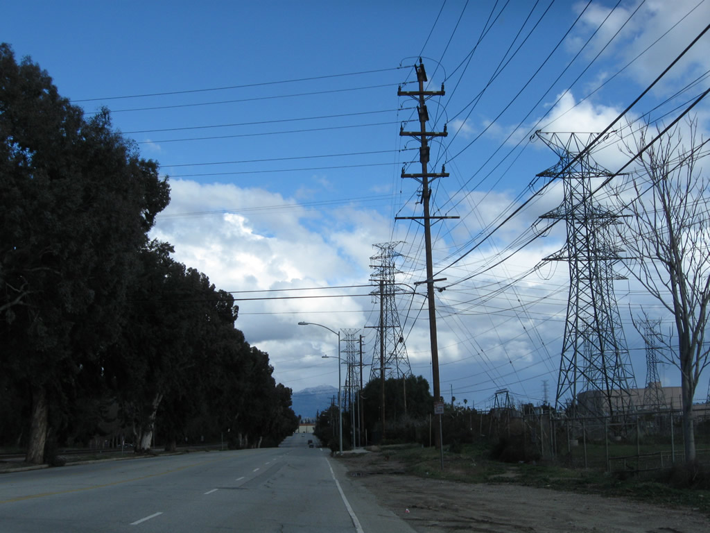
San Fernando Road proceeds east for a bit to pass by a Los Angeles Department of Water and Power substation, then will turn southeast again prior to Roxford Street.
02/26/11
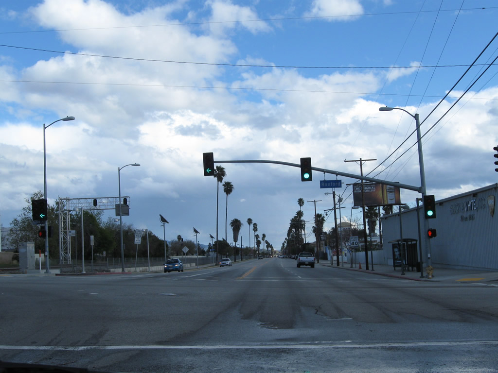
Southbound Historic U.S. 6 and U.S. 99 meet Roxford Street.
02/26/11
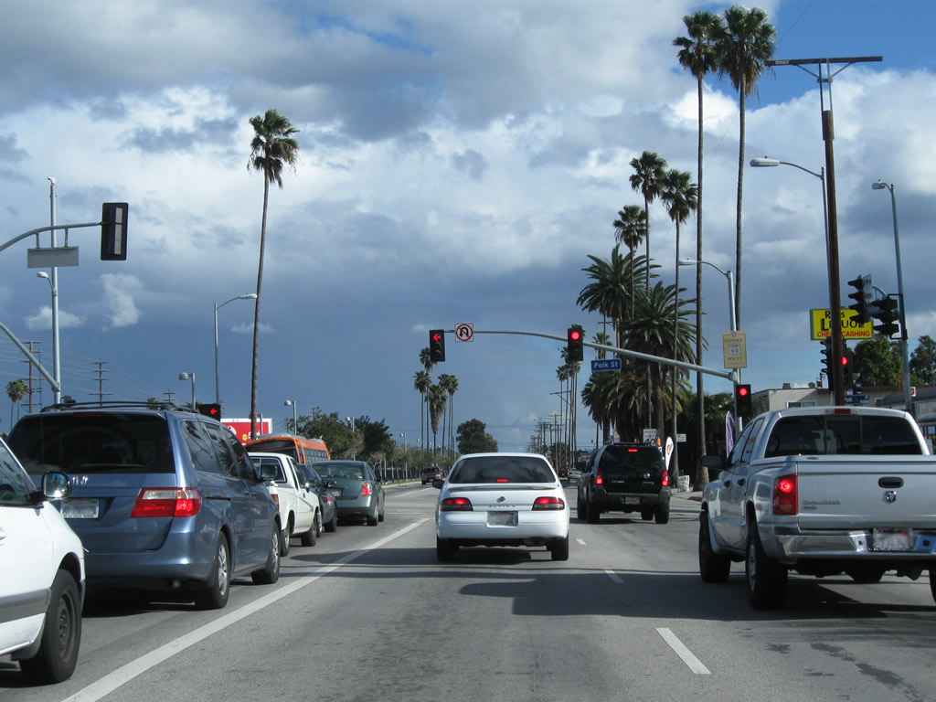
San Fernando Road meets Polk Street. Another Historic U.S. 99 sign is posted at this intersection.
02/26/11
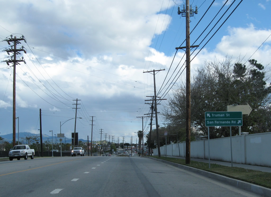
Continuing southeast, San Fernando Road meets Truman Street, which parallels San Fernando Road to the east through downtown San Fernando.
02/26/11
Photo Credits:
- Andy Field: August 1998, 07/09/07, 11/08/08, 11/10/08, 02/26/11
- AARoads: 11/10/08
Connect with:
Page Updated Thursday February 17, 2011.