
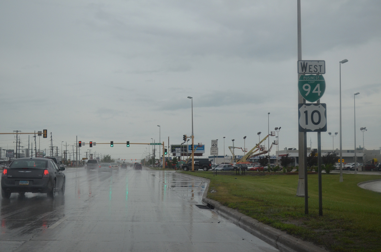
Business Loop I-94/U.S. 10 West

 West
West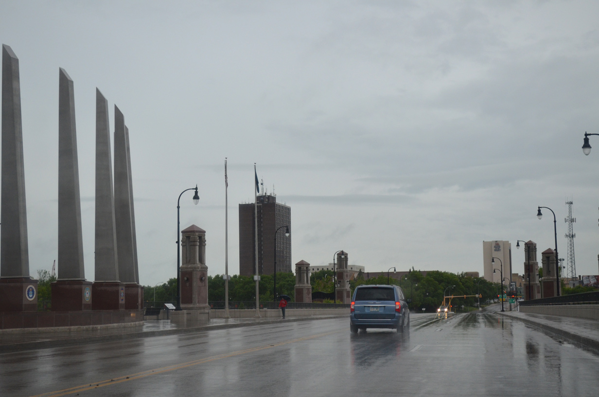
Business Loop I-94 & U.S. 10 enter Cass County, North Dakota midway across the Veterans Memorial Bridge over the Red River.
06/16/15
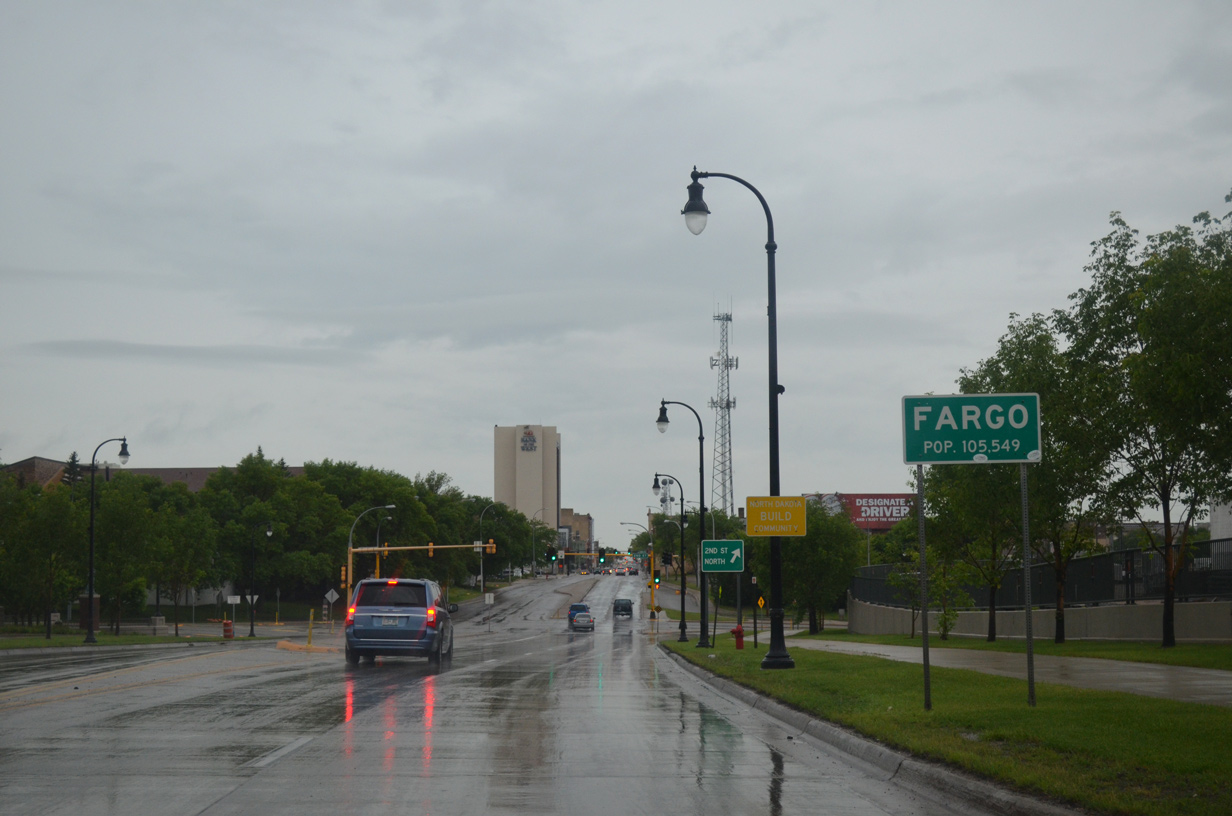
Drivers enter the city of Fargo along U.S. 10 west. Main Avenue separates north and south street addresses across North Dakota's largest city.
06/16/15
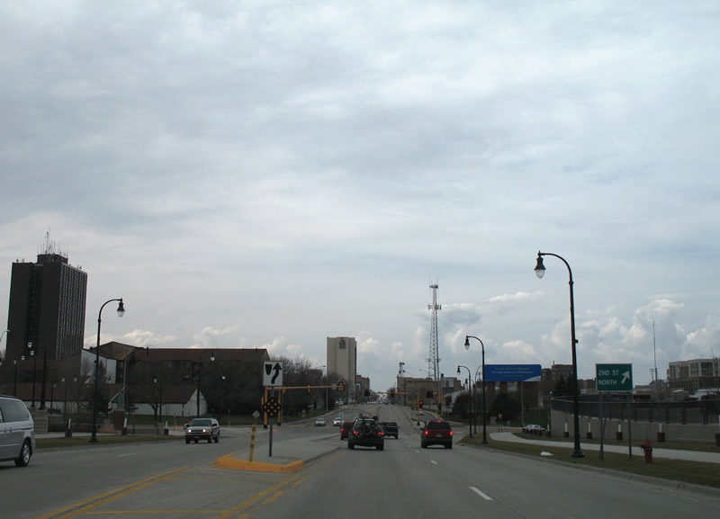
A few modest mid-rise buildings accent the Fargo skyline as Main Avenue approaches the intersection with 2nd Street.
04/22/07
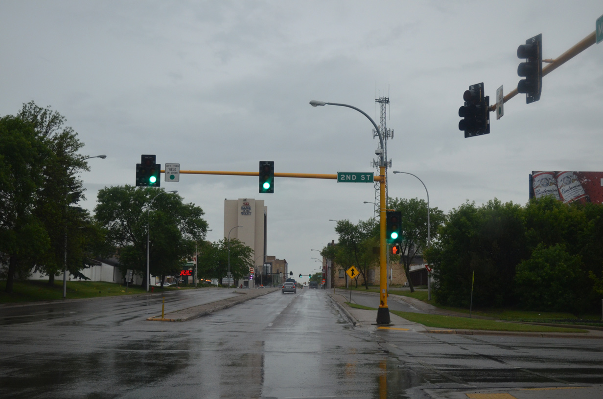
2nd Street South runs along Dike East Park to 4th Street South at Island Park. 2nd Street North passes by Fargo Civic Center to the Horace Mann neighborhood.
06/16/15
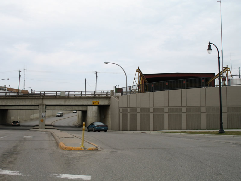
2nd Street North dives under the adjacent BNSF Railroad through this subway between Main Avenue and Northern Pacific Avenue.
04/22/07
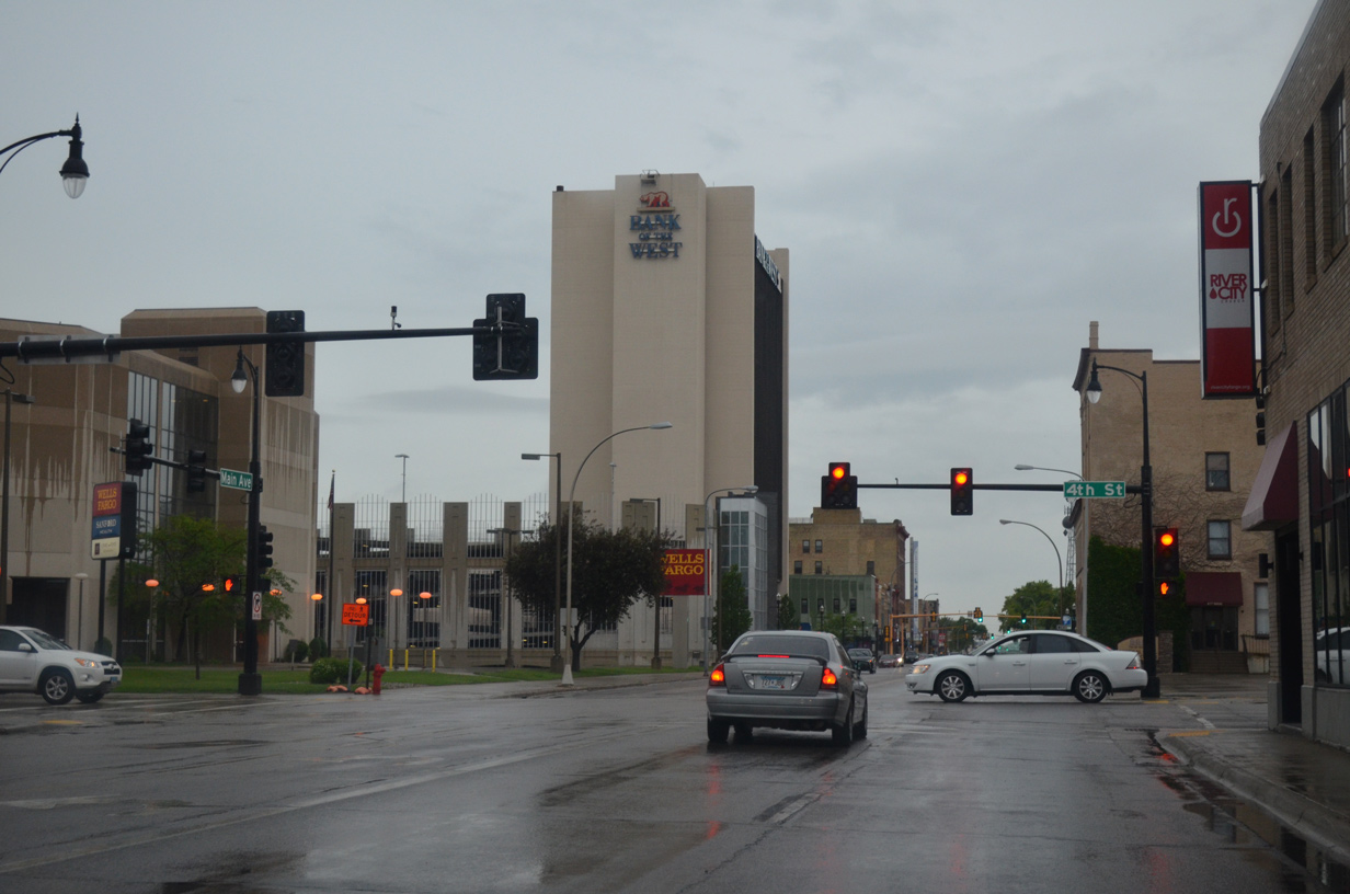
Continuing west along Business Loop I-94/U.S. 10 (Main Avenue) to the signalized intersection with 4th Street. 4th Street S leads to Island Park and the Hawthorne neighborhood south of Downtown. 4th Street N heads toward Sanford Medical Center.
06/16/15
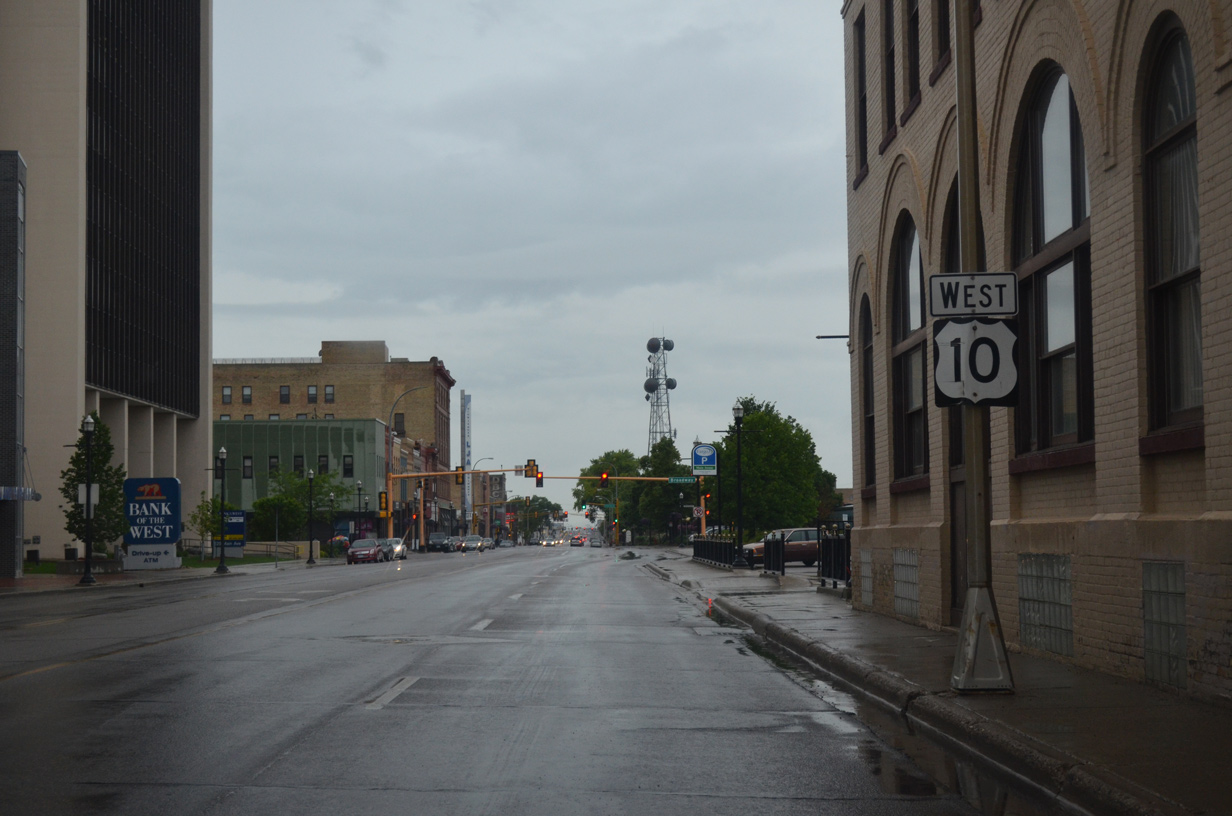
Posted near Fargo's third tallest building, the Bank of the West Tower, is this U.S. 10 westbound reassurance marker.
06/16/15

Business Loop I-94/U.S. 10 (Main Avenue) west at the intersection with Broadway in the heart of Downtown Fargo. Broadway takes the place of 6th Street.
06/16/15
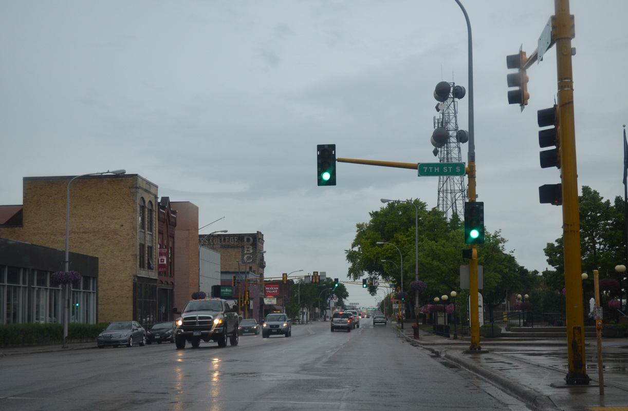
Westbound at 7th Street on Business Loop I-94/U.S. 10 (Main Avenue). 7th Street S heads southward to Island Park.
06/16/15
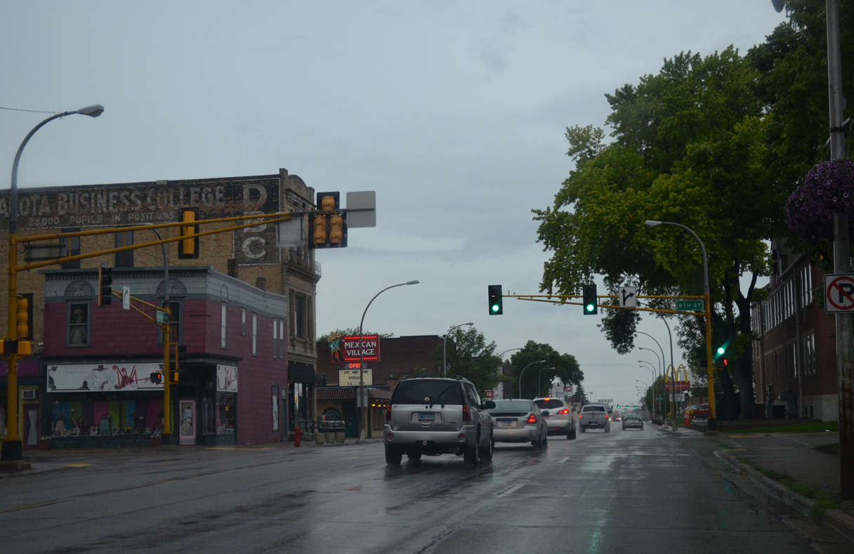
Older style mast arm assemblies posted at the intersection of Main Avenue and 8th Street. 8th Street turns into Roberts Street at Northern Pacific Avenue nearby.
06/16/15
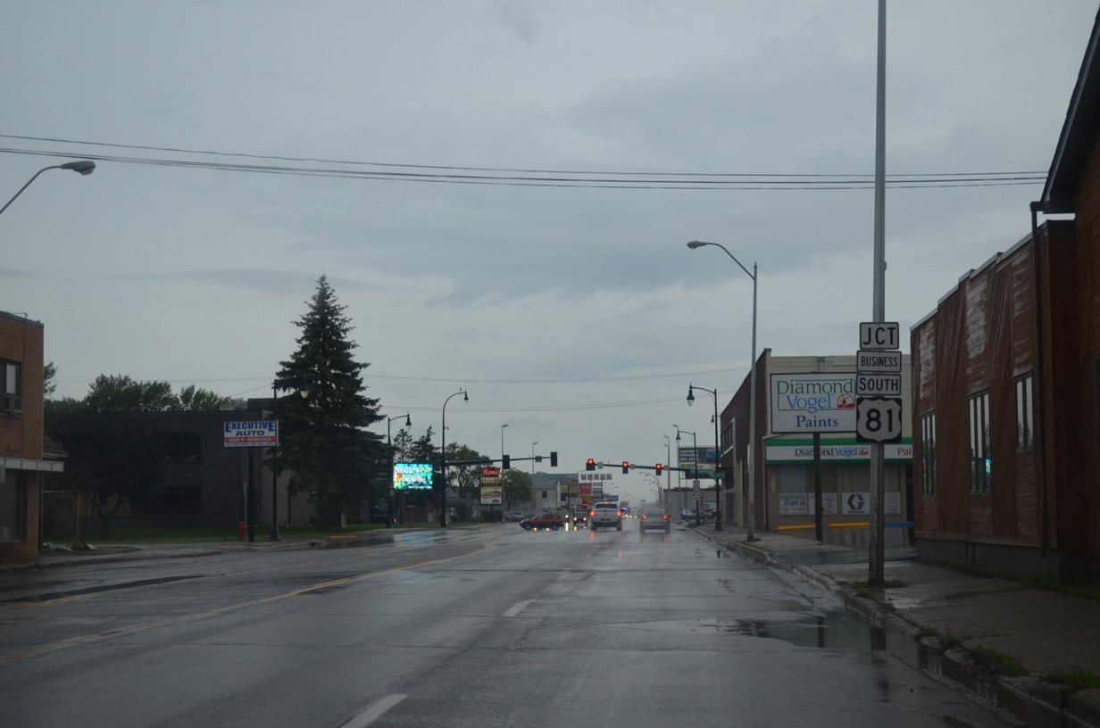
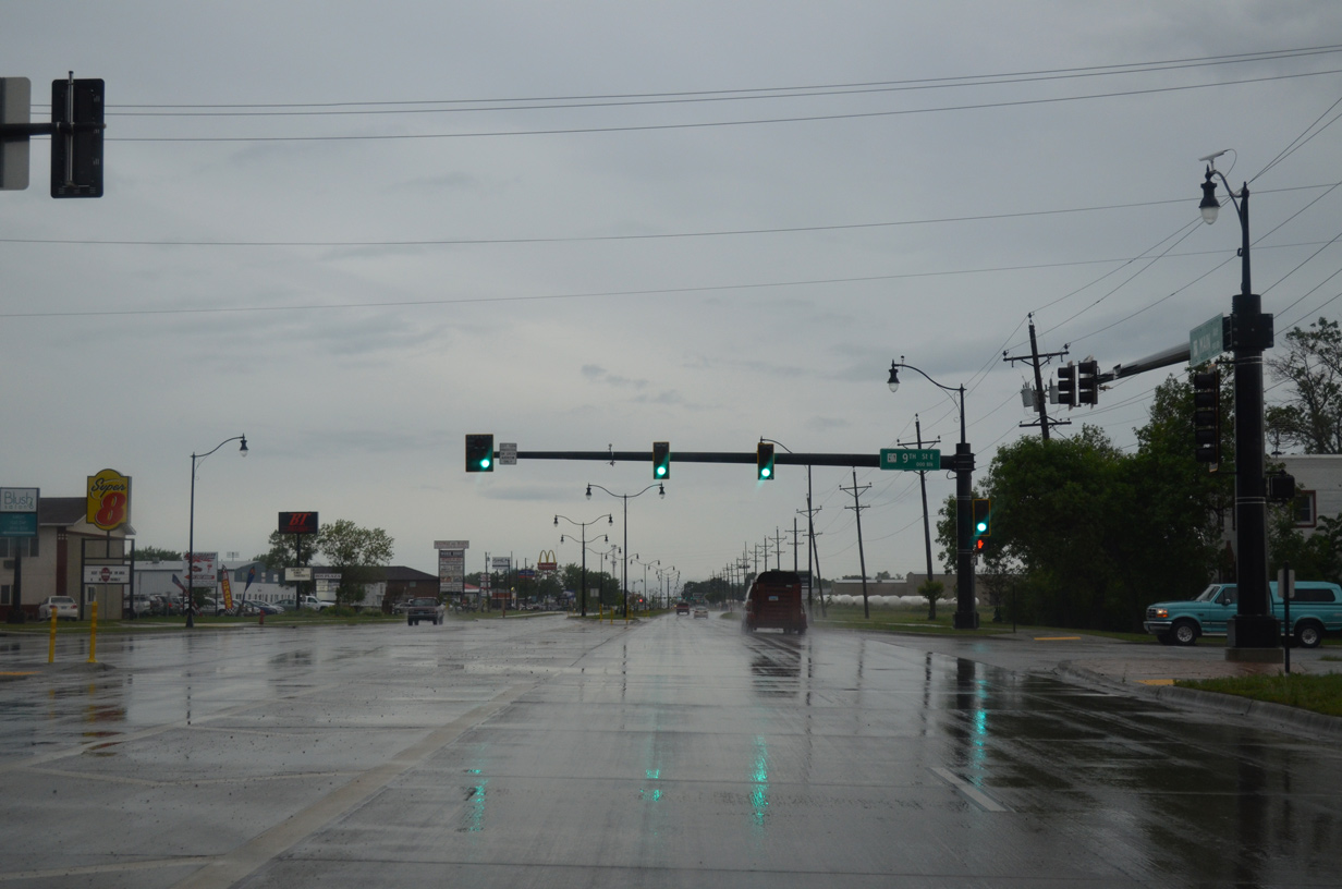
U.S. 81 Business north meets Business Loop I-94/U.S. 10 (Main Avenue) at 10th Street. U.S. 81 Business partitions between the couplet of 10th Street north and University Drive south from 13th Avenue S to 19th Avenue N at the Fargodome.
06/16/15
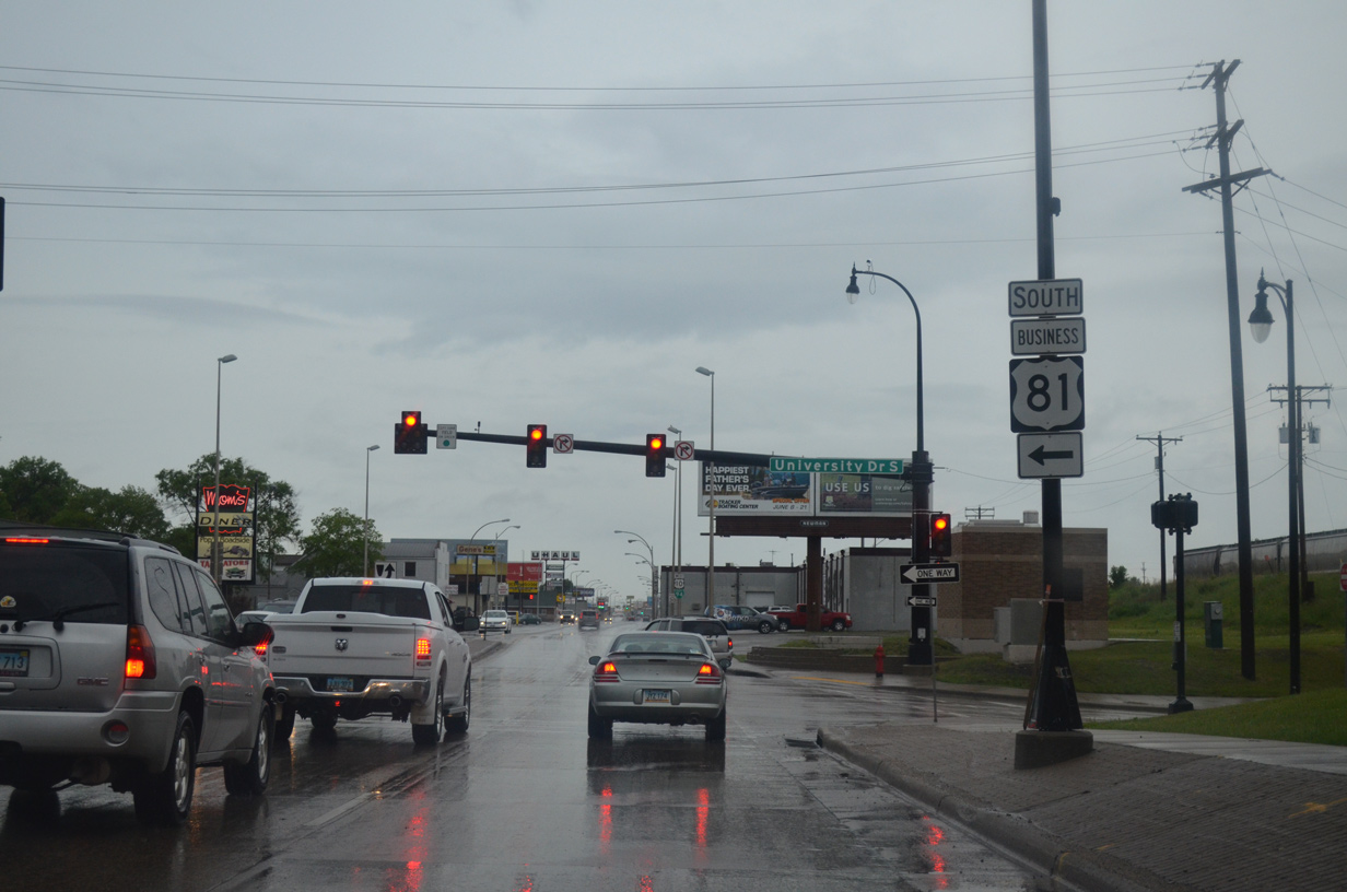
U.S. 81 Business south follows University Drive from North Dakota State University to 52nd Avenue South at the Rose Creek and Bennett neighborhoods. The business loop follows the original U.S. 81 through most of Fargo.
06/16/15
Business Loop I-94 appears for the first time within North Dakota at this shield assembly posted after University Drive (U.S. 81 Business south).
06/16/15
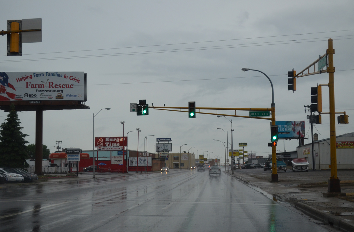
Main Avenue west separates the Madison/Unicorn Park neighborhood to the north with the Jefferson/Carl Ben neighborhood to the south. Pictured here is the intersection with 18th Street South.
06/16/15
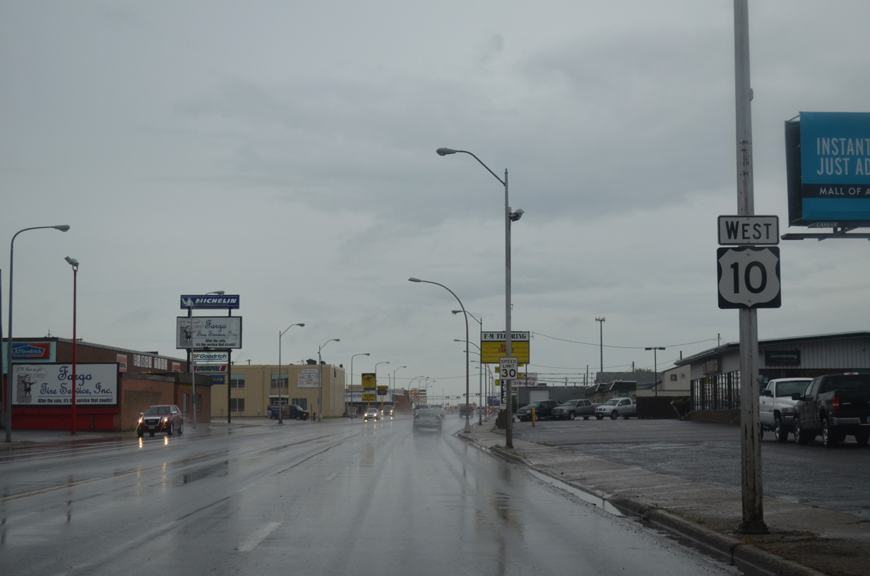
U.S. 10 shield posted after 18th Street South on Main Avenue west. There are no streets leading north between U.S. 81 Business (10th Street North) north and 25th Street North due to the parallel BNSF Railroad.
06/16/15
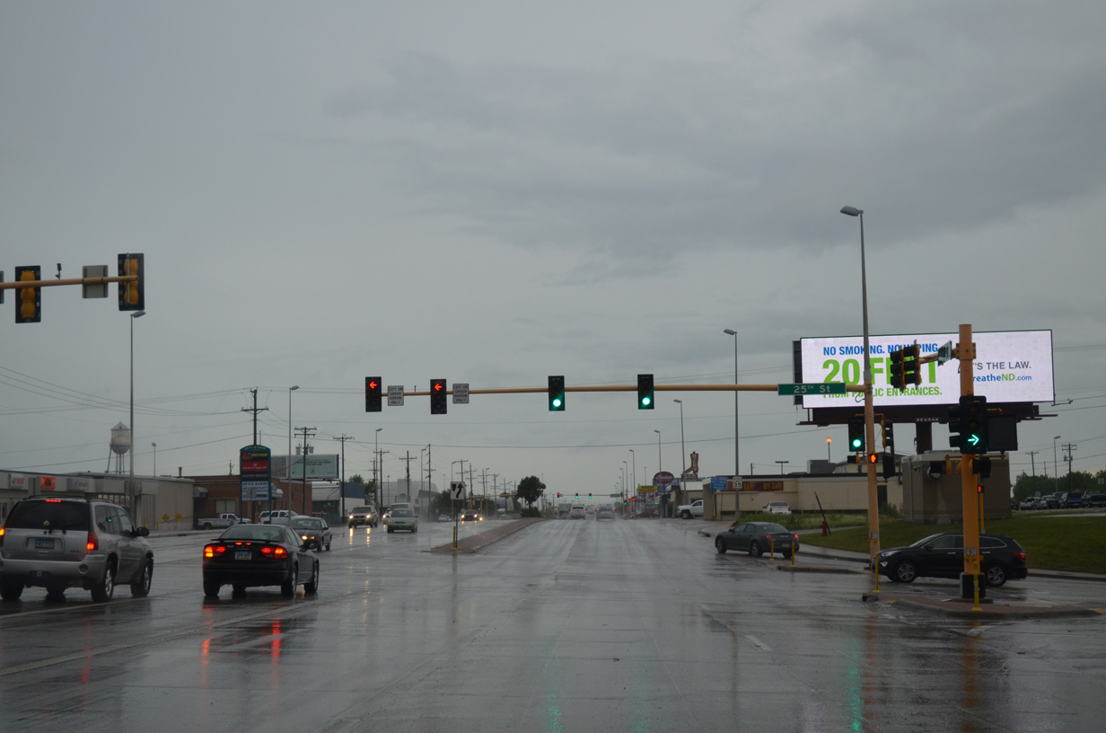
25th Street represents a main arterial through Fargo, leading southward to I-94/U.S. 52 at the South High and Brunsdale neighborhoods and northward to 12th Avenue North through Madison/Unicorn Park.
06/16/15
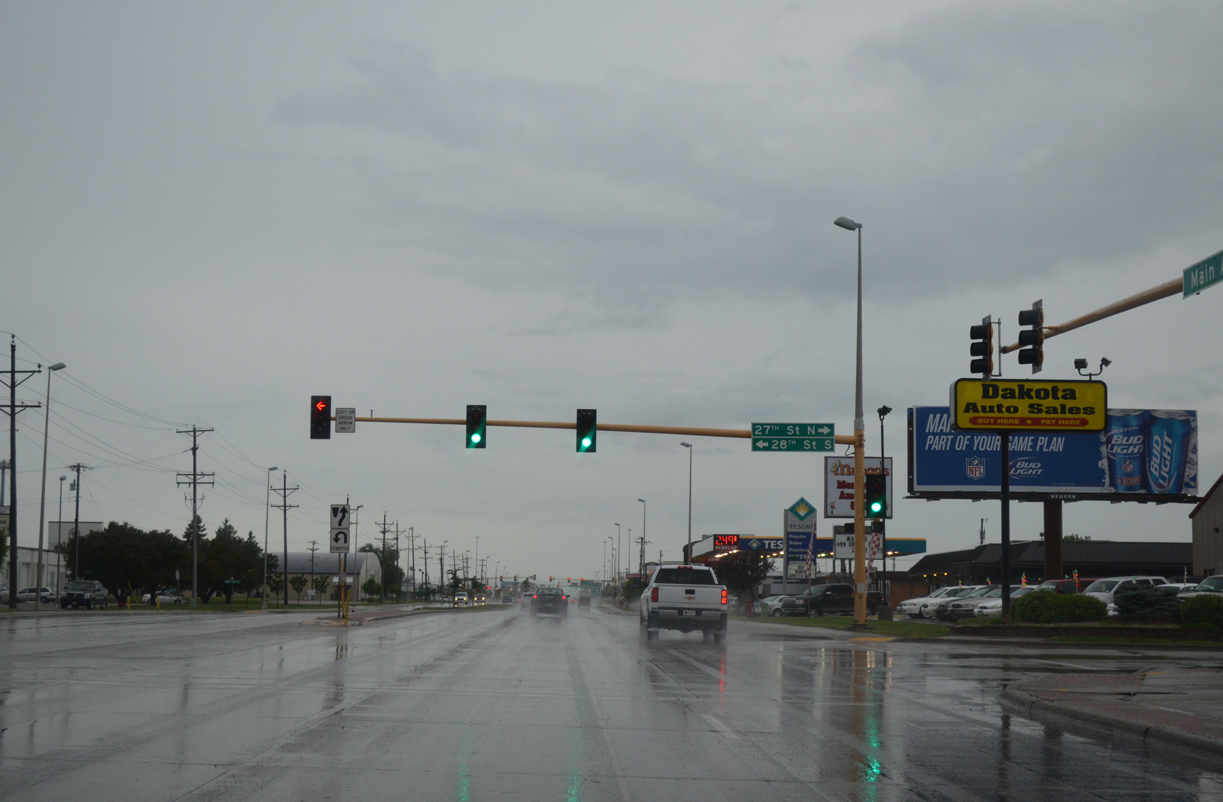
Westbound Main Avenue at the split intersection of 28th Street South and 27th Street North. 27th Street North loops east and than north before crossing the BNSF Railroad. 28th Street simply continues the road south into an adjacent industrial area.
06/16/15
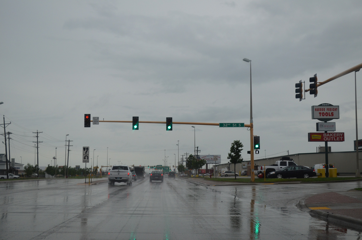
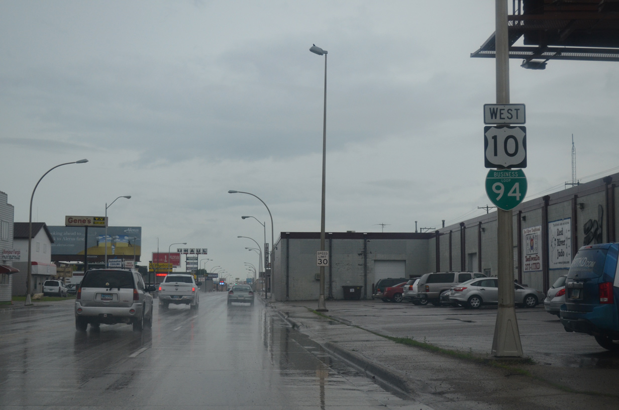
Main Avenue west at 32nd Street South. Industrial and retail businesses line Business Loop I-94 & U.S. 10 to I-29/U.S. 81.
06/16/15
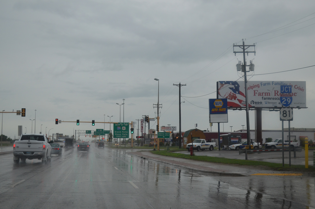
Business Loop I-94/U.S. 10 west advance to 34th Street and I-29/U.S. 81. 34th Street connects Main Avenue with adjacent frontage roads leading to 36th Street along the freeway while en route to the Westgate neighborhood.
06/16/15
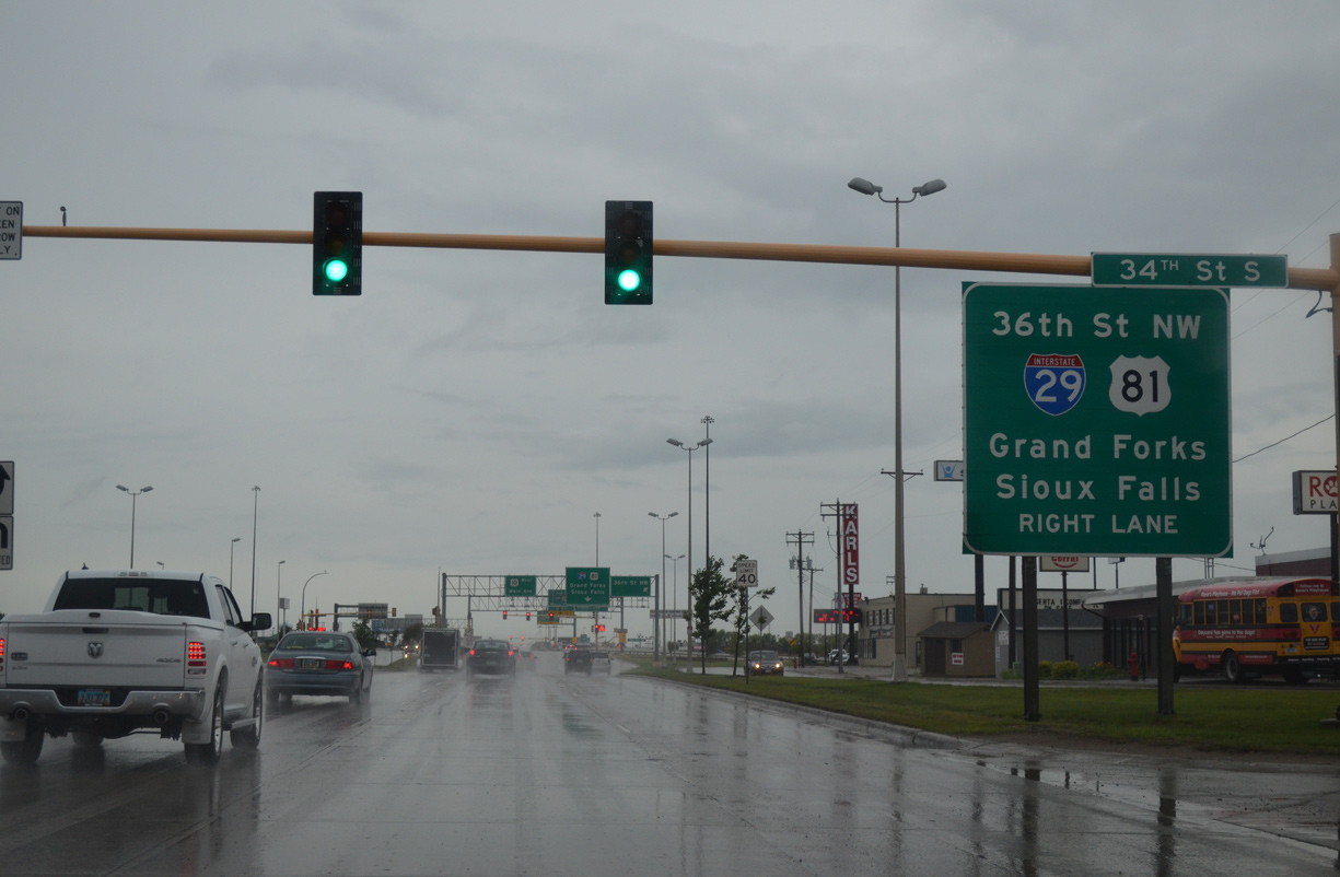
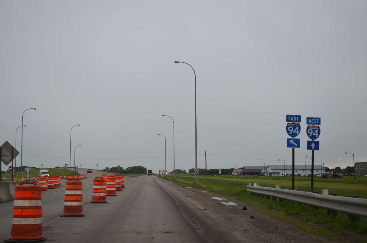
All drivers bound for I-29/U.S. 81 are advised to move into the right lane for the six-ramp parclo interchange (Exit 65) with the freeway below. I-29/U.S. 81 north join the city with Grand Forks and Winnipeg, Canada.
06/16/15
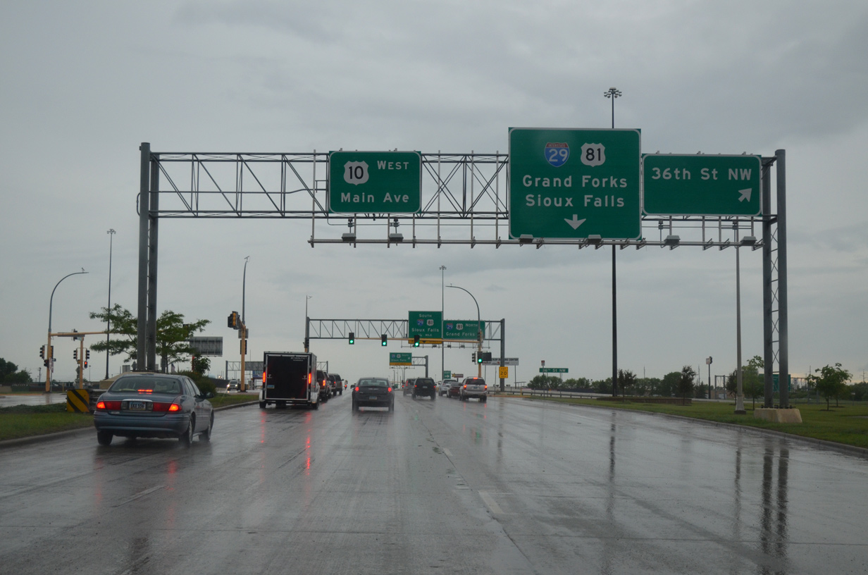
Business Loop I-94/U.S. 10 (Main Avenue) intersect 36th Street ahead of the ramps to I-29/U.S. 81. 36th Street NW connects Main Avenue with industrial areas to 7th Avenue N.
06/16/15
Motorists bound for I-29/U.S. 81 north to Hector International Airport (FAR) and Grand Forks depart Business Loop I-94 & U.S. 10 (Main Avenue) west. Three additional interchanges serve the city of Fargo before the tandem exit the area for Grandin.
06/16/15
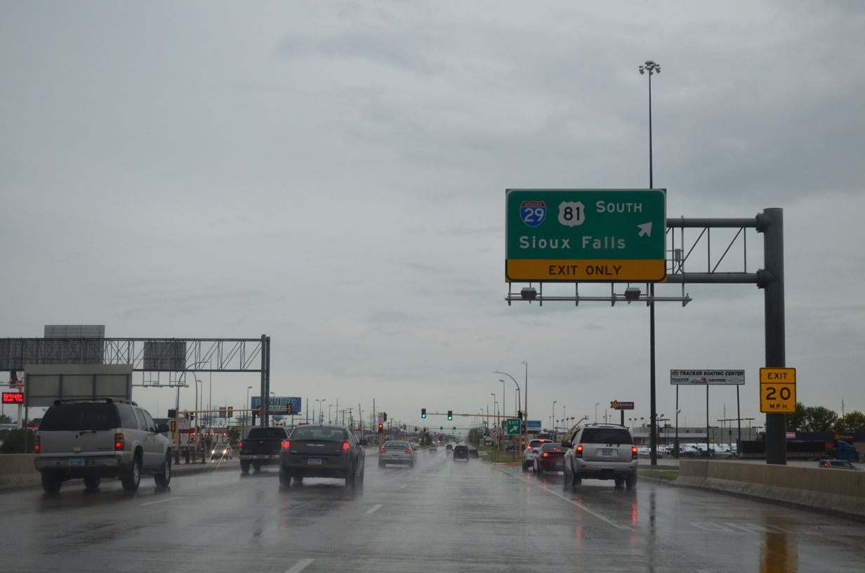
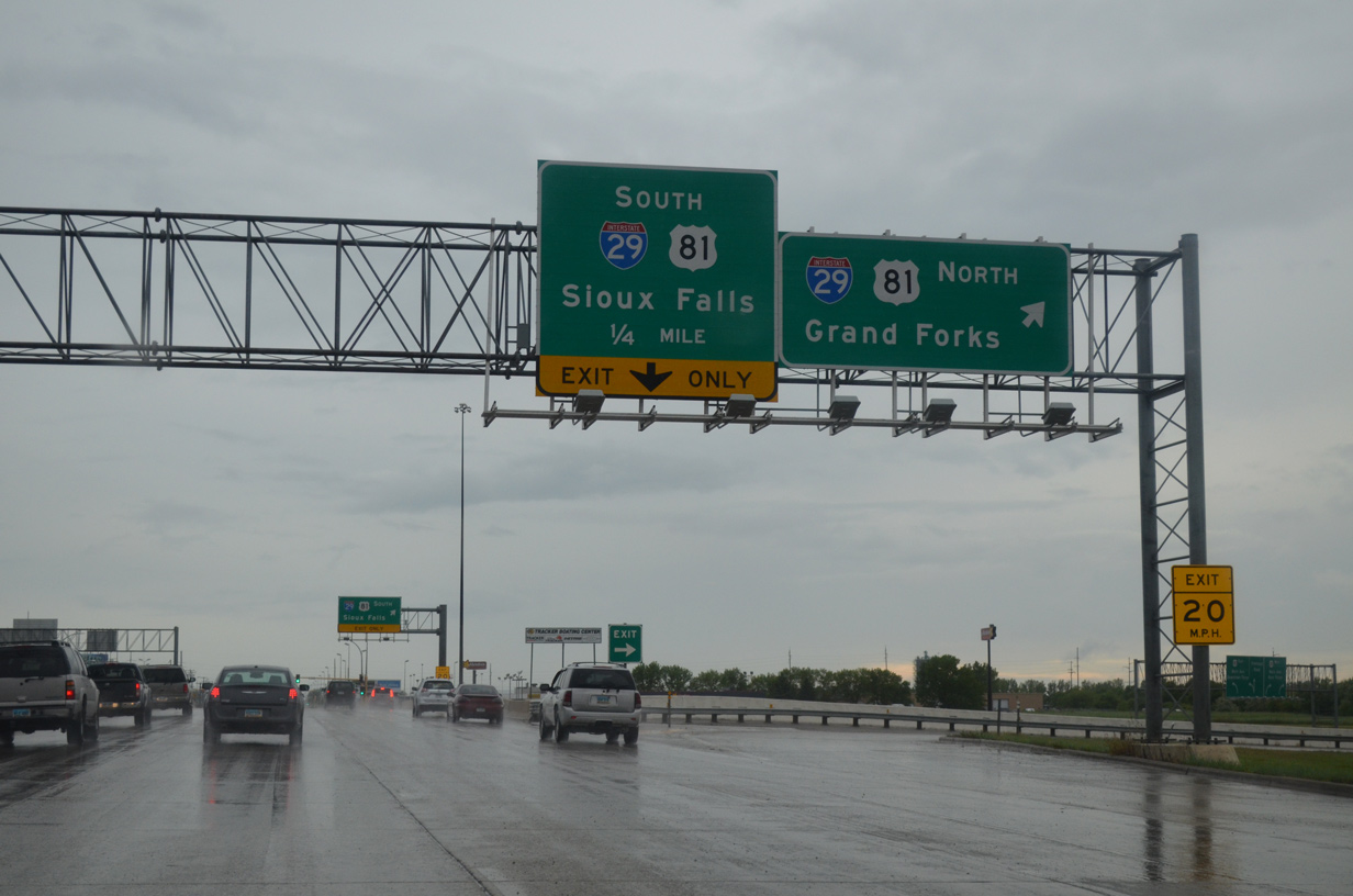
A loop ramp joins Business Loop I-94 & U.S. 10 (Main Avenue) west with I-29/U.S. 81 south through the city to the suburbs of West Fargo and Frontier while en route to Wahpeton. Interstate 29 travels 236 miles from Fargo to Sioux Falls, South Dakota.
06/16/15
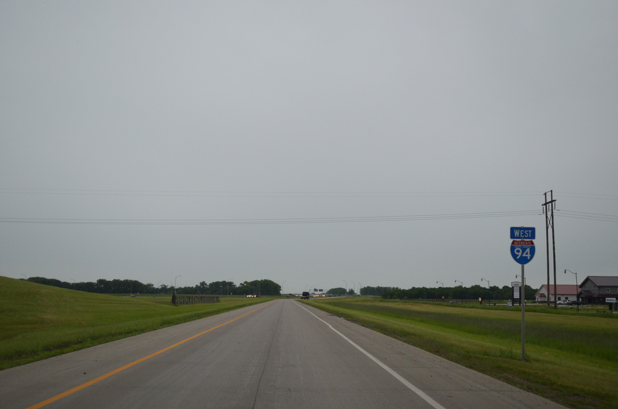
Leaving I-29/U.S. 81, motorists pass by this reassurance shield assembly along Main Avenue as U.S. 10 runs along the north side of the Village West neighborhood.
06/16/15
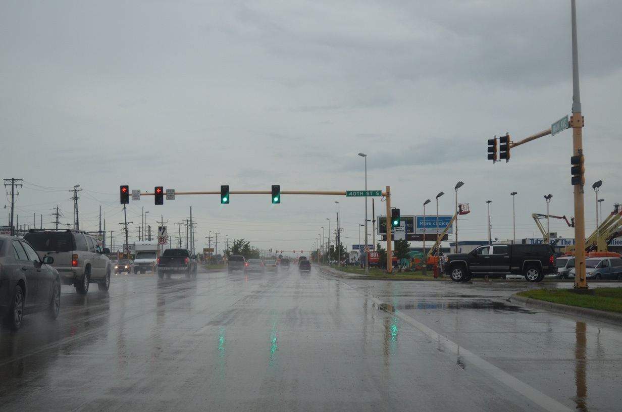
40th Street comprises a north-south commercial arterial between Business Loop I-94 & U.S. 10 and the West Acres Shopping Center at 13th Avenue South.
06/16/15
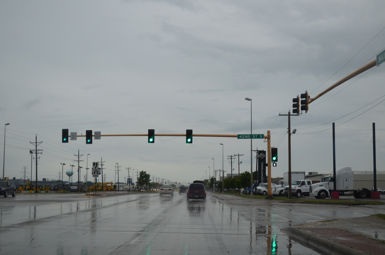
42nd Street South provides a second route to 13th Avenue South with connections to a large mobile home park and apartment complex area along the way.
06/16/15
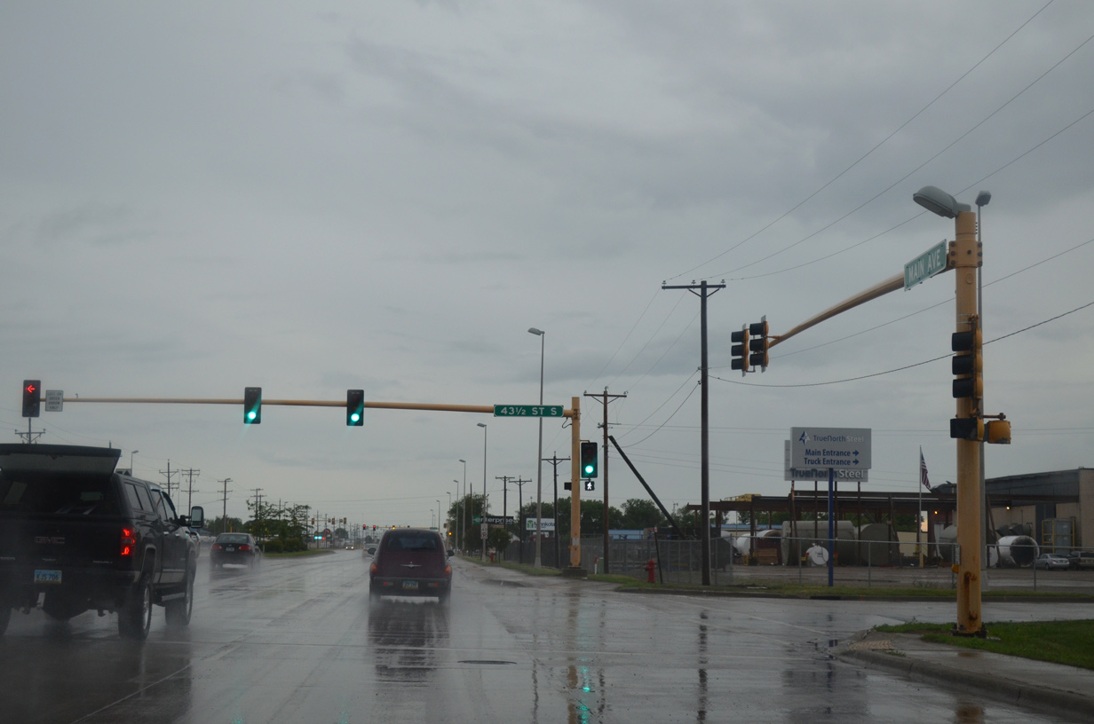
Much of the frontage along Main Avenue between I-29/U.S. 81 and 45th Street remains the same. Pictured here is the industrialized intersection with 43 1/2 Street South.
06/16/15
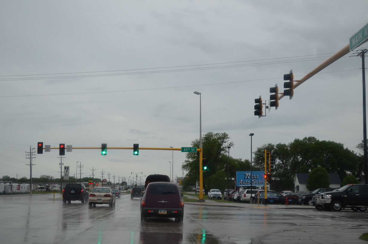
45th Street crosses paths with Business Loop I-94 & U.S. 10 (Main Avenue) in this scene. The north-south arterial provides a main route to the growing suburbs south of I-94/U.S. 52 and new industrial development north of 12th Avenue North.
06/16/15
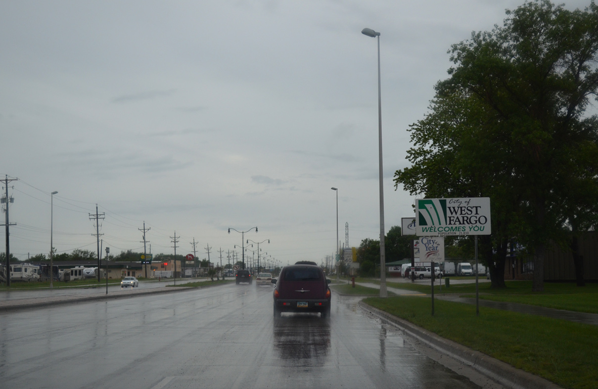
45th Street straddles the city lines of Fargo and West Fargo while Business Loop I-94 & U.S. 10 enter West Fargo for the remainder of their drive along Main Avenue.
06/16/15
Business Loop I-94 & U.S. 10 shields posted west of 45th Street in West Fargo. Street numbers reset once Main Avenue enters West Fargo.
06/16/15
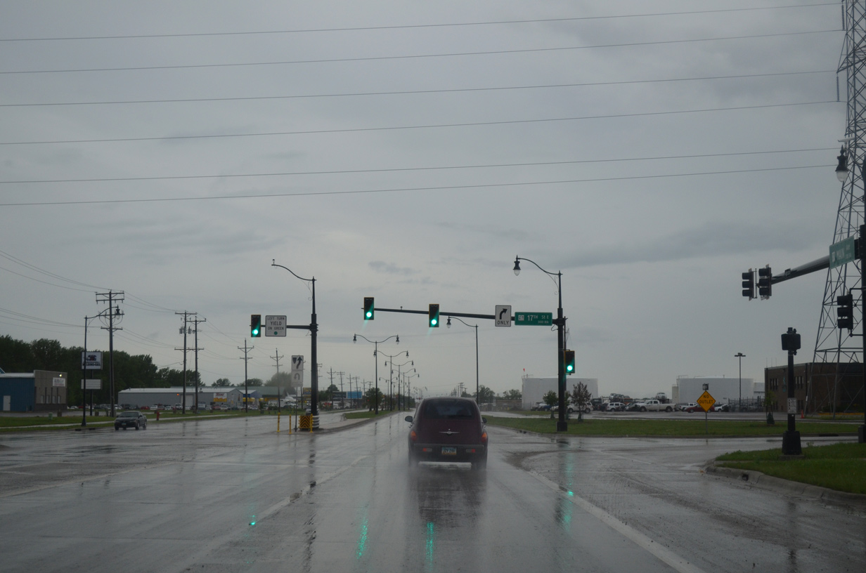
17th Street stems south from Business Loop I-94 along the Fargo city line from 7th Avenue East to I-94 by the Village West and Willow Park neighborhoods.
06/16/15
Decorative street lights and new mast arm signal assemblies were added to Main Avenue during reconstruction of U.S. 10 from a five lane arterial into a four lane divided boulevard. 9th Street East leads south from Main Avenue here to a 2009-built interchange at I-94/U.S. 52 at Amber Valley in Fargo.
06/16/15

Continuing west from 9th Street East, Main Avenue heads toward the West Fargo city center. Annexations expanded the city limits west to Interstate 94 and south to incorporate growing suburbs to 52nd Avenue.
06/17/15
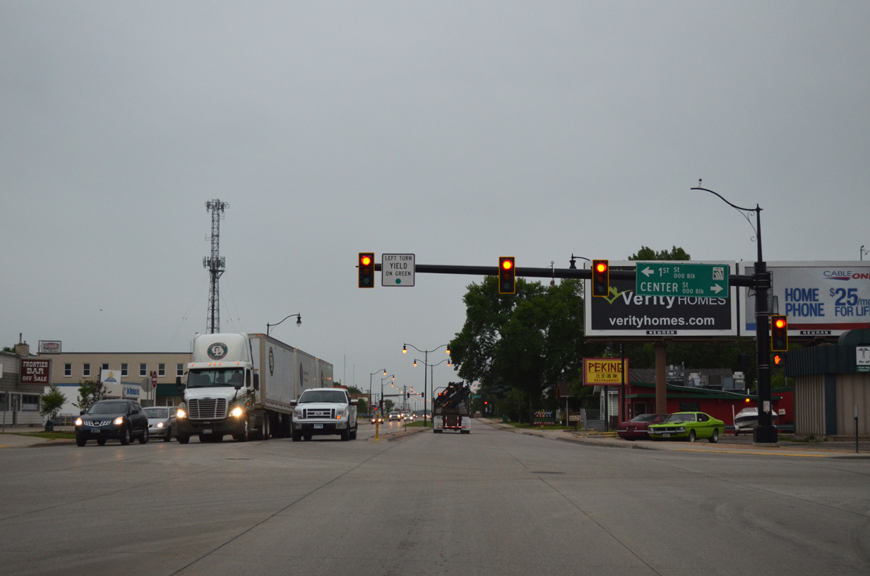
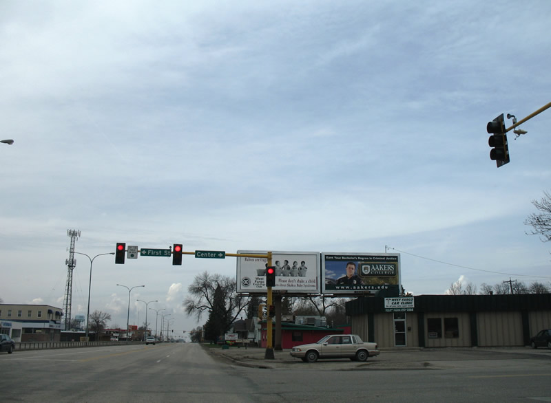
Business Loop I-94 & U.S. 10 (Main Avenue) west at 1st Street south and Center Street (Cass County 17) north. Cass County 17 north continues to 12th Avenue (CR 10) west and Pinkham.
06/17/15
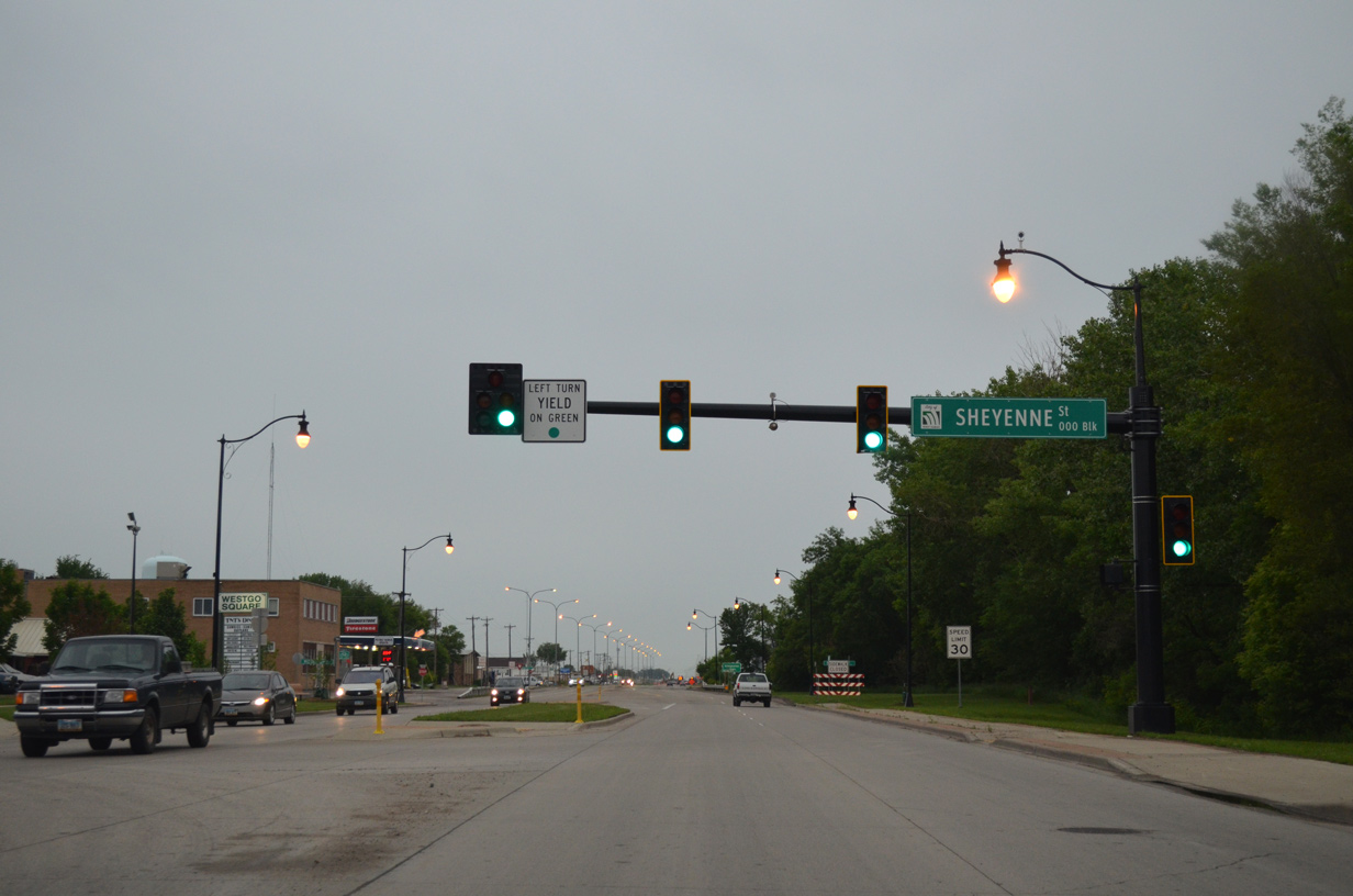
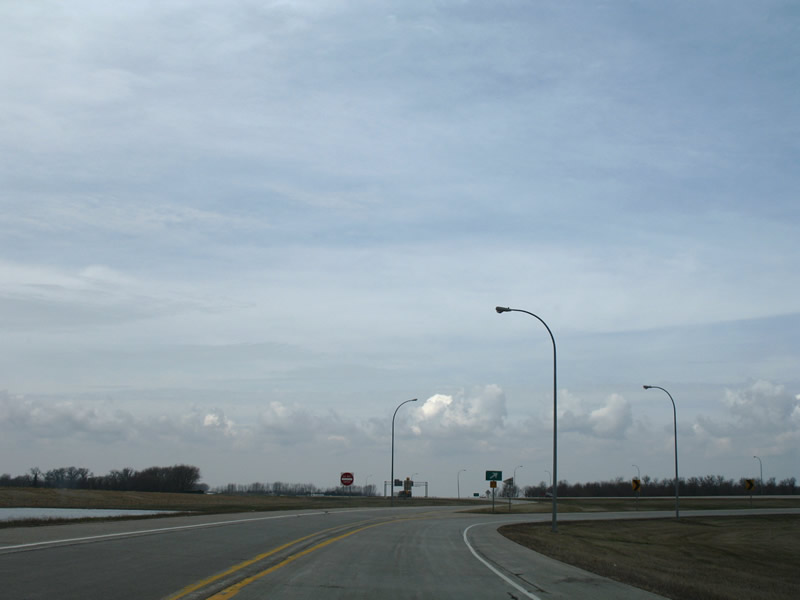
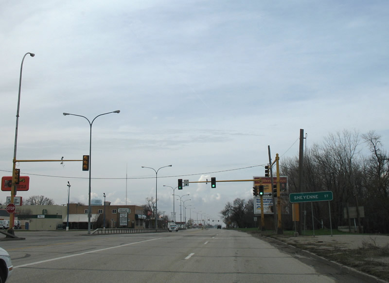
Westbound Main Avenue at Sheyenne Street (CR 17 south). Sheyenne Street heads south from the West Fargo city center to Exit 346 of I-94/U.S. 52. 170th Avenue SE (CR 17) extends south from the freeway through growing suburban areas to the city of Horace.
06/17/15
Business Loop I-94 & U.S. 10 (Main Avenue) span the Sheyenne River and enter an industrial area of West Fargo. A signalized intersection joins Main Avenue with 6th Street West adjacent to the river.
04/22/07
Reassurance shield assembly posted along Main Avenue westbound between 6th and 8th Street West. Frontage streets again join Business Loop I-94 & U.S. 10.
06/17/15
Main Avenue passes by Bonanzaville USA and the Red River Fairgrounds on the approach to I-94/U.S. 52.
06/17/15
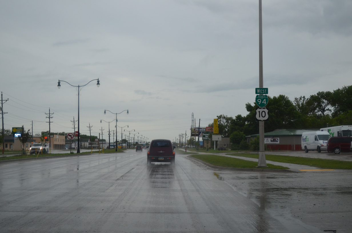
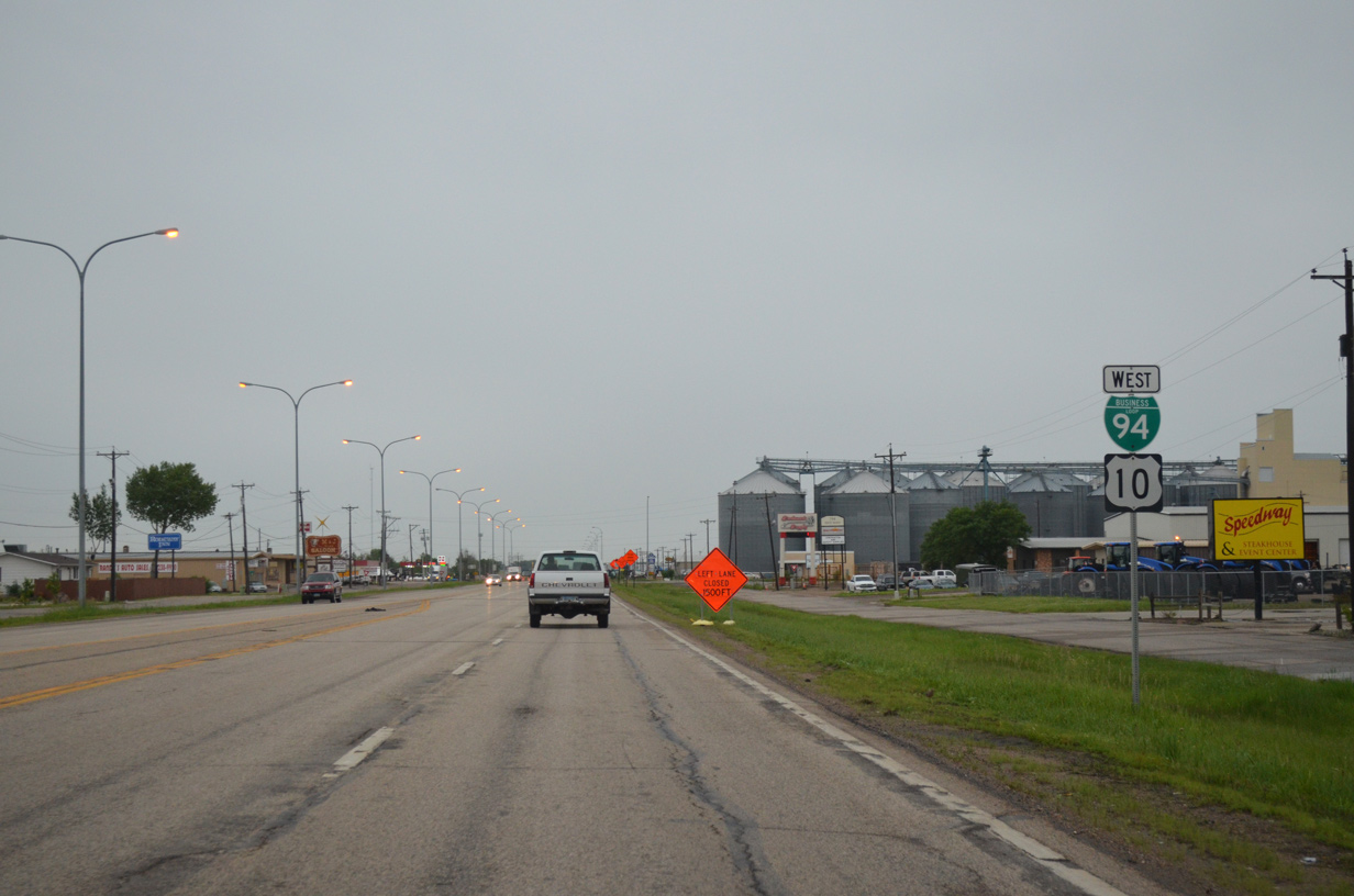
The forthcoming trumpet interchange marks the end of Business Loop I-94/U.S. 10 in West Fargo.
06/17/15
U.S. 10 originally ended at Seattle, but was truncated to West Fargo in 1987 since the majority of the route was replaced with either Interstates 90 or 94.
06/17/15
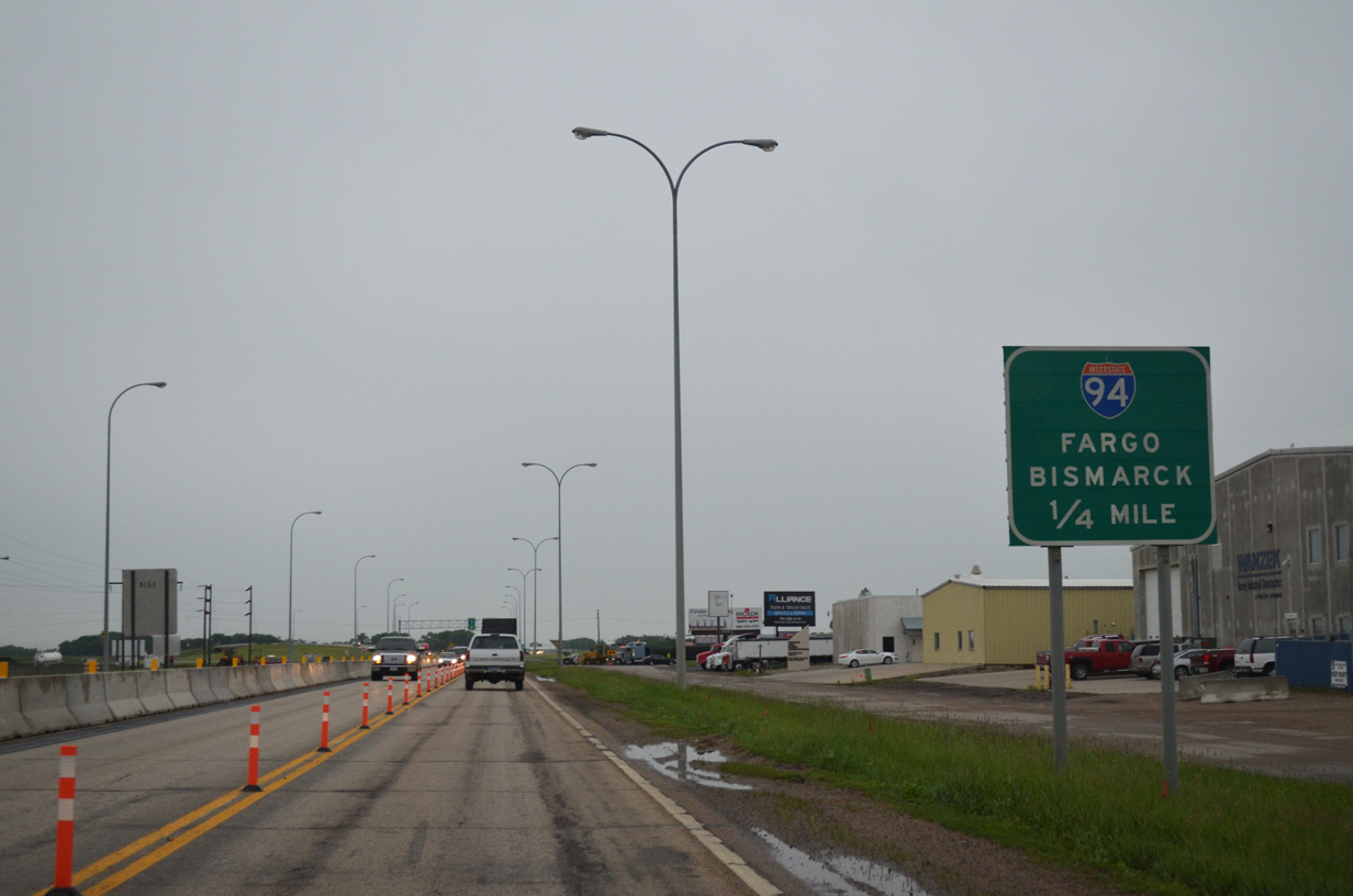
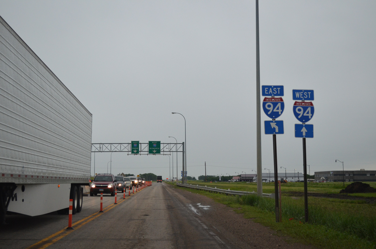
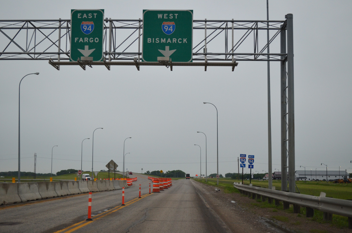
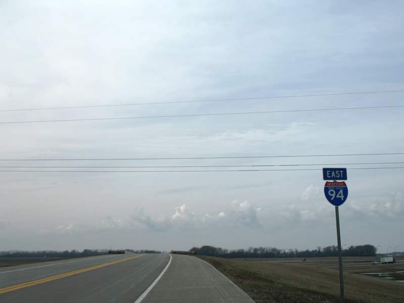
Traffic partitions to I-94/U.S. 52 east toward Moorhead, Minnesota and west to Jamestown, Bismark and Billings, Montana.
06/17/15
Taking the westbound on-ramp to I-94/U.S. 52 from Main Avenue. I-94/U.S. 52 west split at Jamestown with Interstate 94 continuing along the original U.S. 10 alignment to Bismark and points west.
06/17/15
A shield assembly lines the eastbound I-94/U.S. 52 ramp leading back to Fargo.
04/22/07
The Sheyenne River diversion channel appears along the south side of the I-94 & U.S. 10 exchange. West from adjacent Exit 342, old U.S. 10 runs along portions of the frontage road system.
04/22/07
West - Archive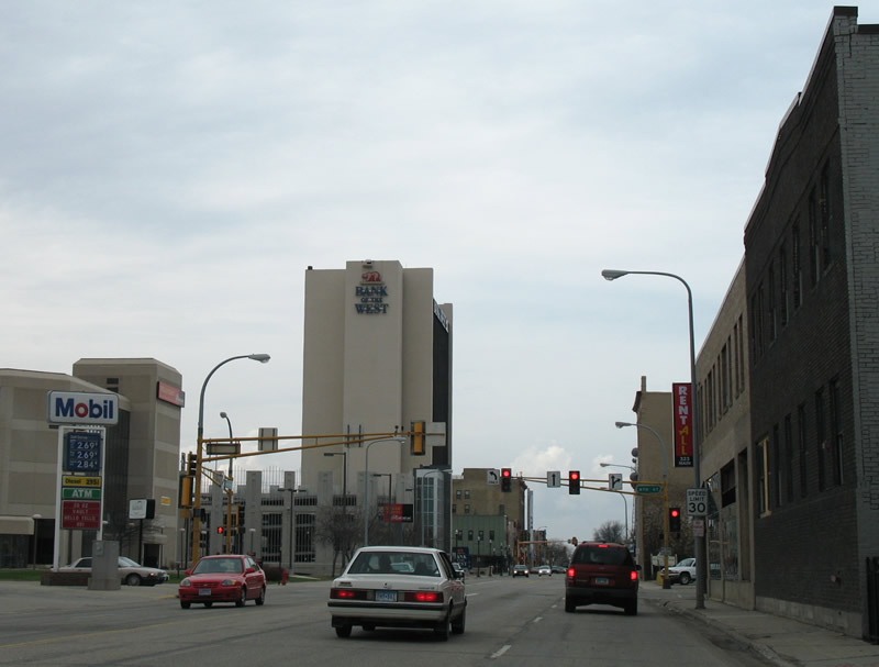
These truss mast arm based signals at Main Avenue and 4th Street in Downtown Fargo were replaced after 2011.
04/22/07

Westbound Main Avenue at 9th Street East in West Fargo.
04/22/07

This shield assembly for Business Loop I-94 & U.S. 10 was posted just west of 9th Street East on a light post. The frontage roads here were removed during the rebuild of West Main Avenue and were finished in 2009 along this stretch.
04/22/07
Main Avenue west at First Street south and Center Street north in West Fargo.
04/22/07
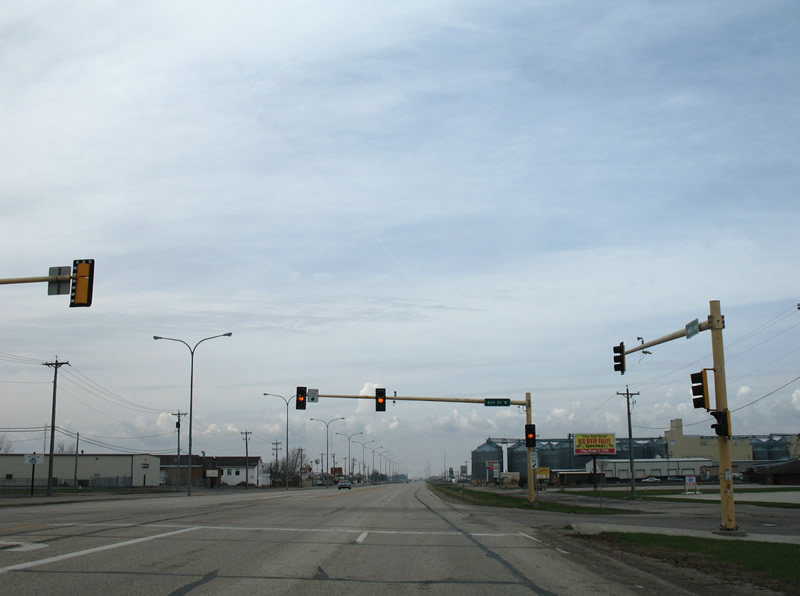
The previous configuration of Main Avenue west at Sheyenne Street, with a south side frontage road.
04/22/07
Photo Credits:
- ABRoads: 06/16/15, 06/17/15
- Alex Nitzman: 04/22/07
Connect with:
Page Updated Monday April 11, 2016.