
U.S. 15/29 North - Culpeper to Gainesville


 North
North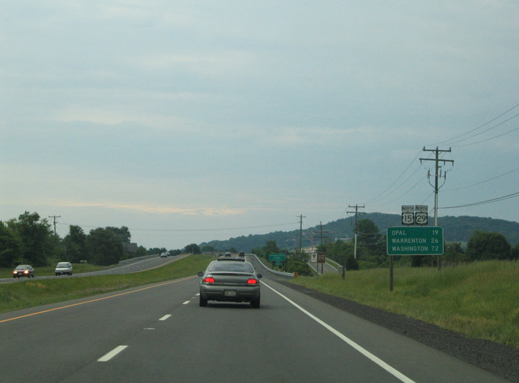
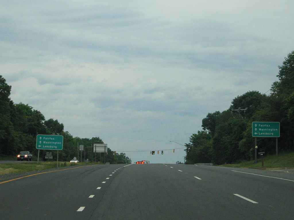
U.S. 15/29 combine for 19 and 26 miles to Opal and Warrenton respectively. SR 686 (Lovers Lane) parallels the freeway beyond the distance sign.
05/30/05
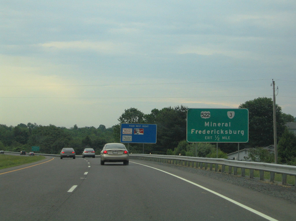
Meeting U.S. 15/29 first is U.S. 522/SR 3 (Germanna Highway) at a diamond interchange. U.S. 522/SR 3 combine from U.S. 15/29 Business to Mount Pony.
05/30/05
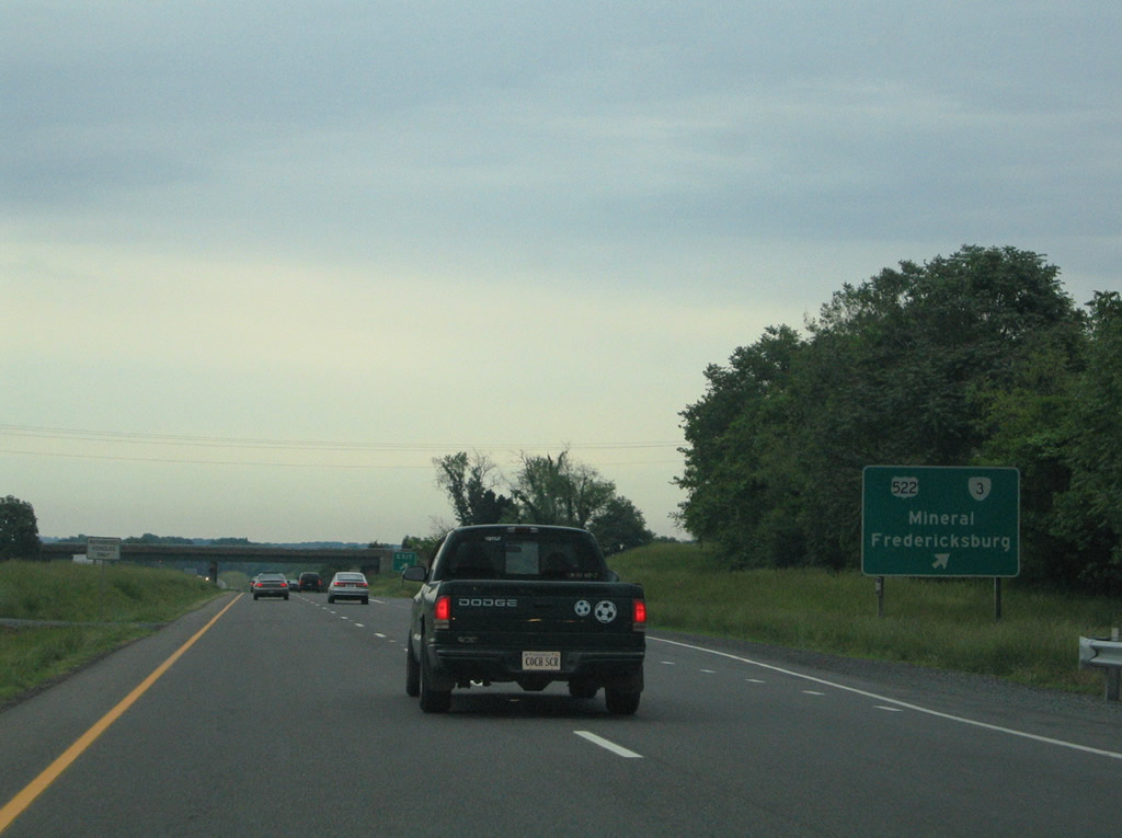
U.S. 522 heads south from Culpeperto Mineral and Goochland along a two lane route. SR 3 run southeast to Lignum and Fredericksburg along a 155 mile long course to Gloucester. U.S. 522/SR 3 lead northwest to Germanna Community College and Downtown Culpeper.
05/30/05
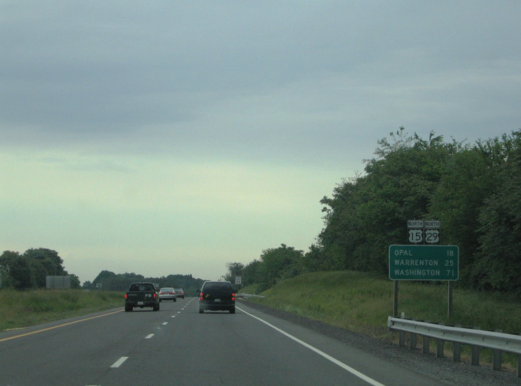
Continuing to encircle Culpeper, U.S. 15/29 advances one mile closer to Opal and Warrenton.
05/30/05
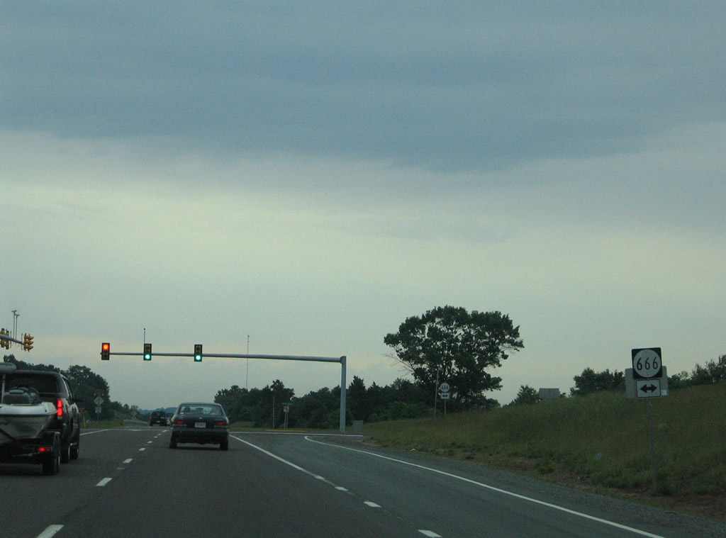
SR 666 intersects U.S. 15/29 (James Madison Highway) at Braggs Corner. SR 666 follows Braggs Corner Road north to U.S. 15-29 Business (Brandy Road) and Greens Corner Road east to Greens Corner and Stevensburg Road (SR 663).
05/30/05
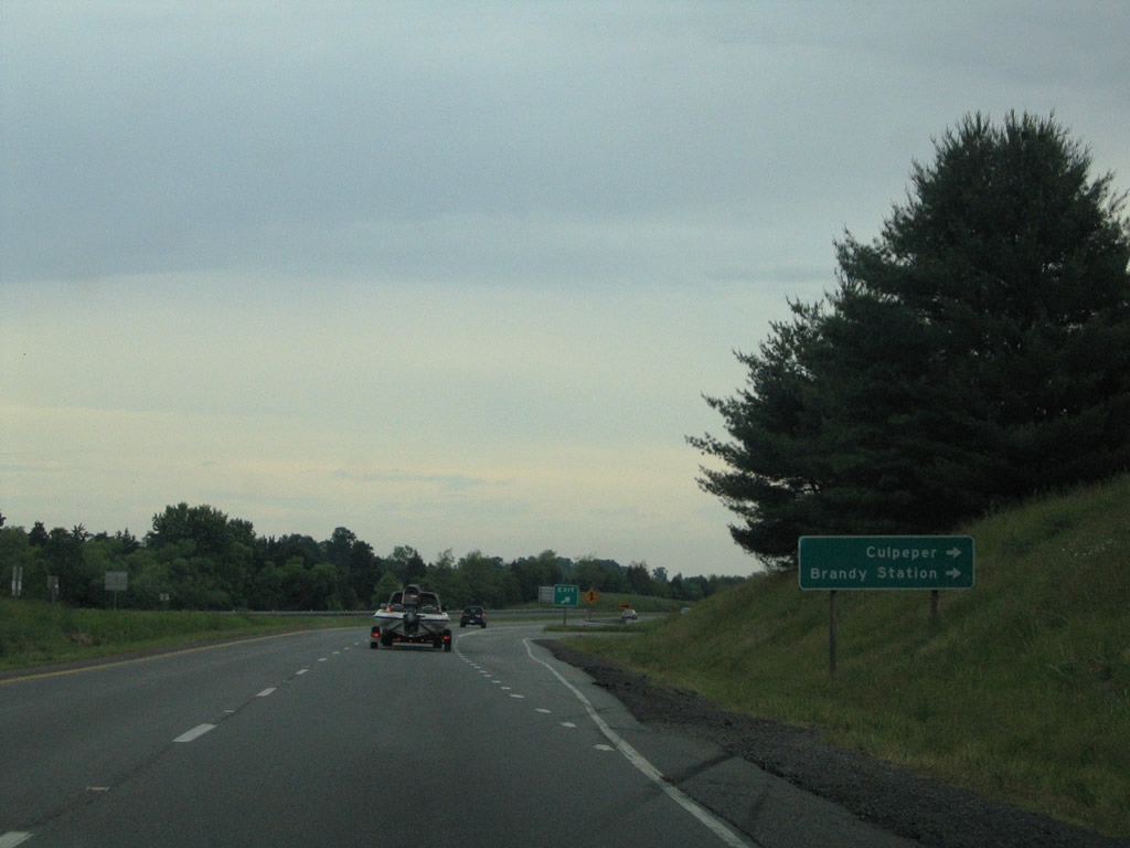
U.S. 15-29 Business line Brandy Road east from Main Street (SR 229) to a folded diamond interchange with the Culpeper bypass. SR 762 continues Brandy Road east from Inlet and U.S. 15-29 to Brandy Station.
05/30/05
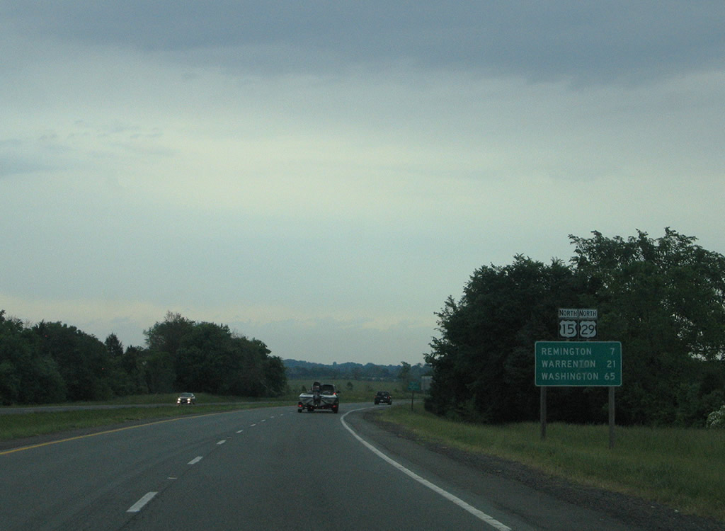
Remington replaces Opal as the next control point for U.S. 15/29 (James Madison Highway) north.
05/30/05
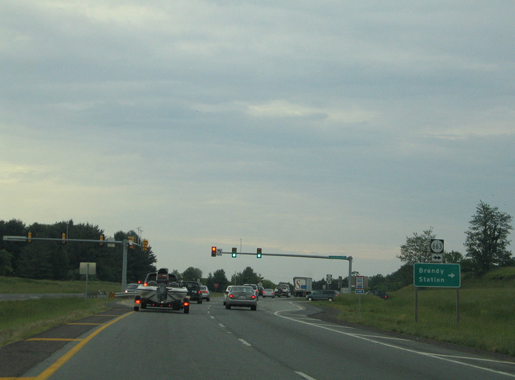
U.S. 15/29 north stay north of Brandy Station, intersecting SR 663 (Alanthus Road) at a traffic light north of SR 762. SR 663 continues northwest to Alanthus and SR 625.
05/30/05
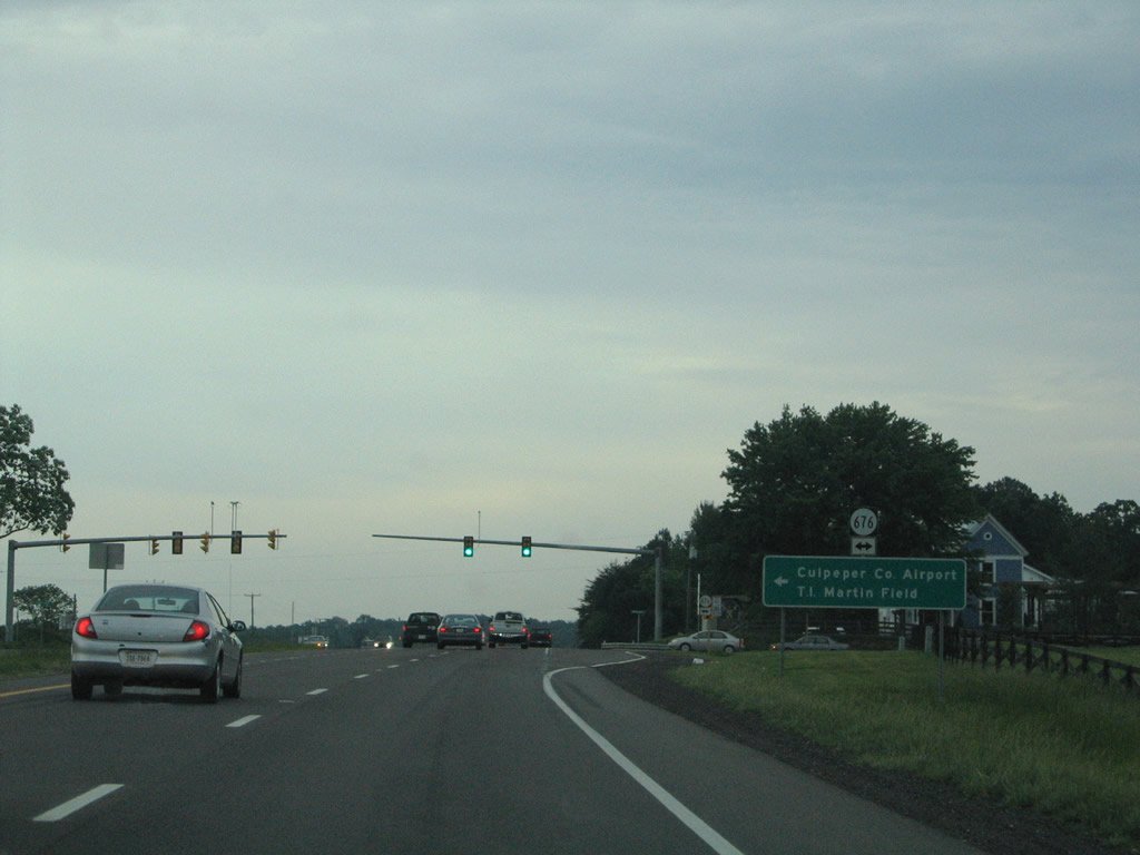
SR 676 (Beverly Ford Road north / Berry Hill Road) crosses paths with U.S. 15/29 (James Madison Highway) at a traffic light at Elkwood. SR 676 serves Culpeper County Airport / Martin Field to the north and ends at SR 675 (Thoms Road) amid farm fields to the south.
05/30/05
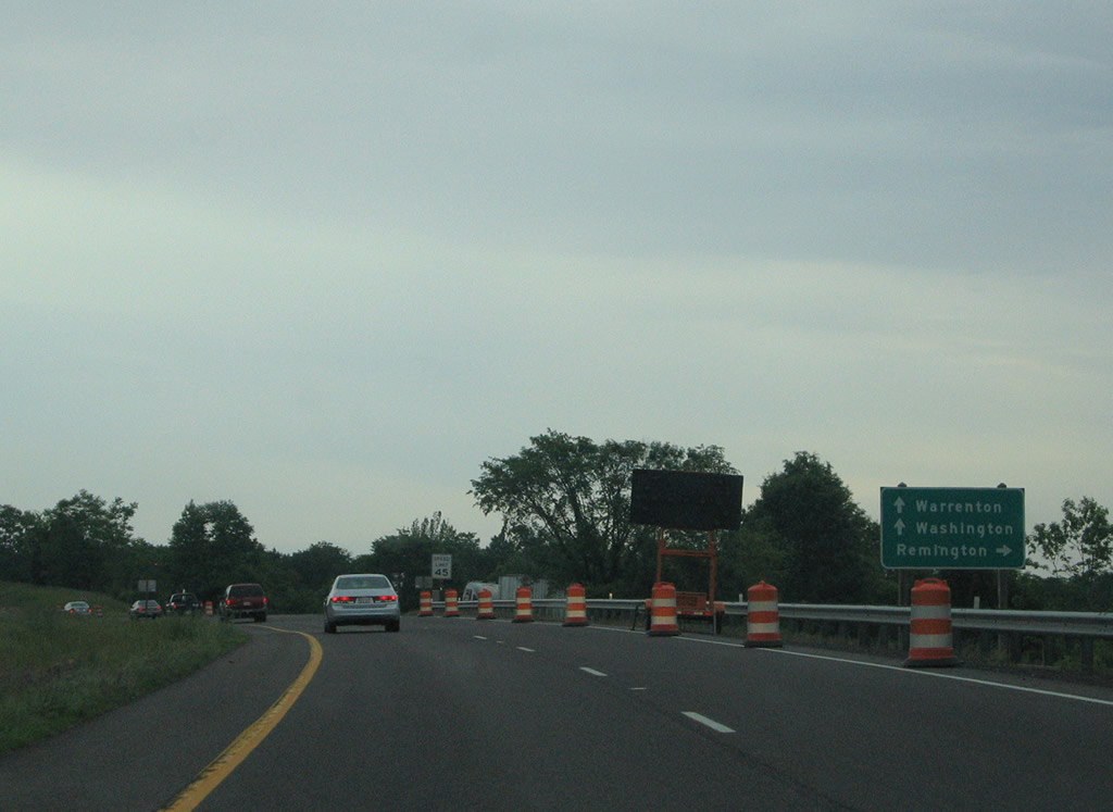
U.S. 15/29 stay west and bypass Remington along a four lane expressway. A business loop for the combined route travels the old alignment (Remington Road) into town.
05/30/05
Northbound at the split with U.S. 15-29 Business (Remington Road) on U.S. 15/29 (James Madison Highway) north. Both routes span the Rappahannock River into Faquier County outside of Remington.
05/30/05

Seven miles north of Opal and 14 miles from Warrenton on U.S. 15/29 (James Madison Highway) north.
05/30/05
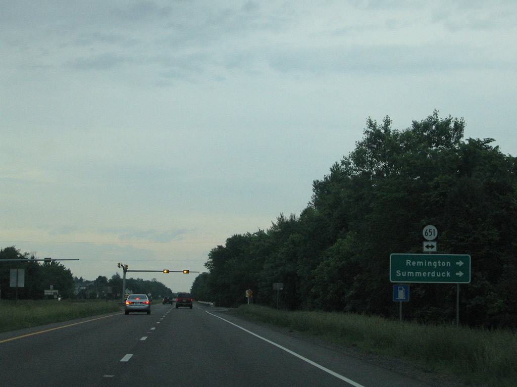
SR 651 (W Main Street / Freemans Ford Road) meet U.S. 15/29 (James Madison Highway) north outside Remington. SR 651 straddles the Rappahannock River southeast from Remington to Summerduck and U.S. 17 near Goldvein.
05/30/05
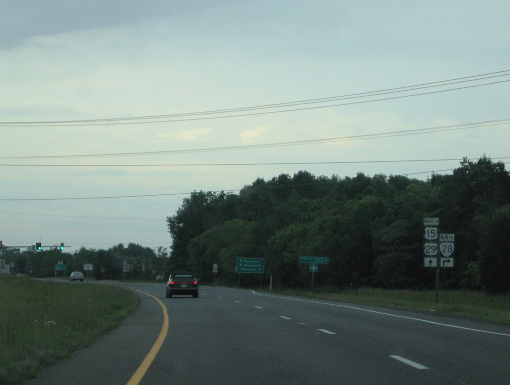
Just north of the U.S. 15/29 Business (James Madison Street) return from Remington is the SR 28 (Catlett Road) northbound beginning at Kings Hill Road (SR 657).
05/30/05
SR 28 provides a direct route to Manassas via Midland, Catlett, and Nokesville. SR 657 continues the Catlett Road alignment southwest to SR 658 (Cemetery Road).
05/30/05

U.S. 15/29 (James Madison Highway) northbound at SR 28 (Catlett Road). SR 28 travels 49 miles to SR 7 at Sterling. The state route plays a much bigger role with commuter and through traffic interests at Manassas, Centreville, and Dulles International Airport than its rural end point here.
05/30/05
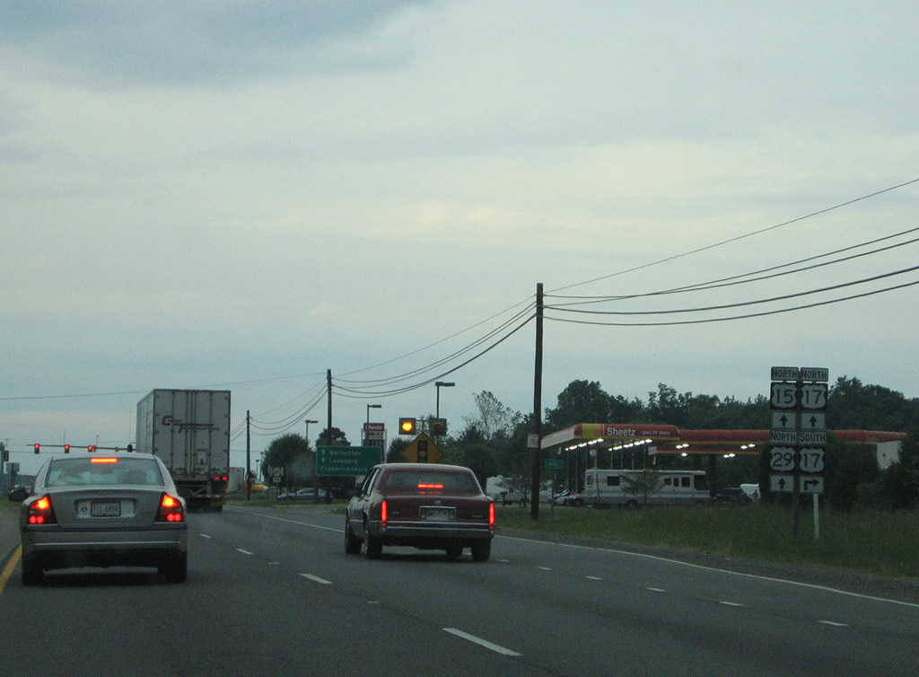
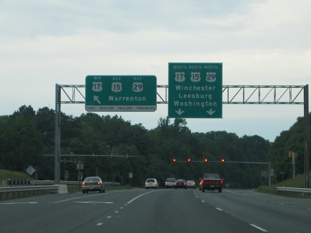
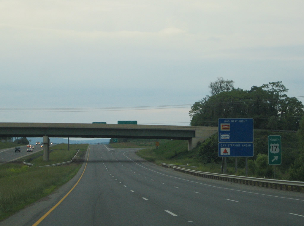
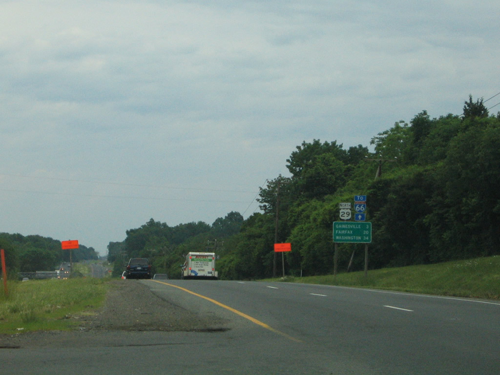
Opal represents the cross roads between U.S. 15/29 (James Madison Highway), U.S. 17 south, and SR 687 (Opal Road) north. U.S. 17 (Marsh Road) travels northwest 26 miles from its split with Interstate 95 at Frederick to its merge with U.S. 15/29.
05/30/05
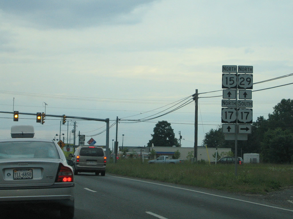
Entering the signalized intersection with U.S. 17 (Marsh Road) and SR 687 (Opal Road) on U.S. 15/29 north. U.S. 15-17-29 overlap for 7.15 miles north to Warrenton. U.S. 17 travels 255.09 miles overall in Virginia between Winchester and the North Carolina state line at Chesapeake.
05/30/05
 North
North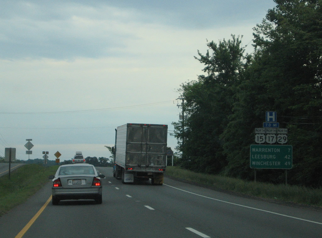
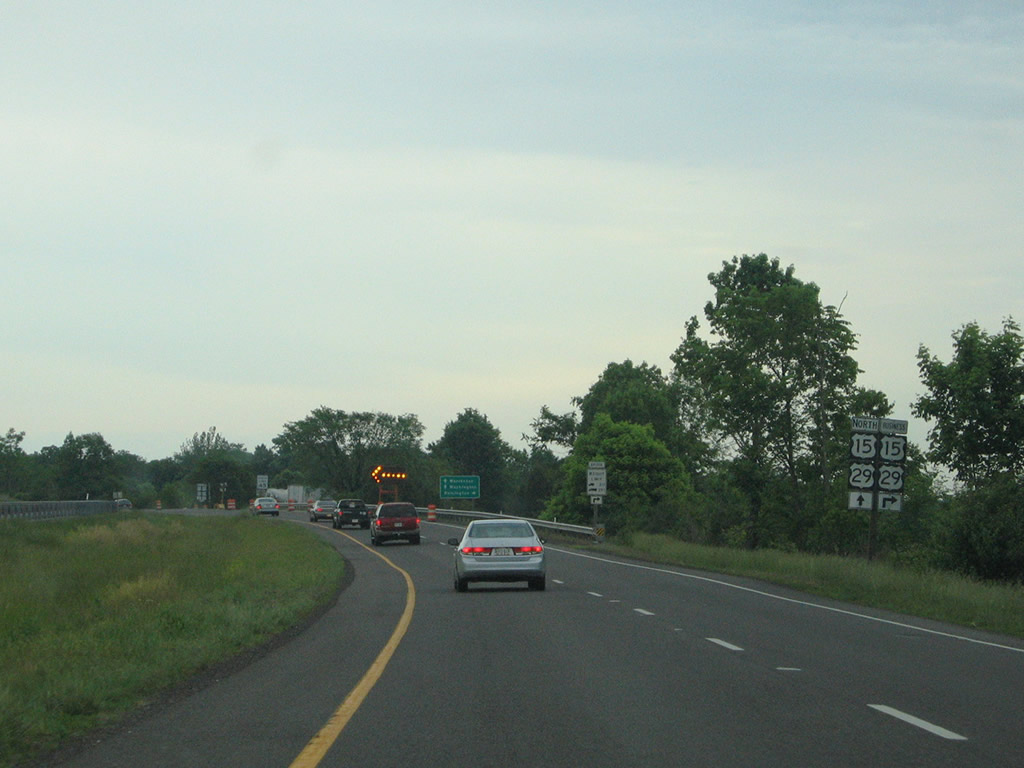
Beyond the overlap of U.S. 15-17-29 (James Madison Highway) at Opal, Leesburg is 42 miles to the north along U.S. 15 and Winchester 49 miles to the northwest at the end of U.S. 17.
05/30/05
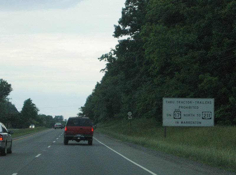
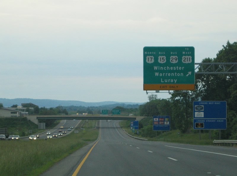
Truck traffic bound for U.S. 211 (Lee Highway) west from Warrenton is directed to remain along U.S. 15/17/29 north to U.S. 211 directly in lieu of U.S. 17-29 Business along Shirley Avenue.
05/30/05
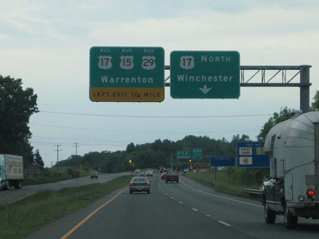
U.S. 15-17-29 (James Madison Highway) follow a limited access bypass east of Warrenton while U.S. 17-29 Business follow Shirley Avenue 2.65 miles northwest to U.S. 211 (Frost Avenue). U.S. 15 Business meanders through Downtown via Falmouth and Main Streets.
05/30/05
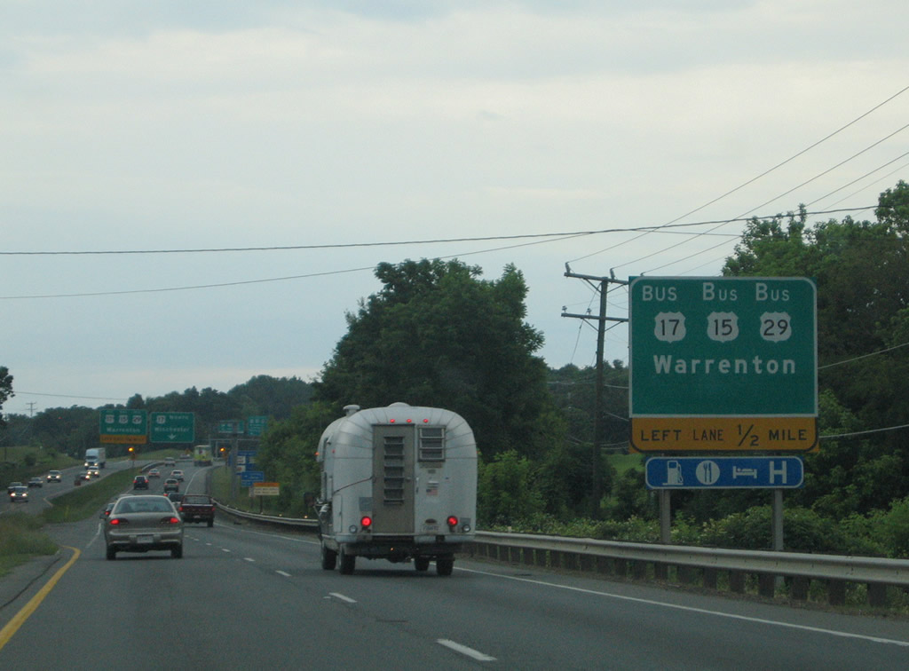
U.S. 15-17-29 Business branches north into Warrenton. Shirley Avenue bypasses Downtown as a direct route to U.S. 211 (Frost Avenue / Lee Highway) west to Washington, Luray and New Market.
05/30/05
Construction in 2019/20 replaced the at-grade intersection with U.S. 15-17-29 Business north and SR 880 from Lord Fairfax Community College with a dumbbell interchange.
05/30/05

Marshall was used in lieu of Winchester on this distance sign for U.S. 15-17-29 along the Eastern Bypass of Warrenton.
05/30/05
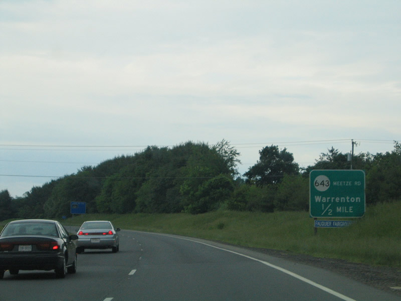
SR 643 (Meetze Road) enters the Warrenton area from Meetze to meet U.S. 15-17-29 near Frytown. Meetze Road continues west from a diamond interchange with the freeway to U.S. 15 Business (Falmouth Street) at Lee Street.
05/30/05
U.S. 17 separates from U.S. 15/29 (Eastern Bypass) at a wye interchange beyond the Academy Hill Road overpass.
05/30/05
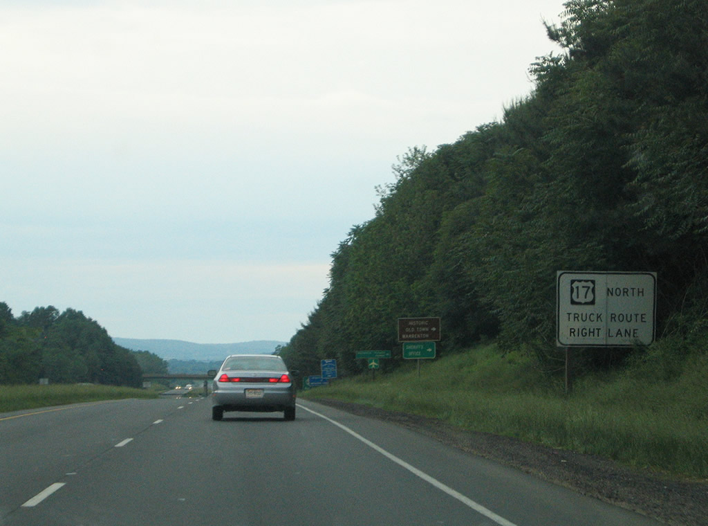
Since removed, this overhead for the ramp to U.S. 15-29 Business south (Lee Highway) to U.S. 211 west omitted U.S. 17 north. U.S. 17 was relocated wholly onto the Warren bypass in 1998, with the completion of US 17 Spur between Lee Highway and Broadview Avenue.
05/30/05
U.S. 17 splits with U.S. 15/29 ahead of a loop ramp U.S. 15-29 Business (Lee Highway) south to U.S. 211 west in Warrenton.
05/30/05
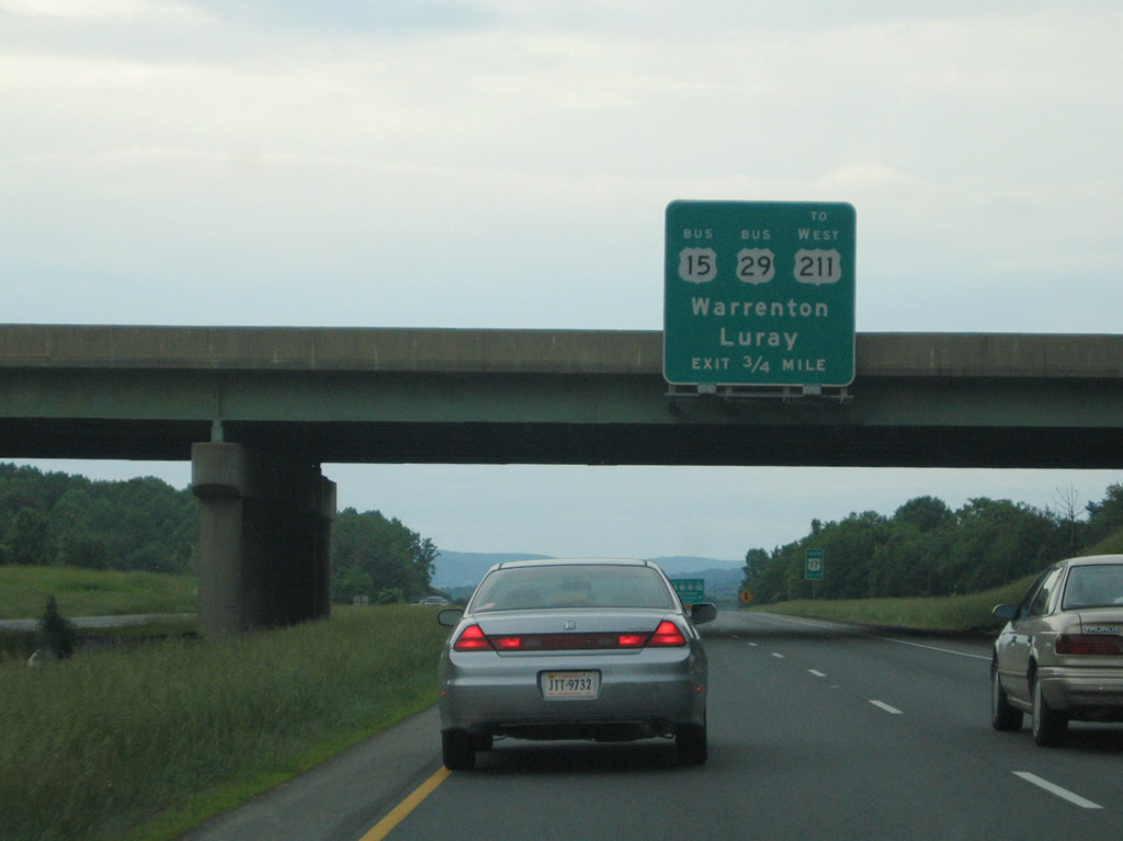
U.S. 211 begins at the intersection joining U.S. 15-29 Business with Blackwell Road (U.S. 15-211 Business west). U.S. 211 travels just 59 miles from Warrenton to Interstate 81 at New Market.
05/30/05
North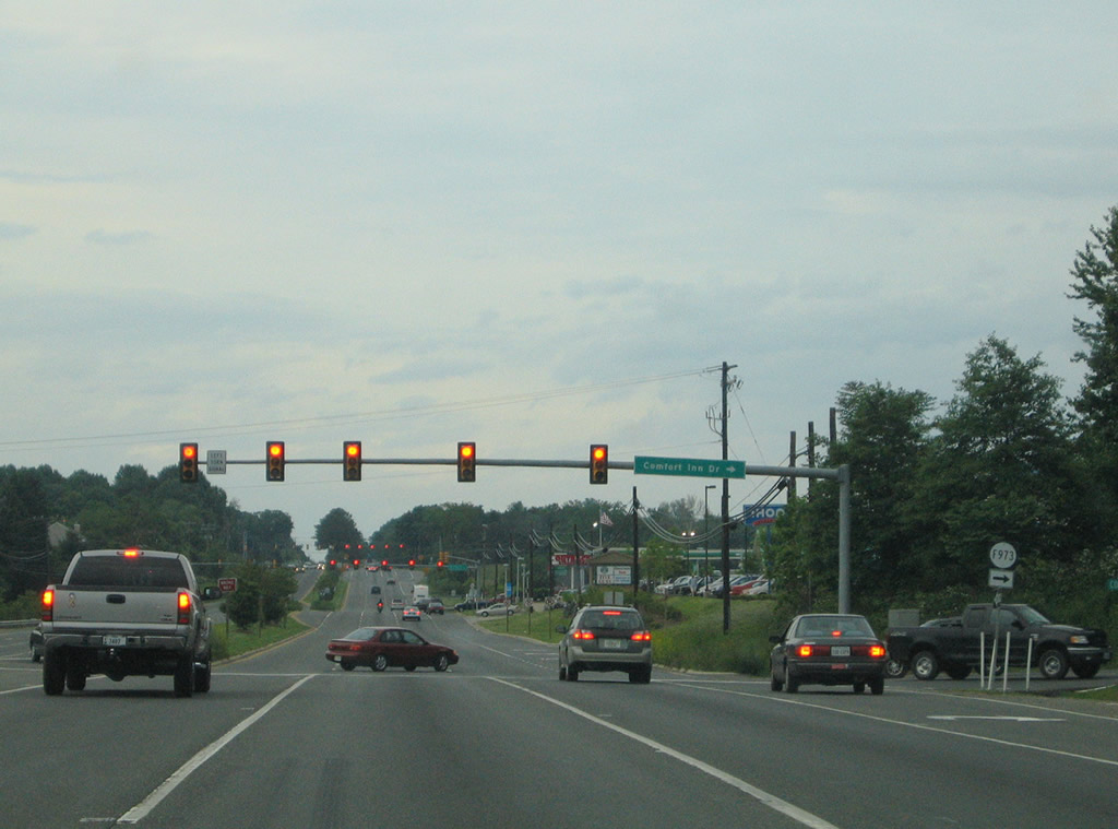
Suburban sprawl spreads northeast from Warrenton. U.S. 15/29 overtake Lee Highway from U.S. 211 and continue northeast to New Baltimore. The first of several traffic lights operates at SR F973 (Comfort Inn Drive).
05/30/05
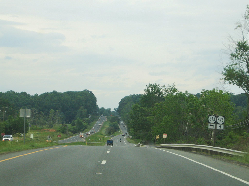
A staggered intersection joins SR 673 (Fosters Fork Road north / Baldwin Street south) with U.S. 15/29 (Lee Highway). SR 673 travels a short distance to SR 694 (Old Bust Head Road) at Foster Fork and an end at Baldwin Ridge east of SR 674 (Grays Mill Road).
05/30/05
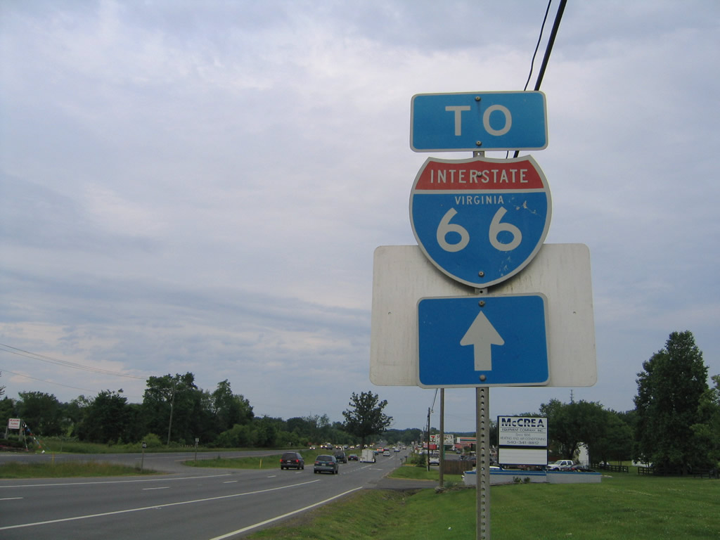
An Interstate 66 trailblazer stands along U.S. 15/29 (Lee Highway) ahead of SR 215 (Vint Hill Road) south in New Baltimore.
05/30/05
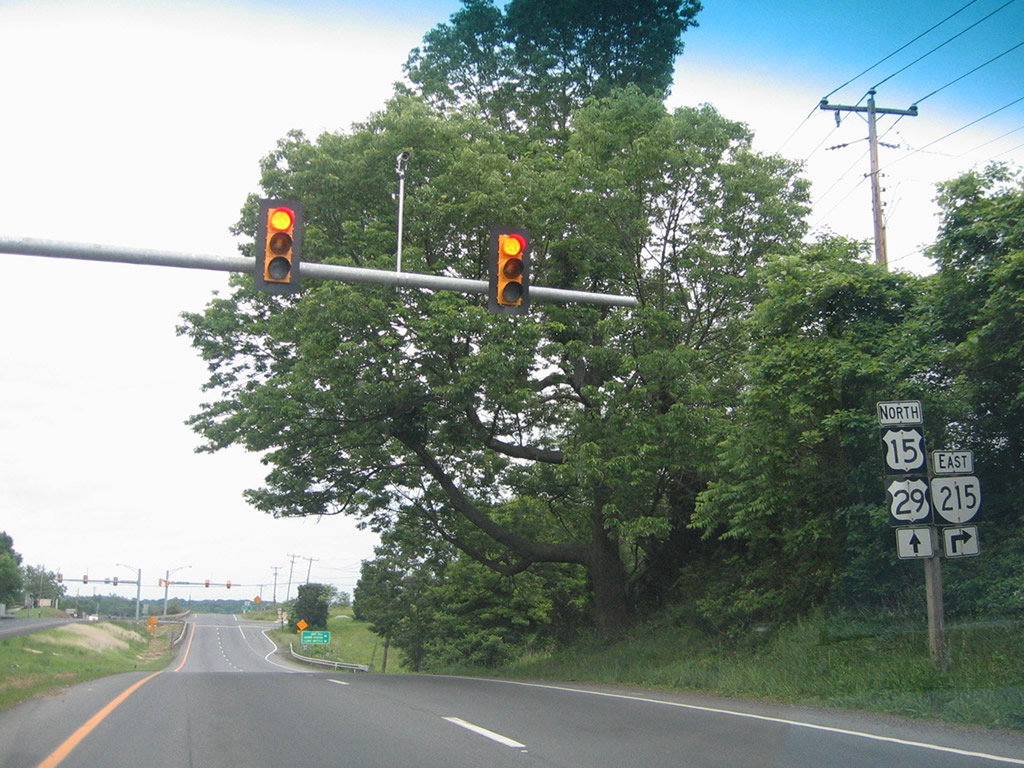
U.S. 15/29 (Lee Highway) north at the eastbound beginning of SR 215 (Vint Hill Road). SR 215 runs 10.81 miles between the Buckland area and SR 28 near Nokesville.
05/30/05
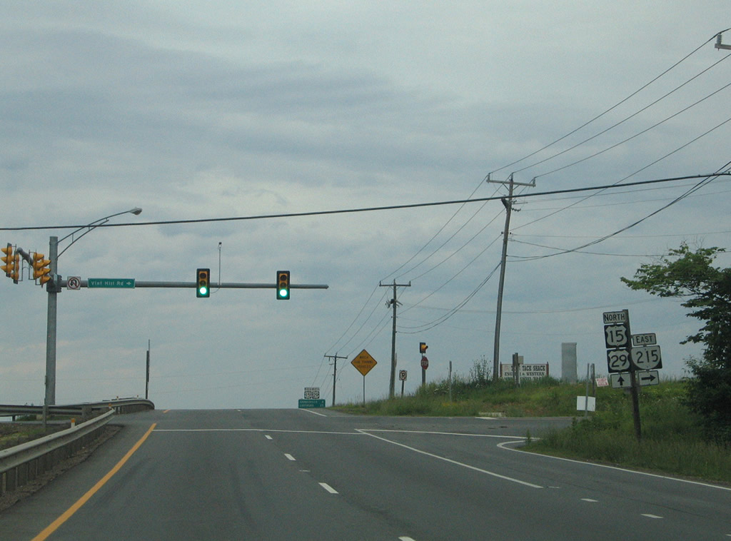
U.S. 15/29 (Lee Highway) north at the west end of SR 215 (Vint Hill Road). SR 215 used to serve the Vint Hill Farms Station military facility that closed in 1997 and was subsequently redeveloped as a commercial real estate economic development site.
05/30/05
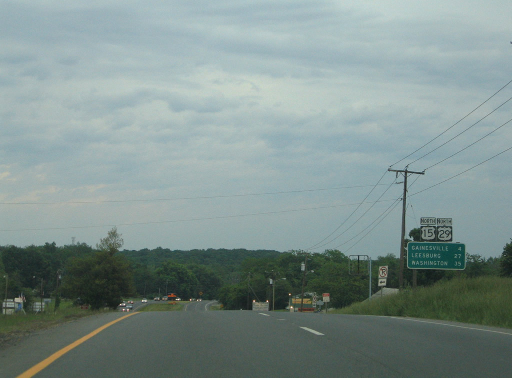
The final distance sign for U.S. 15/29 appears between SR 215 and the Prince William County line. U.S. 29 next meets Gainesville.
05/30/05
U.S. 15/29 separate just east of Buckland. U.S. 15 continues north along James Madison Highway to I-66 at Exit 40 and Leesburg. U.S. 29 bee lines east along a suburban arterial past Lake Manasas to I-66 at Exit 43.
05/30/05
U.S. 29 parallels Interstate 66 along a congested route from Gainesville to Centreville en route to Fairfax and Washington, DC.
05/30/05
Photo Credits:
- Alex Nitzman: 05/30/05
Connect with:
Page Updated Wednesday March 24, 2010.