
U.S. 17/76 West - Wilmington to Leland

 South
South  West
West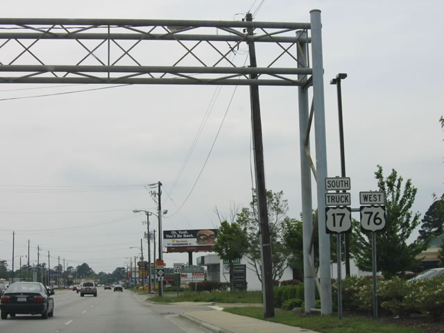
U.S. 17 south / U.S. 76 west overlap 4.16 miles west from U.S. 74 (Eastwood Road) to U.S. 117/NC 132 (South College Road). The two routes bend northward beyond College Road toward Downtown Wilmington.
06/01/05
Oleander Drive advances 2.41 miles west from U.S. 117/NC 132 (South College Road) to split into Wooster Street (westbound) and Dawson Street (eastbound).
06/01/05
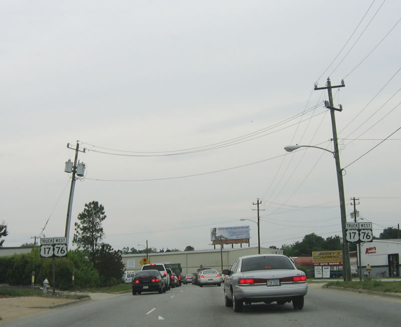
U.S. 17/76 partition into a one way couplet from Oleander Drive to the Cape Fear Memorial Bridge. These reassurance shields appear at the transition onto Wooster Street westbound.
06/01/05
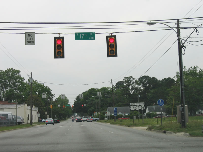
Wooster Street intersects 17th Street north just after Oleander Drive. 16th and 17th Streets formerly carried U.S. 17/74 north from Dawson/Wooster Streets to Market Street (U.S. 17 Business).
06/01/05
Truck U.S. 17 followed Military Cutoff Road and Oleander Drive west to end at 16th Street in Wilmington. The realignment of U.S. 17 approved in 2015 overtook the former truck bypass, which was dropped in 2006.
06/01/05
West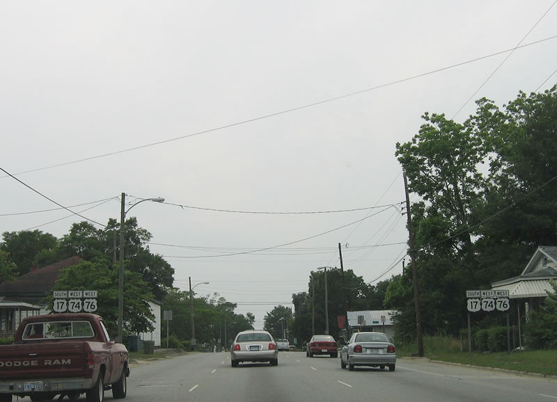
A pair of shield assemblies for the former U.S. 17/74/76 overlap lined Wooster Street west of 9th Street. These were removed by 2007.
06/01/05

Continuing west along Wooster Street, U.S. 17/76 approaches U.S. 421 south and U.S. 17 Business north at 3rd Street.
06/01/05
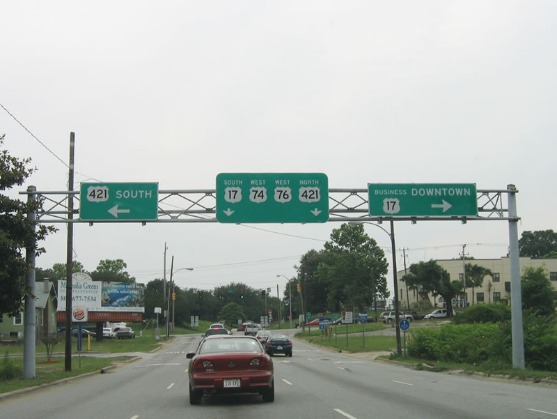
U.S. 421 spurs 21 miles south to Federal Point at Fort Fisher. U.S. 17 Business lines 3rd Street north eight blocks to Market Street at Downtown Wilmington.
06/01/05
South West  North
North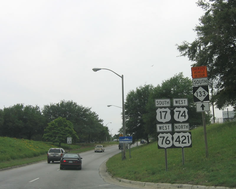
Wooster Street shifts onto an expressway west to the Cape Fear River Memorial Bridge. The lone shield assembly for U.S. 17-76-421 was posted just beyond 3rd Street. With completion of Martin Luther King, Jr. Parkway in September 2005, U.S. 74 was relocated northward onto the Parsley Street Bridge.
06/01/05
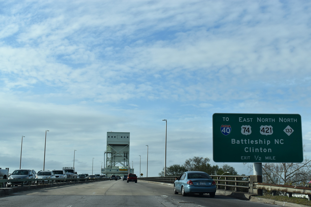
A loop ramp joins the Cape Fear River Memorial Bridge westbound from Front Street. U.S. 421 departs from U.S. 17/76 west at the ensuing interchange on Eagle Island to combine with U.S. 74 and NC 133 north.
01/19/19
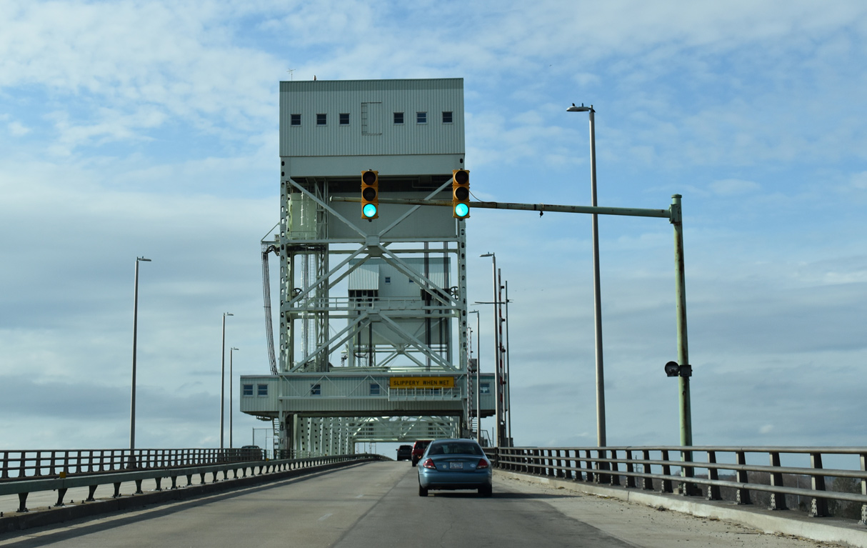
The Cape Fear Memorial Bridge along U.S. 17/76/421 opened to traffic on October 1, 1969.
01/19/19

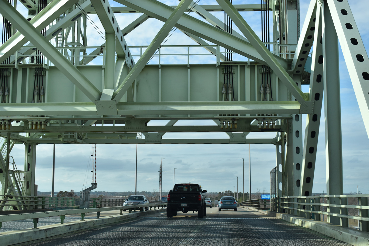
The Cape Fear Memorial Bridge has a vertical clearance of 135 feet over the river, and it can be raised on signal 24 hours a day, seven days a week. The water is approximately 40 feet deep here, allowing large ships to navigate the river.1
01/19/19
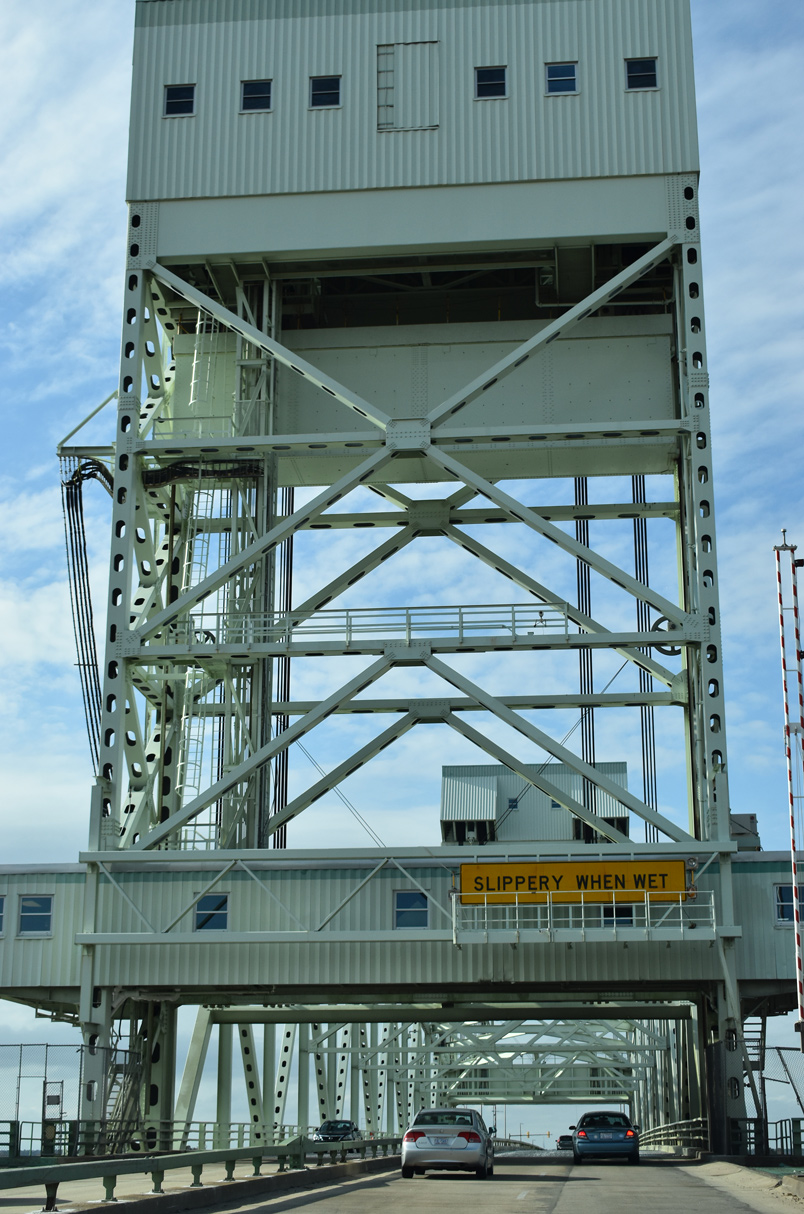
Metal grading forms the road deck of the movable portion of the Cape Fear Memorial Bridge. Drivers are cautioned of potential slippery conditions during inclement weather.
01/19/19
After passing under the second tower, U.S. 17-76-421 enter a trumpet interchange with U.S. 74/NC 133 in Brunswick County.
01/19/19
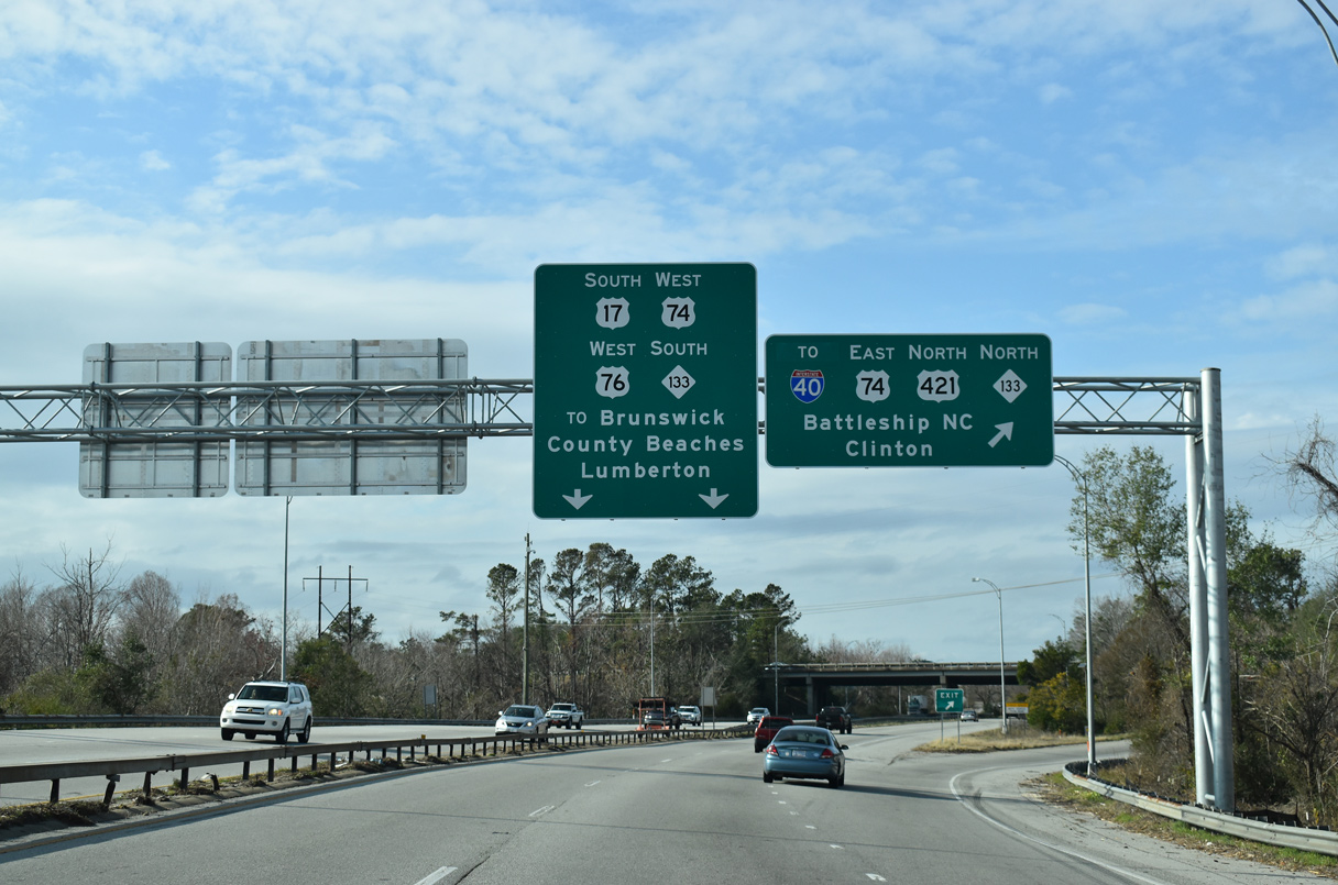
Unlike U.S. 421, NC 133 is a local route that remains in the Wilmington area. NC 133 overlaps with U.S. 74 east across the Cape Fear River and west to Belville. The part of NC 133 between Martin Luther King, Jr. Parkway and College Road (NC 132) is the pre-2003 alignment of U.S. 117.
01/19/19
 South
South  West
West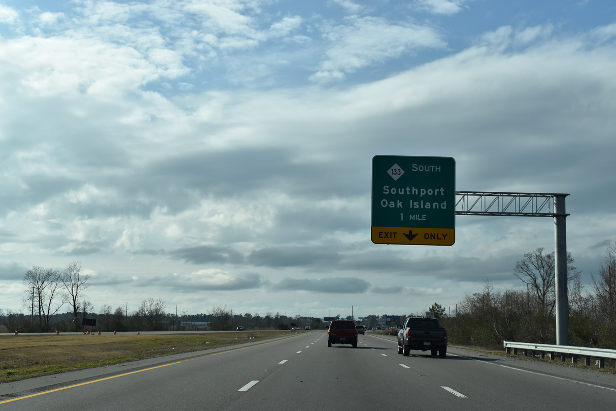
U.S. 17-74-76/NC 133 combine ahead of Alligator Creek on Eagle Island. The Causeway Bridge Project underway between January 2014 and November 2016 included replacement of the bridges across Alligator Creek.
01/19/19
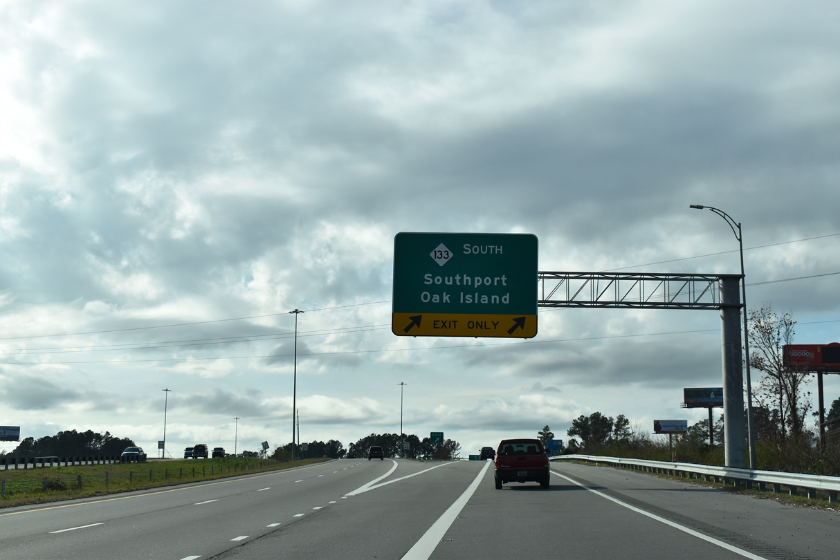
NC 133 bypasses Southport along Long Beach Road, linking NC 87 with NC 210 west before continuing south onto Oak Island. Oak Island features several beaches, including Caswell Beach on the eastern tip (near the Oak Island Lighthouse), Yaupon Beach near the center of the island, and Long Beach.
01/19/19
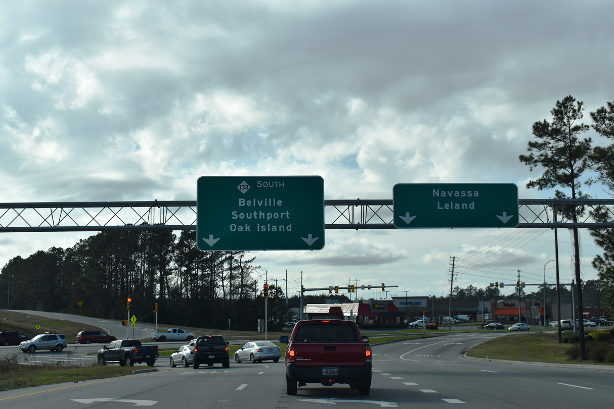
The diamond interchange with River Road (NC 133) south and Village Road (SR 1472) west was reconfigured into a DDI. The new ramp system debuted to motorists on April 15, 2016.
01/19/19
South West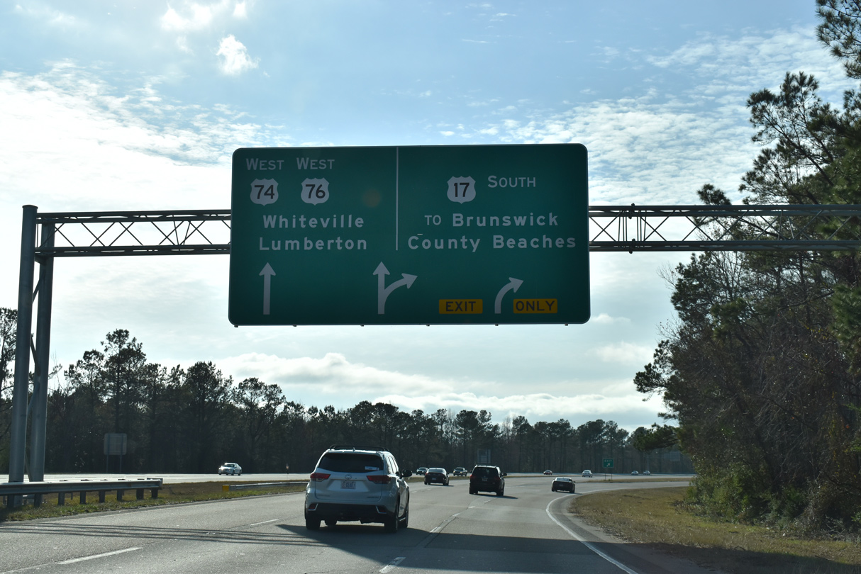
Traffic partitions at the forthcoming trumpet interchange with two lanes for both U.S. 17 south to Shalotte and two lanes for U.S. 74/76 west to Whiteville.
01/19/19
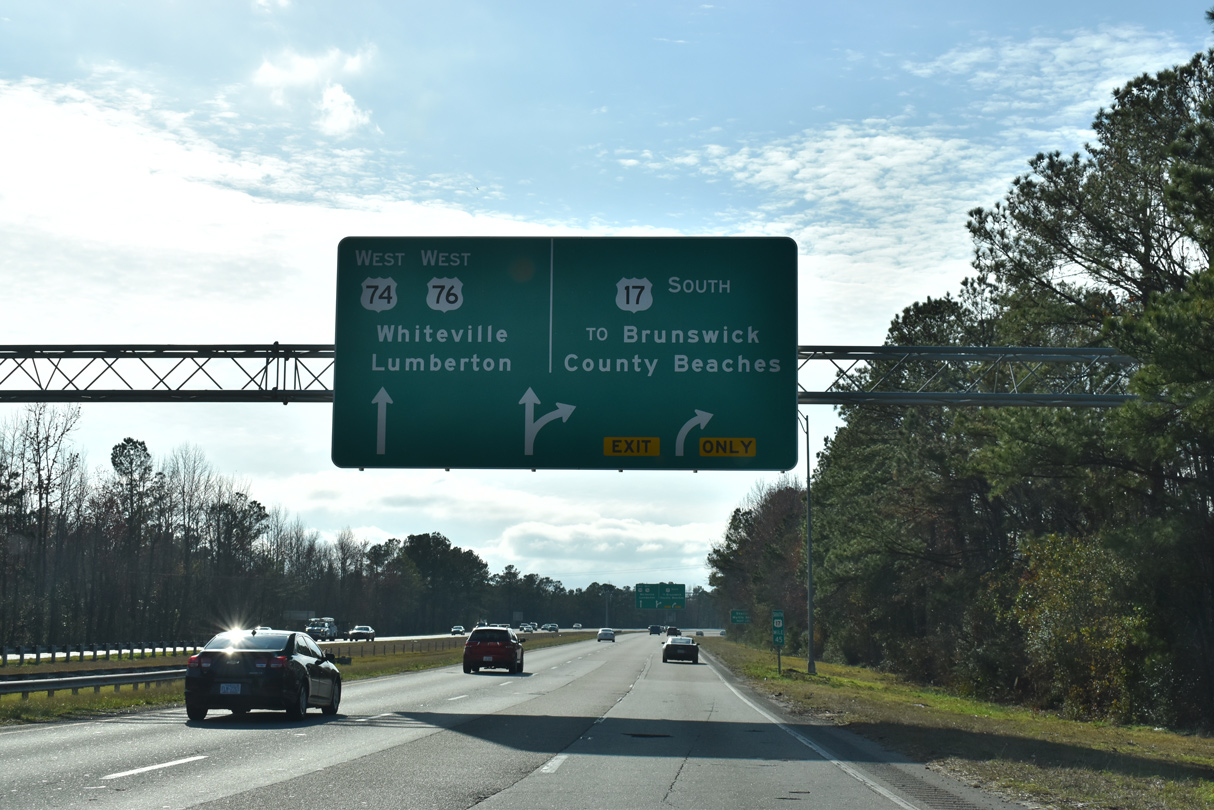
U.S. 74/76 overlap from U.S. 17 to Chadborn. Beyond there, U.S. 76 continues west toward Marion and Florence in South Carolina, while U.S. 74 turns northwest along the I-74 Corridor to Lumberton, Laurinburg and Rockingham.
01/19/19
References:
- NCwaterways.com - Bridge Schedule.
http://www.ncwaterways.com/boating/bridgeschedules.htm
Photo Credits:
- Andy Field: 06/01/05
- Brent Ivy: 01/19/19
Connect with:
Page Updated Monday August 03, 2020.