
U.S. 17 Business North - Wilmington

 North
North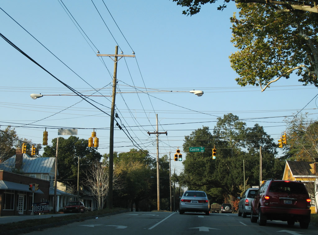
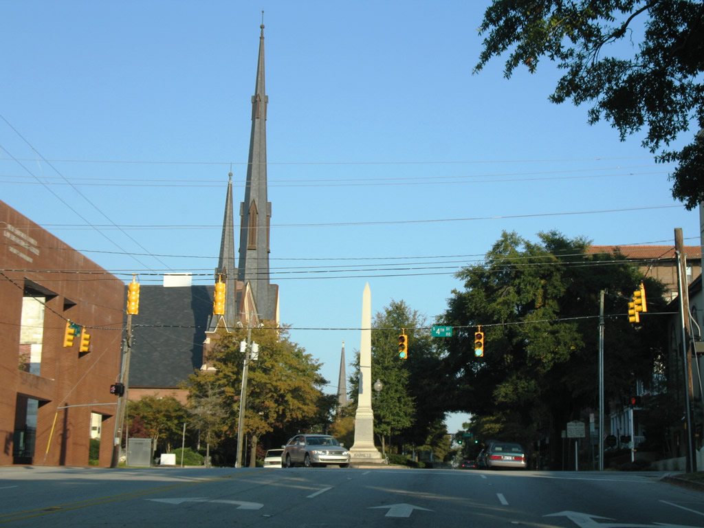
U.S. 17 Business (3rd Street) Northbound at Castle Street. Castle Street leads west to the riverfront and east to Wrightsville Avenue.
11/11/06
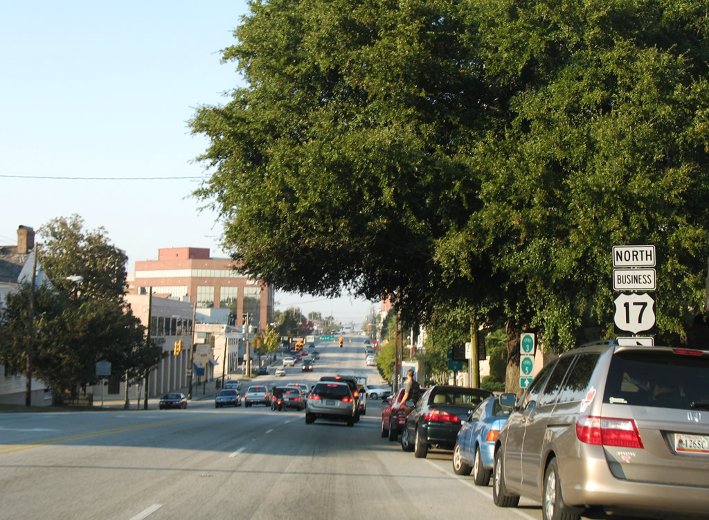
Nine blocks north of U.S. 17/76 (Dawson Street) east, U.S. 17 Business reaches Downtown Wilmington and the turn onto Market Street.
11/11/06
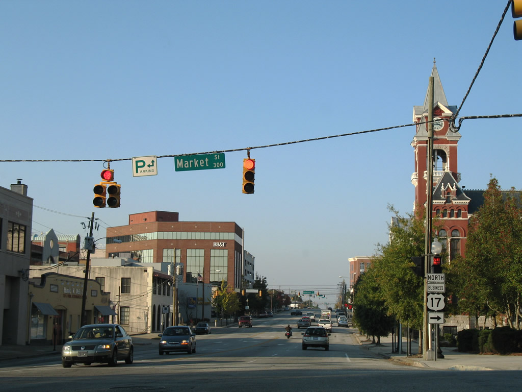
Third Street continues north through Downtown to connect with U.S. 74 (MLK, Jr. Parkway) and the Isabel Holmes Bridge across the NE Cape Fear River.
11/11/06
Confirming marker for U.S. 17 Business north at 3rd and Market Streets.
11/11/06
Market Street east widens to a tree-lined parkway beyond 4th Street.
11/11/06
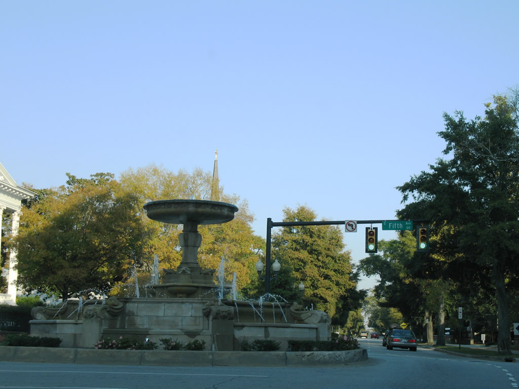
Kenan Plaza fountain lies within the intersection of U.S. 17 Business (Market Street) east at 5th Street. 5th Street comprises of a divided parkway south to U.S. 17/76 and Greenfield Street and north toTaylor Street.
11/11/06
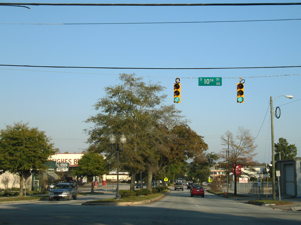
Market Street advances east from Downtown to an industrial area at 10th Street.
11/11/06
The one way couplet of 16th/17th Streets carried U.S. 17 between Market Street and Wooster/Dawson Streets until the 2006 opening of Interstate 140.
11/11/06
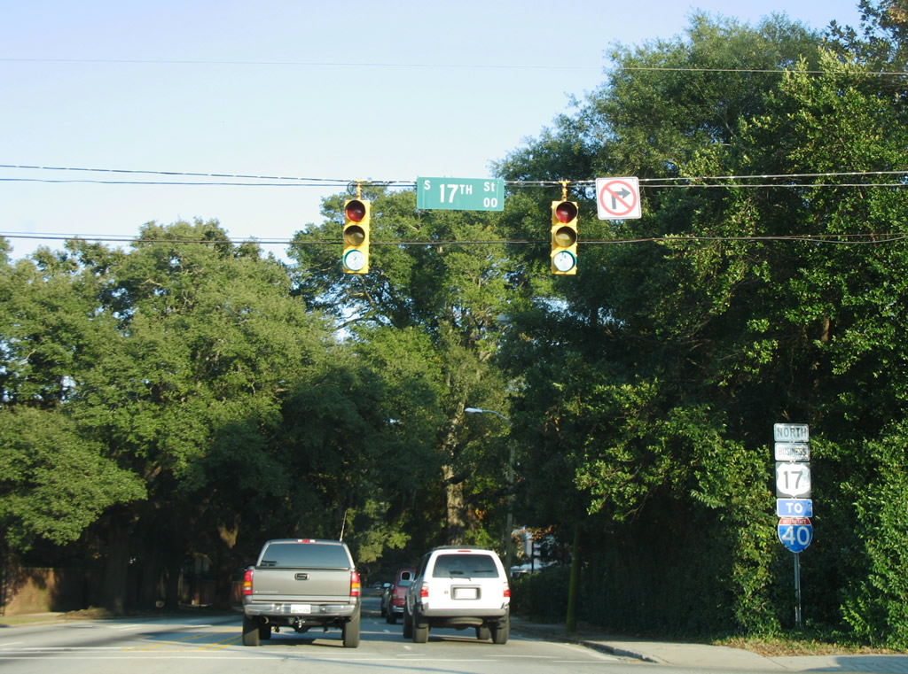
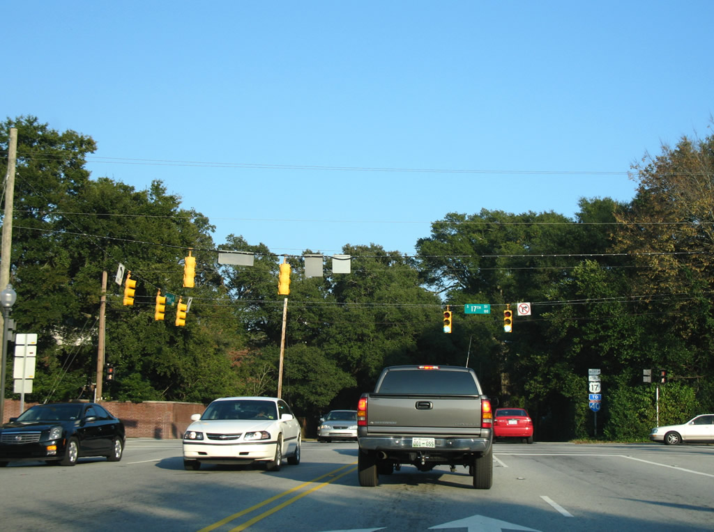
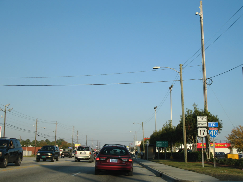
An Interstate 40 trailblazer accompanies this U.S. 17 Business reassurance marker at 17th Street. U.S. 17 Business follows the pre-2006 alignment of U.S. 17 from this point east to Military Cutoff Road.
11/11/06
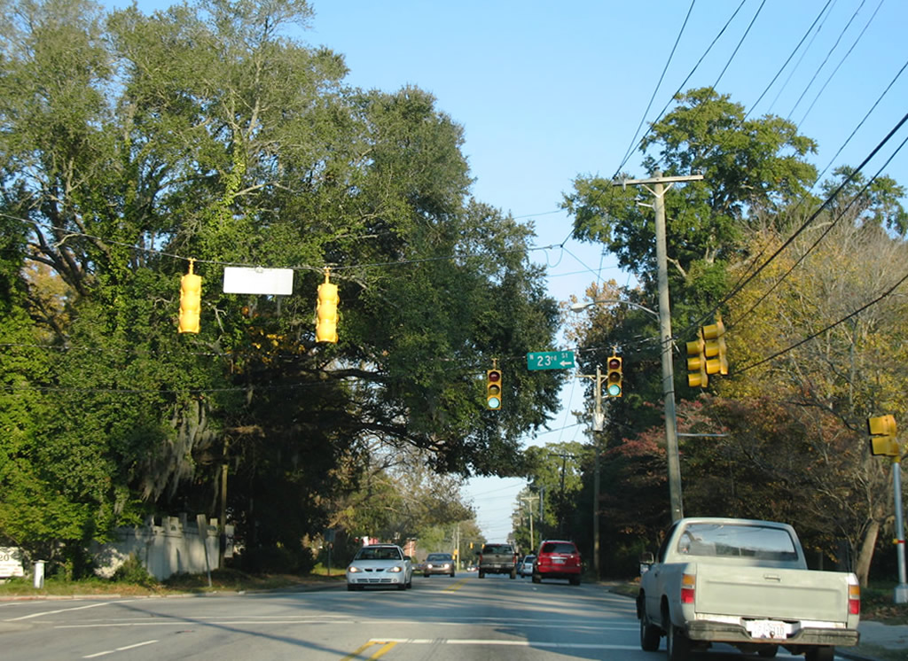
Market Street spans Burnt Mill Creek through Wallace Park ahead of 23rd Street. 23rd Street leads north to U.S. 74 (Martin Luther King, Jr. Parkway) and Wilmington International Airport (ILM).
11/11/06
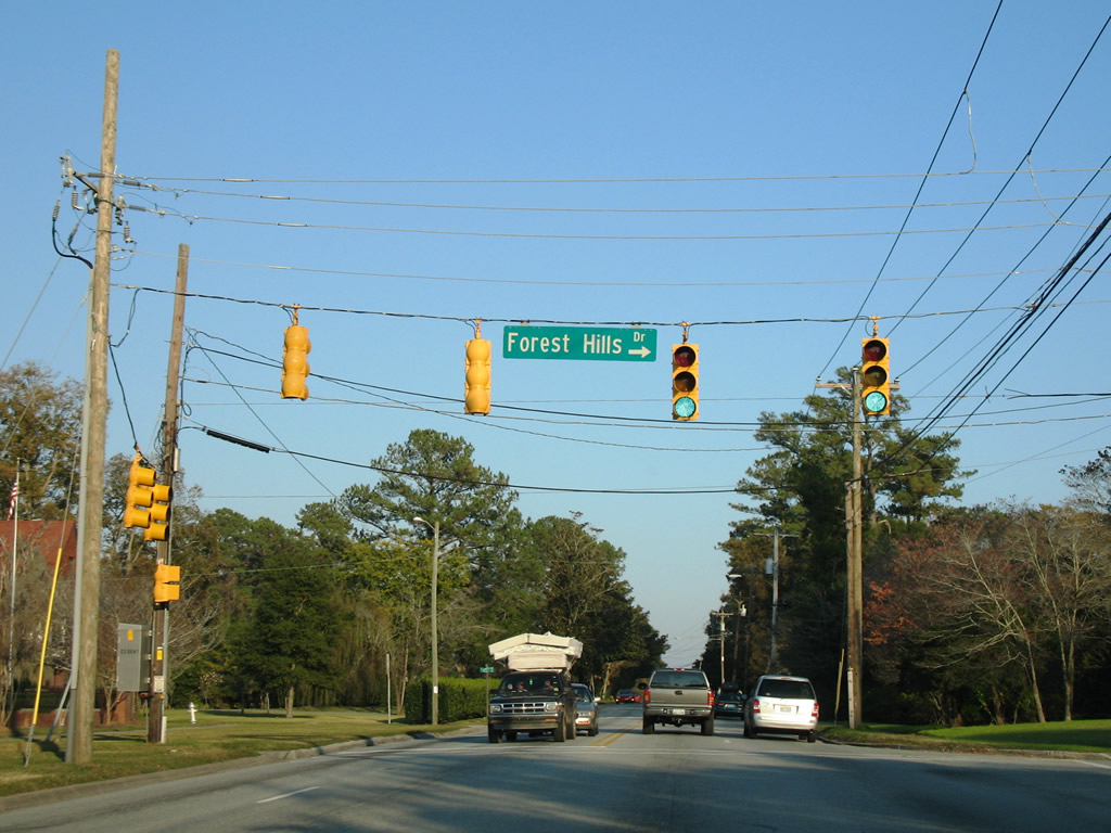
Forest Hills Drive stems south from U.S. 17 Business (Market Street) to Colonial Drive and U.S. 17/76 (Oleander Drive).
11/11/06

Continuing east from 30th Street, Market Street transitions into a commercial arterial to this intersection with Barclay Hills Drive. Barclay Hills Drive spurs north to adjacent Princess Place Drive and a residential area north of there.
11/11/06
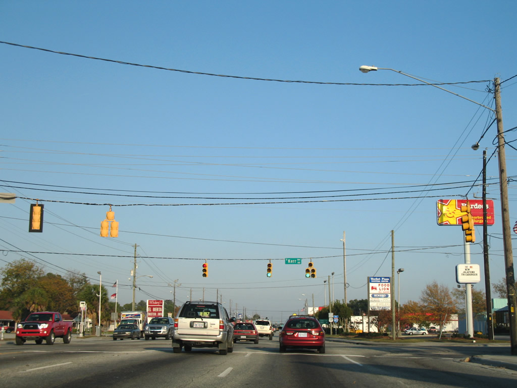
Kerr Avenue provides a secondary route northward from Wrightsville Avenue and U.S. 117 to the Wilmington International Airport (ILM) area and NC 133 (Castle Hayne Road).
11/11/06
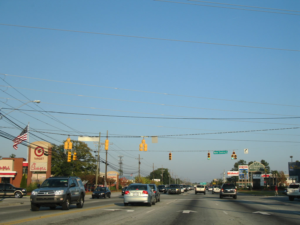
Commercial development lines both sides of U.S. 17 Business east to the exchange with U.S. 117/NC 132 (College Road) south of Interstate 40.
11/11/06
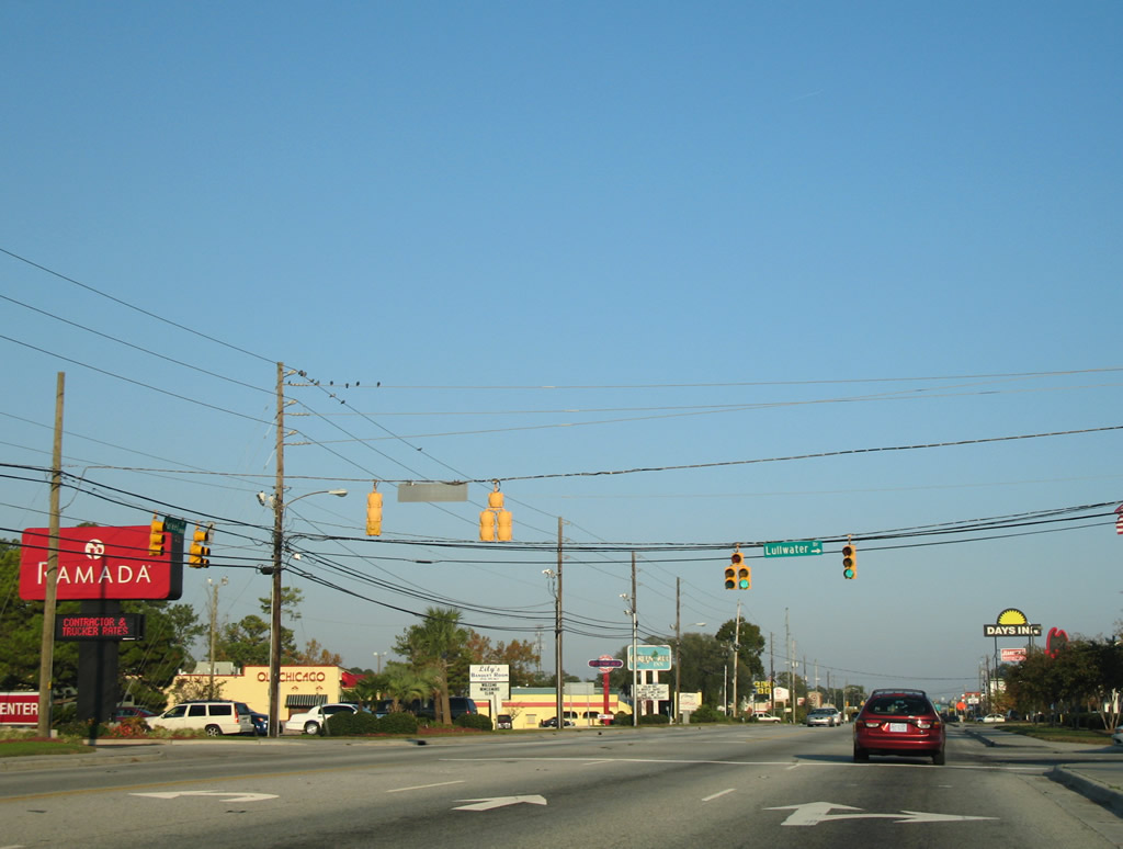
Eastbound Market Street at Lullwater Drive south. Lullwater Drive connects with several apartment communities and single family homes.
11/11/06
New Centre Drive arcs northwest from U.S. 17 Business (Market Street) to Kerr Avenue and southeast to U.S. 117/NC 132 (College Road) amid a bevy of shopping centers.
11/11/06
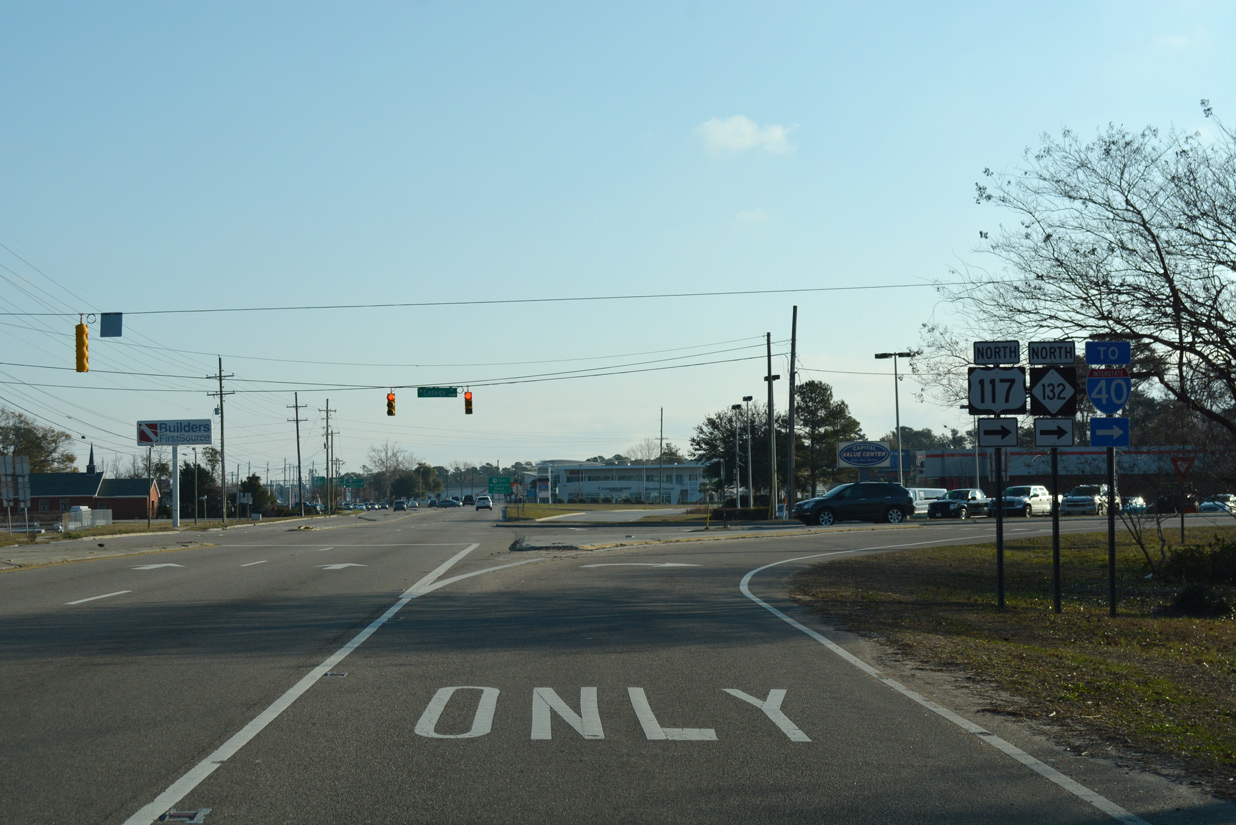
U.S. 117/NC 132 follow College Road north from their merge at Shipyard Boulevard to the beginning of Interstate 40.
11/11/06
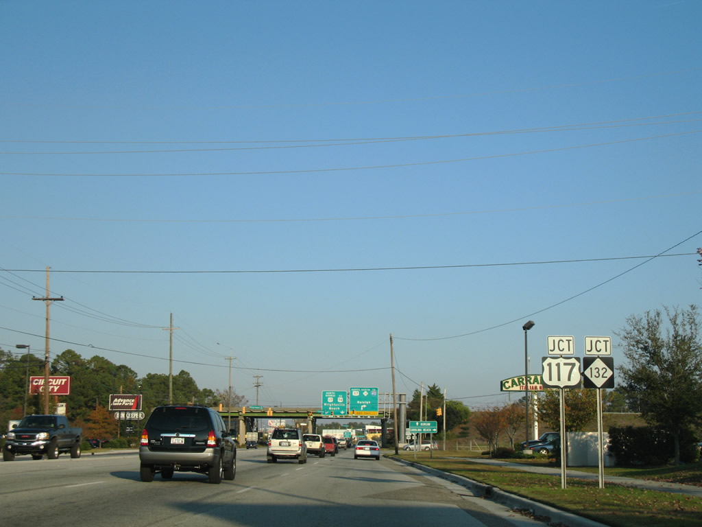
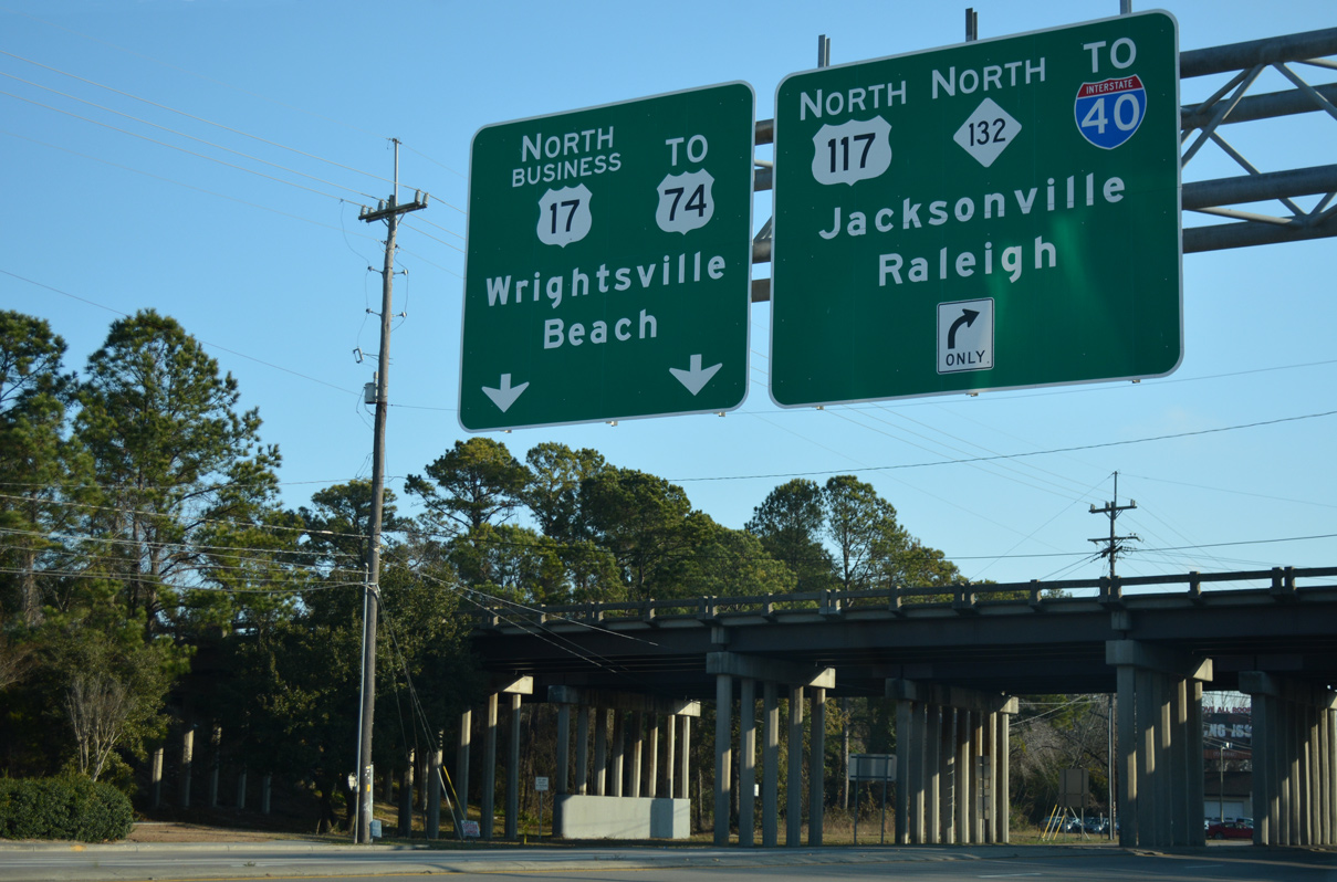
A folded diamond interchange joins U.S. 17 Business (Market Street) with College Drive. Departing here is the southbound ramp to U.S. 117 for the State Port and NC 132 south to U.S. 421 for Carolina Beach.
11/11/06
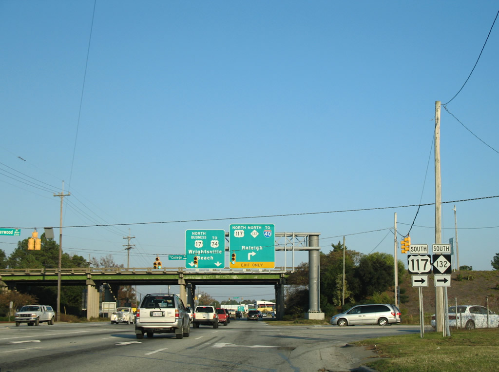
A loop ramp follows for U.S. 117/NC 132 (North College Road) to Interstate 40 west for Raleigh. The overpasses spanning Market Street and the adjacent NCDOT Railroad dates from 1958.
12/31/17
U.S. 117/NC 132 (College Road) parallel Interstate 40 through Murraysville to Castle Hayne.
12/31/17
Photo Credits:
- Alex Nitzman, Justin Cozart: 11/11/06
- Alex Nitzman: 12/31/17
Connect with:
Page Updated Wednesday September 12, 2018.