
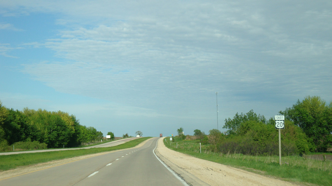
U.S. 20 East - Manchester to Dubuque
 East
East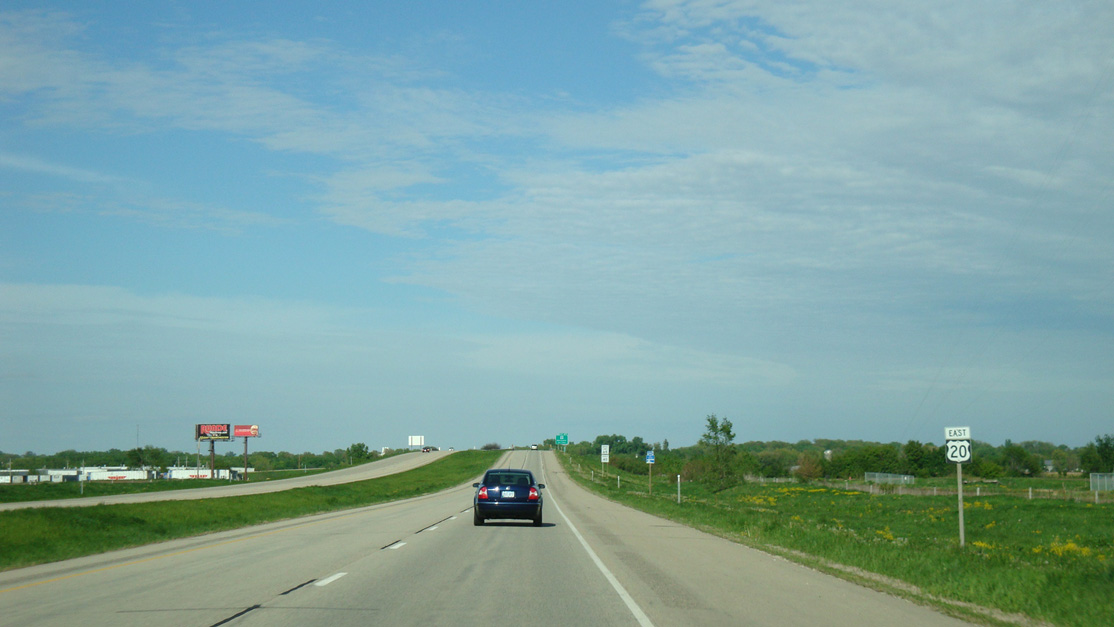
U.S. 20 elevates across a CN Railroad east of the Iowa 13 entrance ramp at Exit 275.
05/23/08
County Road D5X winds southward from U.S. 20 at Bailey Drive in Manchester along Jefferson Road, 240th Street, 210th Avenue and 250th Street east to Delhi.
05/23/08
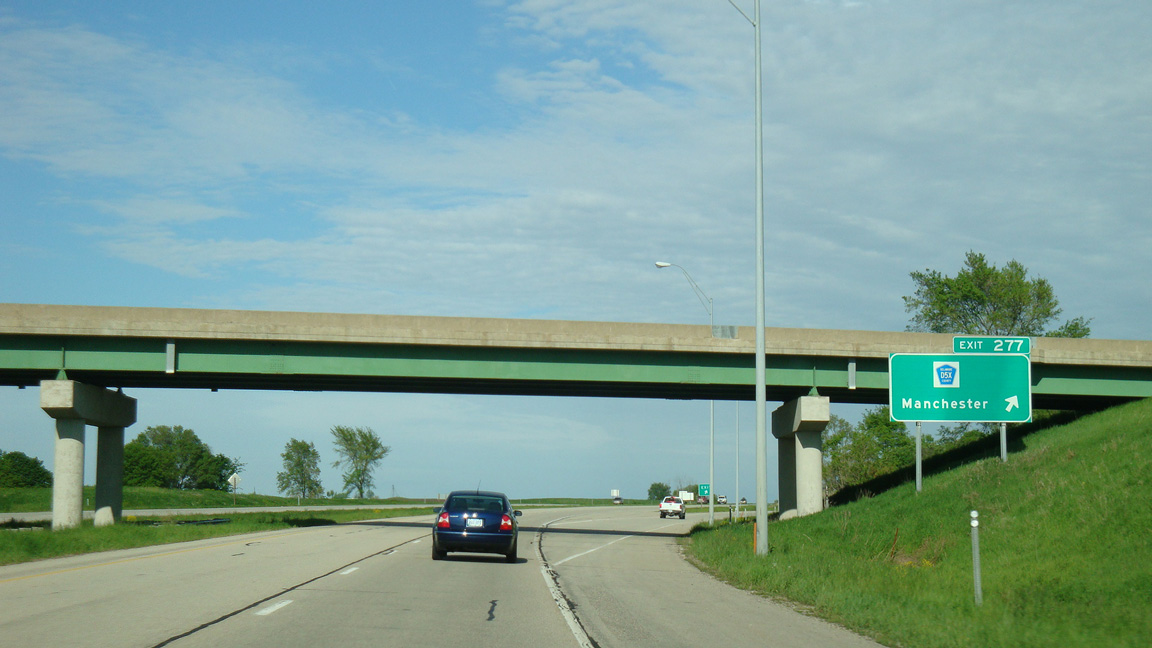
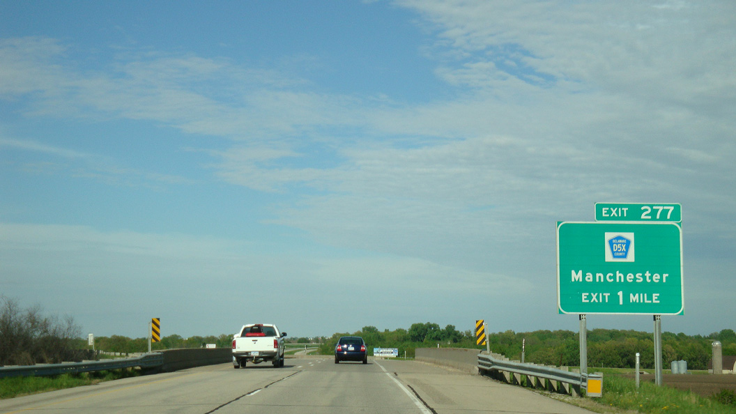
U.S. 20 spans the Maquoketa River ahead of the folded diamond interchange (Exit 277) with CR D5X (Jefferson Road) east and Bailey Drive north into Manchester.
05/23/08
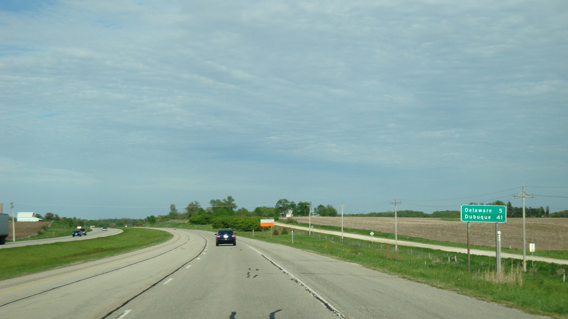
U.S. 20 continues along a freeway five miles east from Manchester to Delaware.
05/23/08
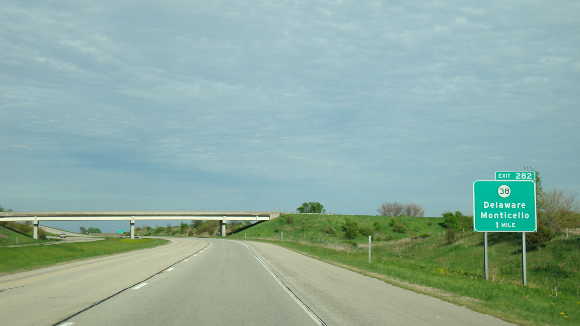
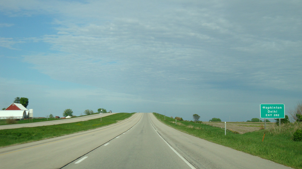
220th Avenue crosses over U.S. 20 one mile west of the parclo interchange (Exit 282) with Iowa 38 at Delaware.
05/23/08
Iowa 38 travels through the small cities of Delhi and Hopkinton on the 21 mile drive south to Monticello.
05/23/08
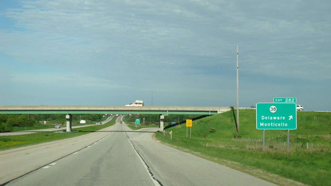
Iowa 38 follows 5th Street north through Delaware. The state highway extends another ten miles to Greeley and Iowa 3 near Edgewood.
05/23/08
Leaving the city of Delaware, U.S. 20 transitions into an at-grade expressway.
05/23/08
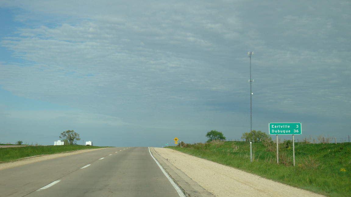
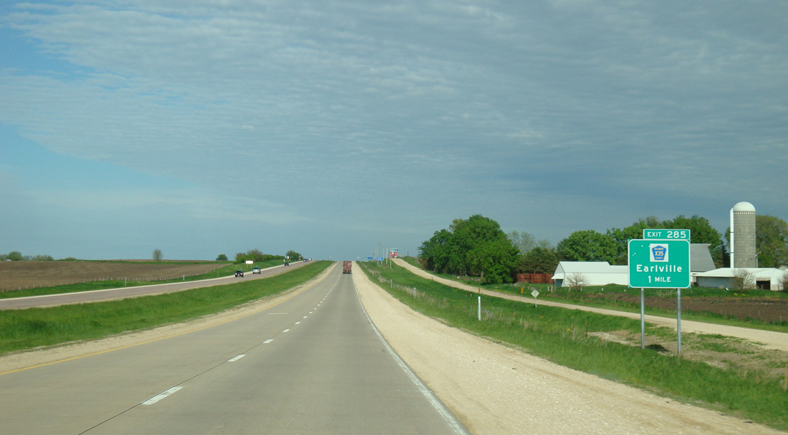
Earlville lies three miles east of U.S. 20 at 245th Avenue. Dubuque follows in another 33 miles.
05/23/08
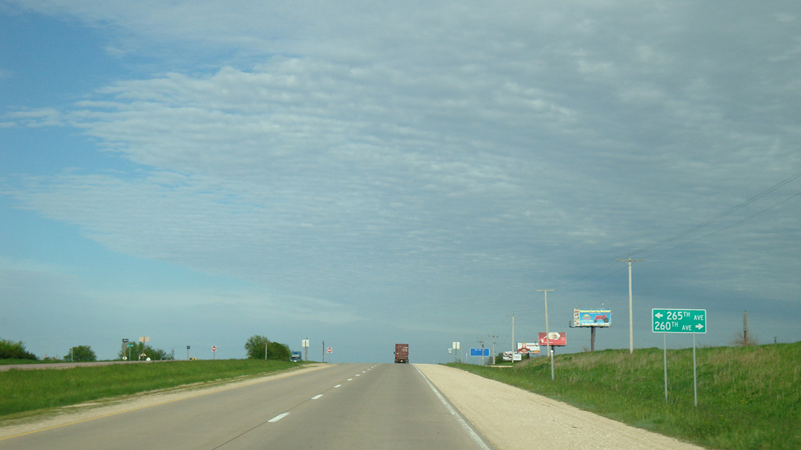
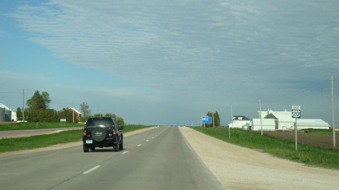
U.S. 20 meets County Road X35 (260th Avenue) south at Exit 285 one mile east of 225th Street.
05/23/08
County Road X35 follows 260th Avenue south from an at-grade intersection with U.S. 20 to Iowa 38 east of Delhi.
05/23/08
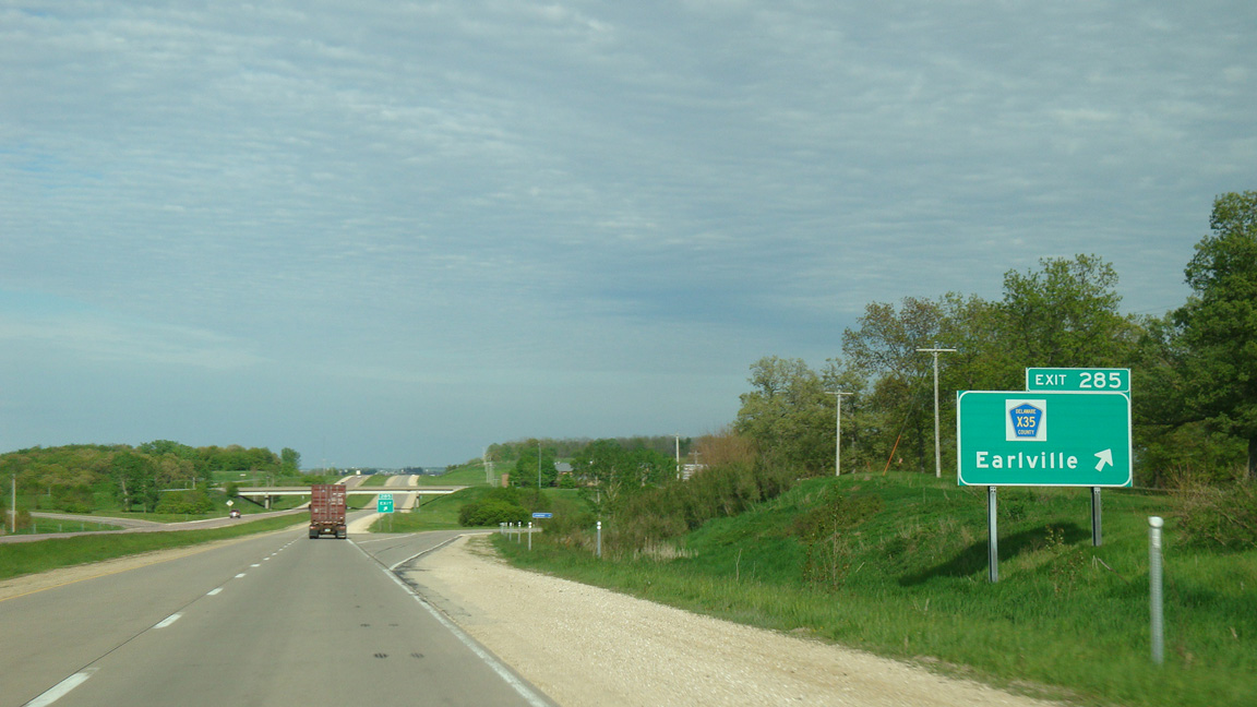
CR X35 shifts east along an implied overlap with U.S. 20 three quarters of a mile to 270th Avenue north to the city of Earlville.
05/23/08
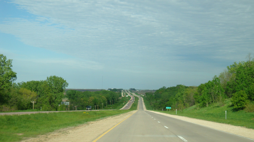
U.S. 20 lowers 100 feet in elevation from the exchange at Exit 285 to Plum Creek. Dyersville lies nine miles ahead.
05/23/08

285th Avenue links U.S. 20 with the frontage road system along 218th and 221st Streets in North Fork township.
05/23/08
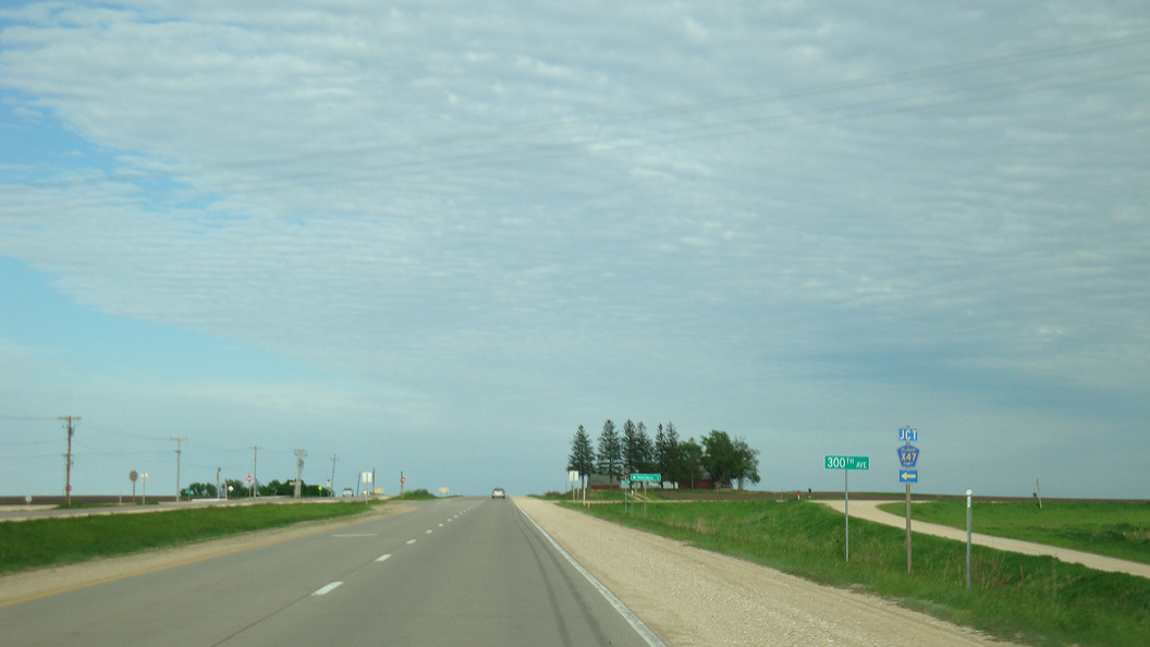
The northern branch of CR X47 follows 300th Avenue to Petersburg and Iowa 3 outside Colesburg.
05/23/08
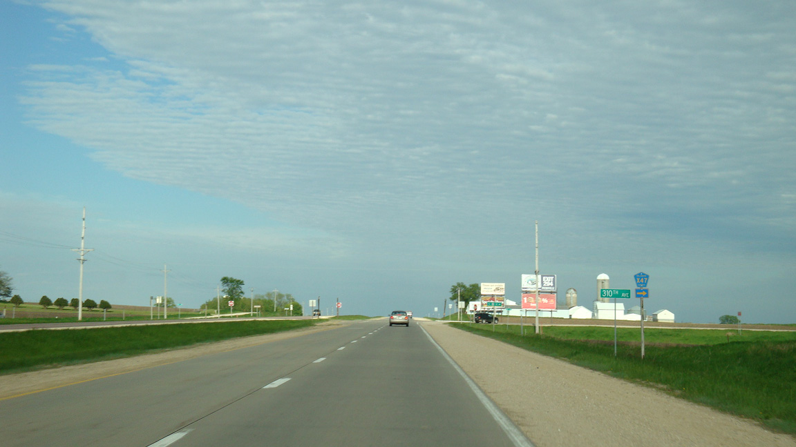
CR X47 along 310th Avenue provides a cut off from Dyersville to Iowa 38 near Sand Springs, 9.7 miles to the south.
05/23/08
A diamond interchange (Exit 292) was constructed on U.S. 20 with a realignment of CR X49 along 330th and 332nd Avenues in 2016.
05/23/08
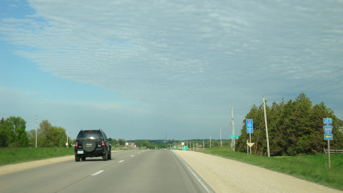
CR X49 (332nd Avenue) runs along the west side of Dyersville north from U.S. 20.
05/23/08
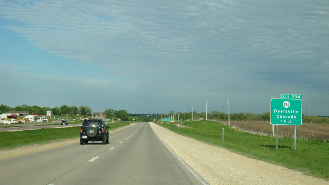
Shifting southward across the North Fork of the Maquoketa River, U.S. 20 advances one mile to a parclo A2 interchange (Exit 294) with Iowa 136 (9th Street SE).
05/23/08
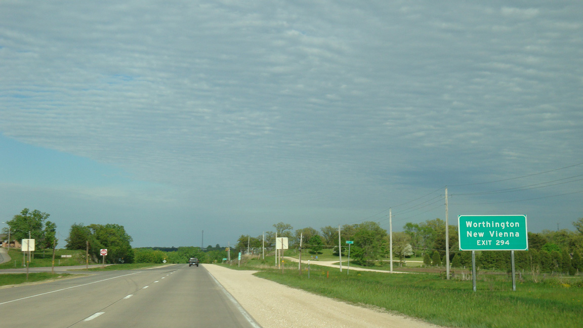
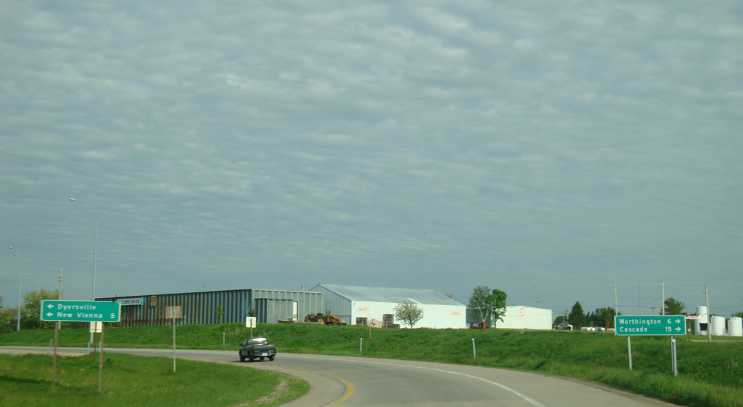
Iowa 136 connects the city of Dyersville with Worthington five miles to the south and New Vienna four miles to the north.
05/23/08
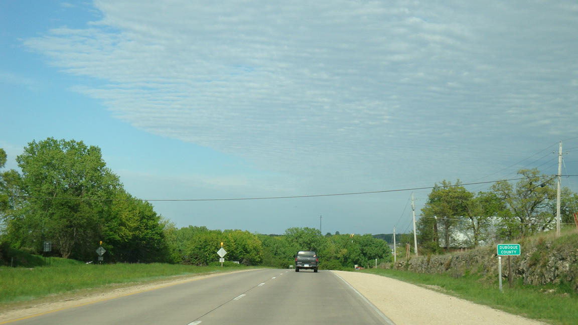
Dyersville stretches across both Delaware and Dubuque Counties along U.S. 20.
05/23/08
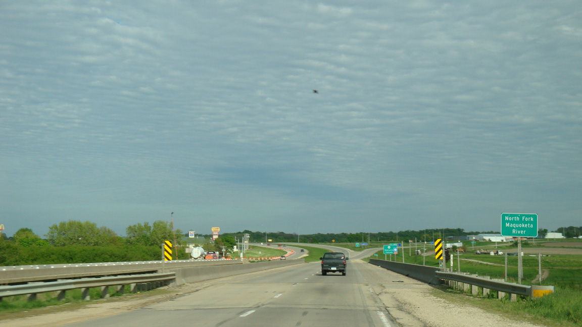
The bridges taking U.S. 20 across the North Fork of the Maquoketa River date from 1986 eastbound and 1958 westbound.
05/23/08
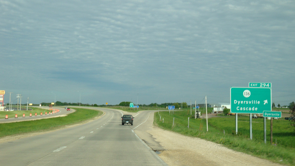
U.S. 20 reenters the Dyersville city limits at the departure of Exit 294 to Iowa 136 (9th Street SE). Iowa 136 forms an L-shaped route north to U.S. 52 and Iowa 3 at Luxemburg, south to Oxford Junction and east to Clinton and Illinois 136 to Fulton.
05/23/08
Traveling 98 miles overall, MSR 136 runs 15 miles southeast to U.S. 151 at Cascade.
05/23/08
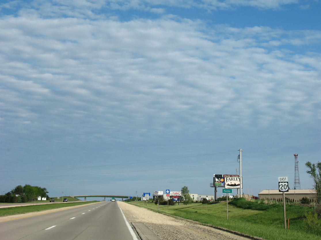
U.S. 20 wraps around the south side of Farley along a short section of freeway.
05/23/08
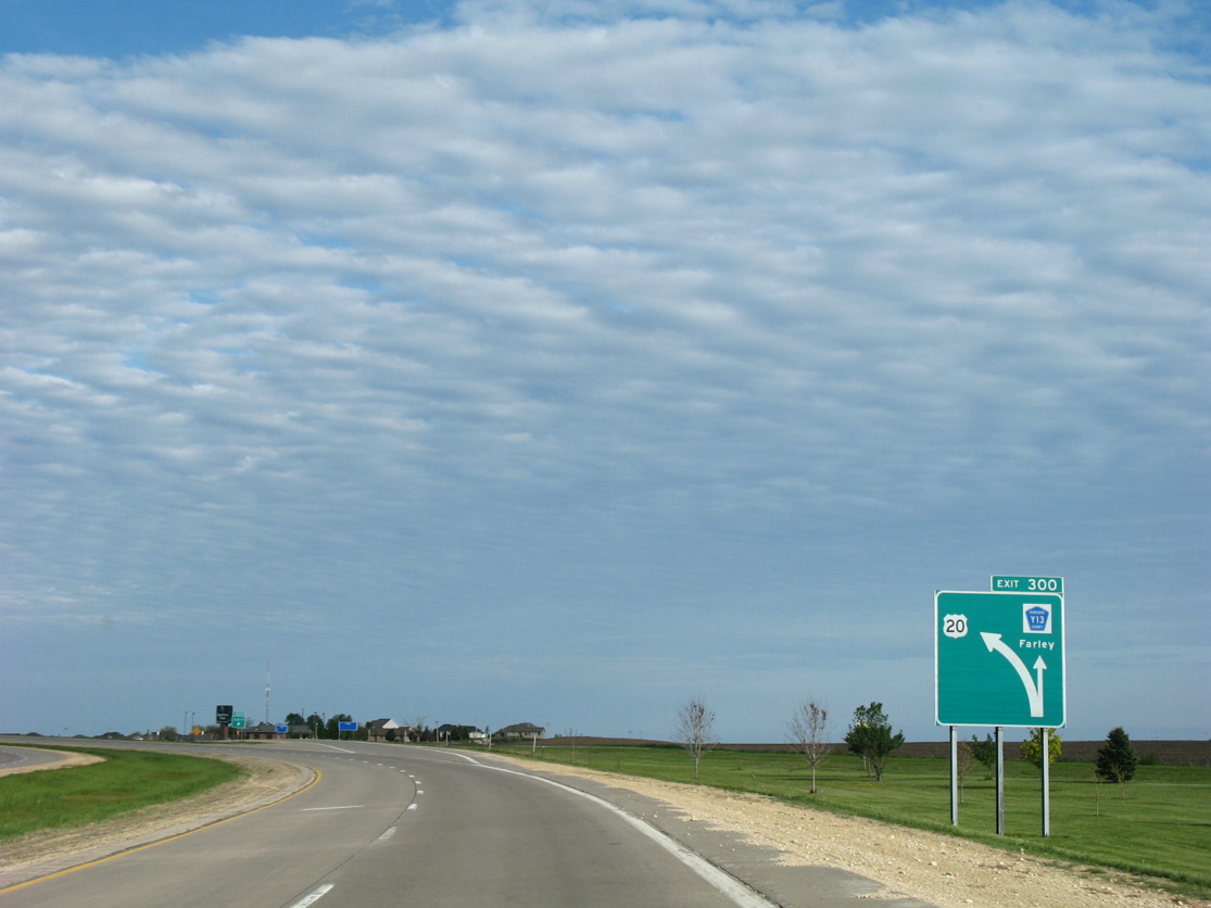
Curving southeast below the Farley Road (CR Y13) overpass, U.S. 20 enters the diamond interchange (Exit 300) with 1st Street SW in Farley.
05/23/08
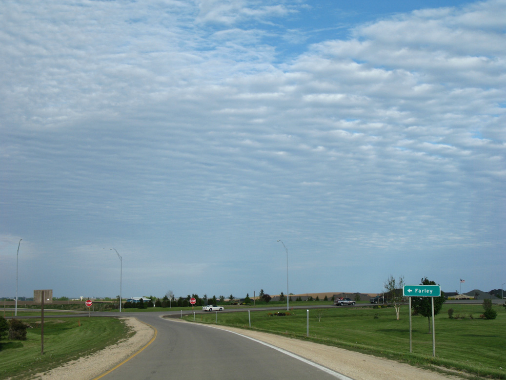
1st Street heads north into the Farley business district from U.S. 20. Pleasant Grove Road extends southward into agricultural areas of Taylor township.
05/23/08
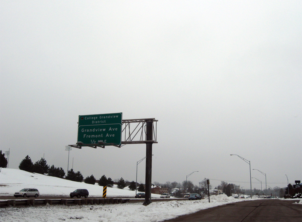
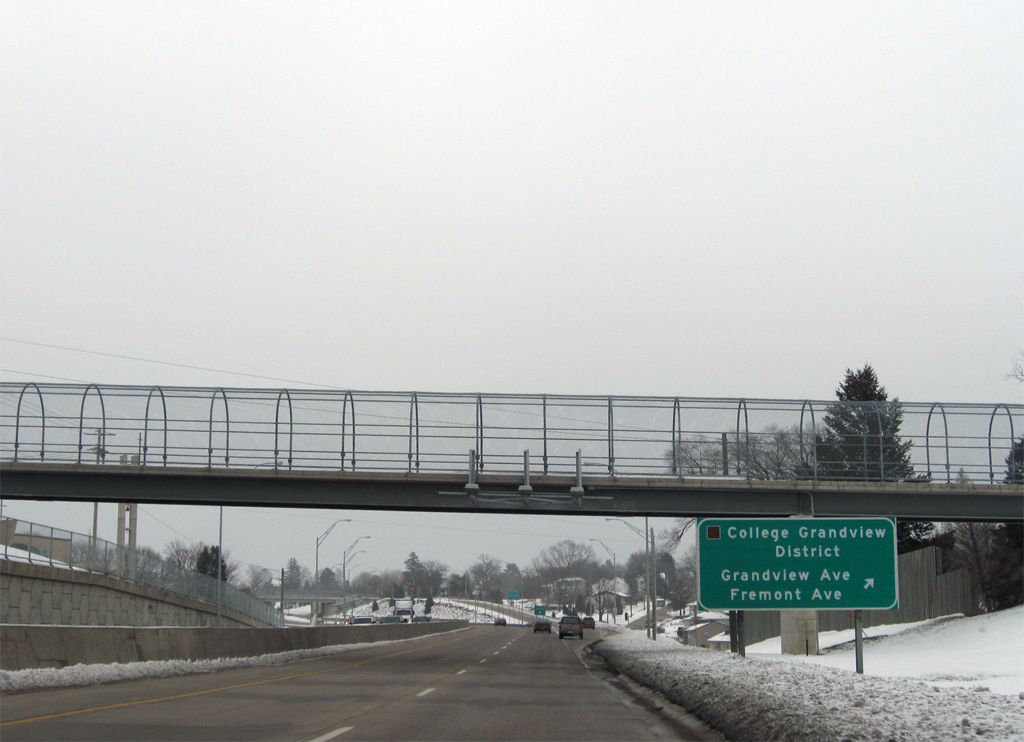
U.S. 20 (Dodge Street) approaches the split diamond interchange with Fremont and Grandview Avenues by a shopping center and Devon Drive near the College Grandview District of Dubuque.
12/21/09

The freeway portion of U.S. 20 begins east of the intersection with Cherokee Drive. A barrier median prevents left turns from Cherokee Drive north and to St. Joseph north from U.S. 20 east.
12/21/09
Fremont Avenue heads south from Lombard Street and U.S. 20 to residential areas adjacent to the Middle Fork of Catfish Creek. Grandview Avenue follows on a north-south trajectory from Clarke University and Finley Hospital to the U.S. 52-61-151 freeway and the Southside District.
12/21/09
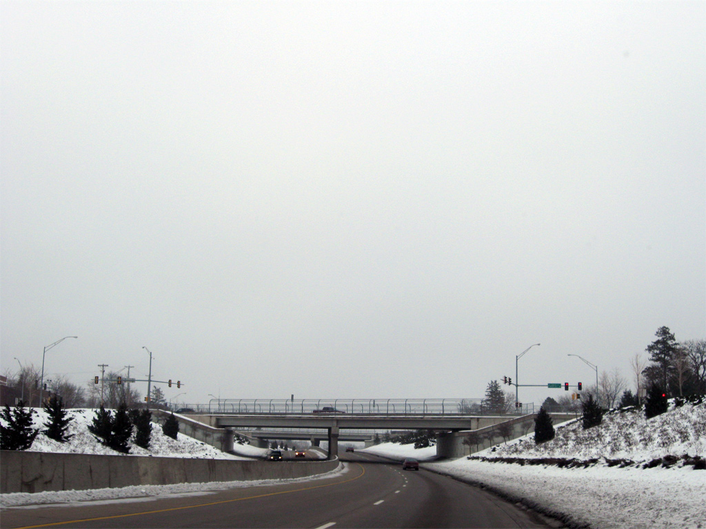
U.S. 20 drops below grade to pass under both Fremont and Grandview Avenues. Next is the parclo B2 interchange with Bryant Street south and Hill Street north.
12/21/09
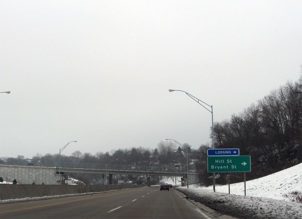
Bryant Street branches northward from Grandview Avenue to become Hill Street north of U.S. 20. Hill Street continues from Mercy Hospital to University Avenue and 9th Street to downtown.
12/21/09
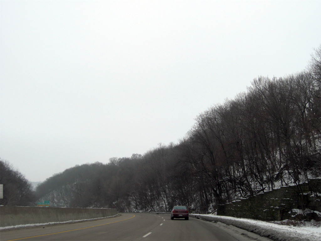
U.S. 20 (Dodge Street) drops quickly from the Bryant Street on-ramp to the Mississippi River.
12/21/09
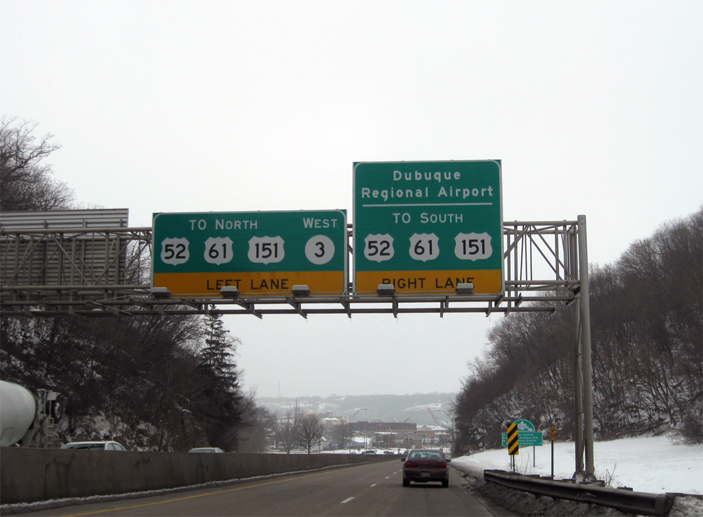
U.S. 20 intersects Locust Street (unsigned Iowa 946) at the base of the hill. Iowa 946 connects Dodge Street with U.S. 52-61-151, which travel along the east side of downtown without direct access to U.S. 20.
12/21/09
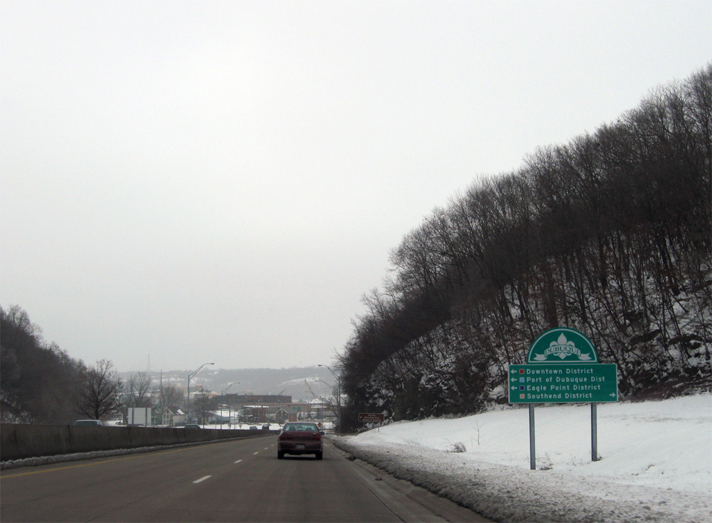
Wayfinding signs such as this are found throughout Dubuque directing motorists to the various districts of the city. Locust Street leads north directly into Downtown, meeting 3rd Street west from the Port of Dubuque. The Eagle Point District is reached via the U.S. 61/151 freeway north to Kerper Boulevard.
12/21/09
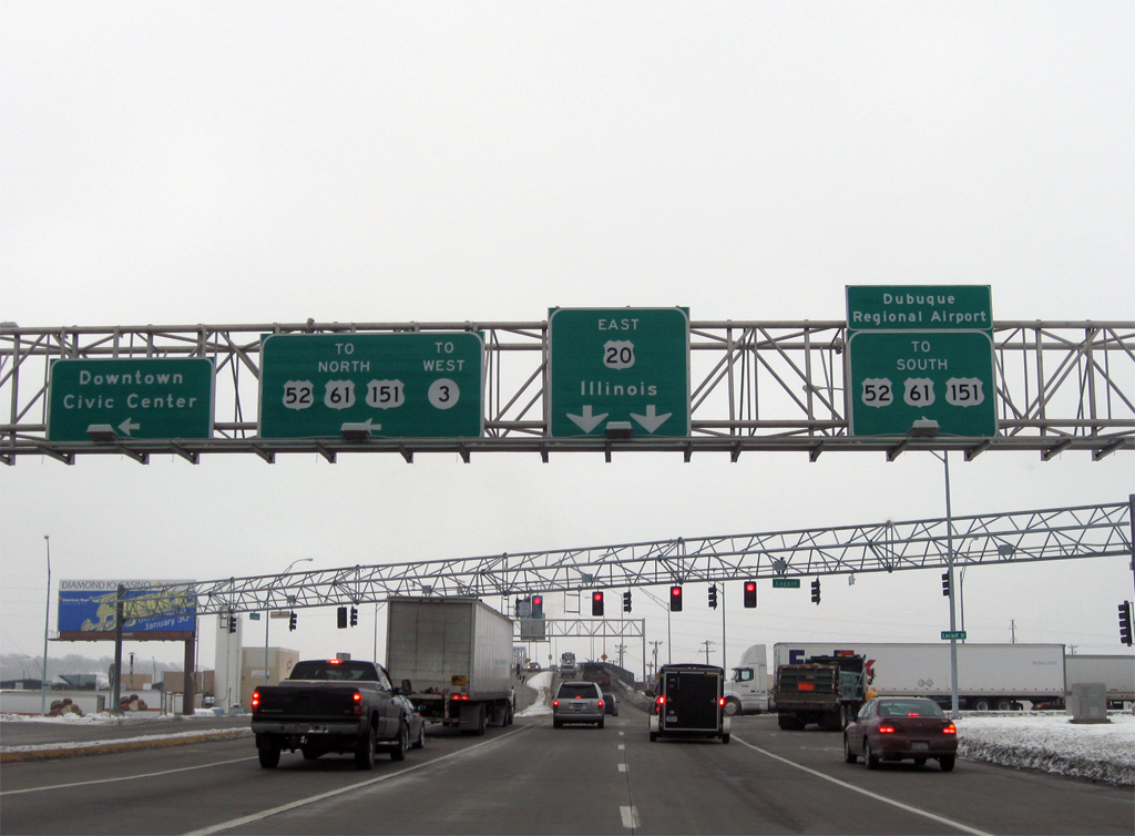
Entering the expansive intersection with Iowa 946 (Locust Street) on U.S. 20 (Dodge Street) east. U.S. 52-61-151 split just north of here, with U.S. 52 combining with Iowa 3 through northern reaches of Downtown. U.S. 61/151 head north across the Dubuque-Wisconsin Bridge to Dickeyville and south to a split near Key West and Dubuque Regional Airport (DBQ).
12/21/09
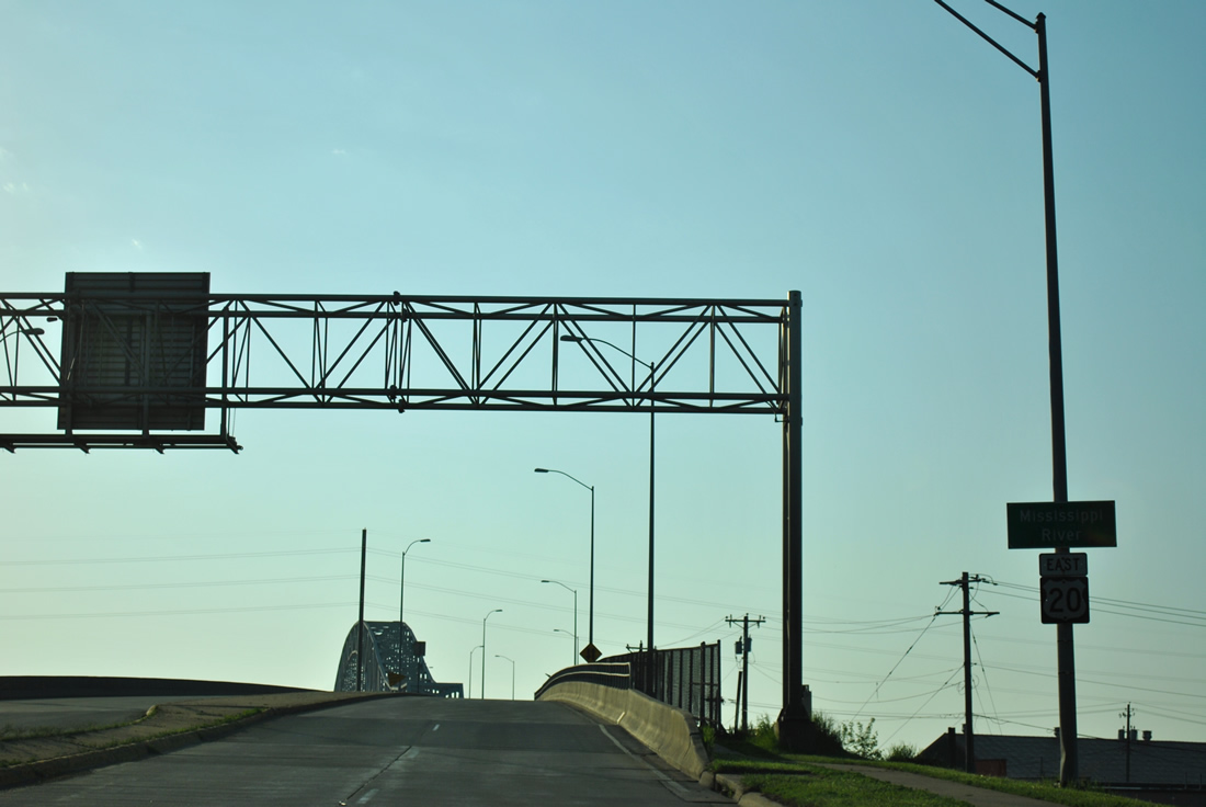
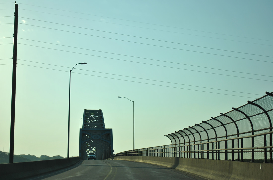
U.S. 20 quickly reduces to two lanes on a 28 feet deck as the route rises onto the Julien Dubuque Bridge over the Mississippi River.
05/30/11
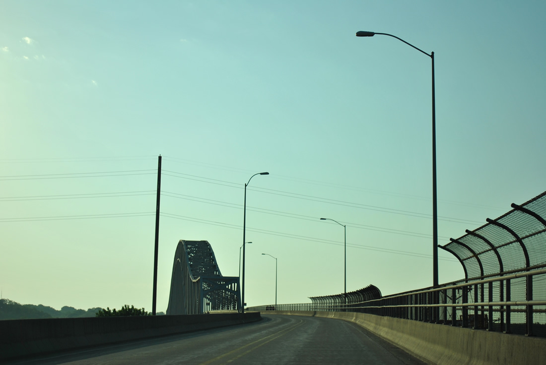
U.S. 20 exits Iowa above an industrial area of Dubuque bisected by the U.S. 52-61-151 freeway and a Canadian National Railroad yard. The Julian Dubuque Bridge is a continuous steel arch truss bridge that opened to traffic in 1943.1
05/30/11
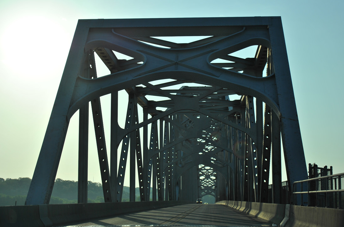
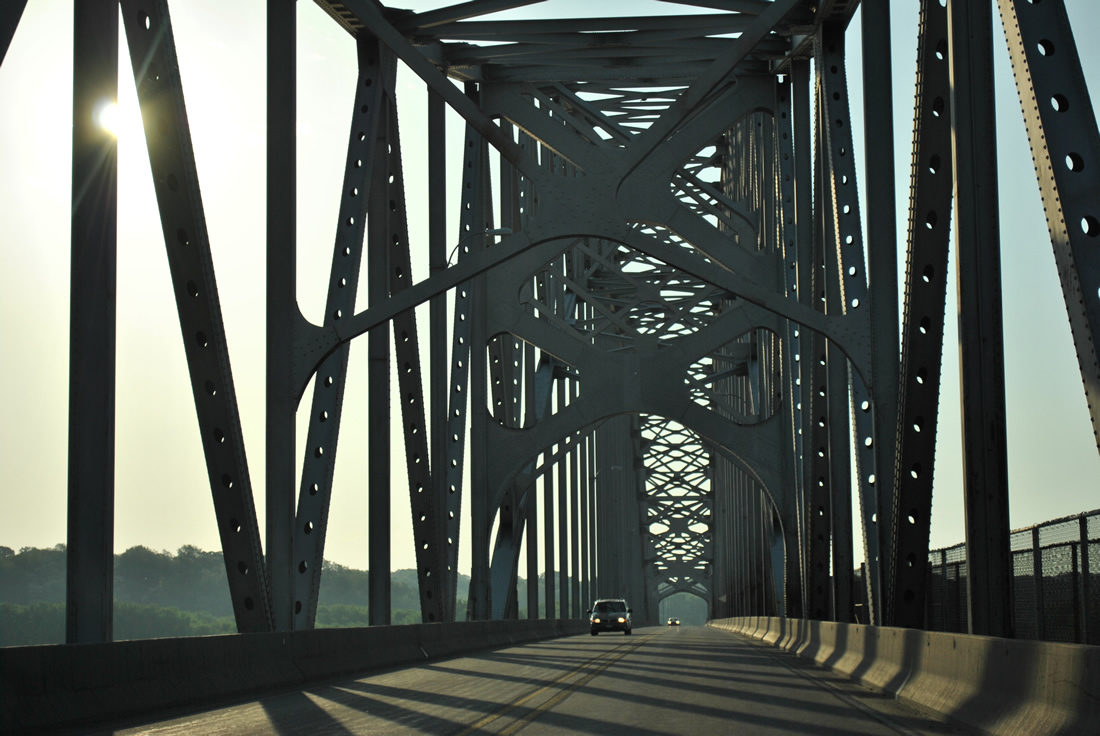
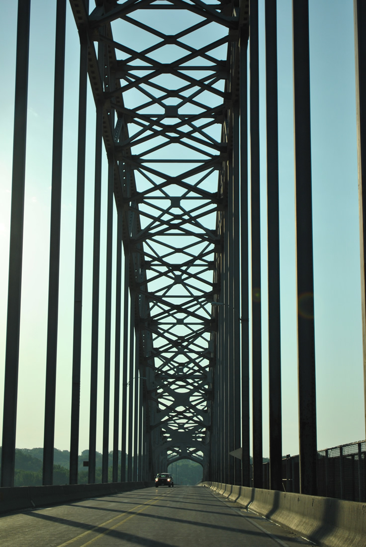
Passing through the superstructure of the Julian Dubuque Bridge, drivers on U.S. 20 enter the state of Illinois. The bridge was named after Julien Dubuque, a French Canadian settler who befriended area natives and established the community that would later honor his name. The span travels 5,760 feet in length to a height of 64 feet. It was painted gray in the early 1990s, which was its original color. During that time a pedestrian walkway was added on the eastbound side.1
05/30/11
References:
Photo Credits:
- Alex Nitzman: 05/23/08, 12/21/09, 05/30/11
Connect with:
Page Updated Thursday December 19, 2019.