
U.S. 29 South - Culpeper to Amherst

 South
South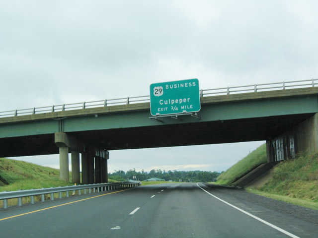
Now separated from U.S. 15, the final exit of the U.S. 29/Culpeper Bypass is the interchange with Business U.S. 29 north and SR 299/Friendship Way.
06/05/04
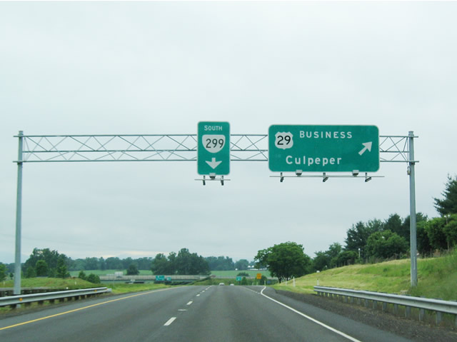
SR 299 is a very short route that connects the southern end of the Culpeper business loop with U.S. 15 southbound.
06/05/04
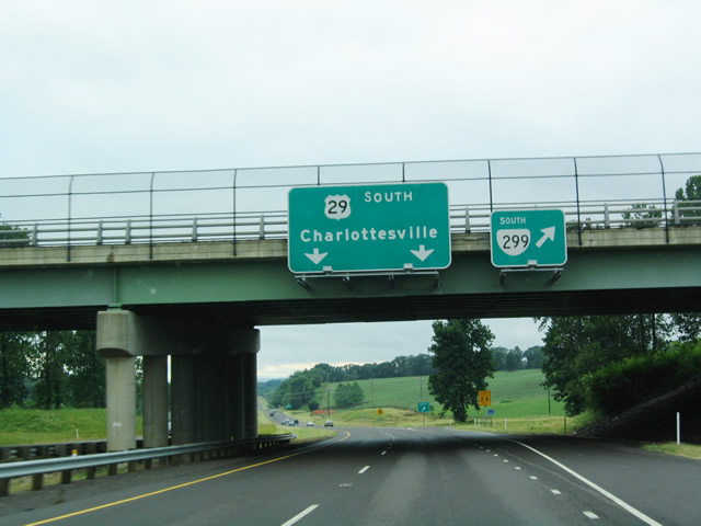
Southbound U.S. 29 reaches the exit for Business U.S. 29 back to Culpeper and SR 299 south to U.S. 15.
06/05/04
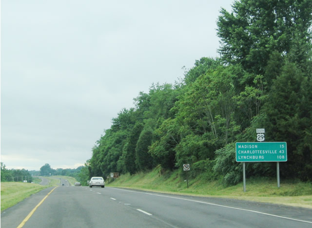
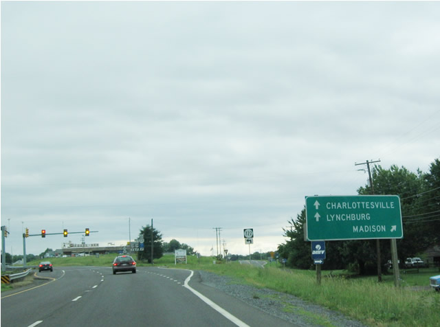
After the SR 299 interchange, U.S. 29 again assumes a four lane divided highway configuration with some access control. The highway will occasionally assume a freeway configuration in order to bypass some towns, such as Madison and downtown Charlottesville.
06/05/04
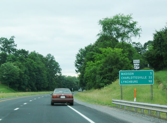
Madison is the next town visited by southbound U.S. 29 after Culpeper and Brightwood.
06/05/04
The primary route into Madison is Business U.S. 29, which heads southwest into Madison, with a connection to scenic SR 231/Blue Ridge Turnpike.
06/05/04
U.S. 29 bypasses the town to the east, as it continues south toward Charlottesville, Lynchburg, and Danville. A left turn takes travelers onto SR 722 south to SR 634..
06/05/04
A short ramp provides direct access from southbound U.S. 29 onto Business U.S. 29.
06/05/04
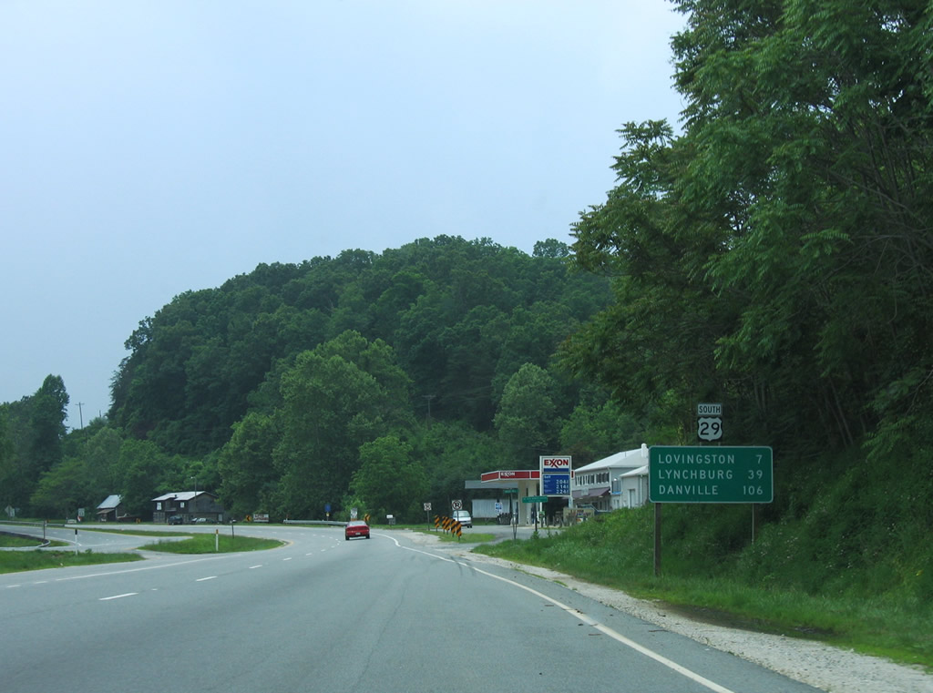
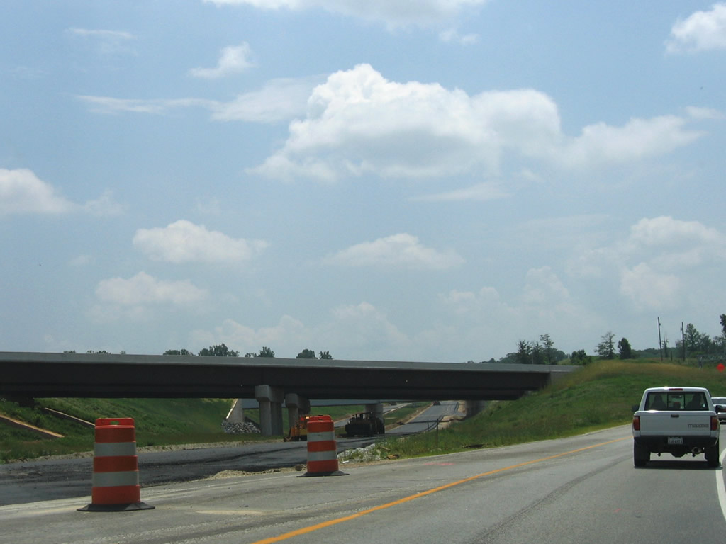
Heading south from the split with SR 6 (Pike Road) on U.S. 29 (Thomas Nelson Highway) toward the Nelson County seat of Lovingston. The four lane divided highway parallels Muddy Creek between Roberts and Woods Mountains to the west and Simpson and Sugarloaf Mountains to the east.
06/05/04
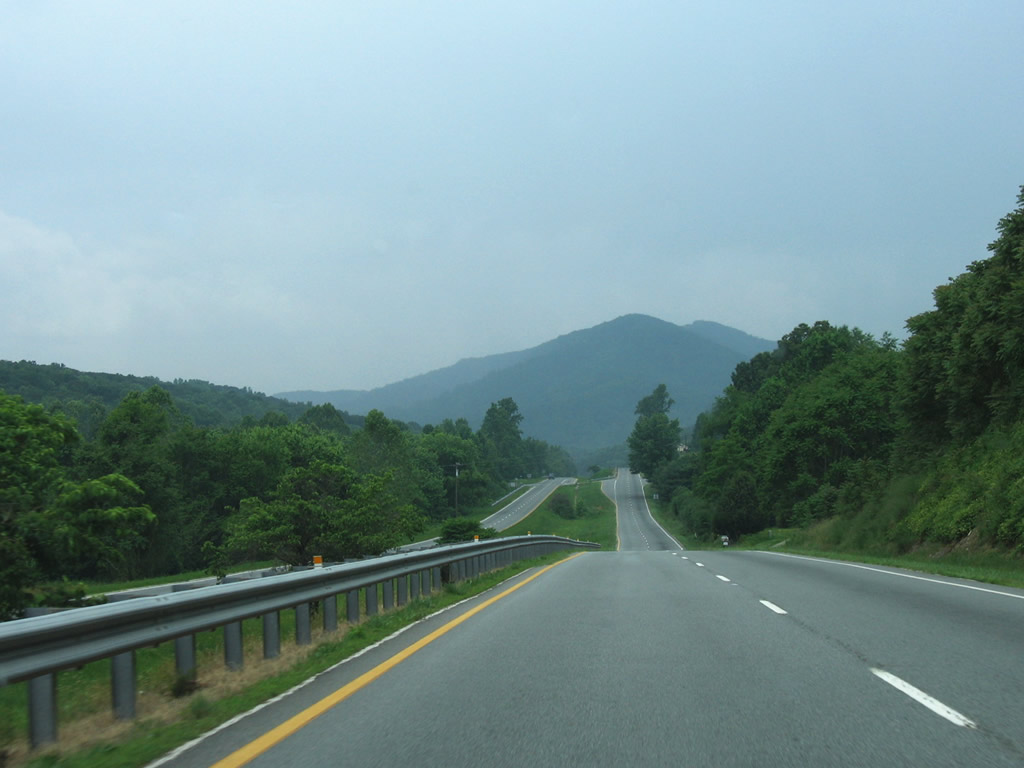
U.S. 29 southbound near Polly Wright Cove. Woods Mountain rises to the south.
06/05/04
South  West
West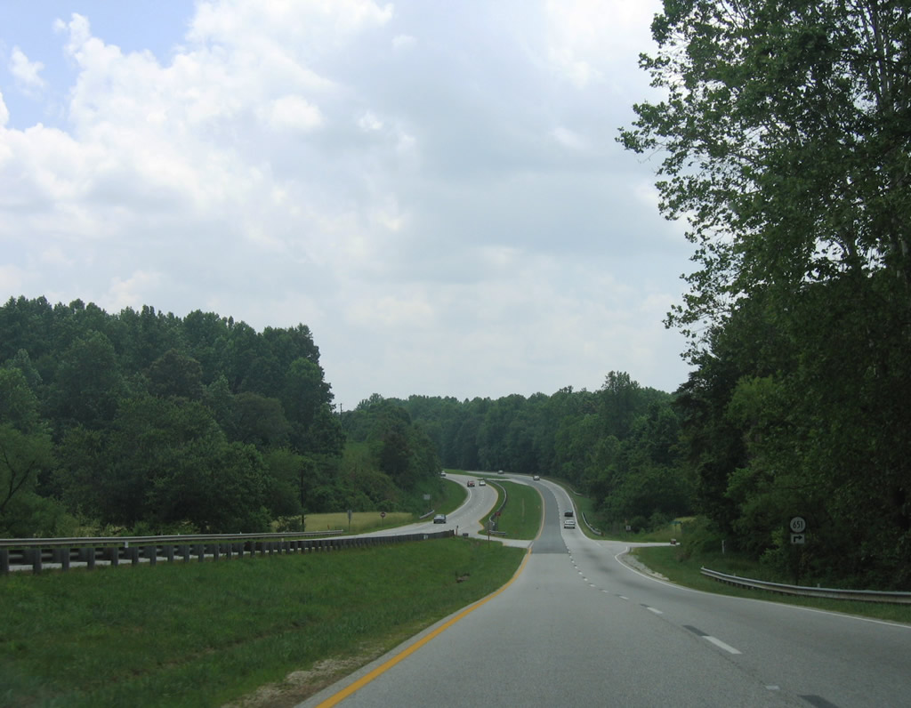
South of Lovingston and U.S. 29 Business (Front Street), U.S. 29/SR 56 (Thomas Nelson Highway) meet SR 651 (Stevens Cove Road) north. SR 651 spurs to Fortunes Cove near Mills and Woods Mountains.
06/05/05
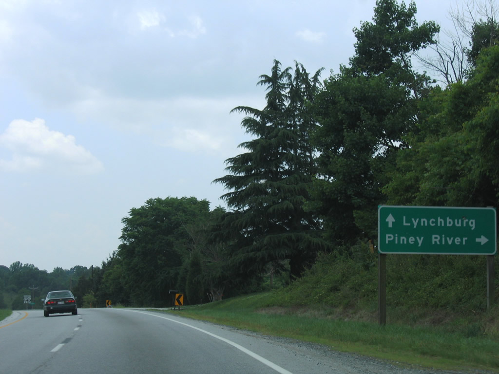
SR 56 (Tye Brook Highway) branches westward from U.S. 29 (Thomas Nelson Highway) at Colleen five miles west to SR 161 north at Piney River. SR 56 concludes at U.S. 11 and Steeles Tavern.
06/05/05
South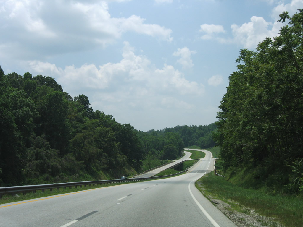
Nearing the Tye River crossing of U.S. 29 (Thomas Nelson Highway) south. The waterway separates Nelson and Amherst Highway at the bridge.
06/05/04
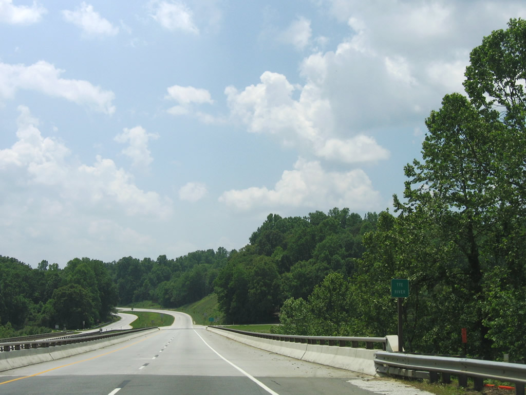
SR 662 (Geddes Mountain Road) stems west from U.S. 29 (Amherst Highway) from across the Tye River onto Geddes Mountain.
06/05/04

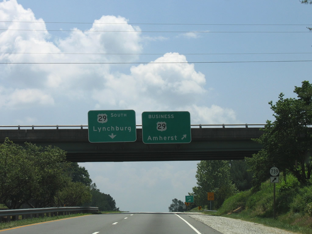
Two miles south of SR 151 (Patrick Henry Highway), U.S. 29 splits with U.S. 29 Business (Main Street) into Amherst. SR 608 (Campbells Mill Road) spurs northward along the Buffalo River to SR 736 in this scene.
06/05/04
The folded diamond interchange with N Main Street and SR 739 (Boxwood Farm Road) east is the first of three exits to serve the Amherst County seat. U.S. 29 Business stays west of the freeway bypass, ultimately connecting to the Madison Heights and Monroe Business loop to the south.
06/05/04
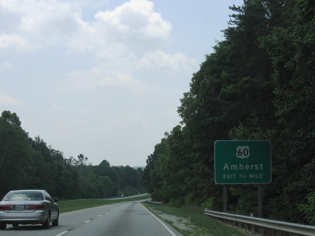
U.S. 60 (Lexington Avenue west / Richmond Highway) east meets U.S. 29 (Amherst Highway) at a parclo interchange on the outskirts of Amherst. U.S. 60 joins Buena Vista with Buckingham.
06/05/04
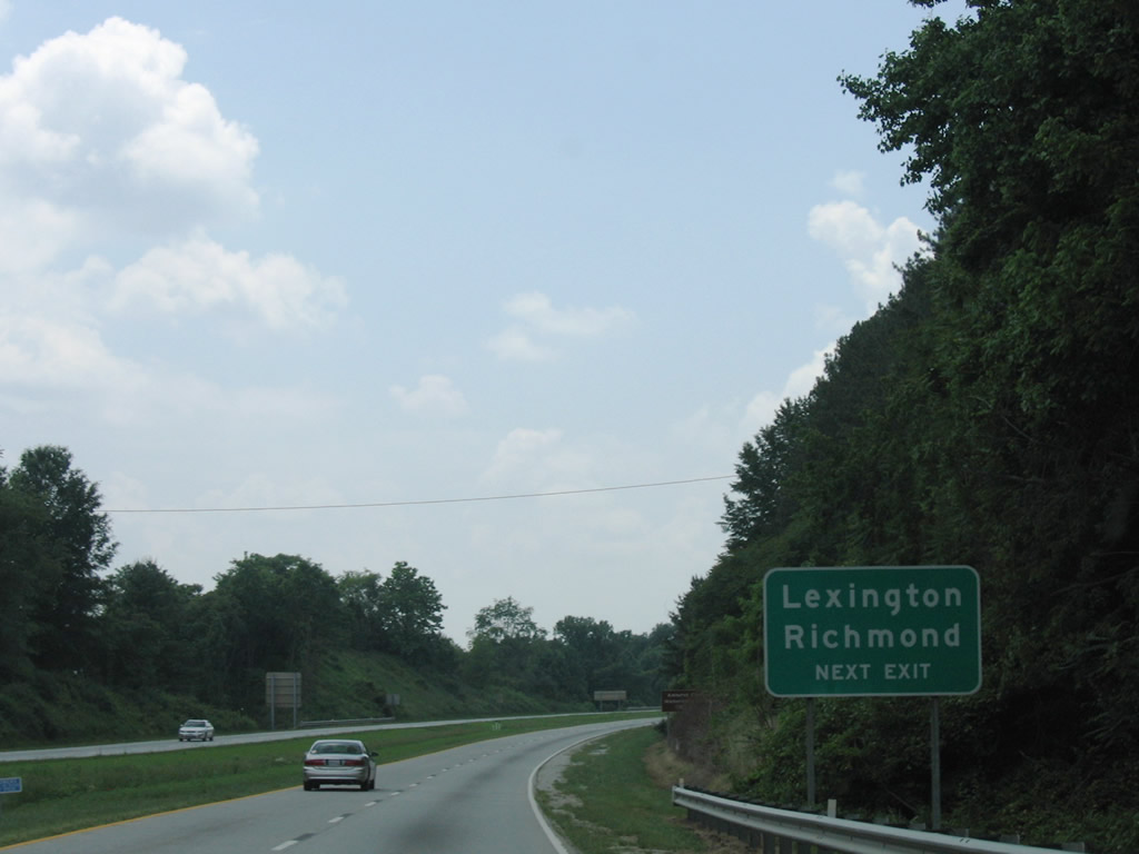
Longer distance control cities for U.S. 60 include Lexington (Interstates 64 and 81) and Richmond. U.S. 60 runs 296.16 miles across Virginia between West Virginia near Callaghan and Virginia Beach.
06/05/04
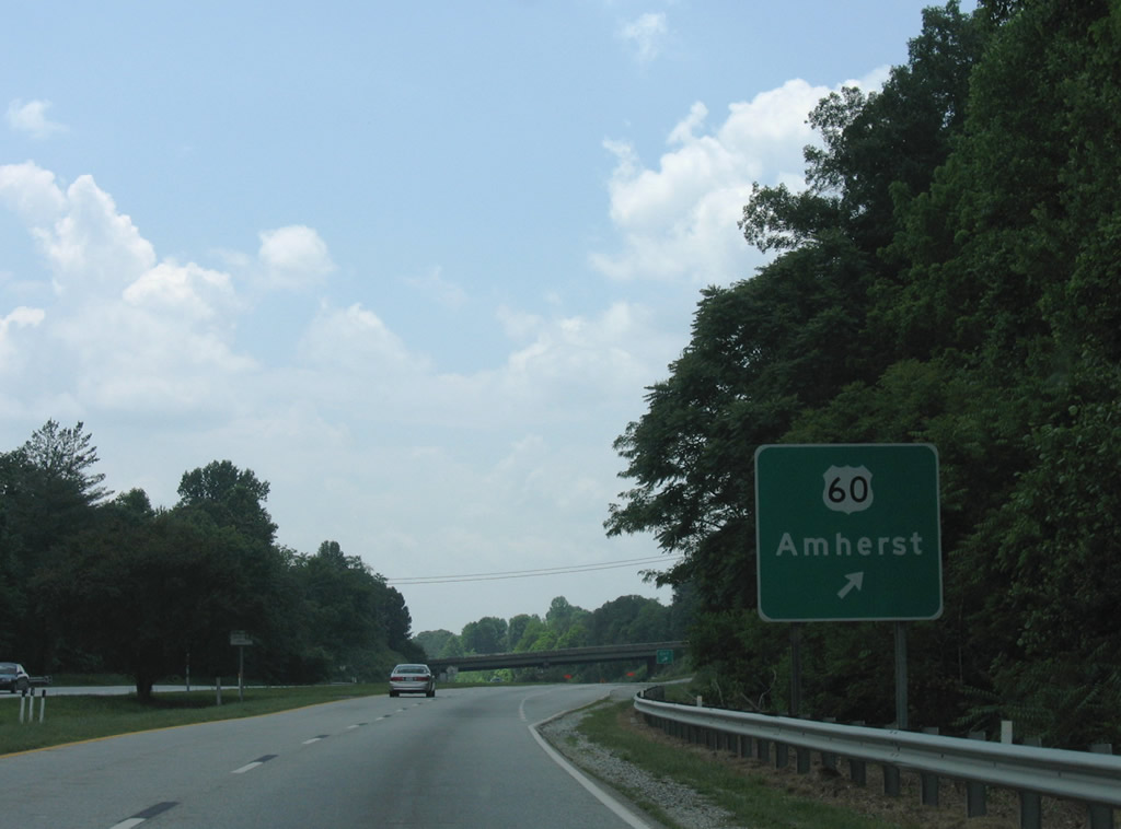
Motorists bound for U.S. 60 (Lexington Avenue) into Amherst depart U.S. 29 (Amherst Highway) south. U.S. 60 (Richmond Highway) continues east otherwise to Gladstone, Bent Creek, and Mt. Rush.
06/05/04
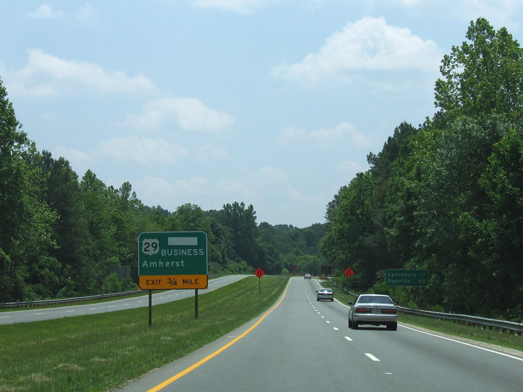
Nearing the return of U.S. 29 Business (Main Street) from Amherst and the beginning of the Lynchburg-Madison Heights Bypass on U.S. 29 (Amherst Highway) south.
05/30/05
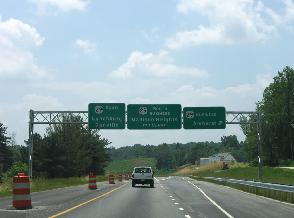
Opened in October 2005, the Lynchburg-Madison Heights Bypass constitutes a full freeway leading south from Amherst to U.S. 460 east of Lynchburg. U.S. 29 relocated from the Amherst Highway to the west, with that arterial redesignated U.S. 29 Business.
05/30/05
A parting shot of the near completed U.S. 29 freeway leading south from U.S. 29 Business (Amherst Highway).
05/30/05
Photo Credits:
- Andy Field: 06/05/04, 06/05/05
- Alex Nitzman: 05/30/05
Page Updated Monday March 22, 2010.