
U.S. 33

Measuring 135.69 miles in Virginia, U.S. 33 begins in Richmond. The highway runs north of the I-64 corridor to the Louisa County seat of Louisa and the Greene County seat of Stanardsville to Harrisonburg. West from Harrisonburg, U.S. 33 ascends into George Washington National Forest to the West Virginia state line across Shenandoah Mountain.
Within the city of Richmond, U.S. 33 combines with U.S. 250 along Broad Street 3.92 miles southeast to The Fan District and Virginia Commonwealth University (VCU). U.S. 33 ends at an unmarked intersection joining U.S. 250 with SR 33 along the couplet of Harrison and Hancock Streets. SR 33 shifts north onto Leigh Street through the Carver neighborhood, and continues to the East End community in Richmond toward Sandston in Henrico County.
Branching northwest from U.S. 250 (Broad Street) at Richmond, U.S. 33 follows Staples Mill Road to Laurel, Glen Allen and other suburban areas in Hanover County en route to Montpelier. Through Lousia County, U.S. 33 joins with U.S. 522 for 0.66 miles at Cuckoo, SR 208 at Louisa and SR 22 to Trevilians. U.S. 15 overlaps with U.S. 33 for 1.78 miles to a roundabout with SR 231 (Gordon Avenue) in Gordonsville.
West from U.S. 29 at Ruckersville, U.S. 33 bypasses the town of Stanardsville, where a business route is designated along Spotswood Trail. Climbing onto the Blue Ridge Mountains, U.S. 33 winds alongside Swift Run to Swift Run Gap on the Greene / Rockingham County line, where the highway meets Skyline Drive. Continuing northwest from Shenandoah National Park, U.S. 33 lowers into the town of Elkton where another business route is designated along Spotswood Trail.
U.S. 33 circumvents Massanutten Mountain to the south between McGaheysville and Penn Laird between Elkton and Harrisonburg. Through Harrisonburg, U.S. 33 runs through a heavily developed retail area south of I-81, and arcs northwest onto Market Street beyond I-81 into Downtown. Advancing west around Cooper Mountain, U.S. 33 heads to Rawley Springs where it converges with the Dry River. U.S. 33 runs along the river between River Rock Mountain and Dictum Ridge among other mountains toward the Mountain State.
 East
East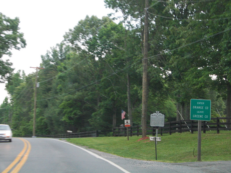
U.S. 33 (Spotswood Trail) proceeds 2.24 miles east of U.S. 29 at Ruckersville to the Orange County line.
05/30/05
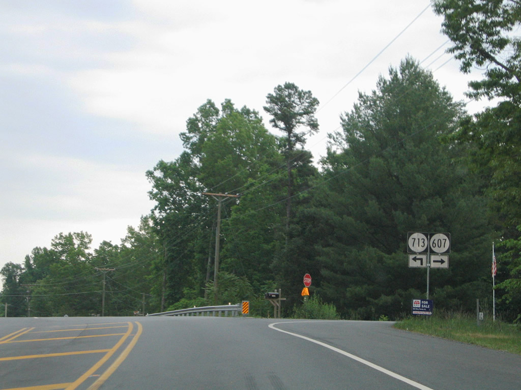
SR 607 (Carpenters Mill Road) heads east from U.S. 29 in Greene County to U.S. 33 (Spotswood Trail) near Dickersons Lane (SR 713).
05/30/05
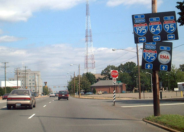
Trailblazers to I-195 (Beltline Expressway) previously posted along U.S. 33/250 (Broad Street) east at Kent Road in the Sauer's Garden neighborhood. Kent Road south to Cutshaw Avenue provides an alternate route to the I-195 entrance ramp from Hamilton Street.
06/02/03
West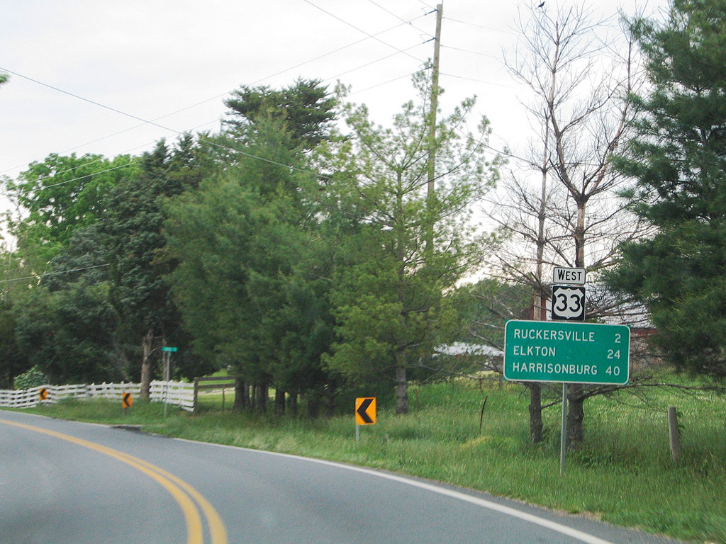
U.S. 33 (Spotswood Trail) continues west from the Orange County line two miles to U.S. 29 at the community of Ruckersville.
05/30/05
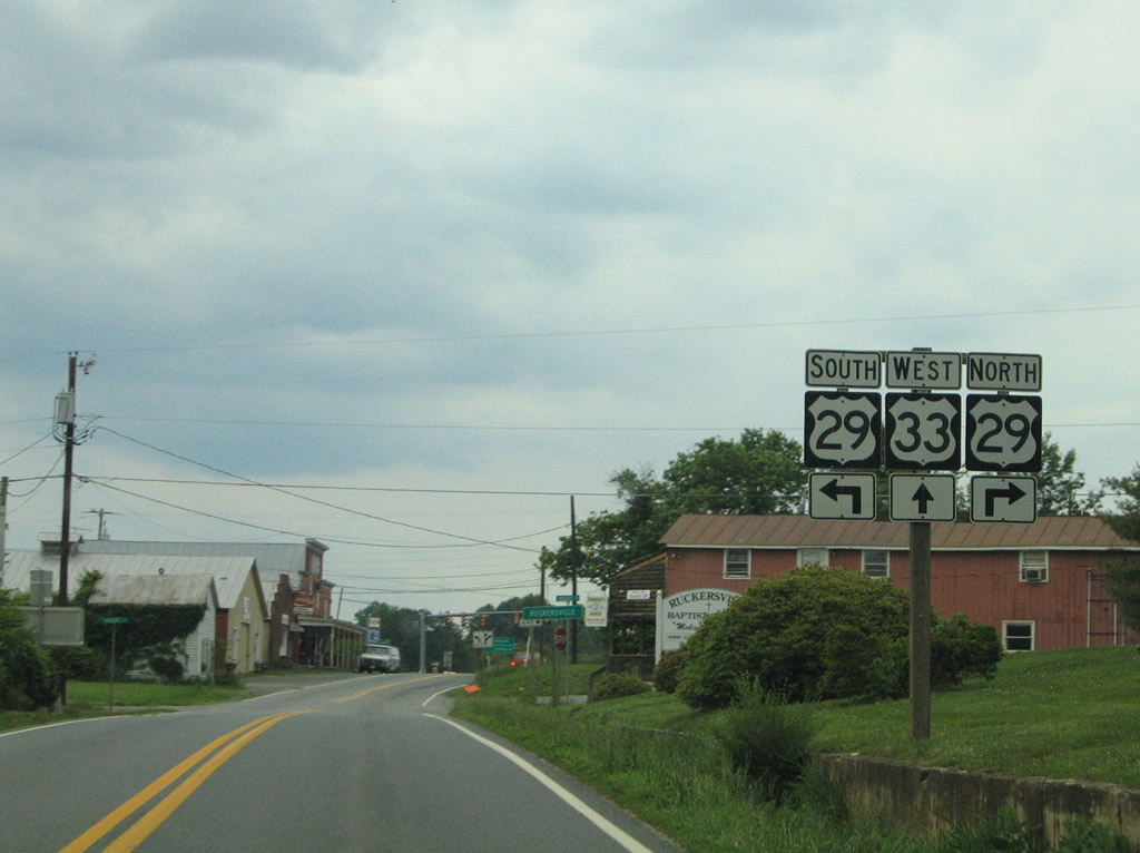
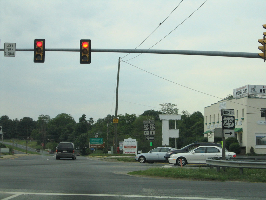
Entering Ruckersville, U.S. 33 (Spotswood Trail) approaches a signalized intersection with U.S. 29 (Seminole Trail).
05/30/05
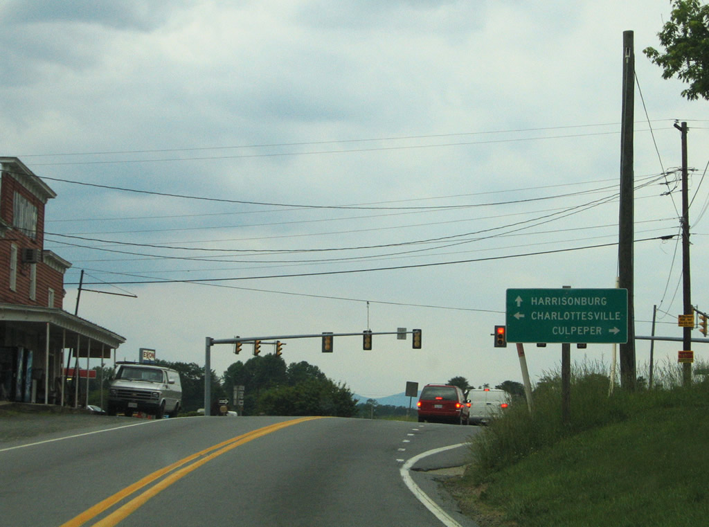
Throughout most of Virginia, U.S. 29 constitutes a four lane, divided highway or expressway. Joining U.S. 33 with Charlottesville to the south and Culpeper to the north, U.S. 29 is a commercial arterial at Ruckersville.
05/30/05
U.S. 29 (Seminole Trail) travels ten miles north to the bypass around the Madison County seat of Madison. South from U.S. 33 (Spotswood Trail), U.S. 29 reaches the outskirts of Charlottesville in 15 miles.
05/30/05
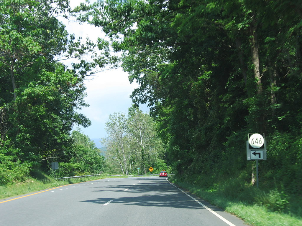
Passing south of Little Ledge Mountain, U.S. 33 (Spotswood Trail) meets SR 646 (Blue Run Road) west to Runkle Mountain and SR 810 (Dyke Road) at Geer.
06/05/05
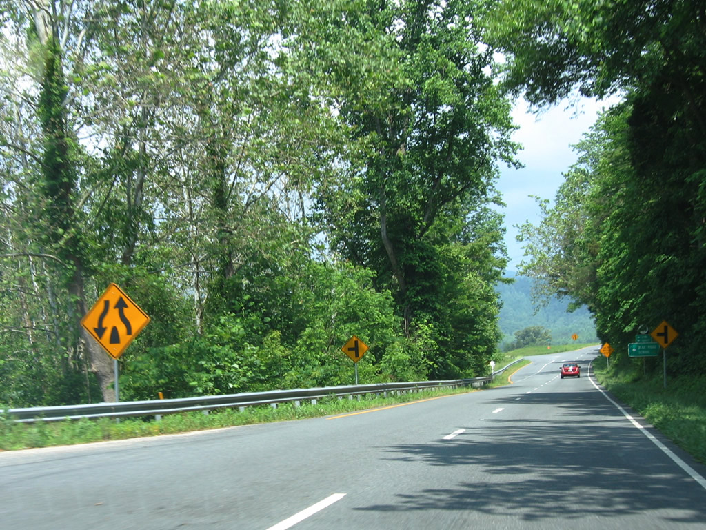
SR 810 (Dyke Road) runs 8.23 miles southwest from U.S. 33 (Spotswood Trail) to Geer, Parker Mountain, Dyke and SR 663/664 near Nortonsville.
06/05/05
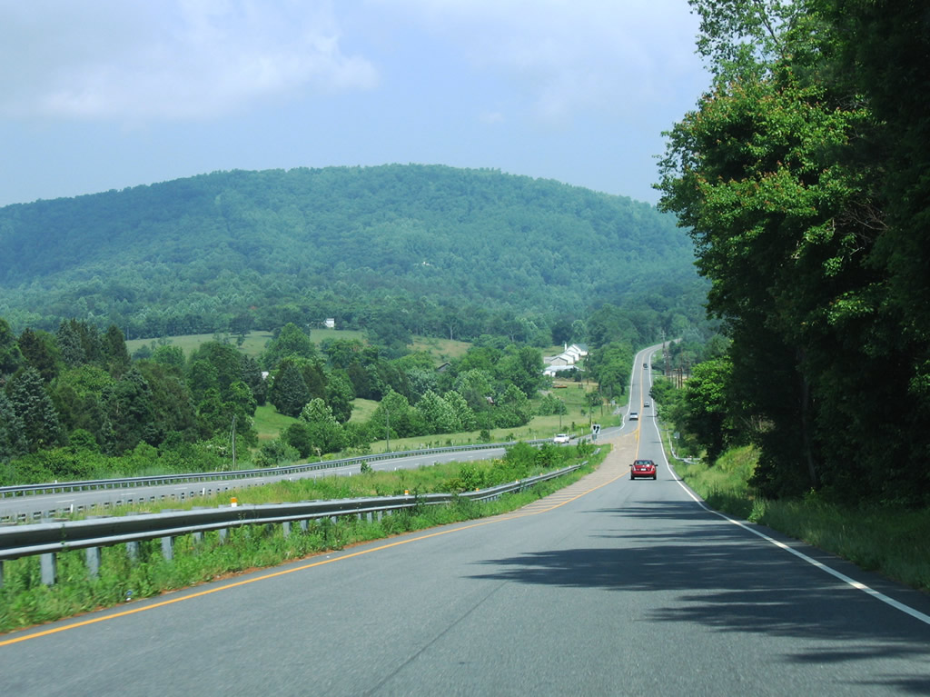
U.S. 33 narrows to two lanes on the ascent to Lydia between Powell Mountain and Turkey Ridge.
06/05/05
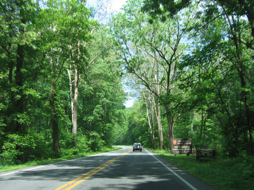
U.S. 33 (Spotswood Trail) continues west from Lydia into Shenandoah National Park. Paralleling Swift Run, U.S. 33 winds between High Top (elevation 3,587 feet) and Saddleback Mountain.
06/05/05

A truck climbing lane joins U.S. 33 westbound on the climb to Swift Run Gap across the Blue Ridge Mountains.
06/05/05
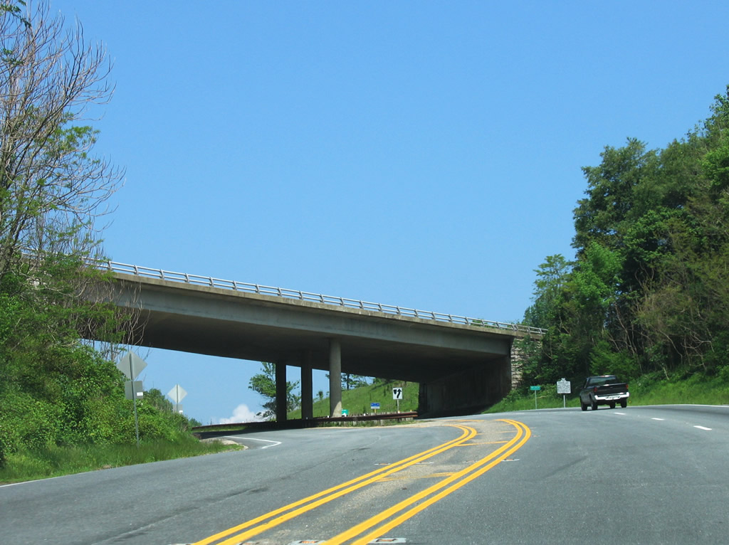
Skyline Drive crosses over U.S. 33 (Spotswood Trail) at Swift Run Gap along the Rockingham County line.
06/05/05

Maintained by the National Park Service, Skyline Drive comprises a scenic and controlled access route through Shenandoah National Park. Trucks and other commercial vehicles are not permitted along the byway.
06/05/05
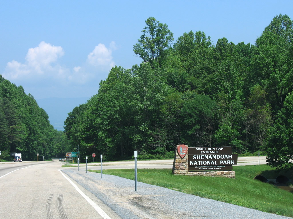
A two lane access road links U.S. 33 with Skyline Drive at the Swift Run Gap entrance. The parkway winds northeast to Front Royal and southward to Waynesboro. South of I-64, Skyline Drive continues as the Blue Ridge Parkway to western North Carolina.
06/05/05
scenes
SR 607 (Carpenters Mill Road) east at U.S. 33 in Orange County.
05/30/05

Hamilton Street (SR 949) links I-195 (Beltline Expressway) south with U.S. 33/250 (Broad Street) in Richmond.
12/17/20
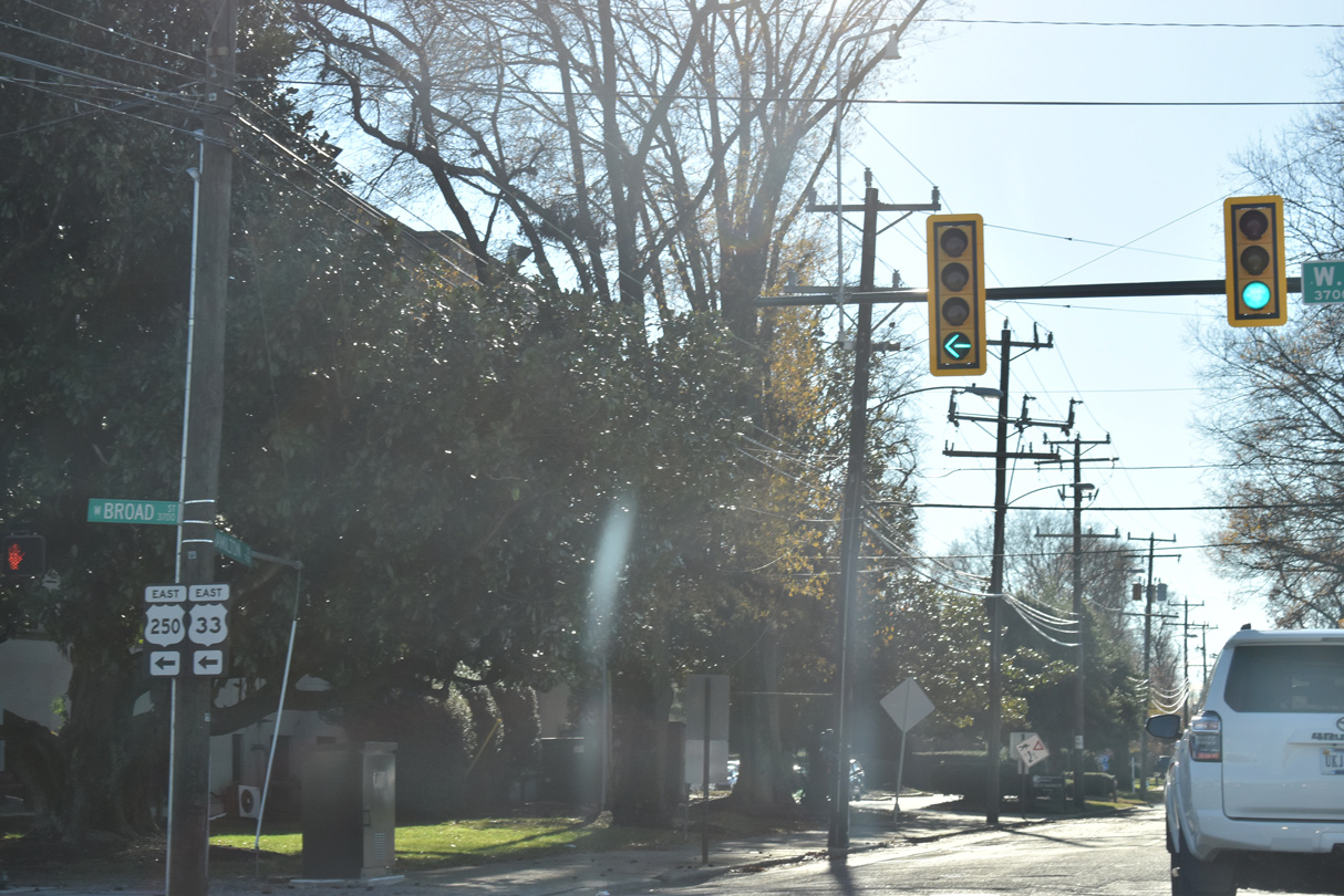
U.S. 33/250 (Broad Street) head southeast from Hamilton Street and I-195 between Scott's Addition and the Museum District neighborhoods toward City Center in Richmond.
12/17/20
Photo Credits:
- Alex Nitzman: 05/30/05, 12/17/20
- Andy Field: 06/02/03, 06/05/05
Connect with:
Page Updated Sunday February 21, 2021.