
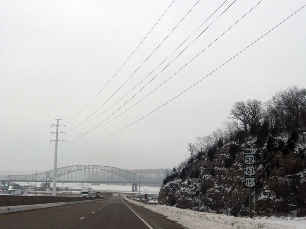
U.S. 61/151 North - Dubuque


 North
North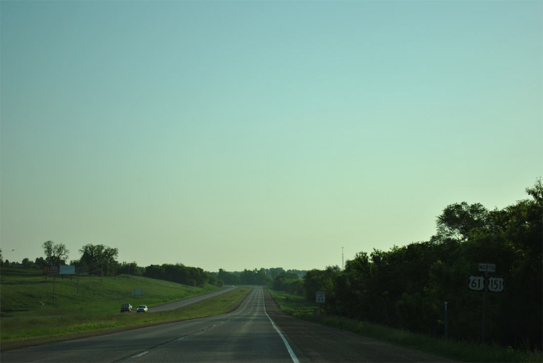
U.S. 61/151 combine for 16 miles northeast to Dickeyville, Wisconsin.
05/30/11
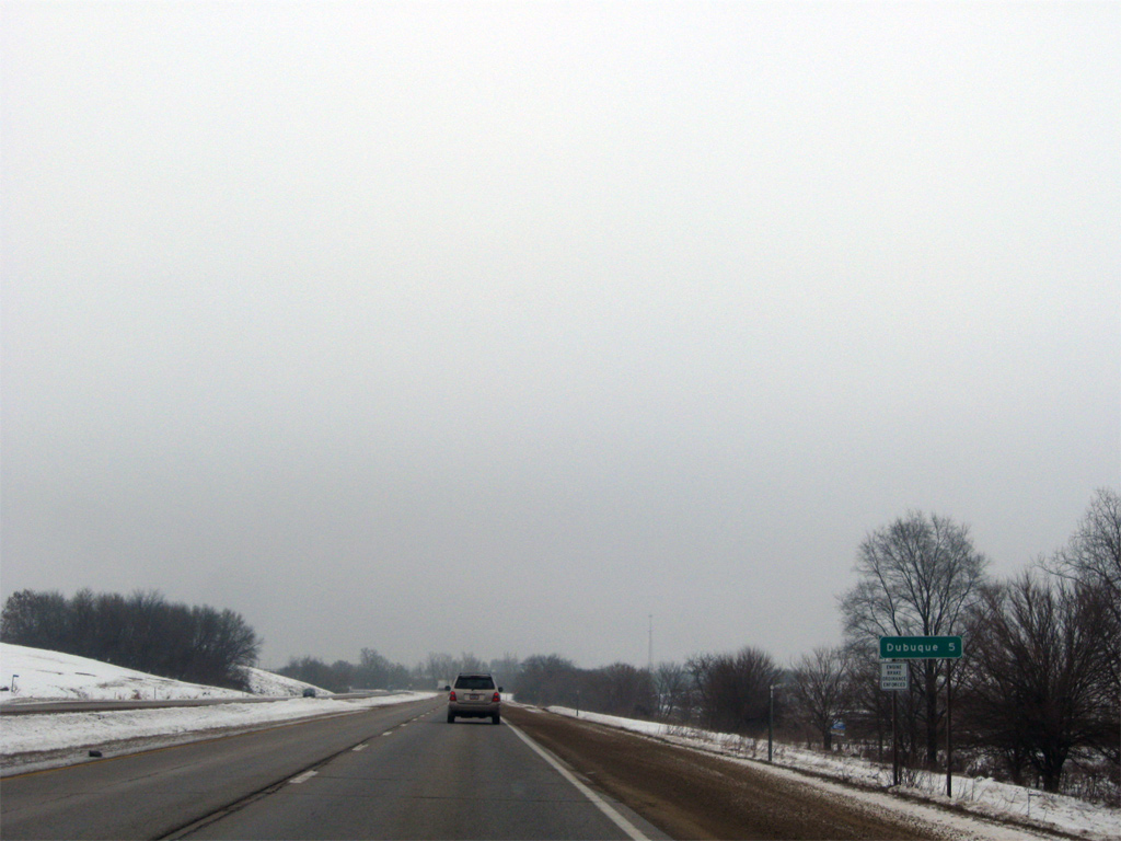
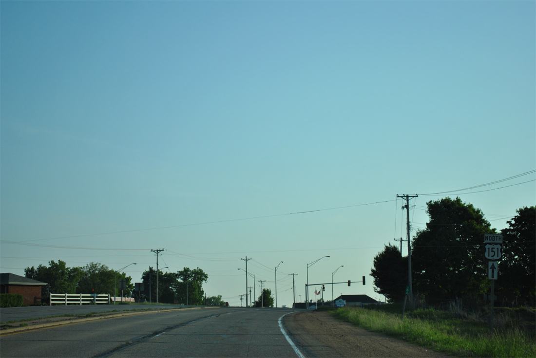
Downtown Dubuque is five miles to the north, though U.S. 61/151 reaches the city limits just north of Olde Davenport Road ahead.
12/21/09
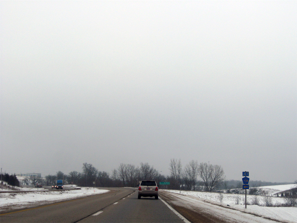
Olde Davenport Road becomes Key West Drive (County Road Y38) west from U.S. 61/151. Key West Drive follows old U.S. 61 through the community of Key West, with Military Road (County Road D35) tying in from the west as the former alignment of U.S. 151.
12/21/09
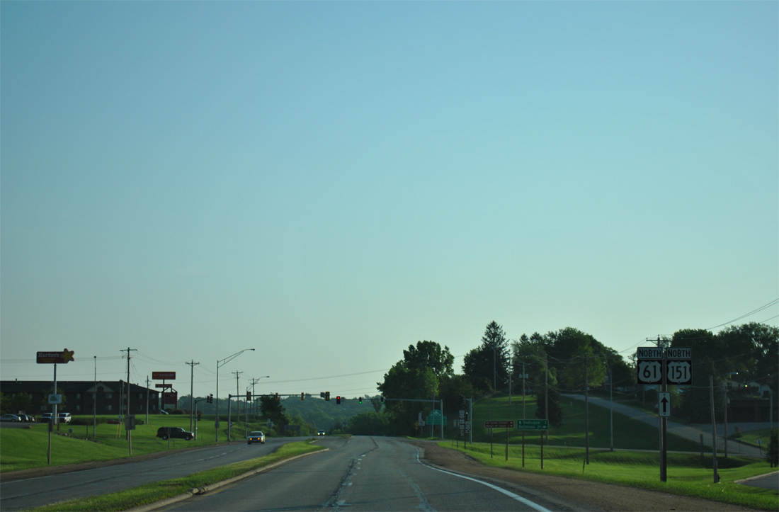
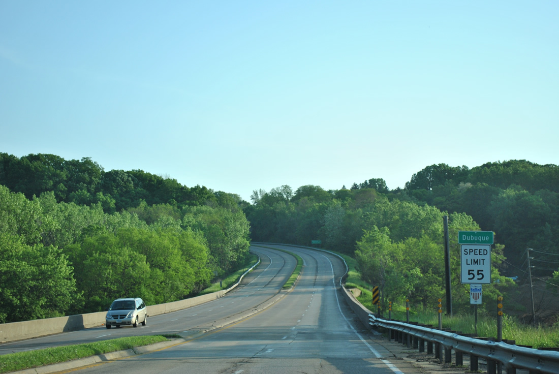
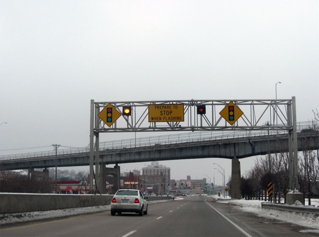
The first traffic light along U.S. 61 north since Davenport operates along U.S. 61/151 at Maquoketa Drive in south Dubuque.
05/30/11
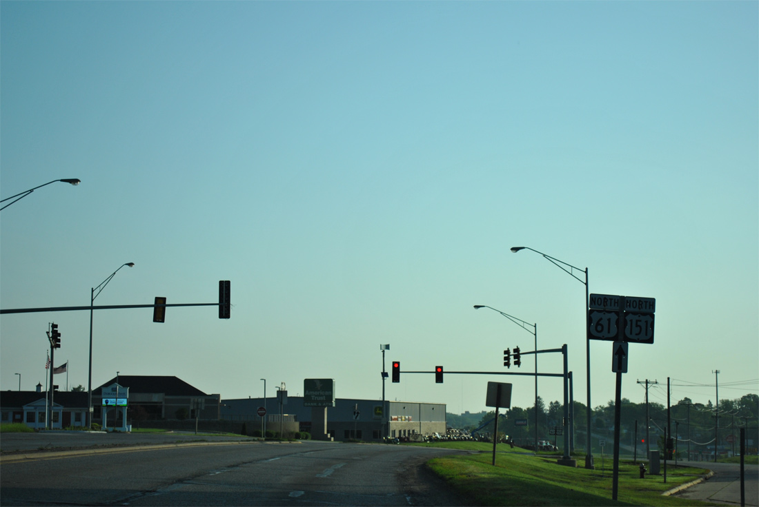
Maquoketa Drive links U.S. 61/151 with parallel Key West Drive south and Rockdale Road north and an adjacent mobile home park and subdivision. Rockdale Drive follows old U.S. 61/151 northward to Grandview Avenue.
05/30/11
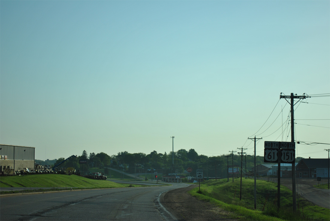
Several businesses line both Rockdale Road and Gateway Drive, an east side frontage road, along U.S. 61/151 north. The four lane arterial retains access control for the most part through Dubuque.
05/30/11
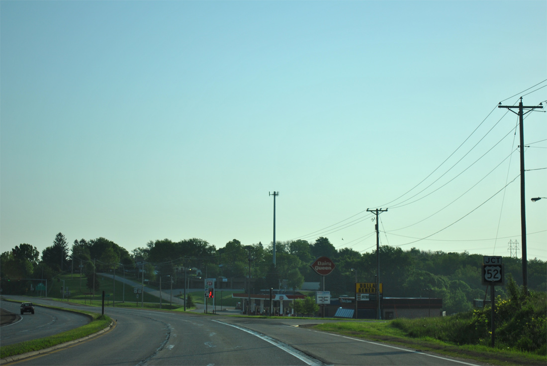
U.S. 52 enters Dubuque from Bellevue, 21 miles to the southeast and formerly combined with U.S. 61/151 north to Downtown.
05/30/11
Twin Valley Drive combines with Rockdale Road ahead of the crossing over Catfish Creek, where U.S. 52 historically joined U.S. 61/151. U.S. 67 once combined with U.S. 52 northward from Sabula to Rockdale as well.
05/30/11
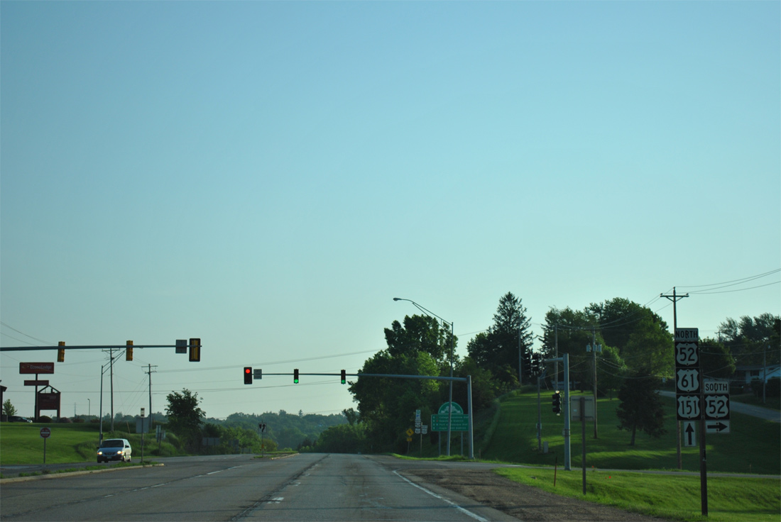
Traveling 167 miles through northeast Iowa, U.S. 52 heads southeast from Dubuque to St. Catherine and St. Donatus, meeting the north end of U.S. 67 in 40 miles at Sabula. U.S. 52 south also leads to the Mines of Spain Recreation Center and the E.B. Lyon's Interpretive and Nature Center.
05/30/11
 North
North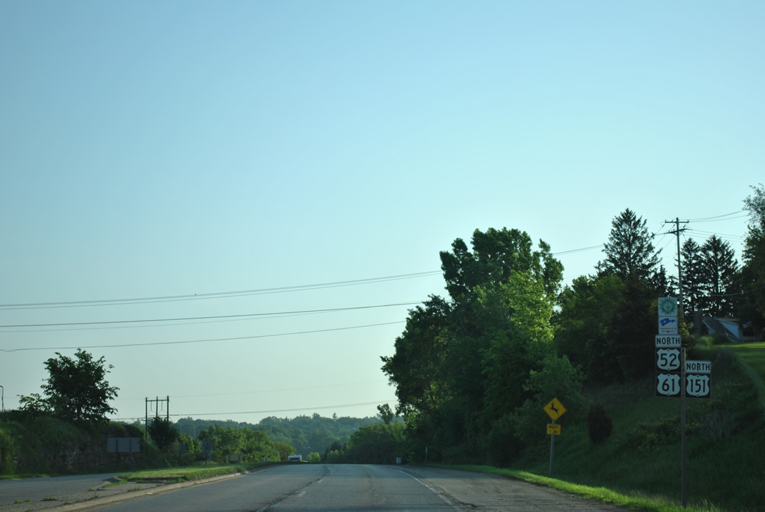
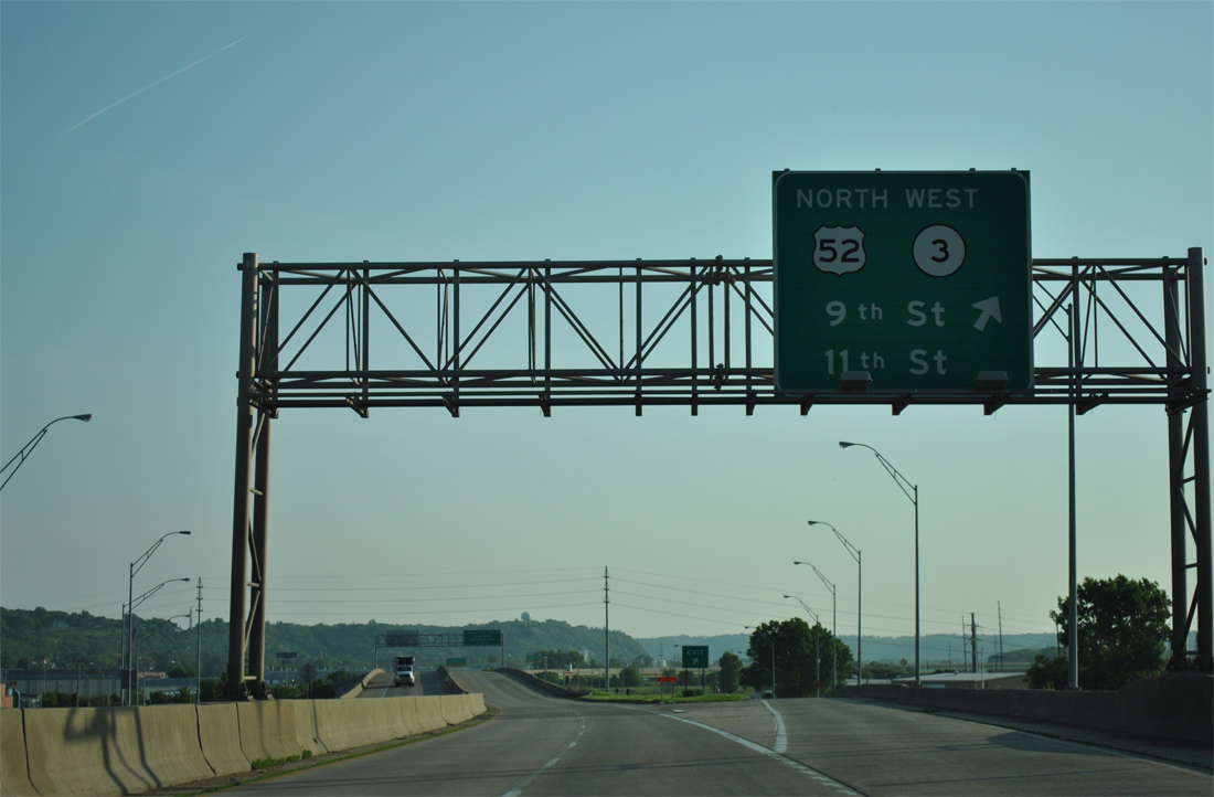
U.S. 52 previously combined with U.S. 61/151 for 2.8 miles north.
05/30/11
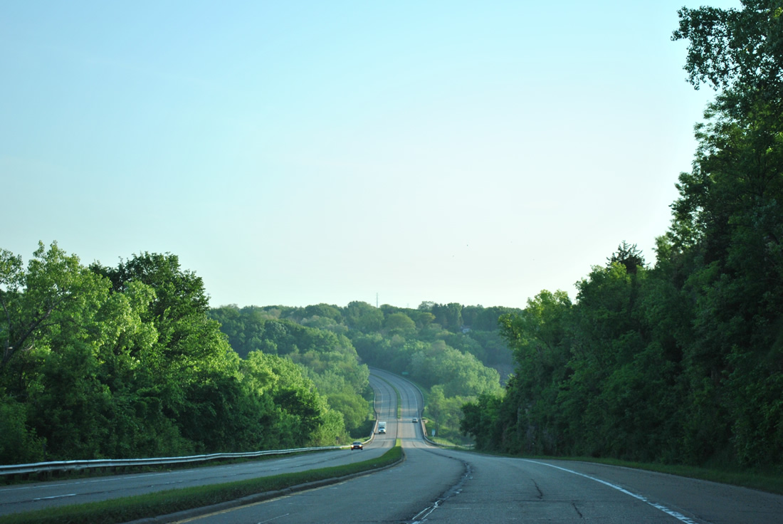
U.S. 52-61-151 lower between a rock cut steeply to cross Catfish Creek as the trio upgrade to a freeway.
05/30/11
Spanning Catfish Creek and an adjacent Canadian National Railroad, U.S. 52-61-151 northbound reenter the city of Dubuque.
05/30/11
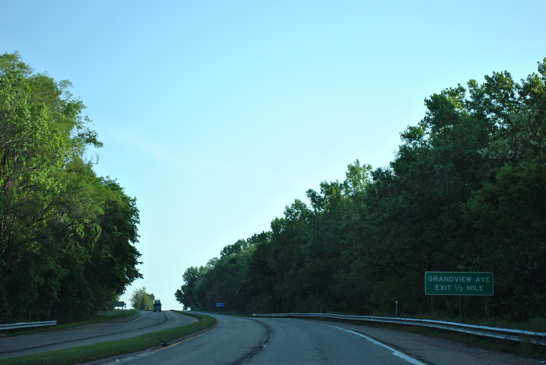
A diamond interchange lies at the top of the hill beyond Catfish Creek with Grandview Avenue.
05/30/11
Grandview Avenue winds northwest from a residential area above the Mississippi River to U.S. 20 and the College Grandview District of Dubuque.
05/30/11
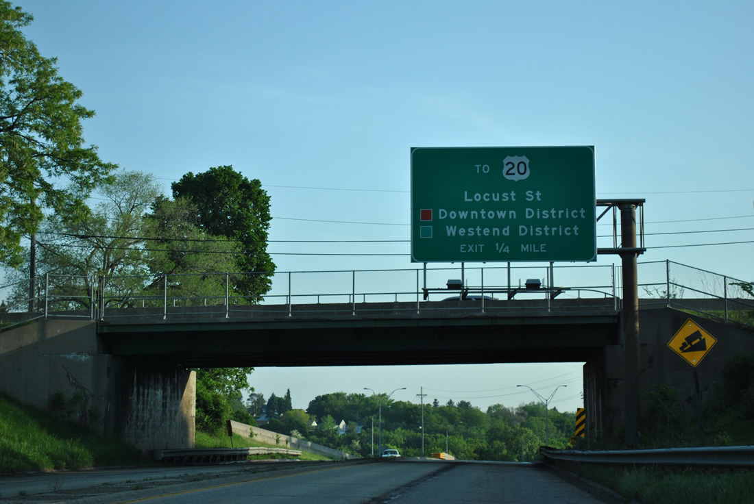
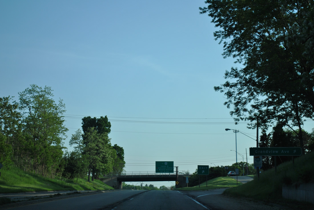
U.S. 20 (Dodge Street) follows an expressway east from Grandview and Fremont Avenues to cross paths with U.S. 52-61-151 en route to East Dubuque, Illinois. There is no direct access between the two highways, with Locust Street (unsigned Iowa 946) providing access from northbound at a wye interchange in one quarter mile.
05/30/11
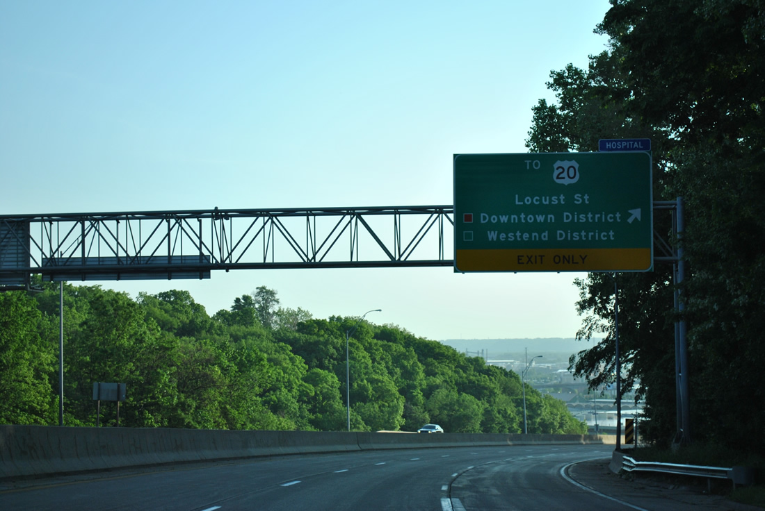
Locust Street (Iowa 946) is the former alignment of U.S. 52-61-151 north into the Downtown District. The street comprises an arterial to an at-grade intersection with U.S. 20 (Dodge Street). U.S. 20 ascends from that junction to the Westend District and the Kennedy Mall area while eastbound spans the Mississippi River on the two lane Julien Dubuque Bridge.
05/30/11
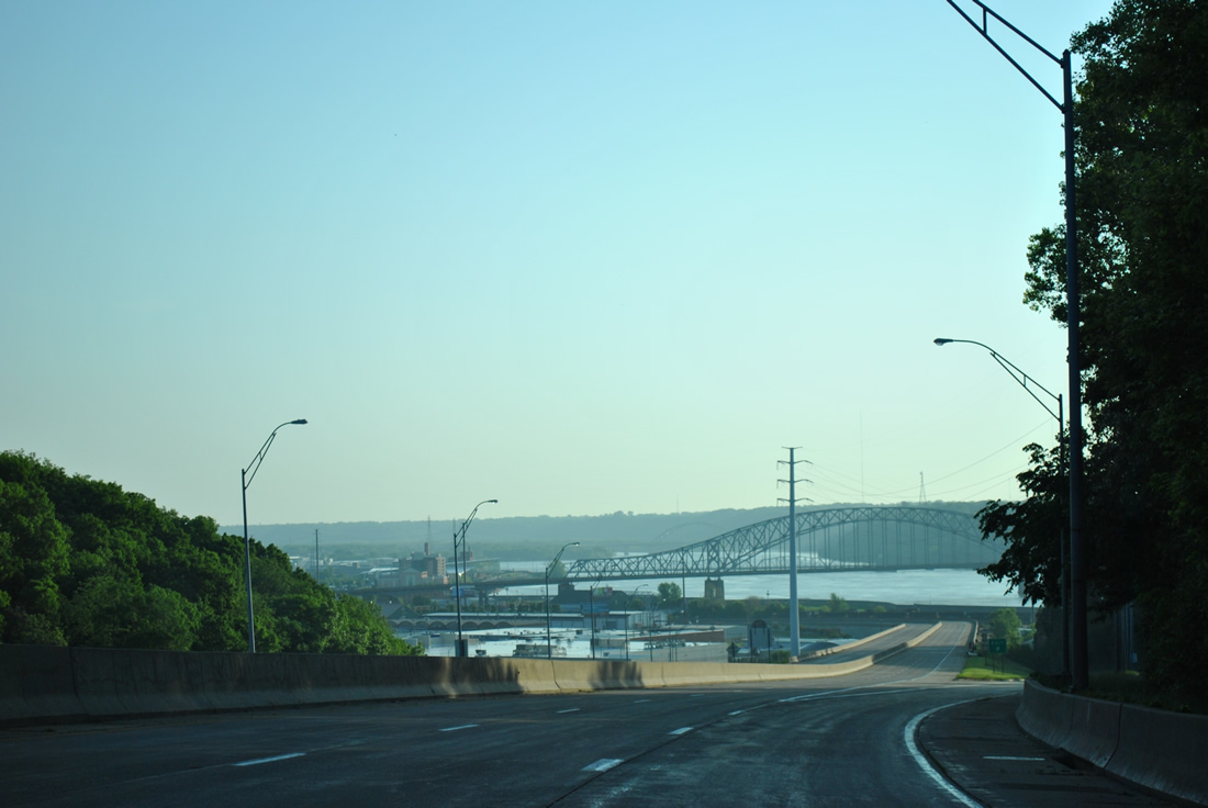
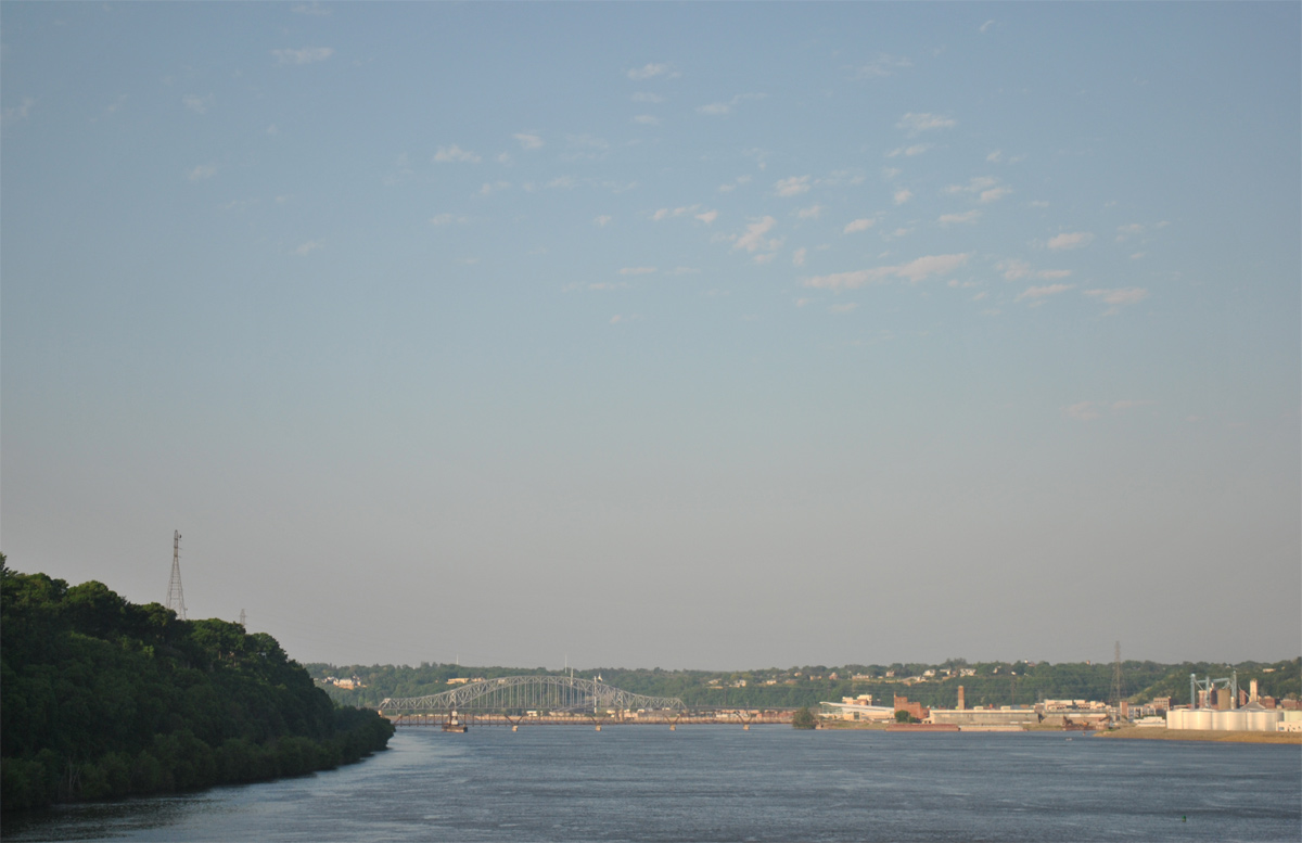
The Julien Dubuque Bridge spreads into view along with the industrial riverfront of Dubuque as U.S. 52-61-151 lowers at a 6% grade. The steel arch truss bridge opened to traffic on August 31, 1943.1
05/30/11
12/21/09
U.S. 52-61-151 pass over an industrial area on a viaduct from Locust Street ahead of the Julien Dubuque Bridge. This stretch of highway opened in 1991.
12/21/09
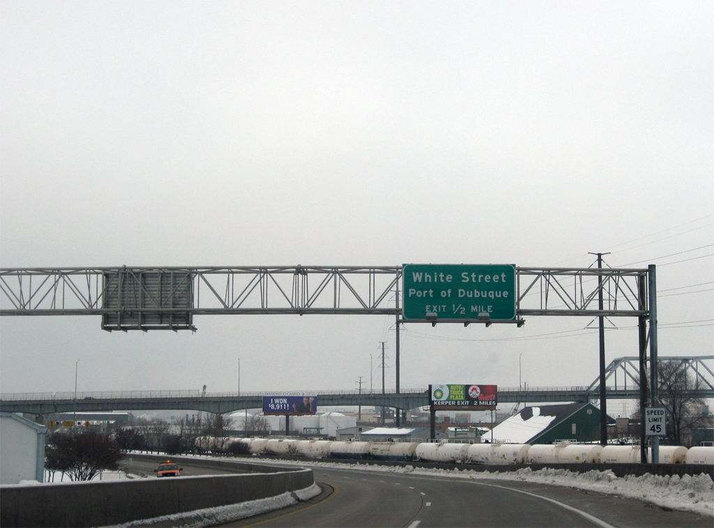
One half mile south of the half diamond interchange with White Street and the Port of Dubuque on U.S. 52-61-151 north. The trio parallel a Canadian National Railroad yard to the Julien Dubuque Bridge.
12/21/09
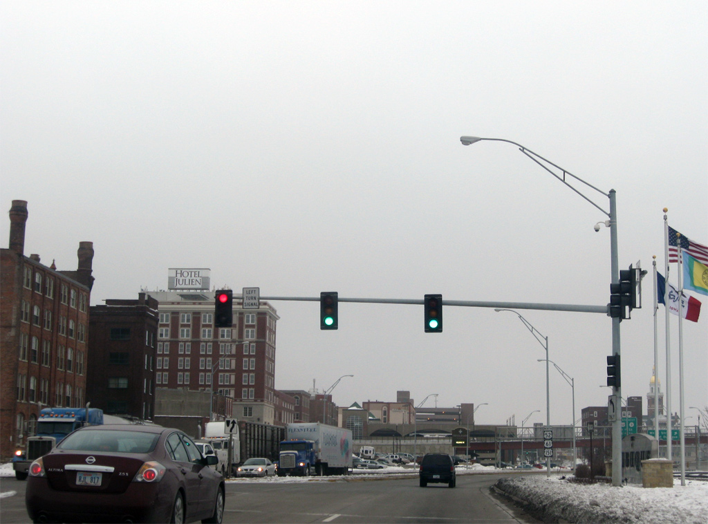
U.S. 52-61-151 travel at-grade for one block between Jones Street and Iowa 946. Traffic lights are present at both intersections.
12/21/09
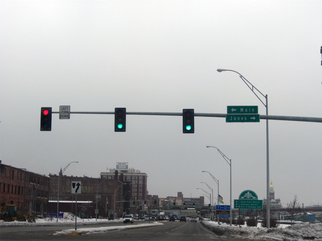
Jones Street spurs east from parallel Main Street to the Dubuque Harbor area while Main Avenue heads south from a cul-de-sac adjacent to IA 946 to an industrial area between U.S. 52-61-151 and Locust Street.
12/21/09
Iowa 946 connects U.S. 52-61-151 with their former alignment along Locust Street. The old route used Locust Street (north) and Bluff Street (south) to 4th & 5th Streets through downtown Dubuque.
12/21/09
A new freeway for U.S. 61/151 opened to traffic on December 26, 1991 from the forthcoming split with U.S. 52 to the Dubuque-Wisconsin Bridge.2 This view looks at the final assembly posted for all three routes.
05/30/11
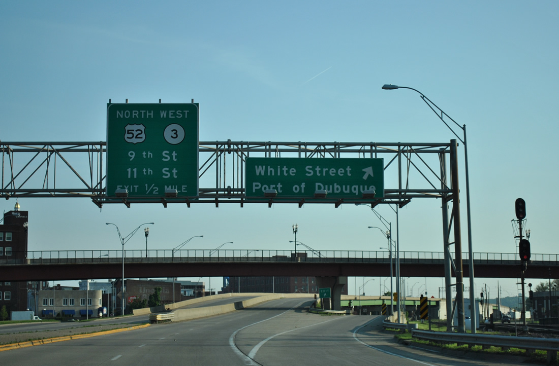
The White Street off-ramp leaves U.S. 52-61-151, one half mile south of their split. White Street heads north from the Port of Dubuque area as the former U.S. 52-61-151 north to become another former alignment of U.S. 52 north after 11th Street.
05/30/11
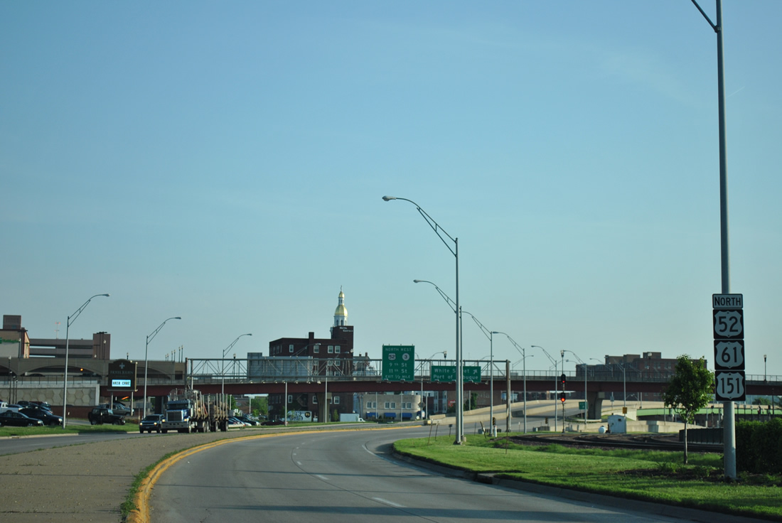
U.S. 52 parts ways with U.S. 61/151 north for 11th Street west to White Street north. Iowa 3 begins a 328 mile trek across the state here, combining with U.S. 52 westward 27 miles from Dubuque to Sageville and Luxemburg.
05/30/11
North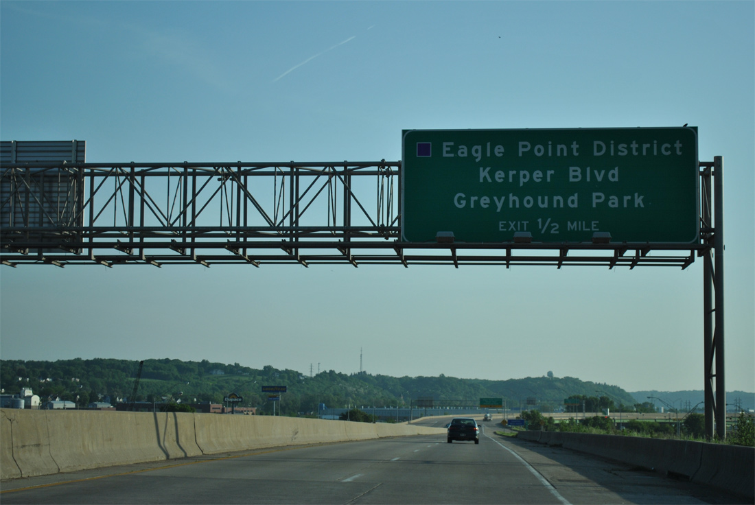
U.S. 61/151 start to turn east in anticipation of the Dubuque-Wisconsin Bridge across the Mississippi River on the half mile approach to Kerper Boulevard.
05/30/11
The 11th Street on-ramp adds a third northbound lane to the half diamond interchange with Kerper Boulevard.
05/30/11
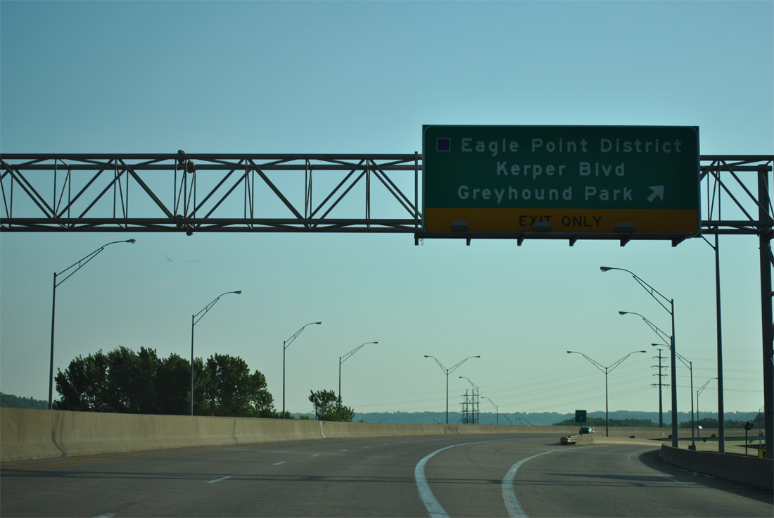
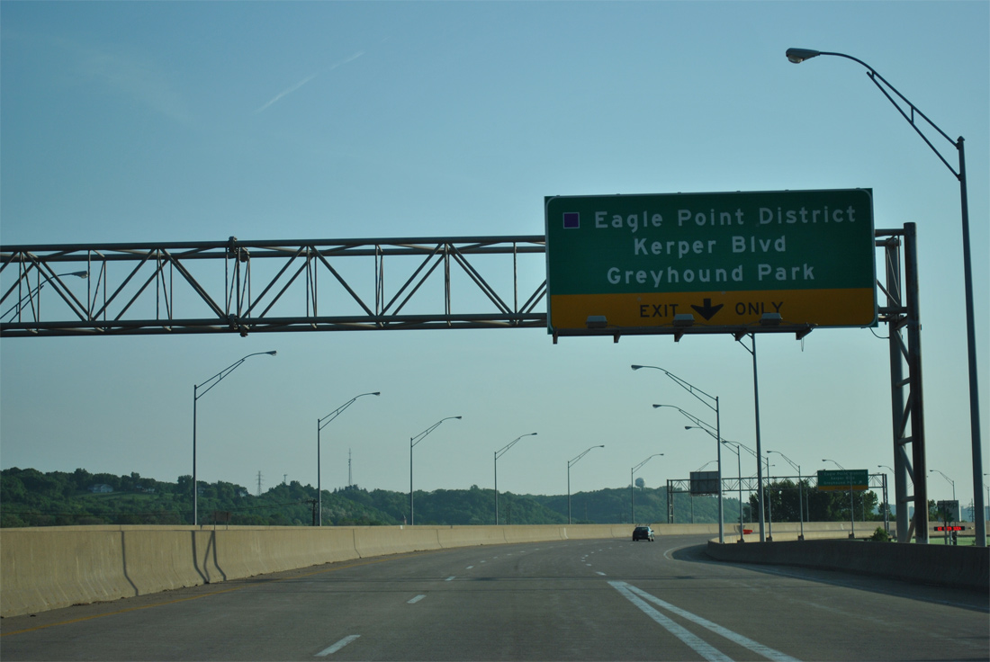
Kerper Boulevard leads north from the ends of 9th and 11th Streets to Hawthorne Street in the Eagle Point District. 16th Street intersects the arterial south of U.S. 61/151 to cross Lake Peosta Channel onto City Island, where Dubuque Greyhound Park resides.
05/30/11
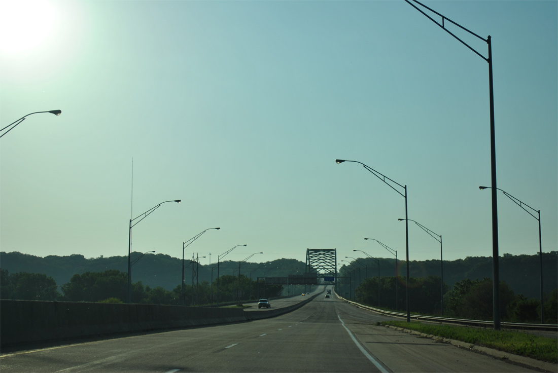
A single wye interchange joins the end of 16th Street with U.S. 61/151 north at the Dubuque-Wisconsin Bridge.
05/30/11
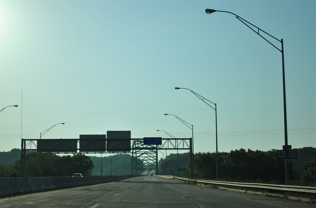
Motorists pass by the final shield assembly for U.S. 61/151 in Iowa on City Island.
05/30/11
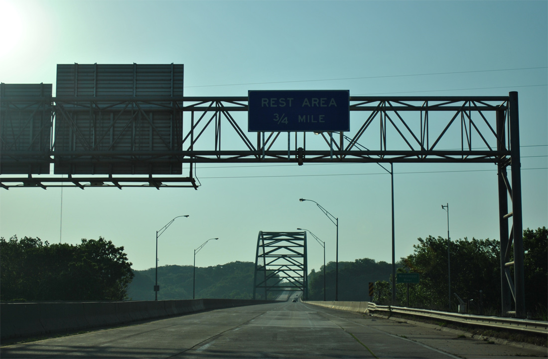
A rest area lies just west of the first Wisconsin exit in three quarters of a mile.
05/30/11
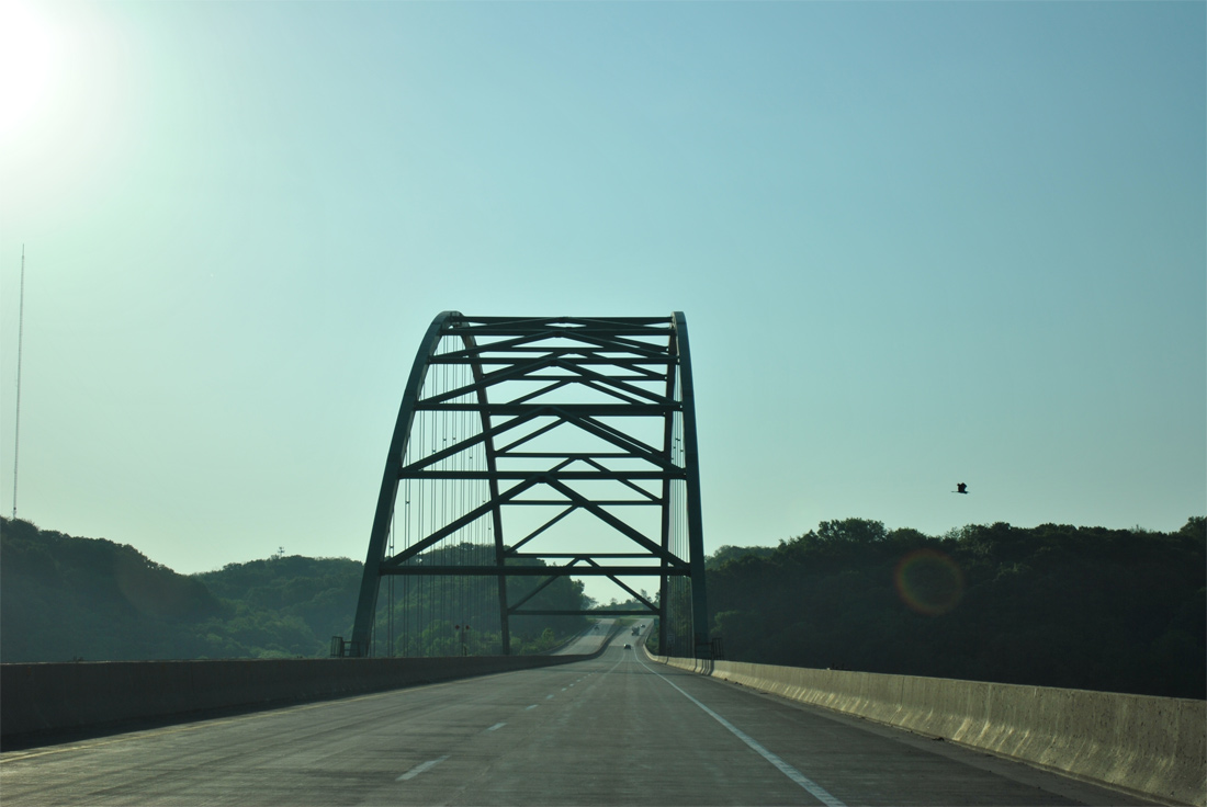
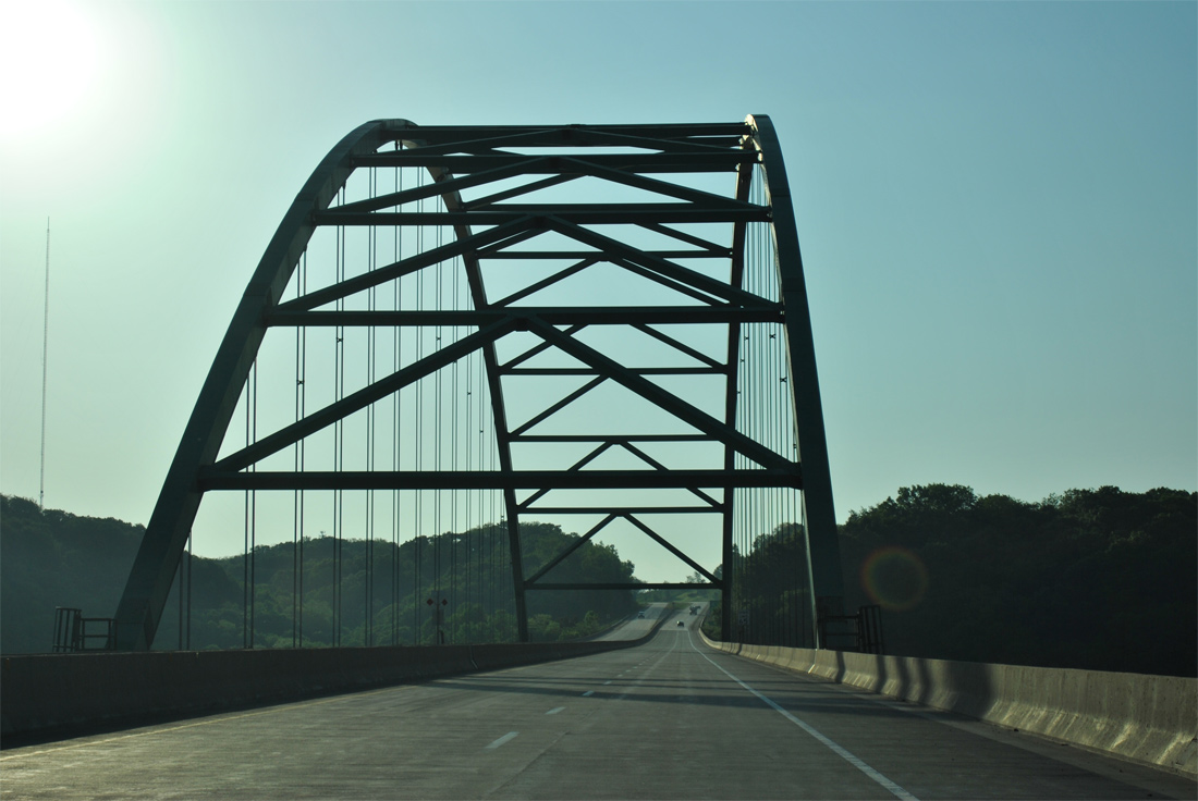
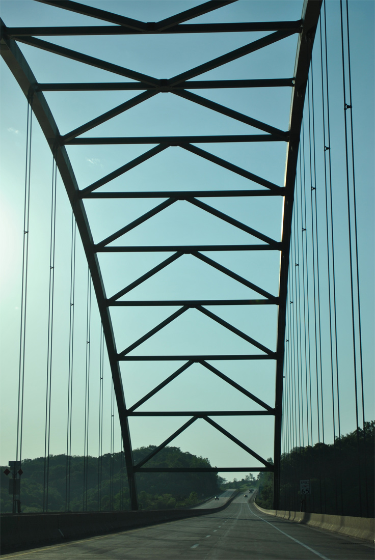
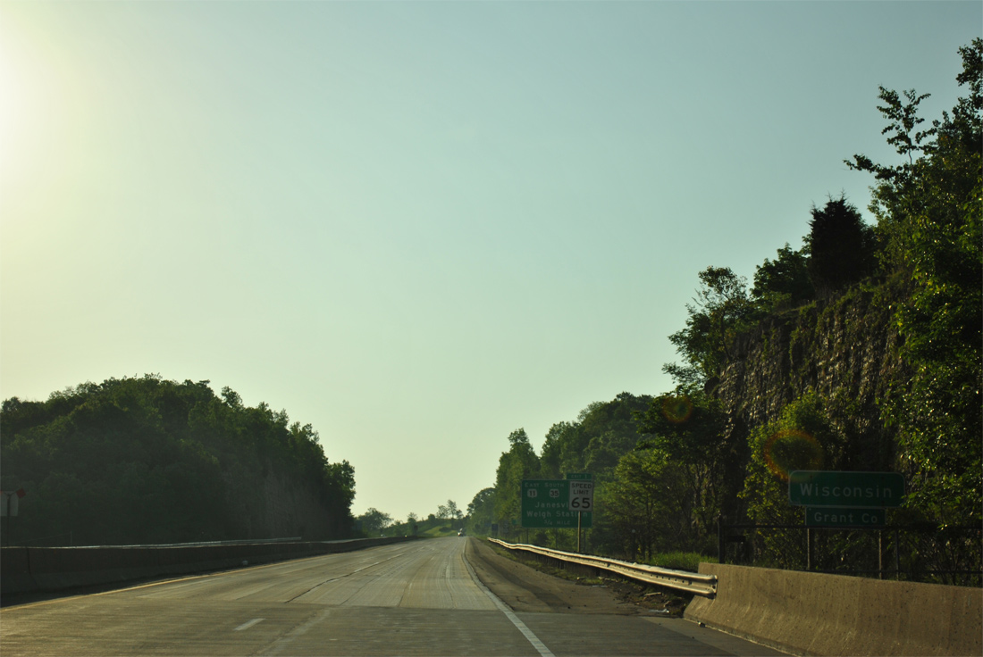
The Dubuque-Wisconsin Bridge opened to traffic on August 21, 1982,2 replacing the Eagle Point Bridge, to the north, as the alignment for U.S. 61/151 across the Mississippi River. The tied-arch bridge joins freeways in Dubuque and Grant County, Wisconsin with four overall lanes and a 65 mile per hour speed limit.
05/30/11
One last look at the city of Dubuque from U.S. 61/151 north.
05/30/11
Motorists depart the Dubuque-Wisconsin Bridge at Boatyard Hollow on the bluffs rising from the east banks of the Mississippi River.
05/30/11
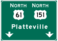

Photo Credits:
- ABRoads: 05/30/11
- Alex Nitzman: 12/21/09
Connect with:
Page Updated Wednesday March 13, 2013.