
U.S. 64 East - Hayesville to Brevard
 East
East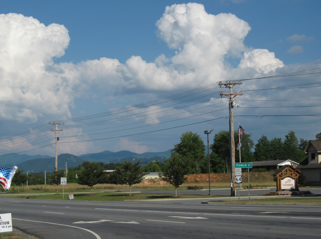
U.S. 64 Business loops 2.07 miles north from U.S. 64 into the Clay County seat of Hayesville. U.S. 64 bypasses the town to the south along a commercialized arterial, connecting with NC 69 ahead of this shield assembly.
07/09/10
 East
East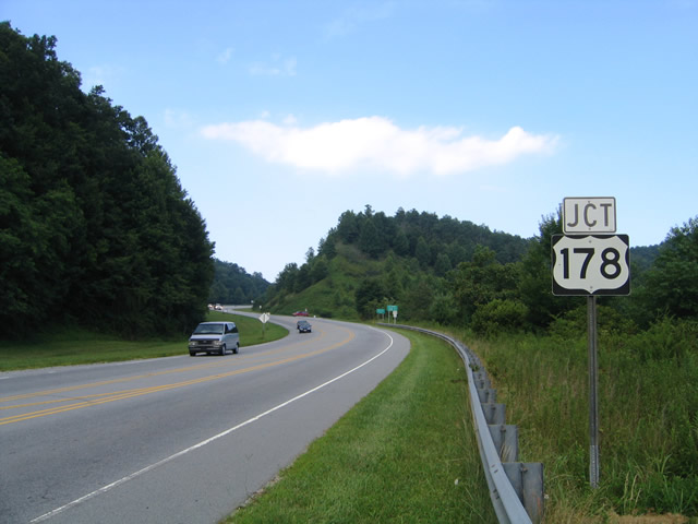
U.S. 64 meets the north end of U.S. 178 outside the town of Rosman in Transylvania County. U.S. 178 traverses the Blue Ridge Mountains south to Pickens, South Carolina.
07/23/04
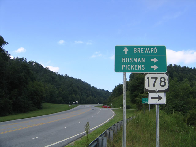
U.S. 178 (Pickens Highway) follows a winding course south 6.71 miles from U.S. 64 to the South Carolina between Flatrock and Indian Camp Mountains. The city of Pickens is 25 miles away.
07/23/04
U.S. 64 bypasses Rosman to the north alongside Big Ridge between U.S. 178 (Pickens Highway) and Old Rosman Highway (SR 1388) at Cherryfield.
07/23/04

U.S. 64 descends from Big Ridge to Cassell Road (SR 1329), which links with Old Rosman Highway (former U.S. 64) south to Rosman.
07/23/04
U.S. 64 continues northeast from SR 1388 (Old Rosman Highway) and Cherryfield past Morgan Field six miles to Brevard.
07/23/04
U.S. 64 expands to a four lane highway at Clement Road (SR 1337) and Seleca.
07/23/04
Advancing into the city of Brevard, U.S. 64 turns onto Broad Street, one block of Caldwell Street, north to Downtown.
07/23/04
U.S. 64 follows Broad Street north from Rosman Highway and Country Club Drive (SR 1116) 0.55 miles to U.S. 276 (Main Street) in Downtown Brevard.
07/23/04
Reassurance marker preceding Miner Street on Broad Street north.
07/23/04
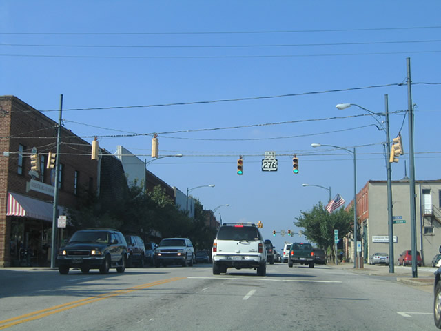
Progressing into Downtown Brevard, U.S. 64 (Broad Street) east intersects Jordan Street one block from the north end of U.S. 276 (Main Street).
07/23/04
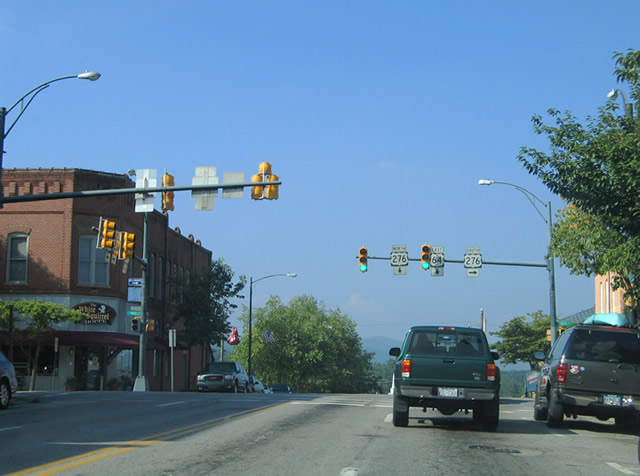
U.S. 276 north combines with U.S. 64 east 3.38 miles to NC 280 (Asheville Highway) in northern reaches of Brevard. U.S. 276 follows Pisgah Highway northwest from there to Waynesville as U.S. 64 continues east to Hendersonville.
07/23/04

U.S. 276 runs 12.52 miles south from U.S. 64 (Broad Street) in Brevard to the state line beyond Cedar Mountain. U.S. 276 continues through the Upstate of South Carolina to Caesars Head, Travelers Rest and Greenville.
07/23/04
Photo Credits:
- Alex Nitzman, Carter Buchanan: 07/09/10
- Alex Nitzman: 07/23/04
Connect with:
Page Updated Monday May 17, 2021.