
U.S. 74 East - Wilmington to Wrightsville Beach

 North
North 
 East
East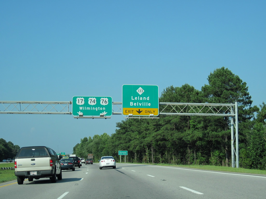
U.S. 17-74-76 advance 1.06 miles east to a diverging diamond interchange (DDI) with NC 133 (River Road) south and Village Road (SR 1472) north.
06/24/10
 North East
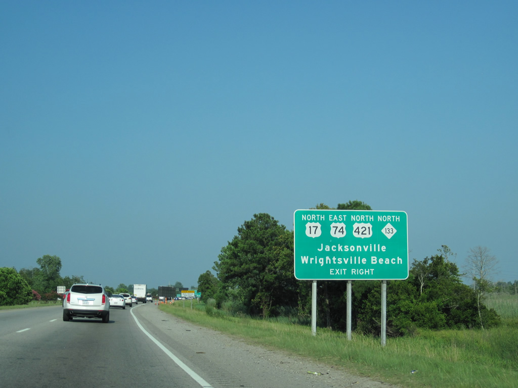
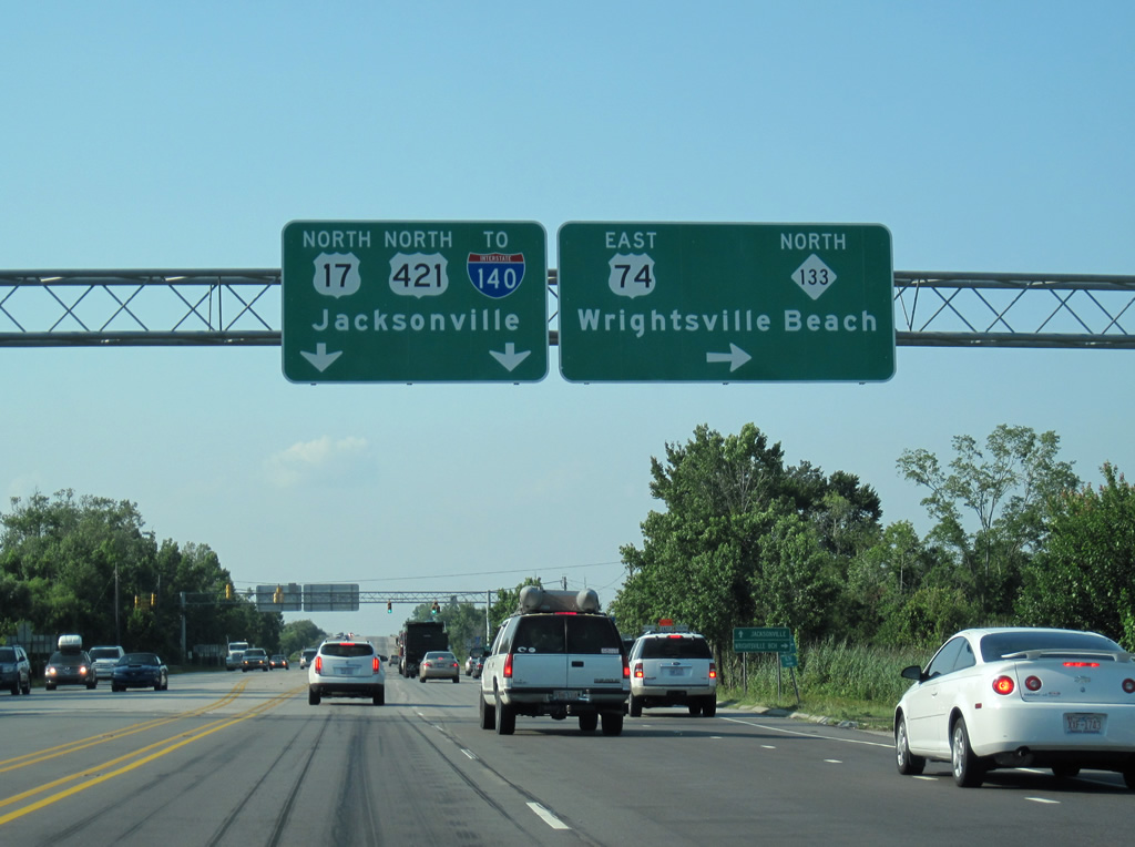
U.S. 74 east / NC 133 north part ways with U.S. 17 north / U.S. 76 east 1.57 miles beyond the Brunswick River at U.S. 421. U.S. 421 combines with U.S. 74 northward from the U.S.S. North Carolina Battleship Memorial to the Isabel Holmes Bridge over the Cape Fear River.
06/24/10
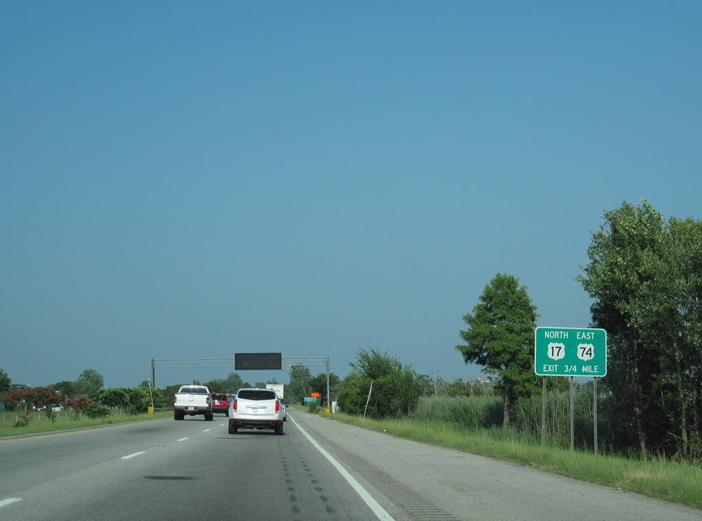
A third eastbound lane was constructed during the Causeway Bridge Project to the trumpet interchange with U.S. 421.
06/24/10
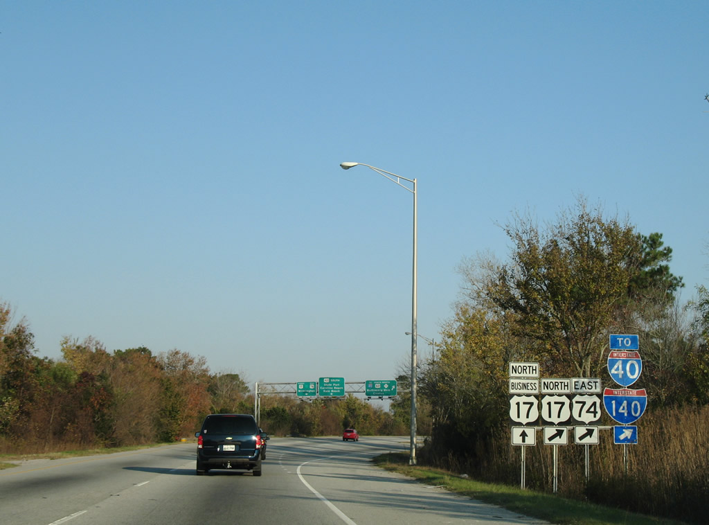
U.S. 17 was realigned to bypass Wilmington along I-140 from 2006 to 2017. The former route into Wilmington was redesignated as U.S. 17 Business during that time frame.
11/11/06
East  North
North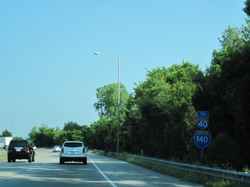
A set of trailblazers for I-40 and I-140 stand along the transition ramp taking U.S. 74 east / NC 133 north onto U.S. 421 north. I-140 opened east from U.S. 421 to I-40 on June 30, 2006.
06/24/10

The USS North Carolina Battleship is permanently moored across from Downtown Wilmington as a floating memorial. U.S. 74-421 / NC 133 cross the New Hanover County line at USS North Carolina Road east.
06/24/10
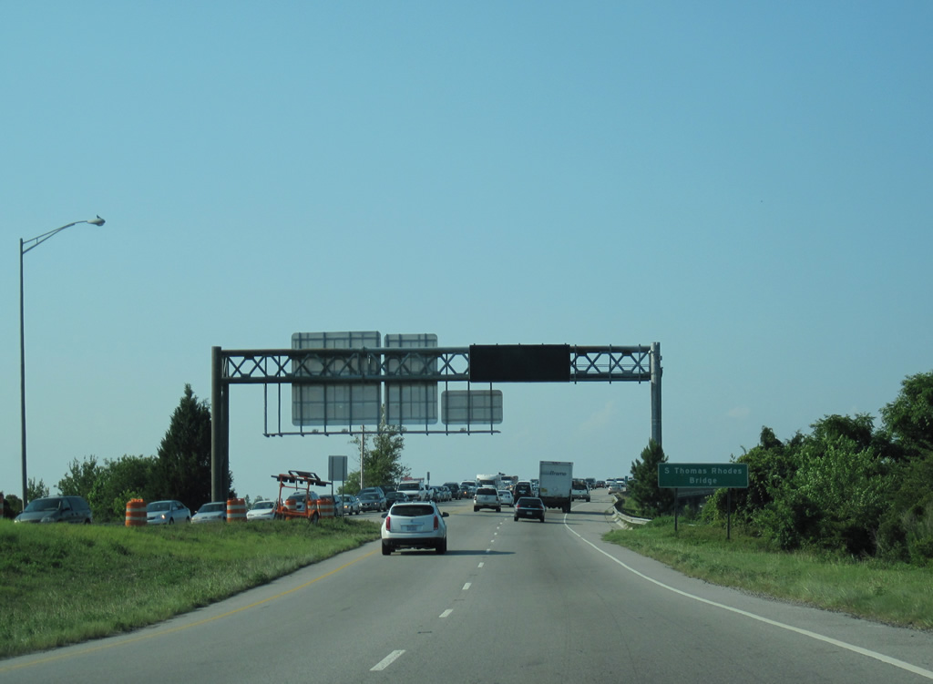
U.S. 74-421 span the Cape Fear River across the four lane wide S. Thomas Rhodes Bridge.
06/24/10

The Cape Fear River converges with the mouth of the Northeast Cape Fear River just northwest of Downtown Wilmington.
06/24/10
U.S. 74 provides a bypass of Wilmington for motorists bound for Wrightsville Beach via Martin Luther King, Jr. Parkway. U.S. 421 continues another 2.7 miles north to Interstate 140.
06/24/10
East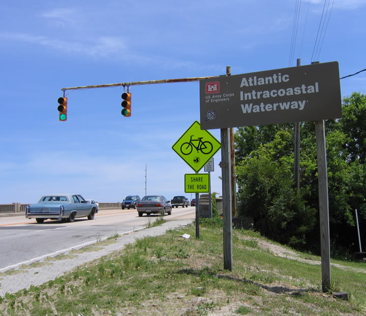
U.S. 74-76 east cross the Intracoastal Waterway over a drawbridge. Maintained by the United States Army Corps of Engineers, the Intracoastal Waterway offers a commercial and recreational waterway along the Atlantic Ocean between Key West, Florida, and Boston, Massachusetts. The waterway connects existing waterways between the mainland and barrier islands, and it includes some sections that were dredged or created by the Army Corps in the 20th Century. Various boats and ships use the waterway because it has a minimum depth of 12 feet.
05/29/05
East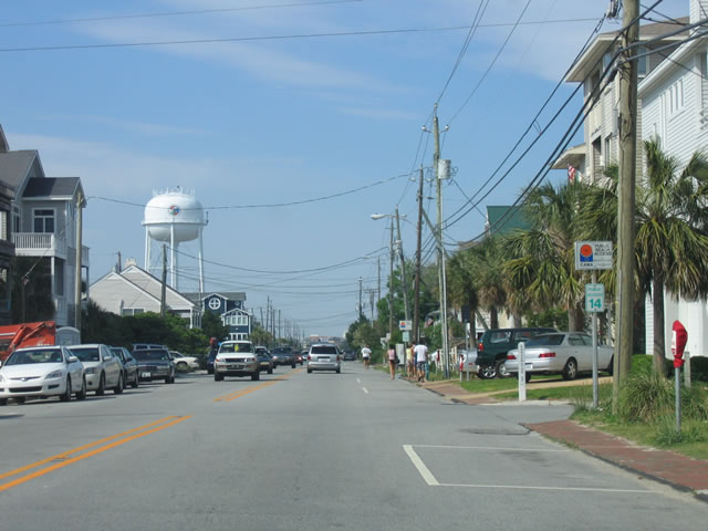
Salisbury Street spans Banks Channel and connects with Lumina Avenue near Johnnie Mercers Fishing Pier. The easternmost 1.73 miles of U.S. 74 follow Lumina Avenue to the northern end of the island. The route is unmarked along this stretch, passing Shearwater Street and beach access #14 in this scene.
05/29/05
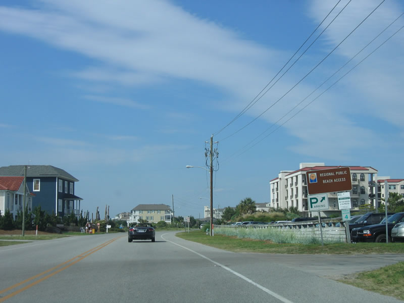
Advancing beyond North Ridge Lane, U.S. 74 (Lumina Avenue) reaches beach access #4 across from marshland at Middle Sound.
05/29/05
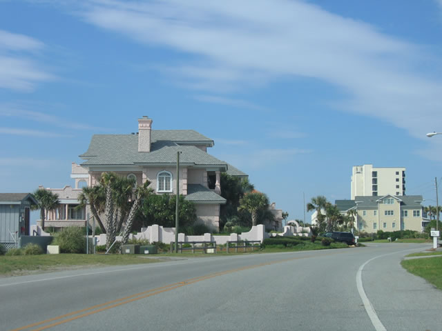
Lumina Avenue winds through a series of subtle S-curves to the north end of Wrightsville Beach.
05/29/05

This cul-de-sac at beach access #1 represents the eastern terminus of U.S. 74. Unlike U.S. 76 at the south end of Wrightsville Beach, there are no signs formally marking the end point.
05/29/05
Photo Credits:
- ABRoads: 06/24/10
- Alex Nitzman, Justin Cozart: 11/11/06
- Andy Field: 05/29/05
Connect with:
Page Updated Wednesday September 12, 2018.