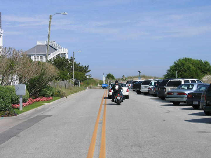
| U.S. 76 begins at the south end of Wrightsville Beach from a turnaround at Jack Parker Boulevard and Water Street. Jack Parker Boulevard connects with Lumina Avenue north by a regional beach access area off Masonboro Inlet. 05/29/05 |
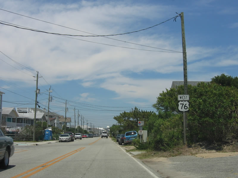
| This was the first reassurance shield for U.S. 76 on Lumina Avenue northbound in Wrightsville Beach. It was removed sometime before 2013. 05/29/05 |
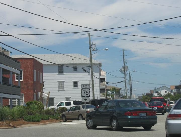
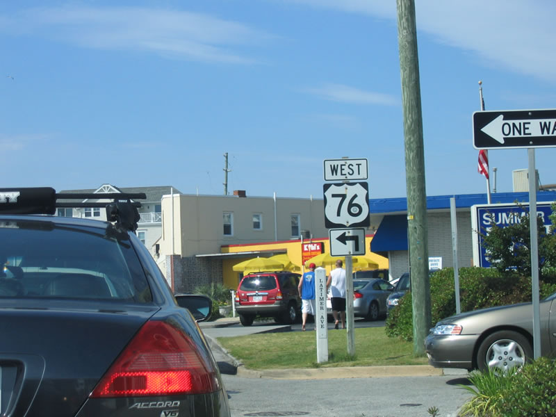
| U.S. 76 dog legs west from Lumina Avenue along Sunset Avenue to continue north along Waynick Boulevard. 05/29/05 |
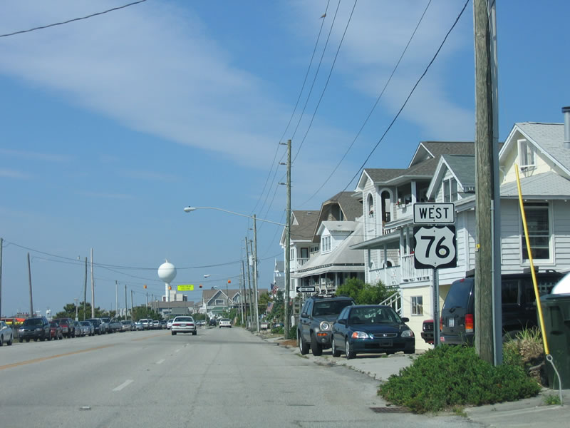
| Waynick Boulevard runs alongside Banks Channel northward with four lanes to Causeway Boulevard. A reassurance marker for U.S. 76 stands near Iula Street. 05/29/05 |
| U.S. 76 turns west from Waynick Boulevard onto Causeway Drive to cross Banks Channel. Causeway Drive links with Lumina Avenue north to U.S. 74 (Salisbury Street). 05/29/05 |
| U.S. 74/76 west span the Intracoastal Waterway from Harbor Island across a bascule bridge. 05/29/05 |
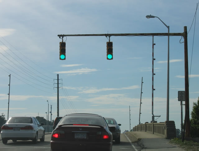
| The Wrightsville Beach Bridge along U.S. 74/76 was built in 1956. The 731 foot long span provides 20 feet of vertical clearance above the Intracoastal Waterway.1 05/29/05 |
| Upon descending from the Wrightsville Beach Bridge, U.S. 74-76 (Eastwood Road) enter the city of Wilmington. The two routes follow separate routes through the city, splitting 1.16 miles ahead at U.S. 17 (Military Cutoff Road). 05/29/05 |
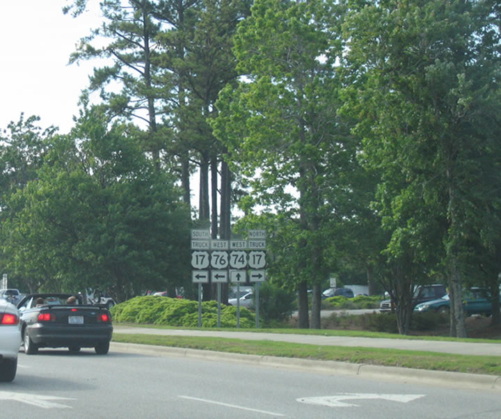
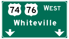
| U.S. 76 arcs westward alongside U.S. 17 (Military Cutoff Road) to Wooster/Dawson Streets in central Wilmington. U.S. 74 remains northwest along Eastwood Road to U.S. 17 Business (Market Street) and Martin Luther King, Jr. Parkway. 05/29/05 |
| U.S. 17 south / U.S. 76 west overlap 4.16 miles west from U.S. 74 (Eastwood Road) to U.S. 117/NC 132 (South College Road). The two routes bend northward beyond College Road toward Downtown Wilmington. 06/01/05 |
| Oleander Drive advances 2.41 miles west from U.S. 117/NC 132 (South College Road) to split into Wooster Street (westbound) and Dawson Street (eastbound). 06/01/05 |
| U.S. 17/76 partition into a one way couplet from Oleander Drive to the Cape Fear Memorial Bridge. These reassurance shields appear at the transition onto Wooster Street westbound. 06/01/05 |
| Wooster Street intersects 17th Street north just after Oleander Drive. 16th and 17th Streets formerly carried U.S. 17/74 north from Dawson/Wooster Streets to Market Street (U.S. 17 Business). 06/01/05 |
| Truck U.S. 17 followed Military Cutoff Road and Oleander Drive west to end at 16th Street in Wilmington. The realignment of U.S. 17 approved in 2015 overtook the former truck bypass, which was dropped in 2006. 06/01/05 |
| A pair of shield assemblies for the former U.S. 17/74/76 overlap lined Wooster Street west of 9th Street. These were removed by 2007. 06/01/05 |
| Continuing west along Wooster Street, U.S. 17/76 approaches U.S. 421 south and U.S. 17 Business north at 3rd Street. 06/01/05 |
| U.S. 421 spurs 21 miles south to Federal Point at Fort Fisher. U.S. 17 Business lines 3rd Street north eight blocks to Market Street at Downtown Wilmington. 06/01/05 |
| Wooster Street shifts onto an expressway west to the Cape Fear River Memorial Bridge. The lone shield assembly for U.S. 17-76-421 was posted just beyond 3rd Street. With completion of Martin Luther King, Jr. Parkway in September 2005, U.S. 74 was relocated northward onto the Parsley Street Bridge. 06/01/05 |
| A loop ramp joins the Cape Fear River Memorial Bridge westbound from Front Street. U.S. 421 departs from U.S. 17/76 west at the ensuing interchange on Eagle Island to combine with U.S. 74 and NC 133 north. 01/19/19 |
| This signal regulates traffic crossing the lift bridge. The Cape Fear Memorial Bridge opened to traffic on October 1, 1969. 01/19/19 |
| The lift bridge has a vertical clearance of 135 feet over the river, and it can be raised on signal 24 hours a day, seven days a week. The water is approximately 40 feet deep here, allowing large ships to navigate the river.2 01/19/19 |
| Metal grading forms the road deck of the movable portion of the Cape Fear Memorial Bridge. Drivers are cautioned of potential slippery conditions during inclement weather. 01/19/19 |
| After passing under the second tower, U.S. 17-76-421 enter a trumpet interchange with U.S. 74/NC 133 in Brunswick County. 01/19/19 |
| U.S. 421 follows a northeasterly trajectory from U.S. 74, paralleling I-40 between Wilmington and Greensboro, where the two routes meet. Beyond Greensboro, U.S. 421 generally trends west, exiting the Tarheel State northwest of Boone. 01/19/19 |
Page Updated 07-11-2020.