
U.S. 93
U.S. 93 runs from near Wickenburg, Arizona, northwest to Las Vegas alongside Interstate 11, then links with I-15 to head northeast to North Las Vegas and Dry Lake Valley. Beyond there, U.S. 93 follows the Great Basin Highway into the most desolate regions of eastern Nevada.
Similar to U.S. 95 in Nevada, U.S. 93 is mostly a two lane, rural highway except through southern Clark County. The US highway angles northwest from Kingman, Arizona along a multi lane, divided highway to Interstate 11 and the Hoover Dam Bypass across the Colorado River. The Interstate 11 corridor was established in 2012 along U.S. 93 between Phoenix and Henderson.
Prior to the completion of the Boulder City Bypass on August 9, 2018, U.S. 93 lowered into Boulder City west from the El Dorado Mountains along a four lane arterial. There it combined with U.S. 95 north. This alignment was redesignated U.S. 93 Business.
Interstate 11 and U.S. 93/95 overlap west around the Boulder City Bypass to Railroad Pass. I-11 overtook Interstate 515 along the Oran K. Gragson Freeway northwest to the Henderson Bowl Interchange joining I-215, I-515 and U.S. 93/95. I-11 replaced the remainder of I-515 northward alongside U.S. 93/95 to I-15 by Downtown Las Vegas.
U.S. 93 Nevada Guides
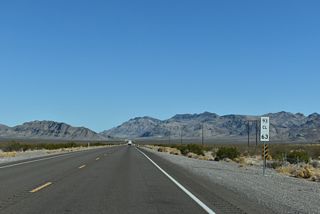
North - Garnet to Ash Springs - 69 photos
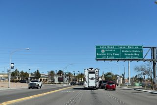
Business - Boulder City - 64 photos
Auxiliary Routes
History
U.S. 93 was commissioned in stages:
- 1927 -- north of U.S. 40 (now Interstate 80) and Wells
- 1932 -- between Wells and U.S. 93 (now Interstate 15) at Glendale
- 1936 -- between Glendale and Boulder City after the opening of Boulder Dam (shared with U.S. 466)
U.S. 93 was rerouted in 1966 to connect with Interstate 15 (U.S. 91) at Garnet rather than Glendale. The original alignment of U.S. 93 from east of Coyote Spring Valley to Glendale is a part of Nevada State Route 168 today. The opening of the Mike O'Callaghan - Pat Tillman Memorial Bridge on October 19, 20101 shifted U.S. 93 off Hoover Dam and onto the Hoover Dam Bypass freeway.
Until 1972, U.S. 93 was paired with U.S. 466 from Kingman to Las Vegas. The duplicative routing was eliminated eight years after the state of California eliminated its section of U.S. 466 west of Barstow and renumbering it to State Route 58.
Originally, U.S. 93-466 followed Boulder Highway north from Henderson to Fremont Street west and Main Street north through Las Vegas. Salt Lake Highway led the route north to Great Basin Highway. With completed segments of Interstate 515 (Oran K. Gragson Freeway) open to traffic southeast from Downtown Las Vegas, U.S. 93 and U.S. 95 were realigned accordingly from Fremont Street and Boulder Highway. The two routes changed course three times until the freeway was finished south around Henderson. This included a portion of Lake Mead Parkway west from Boulder Highway to the temporary freeway end.
Guide
U.S. 93 enters Nevada alongside Interstate 11 on the 3.5 mile long Hoover Dam Bypass freeway. Spanning the Colorado River and Black Canyon south of Hoover Dam, I-11/U.S. 93 cross the Mike O'Callaghan - Pat Tillman Memorial Bridge, the longest single-span concrete arch bridge in the western hemisphere. 250 feet higher than nearby Hoover Damn, the 1,900 foot long bridge includes a walkway along the north side, allowing visitors unobstructed views. This bridge opened to traffic on October 19, 2010 as part of a $240 million project that included the approach freeway.1
Hoover Dam Bypass
Construction on Hoover Dam began in 1931. On September 30, 1935, the Hoover Dam, named Boulder Dam from 1935 to 1947, was dedicated by President Franklin D. Roosevelt. Built across the flood prone Colorado River in the Black Canyon, the massive dam created a resource for water and power in an arid region. Considered one of the engineering marvels of the world, it reduced flooding on the Lower Colorado River; created irrigation for Southern Nevada, Arizona, and California's Imperial Valley; created one of the largest man made reservoirs in the world; provided hydroelectric power to the entire Southwest; employed hundreds of Great Depression-era workers; and provided a transportation link (U.S. 93) between Arizona and Nevada (Muskal, 2010).2
In 1950, Las Vegas had a population of just 24,624, and Phoenix had 106,818 residents. In 1970, five years after the Bureau of Reclamation conducted the "US 93-466 Hoover Dam Origin and Destination Study," covering traffic problems at Hoover Dam, the population of Las Vegas increased to 125,787 while Phoenix grew to 584,303 people. By 1999, Las Vegas had a population of over 460,000, and Phoenix, over 1,260,000. Traffic counts across Hoover Dam were 11,500 vehicles per day (vpd) in 1997.
Eleven possible crossings over the Colorado River were studied for U.S. 93 by 1998, and three crossings were identified as preferable. Ultimately the Sugarloaf alternative was chosen, with a composite concrete arch bridge selected for the crossing over Black Rock Canyon. The Environmental Impact Statement for the alternative was completed and adopted on March 22, 2001.
Congress designated the name of the proposed bridge in a 2004 transportation bill. The span honors Pat Tillman, a former Arizona Cardinals player who joined the U.S. Army after September 11, 2001. Tillman was killed in Spring 2004 during a friendly fire incident in Afghanistan. O'Callaghan was a two-term Governor of Nevada who passed away in 2004.1,2
Construction began on the 890 foot high bridge over the Colorado River on February 14, 2005. 440 concrete blocks were cast to make up the columns supporting the bridge deck. Upon their completion, work commenced on the 1,060 foot arch. The gap in the arch was closed in August 2009.2
Within the U.S., only the Royal Gorge Bridge across the Arkansas River in central Colorado is higher than the Mike O'Callaghan - Pat Tillman Memorial Bridge (Muskal, 2010).2
Prior to opening of the O'Callaghan-Tillman Bridge in October 2010, U.S. 93 remained across the top of Hoover Dam. The dam, which holds back sparkling blue Lake Mead, was closed to through traffic once the arch bridge was complete. The Arizona approach was gated, and the approach to the dam from Boulder City, Nevada, was redesignated as Nevada State Route 172. Completion of the bridge eliminated a major traffic bottleneck and allowed commercial trucks to once again use U.S. 93. Trucks were previously banned due to security concerns after the events of September 11, 2001.1
Approximately 2.2 miles of the Hoover Dam Bypass were built in Nevada, along with a 1.1 mile approach in Arizona. The four lane freeway includes a 400 foot long bridge over Gold Strike Canyon. Curving around Sugarloaf Mountain in Arizona, an 800 foot long bridge spans the old alignment of U.S. 93. Further south, two bighorn sheep overpasses were built to alleviate wildlife concerns.
Boulder City
Opened on August 9, 2018, the Boulder City Bypass shifted U.S. 93 around Boulder City as part of Interstate 11. The 12.5 mile long route separates from U.S. 93 Business (Boulder City Parkway) at the El Dorado Mountains, looping south through the open desert of El Dorado Valley to meet U.S. 95 at a parclo interchange. The freeway converged with the previous expressway along U.S. 93/95 at Railroad Pass, where construction upgraded the highway northwest to limited access standards.
A Record of Decision selecting Alternative D for the Boulder City Bypass was approved on December 8, 2005.3 Naturally occurring asbestos in the project area however resulted in an Environment Re-evaluation. The new environmental study was completed by the Nevada Department of Transportation (NDOT) and the Federal Highway Administration (FHWA) granted a second Record of Decision to the RTC in December 2014. With NDOT developing the western 2.5 mile segment and RTC the remainder of the route east to Hoover Dam, construction on the two phase project commenced in Spring 2015.
Las Vegas
U.S. 93 and U.S. 95 combine with Interstate 11 along the Oran K. Gragson Freeway from Henderson to the Spaghetti Bowl interchange with I-15 near Downtown Las Vegas. I-15/U.S. 93 overlap 21 miles northeast to North Las Vegas, Apex and the Garnet Interchange. I-11/U.S. 95 continue along the Oran K. Gragson Freeway west to Summerlin and north to SR 157 (Kyle Canyon Road).
U.S. 93 splits with I-15 at Exit 64 by the railroad siding of Garnett. The route ventures north along the Great Basin Highway by Arrow Canyon Range to some of the emptiest, most desolate and beautiful terrain in the United States.
Great Basin Highway
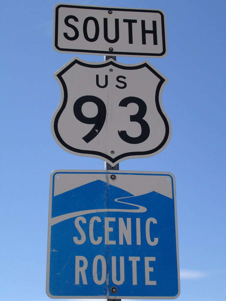
North of Las Vegas, U.S. 93 becomes a contender for the title of "The Loneliest Highway" in America (a title that is bestowed upon U.S. 50). There are only a few towns between I-15 and I-80, with Ely shining as the one "big city" in all of Eastern Nevada. U.S. 93 (Great Basin Highway) is considered to be a scenic route for much of this route, especially through Lake Valley between Panaca and Majors Place. The US highway overlaps with U.S. 6-50 at Majors Place west into Ely.
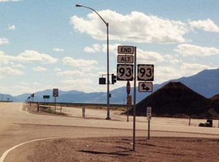
55 miles north of Ely Airport (ELY), U.S. 93 separates with U.S. 93 Alternate. U.S. 93 heads toward Wells through Clover Valley, while U.S. 93 Alternate heads northeast across the Antelope Range toward West Wendover and Interstate 80 east to Salt Lake City.
U.S. 93 Alternate returns to U.S. 93 along Interstate 80 west at Wells. North from I-80, U.S. 93 continues 67 miles to Jackpot, an unincorporated community just south of the Idaho state line. The town of 1,000 is geared for Idahoans who wish to gamble. The northern segment of Great Basin Highway attracts more traffic, since U.S. 93 provides the most direct route to Twin Falls, Idaho, and the fertile Magic Valley.
U.S. 93 Auxiliary Routes
- U.S. 93 Alternate loops east from U.S. 93 at Lages Station to Wells via the border town of Wendover. The bannered route was established by AASHTO on November 12, 1976, replacing former U.S. 50 Alternate north from Lages Station to West Wendover, and overlapping with Interstate 80 northwest back to U.S. 93 at Wells.
- U.S. 93 Business was a former route along Boulder Highway and Fremont Street through the Las Vegas area. These arterials were dually signed with U.S. 95 Business after the Interstate 515 freeway opened to traffic. The shared business route was later eliminated in favor of Nevada State Route 582.
- U.S. 93 Business may have been posted through Boulder City along what was Nevada State Route 500. U.S. 93 Business was established along Boulder City Parkway in 2018 when Interstate 11 was completed.
 South
South
Business Loop I-80 east in Wells reconnects with I-80 south from Sixth Street alongside U.S. 93 (Great Basin Highway).
09/08/05

U.S. 93 south and Business Loop I-80 enter the diamond interchange with Interstate 80 at Exit 352. I-80 travels west to Elko and southeast with U.S. 93 ALT to West Wendover. U.S. 93 continues 78 miles south to U.S. 93 ALT at Lages Station.
09/08/05

U.S. 93 south at the city of Ely. Ely is the seat of White Pine County and sits at an elevation of 6,435 feet above sea level. Located at the cross roads of U.S. 6/50/93, the local economy depends on nearby mines and tourism.
08/15/07
Replaced after 2011, this cutout shield for U.S. 93 stood south of the separation with U.S. 6/50 east at Majors Place in the Spring Valley.
06/20/10
References:
- "Hoover Dam bypass bridge opens to traffic." Las Vegas Sun (NV), October 20, 2010. http://www.lasvegassun.com/news/2010/oct/20/hoover-dam-bypass-bridge-opens-traffic/
- "Hoover Dam bypass bridge an American triumph." The Arizona Republic, October 17, 2010. http://www.azcentral.com/news/articles/2010/10/17/20101017hoover-dam-bypass-bridge-opening.html
- "Henderson residents pleased with change to Boulder City bypass." Las Vegas Sun (NV), October 26, 2010. http://www.lasvegassun.com/news/2010/oct/26/henderson-residents-pleased-change-boulder-city-by/
Muskal, M. (2010, October 15). Hoover Dam bypass bridge dedicated: Soaring 890 feet above the Colorado River, it eliminates a 75-mile detour for commercial trucks. Los Angeles Times. http://articles.latimes.com/2010/oct/15/nation/la-na-hoover-bridge-20101015
Photo Credits:
- AARoads: 09/08/05
- Jose Gutierrez: 08/15/07
- Mark Galbreath: 06/20/10
Connect with:


Page Updated Tuesday November 25, 2025.