
U.S 95 Alternate South

 West
West  South
South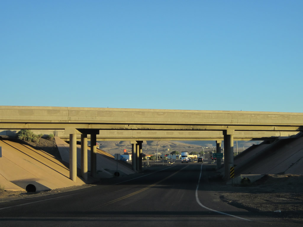
U.S. 95 Alternate departs from I-80 west at a diamond interchange with Business Loop I-80 on the north side of Fernley.
07/31/12
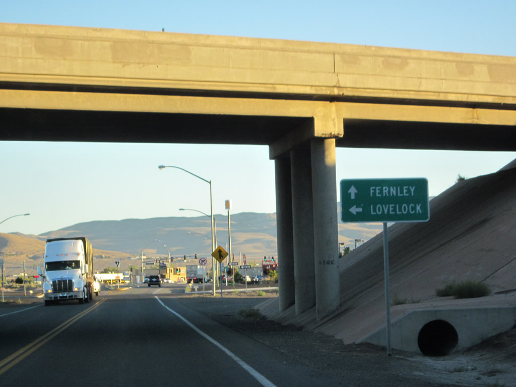
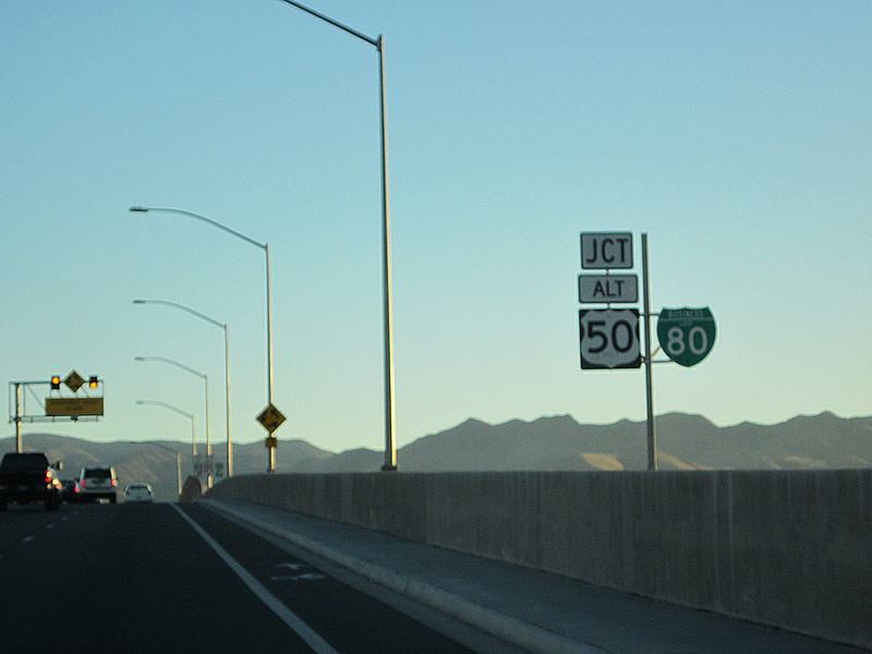
Passing under Interstate 80, U.S. 95 Alternate intersects the eastbound ramp back to Lovelock. Business Loop I-80 begins here and overlays the US highway south to Main Street.
07/31/12

A confirming marker for U.S. 95 Alternate stands just south of I-80. Business Loop I-80 is unmarked.
07/31/12
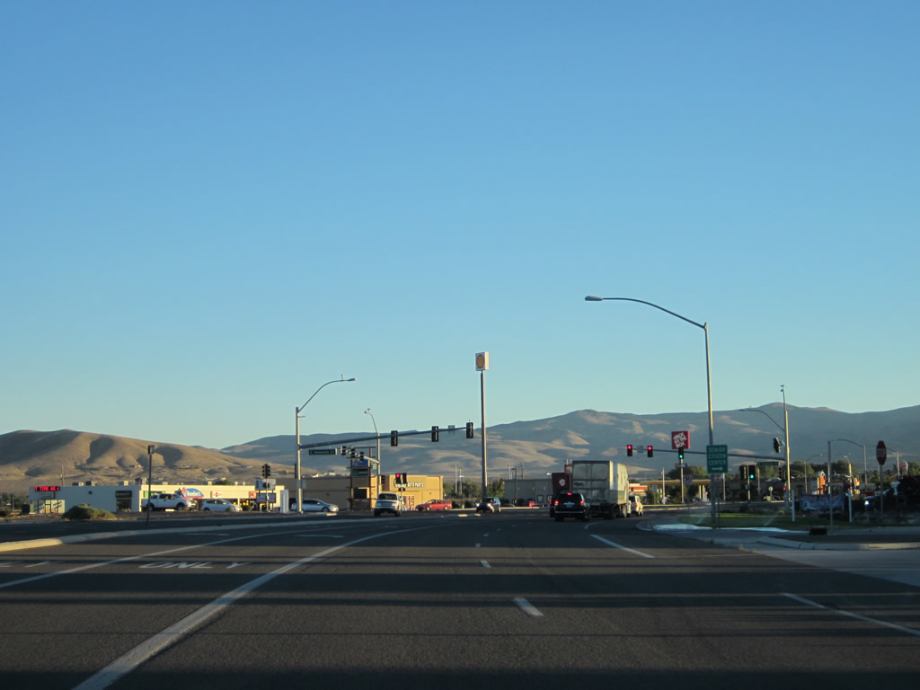
Most motorist services, and big box retail, are available south of the East Fernley Interchange along Business Loop I-80. Newlands Drive meets the arterial at the first of two signals.
07/31/12
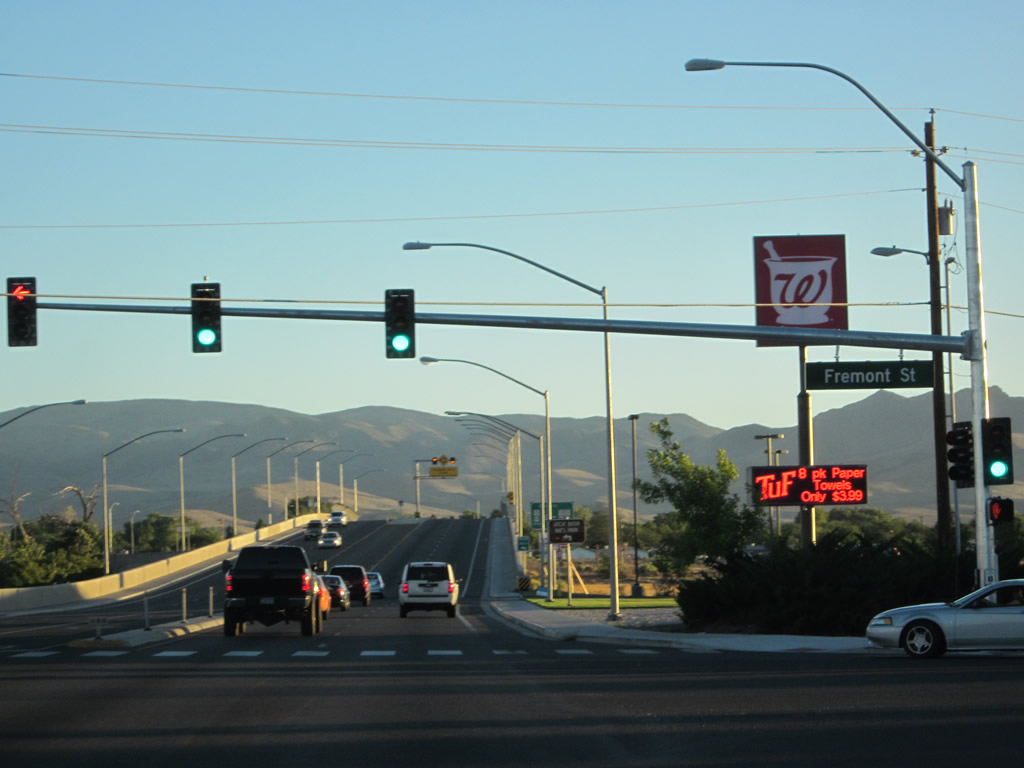
The following traffic signal along U.S. 95 ALT south / Business Loop I-80 west is with Fremont Street west and Chisholm Trail south.
07/31/12
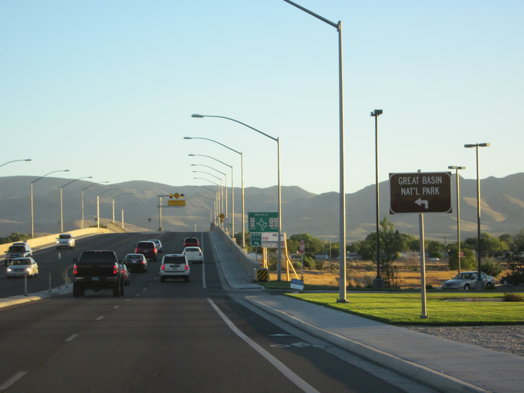
The four lane arterial ascends over a Union Pacific Railroad line ahead of the roundabout with U.S. 50 Alternate (Main Street) and Farm District Road (SR 828). Travelers headed to Great Basin National Park are directed onto forthcoming U.S. 50A east.
07/31/12
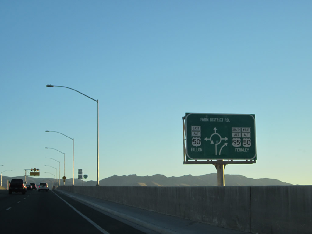
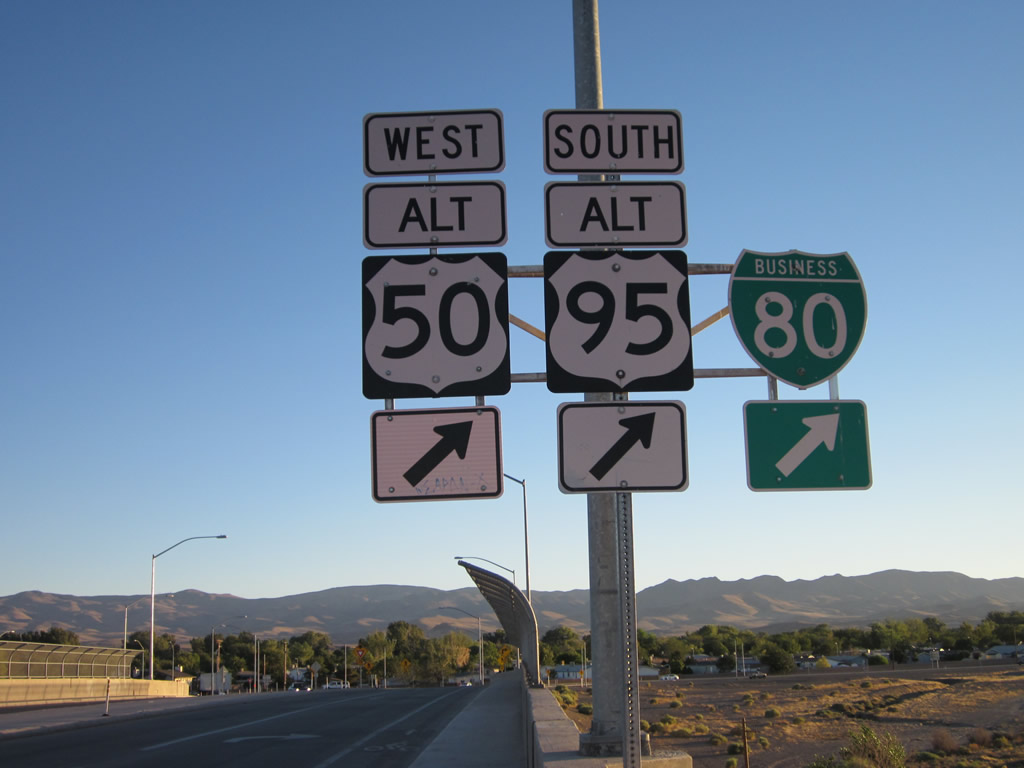
A diagrammatic sign outlines the upcoming roundabout with Farm District Road south and U.S. 50 Alternate (Main Street) east. Omitted from the sign is a Business Loop I-80, which follows Main Street west.
07/31/12
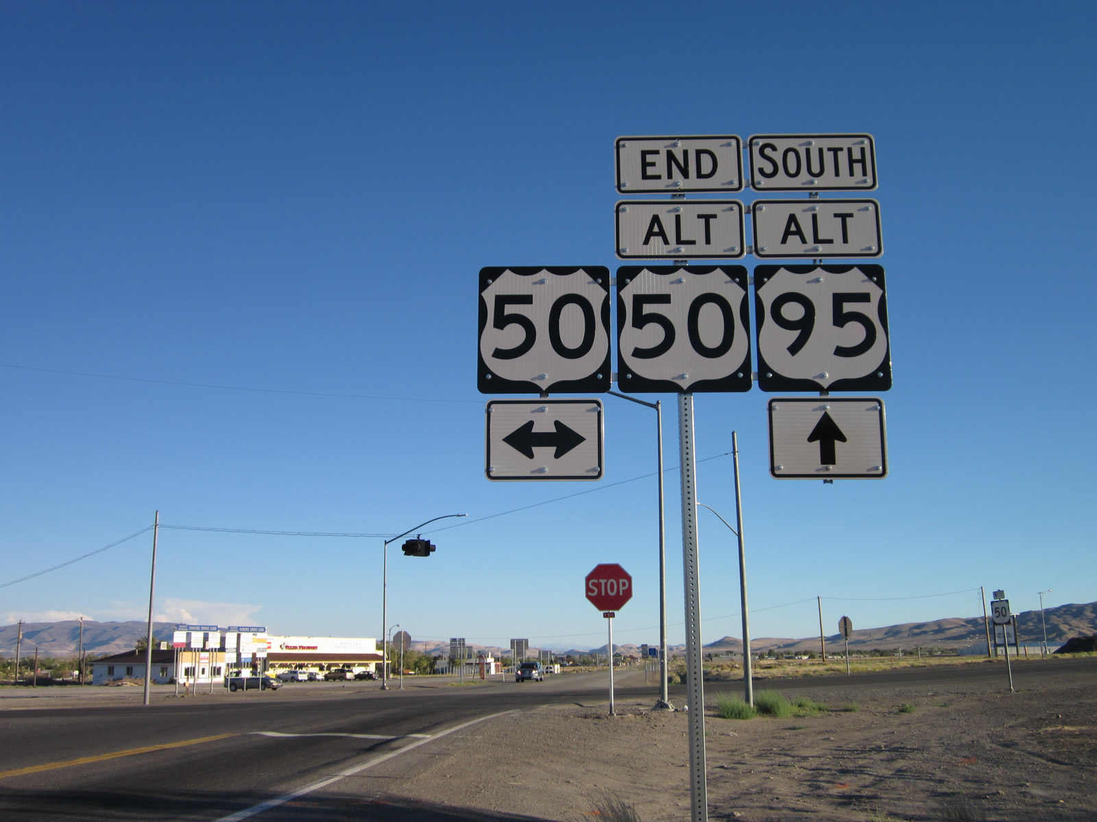
U.S. 50 Alternate travels 17 miles southeast from Business Loop I-80 to U.S. 50 near Fallon.
07/31/12
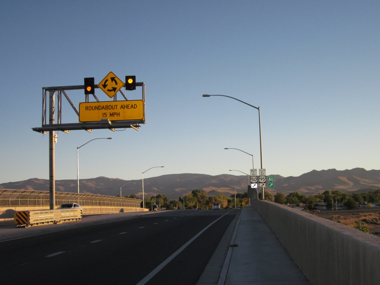
Motorists are advised to slow to 15 miles per hour as U.S. 95 Alternate lowers from the UP Railroad viaduct directly into the roundabout with Main Street.
07/31/12
Business Loop I-80/U.S. 50-95 ALT overlap for 1.3 miles from Farm District Road west through the Fernley business district.
07/31/12
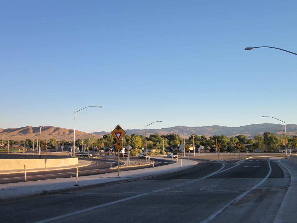
The roundabout linking Main Street, Farm District Road and Business Loop I-80 uses bypass lanes in all directions, allowing free flowing right turns. SR 828 (Farm District Road) begins here and lead south and east to parallel the Truckee Canal. The route runs 7.7 miles east to U.S. 50 Alternate.
07/31/12
 West South
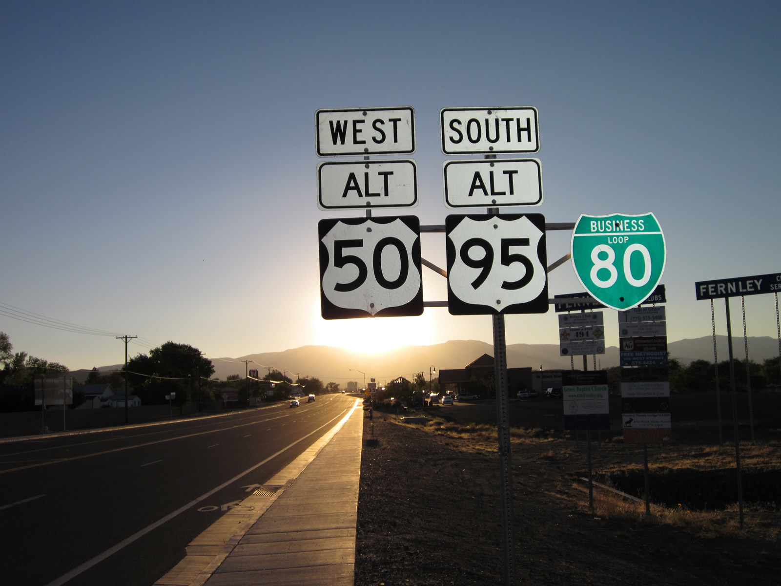
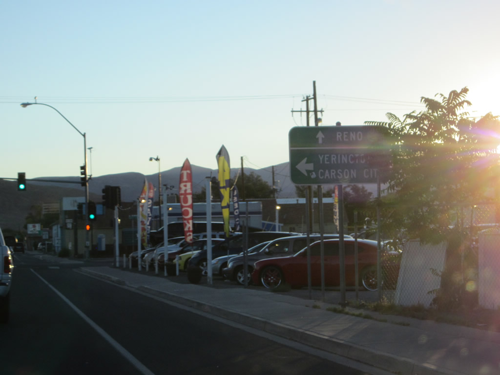
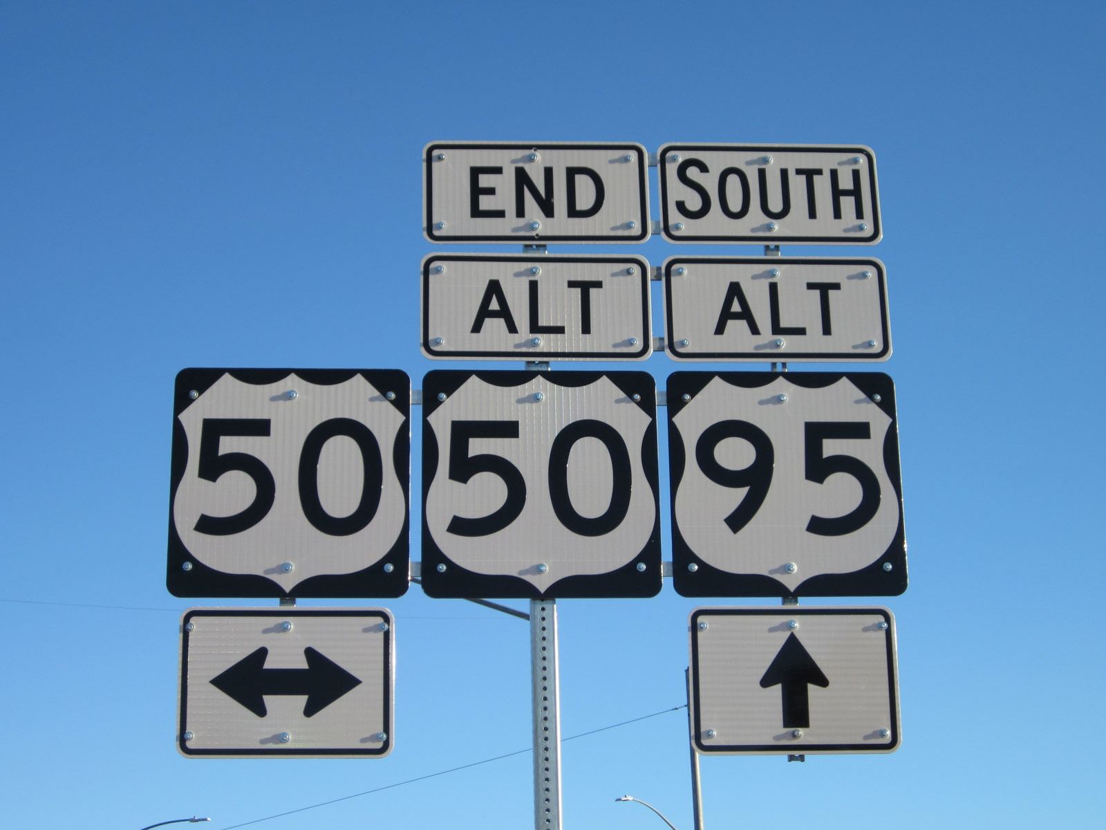
Confirming shields for U.S. 50A west, U.S. 95A south and Business Loop I-80 west posted after the roundabout with Farm District Road (SR 828).
07/31/12
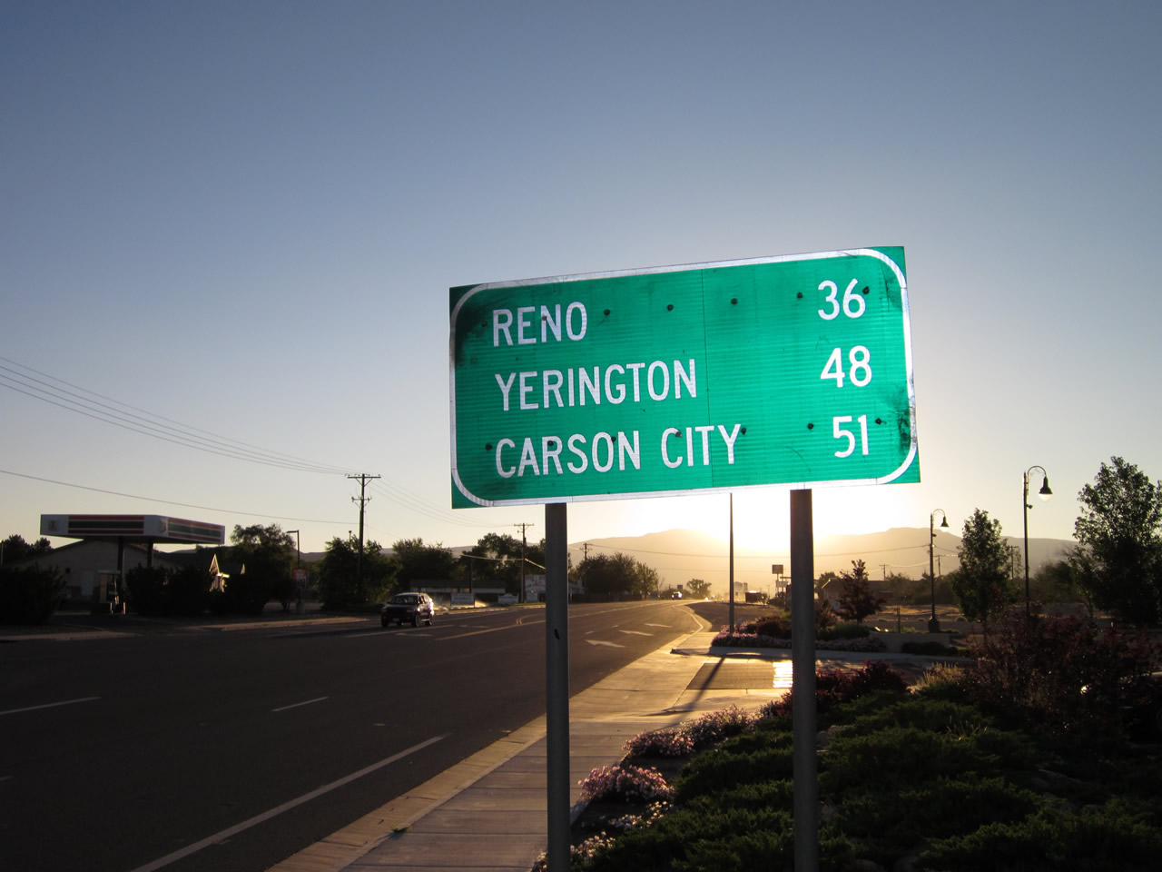
This distance sign along Main Street west provides the distance to Reno (36 miles via Business Loop I-80 and I-80 west), Yerington (48 miles via U.S. 95 Alternate south) and Carson City (51 miles via U.S. 50 Alternate and U.S. 50 west).
07/31/12
Separating from Business Loop I-80 at Downtown Fernley, U.S. 50-95 ALT continue south 14.1 miles to U.S. 50 at Silver Springs.
07/31/12
Remaining west along Main Street (Historic U.S. 40), Business Loop I-80 combines with SR 427 from U.S. 50A and 95A through Wadsworth.
07/31/12
West South
U.S. 50-95 ALT traverse the Virginia Range south from Fernley to Silver Springs and U.S. 50.
07/31/12
U.S. 50 (Lincoln Highway) branches 18.4 miles southwest from U.S. 50A and the Lahontan Valley to intersect U.S. 95 Alternate at Silver Springs. U.S. 50 advances west from here to Carson City and Lake Tahoe.
07/31/12
 South
South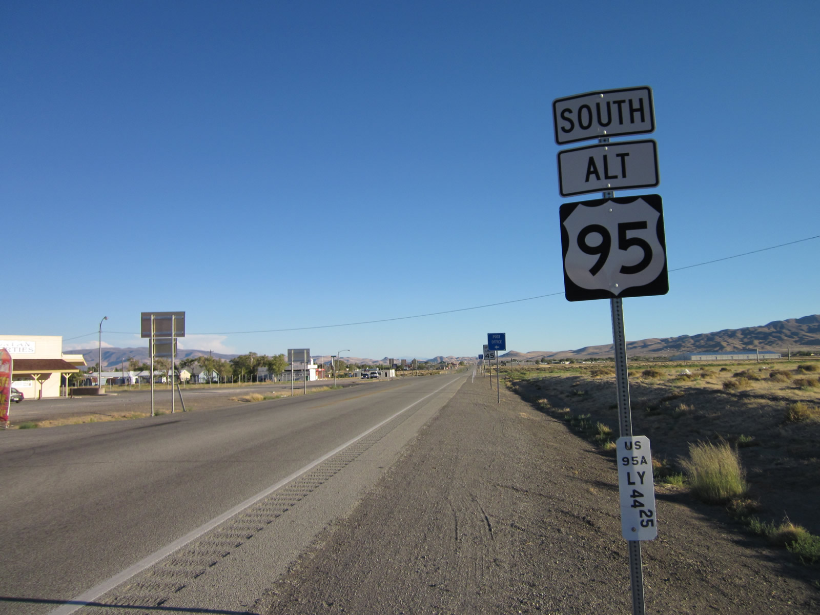
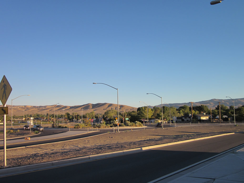
South from U.S. 50 and Silver Springs, U.S. 95 Alternate travels 54.93 miles via Yerington (seat of Lyon County) to U.S. 95 in Schurz, with the final 10.68 miles in Mineral County.
07/31/12
Photo Credits:
- Andy Field: 07/31/12
Page Updated Wednesday July 12, 2017.