
U.S. 101 North - California to Brookings
 North
North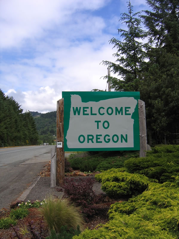
Crossing from California, this sign welcomes northbound U.S. 101 (Oregon Coast Highway) travelers into the state of Oregon, the Beaver State. Added to the United States on February 14, 1859, Oregon has a population of 3,421,399 as of the 2000 Census. U.S. 101 stays close to the coast for its entire route, keeping it within the lush forested areas of the beautiful coastline. Rainfall is plentiful along the coast, but inland areas east of the Cascade Mountains are generally drier and more arid.
05/28/06
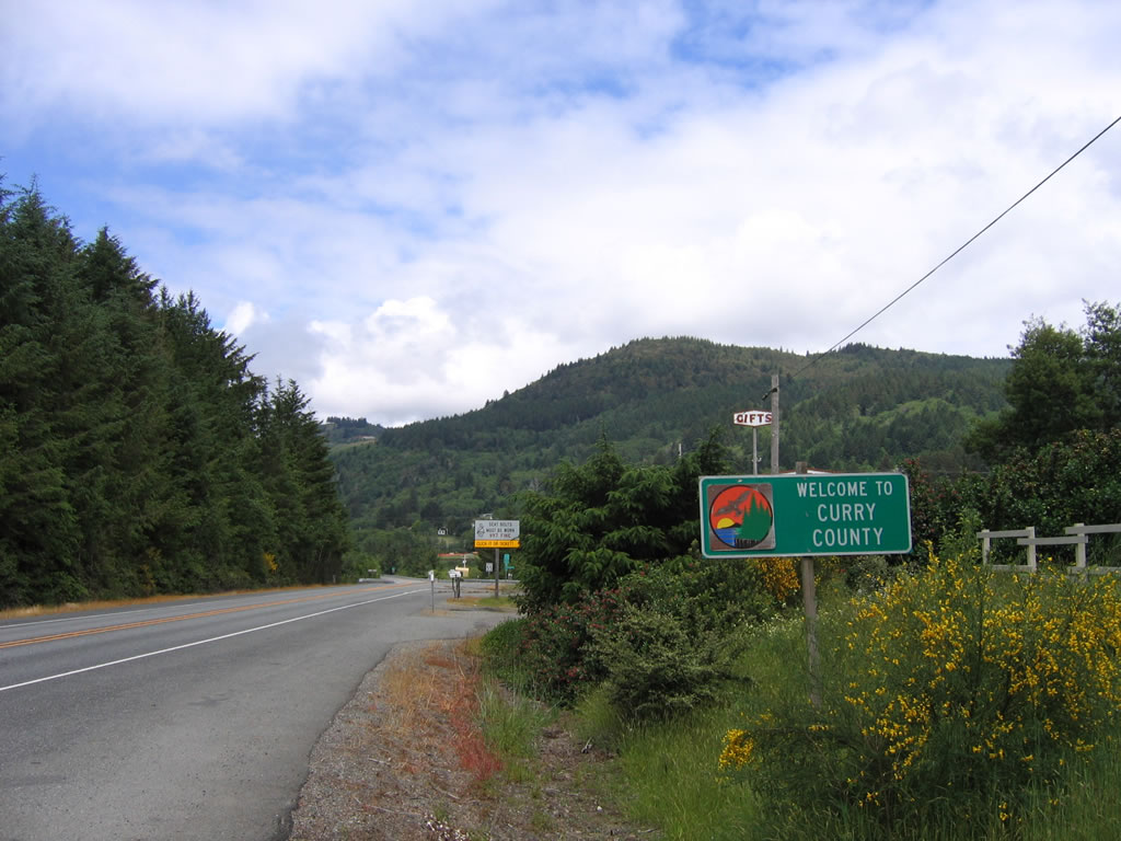
U.S. 101 enters Curry County, which was founded on December 18, 1855, upon splitting from Coos County to the north. Curry County consists of 1648 square miles, and Gold Beach ("where the Rogue River meets the Pacific Ocean") serves as the county seat.
05/28/06
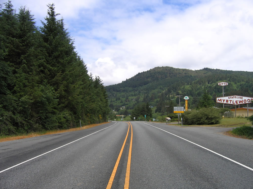
A gift shop selling items made of myrtlewood sits on the north side of the Oregon-California State Line. A hexagonal sign welcomes travelers to the store selling myrtlewood and invites them to visit the gift shop at the state line. "Myrtlewood" is a broadleaf evergreen tree native to Southwestern Oregon and Northwestern California; its wood is used for arts and crafts (such as wooden bowls) due to its hard surface and polish. However, myrtlewood grows very slowly and is normally not usable for crafts until after the tree is 100 years old.
05/28/06
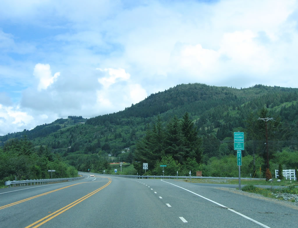
A green milepost identifies the mileage along the Oregon Coast Highway. Known for its scenic ocean views and historic bridges designed by Conde B. McCullough, U.S. 101 follows the Oregon Coast Highway for its entire route. The mileage counts down from south to north, which is standard for mileposts in Oregon (except on Interstate highways, which count from south to north). The intersection ahead is with State Line Road, and an Oregon-standard "Speed 55" sign is posted shortly thereafter.
05/28/06
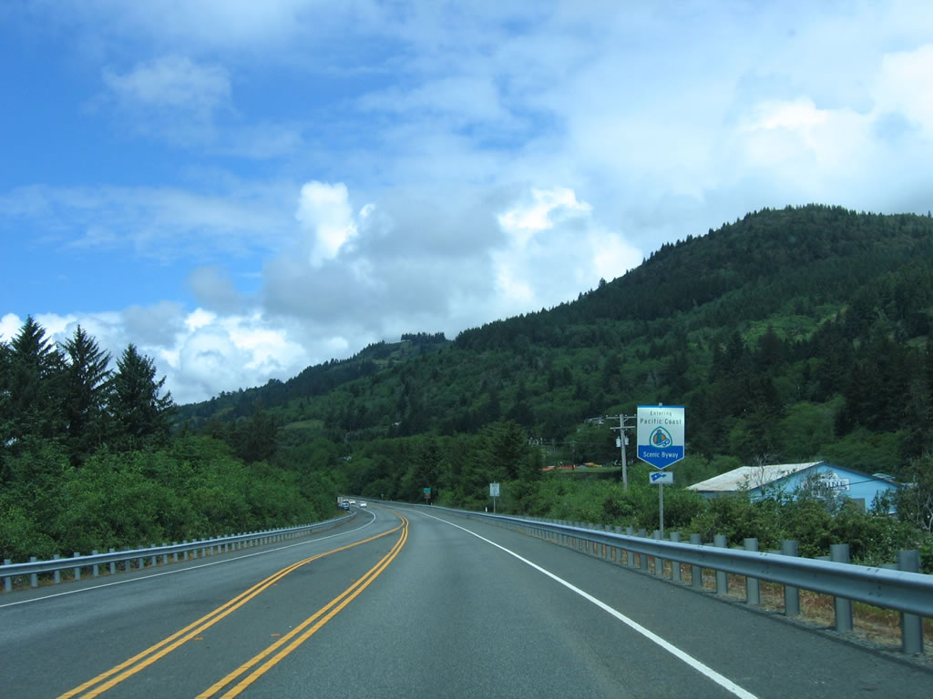
U.S. 101/Oregon Coast Highway follows the Pacific Coast Scenic Byway as it travels north from the state line toward Brookings.
05/28/06
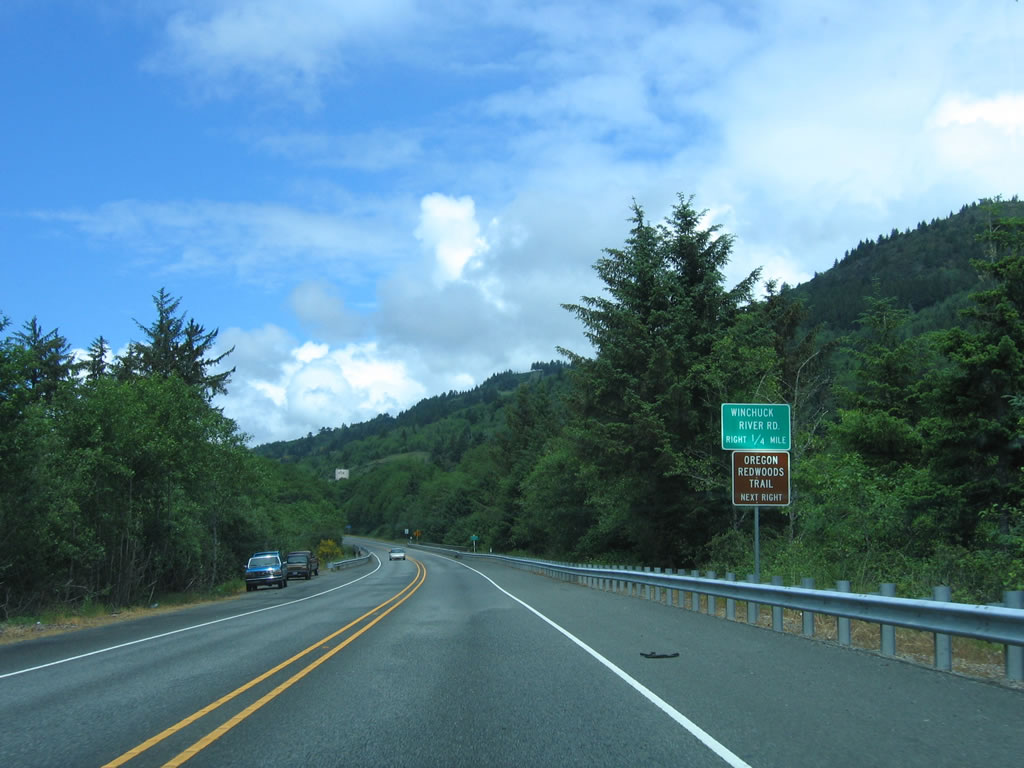
Northbound U.S. 101/Oregon Coast Highway approaches Junction Curry County Route 896/Winchuck River Road, one-quarter mile. Use this route east for the Oregon Redwoods Trail.
05/28/06
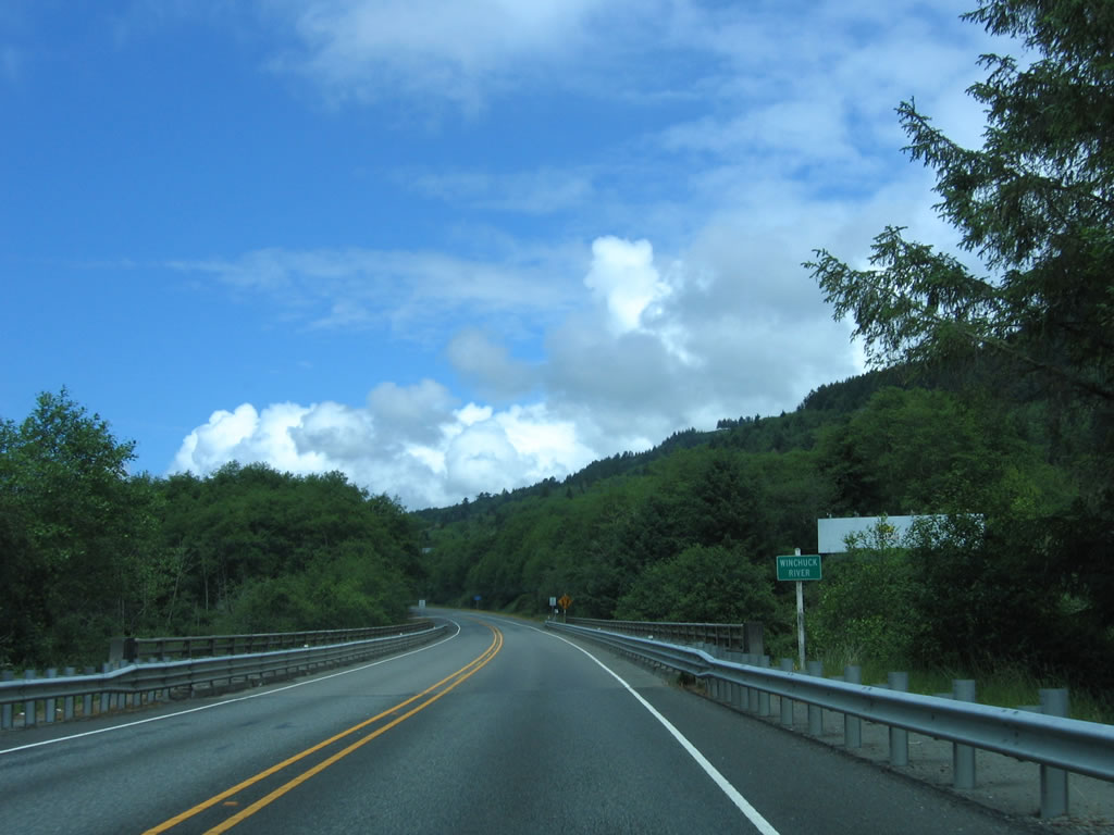
Crossing over the Winchuck River, northbound U.S. 101/Oregon Coast Highway continues toward Brookings.
05/28/06
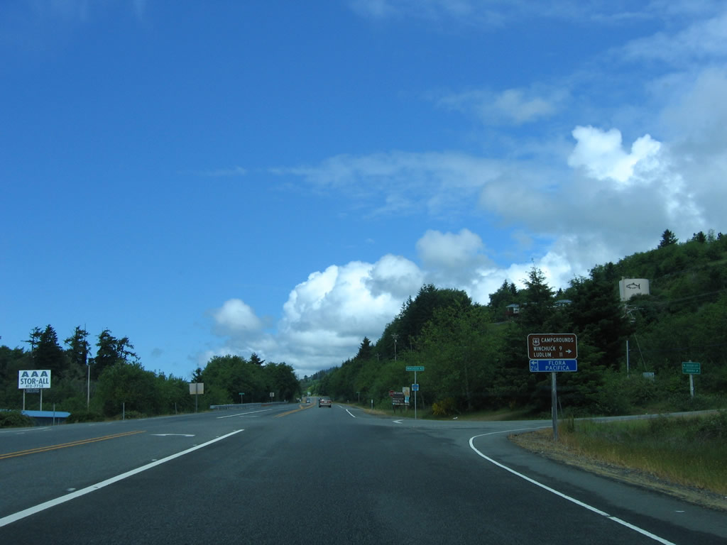
Northbound U.S. 101/Oregon Coast Highway meets Junction Curry County Route 896/Winchuck River Road. Turn right to Winchuck and Ludlum campgrounds and turn left to Flora Pacifica.
05/28/06

U.S. 101 widens to four lanes, with two lanes in each direction. On the right (east) side of the highway is Oregon's Largest Monterey Cypress Tree, which is located at Chetco Valley Museum and was planted in the 1850s by Harrison Blake when he built his house on this site. Use Museum Road east to the tree and museum.
05/28/06
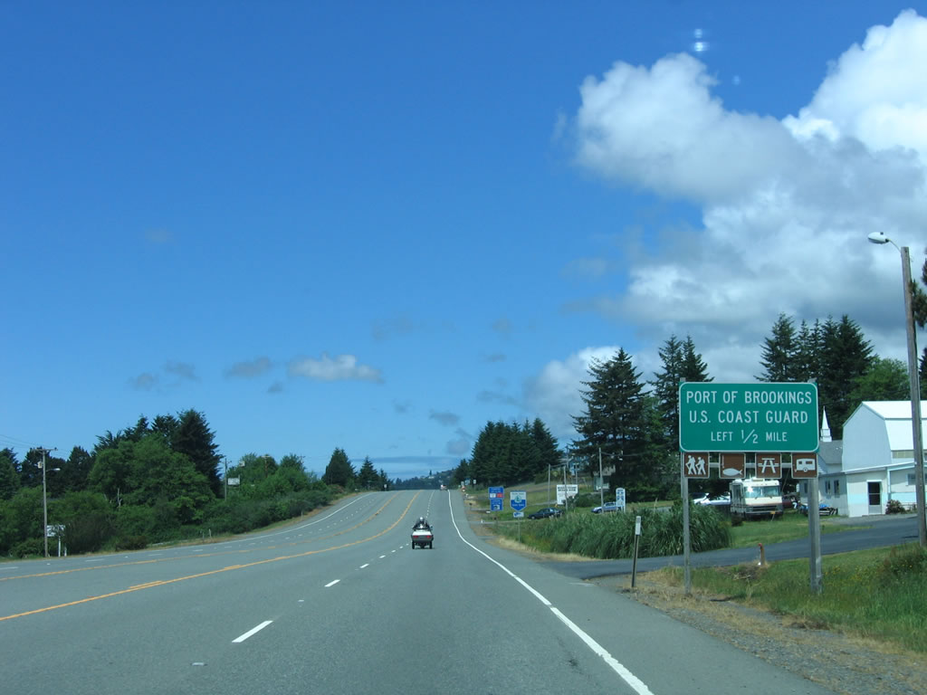
Continuing north after the Museum Road intersection, U.S. 101 approaches the Port of Brookings, which is also signed as the harbor. Use the left turn lane to connect to the harbor at the next traffic signal.
05/28/06
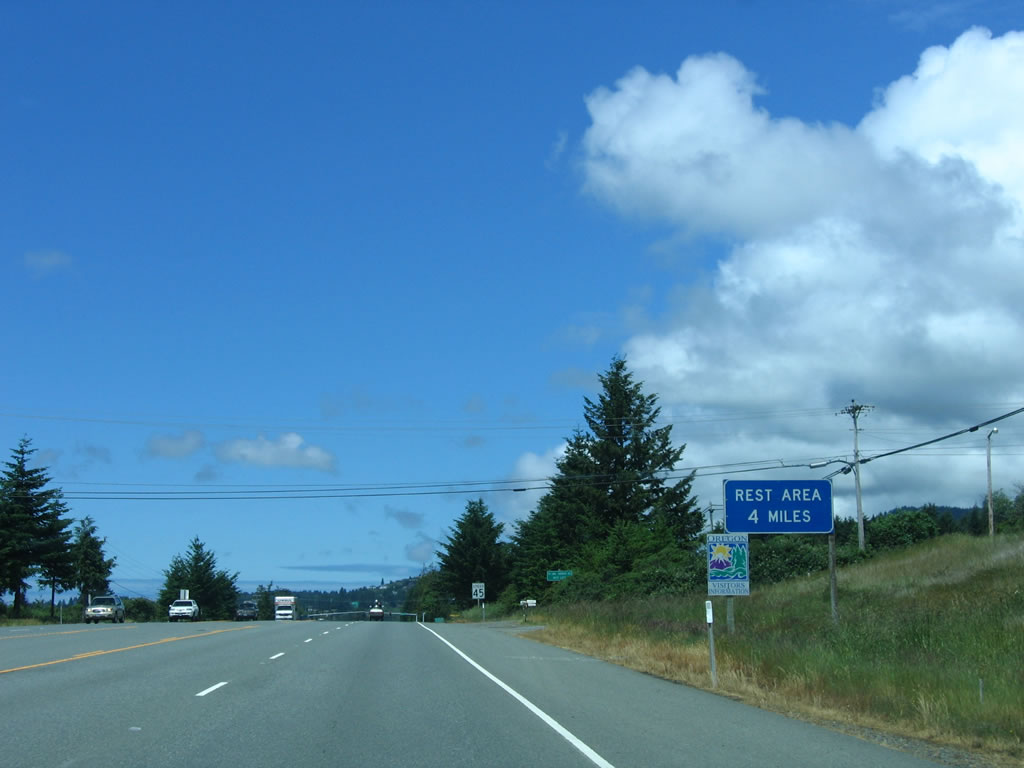
A rest area and Oregon Welcome Center is located four miles north of here; follow the signs. Note the unique, colorful Oregon Travel Information Center trailblazer.
05/28/06

A second harbor sign is posted shortly thereafter on northbound U.S. 101; the traffic signal for Junction Curry County Route 815A Connector can be seen in the distance. Curry County Route 815A Connector is a very short road; it connects U.S. 101 with Curry County Route 815/Shopping Center Avenue. Turn north on Curry County Route 815 and follow it to Curry County Route 816/Lower Harbor Road, where it ends. The Brookings Harbor is located there, at the Chetco River.
05/28/06
After the intersection with Curry County Route 815A Connector, U.S. 101 descends into the Chetco River valley. U.S. 101 gains a brief limited access stretch with an exit for Curry County Route 816/Lower Harbor Road south to the Brookings Harbor and Curry County Route 808/South Bank Chetco River Road east along the Chetco River.
05/28/06
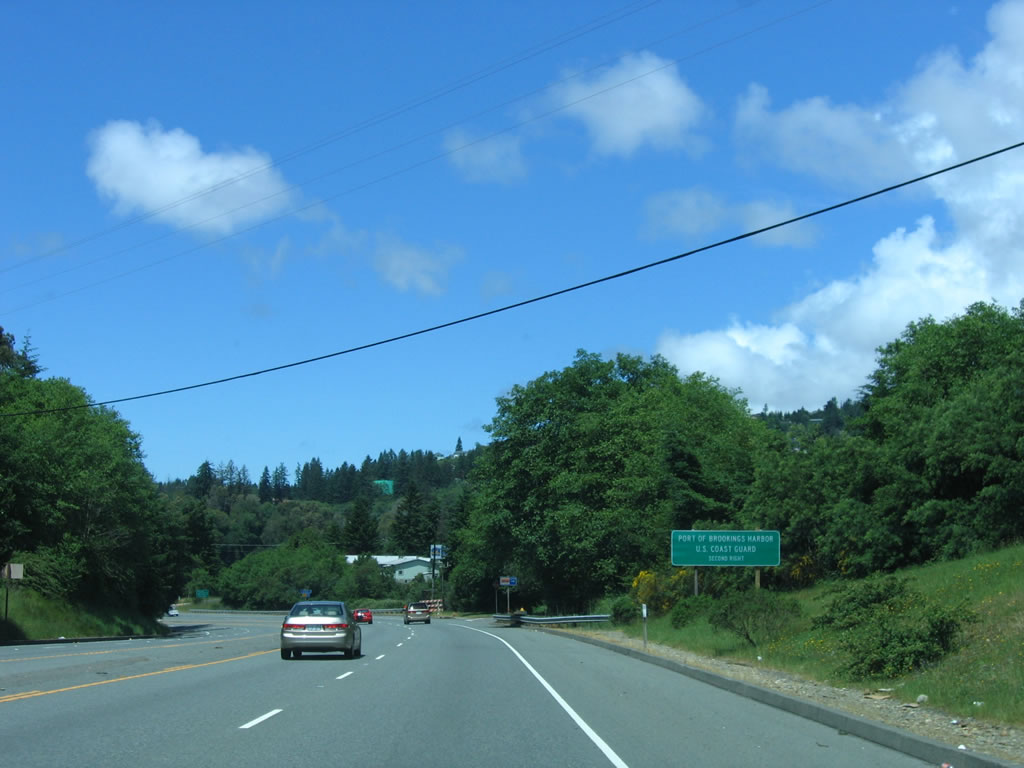
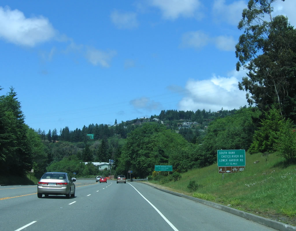
Use Curry County Route 815 southwest to the Port of Brookings harbor and U.S. Coast Guard. After the Curry County Route 816 and Curry County Route 808 off ramp, U.S. 101 will cross the Chetco River. After crossing the bridge, U.S. 101 will then meet Curry County Route 784/North Bank Chetco River Road.
05/28/06
Northbound U.S. 101/Oregon Coast Highway meets Junction Curry County Route 816/Lower Harbor Road and Junction Curry County Route 808/South Bank Chetco River Road. This "offramp" requires a sharp turn. Shortly thereafter, U.S. 101 crosses the Chetco River.
05/28/06
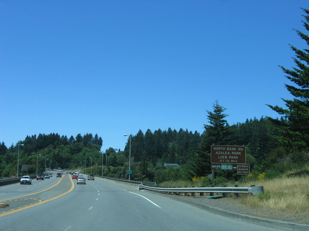
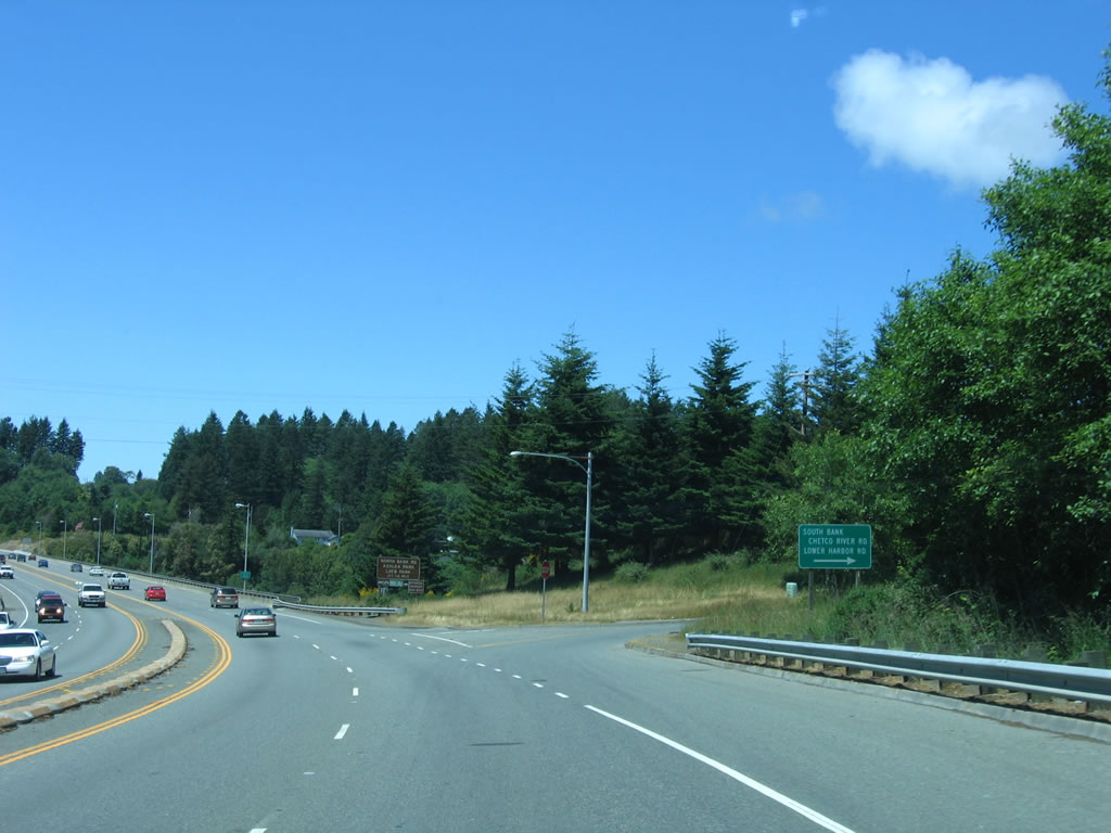
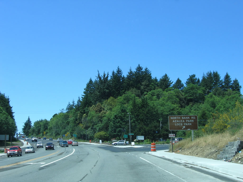
The next right connects U.S. 101 north with Curry County Route 784/North Bank Chetco River Road, which connects to Azalea State Park here in Brookings and Alfred A. Loeb State Park a bit further upstream.
05/28/06

U.S. 101 crosses the Chetco River. At this point, U.S. 101 is traveling due west.
05/28/06
Northbound U.S. 101/Oregon Coast Highway (now Chetco Avenue) meets Curry County Route 784/North Bank Chetco River Road at this intersection, which is a right turn from northbound and a left turn from southbound (unlike the interchange at the south end of the bridge). U.S. 101 next climbs the hill and enters the city of Brookings. Note that there are no northbound reassurance shields for U.S. 101.
05/28/06
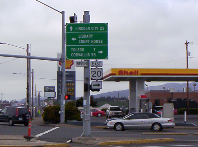
Much further to the north within the city of Newport, is this view of U.S. 101 (Coast Highway) north at the western terminus of U.S. 20 (Olive Street). U.S. 20 represents the longest US route in the system, traveling east from the Oregon coast line 2,376 miles to Boston, Massachusetts. Regionally, U.S. 20 follows the Corvallis Newport Highway east to Toledo, Eddyville and OR 99 at Corvallis.
04/19/05
Photo Credits:
- Andy Field, Joel Windmiller: 05/28/06
- Jordan Brice: 04/19/05
Connect with:
Page Updated Wednesday April 25, 2007.