
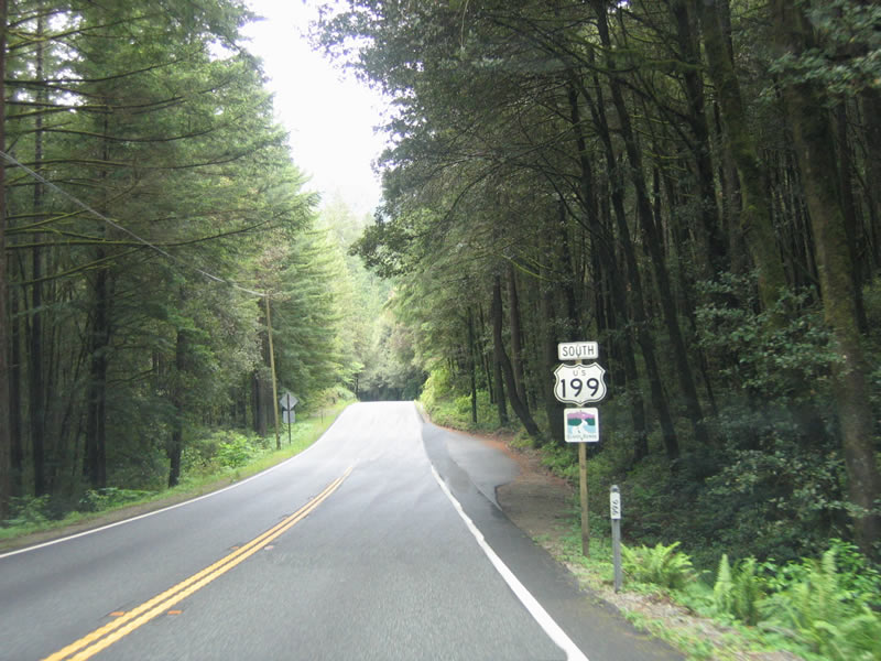
U.S. 199 South
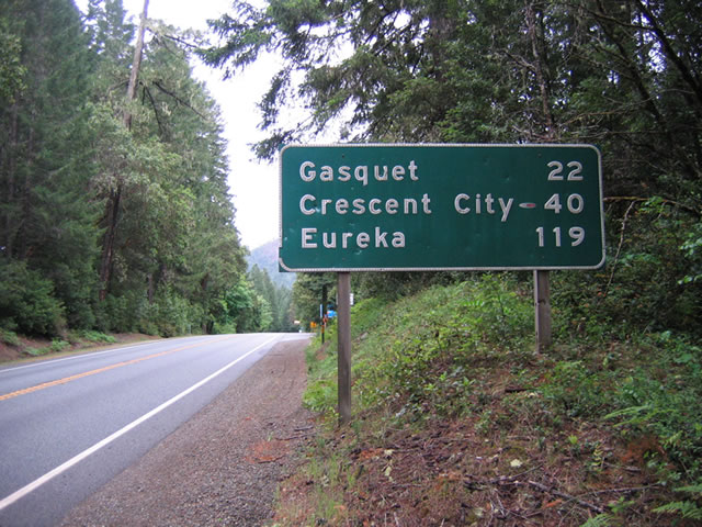
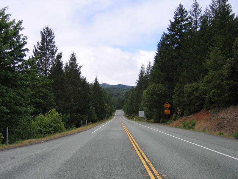
A button copy distance sign is posted just beyond the Oregon state line along U.S. 199 south. Unincorporated Gasquet lies 22 miles ahead. Brookings, Oregon, which was a destination city on previous distance signs, is omitted as Eureka appears for the first time at 119 miles out.
05/27/06
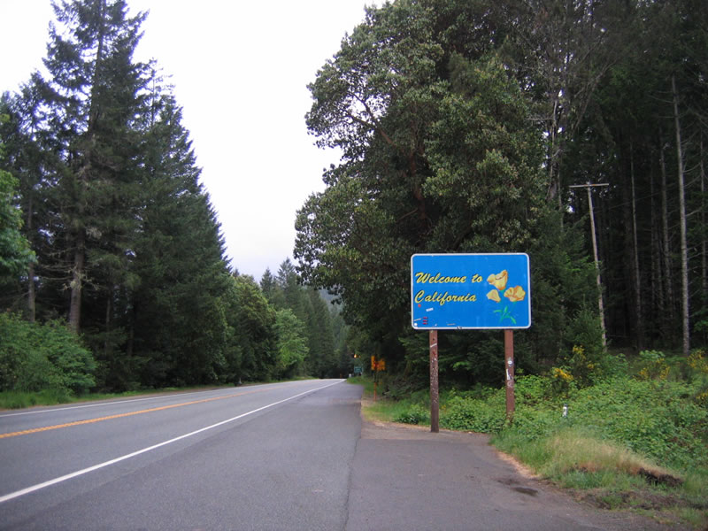
A welcome to California sign, complete with state flower, the California poppy, greets southbound motorists along southbound U.S. 199 (Redwood Highway).
05/27/06
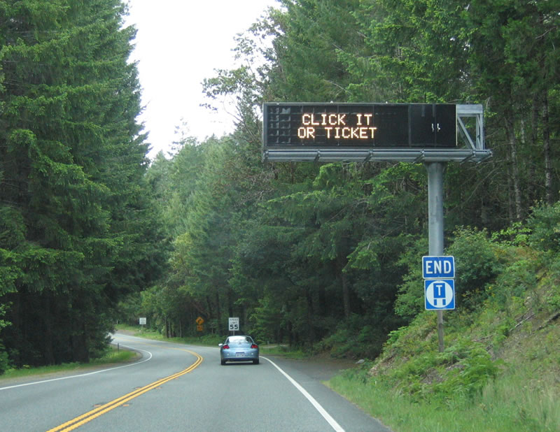
An end truck route sign accompanies this variable message board advising of inclement conditions on Oregon Mountain and within the Collier Tunnel.
05/27/06
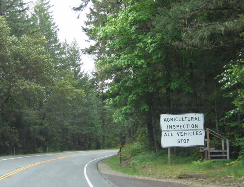
An agricultural inspection station follows, requiring all southbound motorists to stop and declare backyard and home grown fruit and other produce. The objective is to prevent quarantined fruit from entering the state, which is richly dependent on its agricultural economy.
05/28/06
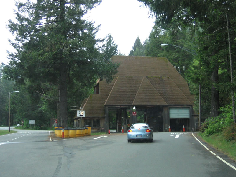
The agricultural inspection station is impressive in its own right, with tall roofs and three bays. A bypass allows vehicles to pass by the station on days when it is closed.
05/28/06
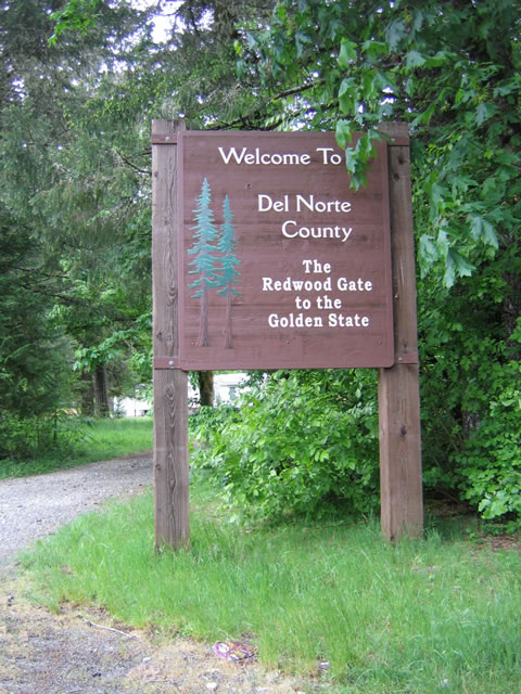
Welcome to Del Norte County, "The Redwood Gate to the Golden State."
05/28/06
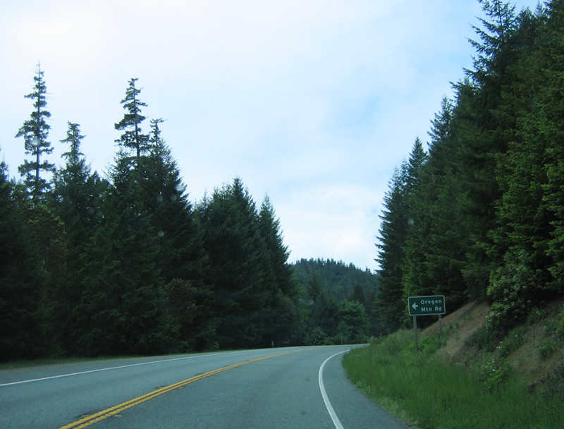
Southbound U.S. 199 (Redwood Highway) approaches Oregon Mountain Road. This is the original alignment of U.S. 199 that preceded the construction of Collier Tunnel. Featuring old highway grades and curves, the former route over the top of Oregon Mountain is still passable.
05/28/06
U.S. 199 ascends to the entrance of Collier Tunnel. A climbing lane helps facilitate uphill traffic flow.
05/28/06

Emerging from the Collier Tunnel, U.S. 199 travels down a six percent grade to the southwest off Oregon Mountain and into the Smith River valley.
05/27/06

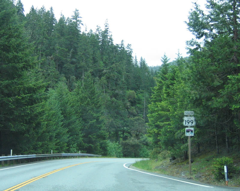
A reassurance marker stands after the second Oregon Mountain Road (Del Norte County 324) along U.S. 199 south.
05/28/06
U.S. 199 passes by tall trees as part of Six Rivers National Forest as the highway descends from Oregon Mountain along Monkey Creek Ridge.
05/28/06
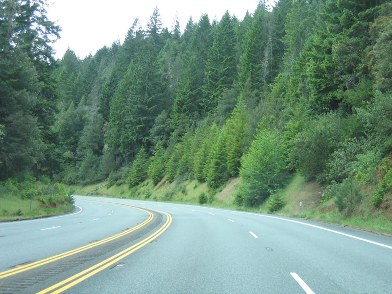
West of Packsaddle Creek, the highway widens briefly to four lanes to accommodate passing.
05/28/06
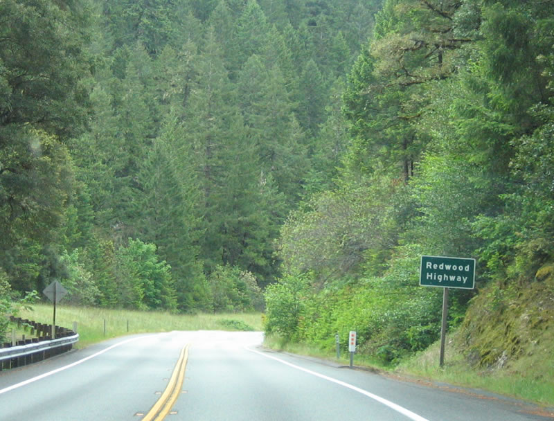
U.S. 199 is part of the Redwood Highway, which extends from Grants Pass south to San Francisco. The majority of the route follows U.S. 101, but the northern-most section follows all of U.S. 199.
05/28/06

This distance sign provides the distance to Gasquet (14 miles), Crescent City (31 miles), and Eureka (111 miles).
05/28/06
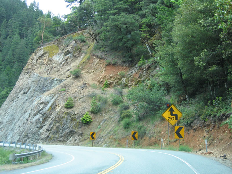
As U.S. 199 continues its descent following the Middle Fork of the Smith River toward Washington Flat, some tight curves can be found.
05/28/06
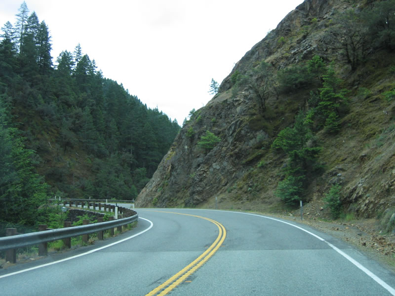
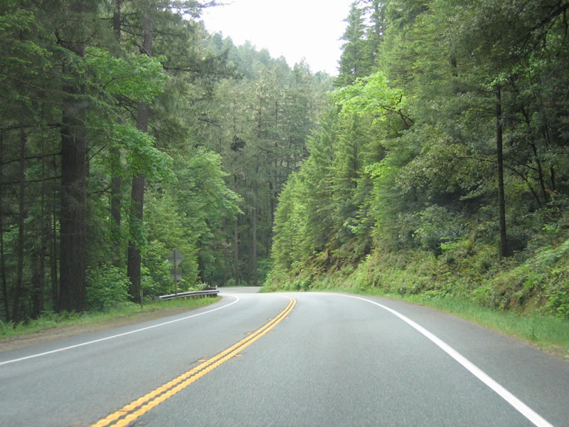
U.S. 199 is one of the most scenic U.S. highways in California, with its narrow canyons and road cuts.
05/28/06
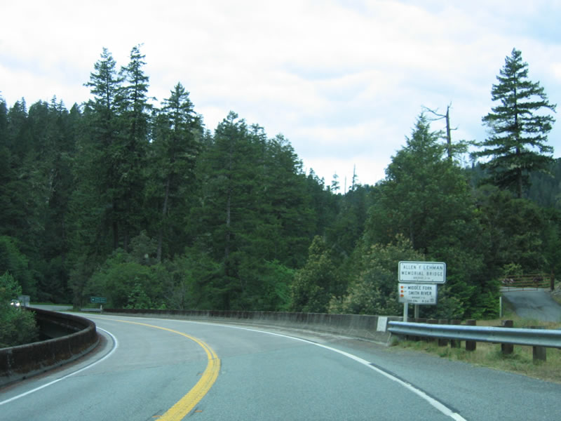
U.S. 199 spans the Middle Fork of the Smith River across the Allen F. Lehman Memorial Bridge.
05/28/06
A U.S. 199 reassurance shield stands beyond the Lehman Bridge and the subsequent intersection with Little Jones Creek Road.
05/28/06
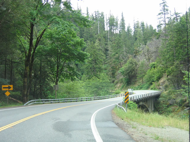
Rounding Dollar Bend, U.S. 199 south approaches a concrete arch bridge over the Smith River Middle Fork.
05/28/06
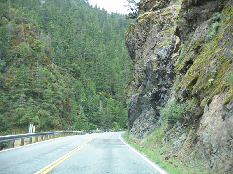
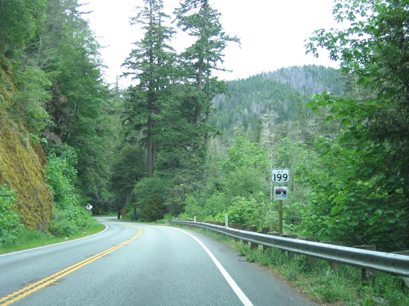
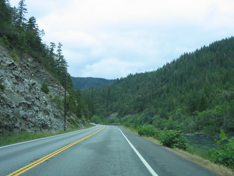
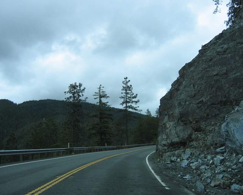
Open rock cuts line U.S. 199 as the highway meanders westward between Shelly Creek ridge and Kelly Peak alongside the Smith River Middle Fork.
05/28/06
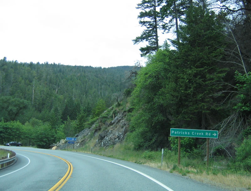
Patricks Creek Road stems north from U.S. 199 (Redwood Highway) to Shelly Creek Campground.
05/28/06
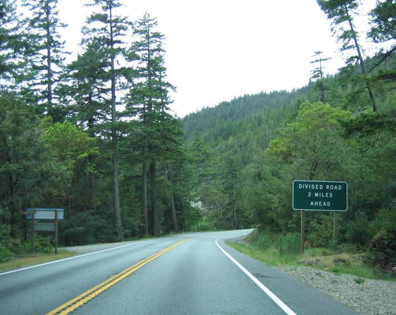
Two miles south of Patricks Creek Road, U.S. 199 expands to a four lane highway with a painted median.
05/28/06
Reassurance shield for U.S. 199 south posted at Patrick Creek.
05/28/06
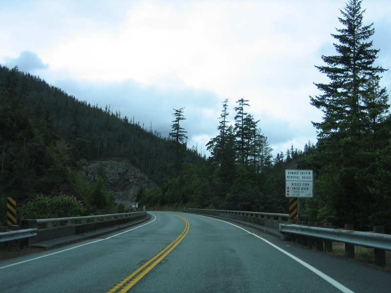
Continuing south, U.S. 199 crosses the Middle Fork of the Smith River again, this time via the Howard Griffin Memorial Bridge south of Cold Spring Mountain.
05/28/06

U.S. 199 expands to four lanes westward ahead of the Grassy Flat Campground. The US route advances west along the Middle Fork of the Smith River and Elk Camp Ridge.
05/28/06

The Botanical Trailhead is located on the north side of the divided highway segment prior to the Pioneer Road intersection.
05/28/06
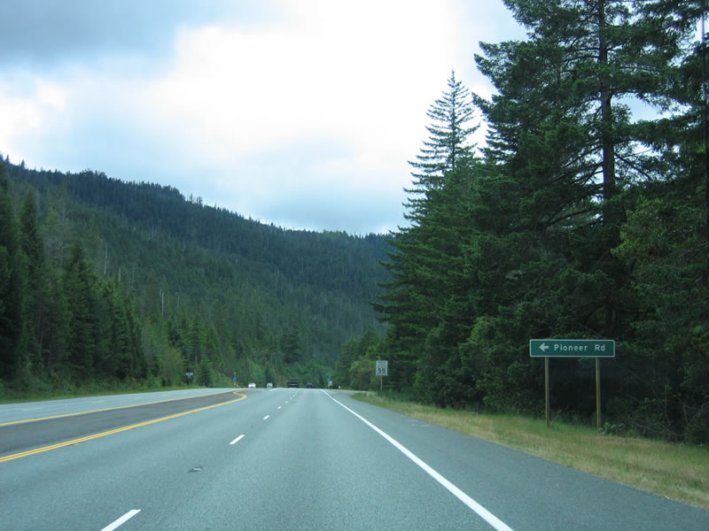
Southbound U.S. 199 (Redwood Highway) meets Pioneer Road, a short residential road spurring south. Panther Flat Camground lies to the north.
05/28/06
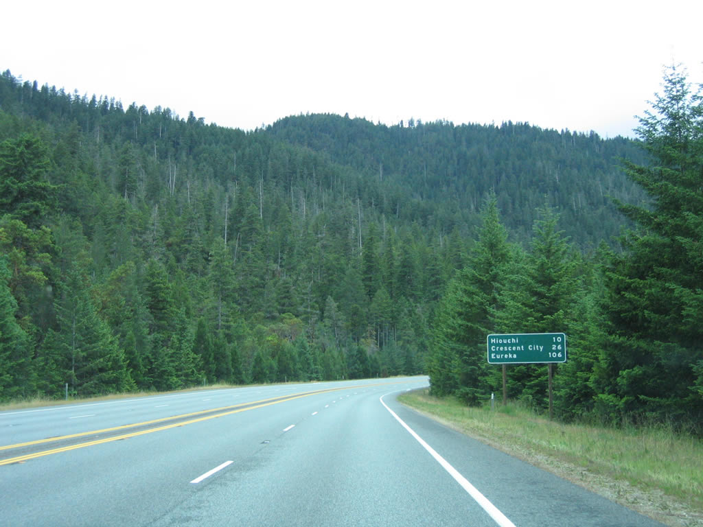
Hiouchi is ten miles ahead, followed by Crescent City in 26 miles via U.S. 101 south.
05/28/06

Entering the unincorporated town of Gasquet, U.S. 199 reduces to two lanes with a center turn lane. A bypass was once proposed for U.S. 199 around Gasquet, but it was never constructed. A national forest visitors center is located on the northwest side of U.S. 199 north of Gasquet.
05/28/06
West of Gasquet, U.S. 199 reenters Six Rivers National Forest, with the Smith River flowing in the canyon below.
05/28/06
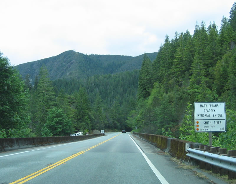
Signal Peak rises to the west as U.S. 199 crosses the Smith River on the Mary Adams Peacock Memorial Bridge.
05/28/06
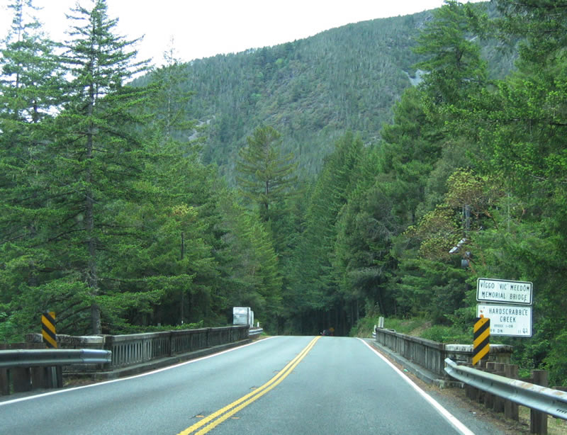
Replaced in 2008, the Viggo "Vic" Meedom Memorial Bridge, a concrete arch span, carried U.S. 199 over Hardscrabble Creek.
05/28/06
Turning around the south slopes of Signal Peak, motorists along Redwood Highway pass by another U.S. 199 reassurance shield.
05/28/06
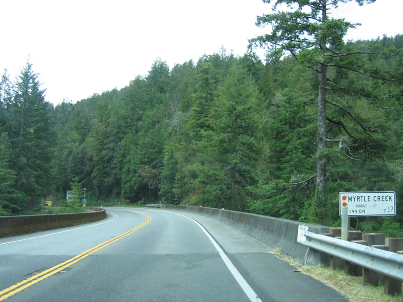
U.S. 199 south crosses Myrtle Creek on this concrete arch bridge located just after South Fork Road to Howland Hill Scenic Drive.
05/28/06
Advancing south, U.S. 199 skirts through another rock cut near the confluence of the Smith River and Smith River South Fork.
05/28/06
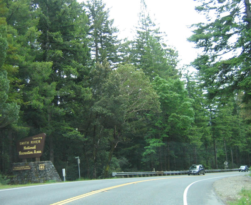
Exiting from the Smith River National Recreation Area, U.S. 199 south enters Hiouchi.
05/28/06

Leading away from Hiouchi, U.S. 199 south meets a visitors center and ranger station for the Redwood National Park, which incorporates several nearby state parks.
05/28/06
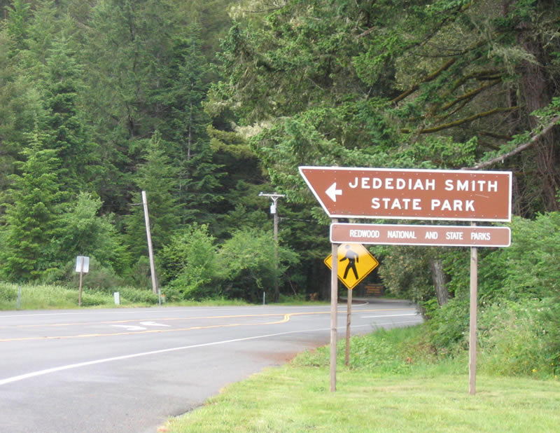
Jedediah Smith State Park, which features a grove of redwood trees, spreads to the west of U.S. 199 along the Smith River outside Hiouchi. For the first time, the Redwood Highway enters a redwood grove (between here and SR 197 / North Bank Road ).
05/28/06
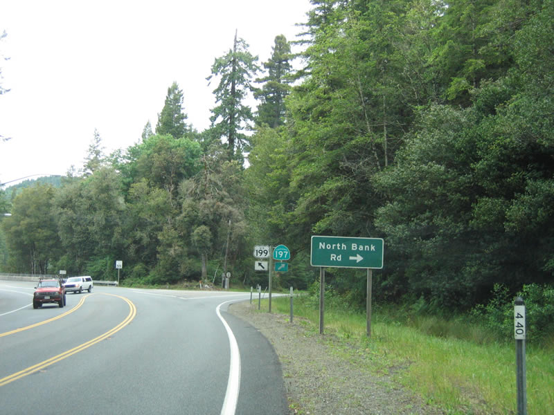
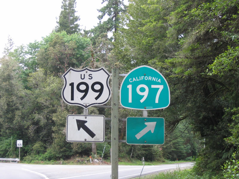
Emerging from the redwood grove, U.S. 199 curves northward to intersect SR 197 (North Bank Road). U.S. 199 resumes a westward heading toward Crescent City while SR 197 parallels the Smith River northwest to U.S. 101 near Smith River. U.S. 101 in turn leads motorists north to Brookings, Oregon, which was the control point for U.S. 199 south in the Beaver State.
05/28/06
SR 197 is totals just 6.7 mile along North Bank Road between U.S. 199 near Jedediah Smith State Park and U.S. 101 near Smith River. U.S. 199 navigates a winding stretch across mountains to the west of the adjacent Smith River to conclude in 4.7 miles at U.S. 101 south to Crescent City.
05/28/06
Photo Credits:
- Andy Field: 05/27/06, 05/28/06
Connect with:
Page Updated Tuesday August 29, 2017.