
Former U.S. 460
U.S. 460 was decommissioned between St. Louis, Missouri and the Indiana state line as approved by AASHTO on November 15, 1975. The route was subsequently truncated to Frankfort, Kentucky as approved by AASHTO on July 13, 1976.
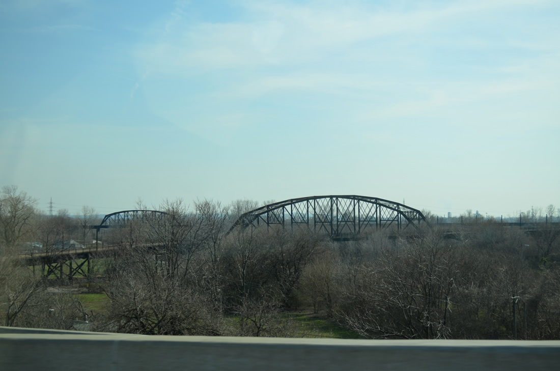
U.S. 460 originated at the west end of the Mac Arthur Bridge at Downtown and LaSalle Park in St. Louis. The route spanned the Mississippi River on the former road deck of the Mac Arthur Bridge, a 1917-opened truss bridge. The double decked bridge was closed to automobiles in 1981 because of pavement deterioration, with the approaches later removed and the loop ramp at 7th Street and Chouteau Avenue (MO 100) replaced by an expanded parking lot.
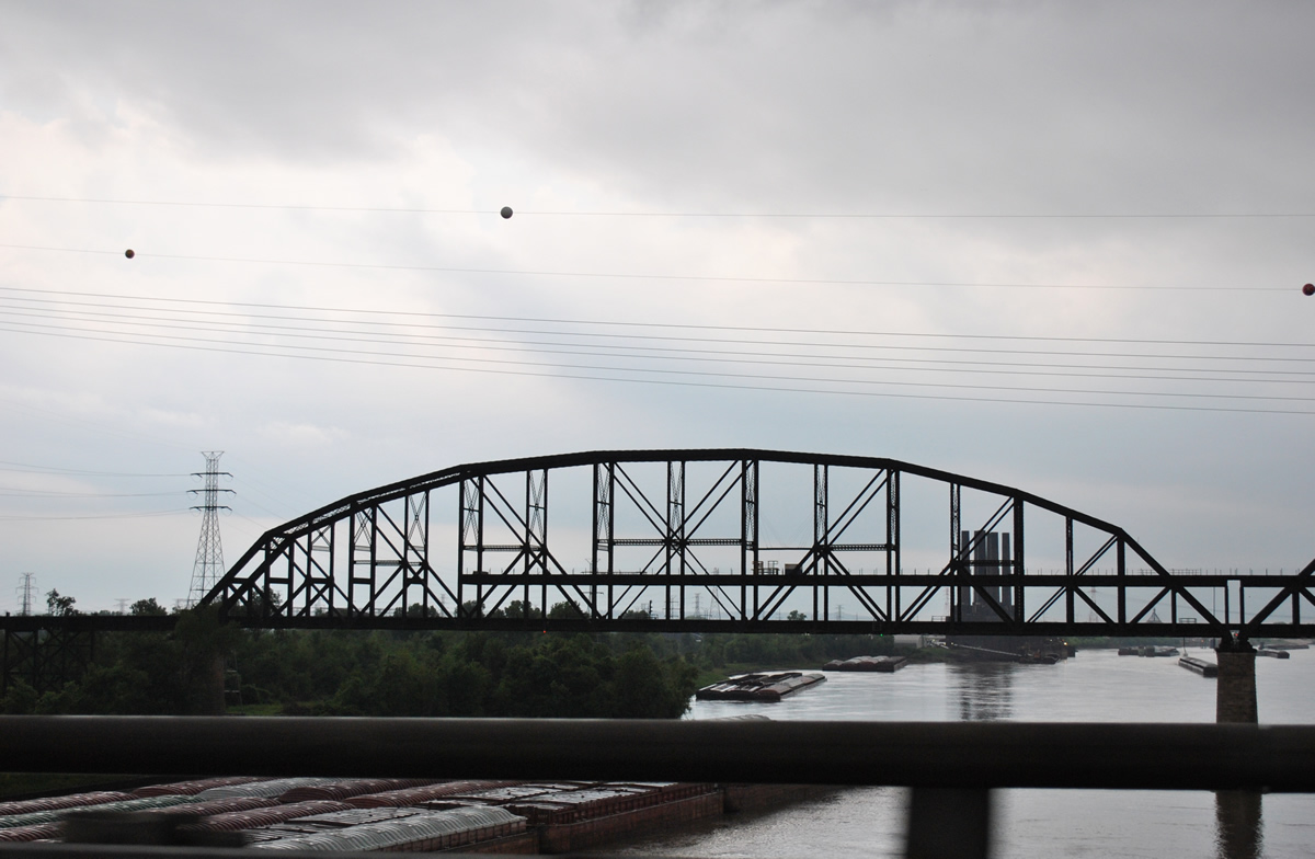
A portion of the Mac Arthur Bridge road deck remains in place above the Alton Southern Railroad tracks. This view looks south from the Poplar Street Bridge (I-55/64-U.S. 40). - 05/04/2012
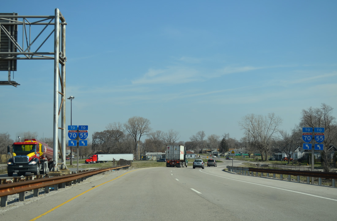
Through East St. Louis, U.S. 460 departed the Mac Arthur Bridge for 10th Street northeast to Missouri Avenue (Illinois 15). Illinois 15 southeast from East St. Louis to Belleville and east from Fayetteville to Mount Vernon represents the historic alignment of the US route. Within Mount Vernon, U.S. 460 turned south from Broadway (IL 15) onto 10th Street (IL 37) to exit the city via the current alignment of Illinois 142 to McLeansboro. Illinois 142 traveled north from McLeansboro to Illinois 15 at Wayne City between 1947 and 1974.1 This alignment is now Illinois 242.
East from Washington Street in McLeansboro, U.S. 460 traveled along what is now Illinois 14 east to Carmi, Crossville and the New Harmony Toll Bridge into New Harmony, Indiana. The 1930-built steel arch bridge across the Wabash River permanently closed to traffic on May 21, 2012 due to the structural integrity of the crossing.
U.S. 460 Freeway - East St. Louis
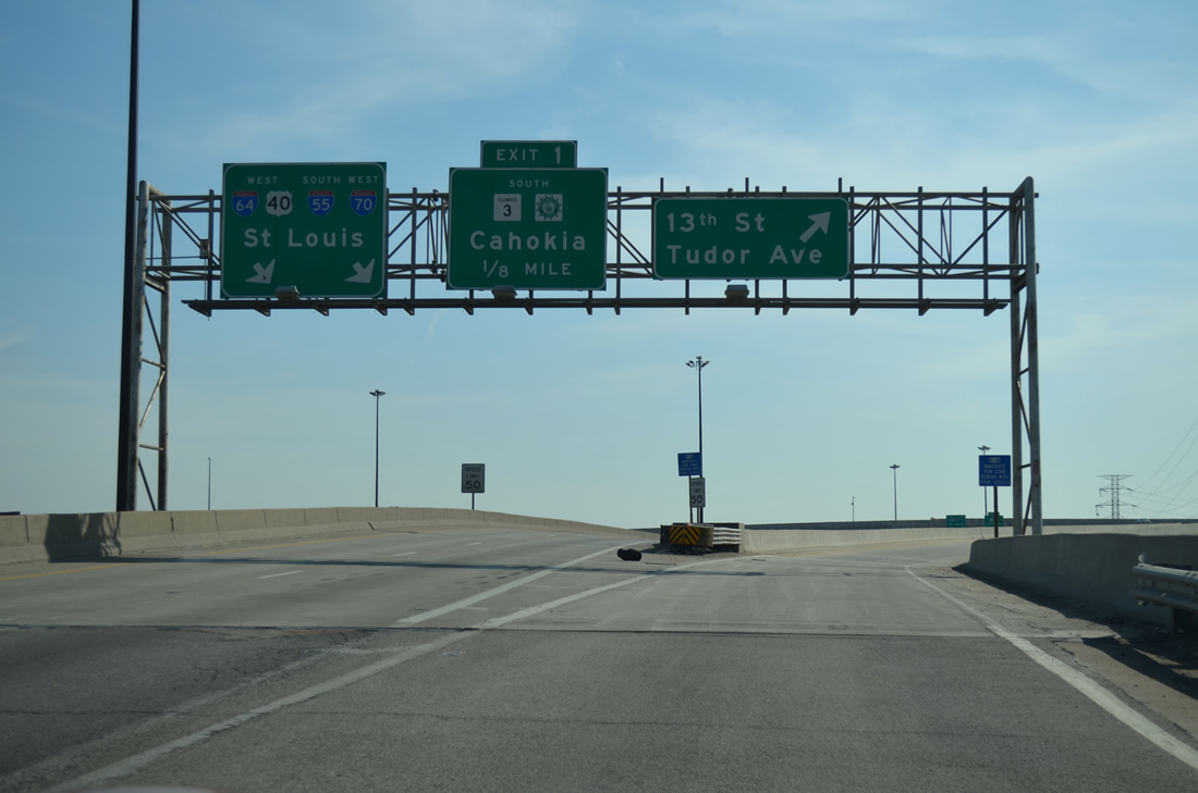
A short freeway spur joins Interstates 55-64, U.S. 40 & Illinois 3 near the east end of the Poplar Street Bridge with Tudor and Piggott Avenues near South 13th Street in East St. Louis. The freeway stub was constructed as the first leg of the planned route for U.S. 460 leading southeast to the Missouri Avenue (Illinois 15) expressway alignment through Alorton and Centreville. The proposed route followed the couplet of Tudor and Piggott Avenue southeast to Lincoln Park, with a shift east to follow Market Avenue to a point near 36th Street and the eastern approach to Missouri Avenue.2
The Alternate route for the U.S. 460 freeway branched southward from the tri-level interchange with Interstates 55-64-70 along the Illinois Central Railroad tracks to South 19th Street. The freeway then curved eastward to meet Missouri Avenue near North 29th Street.2 Neither of these proposals made progress and the stub freeway currently defaults onto Tudor Avenue south with a u-turn ramp providing return access to Interstates 55 & 64.
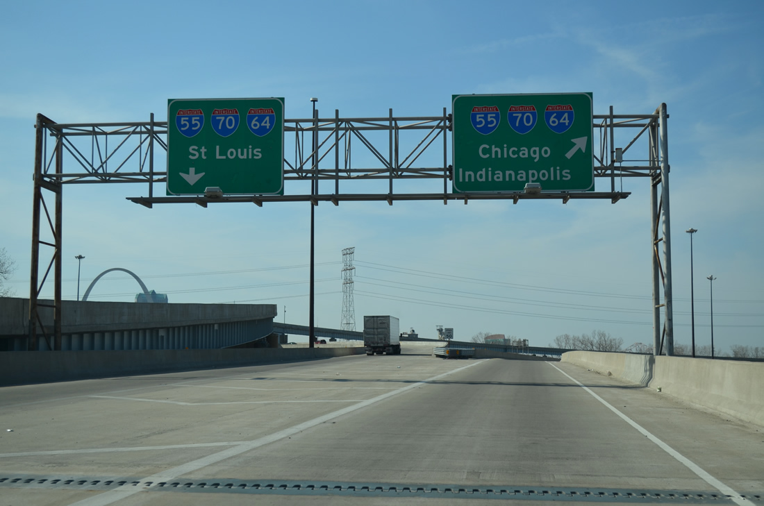
Taking the high flyover from Interstate 55-IL 3 south & Interstate 64-U.S. 40 west, motorists sweep southeast to join the U.S. 460 freeway ahead of South 10th Street.
04/05/13
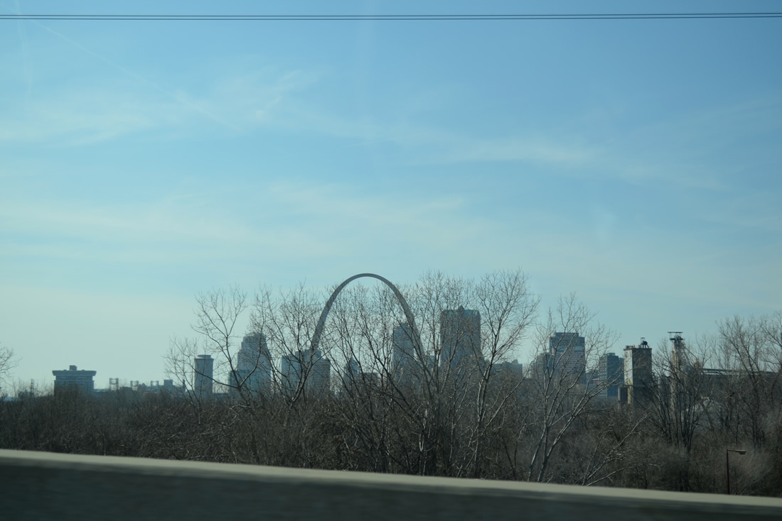
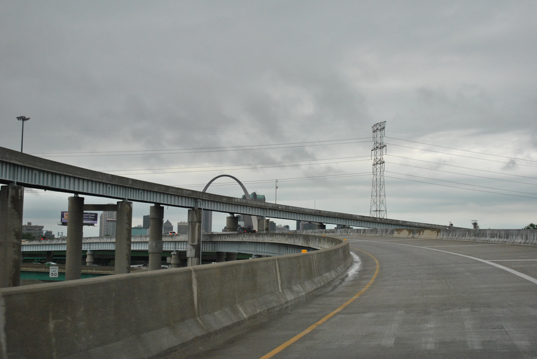
Leave less trees offer drivers a glimpse of the St. Louis downtown skyline and the Gateway Arch from the west to southbound ramp.
04/05/13
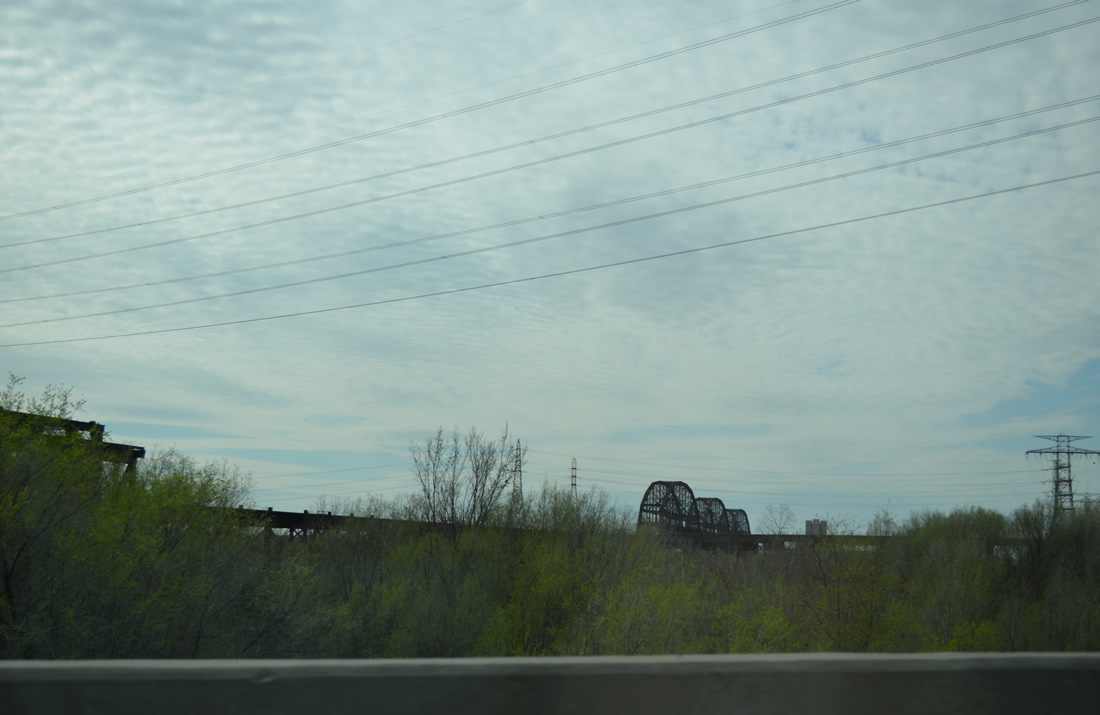
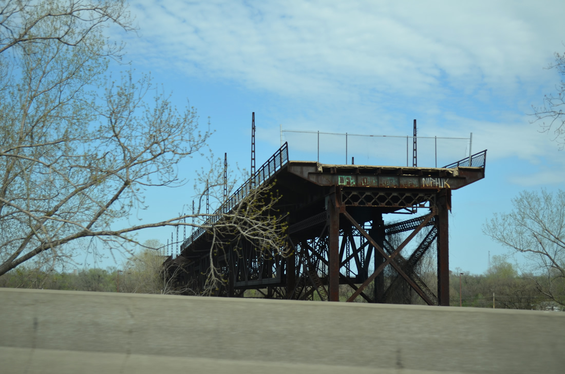
Continuing along the highest flyover at the tri-level stack interchange with I-55/64, coming into view is the abandoned truss bridge and roadway approach U.S. 460 took from the Mac Arthur Bridge east to South 10th Street.
04/05/13
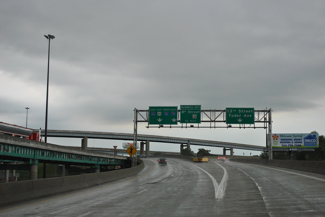
The eastbound off-ramp to the planned U.S. 460 freeway references 13th Street and Tudor Avenue from I-55/64.
05/04/12
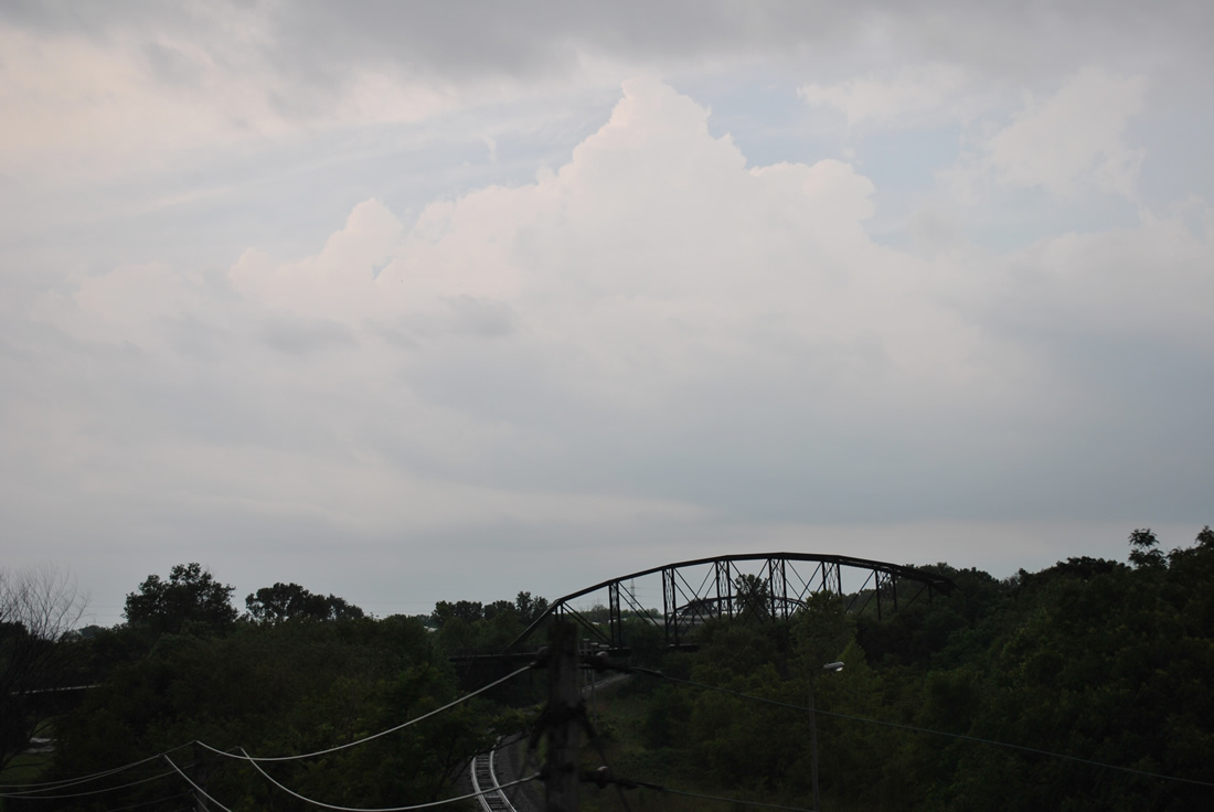
Another view of the truss bridge for the former U.S. 460 crossing into St. Louis. A single set of Illinois Central Railroad tracks travels below the closed span. Two additional tracks were abandoned.
05/04/12
Ramps from the Poplar Street Bridge and Interstates 55 south & 64 west combine to form a short four lane freeway ahead of South 13th Street. A u-turn ramp provides return access to both directions of the freeway.
05/04/12
04/05/13
A grassy right of way alludes to the planned continuation of U.S. 460 southeast to Alorton. A ramp otherwise joins Tudor Avenue south ahead of 13th Street. Tudor and Piggott Avenues comprise a one way couplet to South 15th Street, where both transition to two-way traffic.
05/04/12

Trailblazers direct motorists taking the u-turn ramp back northward along the planned U.S. 460 freeway. Two lanes form the freeway beginning from adjacent Piggott Avenue.
04/05/13
A small stub appears to the left as the freeway prepares to elevate over the Piggott Avenue southbound ramp onto Tudor Avenue.
05/04/12
Overheads prepare motorists for the single lane flyovers onto I-55/64. Both ramps merge onto the collector distributor roadway of the freeway.
04/05/13
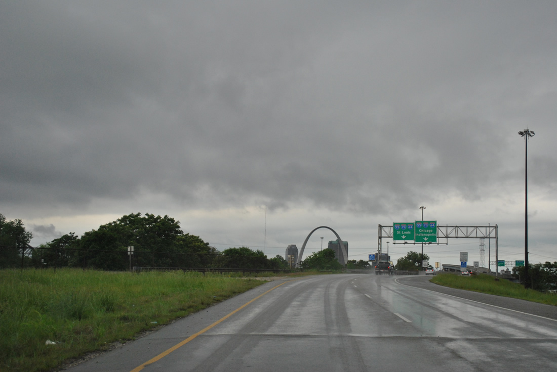
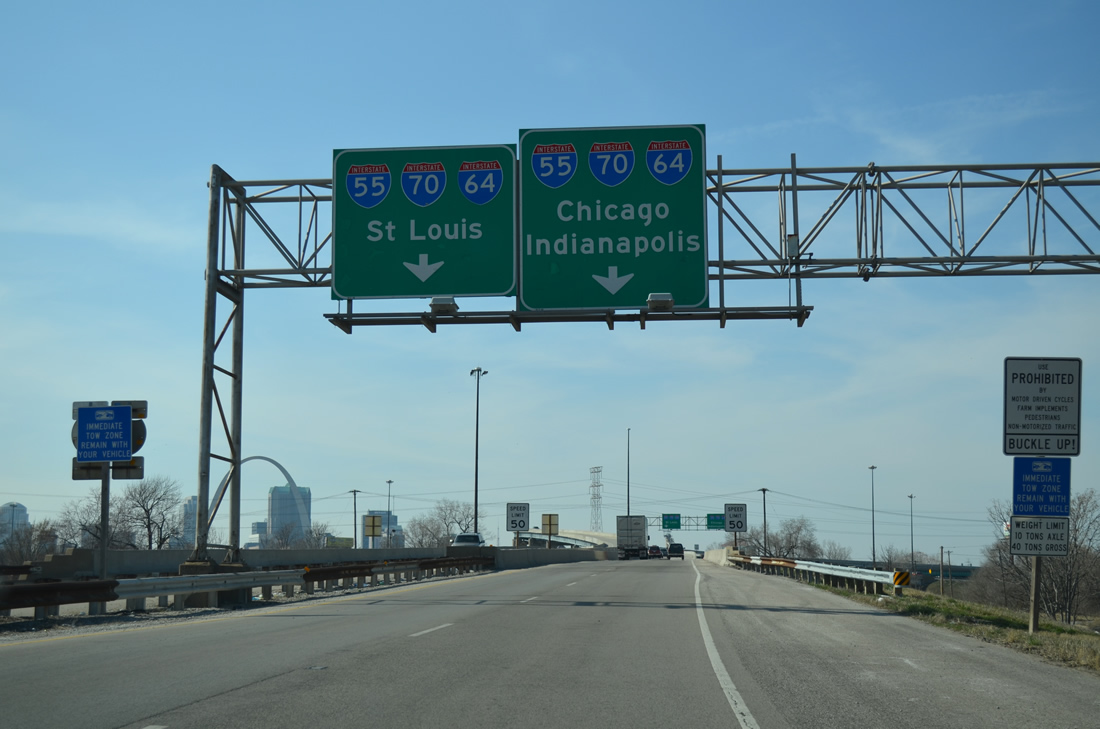
Interstates 55 south & 64-U.S. 40 west span the Mississippi along the Poplar Street Bridge to Downtown St. Louis. I-55 east & 64 north combine with IL 3 to their split at the Tri Level Interchange, where new Interstate 70 ties in from the Stan Musial Veterans Memorial Bridge.
04/05/13
Passing over the I-55 & 64 mainline viaducts, the westbound flyover joins the left side of the c/d roadway that takes IL 3 south to Sauget.
05/04/12
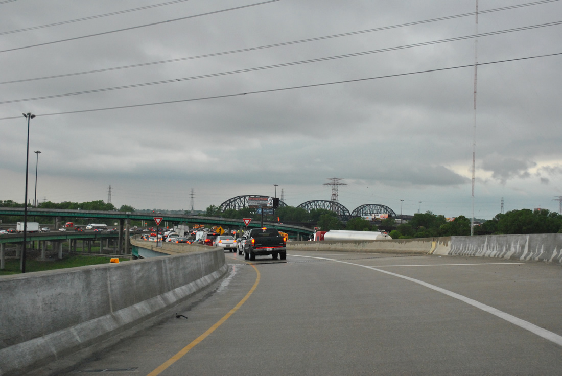
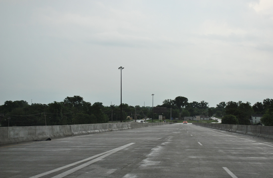
Inbound traffic congestion as the planned U.S. 460 freeway ends. This may have been the intended western conclusion of U.S. 460.
05/04/12
IL 3 ventures south from I-55/64 and U.S. 40 from its own tri-level stack interchange. The short expressway passes under the railroad portion of the Mac Arthur Bridge shortly after leaving I-55 south & 64 west. The original road deck for U.S. 460 tied into the Mac Arthur Bridge at the truss section of the bridge just west of IL 3.
04/05/13
The Mac Arthur Bridge approach from South 10th Street was barricaded and left in place east of IL 3. The abandoned structure looms just to the east of IL 3 as the state route approaches the Poplar Street Bridge east end.
04/05/13
References:
Photo Credits:
- AARoads: 04/05/13
- ABRoads: 05/04/12
Connect with:
Page Updated Tuesday December 03, 2013.