
State Route 143

SR 143 navigates across the Markagunt Plateau mountain range along a 51.21 mile course. One of the highest state routes in Utah (second only to SR 150), SR 143 reaches an elevation of 10,626 feet above sea level. Following the Brian Head-Panguitch Lake Scenic Byway, the state route originates in Parowan. Meandering south through the Hurricane Cliffs and Parowan Canyon, SR 143 leads to Cedar Breaks National Monument.
Turning east from Cedar Breaks Scenic Byway (SR 148), the scenic highway continues toward Blue Spring Mountain and Black Rock Valley. SR 143 turns northward from there to Prince Mountain, Panguitch Lake and Haycock Mountain. Curving northeast around Dickinson Hill, the state route lowers toward Panguitch through South Canyon, concluding at U.S. 89 in the city center.
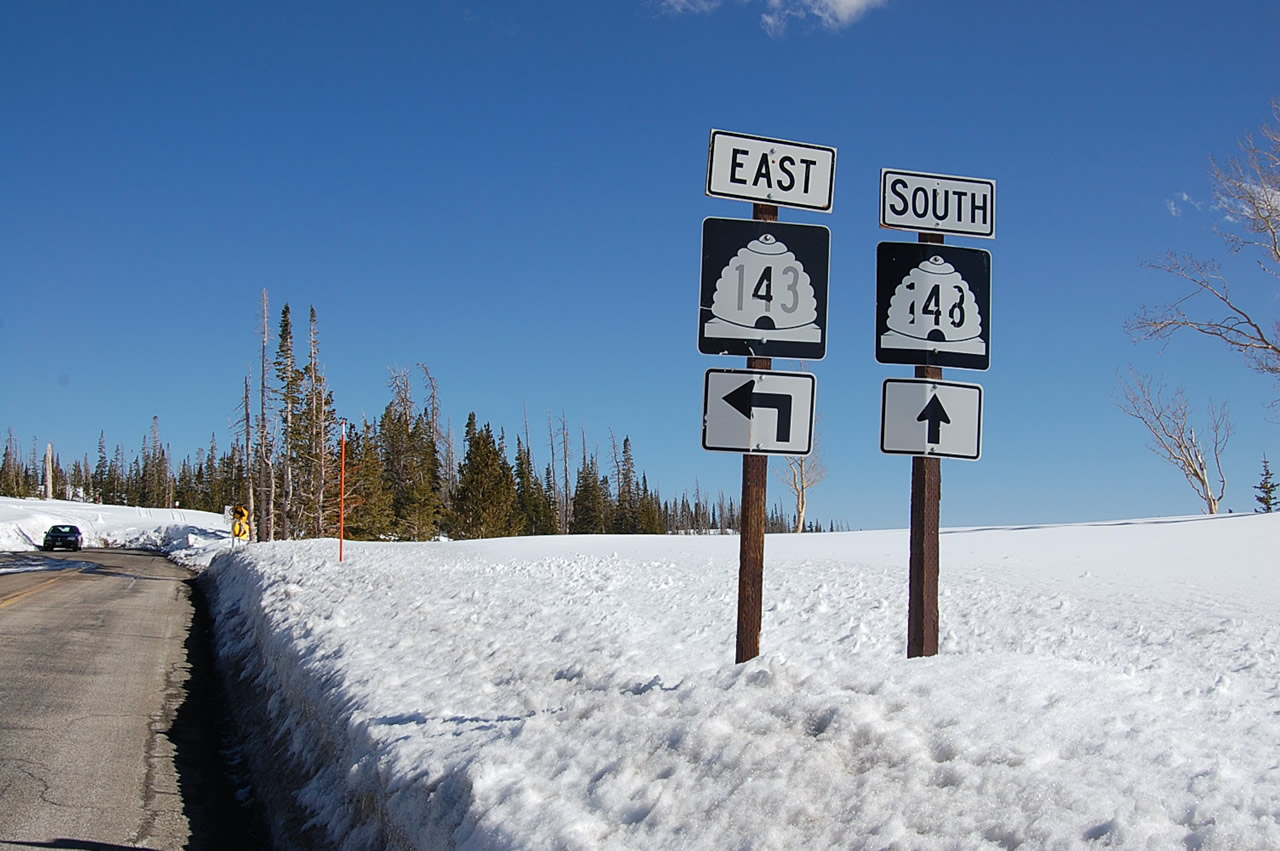
SR 143 curves southeast from Mammoth Summit into Cedar Breaks National Monument. Interesting SR 143 here is the Cedar Breaks Scenic Byway (SR 148), the main route south into the park.
04/28/11
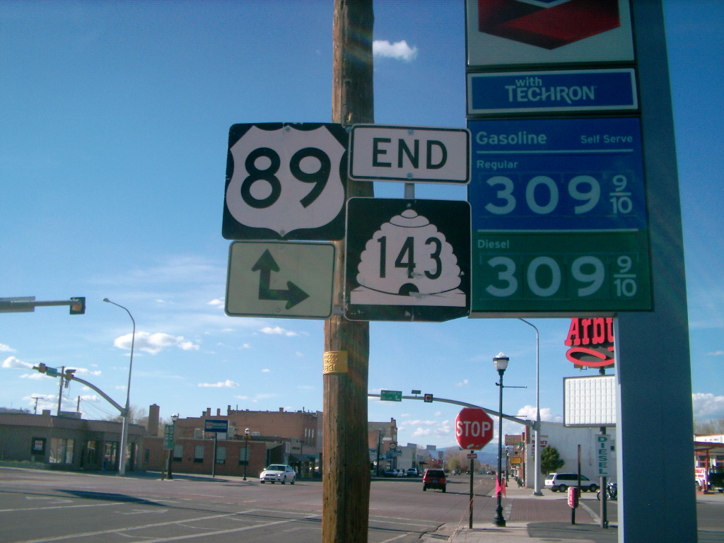
Main Street leads SR 143 north to its eastern end at U.S. 89 (Center Street) in Downtown Panguitch.
06/07/10
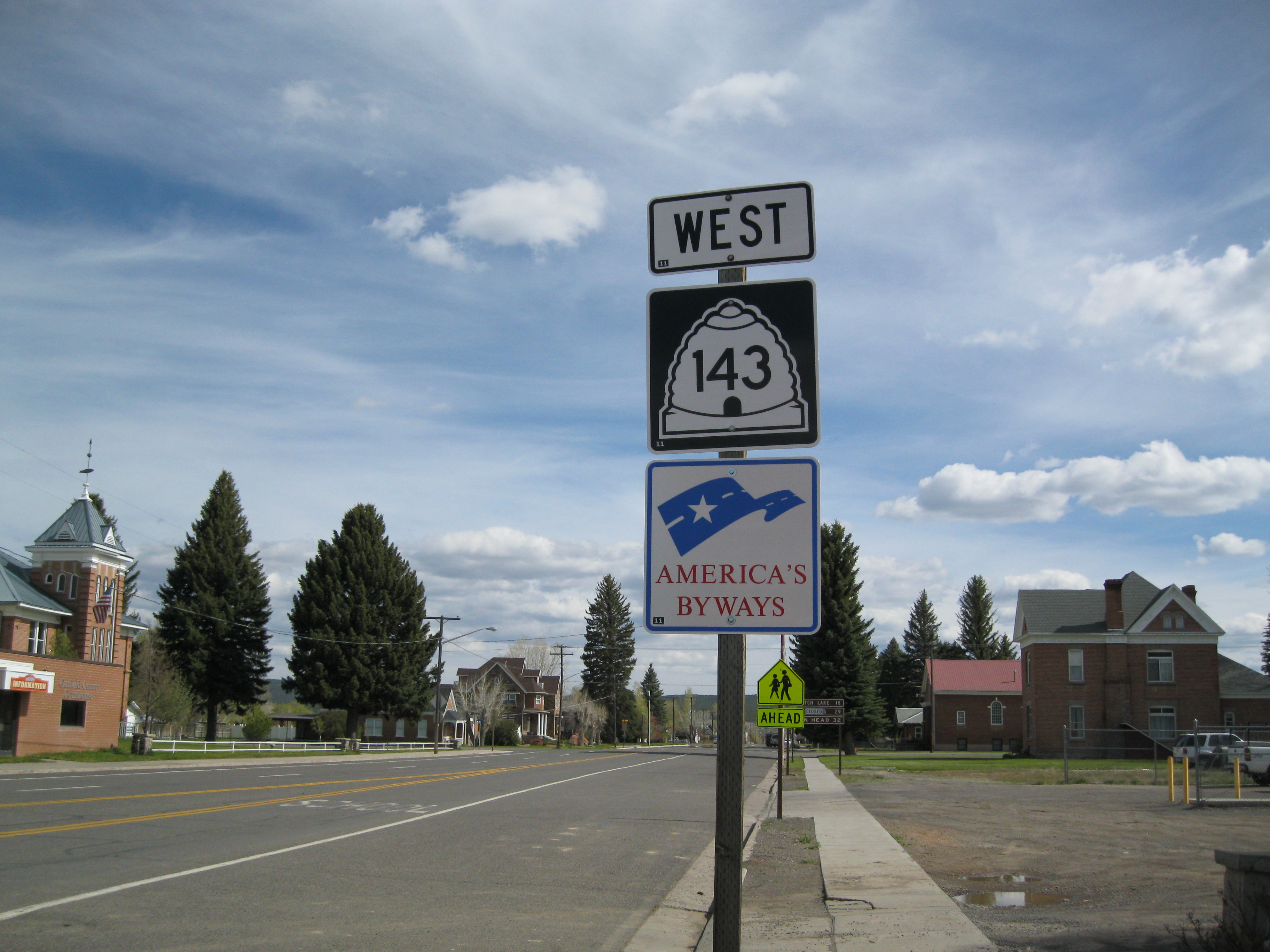
Posted along Main Street south of U.S. 89 in Panguitch, this SR 143 confirming marker is the first posted along the 51 mile route. The Brian Head-Panguitch Lake Scenic Byway acknowledges the gorgeous Cedar Breaks National Monument and the Brian Head Ski Resort.
05/23/11

Confirming marker for SR 143 west after the turnoff to Cedar Breaks National Monument (via SR 148). The state route advances west to the North View scenic overlook nearby.
04/28/11
Photo Credits:
- Karl Forth: 04/28/11
- Landry Heaton: 06/07/10, 05/23/11
Connect with:
Page Updated Monday July 30, 2018.