
State Route 116
SR 116 (Jubal Early Highway) runs northwest from SR 122 (Booker T. Washington Highway) at Burnt Chimney 20.82 miles to Cove Road at SR 101 (Hershberger Road) in the city of Roanoke. SR 116 traverses the Blue Ridge Mountains north from Red Valley across the Roanoke County line at Windy Gap and northwest to Leslie.
Within Roanoke, SR 116 follows Mt. Pleasant Boulevard north to Riverland Road west between Mill Mountain and the Roanoke River. SR 116 dog legs southwest one block on Piedmont Street to the viaduct on Walnut Street northwest. Passing under U.S. 220, SR 116 turns north onto Jefferson Street to Downtown Roanoke.
Combining with U.S. 221/220 Business, SR 116 shifts east onto Franklin Road and then north along Williamson Road to Campbell Avenue. U.S. 11 joins the three routes from Campbell Avenue to the Berglund Center and U.S. 460 (Orange Avenue). SR 116 and U.S. 220 Business turn west alongside U.S. 460/11 ALT (Orange Avenue) to a cloverleaf interchange with I-581/U.S. 220. SR 116 remains along Orange Avenue to Lafayette Boulevard, which leads the route north to Cove Road.


 North
North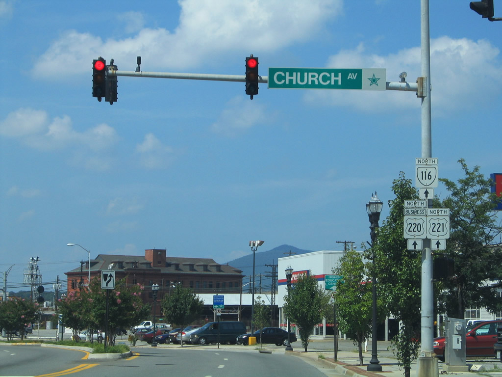
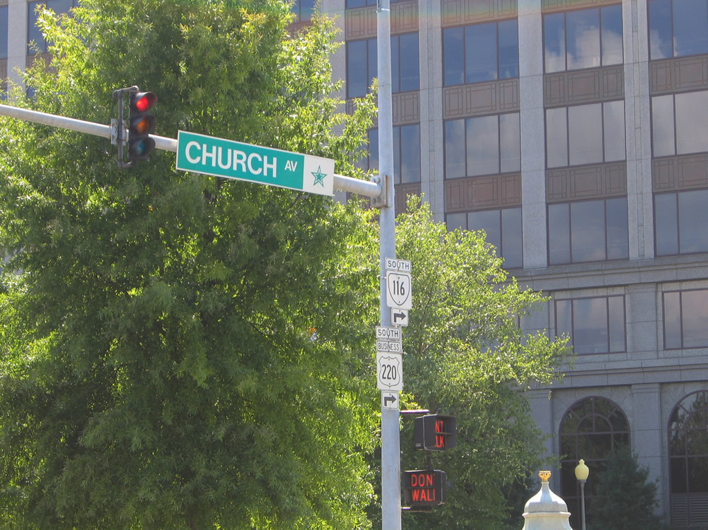
U.S. 220 Business, U.S. 221, and SR 116 reassurance shield assembly posted on Williamson Road northbound at Church Avenue west.
07/24/04
 West North
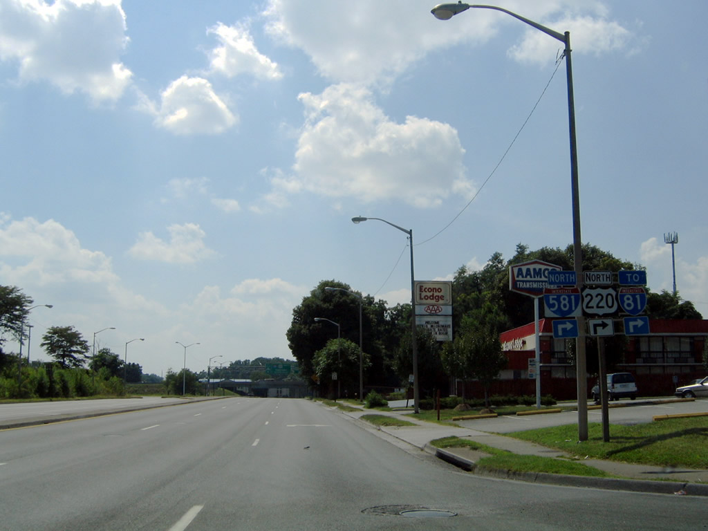
U.S. 460 west, U.S. 11 Alternate south, and U.S. 220 Business north advance 0.32 miles west along Orange Avenue from U.S. 11 north and U.S. 221 south on Williamson Road to the cloverleaf interchange with I-581/U.S. 220. This shield assembly was removed between July and October 2012.
07/24/04

U.S. 220 Business concludes along U.S. 460/SR 116 (Orange Avenue) at the entrance ramp to I-581/U.S. 220 north. The freeway angles northwest from Orange Avenue to Roanoke-Blacksburg Regional Airport (ROA) and I-81 near Brushy Mountain.
07/24/04
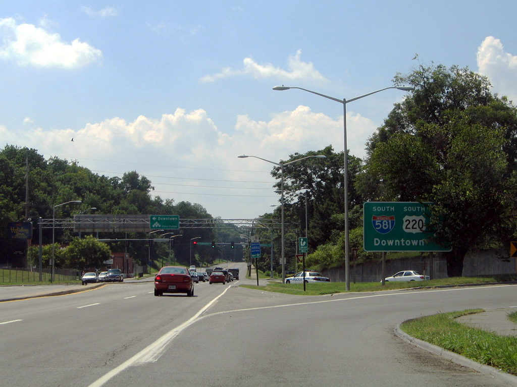
U.S. 460 west / U.S. 11 ALT south at the loop ramp for I-581/U.S. 220 south to Downtown Roanoke. I-581 concludes in 1.20 miles at SR 24 (Elm Avenue).
07/24/04
U.S. 220 Business, U.S. 221 and SR 116 turn westward from Williamson Road south onto Franklin Road in Downtown Roanoke. SR 116 splits from the two for Jefferson Street south nearby. U.S. 221/220 Business continue to their partition at Frankin Road south at Elm Avenue west.
07/24/04
Photo Credits:
- Alex Nitzman: 07/24/04
Connect with:
Page Updated Saturday May 08, 2021.