
State Route 231/670


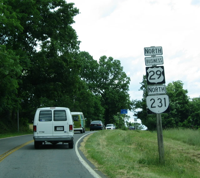
Northbound Business U.S. 29 and SR 231 jointly enter the town of Madison.
06/05/04
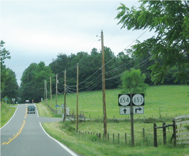
Now separated from Business U.S. 29, SR 231 passes through some rolling hills and river valleys between Madison and Banco. Along the way from Madison, SR 231 intersects SR 653 southeast and SR 645 northwest.
06/05/04
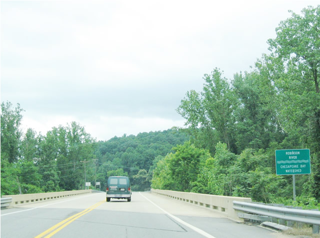
SR 231 crosses the Robinson River at this bridge.
06/05/04
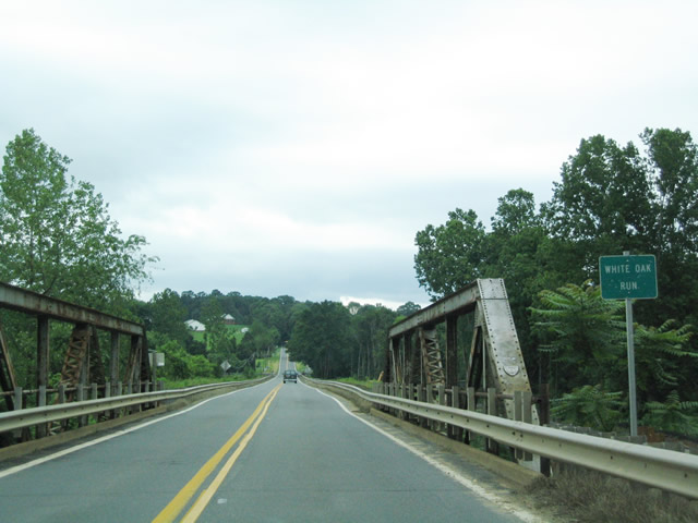
The White Oak Run passes under SR 231 at this bridge. Like other smaller rivers in Virginia, it is referred to as a "Run" rather than "River."
06/05/04
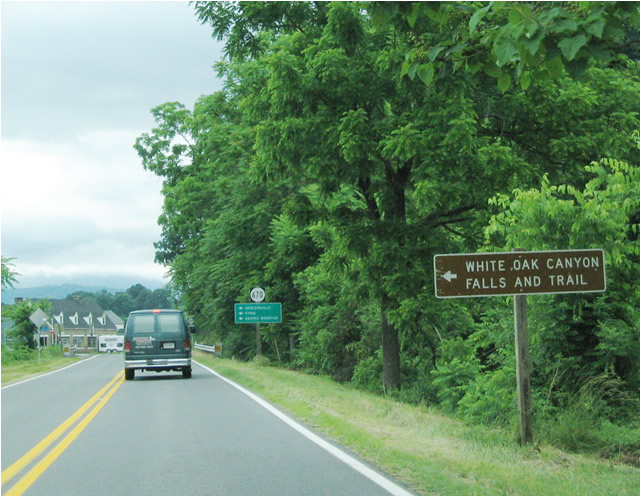
A major intersection along SR 231 north of Madison is with SR 670 near Banco, which follows the Old Blue Ridge Turnpike west to the White Oak Canyon Trail (Via SR 600).
06/05/04
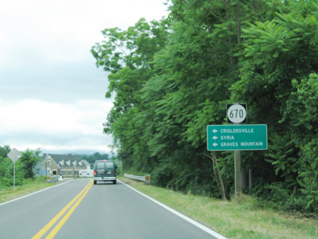
In addition, SR 670 serves Criglersville, Syria, and Graves Mountain.
06/05/04
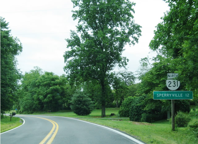
After the SR 670 intersection, this distance sign advises that Sperryville is 12 miles north of here.
06/05/04
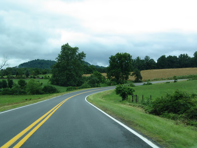
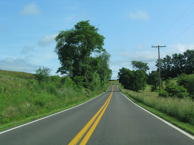
SR 231 earns its spot as a Virginia Scenic Byway as the sun emerges briefly on an otherwise cloudy day.
06/05/04
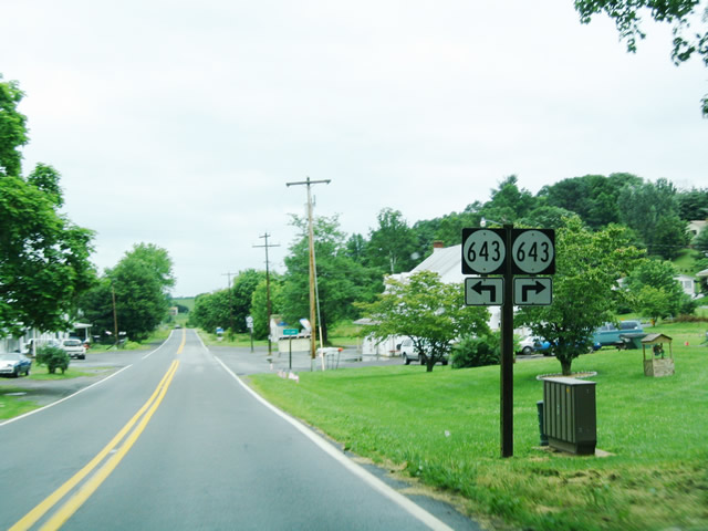
Northbound SR 231 reaches an intersection with SR 643 in Etlan.
06/05/04
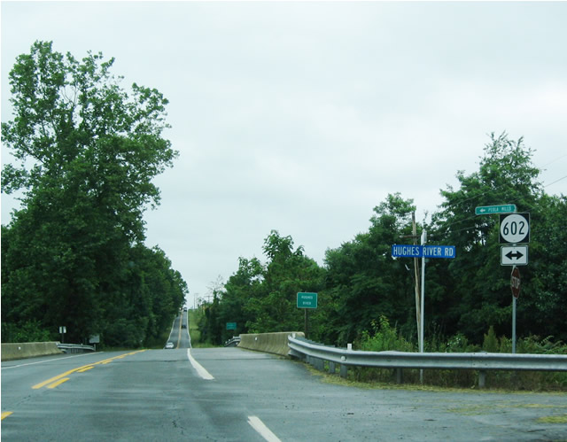
After passing through Etlan, SR 231 reaches an intersection with SR 602/Hughes River Road. The highway passes over the Hughes River and then crosses into Rappahannock County.
06/05/04
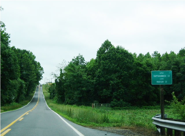
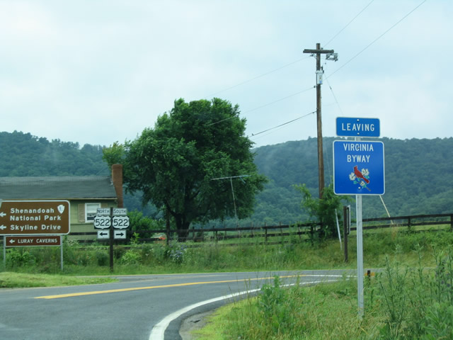
SR 231 leaves Madison County and enters Rappahannock County. The county seat is Washington, which is located off U.S. 211-522 northeast of Sperryville.
06/05/04
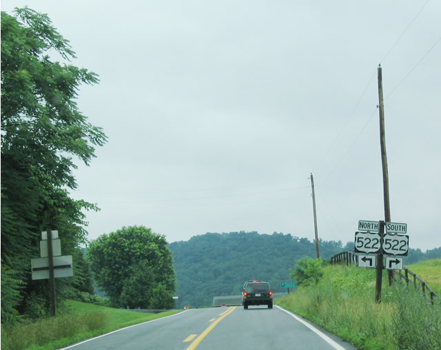
SR 231 reaches its northern terminus at its junction with U.S. 522, a major north-south highway that connects Culpeper with Sperryville and Front Royal.
06/05/04
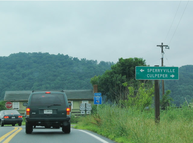
A right turn follows U.S. 522 south to Culpeper, Mineral, Cuckoo, Gum Spring, Goochland, and Powhatan. A left turn follows U.S. 522 north to U.S. 211 and Sperryville.
06/05/04
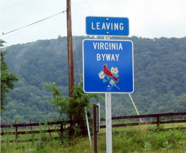
The scenic route of SR 231 comes to an end at its intersection with U.S. 522. There is no "END SR 231" shield assembly.
06/05/04
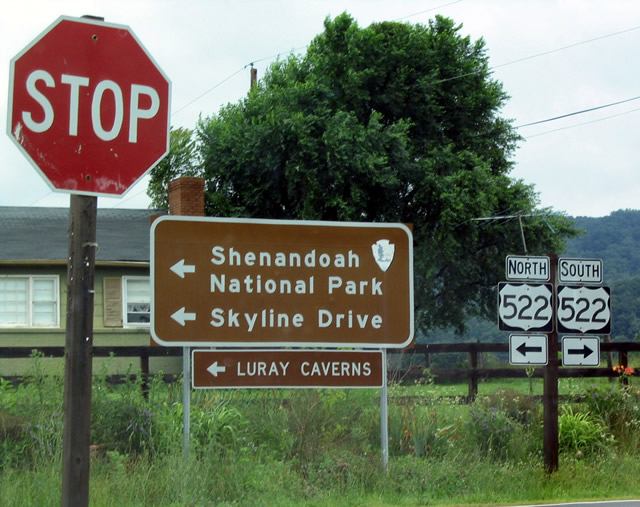
U.S. 522/Taylor Highway north also provides access to Shenandoah National Park and Skyline Drive via U.S. 211/Lee Highway west.
06/05/04
 South
South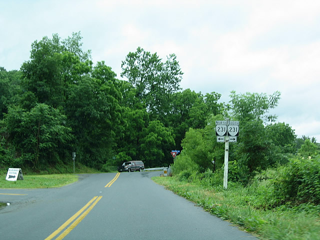
Eastbound SR 670 (Old Blue Ridge Turnpike) ends at Virginia Route 231 northwest of Madison.
06/05/04
North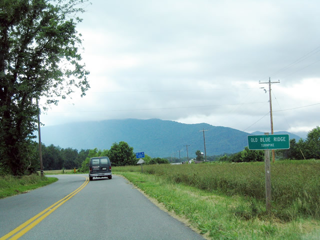
SR 670 is Old Blue Ridge Turnpike.
06/05/04
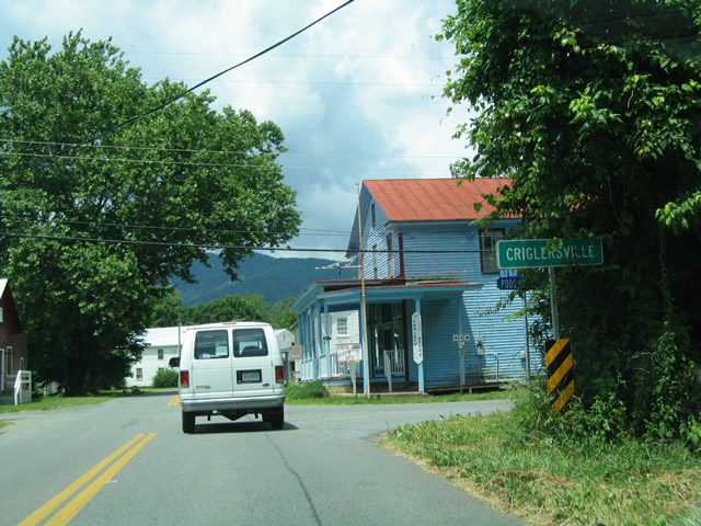
Between the SR 231 turn off and Syria, SR 670 passes through the small town of Criglersville, which is home to a brick elementary school, a few small stores, and several houses. Pastures and farmland surround the area.
06/05/04
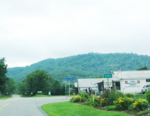
SR 670 east enters Syria, the last stop before the highway ends. A convenience store and nursery are located to the north of SR 670, while Graves Mountain Lodge sits on a hill to the south. SR 643 (Weakley Hollow Road) leads from town to the White Oak Canyon Trail within Shenandoah National Park. In the first weekend after Memorial Day, Graves Mountain Lodge opens up several of its pastures for camping and a bluegrass music festival. The festival lasts for three days, and camping is allowed for the entire week.
06/05/04
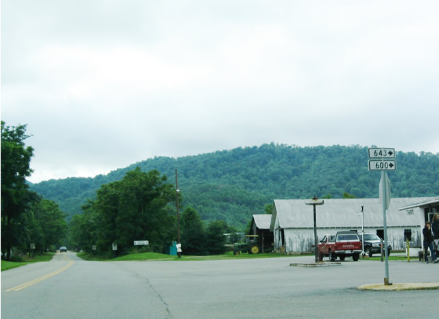
Westbound SR 670 (Old Blue Ridge Turnpike) intersects SR 643, which connects to SR 600 en route to White Oak Canyon Trail.
06/05/04
Photo Credits:
- Andy Field: 06/05/04
Connect with:

Page Updated Saturday July 10, 2004.