
State Trunk Highway 16 West - Pewaukee to Oconomowoc
 West
West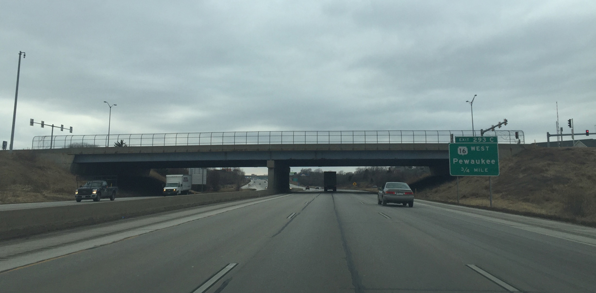
Wis 16 first appears along Interstate 94 west at the Wis 164 overpass in the city of Pewaukee.
02/29/16
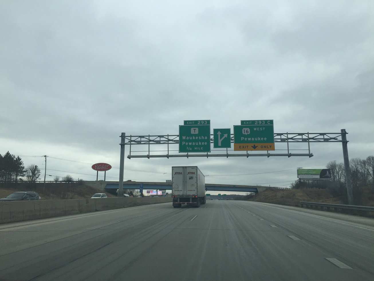
An auxiliary lane accompanies I-94 west from STH-164 to the wye interchange (Exit 293C) with STH-16 west.
02/29/16
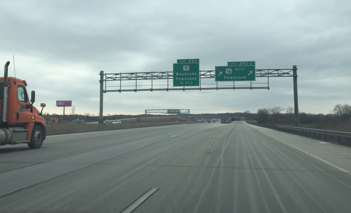
Wis 16 begins off I-94 west via a two lane ramp. The trunk highway parallels adjacent County T north to the village of Pewaukee.
02/29/16
 West
West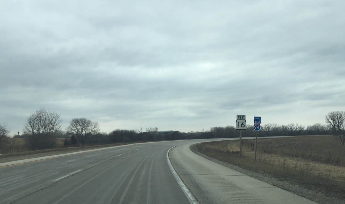
The first reassurance sign on Wis 16 west stands on the ramp leading north from I-94 west.
02/29/16
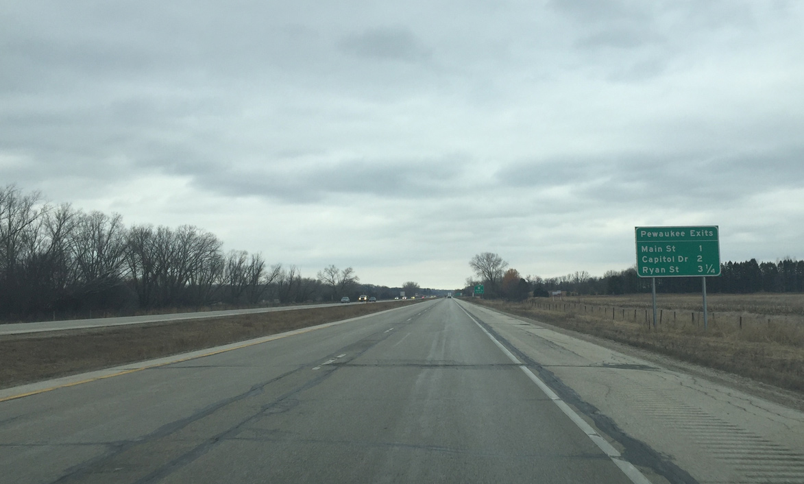
A community interchanges identification sign outlines the ensuing three exits for the village of Pewaukee from the Wis 16 freeway.
02/29/16
Forthcoming Exit 188 serves Downtown Pewaukee and nearby Waukesha County Technical College. County JJ ties into the exchange from Bluemound Road to the southeast.
02/29/16
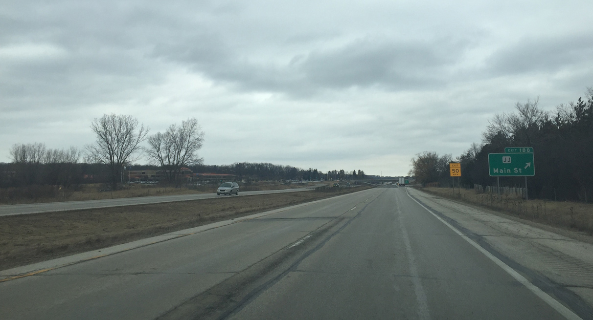
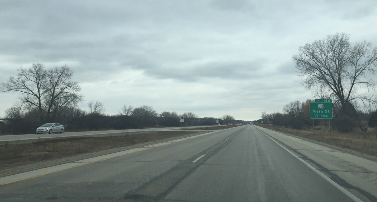
Entering the modified diamond interchange with County JJ (Main Street) on Wis 16 west. Main Street, the former alignment of U.S. 16, angles northwest from Bluemound Road and Exit 188 to Wisconsin Avenue at the east shore of Pewaukee Lake.
02/29/16
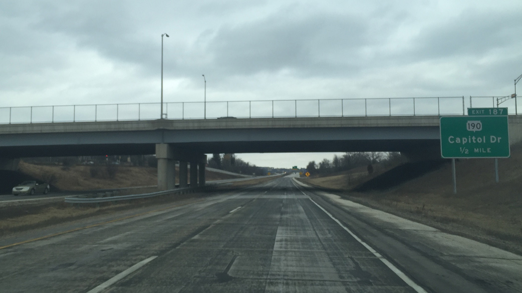
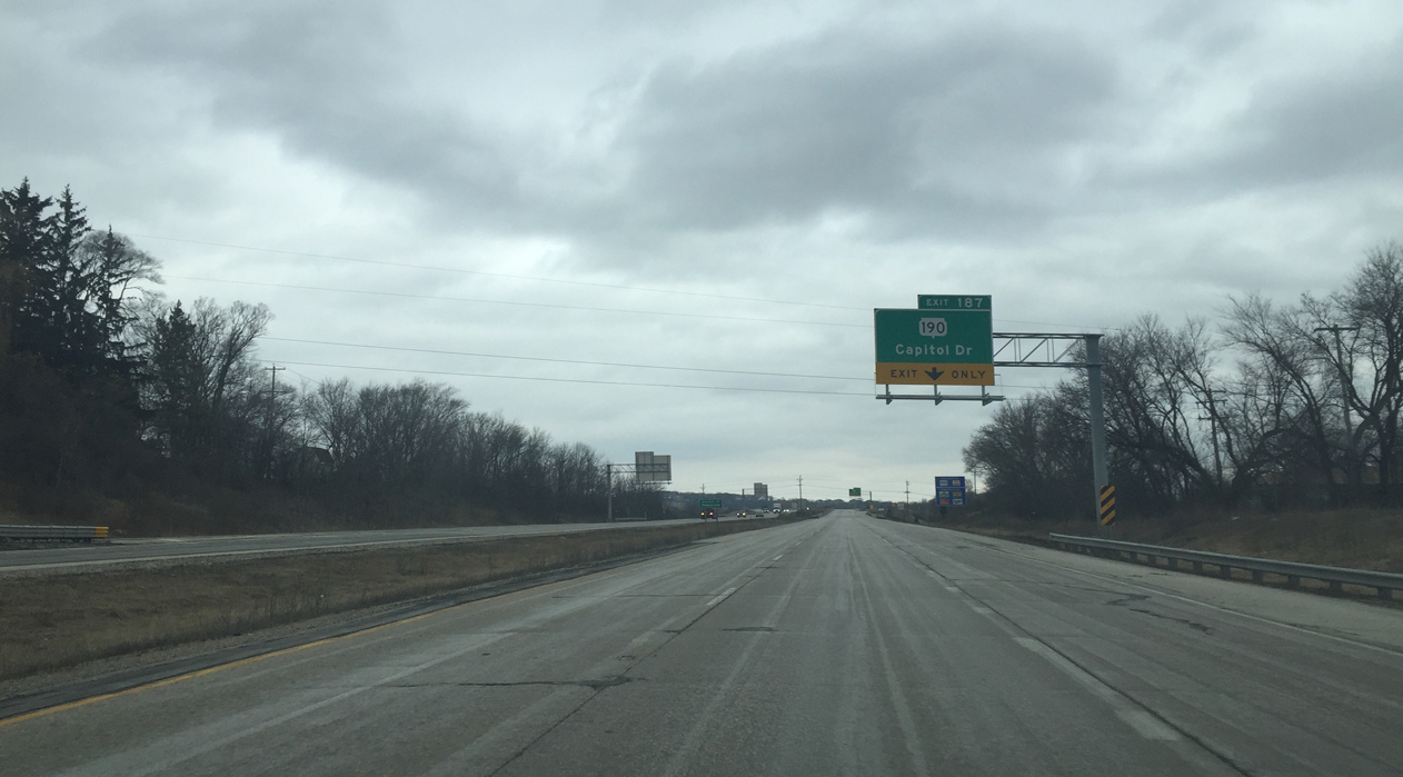
Continuing north, Wis 16 west next meets Wis 190 (Capitol Drive) at Exit 187. Wis 190 is an urban expressway alternative to I-94.
02/29/16
An auxiliary lane adds to the Wis 16 freeway west across the Pewaukee River to Wis 190 (Capitol Drive).
02/29/16
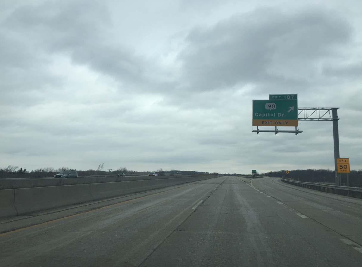
Wis 190 begins here and travels nearly 20 miles east across Brookfield, Wauwatosa and Milwaukee to Shorewood. Capitol Drive stems west as a local street to become Oakton Avenue to Main Street (old U.S. 16).
02/29/16
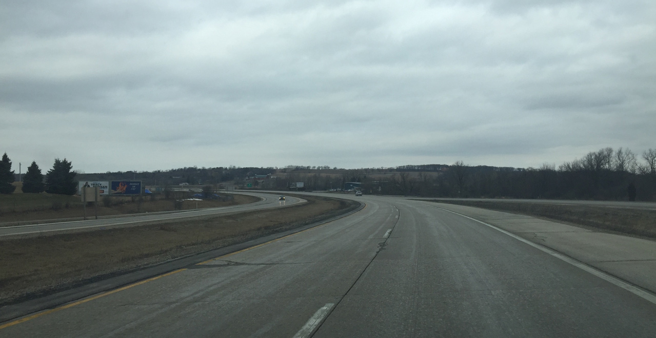
Wis 16 curves from north to west just beyond Wis 190 across an area of wetlands. A distant hill rises around 200 feet to the north.
02/29/16
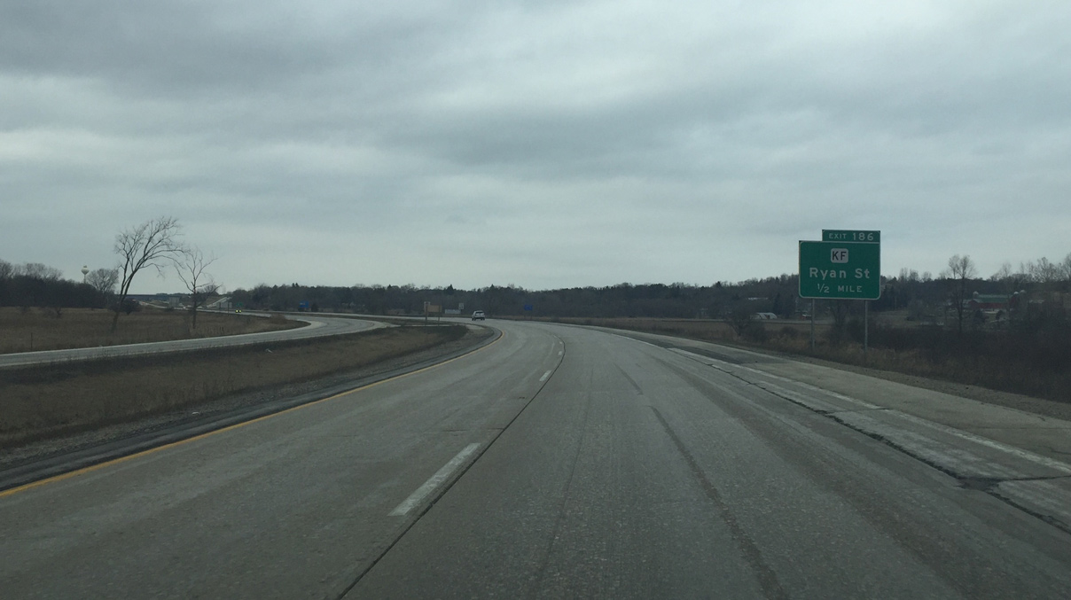
County KF (Ryan Street) connects Wis 16 with Wisconsin Avenue (old U.S. 16) to the south in Pewaukee and County JK (Lynndale Road) to the north.
02/29/16
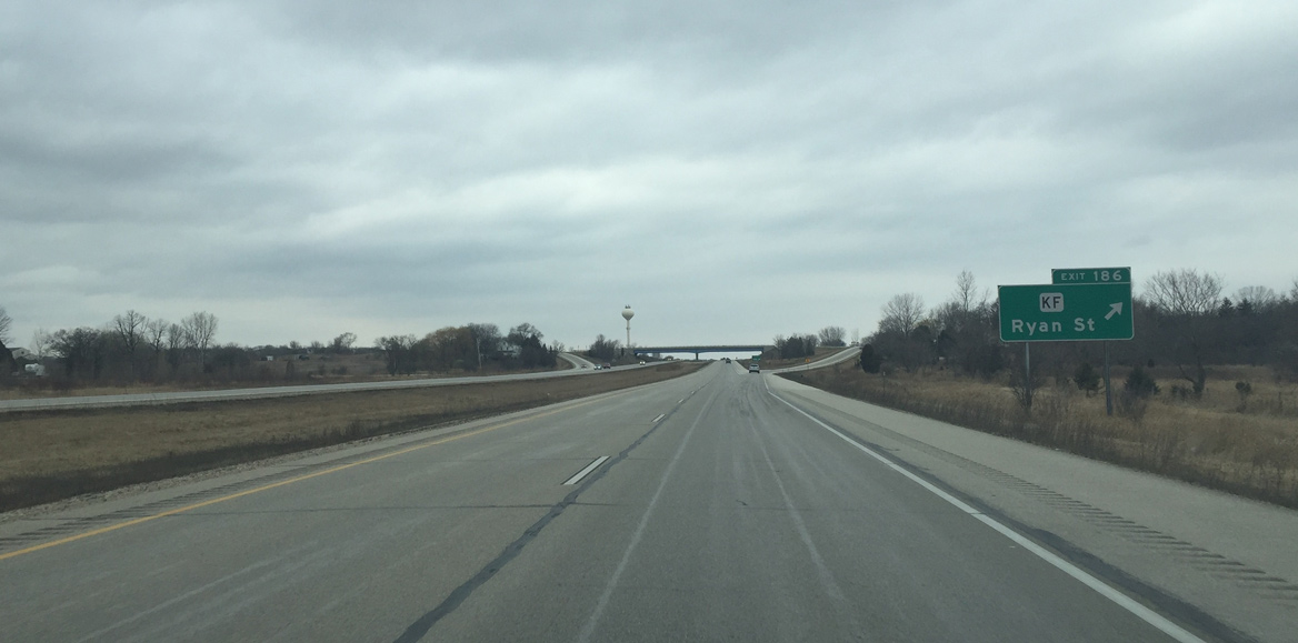
Entering the diamond interchange (Exit 186) with CTH-KF (Ryan Street) on STH-16 west. County KF ends 1.6 miles to the north at County K (Lisbon Road) near Merton.
02/29/16
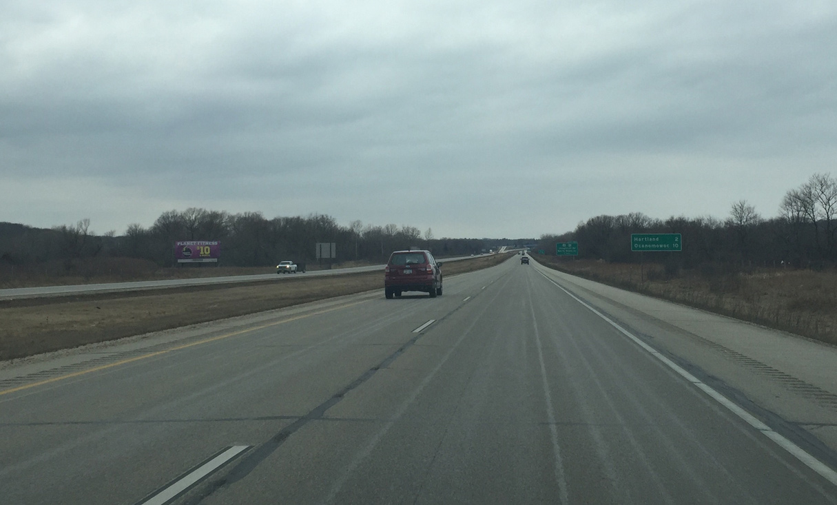
Hartland (two miles away) and Oconomowoc (ten miles away) are the two biggest communities that this stretch of Wis 16 freeway serves.
02/29/16
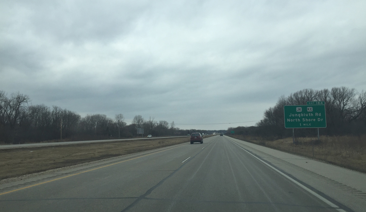
County JK and KE serve local traffic in "Lake Country" at forthcoming Exit 184.
02/29/16
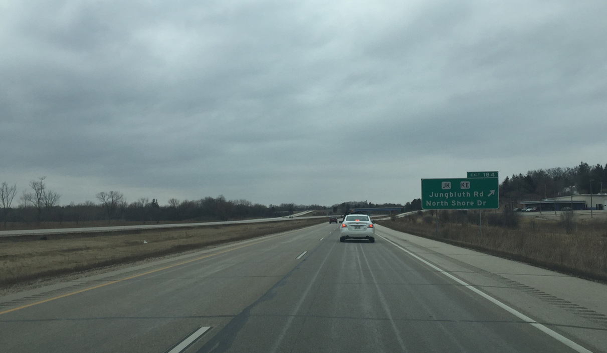
An undeveloped stretch of Wis 16 concludes at the diamond interchange (Exit 184) with County JK & KE. CTH-JK parallels the freeway as a local route along Lynndale Road and Lisbon Avenue while CTH-KE runs north to CTH-K and south along Shore Drive to STH-83.
02/29/16
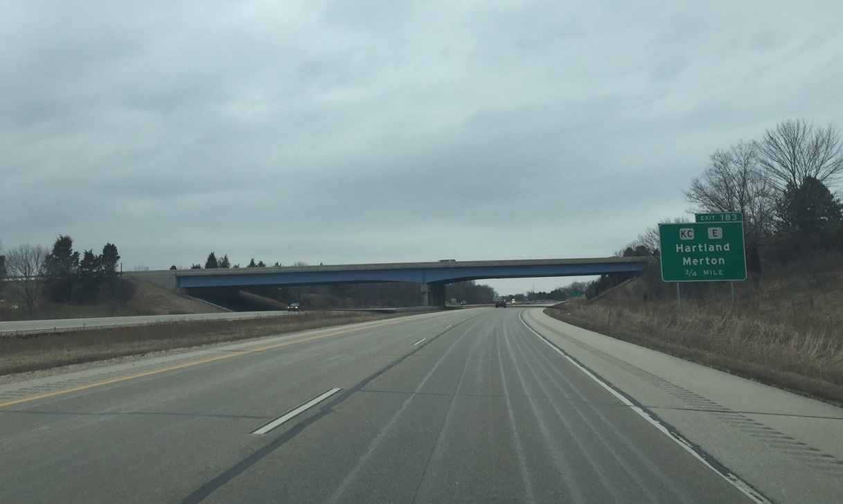
Travelers along Wis 16 west cross northern reaches of the Hartland village limits through the split diamond interchange (Exit 183) with Waukesha County E and KC.
02/29/16
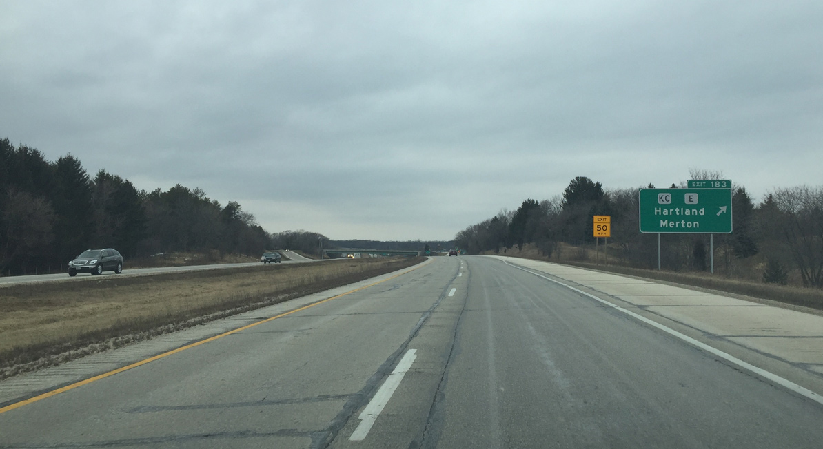
Exit 183 departs Wis 16 west to form a frontage road (Hartbrook Drive) linking County KC (Merton Avenue) with County E (North Avenue) north. The village of Merton lies a short distance to the northeast via County KC, County K and Dorn Road. CTH-E otherwise leads north from Hartland to Monches.
02/29/16
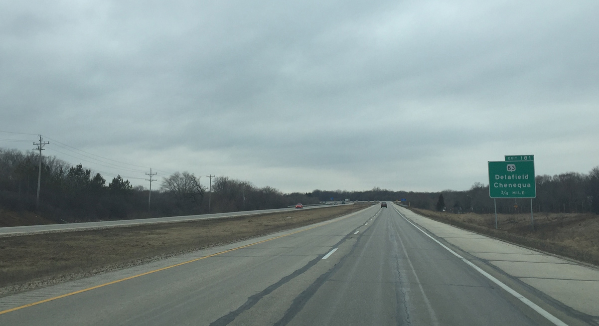
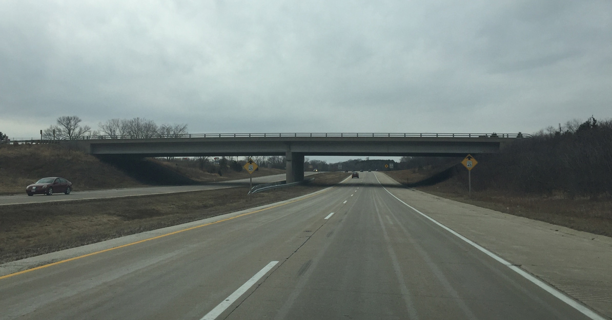
Wis 16 passes over the Bark River and North Avenue on the 0.75 mile approach to Exit 181 with Wis 83. Wis 83 is the main north/south arterial through the Lake Country area. It also serves suburbs southwest of Milwaukee.
02/29/16
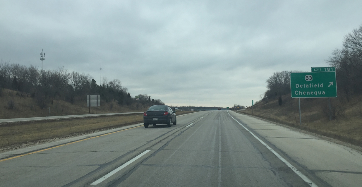
Wis 83 travels north through the village of Chenequa and south from Hartland to the city of Delafield. The state trunk highway totals nearly 75 miles from the Illinois state line by Benet Lake to Wis 175 north of Hartford.
02/29/16
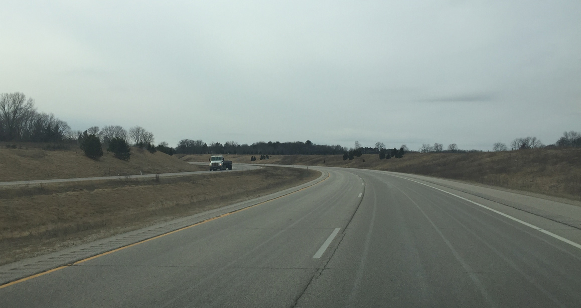
The freeway narrows through a strip south of Pine Lake and north of a parallel CPR Railroad line just west of Exit 181. This section directly overlaid old U.S. 16.
02/29/16
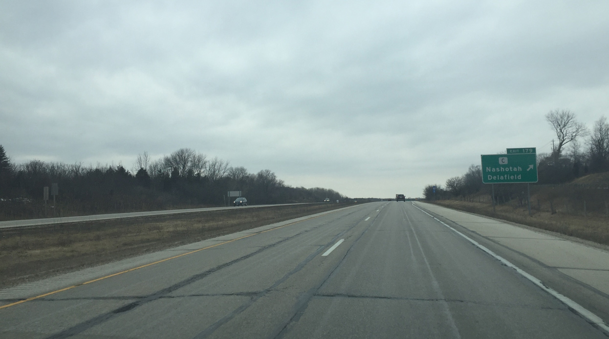
A lone diamond interchange (Exit 179) joins STH-16 with the village of Nashotah at CTH-C (Lakeland Drive). County C south bisects the village to Delafield.
02/29/16
County R forms a north side frontage road (Wisconsin Avenue) from County C west to County P (Sawyer Road) and the adjacent diamond interchange (Exit 176) with Wis 16.
02/29/16
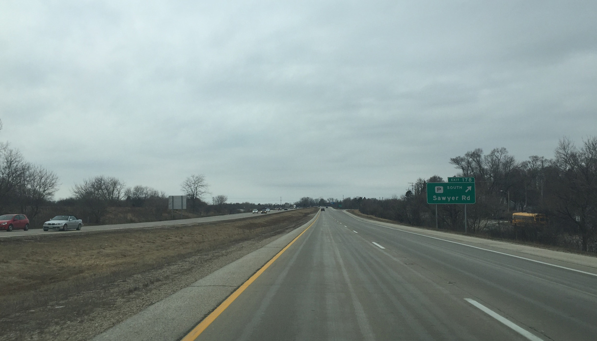
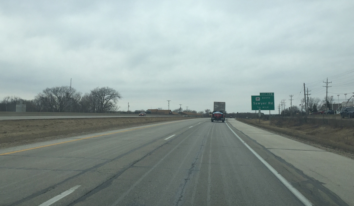
Westbound Wis 16 at the off-ramp (Exit 178) for County P (Sawyer Road). County P south encircles the village of Oconomowoc Lake to the village of Summit.
02/29/16

County P north follows Wis 16 to the subsequent exit. The freeway passes between the community of Okauchee and Oconomowoc Lake ahead of the diamond interchange at Exit 176.
02/29/16

Freeway ends signs. The sign on the right in poor condition is a rare site along state maintained roads in Wisconsin.
02/29/16
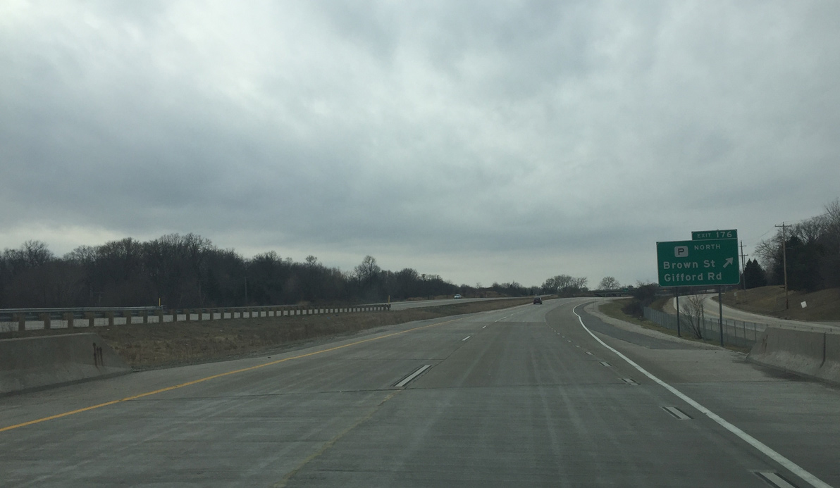
County P departs for Brown Street and serves rural northwestern Waukesha County. Gifford Road ties in from Oconomowoc Lake and Wisconsin Avenue (old U.S. 16) to the south.
02/29/16
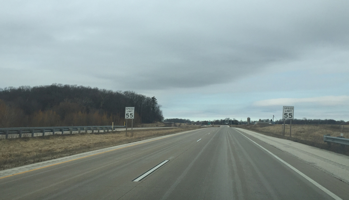
Speed limits reduce to 45 miles per hour as this freeway stretch comes to an end.
02/29/16
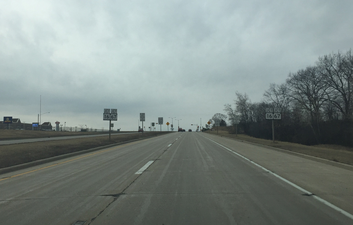
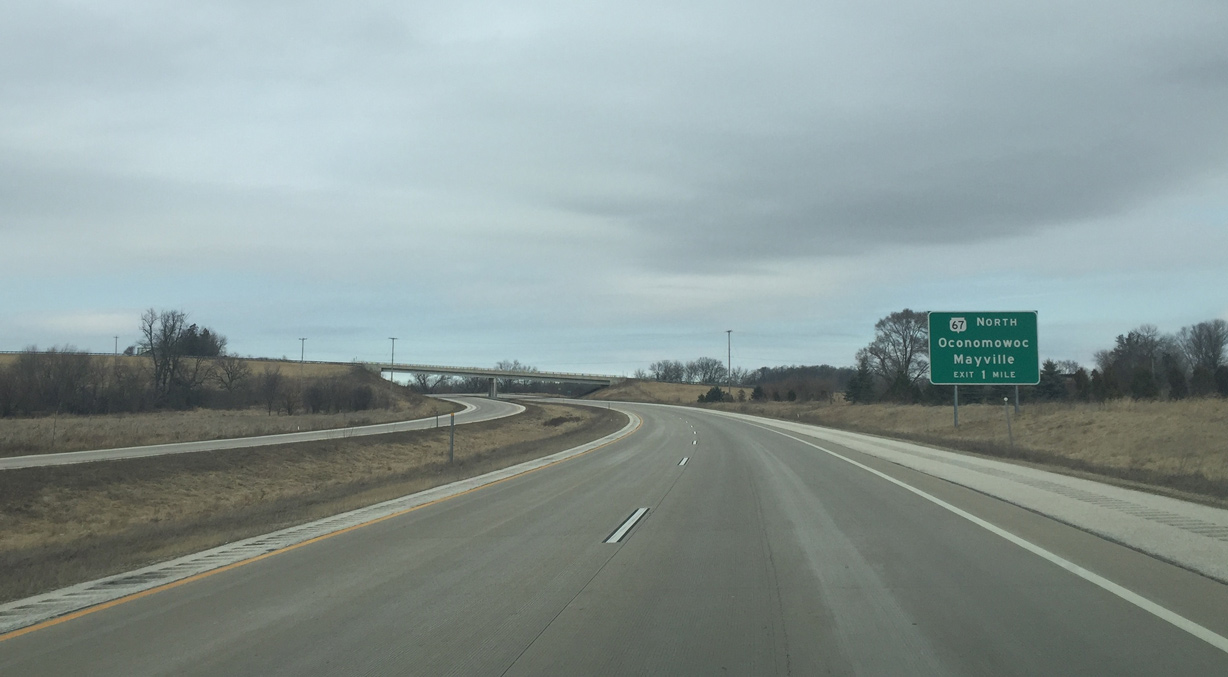
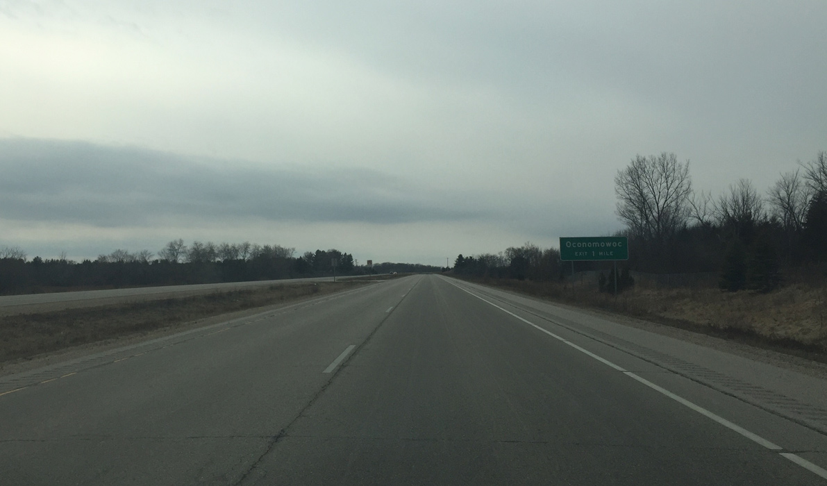
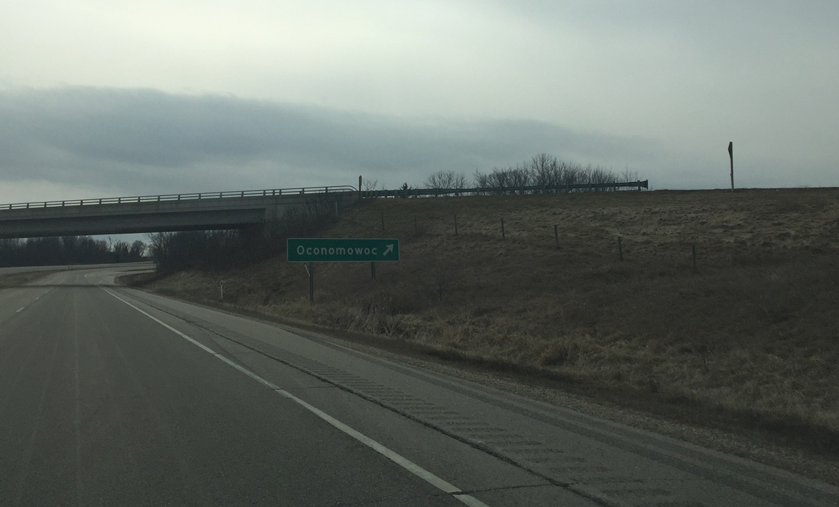
Wis 16 traverses an area of wetlands surrounding the Oconomowoc River preceding Wis 67. The junction Wis 16 sign was most likely put up to warn about the upcoming turn the trunk highway takes to the north.
02/29/16

Wis 16 exits to the right to merge with Wis 67 north on an expressway. This route was signed as Wis 16 Bypass when the eastern section of the bypass opened in 2007. The western section opened in 2008 as Wis 16 was routed onto the bypass and removed from Wisconsin Avenue through central Oconomowoc.
02/29/16
West  North
North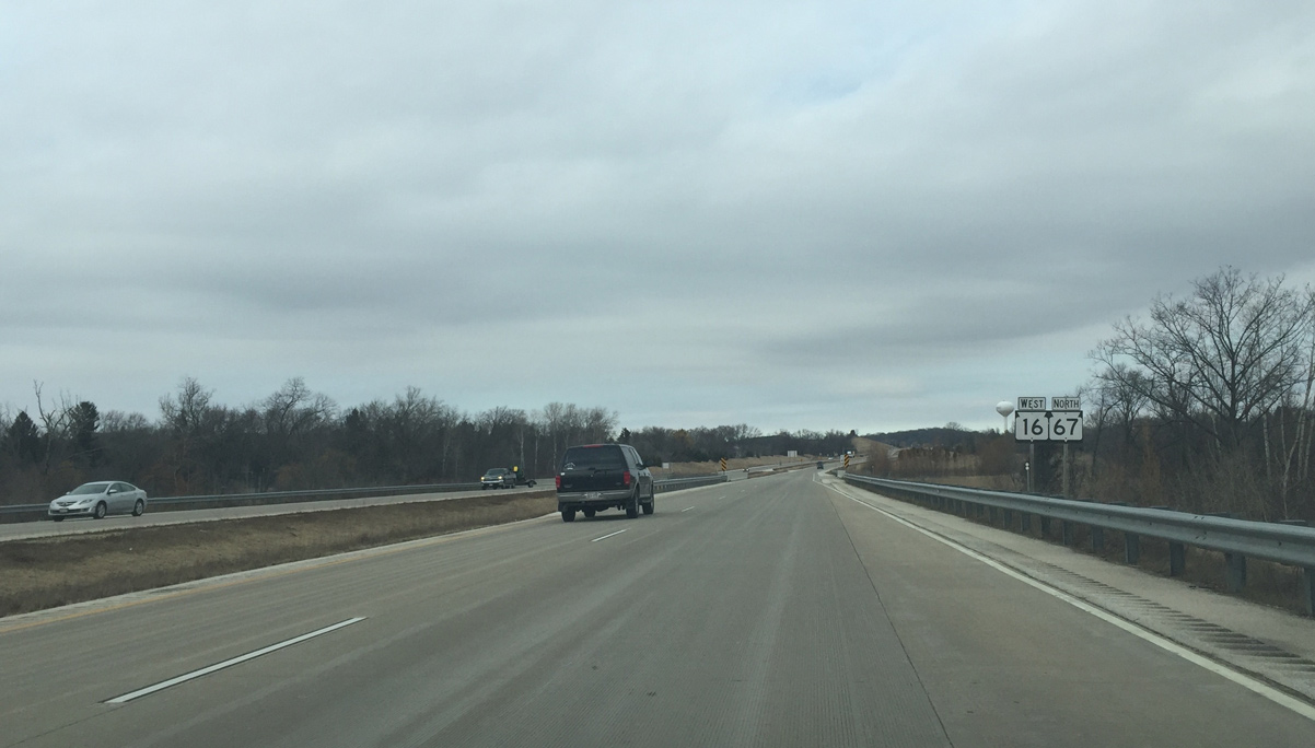
First reassurance for Wis 16 and Wis 67. Wis 67 was also rerouted from central Oconomowoc onto the bypass.
02/29/16
Lisbon Road intersects the Wis 16/67 expressway west from Brown Road (CTH-P) and east of the Oconomowoc Heights neighborhood.
02/29/16
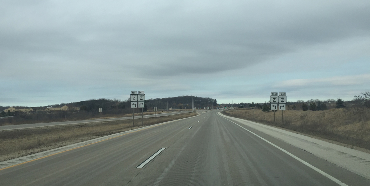
Wis 16/67 advance another half mile to intersect County Z (Lake Drive).
02/29/16
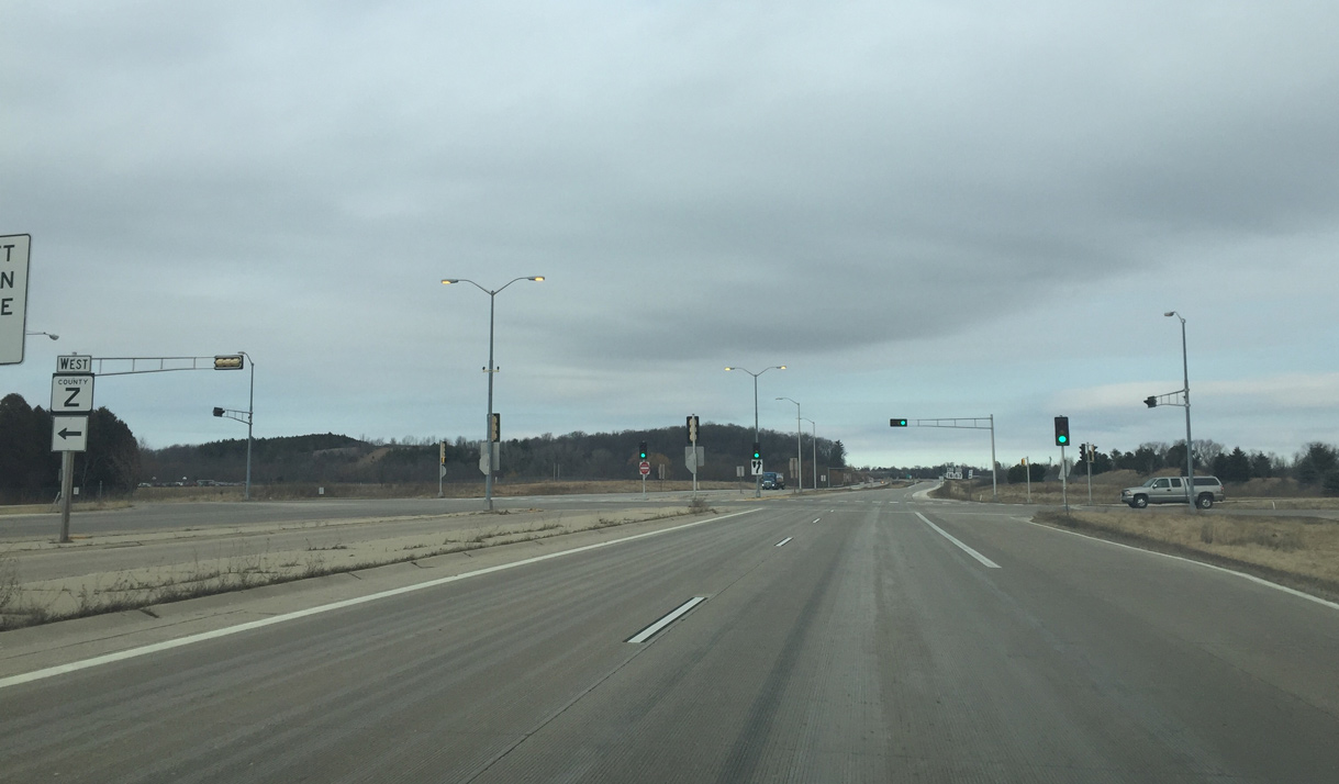
County Z dog legs west along Lake Drive, Lapham Street and Lisbon Road toward old Wis 67 (Lake Road). CTH-Z east bisects a subdivision east to apartments and retail at CTH-P.
02/29/16

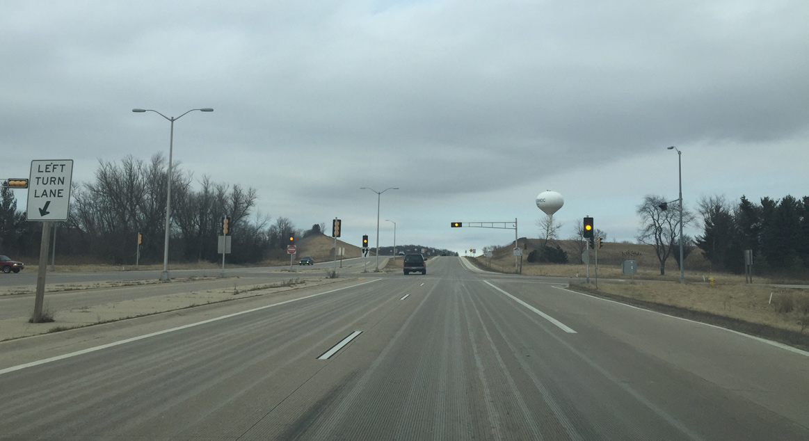
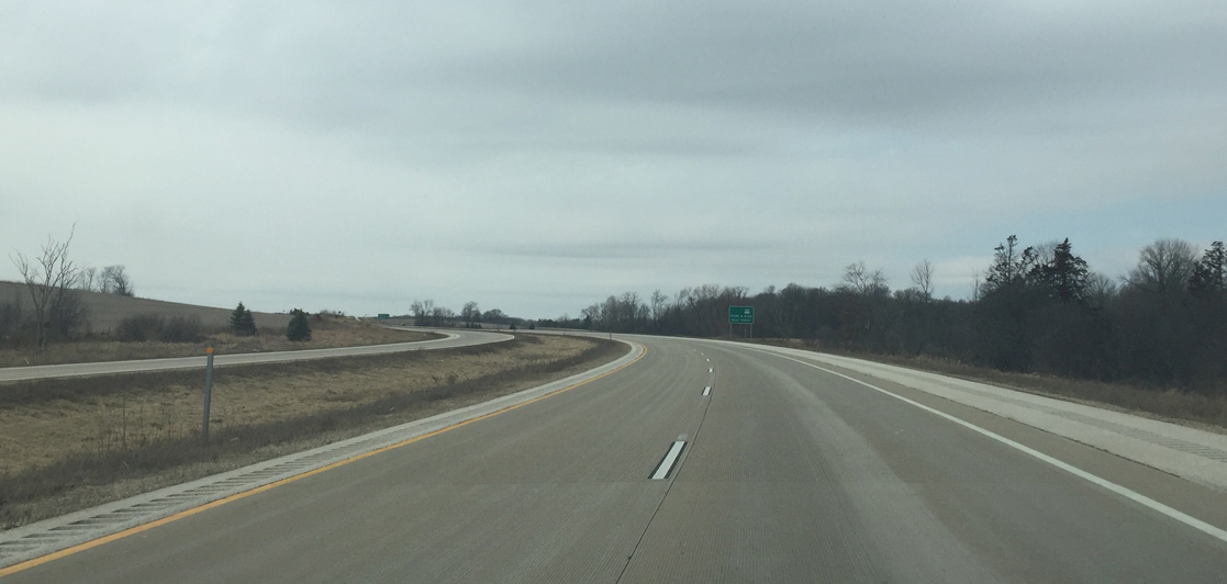
Beyond County Z, the Oconomowoc bypass becomes a freeway.
02/29/16
The speed limit increases to 55 miles per hour. It does not increase to 65 mph due to the relatively short length of the freeway.
02/29/16
Wis 67 departs from the bypass and returns to its original alignment in one mile.
02/29/16
Wis 16 curves from north to west before the diamond interchange with Wis 67 north and old Wis 67 south.
02/29/16
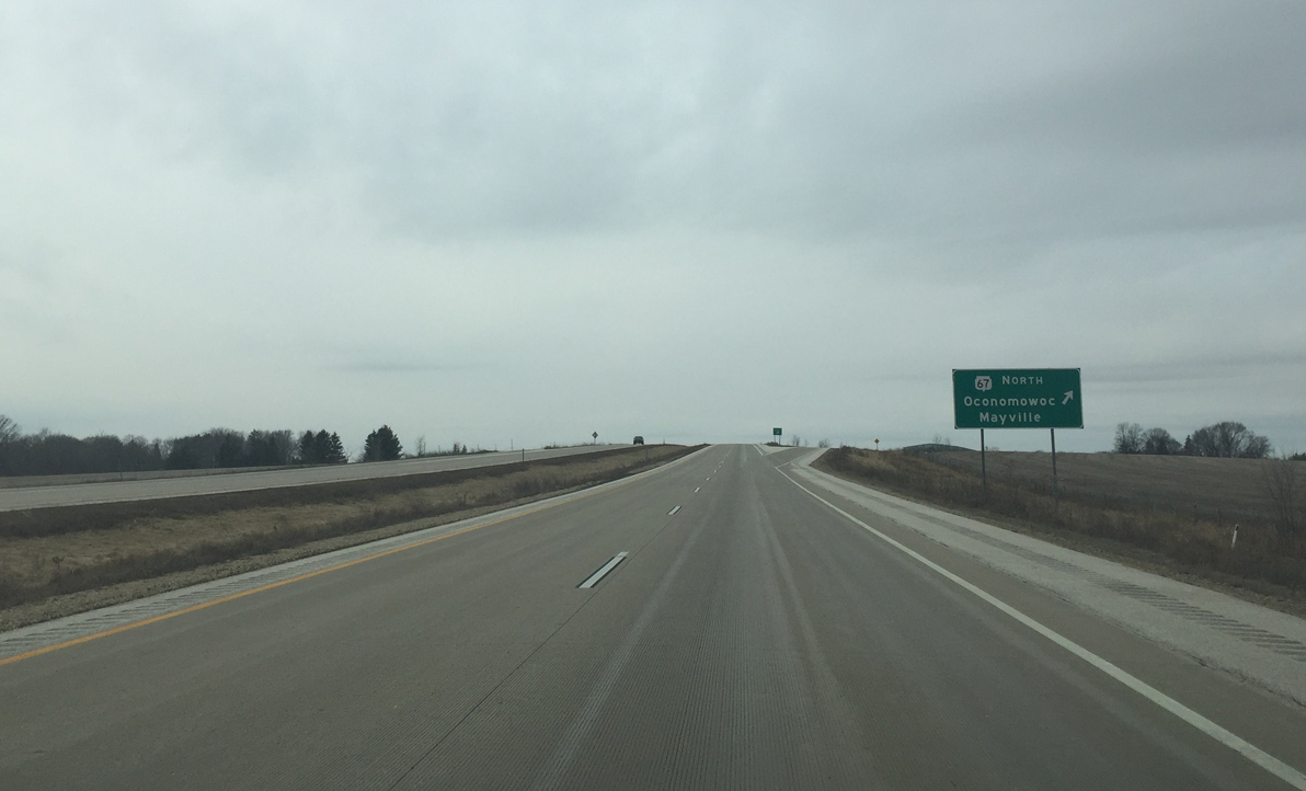
Wis 67 north separates from Wis 16 west and continues towards Mayville and the Kettle Moraine area.
02/29/16
West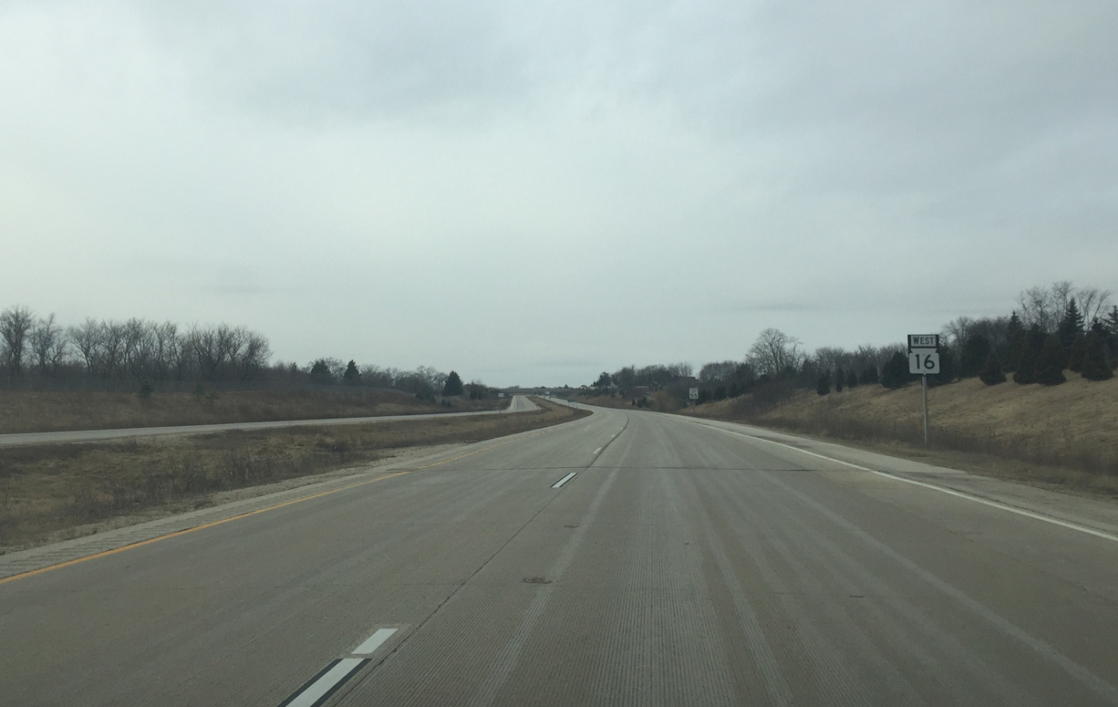
Advancing west, Wis 16 meanders by northern reaches of the Lac La Belle village limits.
02/29/16
Wis 16 curves from west to south. The original concrete surface suffered from excessive chipping so the contractor had to pay for an asphalt overlay a year after opening.
02/29/16
The original Wis 16 alignment, named simply Highway 16 but no longer numbered, is in a mile.
02/29/16
Ski Slide Road spans Wis 16 west just ahead of the diamond interchange with Highway 16 east to Wisconsin Avenue and Oconomowoc. Oconomowoc opted not to have a business route over old 16.
02/29/16
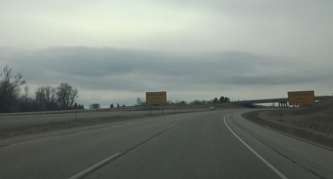
Wis 16 again overtakes its original alignment as expressway ends signs warn that the four lane stretch is about to conclude.
02/29/16
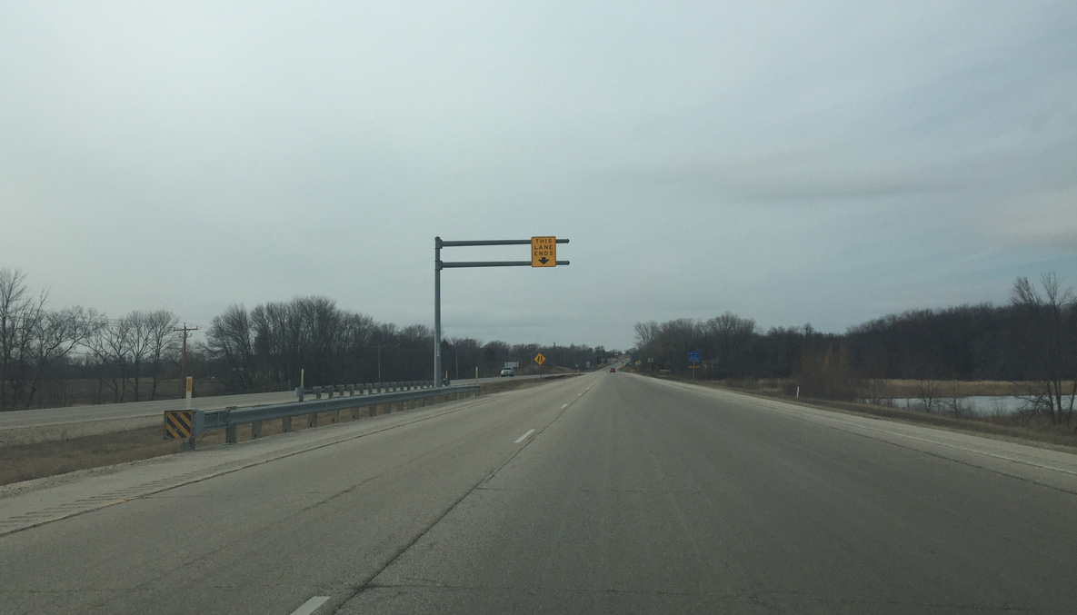
The left lane ends as Wis 16 transitions into a two lane road ahead of the Rock River.
02/29/16
Wis 16 becomes two lanes and intersects Rock River Road. Wis 16 was declared a new connector route in Wisconsin's Corridors 2030 plan between I-94 and Watertown, so it may qualify for further improvements in the future.
02/29/16

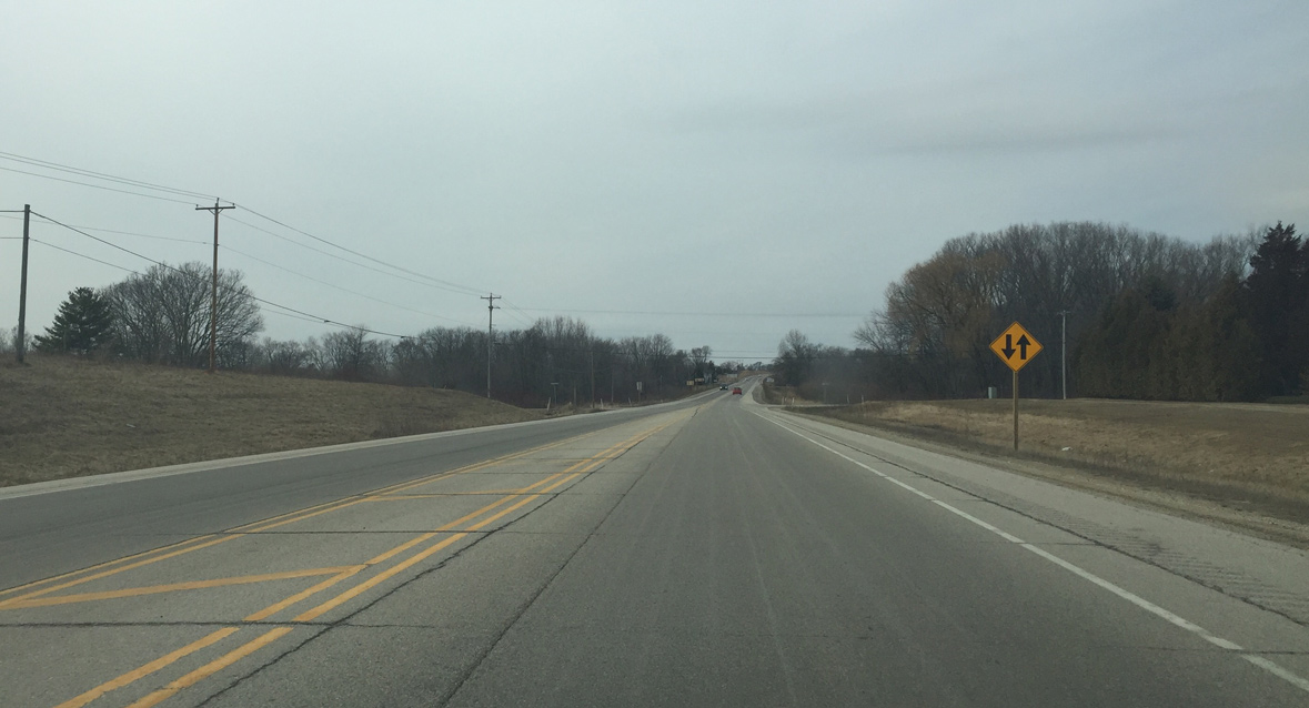
Reassurance marker posted for Wis 16 ahead of the Rock River.
02/29/16
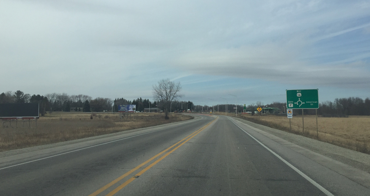
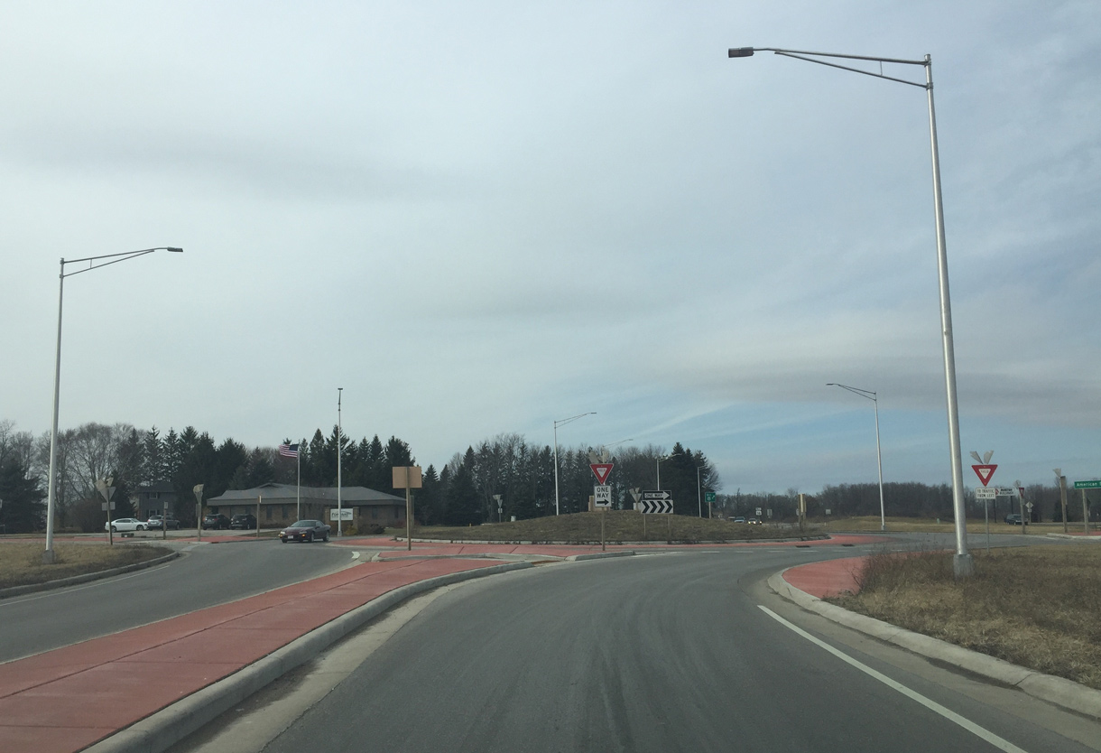
Approaching a roundabout with County F on Wis 16 west. County F serves Ixonia, a community Wis 16 bypasses.
02/29/16
County F south from the roundabout with Wis 16 is the former alignment of Wis 135. The trunk highway connected Ixonia with Concord, Sullivan, Rome and Palmyra within Jefferson County.
02/29/16
Photo Credits:
- Peter Johnson: 02/29/16
Page Updated Wednesday May 25, 2016.