
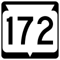
State Trunk Highway 172 West
A reassurance marker lines the ramp from Interstate 43 north onto STH 172 west.
05/30/11
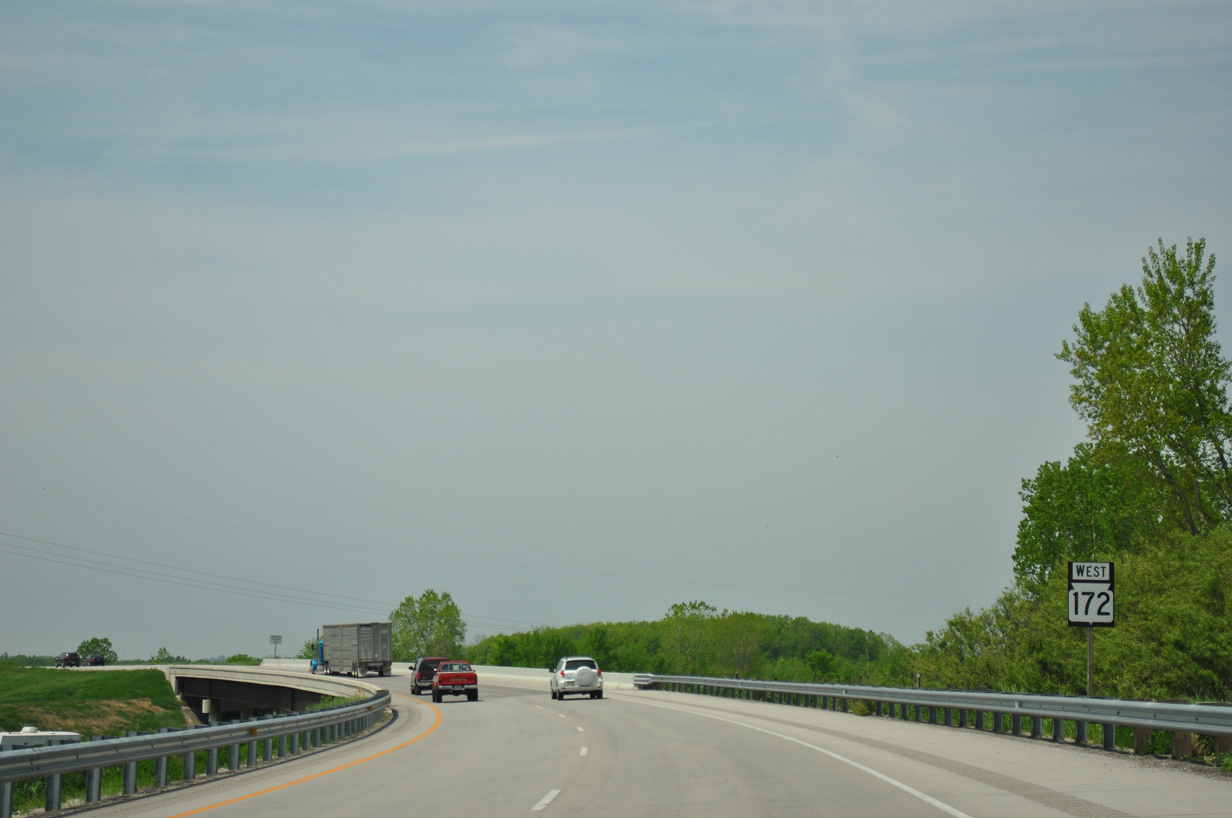
Suburban housing developments flank both sides of the Wis 172 freeway leading west to the CTH V (Lime Kiln Road) under crossing. The first exit lies one mile ahead with CTH GV (Monroe Road).
05/30/11
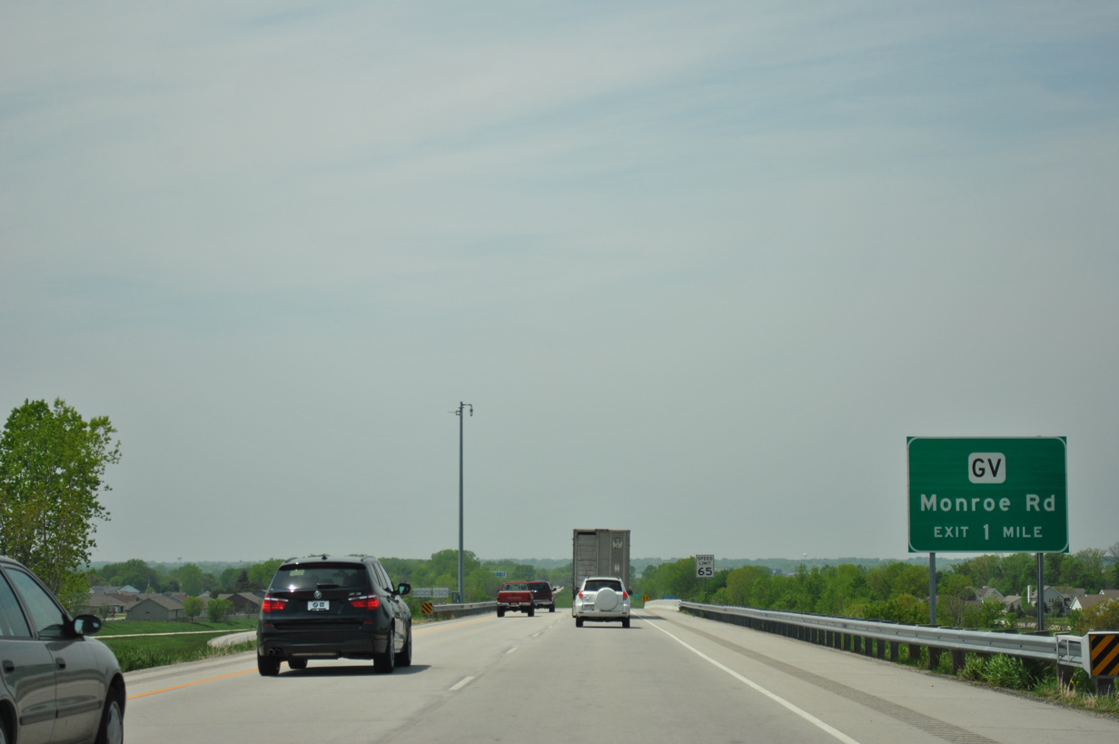
Traffic joining Wis 172 west from I-43 south forms an auxiliary lane west to the diamond interchange with CTH GV (Monroe Road).
05/30/11
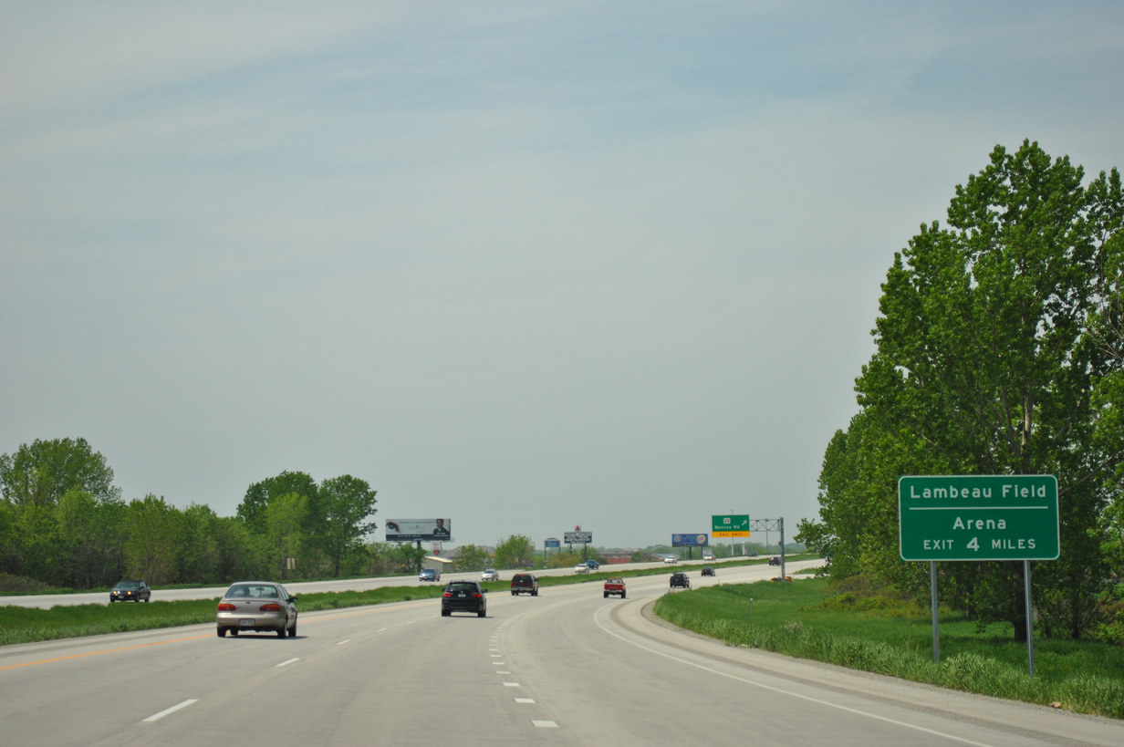
Travelers headed west to Lambeau Field or Resch Arena are directed to remain along the Wis 172 freeway to Oneida Street in Ashwaubenon.
05/30/11
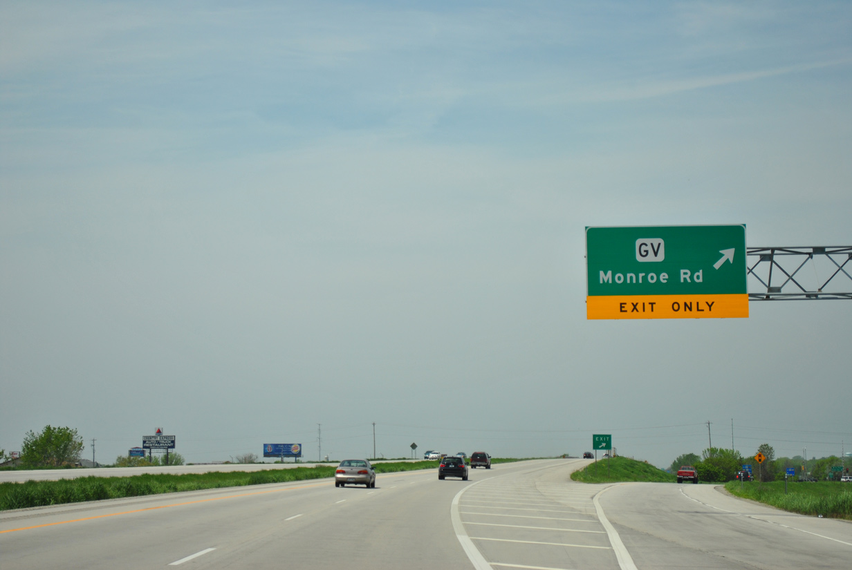
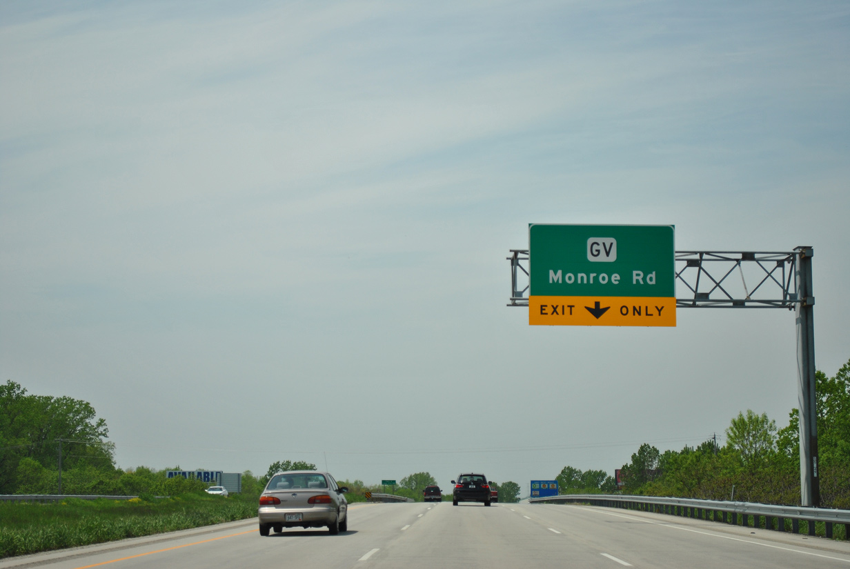
follows Monroe Road north to Lime Kiln Road en route to Green Bay and south to CTH X (Heritage Road) in a rural area of the town of Ledgeview. The trunk highway was expanded into an arterial both south and north of STH 172 to accommodate suburban development.
05/30/11
Wis 172 turns more northwesterly from CTH GV to cross the East River into the village of Allouez.
01/19/16
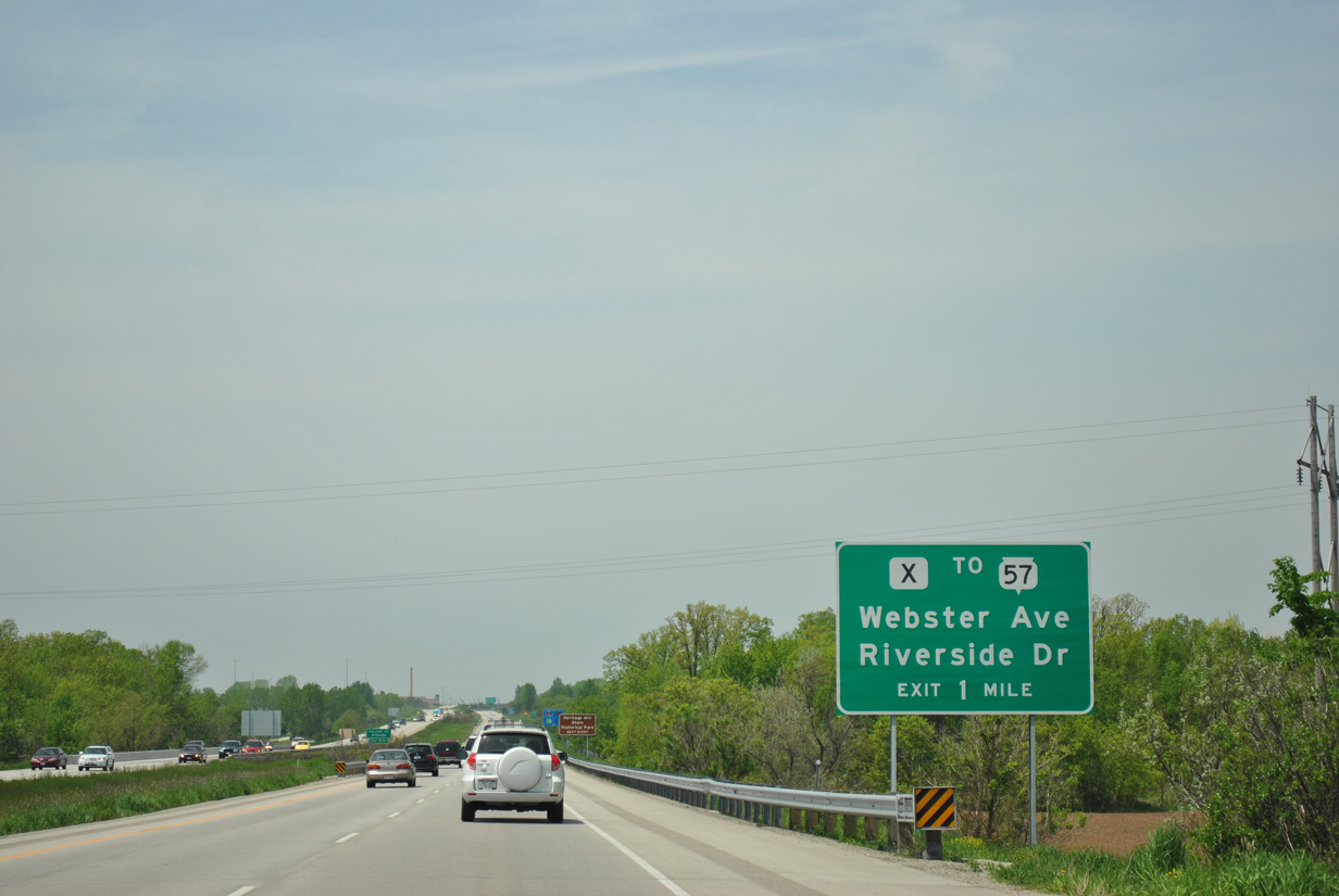
CTH X (Webster Avenue) and CTH 57 (Riverside Drive) meet STH 172 at an interconnected diamond and folded diamond interchange in one mile.
05/30/11
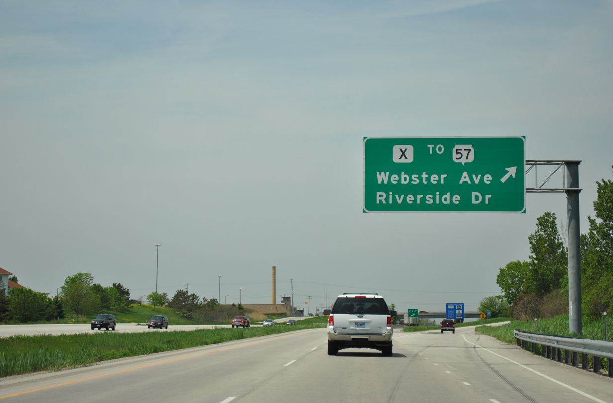
A single off-ramp leads motorists west initially to CTH X (Webster Avenue) and then CTH 57 (Riverside Drive). CTH X comprises a local boulevard south to De Pere and north to the Green Bay city line. STH 57 provides a through route north to Downtown Green Bay and south to De Pere, where it combines with STH 32 to the Calumet County seat of Chilton.
05/30/11
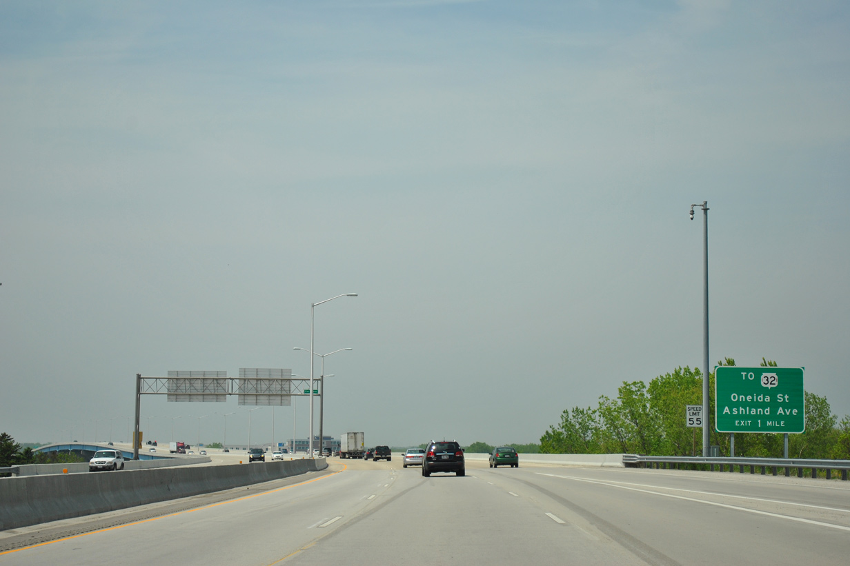
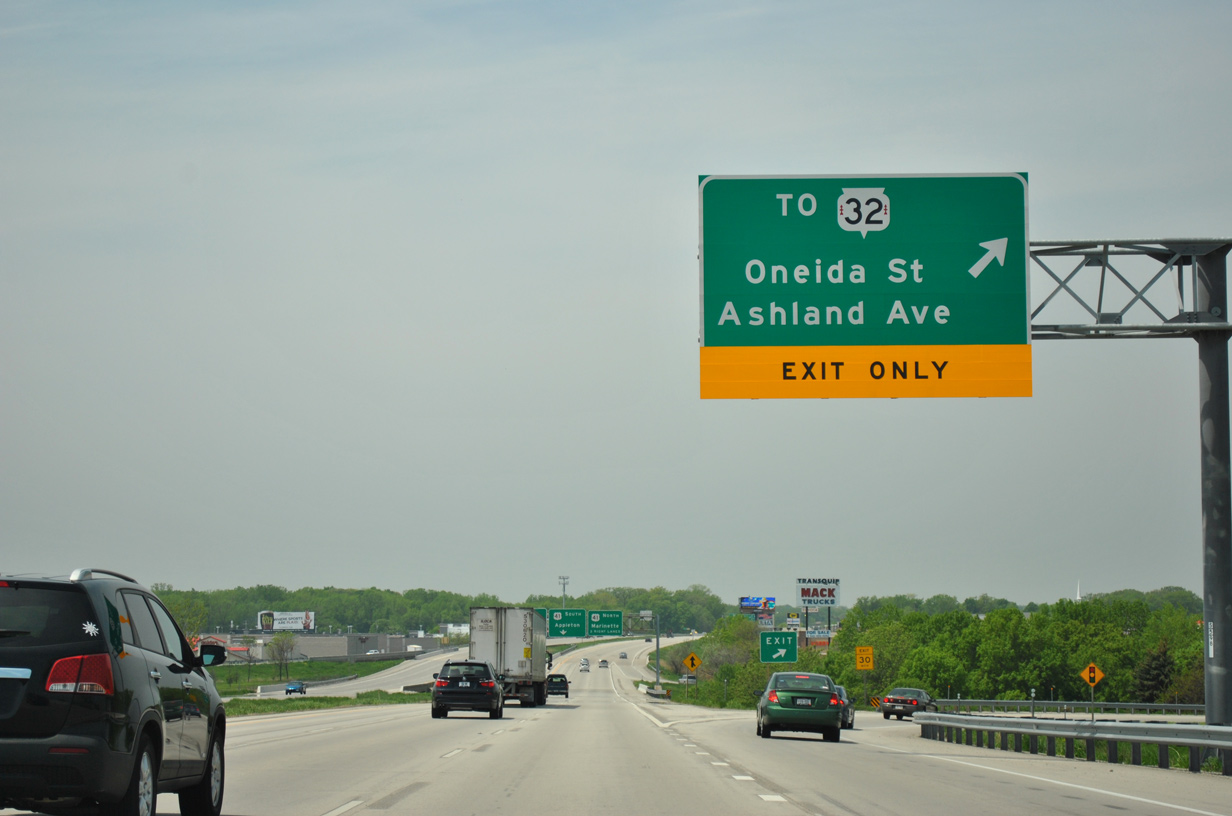
On-ramps from both CTH X and STH 57 expand STH 172 west to three overall lanes as it crosses the Fox River. The next exit lies one mile ahead with Pilgrim Way to both STH 32 (Ashland Avenue) and Oneida Street (CTH AAA).
05/30/11
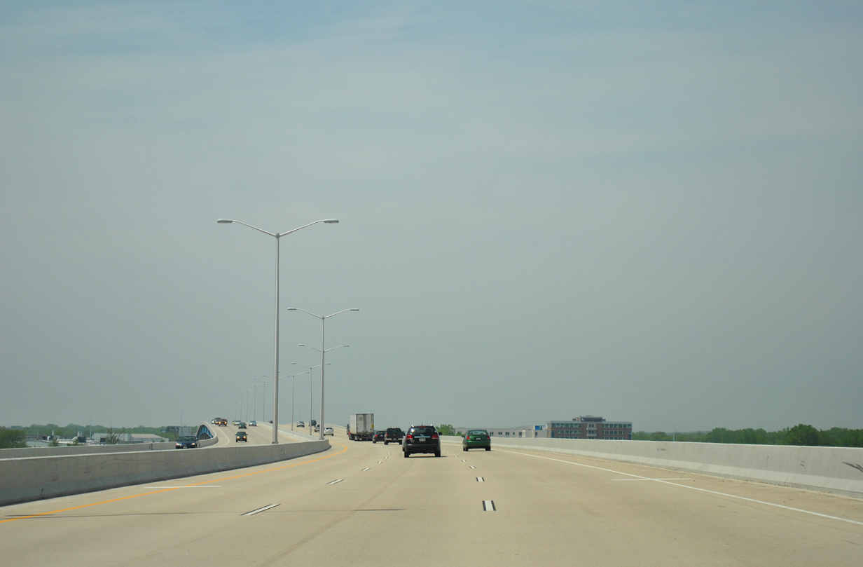
The six lane Fox River bridge was redecked as part of a 5.5 mile construction project to resurface the Wis 172 freeway between I-43 and U.S. 41 (I-41). The $38 million project was completed in September 2010.1
05/30/11
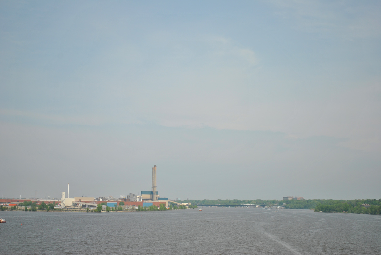
The Lower Fox River flows north along industrial areas and by Downtown Green Bay to empty into Green Bay just north of the Leo Frigo Bridge (I-43).
05/30/11
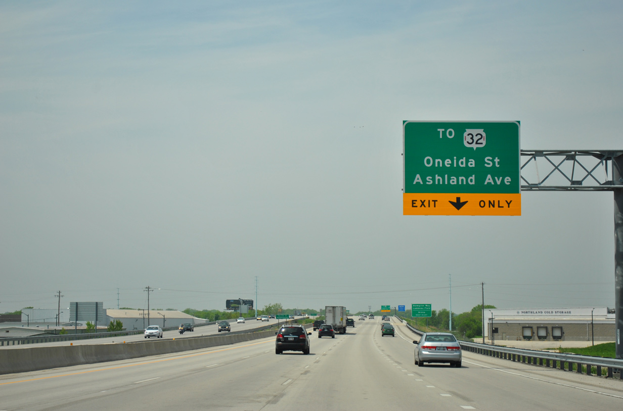
Wis 172 enters the village of Ashwaubenon and crosses over Wis 32 (Red Arrow Highway). Pilgrim Way, a local connector, leads motorists east to Ashland Avenue and west to Bay Park Square mall and Oneida Street (CTH AAA). STH 32 doubles as the 32nd Division Memorial Highway along the nearly 326 mile trek across the height of the state.
05/30/11
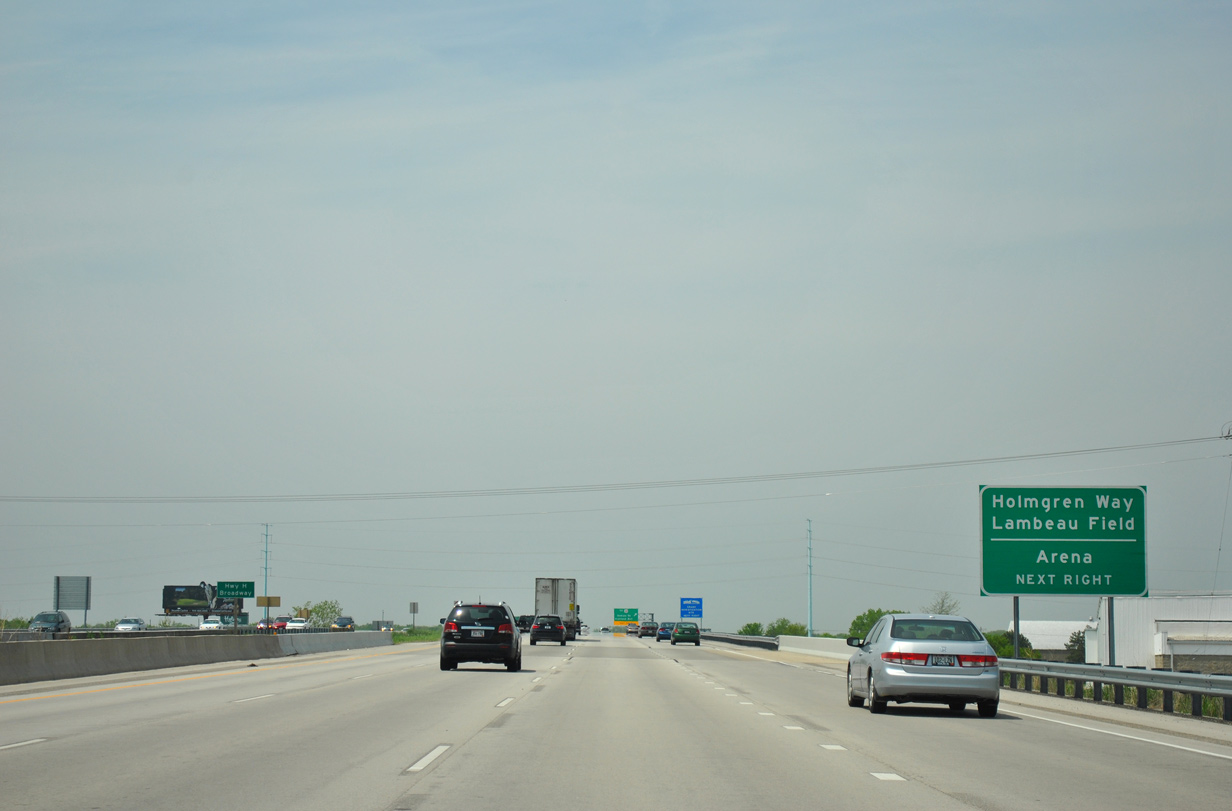
Lambeau Field, legendary home of the NFL Green Bay Packers since 1957, resides at CTH VK (Lombardi Avenue) and CTH AAA (Oneida Street), 1.5 miles north of the Wis 172 freeway. Resch Center, a concert and indoor sports arena, lies adjacent to Lambeau Field as well.
05/30/11
Westbound Wis 172 at the off-ramp to Pilgrim Way. Wis 32 (Red Arrow Highway) consists of an controlled access arterial north to Mason Street (Wis 54) in Green Bay and south to North 8th Street in De Pere.
05/30/11
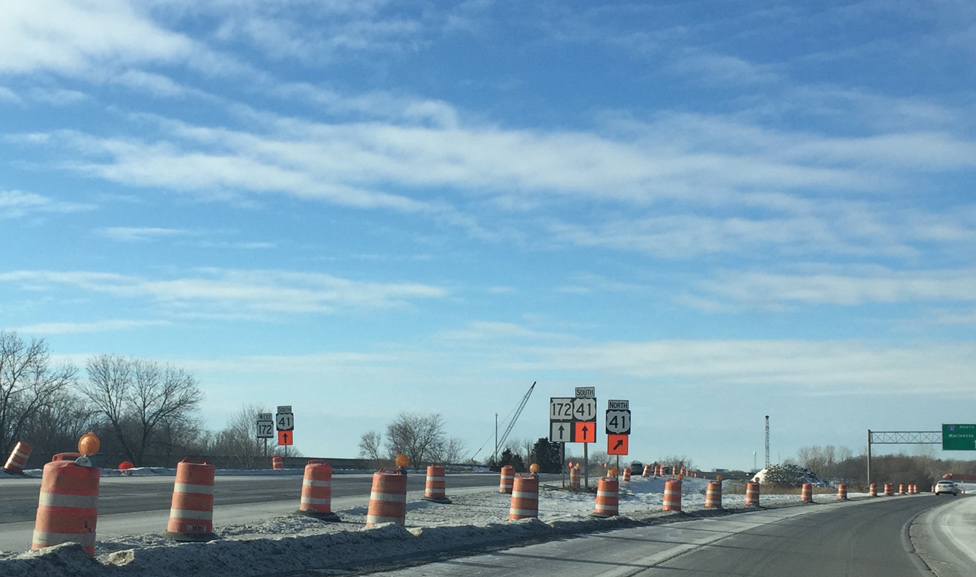
![Crossing Dutchman Creek, Wis 172 advances west to the directional cloverleaf interchange with Interstate 41 [U.S. 41]. U.S. 41 was upgraded to Interstate 41 after upgrades to the freeway corridor were made between Milwaukee and Green Bay. The designation was initially approved by AASHTO on November 15, 2012, with signs changed throughout 2015.](../../wi/172/wi-172_wb_exit_005_01.jpg)
Crossing Dutchman Creek, Wis 172 advances west to the directional cloverleaf interchange with Interstate 41 [U.S. 41]. U.S. 41 was upgraded to Interstate 41 after upgrades to the freeway corridor were made between Milwaukee and Green Bay. The designation was initially approved by AASHTO on November 15, 2012, with signs changed throughout 2015.
01/20/16
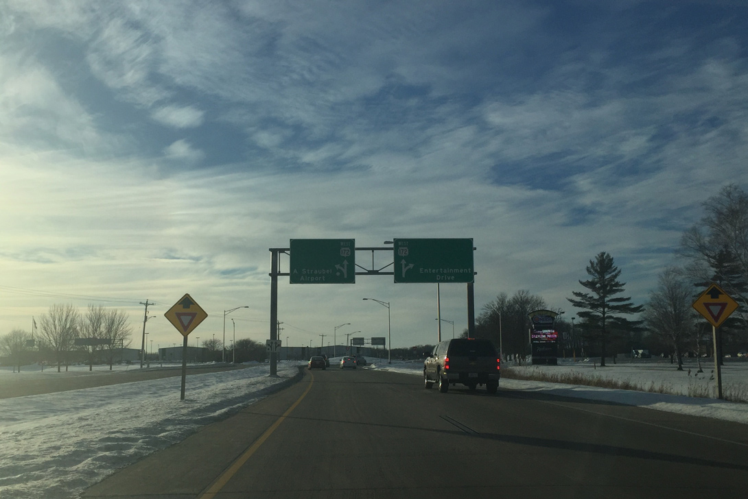
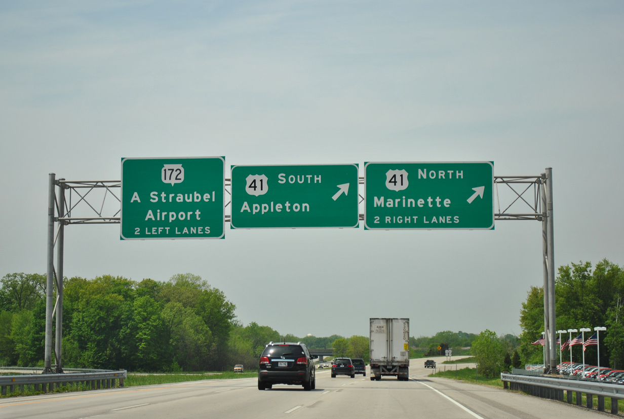
![All traffic to Interstate 41 [U.S. 41] departs Wis 172 in unison as the freeway mainline transitions into an at-grade expressway to Austin Straubel International Airport (GRB).](../../wi/172/wi-172_wb_exit_005_02.jpg)
All traffic to Interstate 41 [U.S. 41] departs Wis 172 in unison as the freeway mainline transitions into an at-grade expressway to Austin Straubel International Airport (GRB).
01/20/16
Construction underway between Fall 2013 and 2016 upgrades ramps to and from STH 172 to tie into new collector distributor lanes added to Interstate 41.
01/20/16
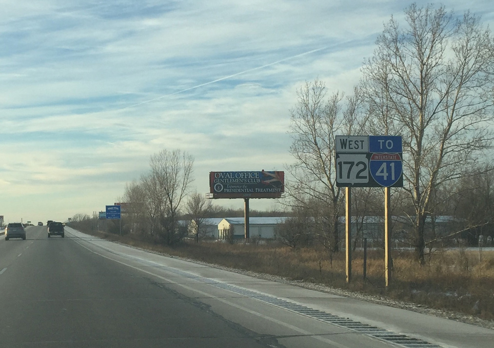
Interstate 41 angles southwest from Ashwaubenon to Appleton. The route turns southward there along Lake Winnebago to Oshkosh, Fond du Lac and ultimately Milwaukee.
01/20/16
A number of businesses appear alongside Wis 172 (Airport Drive) as the freeway ends. Business access is not available from STH 172. Instead motorists must use parallel North Road via the upcoming intersection with Babcock Road.
01/19/16

A traffic light operates along STH 172 at Babcock Road.
01/19/16

Babcock Road forms a residential street beyond adjacent North Road and Commanche Avenue to the south.
01/19/16
An open grassy area spreads to the west as Wis 172 (Airport Drive) approaches both the runway approach for Austin Straubel International Airport (GRB) and Packerland Drive (CTH EB).
01/19/16
South Point Road ties into Wis 172 (Airport Drive) at the east end of the airport opposite the National Weather Service office. The road leads north to West Point Road in suburban areas of west Green Bay.
01/19/16
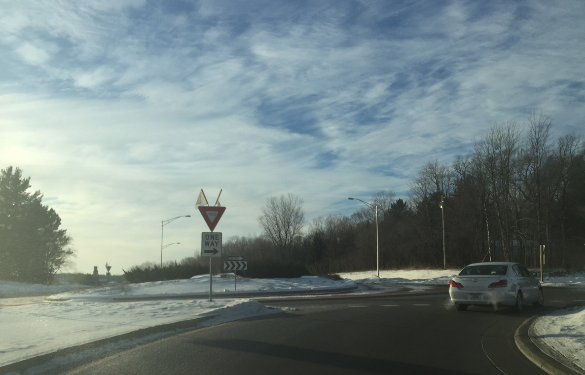
A multi-lane roundabout joins STH 172 with the access roads to the Austin Straubel International Airport (GRB) passenger terminal and Entertainment Drive north to Oneida Casino.
01/19/16
Leaving the airport area, Wis 172 enters Oneida Indian Reservation ahead of the roundabout with CTH GE (Pine Tree Road). CTH GE leads north to nearby STH 54 and south through agricultural areas to CTH EE.
01/19/16
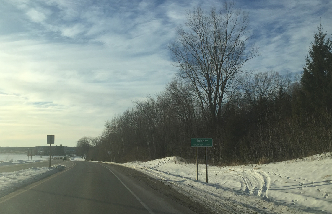
Advancing west, STH 172 enters the village of Hobart.
01/19/16
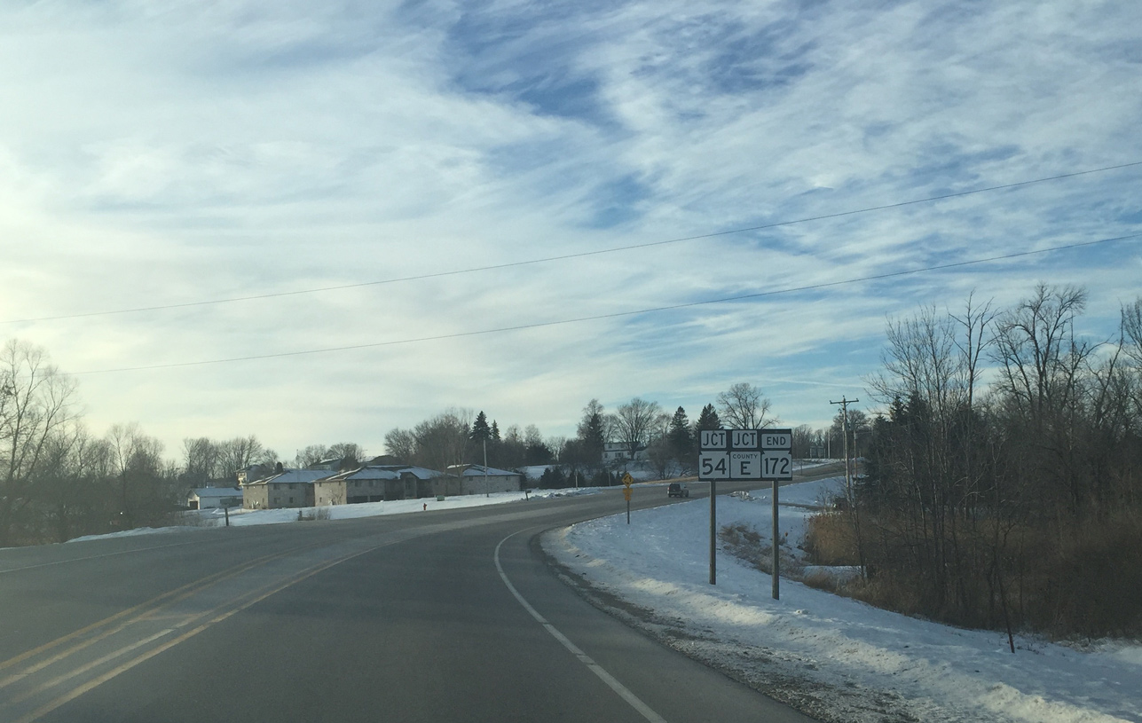
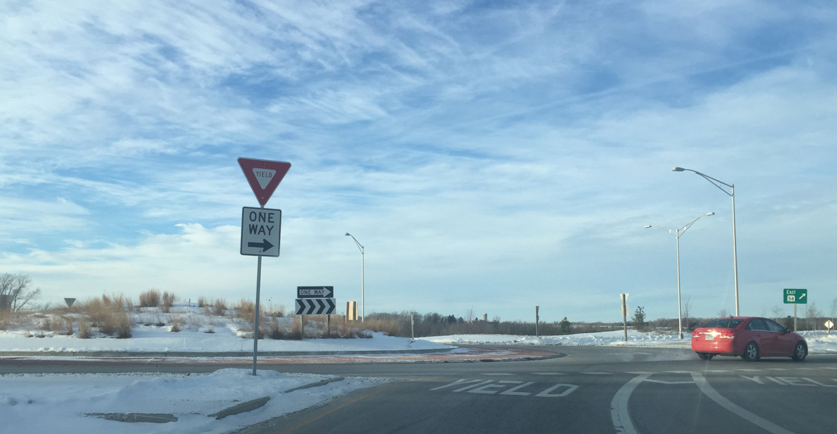
Wis 172 reaches the community of Oneida at junction STH 54 (Mason Street) and CTH E (Freedom Road). The 11.63 mile route concludes at another multi-lane roundabout.
01/19/16
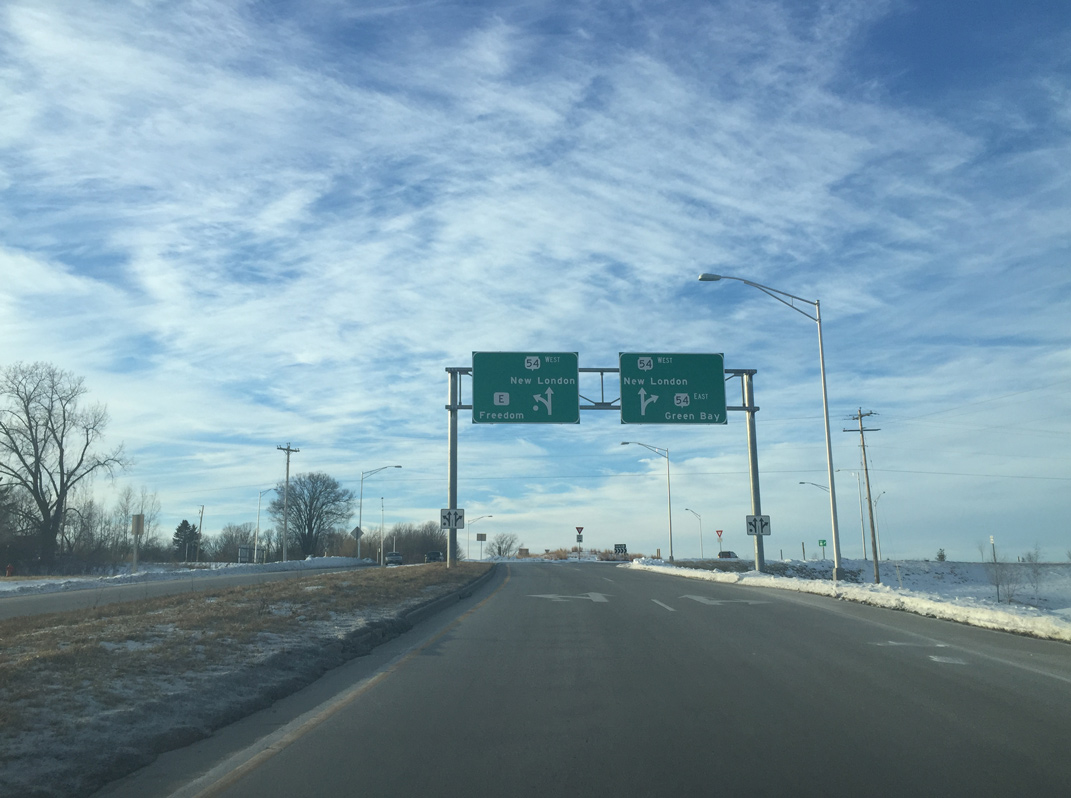
Wis 54 (Mason Street) leads back to the northeast through Hobart to Green Bay. The state trunk highway westbound crosses into Outagamie County en route to Seymour and New London.
01/19/16
CTH E angles southwest from the ending STH 172 through Oneida Indian Reservation to Freedom and north Appleton.
01/19/16
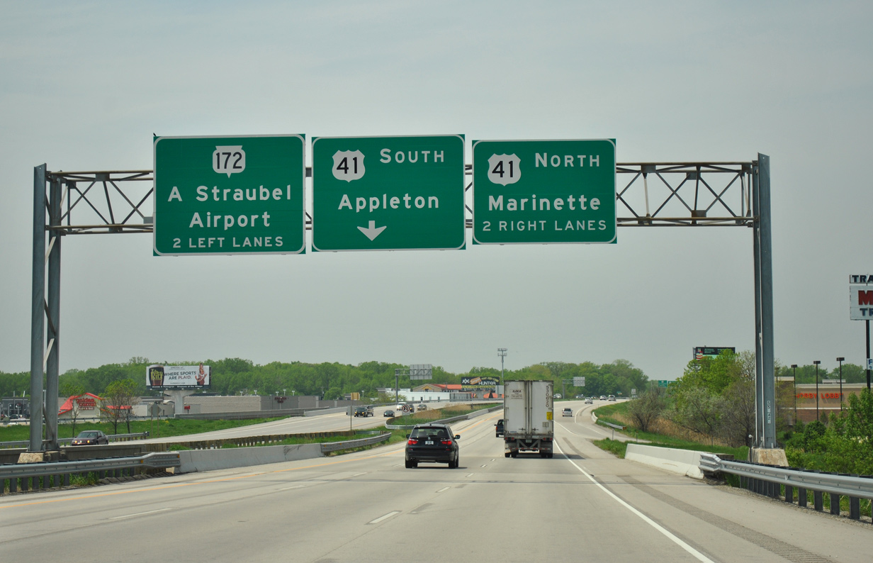
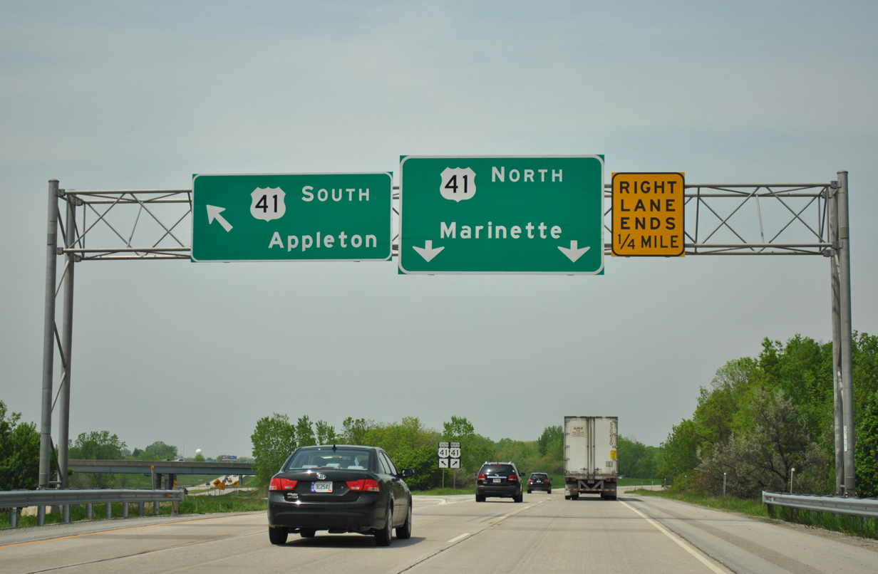
This set of panels posted at the CTH AAA underpass for U.S. 41 was replaced by 2015 to include the new arrow per lane (APL) sign for Interstate 41.
05/30/11
These signs were replaced when U.S. 41 was upgraded to Interstate 41 in 2015.
05/30/11

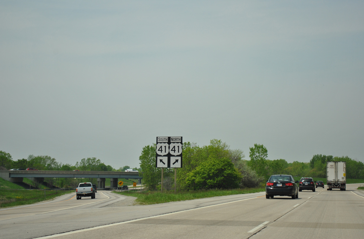
Pre-construction look at the Wis 172 westbound gore point for the ramps to U.S. 41.
05/30/11
Sign replacements made here include up facing arrows for the ramps to now Interstate 41.
05/30/11
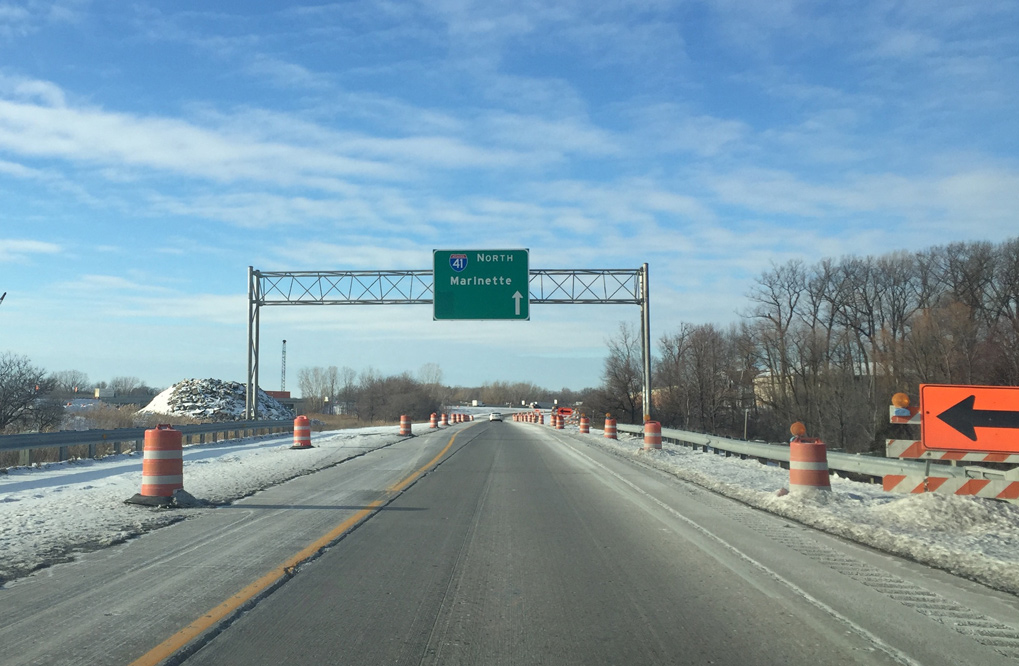
I-41 north continues another 7.7 miles through west Green Bay to the village of Howard and an end at Lineville Road (CTH M). U.S. 41 emerges there as a freeway en route to Abrams and an expressway to Marinette.
05/30/11
References:
- "First Half of Wis.'s Highway 172 Wraps Up Near Green Bay." Construction Equipment Guide.com
Photo Credits:
- ABRoads: 05/30/11
- Peter Johnson: 01/19/16, 01/20/16
Page Updated Thursday January 21, 2016.