Interstate 105 California
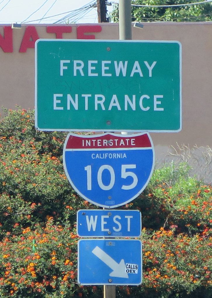
Overview
The elevated structure of Interstate 105 passes over Imperial Highway west from Aviation Boulevard by LAX Airport. 05/31/15
Completed in October 1993, Interstate 105 was the last major freeway to open in the Los Angeles metropolitan area. Connecting Los Angeles International Airport (LAX) with Interstate 405 near El Segundo and I-605 in Norwolk, I-105 follows the Glenn Anderson Freeway. As a multi-modal freeway, Interstate 105 coincides with a segment of Metrolink, which provides rapid transit through South Los Angeles toward LAX Airport. Large train stations are in place at several interchanges, allowing easy access to bus corridors along city streets.
Route Information
East End – Norwalk, CA
West End – El Segundo, CA
Mileage – 17.32
Cities – Los Angeles, Inglewood, Hawthorne, Lynnwood, South Gate, Downey, Bellflower, Norwalk
- Junctions –

Source: December 31, 2021 Interstate Route Log and Finders List
I-105 Annual Average Daily Traffic (AADT)
Source: 2017 Traffic Volumes – Caltrans Traffic Census Program
 History
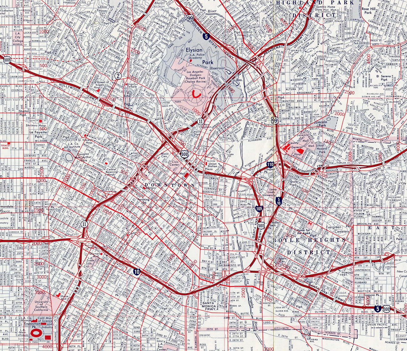
Linking I-5/10, U.S. 101, and California State Route 10 (former I-110) north of Downtown Los Angeles, Interstate 105 was previously commissioned along the Santa Ana Freeway between 1964 and 1968. I-105, then I-110 and U.S. 101 converged at an exchange east of the Los Angeles River and Mission Road. The original Interstate 105 was subsequently decommissioned, and that portion of the Santa Ana Freeway remains as the southernmost extent of U.S. 101.
Interstate 105 was revived several years later as the designation for the proposed Century Freeway. A controversial route, protests against the freeway from adjacent community members arose throughout the 1970s and 1980s. Construction finally commenced on I-105 in 1982. Replacing parallel SR 42 (Manchester Avenue), I-105 was originally slated to meet Interstate 5 in Norwalk, but that extension was deleted from plans. The City of Norwalk considered the freeway to be divisive, and many would argue that the effectiveness of Interstate 105 as a primary east-west freeway was undercut by Norwalk’s action preventing construction within its boundaries.
Another early proposal outlined extending Interstate 105 east beyond I-5 to SR 90 (Richard M. Nixon Freeway) in Orange County. Such a freeway was squashed by public outcry, but the extension remained on the official California state map as a proposed freeway corridor along unconstructed SR 90.
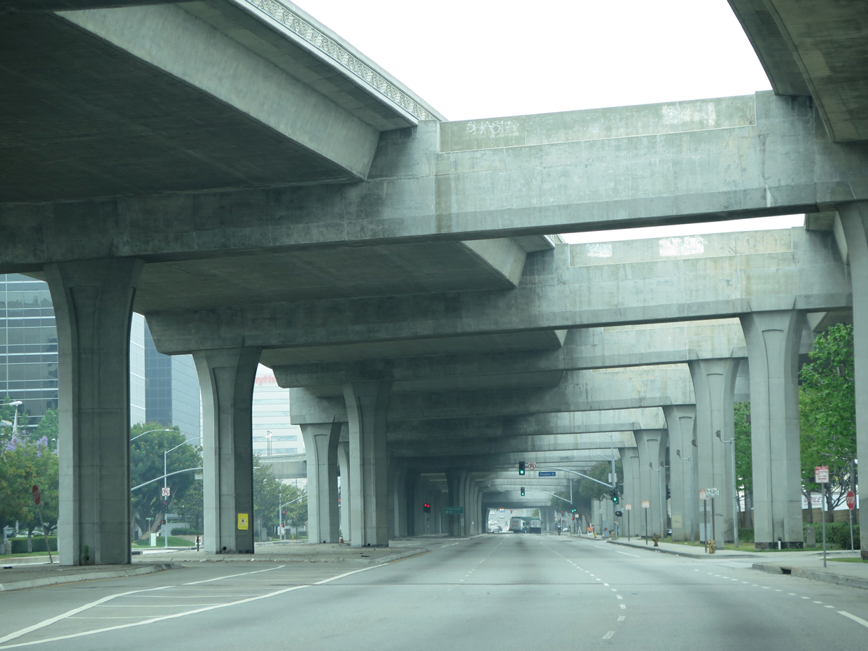
Even after it was completed, some problems continued to plague Interstate 105. Since the freeway was constructed below-grade, portions of the roadway sunk between I-605 and I-710. This section of freeway lies between the San Gabriel River (which parallels I-605) and the Los Angeles River (near I-710). As a result of the pavement sinking and cracking, the freeway required premature repairs. A state of California audit report issued in 1999 scrutinized the California Department of Transportation (Caltrans) for not adequately testing the soil and groundwater conditions prior to construction.1
For more on the Century (Glenn Anderson) Freeway, see Interstate 105 (Daniel Faigin) and In Our Path: Interstate 105 (Jeff Gates).
 Photo Guides
East End  / Studebaker Road – Norwalk, California
![]() East at
East at ![]() / Studebaker Road
/ Studebaker Road
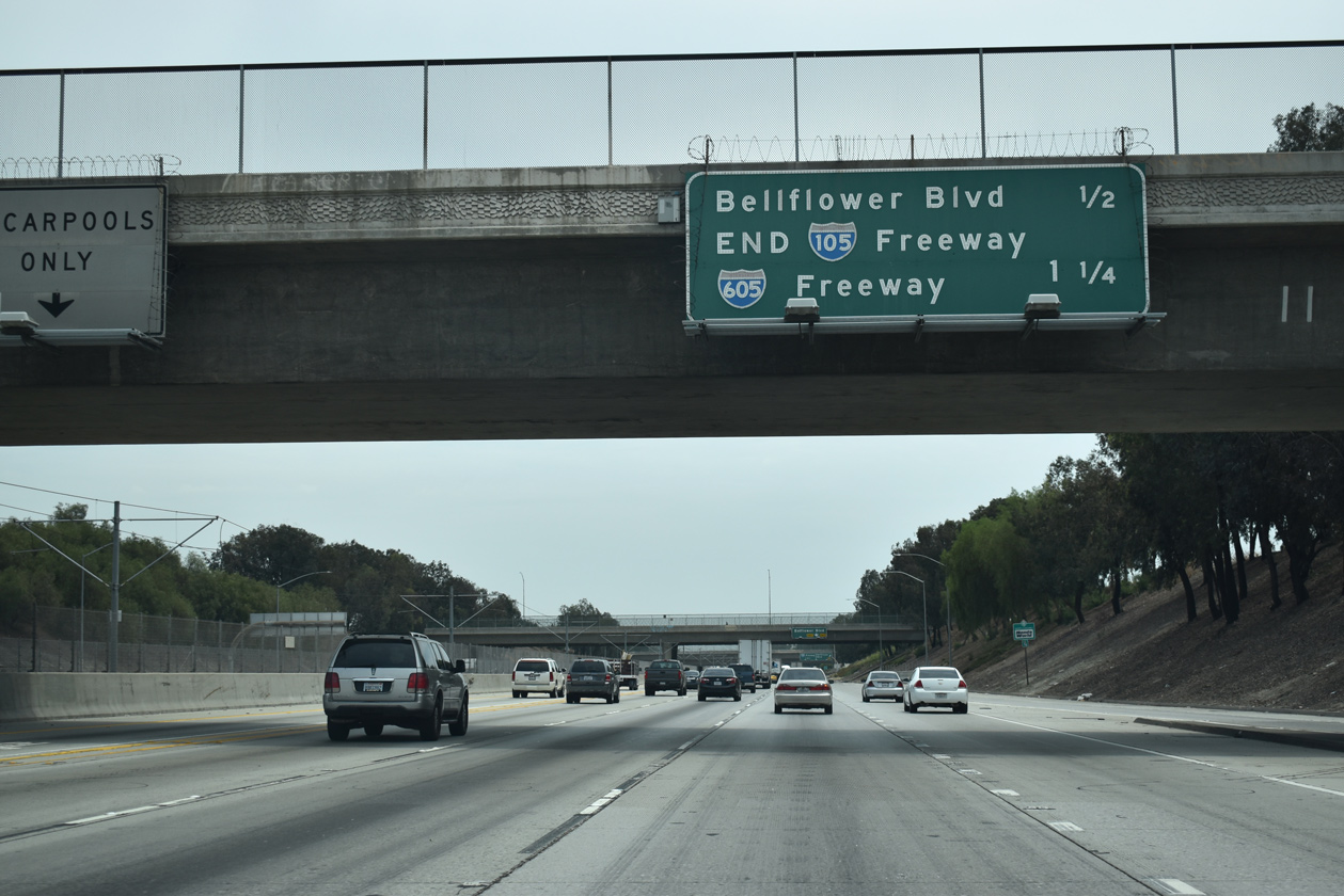
Interstate 105 concludes 1.25 miles beyond the Hanwell Avenue overpass in Downey. 07/09/18
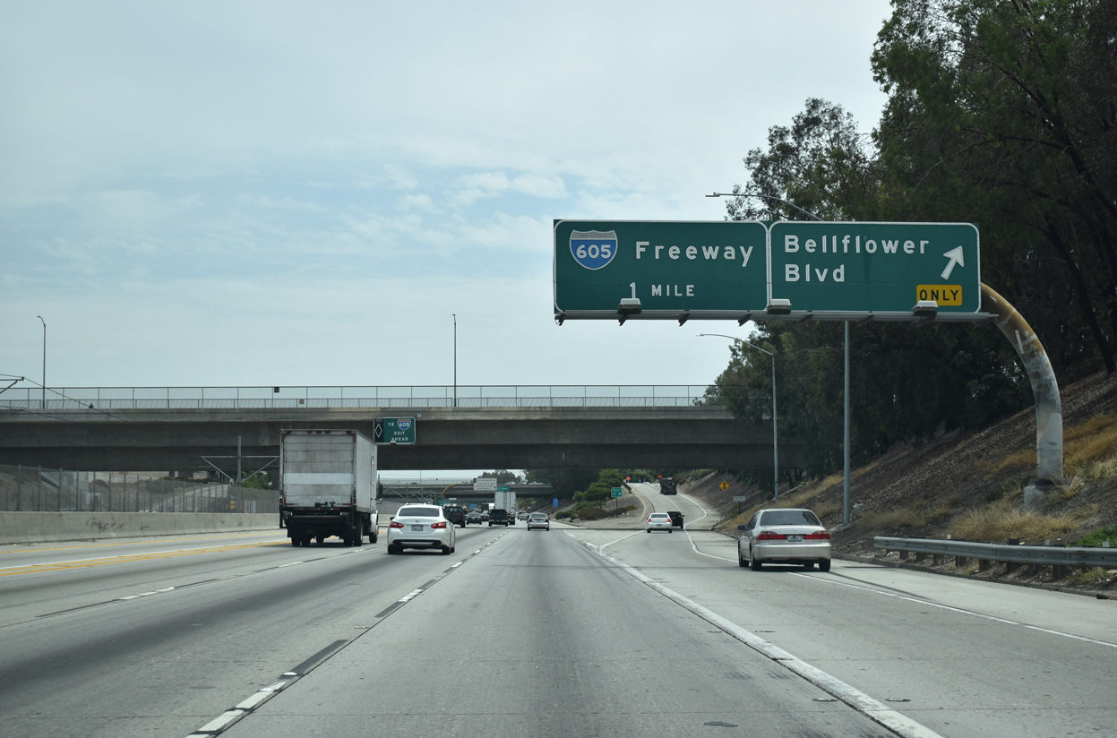
A diamond interchange (Exit 17) joins I-105 (Glenn Anderson Freeway) with Bellflower Boulevard ahead of Interstate 605. 07/09/18
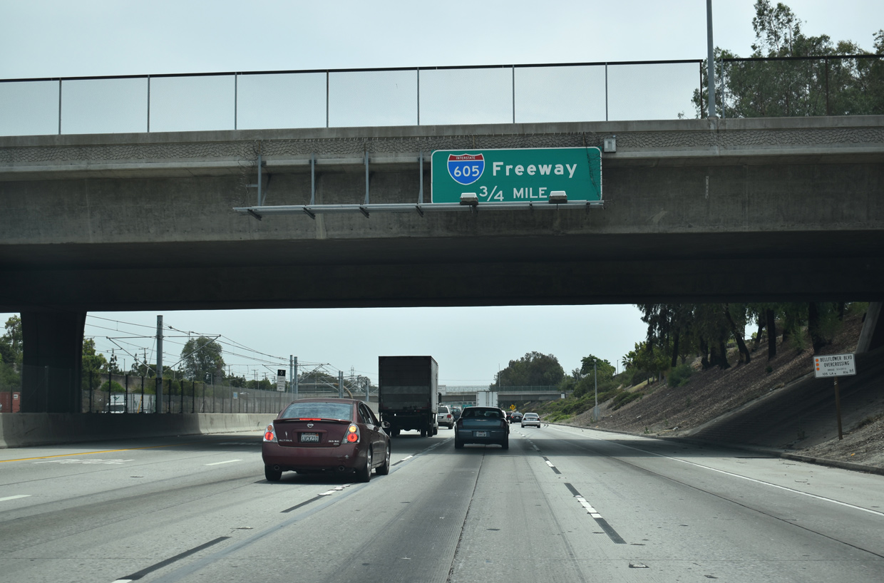
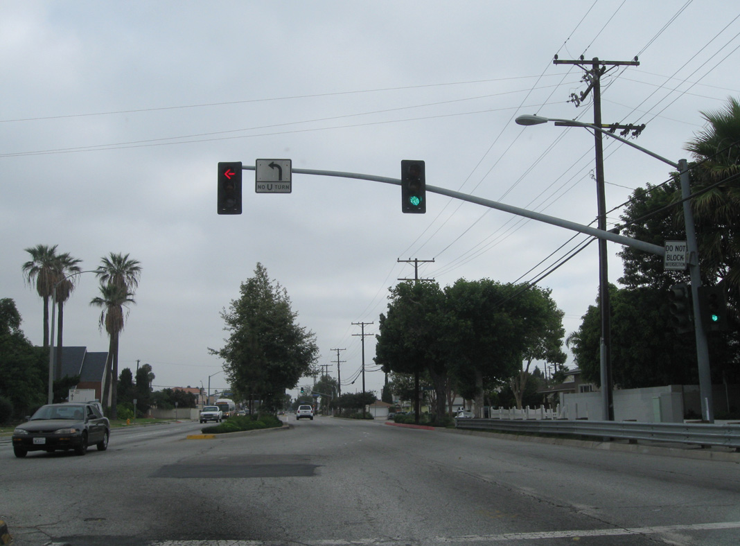
Interstate 105 enters the city of Norwalk at Exit 18 with the San Gabriel River Freeway (I-605). Restricted to HOV-2 motorists, the freeway mainline spurs east to Studebaker Road. 07/09/18
07/09/18
05/31/15
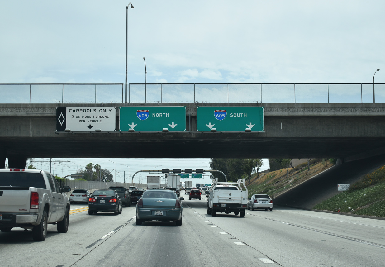
Traffic along Interstate 105 east partitions above the San Gabriel River for I-605 north to Santa Fe Springs and Pico Rivera and I-605 south to Cerritos and Lakewood.
Studebaker Road at ![]()
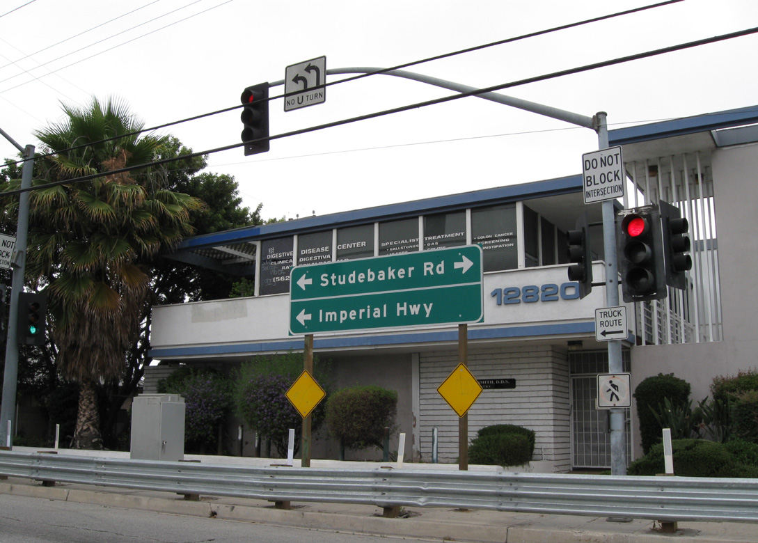
The carpool lanes along I-105 east extend to the traffic light with Studebaker Road just beyond the Norwalk Metro Station. 06/19/10
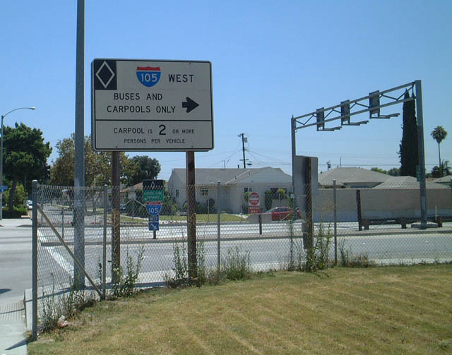
Studebaker Road south at the HOV-2 entrance ramp for Interstate 105 west in Norwalk. 07/21/01
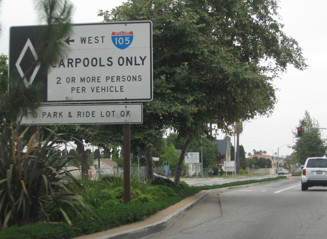
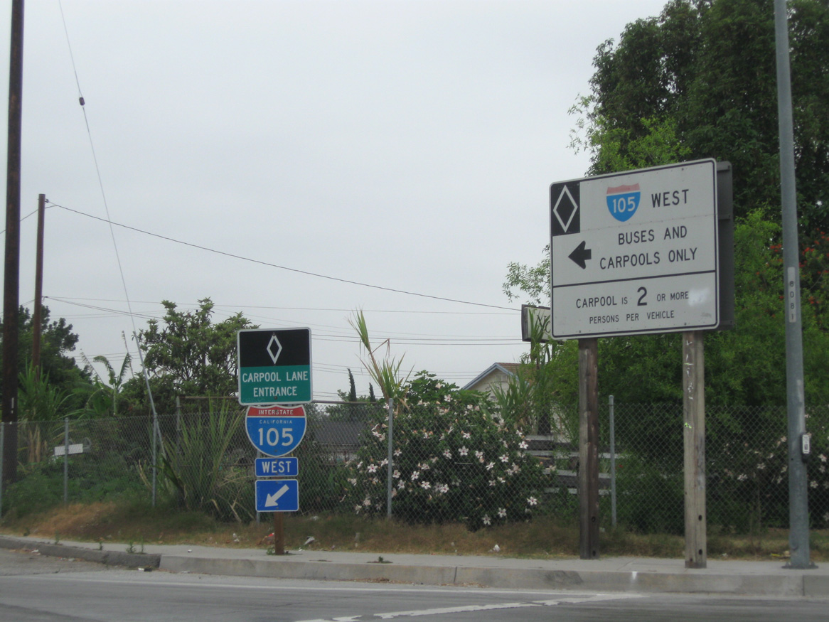
Only high occupancy vehicles (HOV) may use the eastern most 0.75 miles of Interstate 105 between Studebaker Road and I-605. 06/19/10
![]() North at
North at ![]()
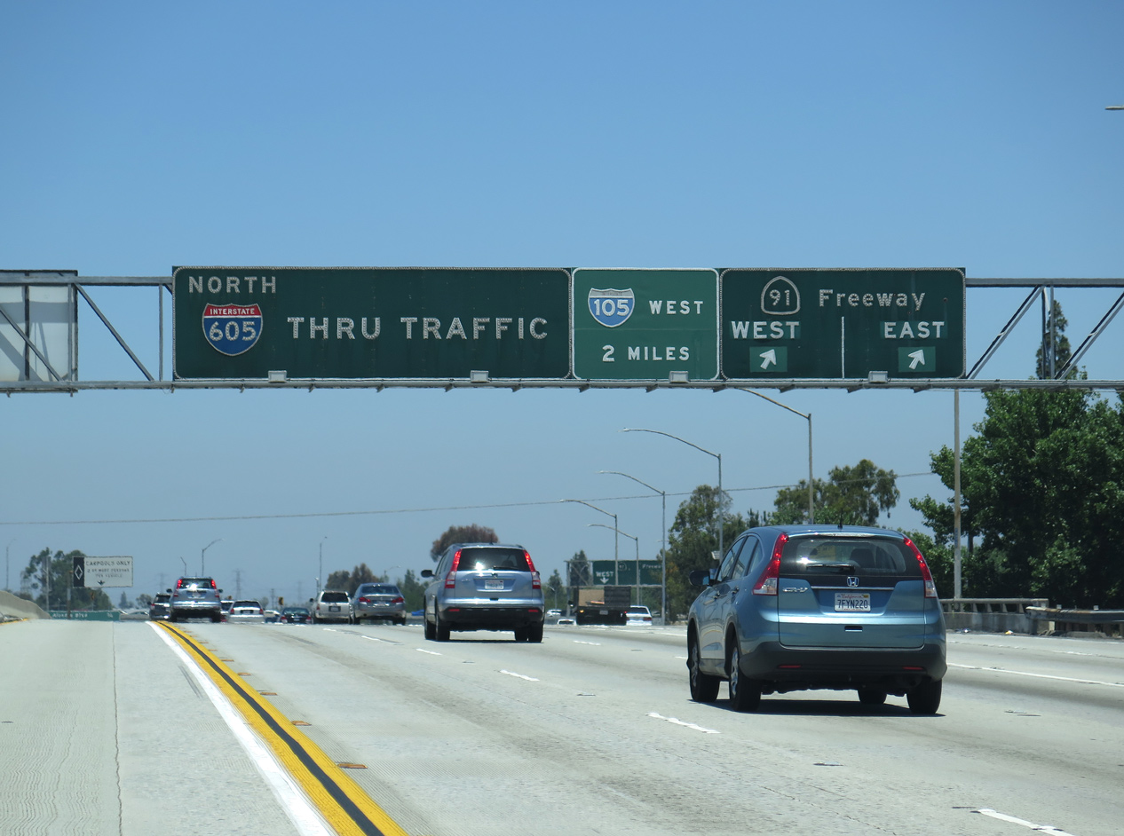
Northbound Interstate 605 at SR 91. The Artesia Freeway provides part of the route west from I-5 north to I-105 west in Norwalk. 06/20/15
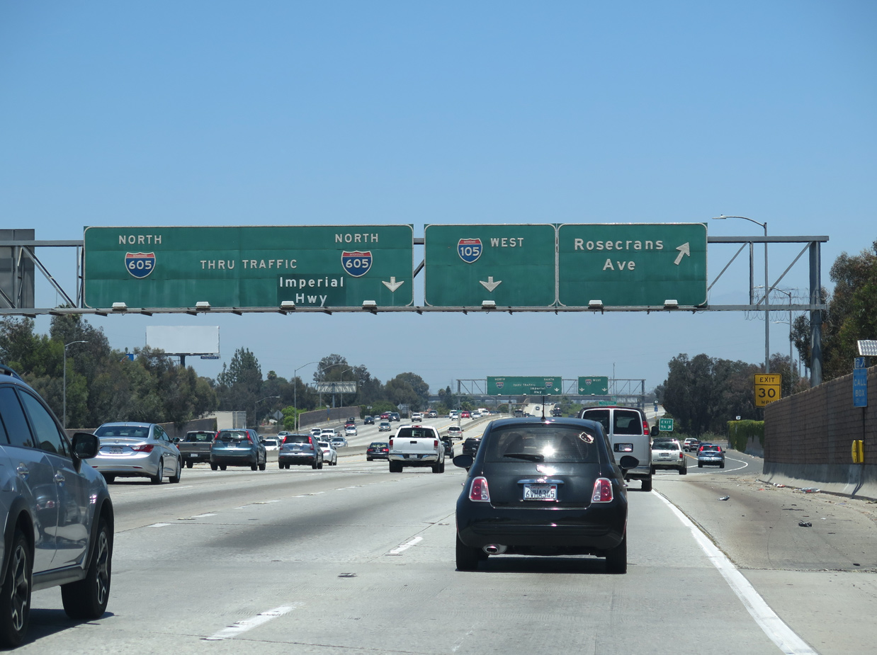
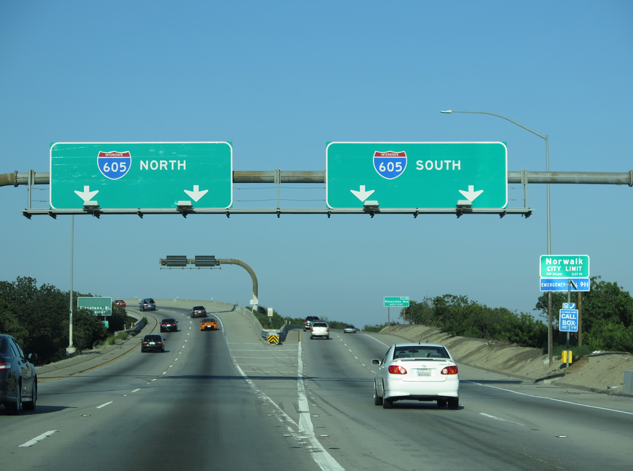
I-605 (San Gabriel River Freeway) crosses into the city of Norwalk at Alondra Boulevard. The freeway proceeds north to Rosecrans Avenue and the directional T interchange (Exit 9 B) with Interstate 105. 06/20/15
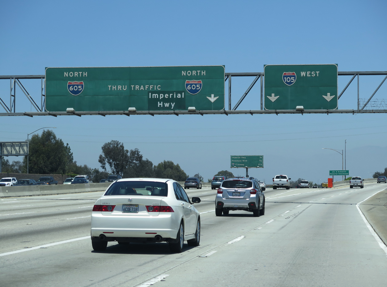
A two lane flyover departs I-605 northbound well ahead of the systems exchange with Interstate 105. Interstate 605 continues north to meet I-5 near the boundary between Norwalk and Downey. 06/20/15
West End – Los Angeles International Airport (LAX) / California St – El Segundo, California
![]() West at LAX Airport / California St
West at LAX Airport / California St
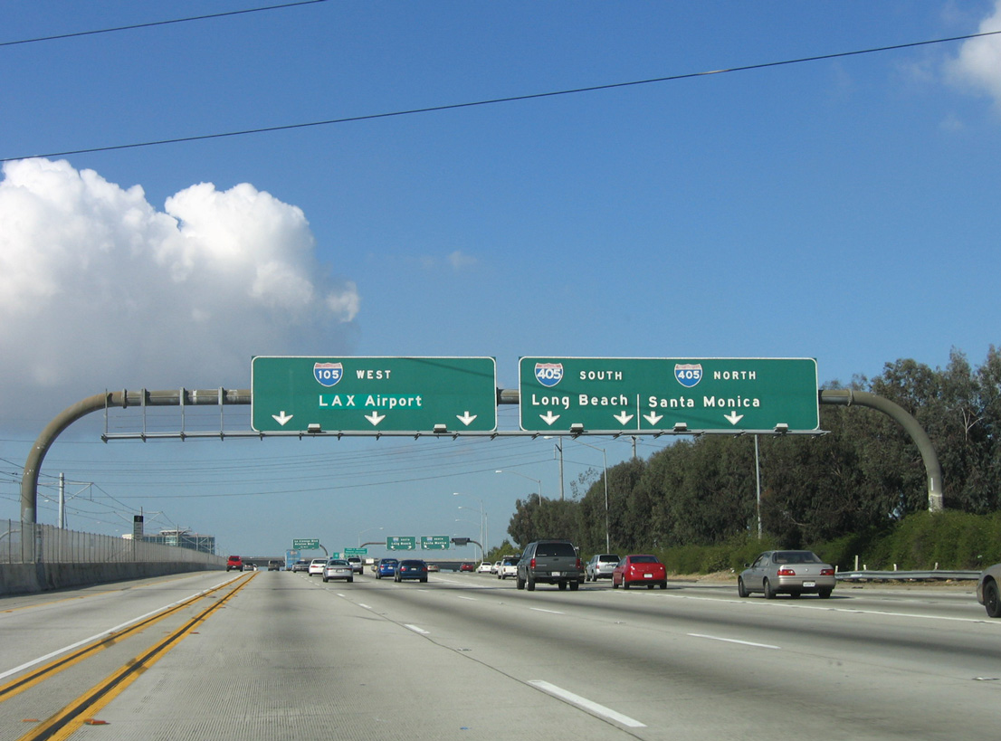
Interstate 105 converges with I-405 (San Diego Freeway) at a systems interchange (Exit 2 B) 2.1 miles east of the freeway end at Imperial Highway. 03/18/06
The transit corridor that followed the median of I-105 concludes at Los Angeles International Airport (LAX). Most traffic remaining Interstate 105 access LAX Airport and its ancillary development or heads toward El Segundo and the beaches near Vista Del Mar. 03/18/06
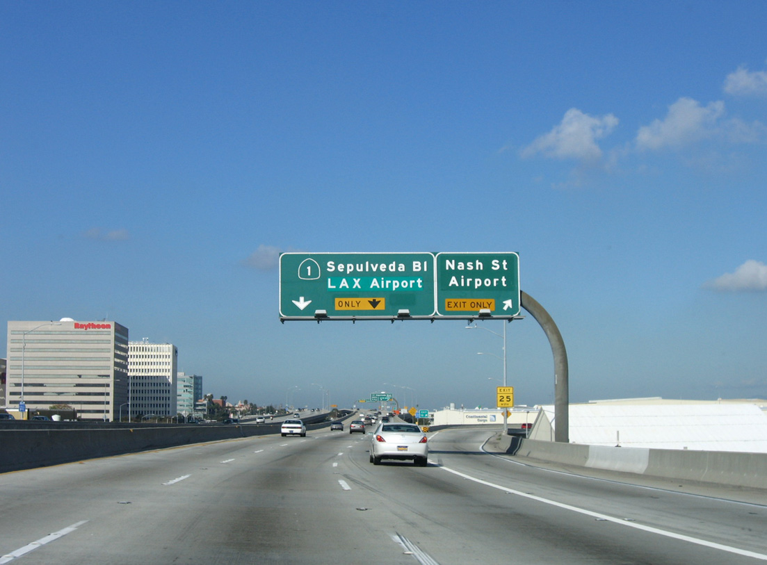
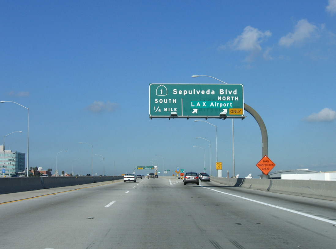
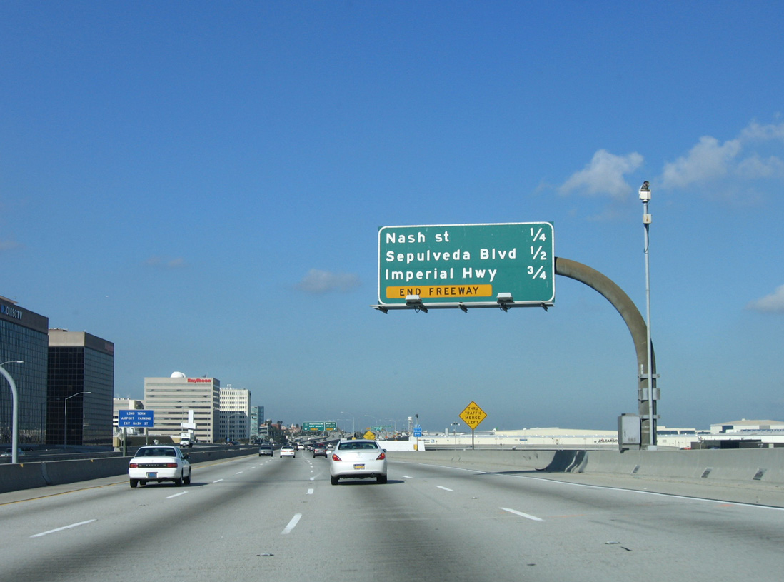
The main exit for Los Angeles International Airport (LAX) is the northbound off-ramp to SR 1 (Sepulveda Boulevard). LAX Airport is the busiest airport in Southern California and arguably the U.S. 03/18/06
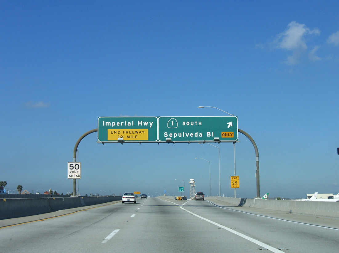
The final exit along westbound Interstate 105 is for SR 1 south, the Pacific Coast Highway, which follows historic Sepulveda Boulevard near LAX Airport. 03/18/06
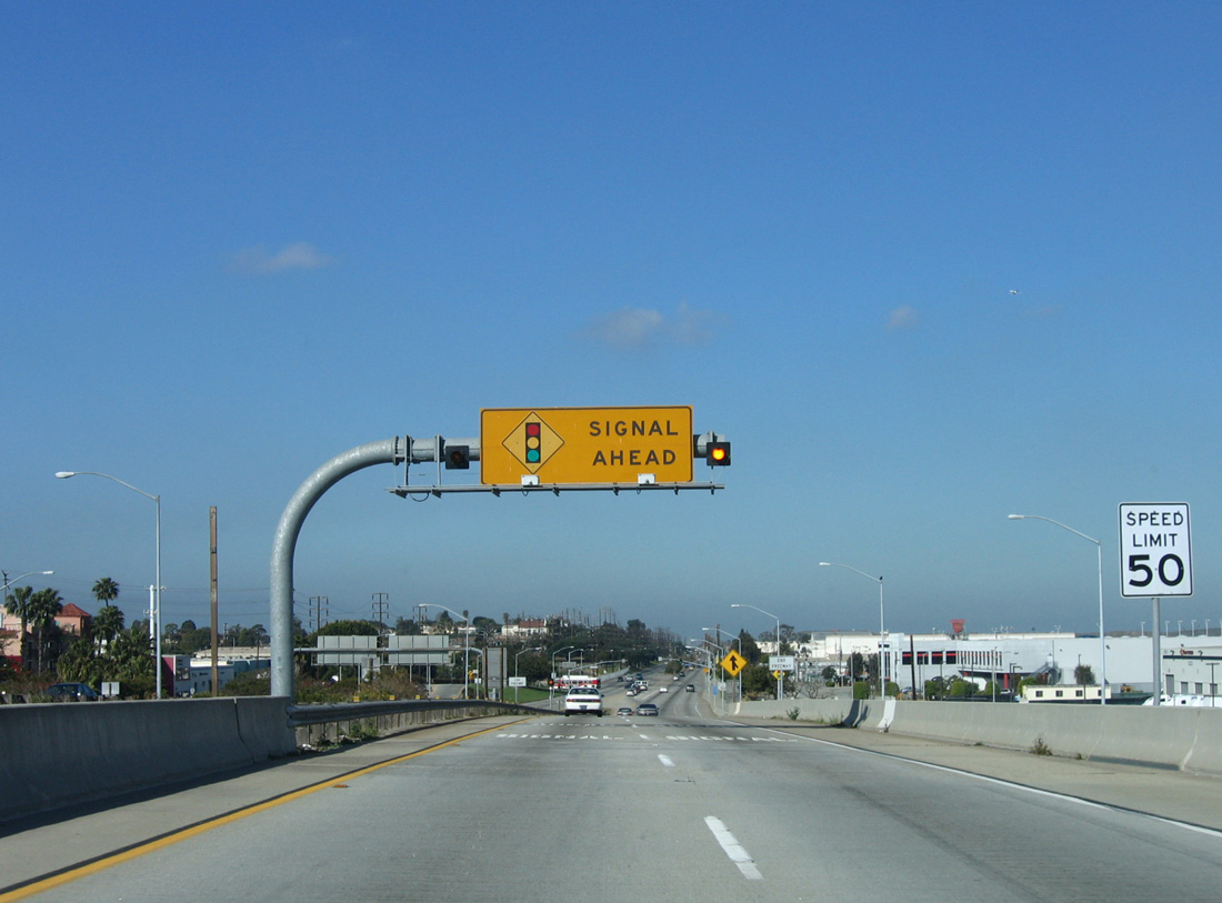
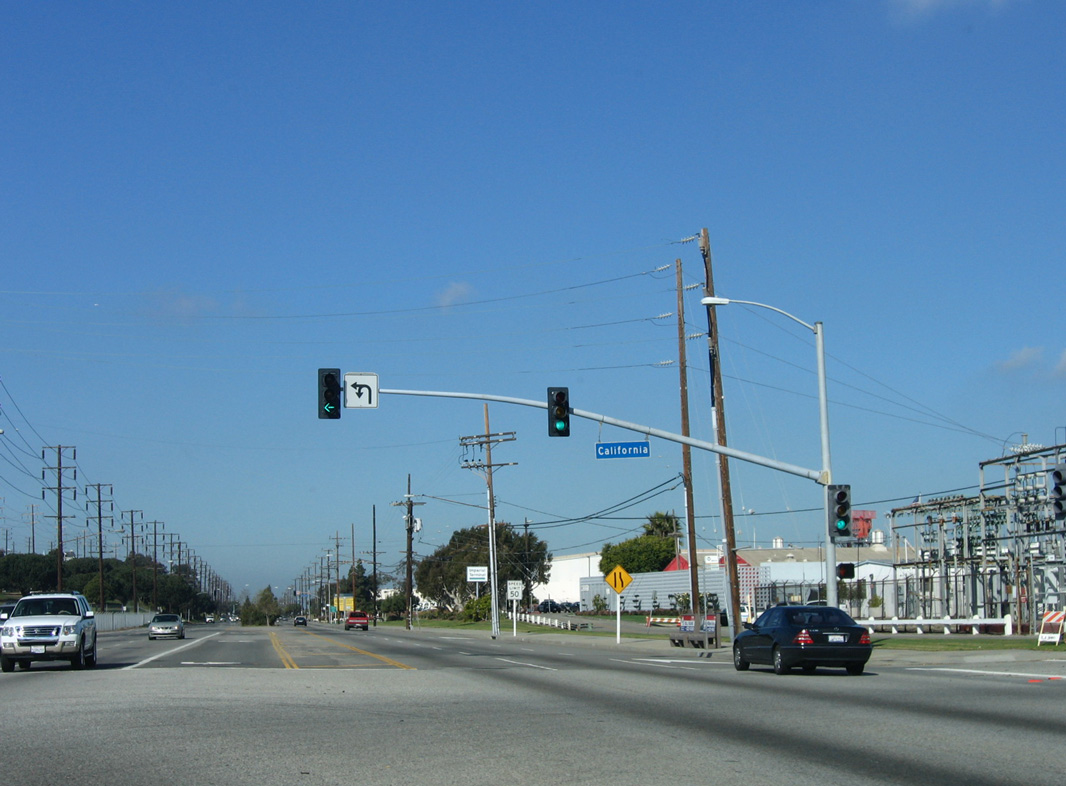
The I-105 westbound viaduct lowers to grade level ahead of the signalized intersection joining Imperial Highway with California Street. 03/18/06
Imperial Highway, a locally maintained arterial, extends 1.75 miles west to Dockweiler State Beach on the Pacific Ocean. 03/18/06
Imperial Highway east at ![]()
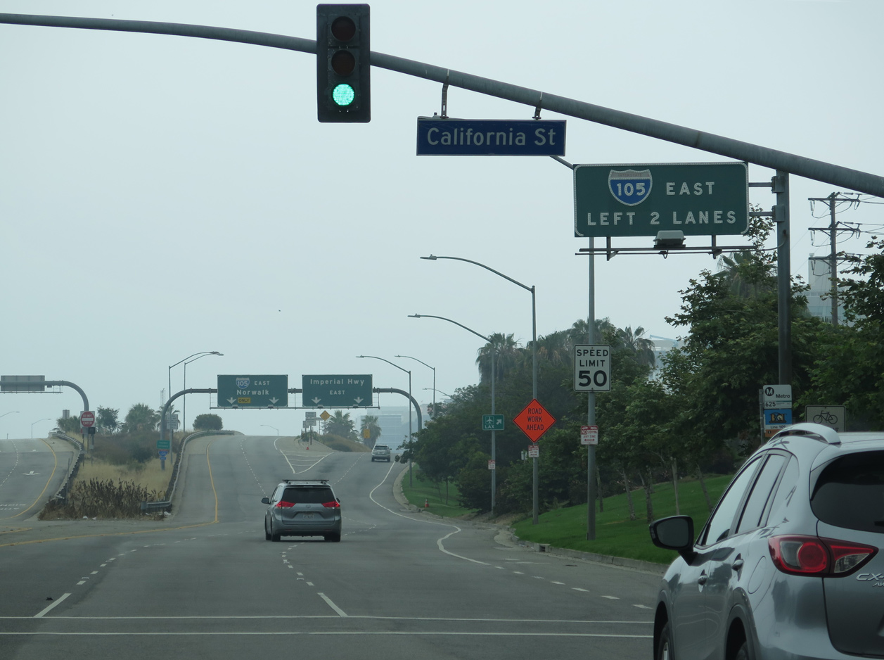
Imperial Highway splits with the eastbound beginning of Interstate 105 beyond the intersection with California Street. 05/31/15
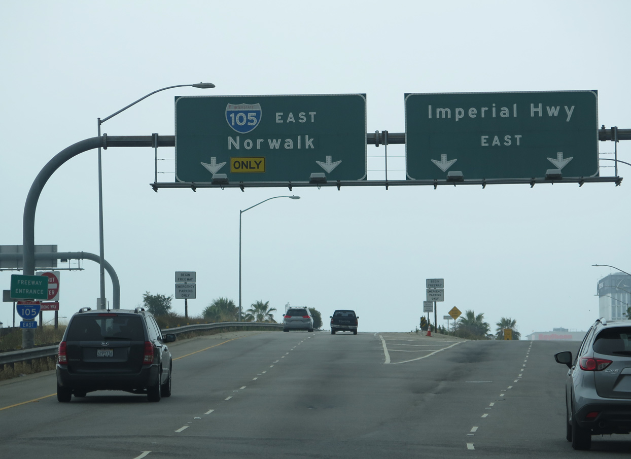
Two lanes ascends onto the I-105 viaduct running along the south side of LAX Airport to Interstate 405 (San Diego Freeway). Imperial Highway parallels the elevated roadway east to SR 1 (Pacific Coast Highway) and Aviation Boulevard. 05/31/15
Sources:
- “Department of Transportation: Disregarding Early Warnings Has Caused Millions of Dollars to be Spent Correcting Century Freeway Design Flaws.” State of California Publication #99113, August 1999.
Page updated March 13, 2019.