Interstate A4

Overview

Interstate A4 overlays all of Alaska State Route 3 along George Parks Highway from Gateway near Wasilla and Palmer to Fairbanks. The southern 4.14 miles of SR 3 is a limited access freeway connecting SR 1 (Glenn Highway) with Seward Meridian Parkway in the city of Wasilla.
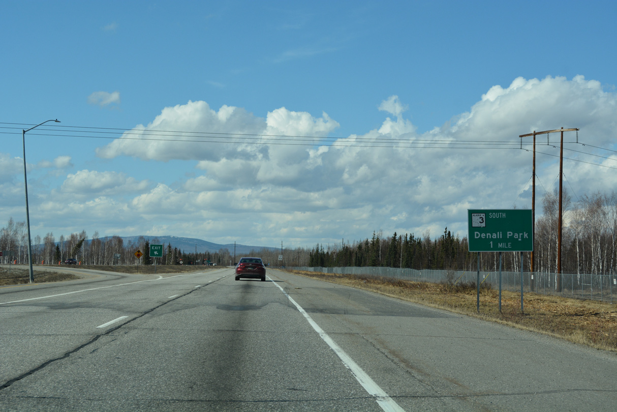
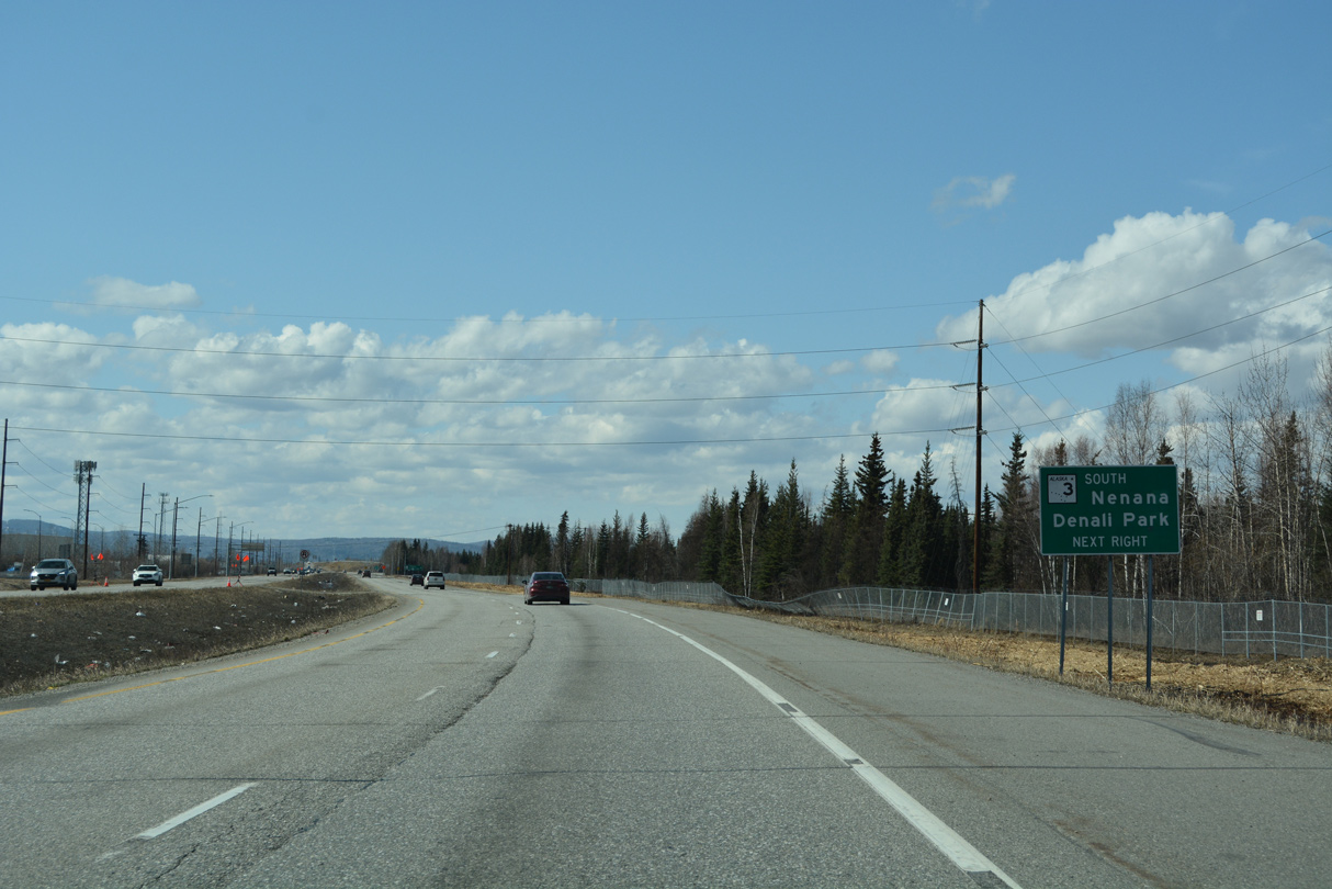
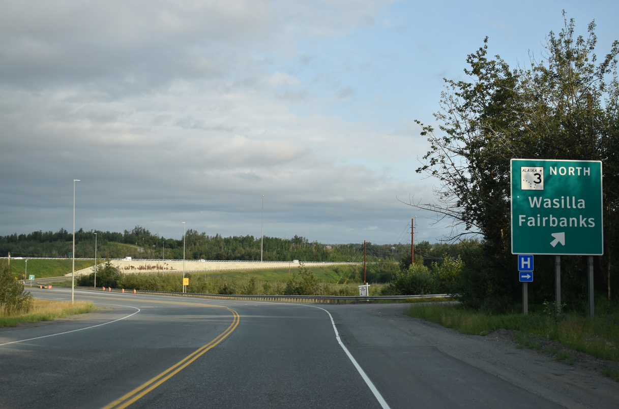
Parks Highway continues west across Wasilla along a four lane boulevard. Expanding with a median, SR 3 travels to Meadow Lakes and into the city of Houston. The majority of the route north from Willow to Talkeetna, Cantwell, Denali Park and Healy is a two lane highway with passing lanes at various intervals. Beyond Nenana, SR 3 turns east, following the trajectory of the Tanana River to Ester and the city of Fairbanks.
Named the Mitchell Expressway within the city of Fairbanks, the northernmost 6.81 miles of SR 3 is a controlled access expressway with two interchanges. I-A4 and SR 3 conclude at SR 2 (Richardson Highway) south of Downtown.
Route Information
North End – Fairbanks, AK
South End – Palmer
Mileage – 323.69
Cities – Wasilla, Houston, Willow, Denali Park, Nenana, Fairbanks
- Junctions –

Source: December 31, 2021 Interstate Route Log and Finders List
Average Annual Daily Traffic
Source: 2020 Average Annual Daily Traffic County, Alaska DOT&PF GIS Shapefile
 History
Potential routes for the Fairbanks-Nenana highway were surveyed in 1949 and 1950 by the Alaska Road Commission (ARC). The ridge route was the most acceptable, and a Winter trail was mapped out in 1951/52 within a dozen miles of the parallel Tanana River. Linking Nenana with Fairbanks, the Winter tote road (an unpaved road for hauling supplies) was completed in Fall 1953.1
With expansion of port activities and economic growth, Nenana residents advocated for an all-year-round route to Fairbanks. Contractors for the Bureau of Public Roads proceeded with right of way work along a 30 mile stretch and by Summer 1957, a two lane gravel road was completed. Work on the remainder of the highway was scheduled for completion in Summer 1958.1 Bids for the reconstruction of the Fairbanks-Nenana highway from the University of Alaska – Fairbanks to Ester Crossing were opened by the Bureau of Public Roads in July 1958. The low bid was $118,906.2
The Nenana road was also envisioned as a step in the overall plan to connect Fairbanks with Denali Park. Surveys along the Nenana River and the Savage Road from Healy into the Park Highway system were completed by 1957.1
George Parks Highway was dedicated at a ceremony held at the bridge spanning Hurricane Gulch on October 14, 1971. Located at milepost 170, the 550 foot long arc bridge crosses Hurricane Gulch at a height of 260 feet. Although unpaved, the event recognized the completion of the 353 mile long highway joining the Anchorage area and Fairbanks. Paving operations along the route paralleling the Alaska Railroad was slated in the following years.3
The initial leg of the Mitchell Expressway was constructed from University Avenue 2.9 miles to Airport Road as part of a $5.4 million project completed in Fall 1976. Work included building the spur to Fairbanks International Airport and coincided with a $2.3 million project widening and extending Geist Road.4
The Glenn-Parks Interchange joining the south end of SR 3/I-A3 and SR 1/I-A1 (Glenn Highway) cost $46 million and was completed in September 2004.5
 Photo Guides
North End  – Fairbanks, Alaska
![]()
![]() North at
North at ![]()
![]()
I-A4/SR 3 (Mitchell Expressway) advances east from Lathrop Street to the trumpet interchange with SR 2 (Richardson Highway) and the southbound beginning of I-A2. 07/30/23

SR 2 (Richardson Highway) turns north from I-A2/A4 to a CFI with Airport Way west by Downtown Fairbanks and Gaffney Road east into Fort Wainwright. 07/30/23

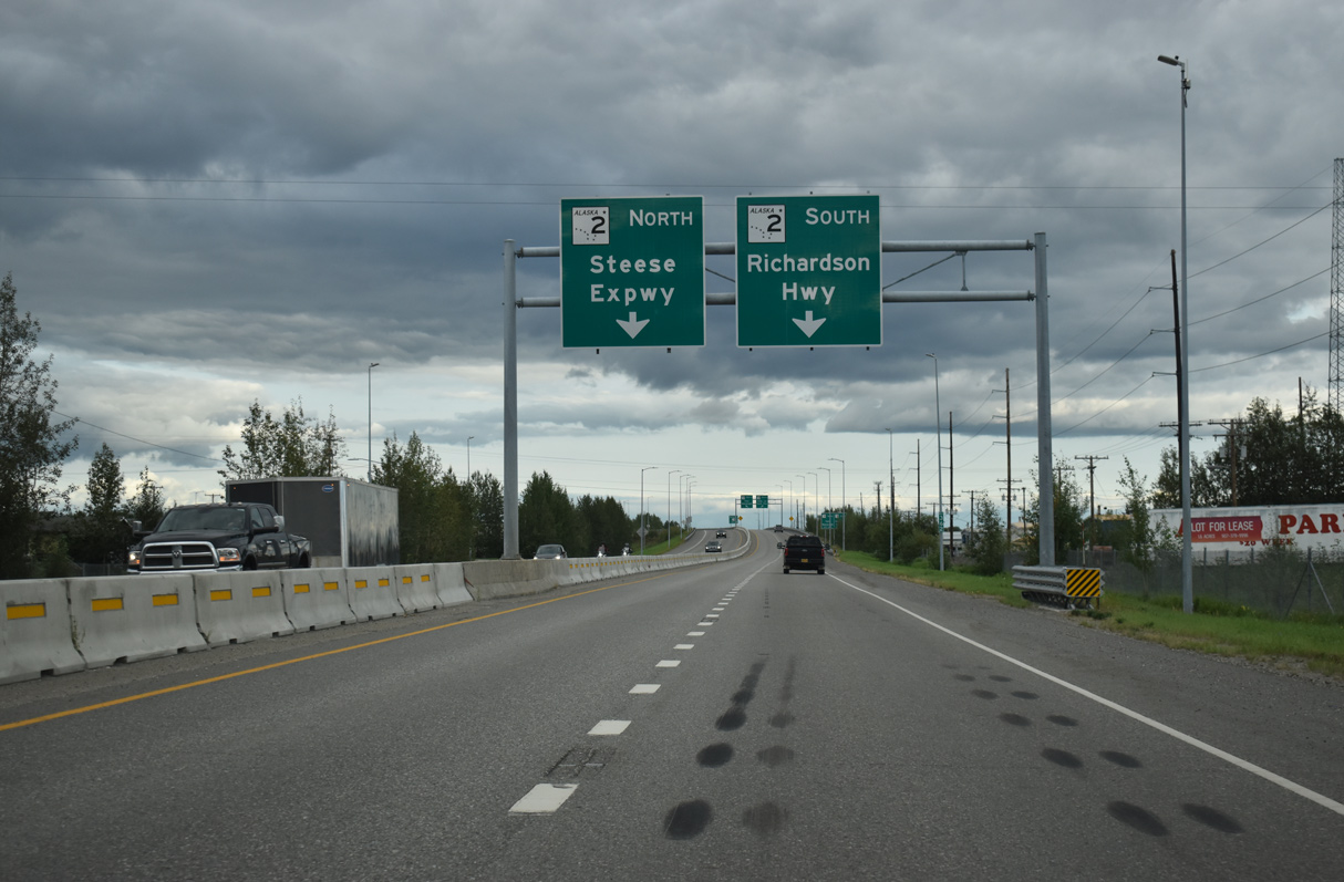
Traffic partitions at the north end of I-A4/SR 3 (Parks Highway) with a single lane ramp for I-A2/SR 2 (Richardson Highway) south to North Pole, Eielson AFB and Delta Junction. 07/30/23

A loop ramp connects SR 3 (Mitchell Expressway) with SR 2 north to Steese Highway through Fairbanks. 07/30/23

An end shield for Alaska State Route 3 stands along the ramp to Richardson Highway northbound. SR 2 follows Steese Highway north from Fairbanks to Fox and Livengood. 05/08/23
![]() South at
South at ![]()
![]()
![]()

SR 2 (Richardson Highway) south enters the trumpet interchange with SR 3 (Mitchell Expressway) beyond the exit to parallel Cushman Street at 23rd Avenue in Fairbanks. 07/30/23

Becoming Interstate A2, SR 2 (Richardson Highway) curves east through the exchange with the north end of I-A4/SR 3 (Mitchell Expressway) along an expressway leading to North Pole. 07/30/23
![]()
![]() North at
North at ![]()
![]()
SR 2 (Richardson Highway) proceeds one mile west from the left exit for Old Richardson Highway into the trumpet interchange with SR 3 (Mitchell Expressway) south in Fairbanks. 05/08/23
I-A2/SR 2 pass south of Fort Wainwright westward to the exit for I-A4/SR 3 (Parks Highway) south to Nenana, Denali Park and Wasilla. 05/08/23
![]()
![]() North at
North at ![]()
![]()
The first confirming marker for southbound Alaska State Route 3 posted along Mitchell Expressway and I-A4 at the Cushman Street underpass in Fairbanks. 05/08/23
South End – Gateway – Palmer, Alaska
![]()
![]() South at
South at ![]()
![]()

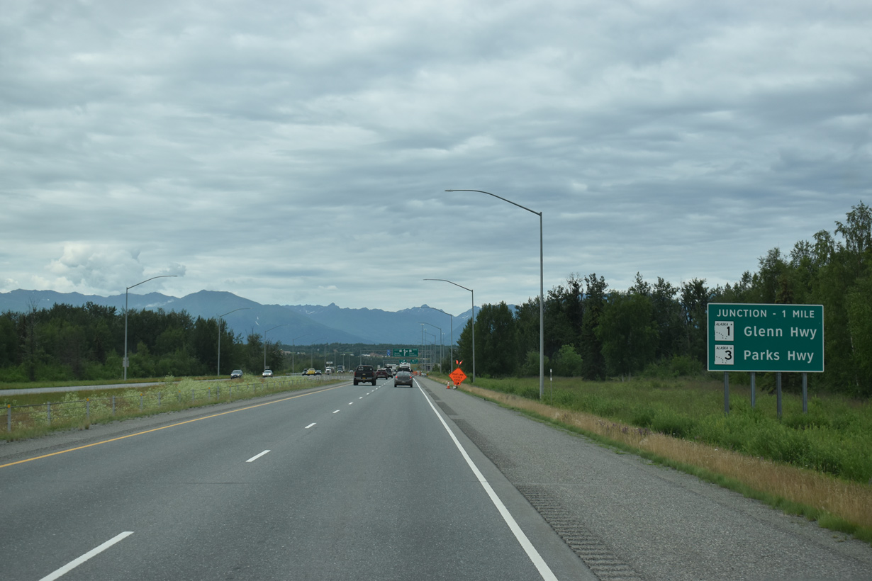
SR 3 (Parks Highway) meets SR 1 (Glenn Highway) beyond a dumbbell interchange with Trunk Road in Gateway. 05/09/23
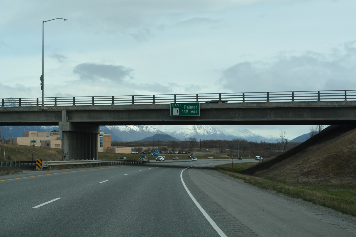
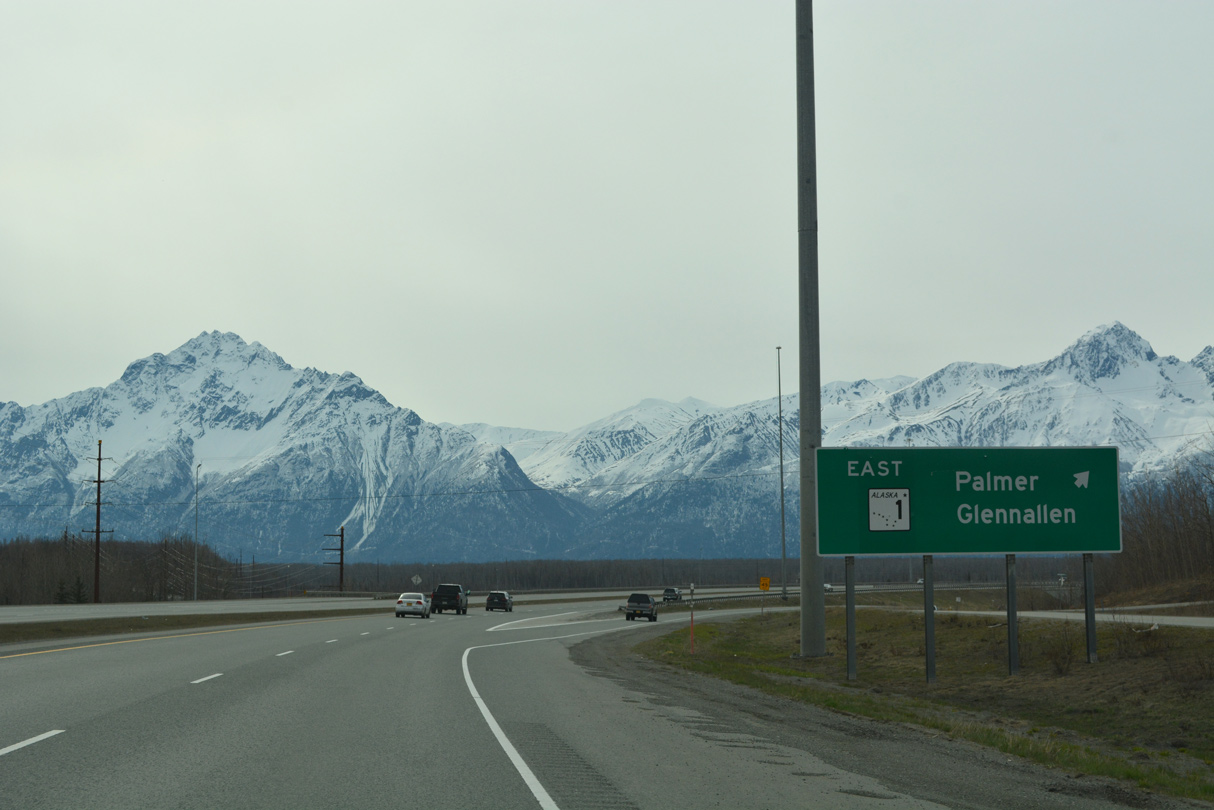
The exit for SR 1 (Glenn Highway) east to Palmer and Glennallen departs from the freeway along Parks Highway a half mile beyond Trunk Road. 05/09/23
The south end of I-A4 defaults onto I-A1 south to Anchorage beyond the off-ramp for Glenn Highway eastbound. 05/07/23

Fireweed Road parallels the ramp linking I-A4 south with I-A1 east by Spring Creek. 05/09/23
The exit for SR 1 east from SR 3 (Parks Highway) south intersects Glenn Highway at a stop sign adjacent to Spring Creek. 05/09/23
![]()
![]() South at
South at ![]()
![]()

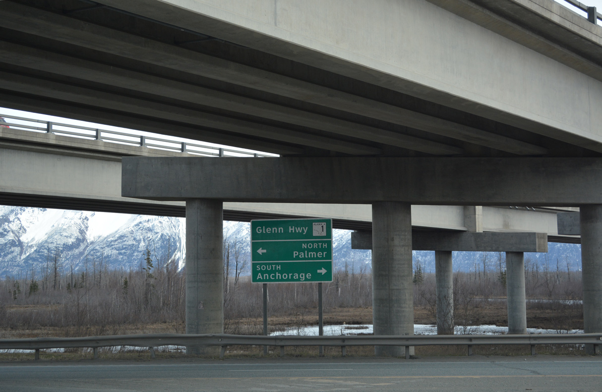
SR 1 (Glenn Highway) converges with SR 3 (Parks Highway) west past Matanuska Lake in the census designated place of Gateway. 07/31/23

I-A4/SR 3 (Parks Highway) ties into SR 1 (Glenn Highway) along a freeway joining Gateway with the city of Wasilla. 07/27/23
SR 1 (Glenn Highway) turns south at the entrance ramp for SR 3 (Parks Highway). I-A1 overtakes the freeway along I-A4 south to Eagle River and Anchorage. 07/27/23
![]()
![]() North at
North at ![]()
![]()
I-A1/SR 1 (Glenn Highway) crosses the Matanuska River valley north to a wye interchange with I-A4/SR 3 (Parks Highway). 07/21/23

The freeway mainline along Glenn Highway defaults onto SR 3 (Parks Highway) west to the city of Wasilla. 05/07/23

I-A1/SR 1 turn east at the exchange with I-A4/SR 3 in Gateway to Palmer. I-A1 continues along Glenn Highway to Glenallen. 05/07/23
![]()
![]() North
North

The first northbound shield for Alaska State Route 3 precedes the dumbbell interchange with Trunk Road west of SR 1 (Glenn Highway). 05/07/23
Sources:
- “Winter Highway to Nenana Soon to be All Year Round.” Fairbanks Daily News-Miner (AK), November 20, 1957.
- “Ester Road Bids Opened.” Fairbanks Daily News-Miner (AK), July 23, 1958.
- “New Highway Opening Set.” Fairbanks Daily News-Miner (AK), October 13, 1971.
- “Millions being spent on highways.” Fairbanks Daily News-Miner (AK), November 10, 1976.
- “Interchange project receives national recognition.” Alaska Journal of Commerce (Anchorage, AK), December 2, 2006.
Page updated September 25, 2023.