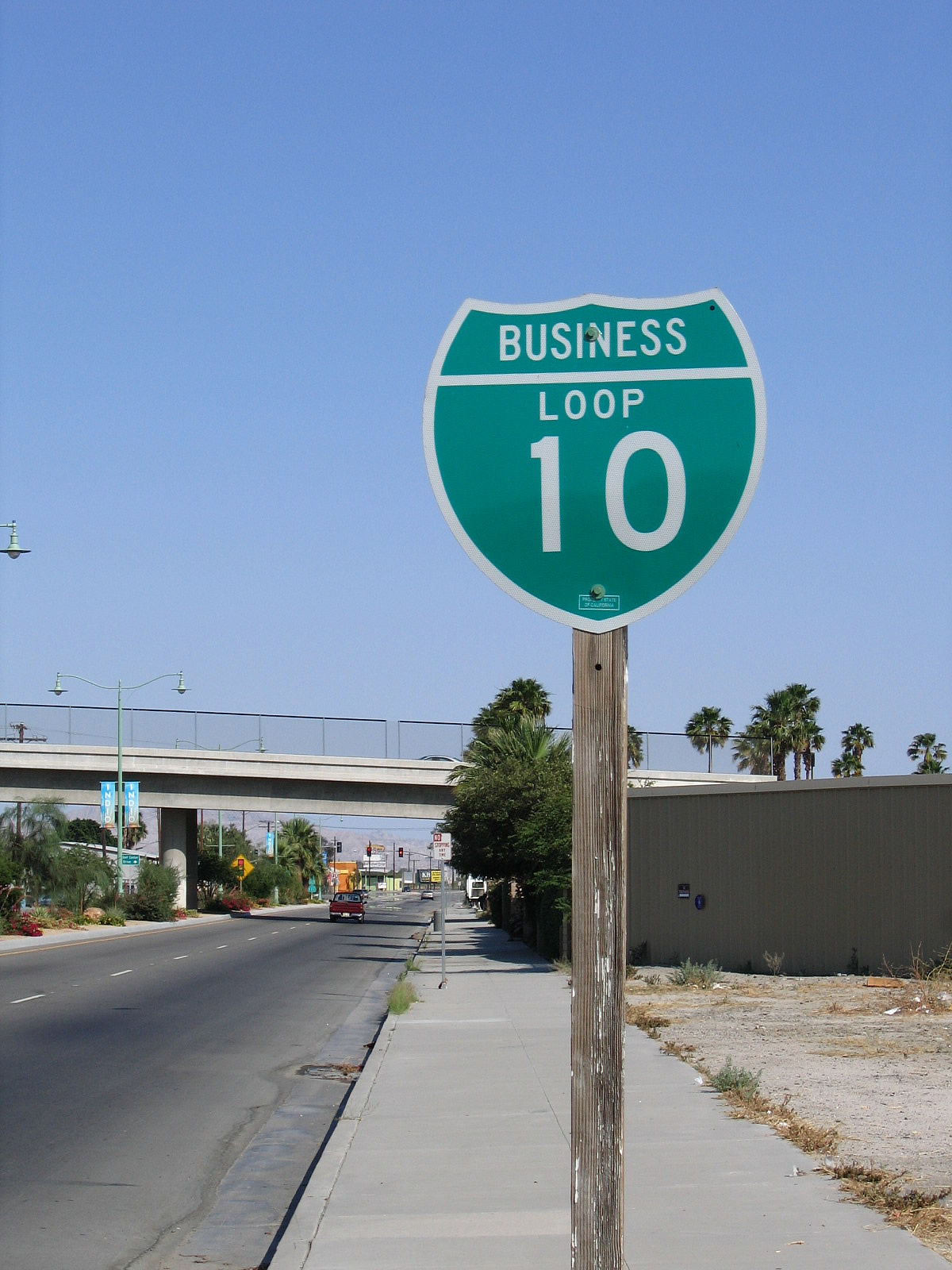
This business route follows Indio Boulevard along former U.S. 60-70-99, beginning at Exit 139, following Indio Boulevard south to Dillon Road, and returning via Dillon Road east to Interstate 10 at Exit 146. This business route is a well-preserved section of old U.S. highway through Indio as it parallels a train yard. The western and central parts of the route are maintained by the city of Indio (the middle segment was formerly controlled by the state as part of California 86-111, but the state transferred the route over to the city). The eastern section of the route is maintained by the city of Coachella. As a result, signage varies depending on the entity maintaining the road. The City of Indio has seemed to lose interest in its segment of Business Loop I-10, as signs for the route were largely gone by 2010, replaced with "Historic U.S. 99" signs that had been added starting in 1999. However, the segment along Dillon Road near the California 86 expressway interchange and eastern Interstate 10 interchange (Exit 146) still has business route signage, even as of 2012. According to the California State Highway System Signing Log (October 1991), Business Loop I-10 in Indio runs from "Interstate 10 and Indio overcrossing near Indio via Indio Boulevard and State Route 86 to Interstate 10 and Dillon Road." This business route remains signed in both directions from mainline Interstate 10. The Dillon Road Grade Separation (built in 2009 at the intersection of Indio Boulevard and Dillon Road) is not an intuitive connection for traffic trying to follow the Business Loop I-10 through route, and there are few if any business route signs at this critical intersection alongo the route.
| Business Loop I-10 east |
|
Leaving Interstate 10 at Exit 139, eastbound Business Loop I-10 and Historic U.S. 60-70-99 follow Indio Boulevard, which begins as an expressway. The first junctions will be with Jefferson Street north and south. Turn left at the stop sign ahead for Jefferson Street north. Photo taken 05/07/06. |
|
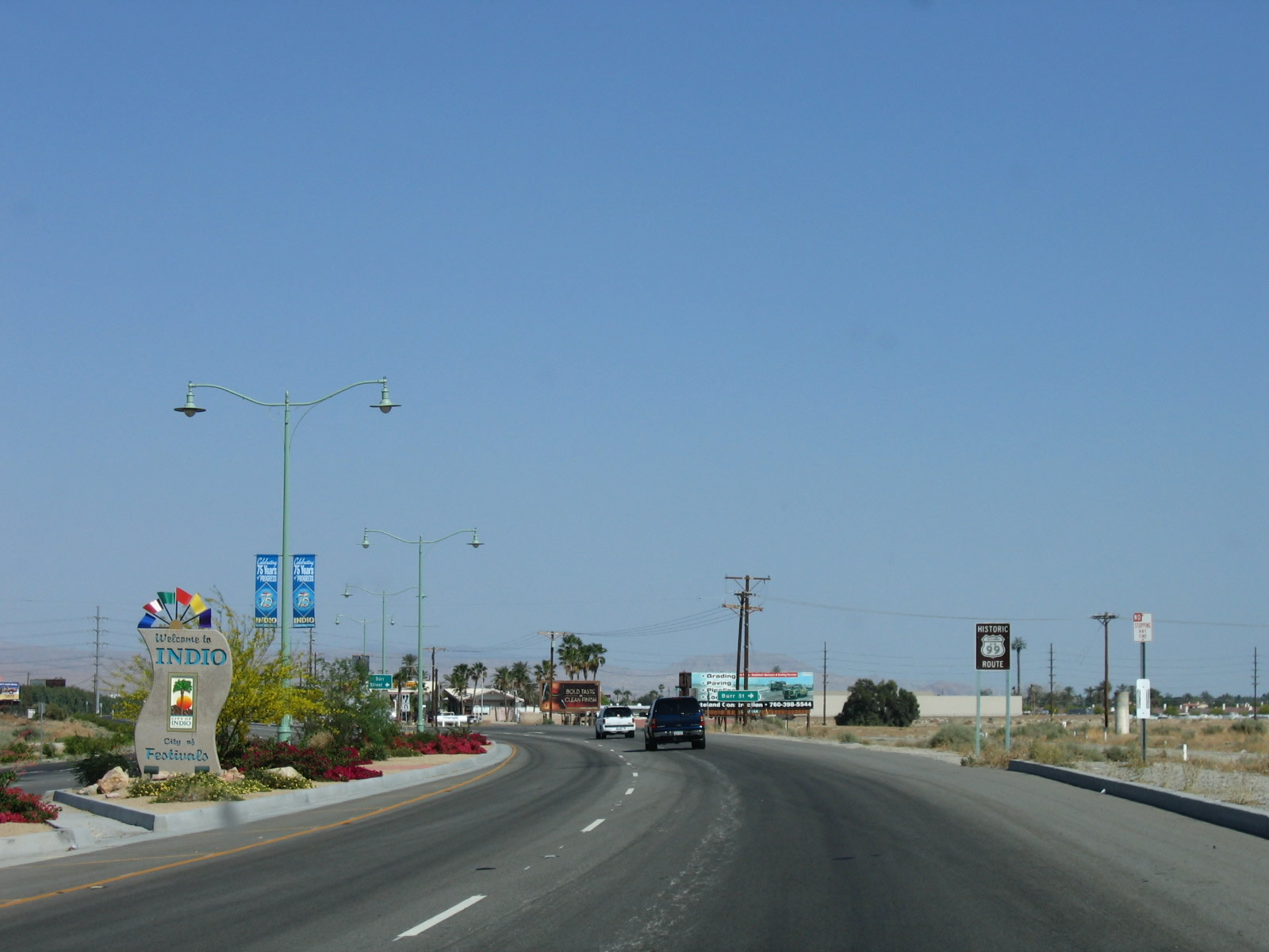
Business Loop I-10 follows Indio Boulevard to serve the city of Indio, the "City of Festivals." Indio had a population of 76,036 as of the 2010 Census, a significant increase from the population of 49,116 counted in the 2000 Census. The city sits at the intersection of Interstate 10, California 86, and California 111. Along with neighboring Coachella, Indio has also served as the historic junction between U.S. 60-70 and U.S. 99. East of Indio, U.S. 60 and U.S. 70 proceed toward Blythe and Phoenix while U.S. 99 turns south toward the Imperial Valley and Mexico. At the stop sign ahead, turn left for Jefferson Street north. Photo taken 05/07/06. |
|
Business Loop I-10 enters the city of Indio, which sits at an elevation of -13 feet below sea level. While Interstate 10 has some below sea level segments, it does not reach the same low elevations as Interstate 8 in the Imperial Valley, which drops to as low as -42 feet below sea level. California 86 and California 111 both travel through some low-lying territory, especially when they pass near the Salton Sea (el. -226 feet below sea level). Both routes generally stay below sea level from Indio south to their termini in the Imperial Valley. California 111 specifically passes through the city with the lowest elevation in California and the United States: Calipatria, which sits at an elevation of -184 feet below sea level. Photo taken 05/07/06. |
|
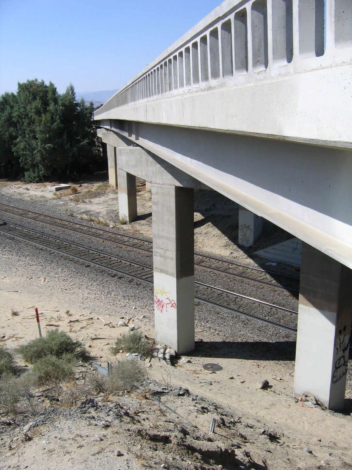
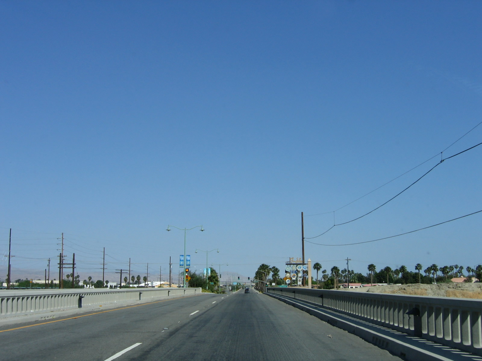
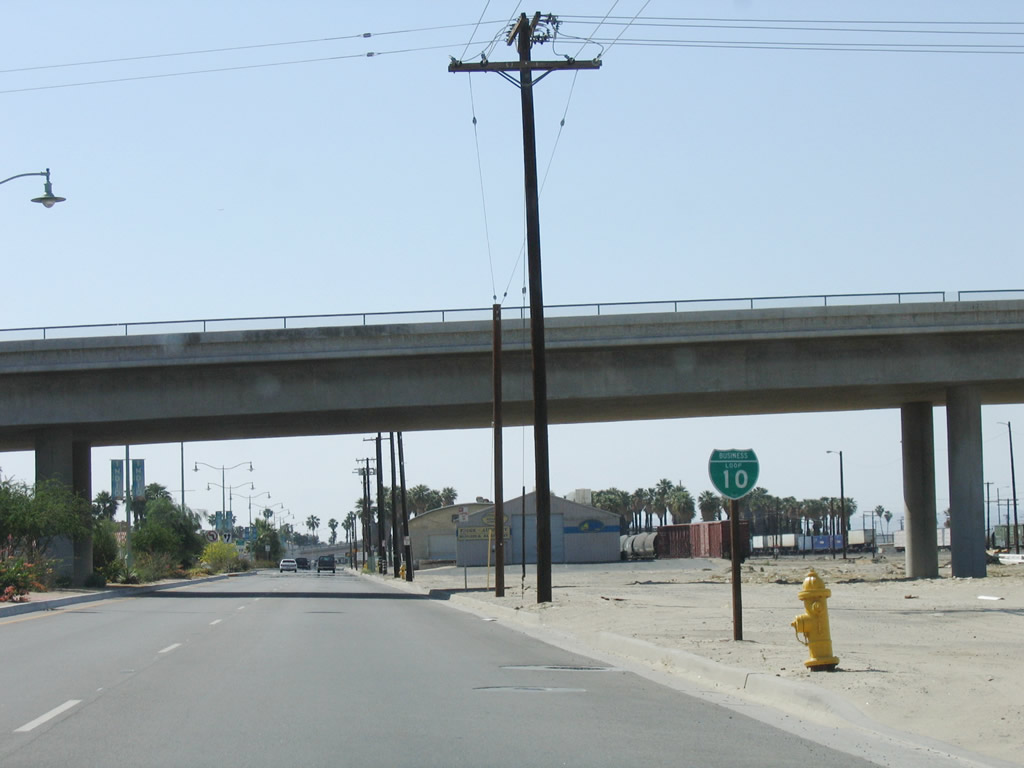
Eastbound Business Loop I-10 (Indio Boulevard) curve to pass over the Union Pacific Railroad on a pair of bridges. The northbound bridge was built in 1936, and the southbound bridge was built in 1956. Photo taken 05/07/06. |
|
Eastbound Business Loop I-10 (Indio Boulevard) approaches Jefferson Street south to La Quinta (first traffic signal on eastbound Indio Boulevard). Photo taken 05/07/06. |
|
An end freeway sign was posted along eastbound Business Loop I-10 (Indio Boulevard) at Jefferson Street south. It's likely that this sign has been removed now that there are stop signs at the Jefferson Street north intersection. Photo taken 05/07/06. |
|
The center median benefitted from landscaping and a welcome monument sign proclaiming Indio to be the "City of Festivals." Photo taken 05/07/06. |
|
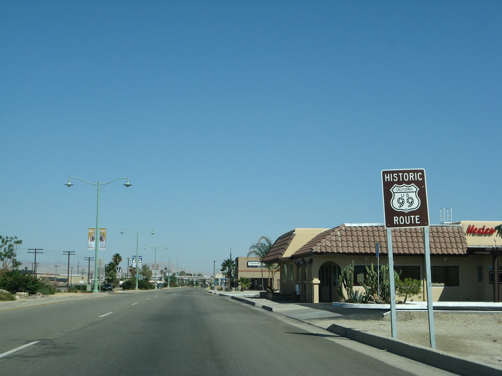
A Historic U.S. 99 sign is posted soon thereafter. U.S. 99 is an officially designated historic route within the state of California, joining an elite group of decommissioned U.S. highways that share that honor. Other official historic routes with similiar signs include U.S. 101 in San Diego County, U.S. 6 in Los Angeles County, U.S. 80 in Imperial and San Diego Counties, and U.S. 40 across Northern California. Photo taken 05/07/06. |
|
Eastbound Indio Boulevard approaches Burr Street. Photo taken 05/07/06. |
|
|
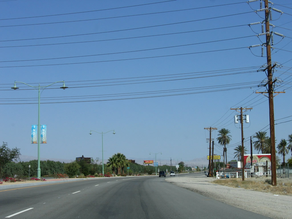
Antique-style street lights line the center median of Indio Boulevard. A set of Imperial Irrigation District power lines cross over Indio Boulevard as well. Photo taken 05/07/06. |
|
Indio Boulevard was originally built as an expressway as it travels past Madison Street toward downtown Indio, but its high-speed aspects have diminished as the expressway has been shifted into a four-lane arterial with adjacent business access points. The boulevard travels alongside the Union Pacific Railroad. Photo taken 05/07/06. |
|
|
| Indio Boulevard eastbound spans the Whitewater River. This river spans the length of the Coachella Valley, originating near San Gorgonio Pass and traveling southeast parallel to both California 111 and Interstate 10 toward the Salton Sea, where it terminates. This concrete tee beam bridge (16 spans) carries the eastbound lanes over the river. It was built in 1925 and was expanded in 1955 to its current configuration. The westbound lanes use a separate, concrete tee beam span that was built in 1956. Another welcome to Indio sign is posted at the east end of the Whitewater River bridge. Photos taken 05/07/06. |
|
Eastbound Business Loop I-10 (Indio Boulevard) approaches Clinton Street (next right). Photo taken 05/07/06. |
|
Business Loop I-10 (Indio Boulevard) east meets Hoover Street, which travels south and turns east as Hoover Avenue. Photo taken 05/07/06. |
|
An Interstate 10 trailblazer is posted after Hoover Street along eastbound Business Loop I-10 (Indio Boulevard). Use Monroe Street north, Jackson Street north, or Golf Center Parkway northeast to return to Interstate 10. Another option is to follow the business route via Indio Boulevard southeast and Dillon Road northeast. This shield assembly is still in place as of January 2012. Photo taken 05/07/06. |
|
A Historic U.S. 99 route marker is posted along eastbound Business Loop I-10 (Indio Boulevard) prior to the Monroe Street viaduct, which was built in 1990 to cross over the Union Pacific Railroad and Indio Boulevard. Photo taken 05/07/06. |
|
Eastbound Business Loop I-10 (Indio Boulevard) passes under Monroe Street. Turn right at the traffic signal to access Monroe Street. Photo taken 05/07/06. |
|
After passing under Monroe Street, eastbound Business Loop I-10 (Indio Boulevard) meets Fred Waring Way, which travels southwest to Monroe Street. Turn right to follow Monroe Street north to the Interstate 10 freeway. Photo taken 05/07/06. |
|
Another Historic U.S. 99 route marker is posted along eastbound Business Loop I-10 (Indio Boulevard) between Fred Waring Drive/Monroe Street and Sun Gold Street. Photo taken 05/07/06. |
|
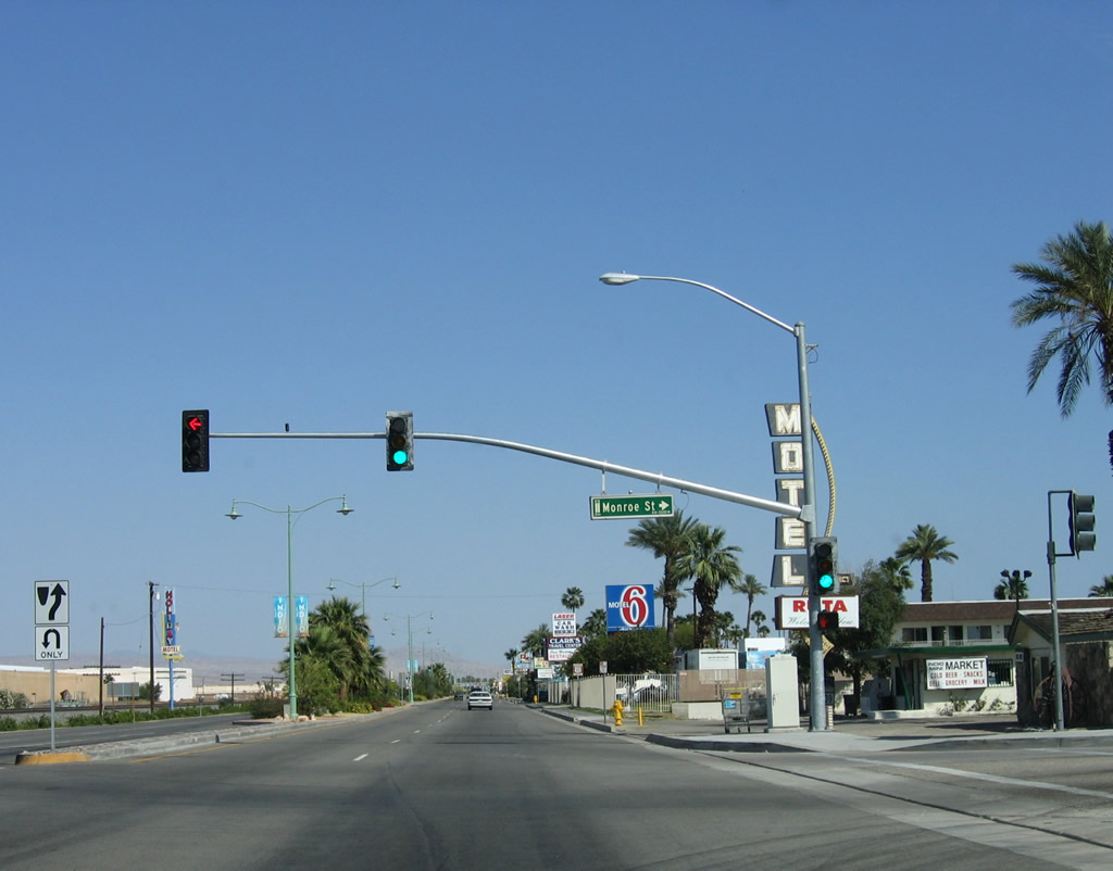
After Clark's Travel Center, eastbound Business Loop I-10 and Historic U.S. 60-70-99 approach Palm Street (next right). The business route designation was deemphasized if not outright eliminated starting in 2007. This coincided with the relinquishment of California 86 and California 111 within city limits to the city of Indio. Photo taken 06/07/08. |
|
The city of Indio enhanced the streetscape of the historic route by adding street lights and xeriscape to the median. The next intersection is with Biskra Street. Photo taken 06/07/08. |
|
This section of eastbound Business Loop I-10 and Historic U.S. 60-70-99 is regularly signed as Historic U.S. 99 signs such as this one posted near Biskra Street in Indio. Green business loop signs were largely removed and gone from this stretch of Indio Boulevard by 2008. Photo taken 06/07/08. |
|
Eastbound Business Loop I-10 approaches Deglet Noor Street south to Miles Avenue Park. Photo taken 05/07/06. |
|
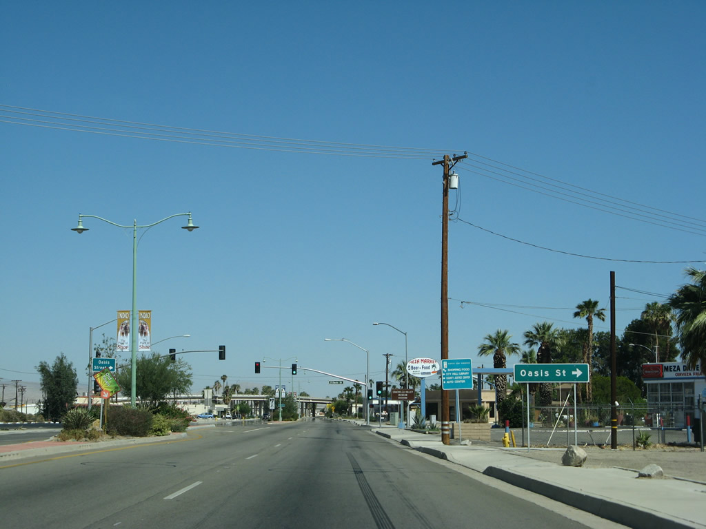
Eastbound Business Loop I-10 and Historic U.S. 60-70-99 approach Oasis Street, which travels south into Old Town Indio and connects to California 111 and the Coachella Valley Museum. Photo taken 06/07/08. |
|
After the Oasis Street intersection, use Towne Street south to Indio City Hall. Photo taken 05/07/06. |
|
|
| After the signalized intersection with Oasis Street, Business Loop I-10 meets Smurr Street and Fargo Street. The Jackson Street bridge that carries the roadway over the adjacent railroad comes into view. Jackson Street will pass over Business Loop I-10 / Historic U.S. 99 due to its proximity to the railroad. Photos taken 06/07/08. |
|
This Business Loop I-10 shield was posted after the Jackson Street viaduct. The next traffic signal along eastbound is with Civic Center Mall to Jackson Street. Photo taken 05/07/06. |
|
After passing under the Jackson Street bridge, Indio Boulevard curves southeast and approaches a right turn to Civic Center Mall followed by Grace Street. Use Civic Center Mall to connect to Jackson Street north to Interstate 10. The Civic Center Mall traffic signal was not in place in 2006 and existed by 2008. Photo taken 06/07/08. |
|
Business Loop I-10 meets Requa Avenue west and Flower Street south at the approaching intersection. Photo taken 05/07/06. |
|
This Business Loop I-10 reassurance shield was posted along eastbound Indio Boulevard after the intersection with Requa Avenue and Flower Street. The route marker was gone by 2008. Photo taken 05/07/06. |
|
Eastbound Business Loop I-10 (Indio Boulevard) passes under Golf Center Parkway. Photo taken 06/07/08. |
|
By 2008 the shield for California 111 was removed. A small guide sign advises of the next signalized intersection, which connects Business Loop I-10 (Indio Boulevard) with northbound California 111 (now called "Highway 111" with its decommissioning within the city of Indio). Photo taken 05/07/06. |
|
|
Back in 2006, a California 111 trailblazer and a mileage sign pointing the way to Palm Desert and Palm Springs via California 111 west were in place; these signs were gone by 2008 as shown in the next box. Photos taken 05/07/06. |
|
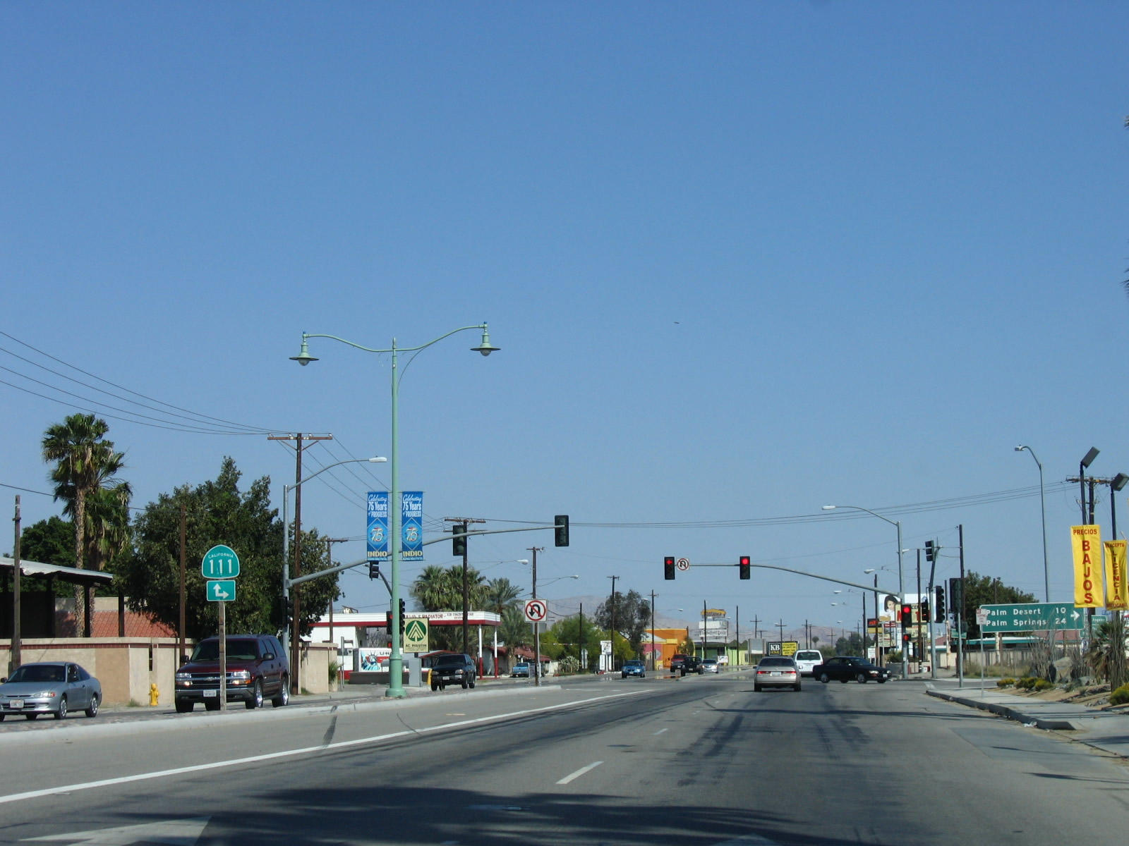
A mileage sign points the way to Palm Desert (10 miles) and Palm Springs (24 miles) via California 111 northwest. This sign was replaced between 2006 and 2008 due to the relinquishment of California 111 from the state to the city of Indio. Ahead, eastbound Business Loop I-10 (Indio Boulevard) will combine with California 111 south as well as former California 86 for several miles toward Coachella. The routes will divide at Dillon Road. Photo taken 06/07/08. |
|
Eastbound Business Loop I-10 (Indio Boulevard) meets California 111 (Highway 111) at this traffic signal in Indio. Photo taken 06/07/08. |
| Business Loop I-10 east & California 111 south |
|
After the Highway 111 and Indio Boulevard intersection in downtown Indio, this Historic U.S. 99 sign is posted along southbound Indio Boulevard. Business Loop I-10 and California 111 are not signed due to the fact that Indio Boulevard was relinquished from the state highway system. Photo taken 06/07/08. |
|
Southbound California 111 and eastbound Business Loop I-10 meets Van Buren Street at this traffic signal in Indio. Van Buren Street travels south, while Indio Boulevard continues southwest, parallel to the railroad tracks. Photo taken 06/07/08. |
|
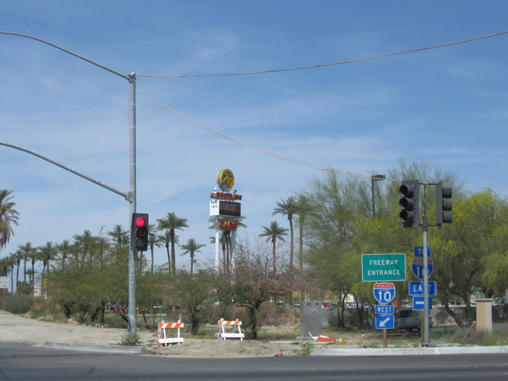
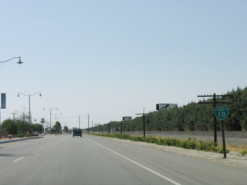
The next signalized intersection along California 111 (Indio Boulevard) and Business Loop I-10 is with Dillon Road. When these pictures were taken, traffic connected to Dillon Road via an at-grade crossing with the railroad. An overpass was built in 2010, and that required all traffic to Dillon Road to turn right at this signal instead. Business Loop I-10 follows Dillon Road east to rejoin Interstate 10 en route to Blythe and Phoenix. Continue straight to follow California 111 southeast to Mecca and California 86 south to Brawley and El Centro. For the first time, California 111 will cease to parallel Interstate 10 and will set out on its own path as it travels south out of the Coachella Valley and toward the Salton Sea and Imperial Valley. This overhead sign used to be the first to mention California 86 south. Even though the sign was changed between 2000 and 2008, it was completely gone by 2012. Photo taken 06/07/08. |
|
A second sign for Interstate 10 east to Blythe and Phoenix used to be posted in the median of southbound former California 86-111 and eastbound Business Loop I-10 in Indio. With the new Dillon Road bridge, this median sign was also removed and not replaced. While California 86 and California 111 proceed south into the city of Coachella as Grapefruit Boulevard, and eastbound Business Loop I-10 turns left to return to Interstate 10 via Dillon Road. Old U.S. 60-70-99 follow California 111 south through Coachella, then divide at the point where California 111 and California 86 divide (at the split between Grapefruit Boulevard and Harrison Street in Coachella). U.S. 60-70 follow California 111 southeast to Mecca, then turn east via Box Canyon Road toward Interstate 10 at Chiriaco Summit. U.S. 99 proceeds south along old California 86 and the California 86 expressway toward Desert Shores, Salton City, Brawley, and El Centro. Photo taken 06/07/08. |
|
The routes divide at the intersection of Indio Boulevard and Dillon Road (48th Avenue). At the time this picture was taken, construction was underway to build a Dillon Road overpass across Indio Boulevard and the railroad. By Summer 2009, this configuration had changed, with all traffic connecting to Dillon Road turning right and then looping onto the bridge that carries traffic over both Indio Boulevard and the railroad tracks. Photo taken 03/14/09. |
| Business Loop I-10 east |
|
After Business Loop I-10 splits from former California 86-111 at the Dillon Road Grade Separation on the border between the cities of Indio and Coachella in the Coachella Valley, it follows Dillon Road back to California 86 and Interstate 10. This two-lane roadway passes through Coachella and is planned for expansion to add capacity. Photo taken 03/14/09. |
|
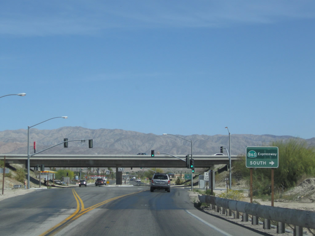
Eastbound Business Loop I-10 (Dillon Road) meets California 86 expressway south to Desert Shores-Salton City, Brawley, and El Centro. Photo taken 03/14/09. |
|
Since California 86 changes from freeway to expressway south of the Dillon Road interchange, a freeway entrance shield assembly is not used for the on-ramp to California 86 expressway (former California 86S) south. Photo taken 03/14/09. |
|
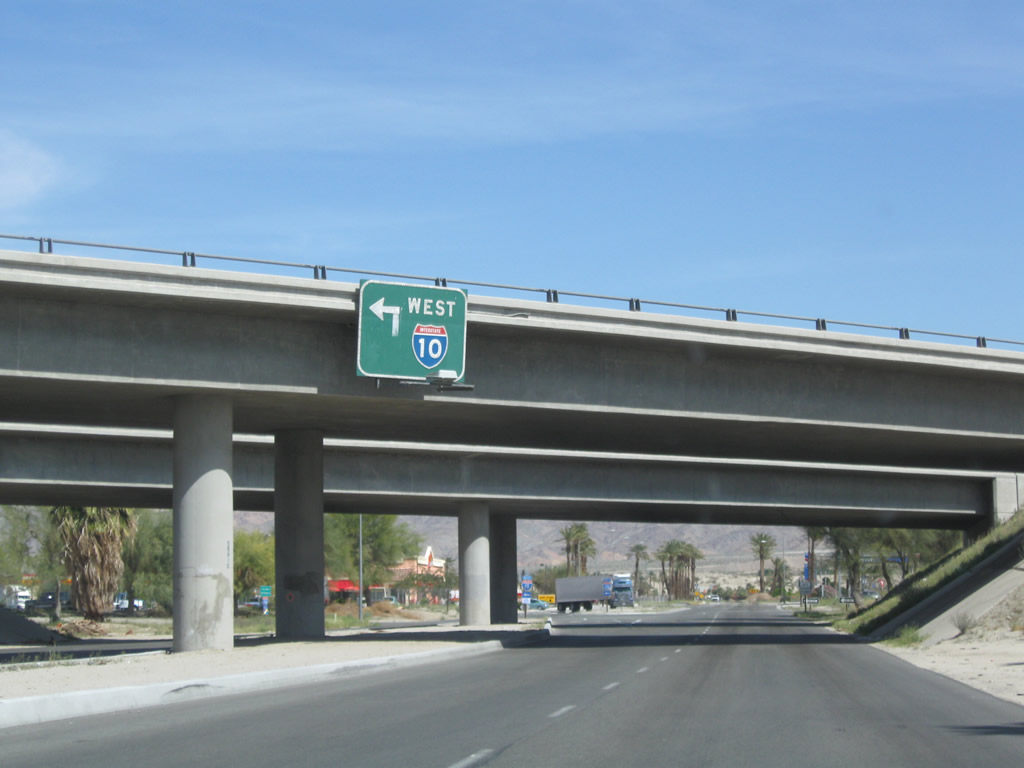
The left lane of eastbound Business Loop I-10 (Dillon Road) becomes exit only for the left turn onto the California 86 expressway north to Interstate 10 west to Palm Springs, Riverside, San Bernardino, and Los Angeles. Continue east on Business Loop I-10 (Dillon Road) to Interstate 10 east to Blythe and Phoenix. Photo taken 03/14/09. |
|
The on-ramp from Business Loop I-10 (Dillon Road) to California 86 north to Interstate 10 west is signed as a freeway entrance to Interstate 10 west. A trailblazer is posted for Interstate 10 east to Phoenix. Photo taken 03/14/09. |
|
Between California 86 expressway and Interstate 10, Business Loop I-10 (Dillon Road) passes through northern Coachella. Turn left at this stop sign to the Trump 29 Indian Casino, which is nestled between California 86 expressway and Interstate 10. Photo taken 03/14/09. |
|
This sign is posted at the end of the Trump 9 Casino driveway; it shows shields for Interstate 10 and former California 86S. Photo taken 03/14/09. |
|
An Interstate 10 east trailblazer is posted along eastbound Business Loop I-10 (Dillon Road) between the California 86 expressway and Interstate 10 interchanges. Photo taken 03/14/09. |
|
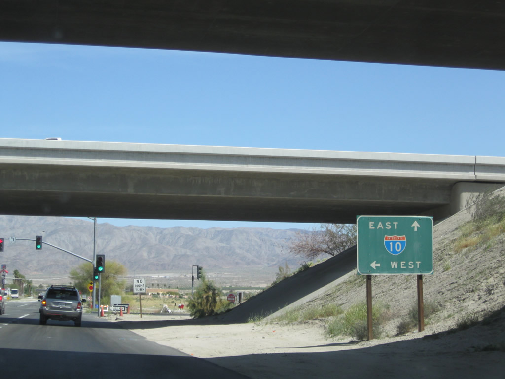
Eastbound Business Loop I-10 (Dillon Road) approaches Interstate 10 east to Blythe and Phoenix (next right) and west to Los Angeles (next left). Photo taken 03/14/09. |
|
Turn left to Interstate 10 west to Los Angeles. Photo taken 03/14/09. |
|
A trailblazer for Interstate 10 west is posted in the median; at this point, Business Loop I-10 ends. Dillon Road continues north and then northwest toward Desert Hot Springs and ultimately California 62. Photo taken 03/14/09. |
|
This view looks northeast on Dillon Road after leaving the Interstate 10 interchange. A new grade-separated intersection opened at Dillon Road and Indio Boulevard in 2011 to allow motorists to avoid an at-grade crossing with the Union Pacific Railroad, so this area changed significantly since this picture was taken. Photo taken 03/14/09. |
| Business Loop I-10 west |
|
Business Loop I-10 begins at the Dillon Road interchange west of Indio within the city of Coachella. This Interstate 10 west trailblazer is posted along southbound Dillon Road as it approaches the Interstate 10 interchange. Photo taken 03/14/09. |
|
|
A pair of Interstate 10 west freeway entrance shield assemblies flanks the entrance to Interstate 10 west from Dillon Road in Coachella. Photos taken 03/14/09. |
|
The first Business Loop I-10 trailblazer is posted after the Interstate 10 west on-ramp and prior to passing under the Interstate 10 freeway. The business loop proceeds southwest along Dillon Road to Grapefruit Boulevard and Indio Boulevard, then turns northeast along Historic U.S. 60-70-99 toward downtown Indio. Photo taken 03/14/09. |
|
The next left turn from westbound Business Loop I-10 (Dillon Road) connects to Interstate 10 east to Blythe and Phoenix. Photo taken 03/14/09. |
|
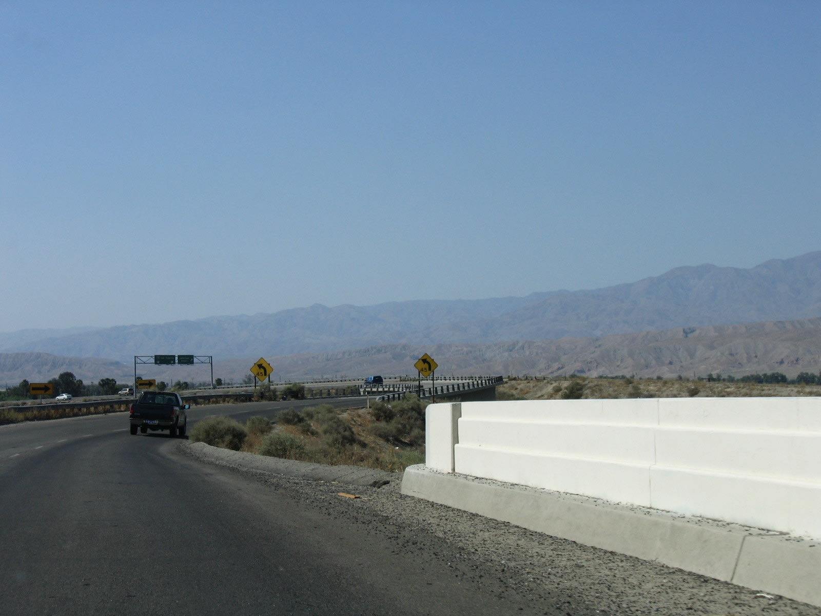
The Santa Rosa Mountains rise in the distance ahead. Photo taken 03/14/09. |
|
Westbound Business Loop I-10 (Dillon Road) next meets California 86 expressway. Turn right to connect to California 86 expressway north to Interstate 10 west to Los Angeles. The next left connects to California 86 south. Photo taken 03/14/09. |
|
Under the California 86 expressway overpass, a trailblazer used to indicate that now-former California 86 was straight ahead via Business Loop I-10 west. Turn left to new California 86 south to Brawley and El Centro. California 86S was decommissioned in favor of California 86 in 2012. Photo taken 03/14/09. |
| Business Loop I-10 west & California 111 north |
|
The routing of California 111 through Coachella and Indio is a bit confusing, as the original alignment (along Grapefruit Boulevard in Coachella and Indio Boulevard/"Highway 111" in Indio) is maintained by local agencies (Riverside County, City of Coachella, and City of Indio). As a result, the state-maintained segments are not continuous. California 111 is generally unsigned along Indio Boulevard, which originally was U.S. 60-70-99 and California 111, later California 86-111 and Business Loop I-10, and now is unsigned California 111 and (mostly) unsigned Business Loop I-10. Photo taken 05/07/06. |
|
The routes divide as California 111 prepares to turn left onto Highway 111 northwest, and Business Loop I-10 (Indio Boulevard) and Historic U.S. 60-70-99 proceed north to return to Interstate 10. This sign used to advise that through traffic on California 111 should turn left onto what is now Highway 111 west, but the sign is now gone. Highway 111 travels northwest to serve Indian Wells, La Quinta, Palm Desert, Rancho Mirage, Cathedral City, and Palm Springs. Photo taken 05/07/06. |
|
Northbound California 111 prepares to turn left onto Highway 111 en route to Indian Wells, La Quinta, Palm Desert, Rancho Mirage, Cathedral City, and Palm Springs. Business Loop I-10 continues ahead via Indio Boulevard. Photo taken 05/07/06. |
|
Another California 111 trailblazer is posted along northbound Indio Boulevard for the left turn to Highway 111. By 2008, this sign was removed. Photo taken 05/07/06. |
|
Looking back to 1999, an end shield for California 86 north used to be posted along northbound California 111 at the intersection with Business Loop I-10 / Historic U.S. 99 northwest split in Indio; this sign assembly was gone by 2007. California 86 used to continue north all the way to Interstate 10 via Business Loop I-10, but the section of the business route north of this point was decommissioned by the state. This was an unusual ending point for California 86 since California rarely signs cosigned routes for routes that do not split apart (in other words, back in 1999, California 86 used to merge with California 111, but it never did become a solo route again). These signs were gone by 2006; now California 86 has been shifted onto the former California 86S expressway. Photo taken 06/12/99. |
| Business Loop I-10 west |
|
Now separated from California 111, westbound Business Loop I-10 and Historic U.S. 60-70-99 proceed northwest along Indio Boulevard parallel to the railroad tracks. As a result, there is no direct access to Golf Center Parkway (which uses a bridge to cross over the railroad and Indio Boulevard). A larger-than-normal Historic U.S. 99 sign is posted shortly after the traffic signal. Photo taken 05/07/06. |
|
A Business Loop I-10 route marker is posted a bit further northwest along Indio Boulevard. This reassurance shield used to be located just north of the point where California 111 splits off to the west via Avenue 46 toward Palm Springs. Business Loop I-10 was originally U.S. 60-70-99, with U.S. 60 the last U.S. route to be decommissioned of the three in California. After U.S. 60-70-99 were gone, what is now Indio Boulevard was designated as the northernmost reach of California 86. Former U.S. 99 south of Indio had largely been replaced by California 86 in 1964. By the late 1990s, California 86 was truncated south to the California 111 intersection in Indio; by 2006, California 86 signage was starting to disappear from Indio Boulevard; and in 2012, California 86 was completely rerouted onto the California 86S expressway. Photo taken 05/07/06. |
|
Westbound Business Loop I-10 and Historic U.S. 60-70-99 pass under the Golf Center Parkway viaduct in downtown Indio. Golf Center Parkway itself is part of a connector route between California 111 and Interstate 10 in Indio. Back in 2006, the features of the original U.S. 60-70-99 expressway through Indio were prominently featured; subsequent streetscaping projects dialed back the expressway appearance and tried to add more landscaping and traffic calming features. Ahead, Business Loop I-10 will closely parallel the railroad through Indio. Business Loop I-10 signage has become less common if not rare within the city of Indio as a result of hte streetscaping projects. Photo taken 05/07/06. |
|
Another U.S. 99 historic route marker is posted along northwestbound Indio Boulevard. Photo taken 05/07/06. |
|
Continuing northwest, Business Loop I-10, Historic U.S. 60-70-99, and former California 86 pass under Jackson Street. A left turn on Civic Center Mall connects Indio Boulevard with Jackson Street. Photo taken 05/07/06. |
|
Northwestbound Business Loop I-10, Historic U.S. 60-70-99, and former California 86 (Indio Boulevard) approach a signalized intersection with Oasis Street. Turn left at the traffic signal to the Indio Civic Center. Photo taken 05/07/06. |
|
Landscaping lines the median of Indio Boulevard as it proceeds northwest. Photo taken 05/07/06. |
|
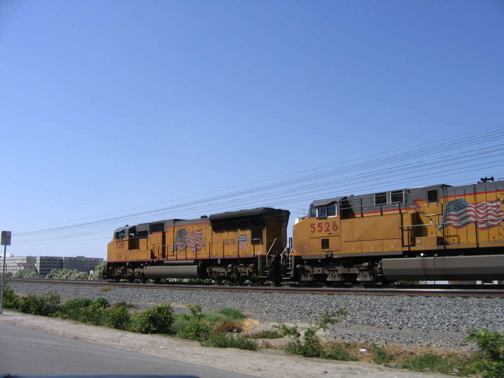
A Union Pacific locomotive comes into view alongside Indio Boulevard. Trains frequently travel visibly alongside this stretch of Indio Boulevard. Photo taken 05/07/06. |
|
Northwestbound Business Loop I-10, Historic U.S. 60-70-99, and former California 86 (Indio Boulevard) approach a signalized intersection with Fred Waring Drive, which connects with Monroe Street. The upcoming overpass carries Monroe Street over Indio Boulevard. Photo taken 05/07/06. |
|
After passing under the 1990 Monroe Street bridge, northwestbound Business Loop I-10, Historic U.S. 60-70-99, and former California 86 (Indio Boulevard) approach a signalized intersection with Hoover Street. Photo taken 05/07/06. |
|
Indio Boulevard next meets Clinton Street at this traffic signal. Photo taken 05/07/06. |
|
Soon thereafter, Indio Boulevard crosses over the Whitewater River on this 1956 bridge. The Whitewater River spans the length of the Coachella Valley and empties into the Salton Sea. A companion 1925 bridge carries the southbound (eastbound) traffic. Photo taken 05/07/06. |
|
A Business Loop I-10 route marker used to be posted along Indio Boulevard after the Whitewater River and prior to the Madison Street intersection. Photo taken 05/07/06. |
|
Westbound Business Loop I-10 (Indio Boulevard) meets Madison Street at the next traffic signal. Photo taken 05/07/06. |
|
Continuing west, Business Loop I-10 meets Jefferson Street, which travels south from here. Due to the proximity of Interstate 10 and the Union Pacific Railroad, the northern segment of Jefferson Street is not accessible from here. Instead, traffic for Jefferson Street north must proceed west on Indio Boulevard. Photo taken 05/07/06. |
|
A "To Freeway Entrance" sign is posted after the Jefferson Street southbound traffic signal. Continue ahead to Interstate 10 west to Los Angeles. Photo taken 05/07/06. |
|
Stay right for the connection to Jefferson Street north. Photo taken 05/07/06. |
|
An older type of bridge rail is used on the bridge that carries Indio Boulevard over the Union Pacific Railroad and into the Interstate 10 interchange. The northbound bridge was built in 1936, and the southbound bridge was built in 1956. Photo taken 05/07/06. |
|
Indio Boulevard next curves toward the west in preparation to crossing over Interstate 10. Photo taken 05/07/06. |
|
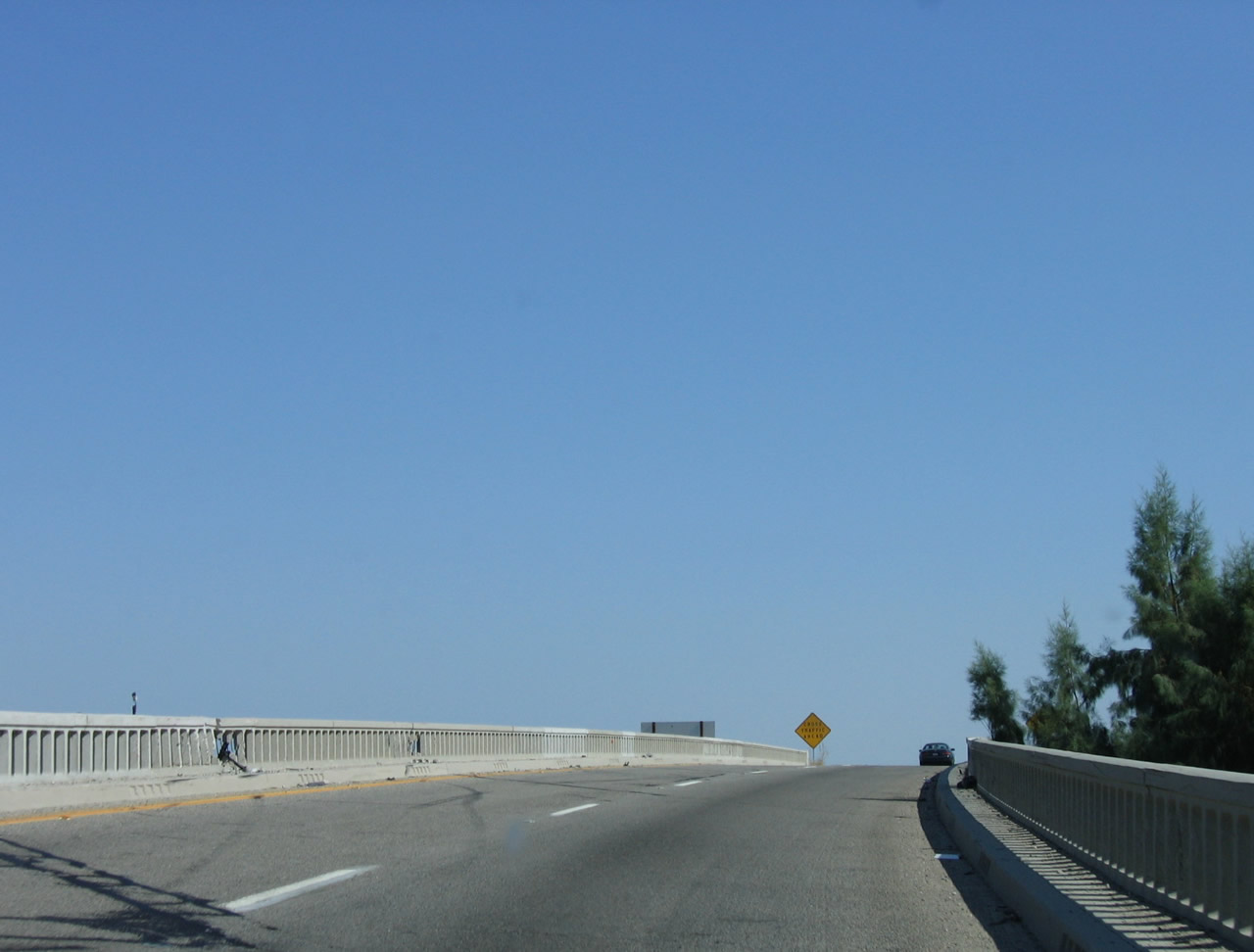
Business Loop I-10 (Indio Boulevard) crosses over Interstate 10 on this two-lane bridge. Both lanes will connect directly to Interstate 10 west, while the right lane will also link to Jefferson Street north. Photo taken 05/07/06. |
|
The view of Interstate 10 westbound can be seen from the Indio Boulevard separation over Interstate 10. The overpass bridge was built in 1972 to connect westbound Indio Boulevard with Interstate 10 west. This marks the northernmost point along the longest extent of California 86. Photo taken 05/07/06. |
|
Wastbound Business Loop I-10 (Indio Boulevard) meets the off-ramp to Jefferson Street and prepares to merge onto Interstate 10 west. This effectively is the endpoint of Business Loop I-10 in Indio. Photo taken 05/07/06. |
|
A freeway entrance shield assembly is posted for the westbound Business Loop I-10 to Interstate 10 transition ramp. Photo taken 05/07/06. |
| Business Loop I-10 scenes |
|
|
|
|
|
Two bridges carry Indio Boulevard over the Union Pacific Railroad tracks. The one shown in the foreground is the 1956 bridge that carries the eastbound lanes of Business Loop I-10 (Indio Boulevard) over the railroad tracks. Behind it is the older, 1936 bridge that carries the westbound lanes. The 1936 bridge over the Union Pacific Railroad tracks is distinctive due to its unique bridge railing, which unlike most other railings seen in this area. Photos taken 05/07/06. |
|
Old-style guardrail lines the eastbound lanes of Indio Boulevard on the descent from the Union Pacific Railroad bridge. Photo taken 05/07/06. |
|
This FAP ("Federal Aid Primary") porcelain-enamel marker was posted along Indio Boulevard at the Union Pacific Railroad bridge and still stood in place as of May 2006. Photo taken 05/07/06. |
|
|
Northbound Jefferson Street approaches Business Loop I-10 (Indio Boulevard / Historic U.S. 60-70-99). Turn left for Indio Boulevard northwest to Interstate 10 and the continuation of Jefferson Street north. Turn right for Business Loop I-10 (Indio Boulevard) southeast to downtown Indio. Photo taken 05/07/06. |
|
|
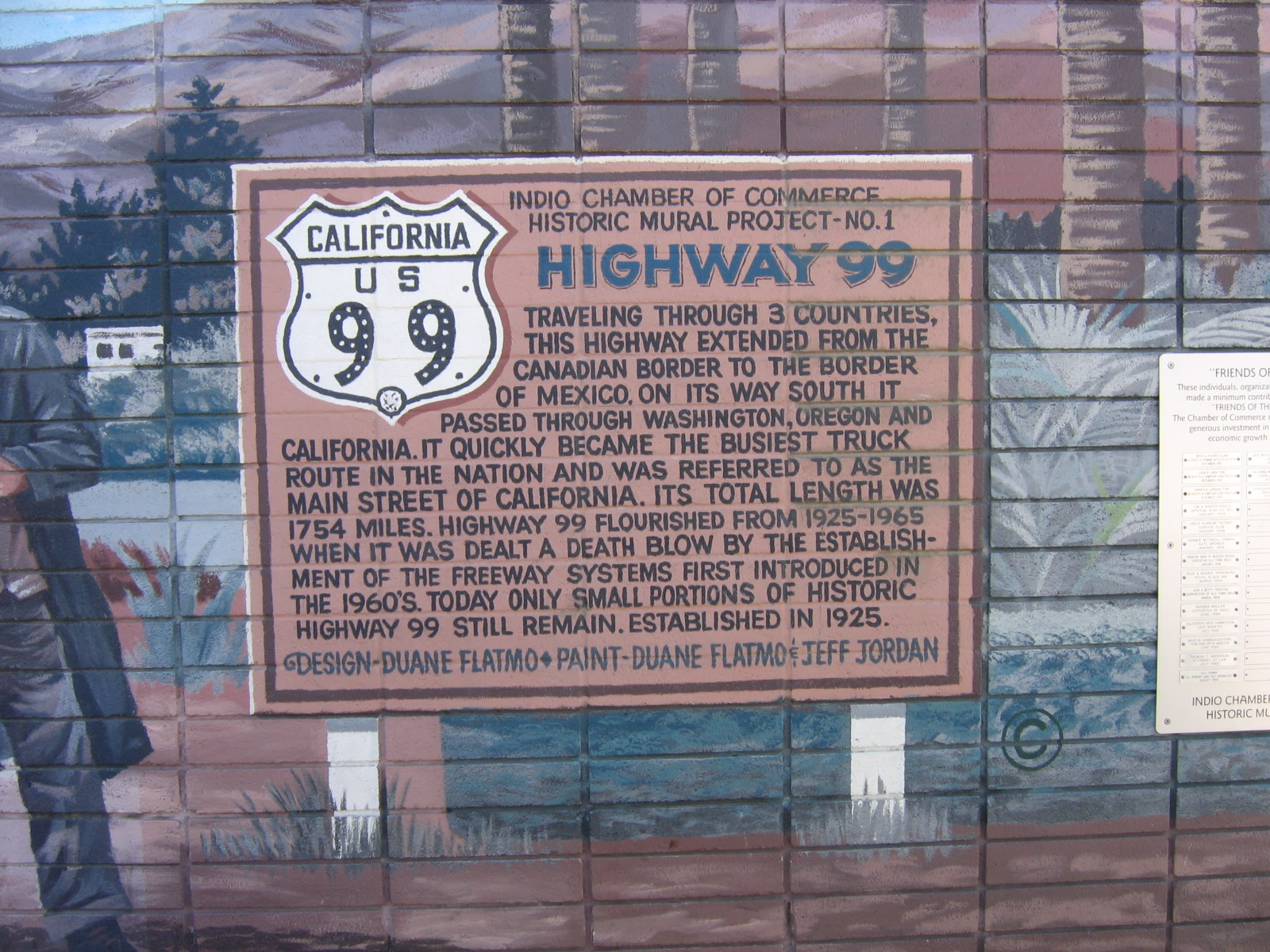
On the south side of Indio Boulevard is Clark's Travel Center, which at one time hosted a large collection of historical signs, many of which dated back to signs posted by the Automobile Club of Southern California (ACSC) as well as the California Division of Highways (CDOH). The historic sign display is not in place as of 2008, but an exterior mural provides a background and history of U.S. 99, the "Main Street of California." Photo taken 05/07/06. |
Page Updated March 17, 2013.