In Escondido, Business Loop I-15 follows Old U.S. Highway 395 between Exits 28 and 34 along Centre City Parkway; the entire route is a four-lane, divided highway and bypasses downtown Escondido to the west.
| Business Loop I-15 north |
|
Departing Interstate 15, northbound Business Loop I-15 has at least two lanes for its entire route through Escondido. Due to the construction of the managed express lanes in 2009, the configuration of this exit has changed since the time this picture was taken. Photo taken 10/13/05. |
|
The ramp from Interstate 15 (Escondido Freeway) north to Business Loop I-15 (Centre City Parkway) north is a high-speed, directional ramp. Photo taken 10/13/05. |
|
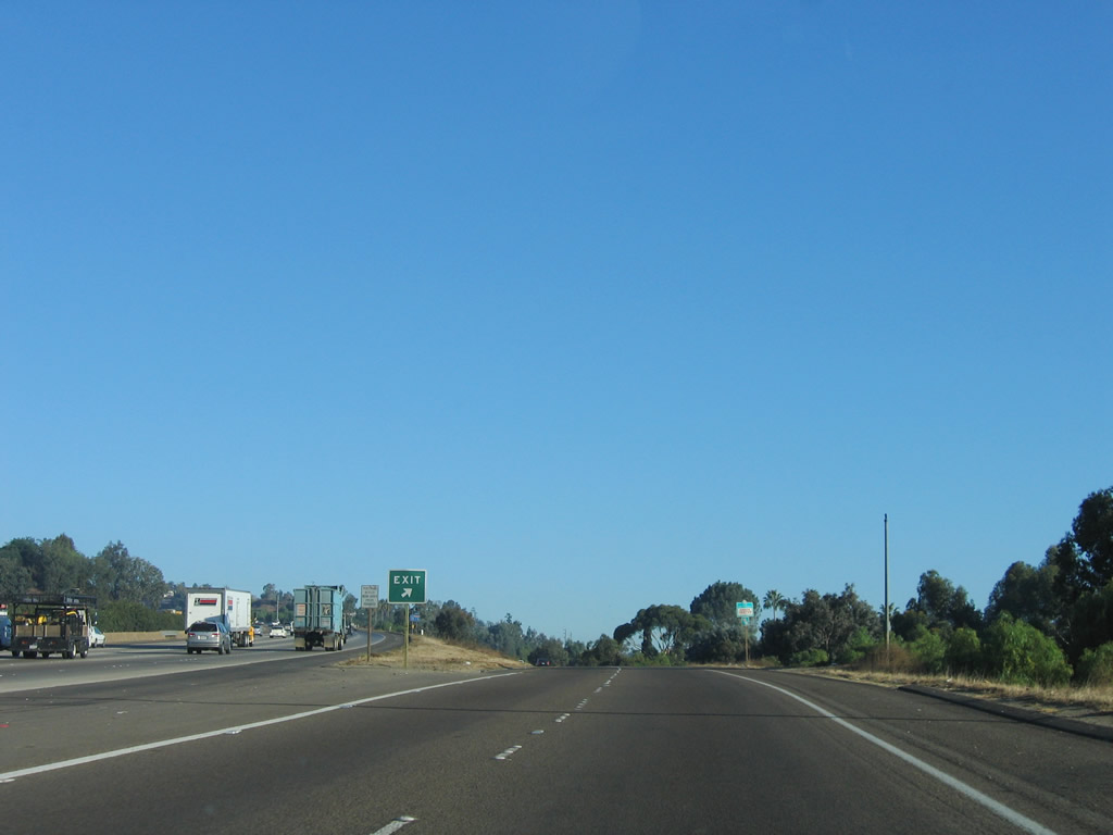
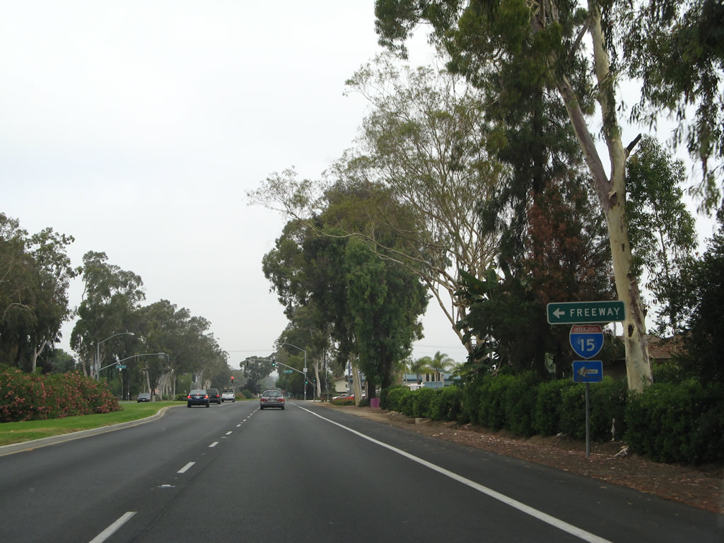
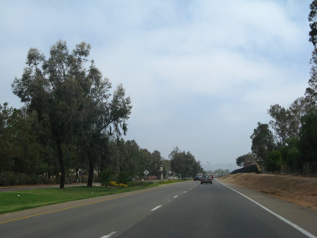
Although Business Loop I-15 (Centre City Parkway) begins almost like a freeway, the first intersection along northbound comes quickly. Photo taken 10/13/05. |
|
Northbound Business Loop I-15 (Centre City Parkway) approaches South Centre City Parkway and Historic U.S. 395/Escondido Boulevard . Escondido Boulevard is the original route of U.S. 395 through Escondido; Centre City Parkway was built as the expressway bypass of downtown Escondido. Photo taken 10/13/05. |
|
The first business loop route marker is posted prior to the intersection with Escondido Boulevard. Photo taken 06/24/07. |
|
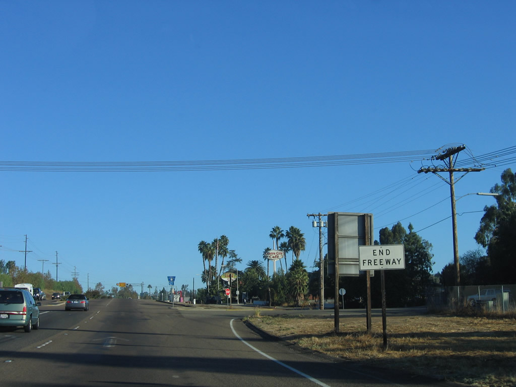
This end freeway sign is posted at the South Centre City Parkway and Escondido Boulevard intersection. From here, Business Loop I-15 has an expressway configuration with most intersections governed by traffic signals. Photo taken 10/13/05. |
|
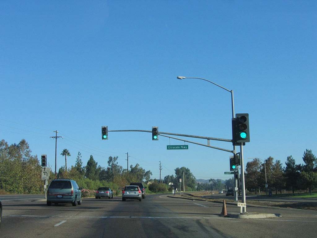
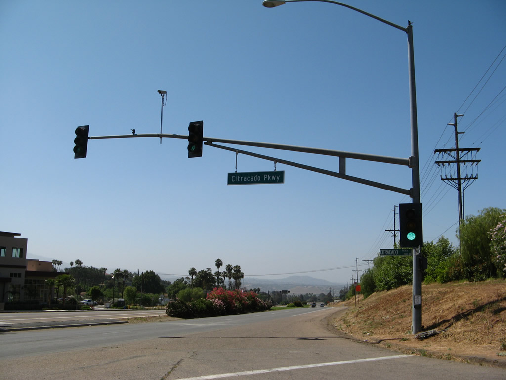
The first traffic signal along Business Loop I-15 north is with Citracado Parkway. Photo taken 10/13/05. |
|
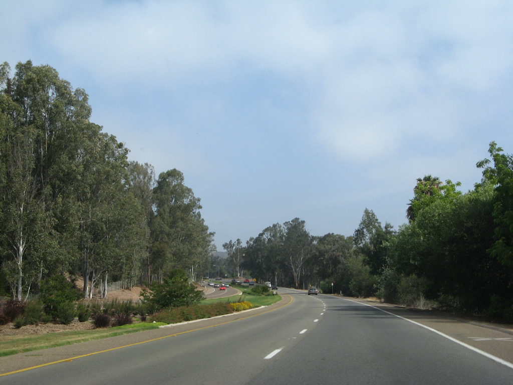
Citracado Parkway travels northwest to Interstate 15 (Exit 29/Felicita Road) and is planned to continue around the western edge of the city of Escondido toward Stone Brewery and the Palomar Energy Center. A few gaps in this planned belt route are still present as of June 2009. Photo taken 10/13/05. |
|
Northbound Business Loop I-15 (Centre City Parkway) meets Citracado Parkway at this traffic signal. Photo taken 10/13/05. |
|
The next intersection along Business Loop I-15 (Centre City Parkway) north is with Brotherton Road. Photo taken 10/13/05. |
|
Escondido Boulevard veers away from Business Loop I-15 (Centre City Parkway). Photo taken 06/07/08. |
|
Another (faded) reassurance marker along northbound Business Loop I-15 in Escondido is posted after Brotherton Road. Photo taken 06/07/08. |
|
Northbound Business Route 15 and Centre City Parkway approach the entrance to Towne Centre Driveway (signalized). Photo taken 06/07/08. |
|
Continuing north, the next traffic signal is with Felicita Avenue. Photo taken 10/13/05. |
|
A newer Business Loop I-15 shield is posted along northbound Centre City Parkway after Felicita Avenue. Photo taken 06/07/08. |
|
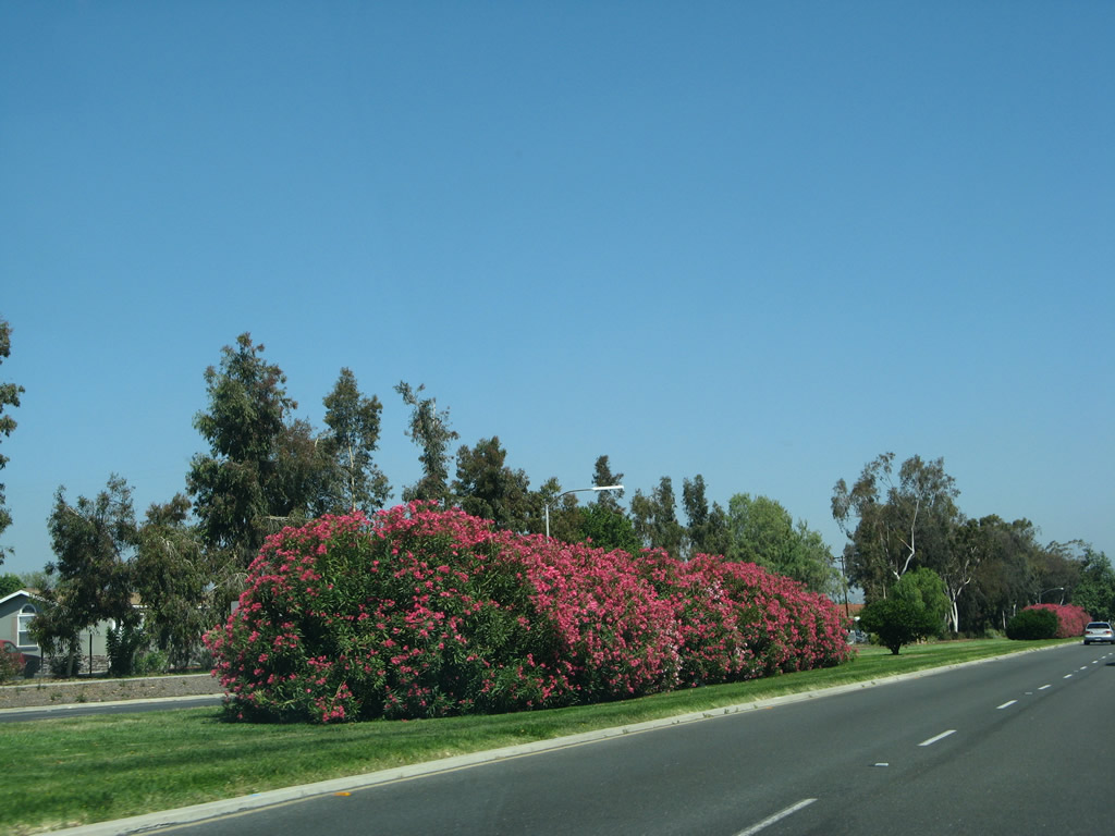
An oleander bush and turf decorates the centerline median on northbound Business Loop I-15 (Centre City Parkway) between Felicita Avenue and Thirteenth Avenue. Photo taken 06/07/08. |
|
This older guide sign advises that the next intersection along northbound Business Loop I-15 will be Thirteenth Avenue. Photo taken 06/07/08. |
|
Northbound Business Loop I-15 (Centre City Parkway) meets Thirteenth Avenue at this traffic signal. Photo taken 10/13/05. |
|
A turf median lies in the middle of Centre City Parkway between 13th Avenue and 9th Avenue. Photo taken 06/07/08. |
|
|
An Interstate 15 trailblazer is posted on northbound Business Loop I-15 (Centre City Parkway) prior to the Ninth Avenue traffic signal. Note that this is a neutered shield, likely placed by the city of Escondido. Photos taken 06/24/07 and 06/07/08. |
|
|
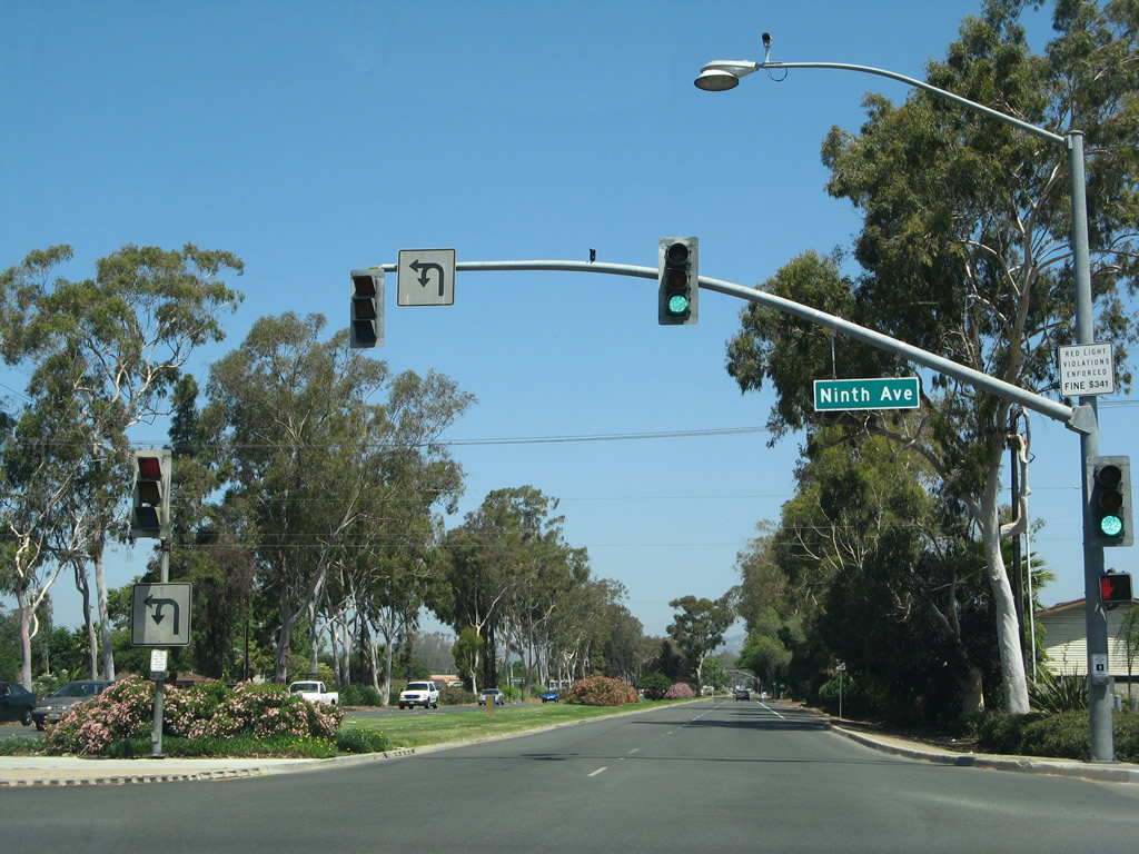
Northbound Business Loop I-15 (Centre City Parkway) meets Ninth Avenue at this traffic signal. Photos taken 06/24/07 and 06/07/08. |
|
|
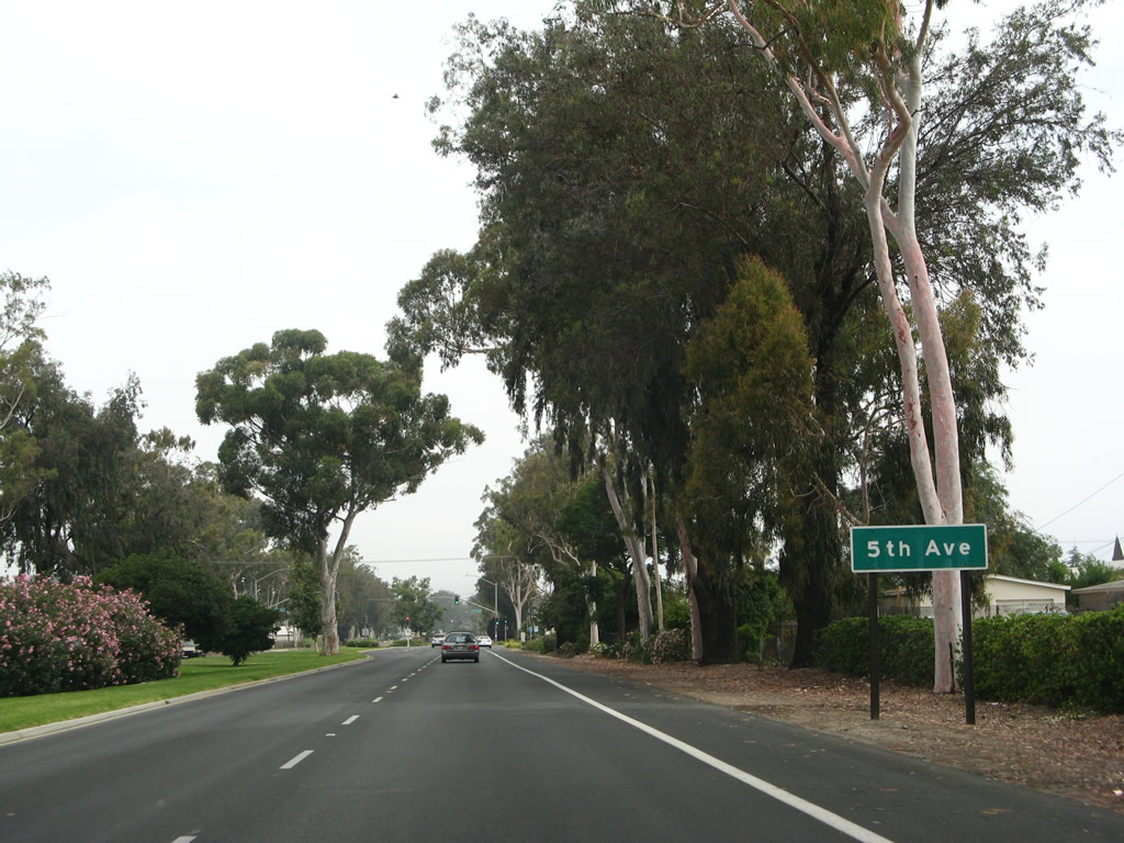
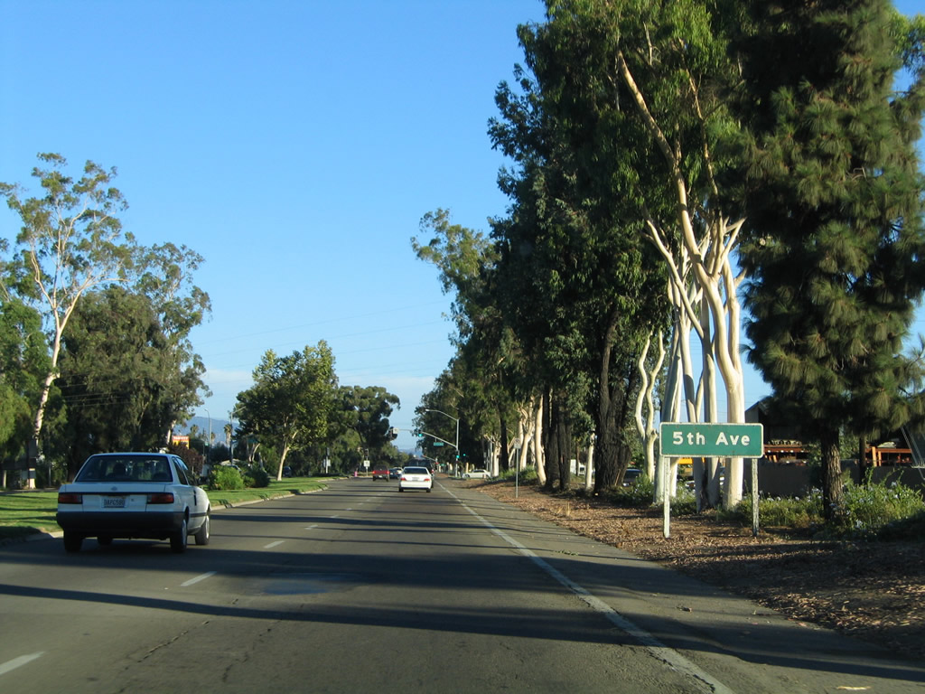
The next intersection along northbound Business Loop I-15 (Centre City Parkway) is with Fifth Avenue. Photos taken 06/24/07 and 06/07/08. |
|
|
Northbound Business Loop I-15 (Centre City Parkway) meets Fifth Avenue at this traffic signal. Photos taken 06/24/07 and 10/13/05. |
|
|
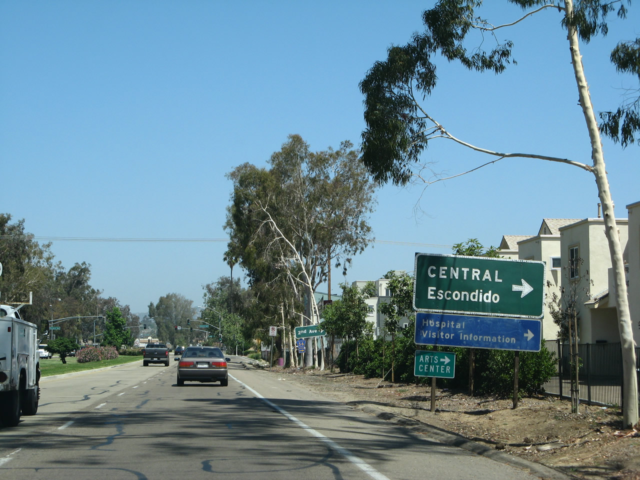
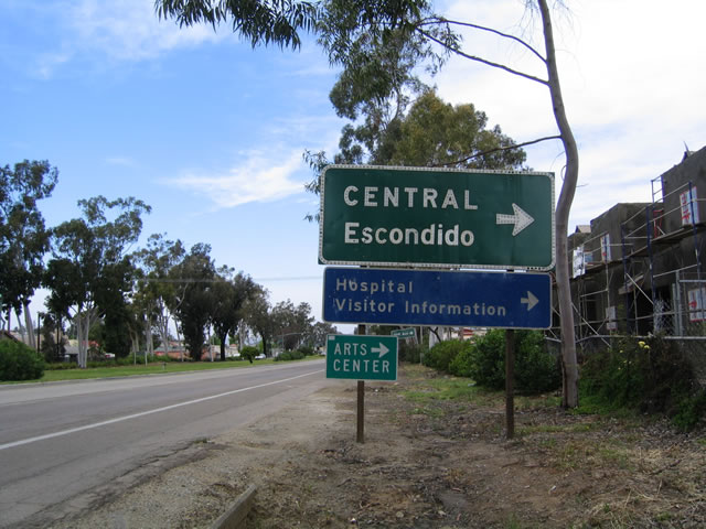
The major connector from Business Loop I-15 to downtown Escondido is via San Diego County S-6, which follows 2nd Avenue east to the city center. A right turn here connects with the California Center for the Arts (via a connection with northbound Escondido Avenue), the civic center, hospital, and visitors information center. Photos taken 06/07/08 and 04/23/05. |
|
|
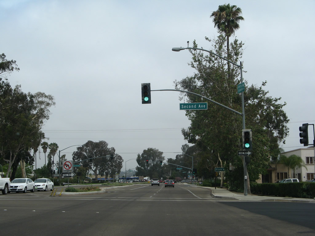
Business Loop I-15 intersects San Diego County S-6 twice, since S-6 follows two one-way streets through downtown Escondido. The first intersection is with eastbound San Diego County S-6, which follows one-way Second Avenue through downtown Escondido, then travels northeast toward Valley Center, Pala, and ultimately Palomar Mountain. The second intersection on northbound Business Loop I-15 is with Grand Avenue, which serves the downtown shopping and cultural center of Escondido (see below). The third intersection is with Valley Parkway, which carries San Diego County S-6 westbound toward Interstate 15 and connects to Del Dios Highway. Photos taken 06/07/08 and 04/23/05. |
|
Northbound Business Loop I-15 (Centre City Parkway) meets Second Avenue. Photo taken 06/24/07. |
|
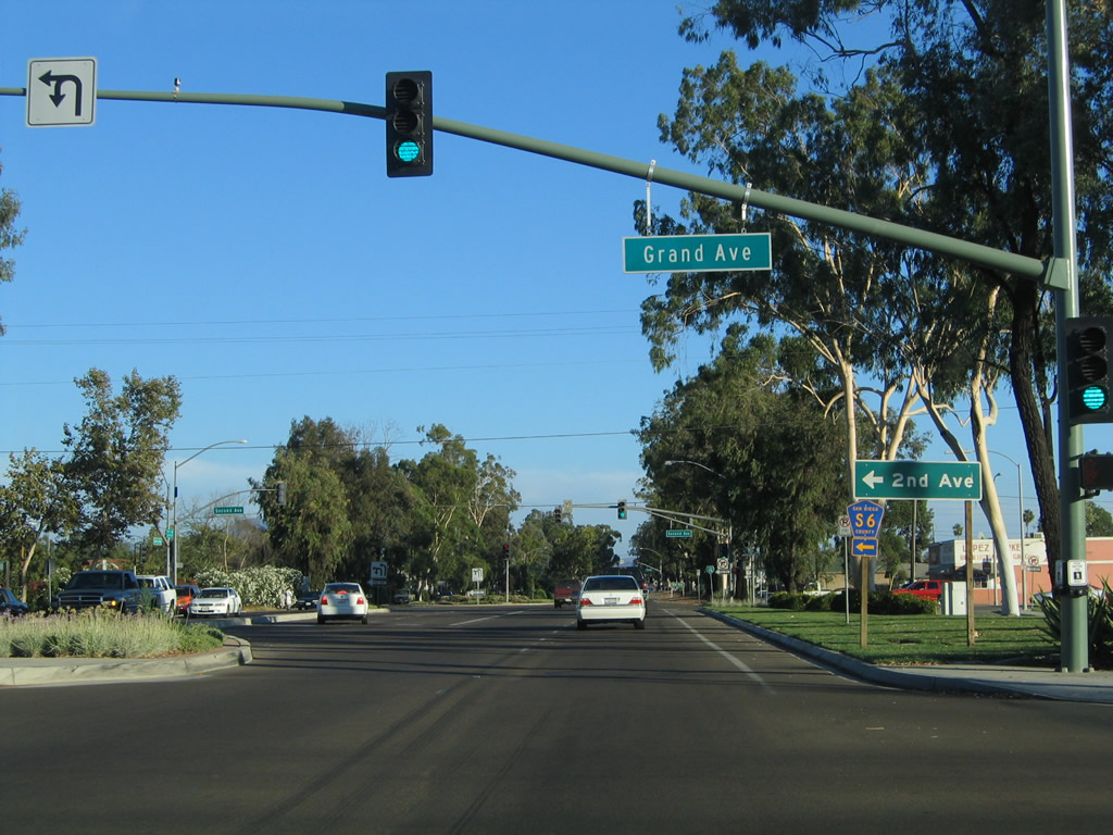
The next intersection along northbound Business Loop I-15 (Centre City Parkway) is with Grand Avenue, which provides a local connection to downtown's strip of shops. Grand Avenue is a four-lane, divided main street that features on-street parking, easy access to shops, and walkable amenities. Grand Avenue is not part of San Diego County S-6, even though the tree-lined boulevard is situated between 2nd Avenue and Valley Parkway, which together constitute the east-west county route through downtown Escondido. Photo taken 04/23/05. |
|
Northbound Business Loop I-15 (Centre City Parkway) meets Grand Avenue. Photo taken 06/24/07. |
|
|
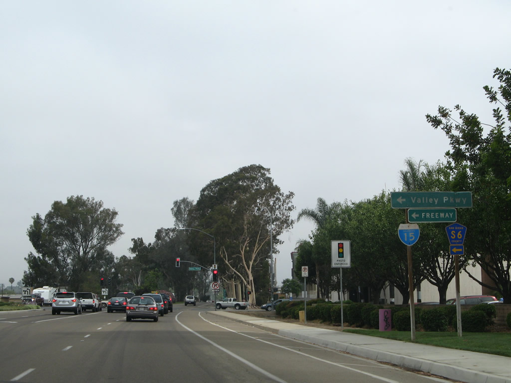
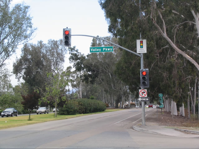
Northbound Business Loop I-15 next approaches the intersection with San Diego County S-6/Valley Parkway westbound. Taking County Route S-6 west leads to Interstate 15 and Del Dios Highway. County Route S-6 becomes Del Dios Highway as it crosses the hills between Escondido and Del Mar/Solana Beach on a southwesterly trajectory. It ends at Coast Highway 101 (San Diego County S-21/Old U.S. 101) just west of the Del Mar Fairgrounds. Photos taken 06/24/07 and 04/23/05. |
|
|
Eucalyptus trees were planted at the time the Centre City Parkway was constructed. This was a standard Caltrans landscaping feature of 1950s and 1960s-era expressways and freeways, and those stands of trees that remain today are as tall as these. Since Business Loop I-15 was formerly U.S. 395, plantings of eucalyptus trees along Centre City Parkway still remain, especially here just north of Valley Parkway. Photos taken 06/24/07 and 04/23/05. |
|
|
After the three Business Loop I-15 intersections through downtown Escondido -- San Diego County S-6 (eastbound via 2nd Avenue), intervening Grand Avenue, and San Diego County S-6 (westbound via Valley Parkway) -- this sign advises of the next major interchange, with California 78 (Ronald Packard Freeway). Photos taken 06/24/07 and 12/99. |
|
|
A pair of older bridges carries Business Loop I-15 over a creek. A relic of its former role as U.S. 395 is a postmile for Route 395 that was left behind even after Centre City Parkway was decommissioned as a state highway and turned over to the city of Escondido. Photos taken 06/24/07 and 06/07/08. |
|
The business loop expressway continues north along Centre City Parkway. Photo taken 06/24/07. |
|
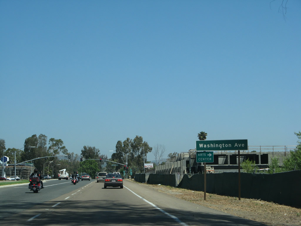
The next intersection along Business Loop I-15 north is with Washington Avenue. Photo taken 06/07/08. |
|
Turn right on Washington Avenue to connect to California 78 east to the San Pasqual Valley and Julian. Photo taken 06/24/07. |
|
|
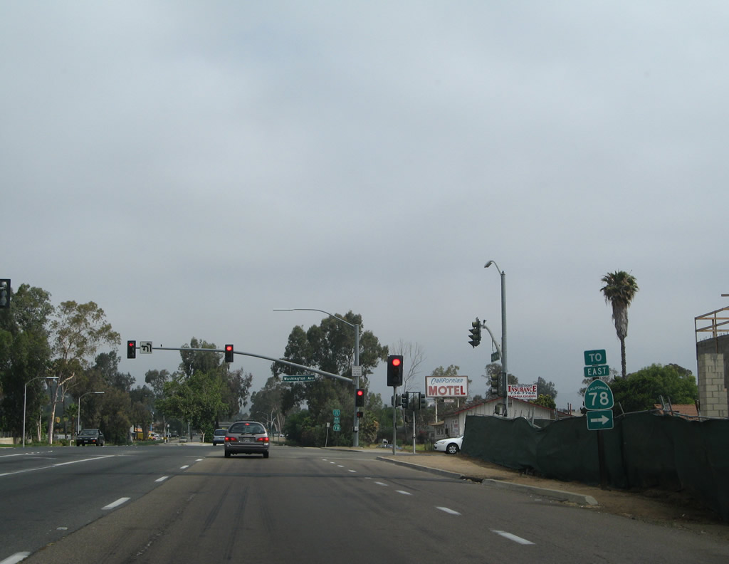
This reassurance shield for Business Loop I-15 and trailblazer for California 78 west is posted after the Washington Avenue traffic signal in Escondido. Photos taken 06/24/07 and 06/07/08. |
|
The next traffic signal along Centre City Parkway north is with Mission Avenue. Photo taken 06/24/07. |
|
Northbound Business Loop I-15 (Centre City Parkway) meets Mission Avenue. Photo taken 06/07/08. |
|
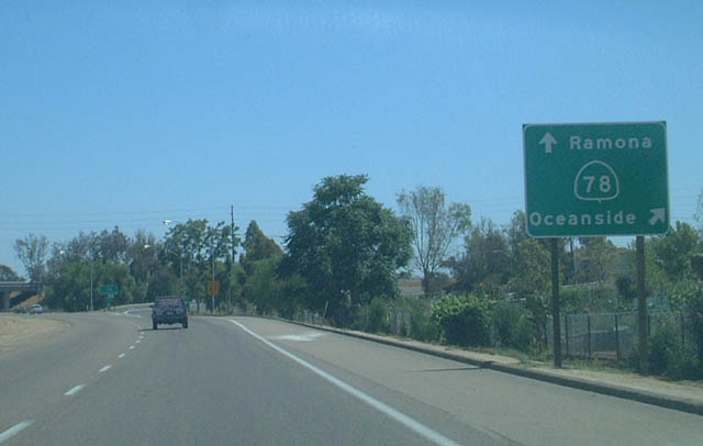
After the intersection with Mission Avenue, northbound Business Loop I-15 next approaches its interchange with California 78. Access at this interchange is only provided to California 78 west to Vista, San Marcos, and Oceanside. Photo taken 06/24/07. |
|
Plans originally called for the California 78 freeway to extend further east, but those plans were never brought to fruition. Photo taken 06/24/07. |
|
Continuing north, Business Loop I-15 reaches a freeway interchange with California 78 (Ronald Packard Freeway) westbound. There is no access from northbound to eastbound California 78, mostly because the California 78 freeway comes to its end just a half mile east of here. Surface streets, such as County Route S-6 (2nd Avenue), may be used to reach California 78 eastbound. Photo taken 08/23/04. |
|
This Business Loop I-15 reassurance shield is posted after the California 78 partial interchange. Photo taken 08/23/04. |
|
Northbound Business Loop I-15 next meets Decatur Way. Photo taken 06/24/07. |
|
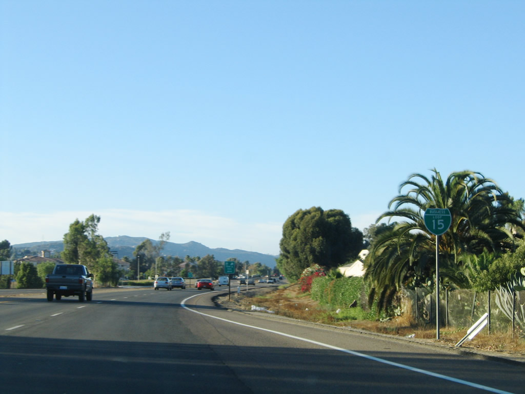
Continuing north, Business Loop I-15 approaches its intersection with El Norte Parkway. Use El Norte Parkway west to Interstate 15 (or continue north along Centre City Parkway for a direct link back to the freeway). Photo taken 08/23/04. |
|
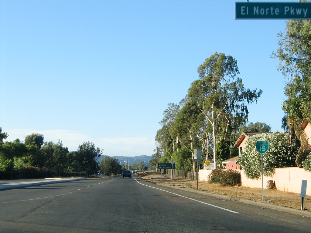
Northbound Business Loop I-15 meets El Norte Parkway at this traffic signal. Photo taken 06/24/07. |
|
Another reassurance shield for Business Loop I-15 is posted after the El Norte Parkway traffic signal. Photo taken 08/23/04. |
|
This mileage sign along Business Loop I-15 (Centre City Parkway) north provides the distance to Temecula (26 miles), Riverside (65 miles), and San Bernardino (76 miles). This mileage sign is an original from when this route was U.S. 395, and it is located north of California 78. Photo taken 08/23/04. |
|
|
|
|
This series of pictures follows Business Loop I-15 (Centre City Parkway) north between El Norte Parkway and Iris Lane. Photos taken 06/24/07. |
|
|
|
|
|
Northbound Business Loop I-15 (Centre City Parkway) meets Iris Lane. Photo taken 06/24/07. |
|
|
|
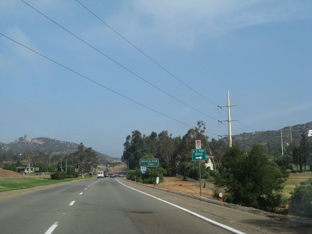
Business Loop I-15 (Centre City Parkway) continues north between Iris Lane and Country Club Lane. A San Diego Gas & Electric 230kV power line crosses over the expressway. Photos taken 06/24/07. |
|
|
|
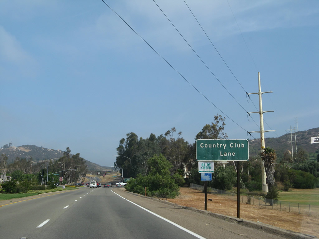
The final traffic signal along Business Loop I-15 (Centre City Parkway) is with Country Club Lane. After this traffic signal, Centre City Parkway will split between Old Highway 395 and Interstate 15 north. Photos taken 06/24/07. |
|
Northbound Business Loop I-15 (Centre City Parkway) meets Country Club Lane at this traffic signal. Photo taken 06/24/07. |
|
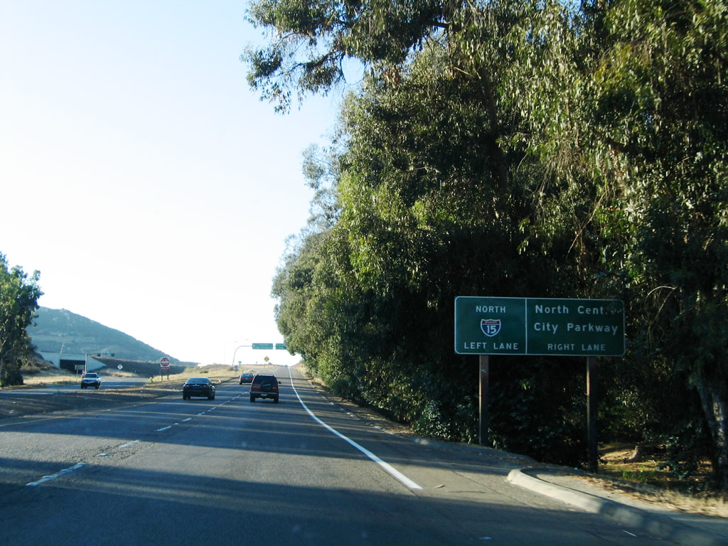
After the final traffic signal, Business Loop I-15 prepares to split for its junction with Interstate 15 north. Stay left to follow the business route back onto the freeway or stay right to follow the frontage road (Old U.S. 395/North Centre City Parkway). Certain segments of the frontage road north of the city of Escondido are still known as Old Highway 395, similar to the way Old Highway 80 is memorialized in eastern San Diego County as it provides local access to communities avoided by Interstate 8. Photo taken 08/23/04. |
|
A tunnel connects from Interstate 15 south to Business Loop I-15 (Centre City Parkway). Photo taken 06/24/07. |
|
The frontage road (Old Highway 395) and Business Loop I-15 separate. Stay left to rejoin the northbound freeway. No end shield is posted for the business loop here. Photo taken 06/24/07. |
|
Now entering the Interstate 15 freeway north on-ramp, a freeway entrance shield assembly is posted on the left side of the ramp. Photo taken 06/24/07. |
|
A bridge carries the on-ramp to Interstate 15 over the southbound lanes of North Centre City Parkway (Old Highway 395). Photo taken 06/24/07. |
|
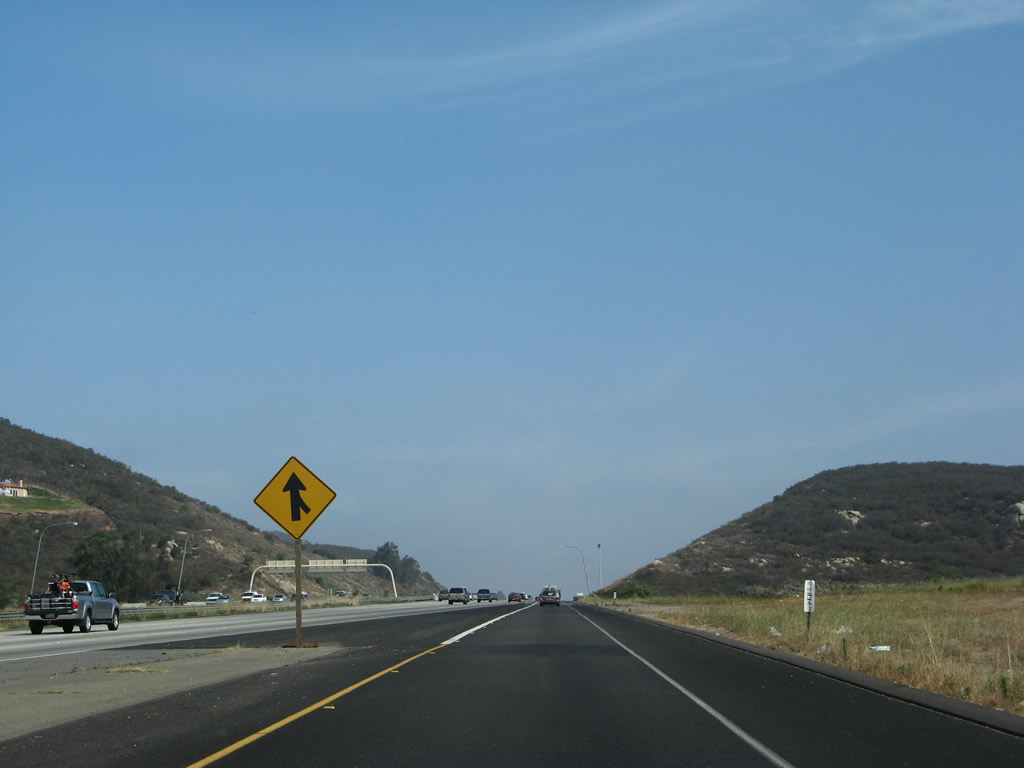
Traffic from Business Loop I-15 north rejoins Interstate 15 north. Photo taken 06/24/07. |
| Business Loop I-15 south |
|
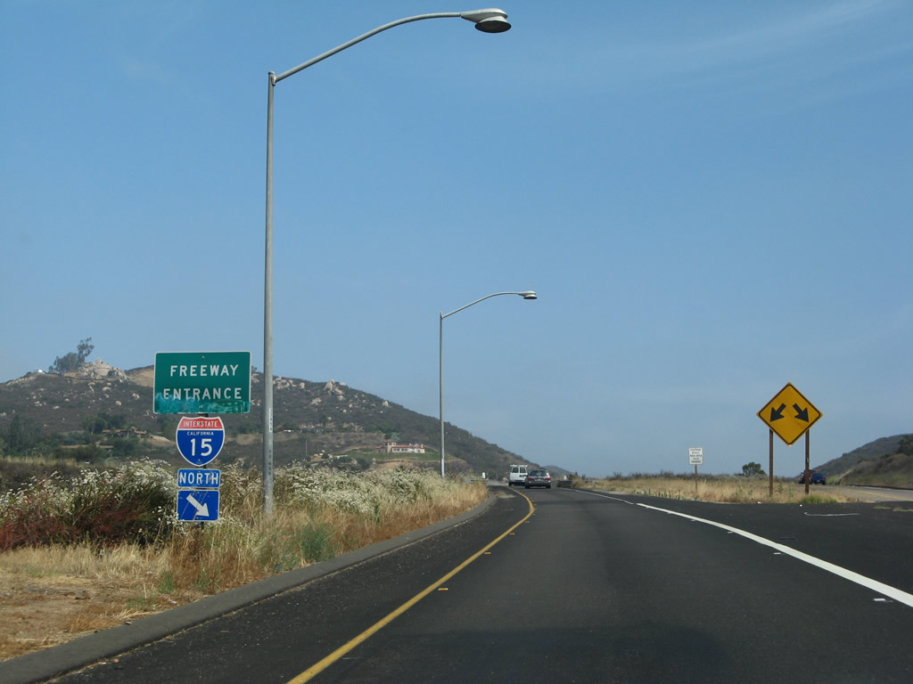
Now traveling southbound, we begin where Business Loop I-15 approaches California 78 in northern Escondido. Similar to the configuration of ramps found along northbound, there is a direct connection onto the westbound California 78 freeway at this exit ramp, but there is no direct link to eastbound California 78. Motorists must continue south toward downtown Escondido to connect with eastbound California 78 toward Julian. Photo taken 06/22/02. |
|
After the California 78 interchange, the next traffic signal is with San Diego County S-14 (Mission Avenue). The signed county route follows the old alignment of California 78 west toward San Marcos, Vista, and Oceanside. Photo taken 08/23/04. |
|
The next signalized intersection along southbound Business Loop I-15 is with Washington Avenue. Use Washington Avenue east to California 78 east toward the Wild Animal Park, San Pasqual Valley, Ramona, and Julian. Photo taken 08/23/04. |
|
Southbound Business Loop I-15 (Centre City Parkway) meets Washington Avenue at this intersection. Use Washington Avenue east to Escondido Boulevard south to Woodward Avenue east for the Escondido Civic Center, Grape Day Park, and the California Center for the Arts. A parking area is located off Woodward Avenue for these facilities. Photo taken 08/23/04. |
|
A Business Loop I-15 reassurance shield is posted after the Washington Avenue traffic signal. Photo taken 08/23/04. |
|
This segment of Old U.S. 395 (Business Loop I-15) is shrouded in eucalyptus trees that date back to the construction of this original expressway bypass of downtown Escondido. All traffic for downtown Escondido should use either Grand Avenue or Second Avenue east. Photo taken 08/23/04. |
|
These signs are posted along southbound Business Loop I-15 (Centre City Parkway) as the expressway approaches its intersection with San Diego County S-6/Valley Parkway. Use San Diego County S-6 west to Interstate 15 and Del Dios Highway. Valley Parkway is a one-way street traveling west; the intersection with eastbound San Diego County S-6 to downtown Escondido is at the Second Avenue intersection. Photo taken 08/23/04. |
|
The next traffic signal along Business Loop I-15 (Centre City Parkway) south is with Grand Avenue. Turn left here to downtown Escondido; the length of Grand Avenue has shops, restaurants, and services. Beyond the intersection, signage is posted for the eastbound direction of San Diego County S-6/Second Avenue. Photo taken 08/23/04. |
|
Southbound Business Loop I-15 (Centre City Parkway) meets San Diego County S-6/Second Avenue. The signed county route leads northeast to Valley Center and Palomar Mountain. A reassurance shield for Business 15 is posted after the intersection. Photo taken 08/23/04. |
|
The next signalized intersection along Business Loop I-15 (Centre City Parkway) south is with Fifth Avenue. Photo taken 08/23/04. |
|
Southbound Business Loop I-15 (Centre City Parkway) meets Fifth Avenue at this intersection. Photo taken 08/23/04. |
|
Southbound Business Loop I-15 approaches Felicita Avenue, which travels west to connect to Interstate 15 (Escondido Freeway). Photo taken 06/22/02. |
|
Southbound Business Loop I-15 (Centre City Parkway) meets Citracado Parkway at this intersection. Photo taken 06/07/08. |
|
After the last traffic light, Business Loop I-15 becomes a freeway for its last half-mile before reaching Interstate 15. This sign is for the next exit along southbound Interstate 15, Via Rancho Parkway. Photo taken 06/22/02. |
| Business Loop I-15 scenes |
|
This sign is mounted in the median of westbound Grand Avenue. Although the 15 shield is green, the sign is referring to Interstate 15, not Business Loop I-15. That is because the sign reads "south San Diego - right lane." To make a right on Centre City Parkway would put you on northbound Business Loop I-15, not southbound. However, to get to Interstate 15 southbound, take Business Loop I-15 north to San Diego County S-6/Valley Parkway westbound. Valley Parkway intersects Interstate 15 a mile or so west of Centre City Parkway. Photo taken 04/23/05. |
Page Updated October 26, 2012.