

California 111 North - Interstate 8 to Brawley
| California 111 north | |
|---|---|
 |
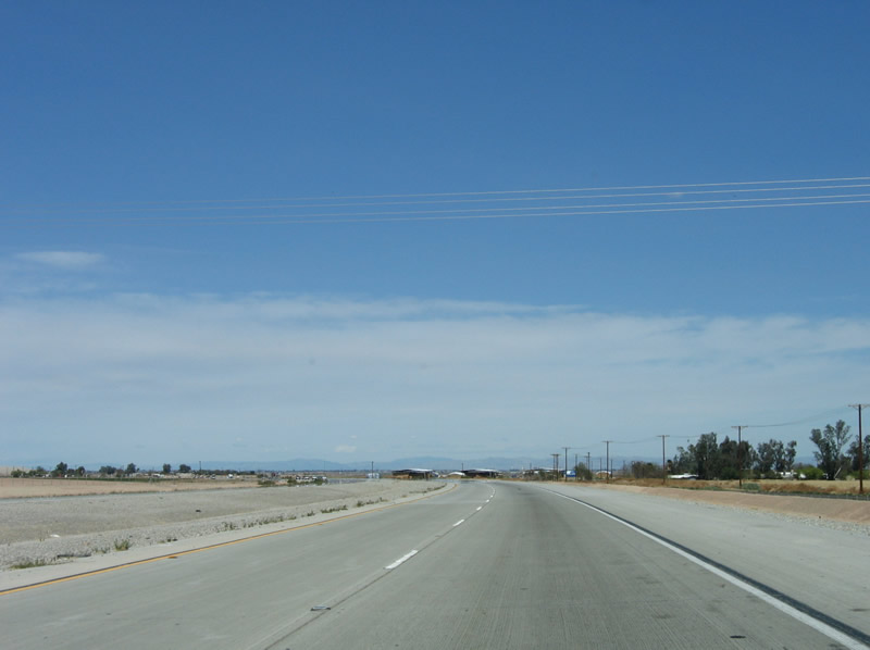
Northbound California 111 proceeds through the Interstate 8 interchange and continues as an expressway, skirting the eastern edge of El Centro. Photo taken 04/20/13. |
 |
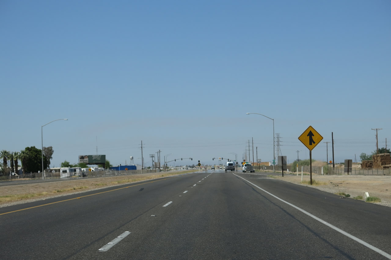
A California 111 north reassurance shield is posted along the northbound expressway after the Interstate 8 interchange. California 111 has a 65 miles per hour speed limit along this segment of expressway. The next intersection is with Ross Road (the traffic signal is visible in the distance). Photo taken 03/26/06. |
 |
Ross Road travels west to El Centro, changing into Ross Avenue upon crossing the city limits. El Centro sits about 1.5 miles west of here. To the east, Ross Road provides farm-to-market access. Photo taken 03/26/06. |
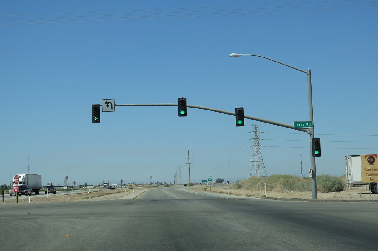 |
Northbound California 111 meets Ross Road at this traffic signal. The recently completed expressway section of California 111 begins here with concrete paving rather than asphalt. Notice the power line relocation ahead, which shows how the expressway was shifted to the east of the old alignment of California 111. Photo taken 04/20/13. |
 |
This reassurance shield is located after the Ross Road intersection. For some reason, most of the California 111 shields north of Interstate 8 along this new expressway have the "111" narrowly compressed into a wide shield. Photo taken 04/20/13. |
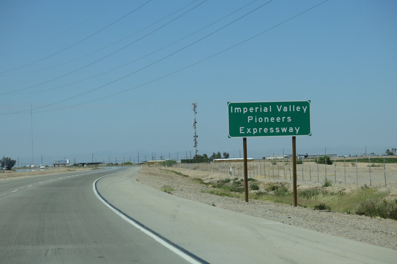 |
California 111 is designated as the Imperial Valley Pioneers Expressway. Photo taken 04/20/13. |
 |
At this point, the California 111 expressway shifts from its old alignment to the new alignment. The old road is located on the west side of the expressway and now serves as a frontage road. An Imperial Irrigation District (IID) power line crosses over the expressway at this point. The power line was realigned when the expressway was built in the late 1990s/early 2000s, hence why the tower structures change from steel lattice to monopole and back to steel lattice. Photo taken 04/20/13. |
 |
The old road is located to the west of the Imperial Irrigation District power lines, while the expressway stays to the west of the lines. Services located on the former alignment can still be accessed via regular intersections along the expressway. The next intersection along northbound California 111 is a junction with Imperial County S-80 (Historic U.S. 80 - Evan Hewes Highway). Photo taken 04/20/13. |
 |
Evan Hewes was a member of the Imperial Irrigation District and the Colorado River Board of California in the late 1930s. Today, Old U.S. 80 is named for him. Photo taken 04/20/13. |
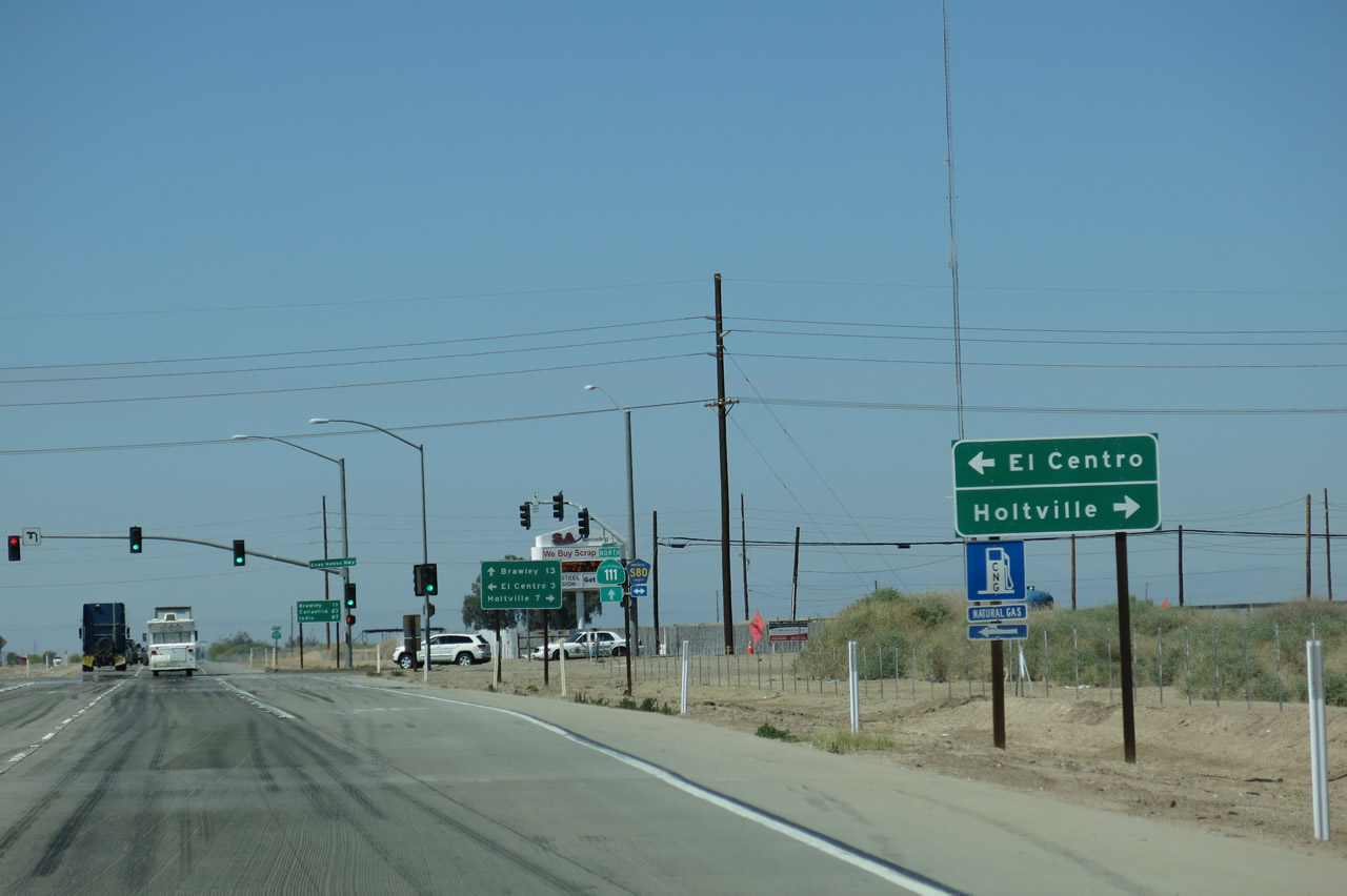 |
Use Imperial County S-80 east to downtown El Centro and west to Holtville and Interstate 8 (via California 115). The entire route between El Centro and Holtville is an expressway that was originally contemplated for the route of Interstate 8 until the new alignment was decided. Photo taken 04/20/13. |
 |
Historic U.S. 80 is signed as Imperial County S-80 from Imperial County S-2 in Ocotillo east to California 115 near Holtville. While this section is expressway, the route is only two lanes through Seeley and Plaster City. Photo taken 08/27/04. |
 |
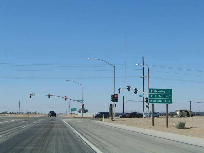 |
The California 111 expressway continues north toward Brawley (13 miles), while downtown El Centro is three miles east of here, and Holtville is seven miles west of here. At no point does California 111 enter the city of El Centro. Photos taken 04/20/13 and 08/27/04. |
 |
Northbound California 111 meets Imperial County S-80 (Historic U.S. 80 - Evan Hewes Highway) at this intersection. Photo taken 04/20/13. |
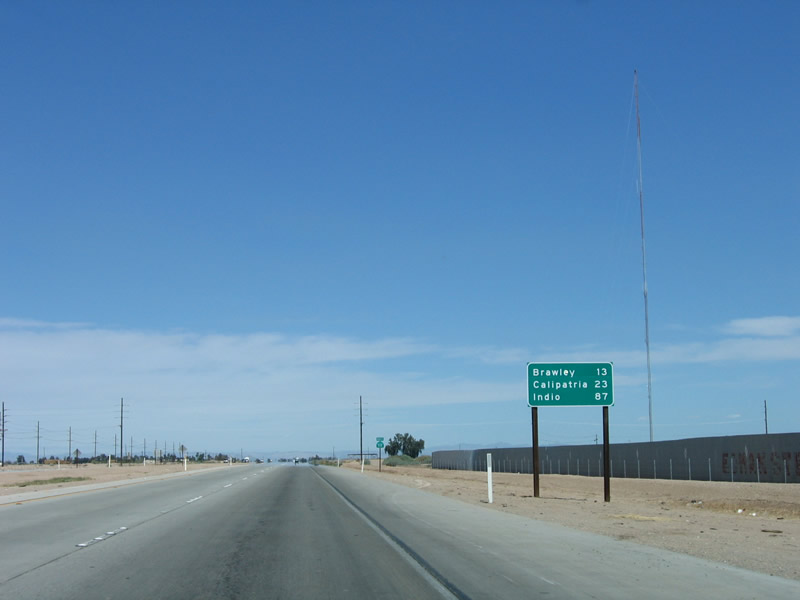 |
This mileage sign (after the intersection with Imperial County S-80) provides the distance to Brawley (13 miles), Calipatria (23 miles), and Indio (87 miles). Photo taken 04/01/06. |
 |
This reassurance shield is posted along northbound California 111 after the Imperial County S-80 intersection. Photo taken 04/01/06. |
 |
Between El Centro and Brawley, California 111 is a four-lane expressway, with access limited to specific intersections usually spaced about a mile apart. Like California 7, California 111 features concrete shoulders. Photo taken 04/01/06. |
 |
The next traffic signal along northbound is with Aten Road. Photo taken 04/01/06. |
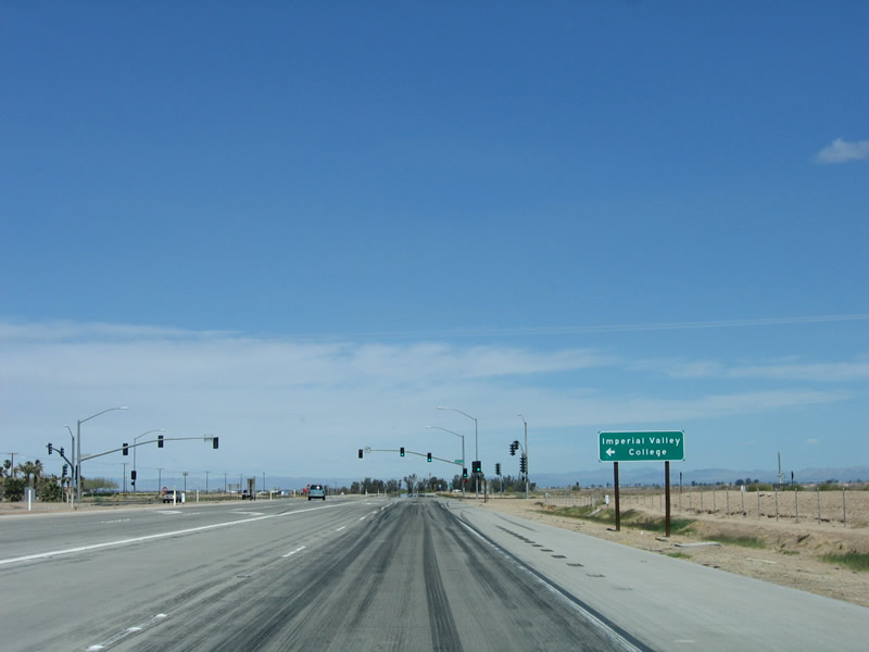 |
Use Aten Road west to Imperial Valley College, the Imperial County Airport, and the city of Imperial. Photo taken 04/01/06. |
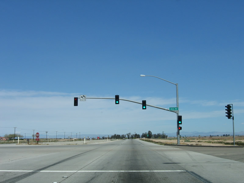 |
Northbound California 111 meets Aten Road at this intersection. Photo taken 04/01/06. |
 |
Another reassurance shield for California 111 is posted after Aten Road. Photo taken 04/01/06. |
 |
California 111, sitting below sea level, actually loses elevation between El Centro (45 feet below sea level) and Brawley (113 feet below sea level). Photo taken 04/01/06. |
 |
The next traffic signal along northbound is the junction with Imperial County S-28 (Worthington Road). Photo taken 04/01/06. |
 |
The city of Imperial lies three miles west of here on Imperial County S-28. The county road travels west through Imperial, turns south at Hurff Road, and ends at Imperial County S-80 (Old U.S. 80) west of Seeley. Photo taken 04/01/06. |
 |
Like Aten Road, the intersection with Worthington Road is signalized. To the east, follow Imperial County S-28 east to California 115, Imperial County S-32 (Holt Road), and Imperial County S-33 (Highline Road). Photo taken 04/01/06. |
 |
Northbound California 111 continues north, passing by more farms and irrigated areas in the Colorado Desert. Photo taken 04/01/06. |
 |
The concrete expressway spreads out on incredibly flat, fertile land. Trucks carrying hay, oranges, and produce are common along California 111. Photo taken 04/01/06. |
 |
The next intersection along northbound is with Harris Road. There is no traffic signal for this intersection. Photo taken 04/01/06. |
 |
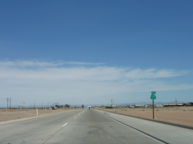
California 111 continues due north toward Brawley, Calipatria, and Indio. Photo taken 04/01/06. |
 |
Industry is common in the Imperial Valley, including geothermal power plants and other related improvements. Photo taken 04/01/06. |
 |
The next intersection along northbound California 111 is Imperial County S-27 (Keystone Road). Photo taken 04/01/06. |
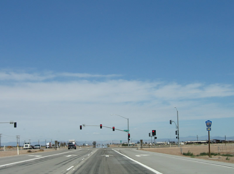 |
Imperial County S-27 travels east as a farm-to-market road, connecting with California 115, Imperial County S-32 (Holt Road), and Imperial County S-33 (Highline Road). To the west, Imperial County S-27 connects with California 86 about midway between Imperial and Brawley. The county route ends at Imperial County S-30 (Forrester Road). Photo taken 04/01/06. |
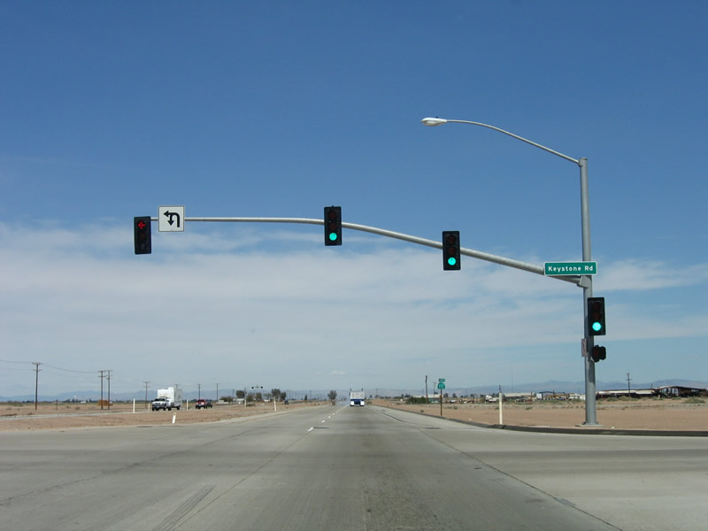 |
Northbound California 111 meets Imperial County S-27 (Keystone Road) at this intersection. Photo taken 04/01/06. |
 |
Another reassurance shield is posted on California 111 northbound after Keystone Road. Photo taken 04/01/06. |
 |
The next intersection along northbound is with Schartz Road. Photo taken 04/01/06. |
 |
Typically, the non-signalized intersections look like this one, with a dedicated lane for left turns and another lane for right turns. The two main lanes continue straight ahead. Photo taken 04/01/06. |
 |
Farmland continues to dominate both sides of California 111 as the expressway continues north. Old Highway 111 parallels California 111 between Imperial County S-80 and California 78 in Brawley. Photo taken 04/01/06. |
 |
A few drainage ditches and irrigation canals criss-cross the valley, including this one along northbound California 111 after Schartz Road. Photo taken 04/01/06. |
 |
The next intersection along northbound is with Wildcat Road. The expressway begins to turn a bit to the northeast. Photo taken 04/01/06. |
 |
Another reassurance shield is posted after the Wildcat Road intersection. Photo taken 04/01/06. |
 |
This "expressway end" sign is no longer posted, since the expressway has since been extended north and west from here. The temporary northern end to California 111 expressway was at the signalized intersection with California 78; in 2011, California 111 was rerouted onto the bypass, and in 2012, the bypass was extended around Brawley and became part of California 78. Back when this picture was taken in 2006, California 111 used to turn west onto former California 78 to enter downtown Brawley. Photo taken 04/01/06. |
 |
Signs changed between 2006 and 2013 to reflect the changed roadway configuration now that the bypass is complete. This particular sign was present in 2006 and gone in 2013. Use California 78 east to Alamorio, Imperial (Algodones) Sand Dunes, and Glamis. California 78 emerges in the Colorado River Valley in Riverside County, then turns north to meet Interstate 10 near Blythe. As of April 2013, no business routes for either California 78 or California 111 were officially designated. Photo taken 04/01/06. |
 |
This particular sign was present in 2006 and gone in 2013. Back in 2006, northbound California 111 prepared to turn left onto westbound California 78 at the upcoming traffic signal. As noted earlier, this was a temporary condition until the expressway bypass was completed in 2012. The bypass now extends eight miles from here west to join with California 78 and California 86 expressway near Westmorland. A copy of the environmental document is available at the Caltrans District 11 Brawley Bypass page. Photo taken 04/01/06. |
 |
This sign is now the first advance guide sign along California 111 north to announce the pending junction with California 78. To the east, California 78 travels through the Chocolate Mountains en route to Glamis, Palo Verde, and Blythe. To the west, California 78 passes through Brawley and Westmorland, then crosses the Cuyamaca Mountains en route to Julian, Ramona, Escondido, and Oceanside. The section of California 78 between Interstate 15 and Interstate 5 is a freeway. Photo taken 04/01/06. |
 |
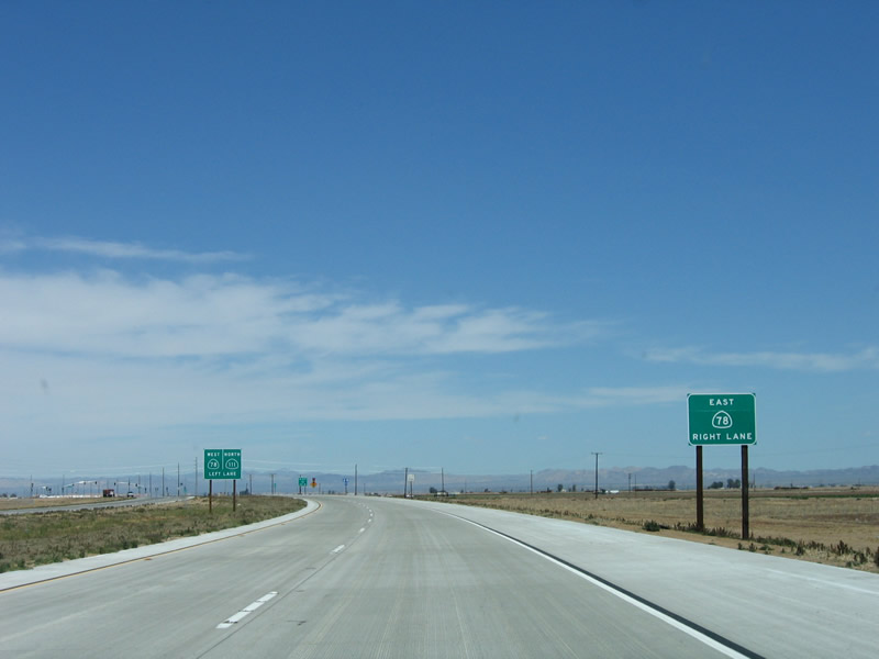
California 111 north is posted as continuing straight ahead through the traffic signal and onto the Brawley Bypass. Photo taken 04/20/13. |
 |
 |
A set of shields shows the directions for California 78 and California 111. Like the previous California 111 trailblazer, this shield assembly has changed between 2006 and 2013 due to the bypass completion. Photos taken 04/20/13 and 04/01/06. |
 |
 |
Northbound California 111 meets California 78. Continue ahead for California 78 west and California 111 north. Turn left here for Old Highways 78-111 west into Brawley (not sure why this is not a business route). Back in 2006, the older picture shows that construction barriers block the continuation of the bypass, which at that time was incomplete. The new eight-mile bypass, which was constructed in stages between 2006 and 2013, includes an interchange at the northern California 111 junction. It will join California 78 and California 86 between Brawley and Westmorland. A bypass of Westmorland is not part of this project but is planned in the future as funding becomes available. Photos taken 04/20/13 and 04/01/06. |

Page Updated May 26, 2013.
|
About Contact Glossary |
In The News Testimonials Interstate Guide |
Social Media:
 |
|
© 2000-23 AARoads.com | All Rights Reserved | Privacy Policy / Terms of Use
|
||