| California 125 - South Bay Expressway north |
|
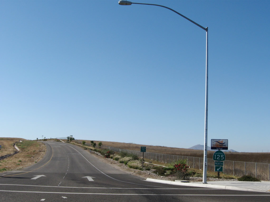
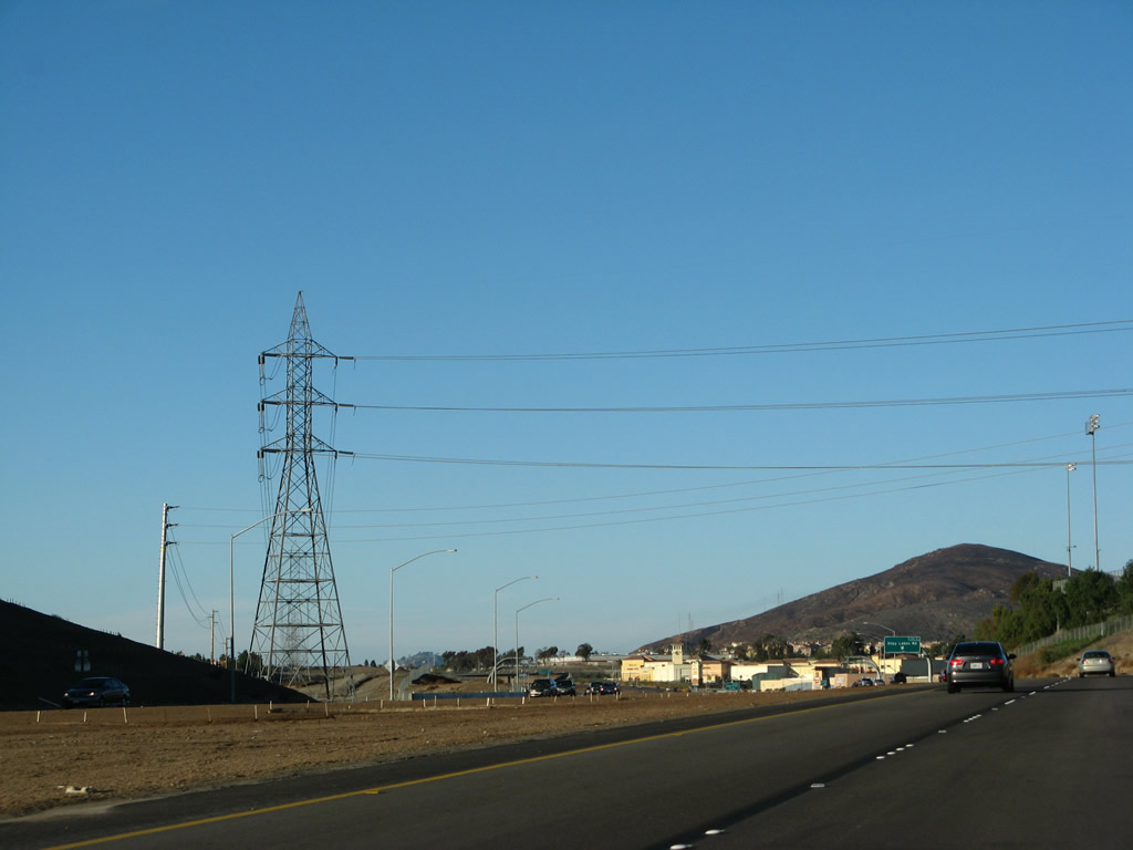
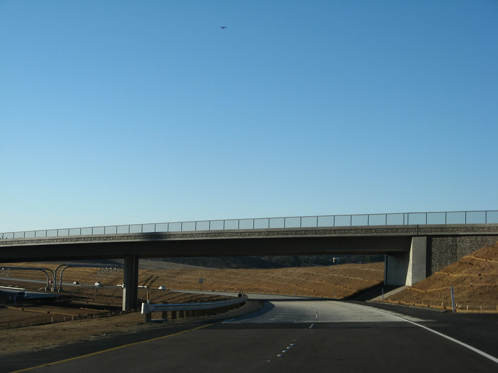
The tolled South Bay Expressway previously started at an at-grade intersection with SR 905. Planned as the San Miguel Parkway, the freeway was ultimately constructed as a toll road in accordance with a state action dating back to 1991. This view shows the initial configuration of two northbound lanes after the California 905/Otay Mesa Road intersection. This configuration will change dramatically once the California 905 freeway is constructed and the southern terminal interchange of California 125 moved south to the future freeway alignment. Photos taken 07/12/09 and 12/02/07. |
|
|
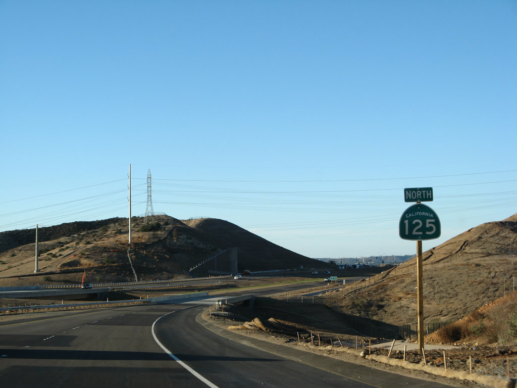
Due to the route taken by California 125 around the Sweetwater Reservoir, the path of California 125 is longer than original planned. As a result, California 125 begins with "L" mileage on its postmiles, and this paddle shows the L0.50 mile (one-half mile north of the eventual California 125-905 interchange). The zero milepost is ahead, close to the Otay River Valley bridge. Photo taken 12/02/07. |
|
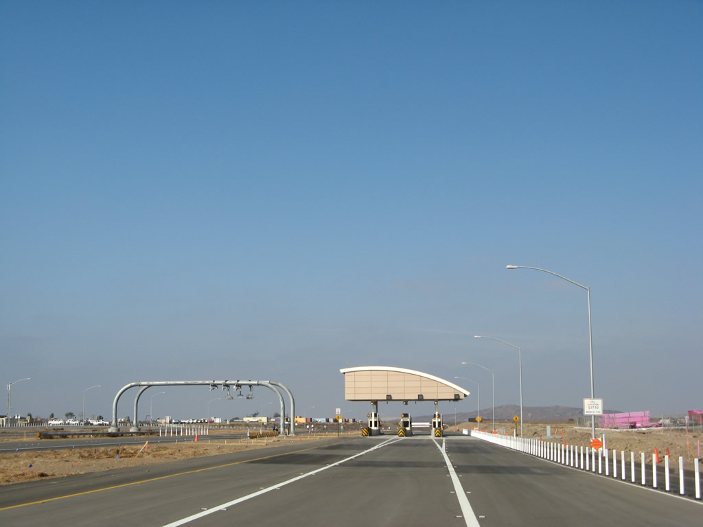
The only mainline toll plaza on California 125 is located at the top of the hill. The left two lanes are for Fastrak users (electronic toll payment), and the right lane is for cash payment. Photo taken 11/17/07. |
|
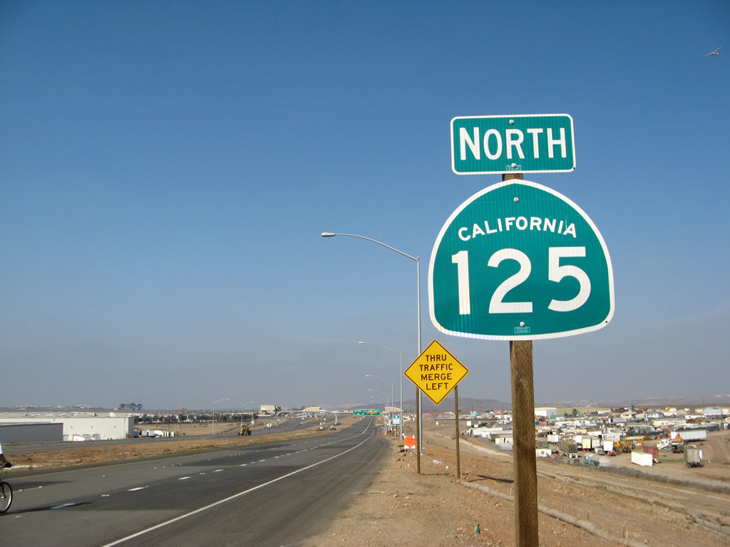
The first California 125 north reassurance shield is posted after the overhead signs for the toll plaza. Photo taken 11/17/07. |
|
The South Bay Expressway opened in November 2007 with a minimum toll rate of $3.75 per trip. Visit the South Bay Expressway official site to obtain the latest toll rates. Photo taken 11/17/07. |
|
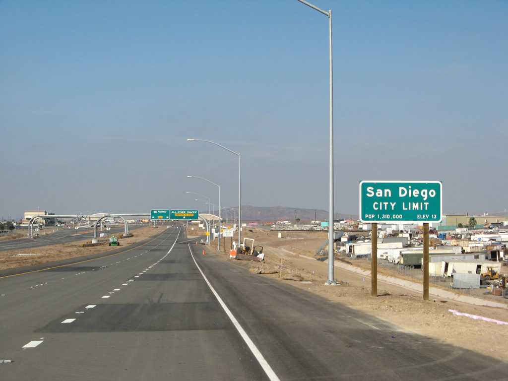
California 125 leaves unincorporated San Diego County and enters the city of San Diego. This is one of the least developed corners of the city of San Diego (in the Otay Mesa community). Home to 1,223,400 people as of the 2000 Census, San Diego is the seventh-largest city in the United States and is second only to Los Angeles in size within the state of California. According to the official site, the total land area is 219,000 acres, of which 30,600 acres are roads or freeways. California 125 nips a corner of the San Diego city limits before departing into Chula Vista. Photo taken 11/17/07. |
|
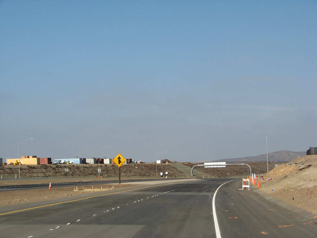
The toll road splits as California 125 approaches the mainline toll plaza. Cash paying customers should exit here and slow to 35 miles per hour. Fastrak users may use the left two lanes and maintain freeway speeds. Photo taken 11/17/07. |
|
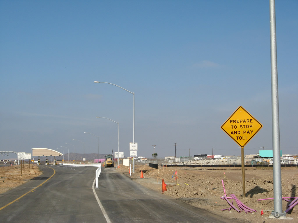
Approaching the cash collection booths, a caution sign warns motorists to prepare to stop and pay the toll. Photo taken 11/17/07. |
|
|
Three toll booths serve cash paying customers on the outside lanes of each direction. Fastrak transponder readers collect tolls electronically from drivers passing below at freeway speeds. Photos taken 11/17/07. |
|
Leaving the toll plaza, the cash lanes prepare to merge back in with the Fastrak lanes. The toll road cost approximately $630 million to build and has an unusual financing structure, which includes bank loans, a $140-million federal loan from the 1998 Transportation Infrastructure and Innovation Act, private equity capital, and developer contributions in the form of right of way dedication in the amount of $40 million. Local funding paid for the northern connection of California 125 to California 54 at a cost of approximately $138 million.1 Photo taken 11/17/07. |
|
A future interchange is planned between California 905 and the Otay Valley River bridge, but that was not included in the original construction. Leaving the toll plaza area, California 125 proceeds north toward the Otay River Valley bridge and the city of Chula Vista. Photo taken 11/17/07. |
|
The speed limit reduces to 55 miles per hour for the trip over the Otay River Valley. Photo taken 11/17/07. |
|
A second reassurance shield for California 125 north is posted shortly thereafter. Photo taken 11/17/07. |
|
California 125 enters the city of Chula Vista, the largest suburb of San Diego. Chula Vista is estimated to have 201,210 people (as of 2003), and demographic estimates suggest that it will continue to grow at a high rate, especially as more residential properties are developed in the eastern part of the city (in the Eastlake and Otay Ranch communities). Photo taken 12/02/07. |
|
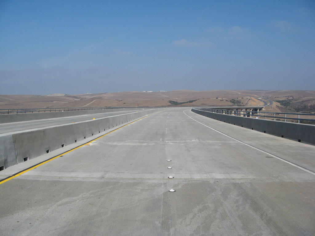
The massive Otay River Valley bridge carries California 125 over the Otay River Valley. Crossing at a height of 160 feet above the floor of the valley, the bridge is a precast segmental bridge (built using the balanced cantilever method). The bridge has a length of almost 0.75 mile (3,280 feet) with 12 precast segments.1 Photo taken 11/17/07. |
|
Metal railing lines both sides of the tall bridge. Photo taken 11/17/07. |
|
Two lanes carry California 125 north over the Otay River Valley bridge. However, there is no left shoulder, hence the reduced speed limit over the bridge. Photo taken 11/17/07. |
|
This median view shows the width of the Otay River Valley bridge and shows the narrow center divide. Photo taken 11/17/07. |
|
The inventory bridge number and construction date for the Otay River Valley bridge are stenciled into the concrete bridge rail. Photo taken 11/17/07. |
|
|
|
This suite of photos shows the Otay River Valley bridge as California 125 continues north. It is one of the most impressive bridges on the San Diego freeway network. At the north end of the bridge, the speed limit returns to 65 miles per hour. Photos taken 11/17/07. |
|
|
|
|
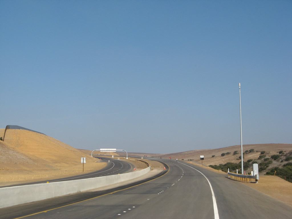
Climbing out of Otay River Valley, northbound California 125 widens to three lanes (the third lane serves as a climbing lane to assist slow-moving traffic). Photo taken 12/02/07. |
|
The 1.00 post mile is located on the grade out of the valley, which means that the zero postmile is located somewhere on the Otay River Valley bridge. Photo taken 12/02/07. |
|
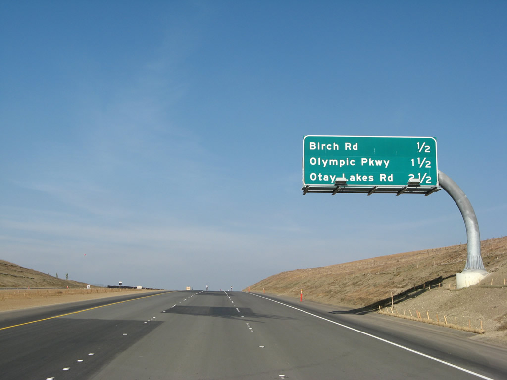
This interchange sequence sign provides the distance to the next three exits on California 125 (South Bay Expressway) north: Exit 5, Birch Road; Exit 6, Olympic Parkway; and Exit 7, Otay Lakes Road. Photo taken 11/17/07. |
|
At the top of the grade leaving Otay River Valley, northbound California 125 reaches Exit 5, Birch Road. This is the first of four exits to serve the city of Chula Vista and its rapidly growing communities of Otay Ranch and Eastlake. Photo taken 11/17/07. |
|
The next exit along California 125 (South Bay Expressway) north is Exit 6, Olympic Parkway. This major east-west expressway travels through the Otay Ranch community and extends east to the Olympic Training Center on the shores of the Otay Lakes. Photo taken 12/02/07. |
|
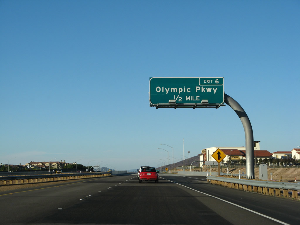
A California 125 (South Bay Expressway) reassurance shield is posted after the on-ramp from Birch Road and prior to the off-ramp for Exit 6, Olympic Parkway. A new auxiliary lane forms to serve entering and exiting traffic. Photo taken 12/02/07. |
|
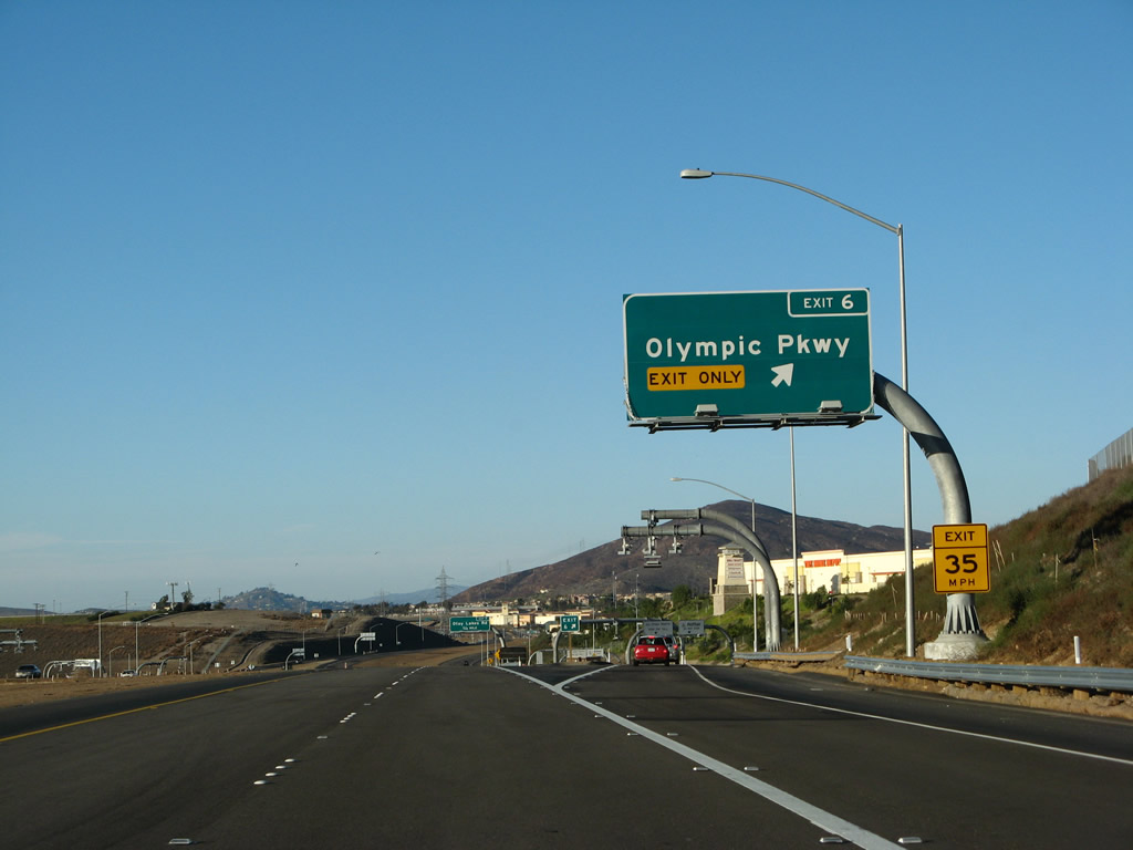
Northbound California 125 (South Bay Expressway) north reaches Exit 6, Olympic Parkway. Photo taken 12/02/07. |
|
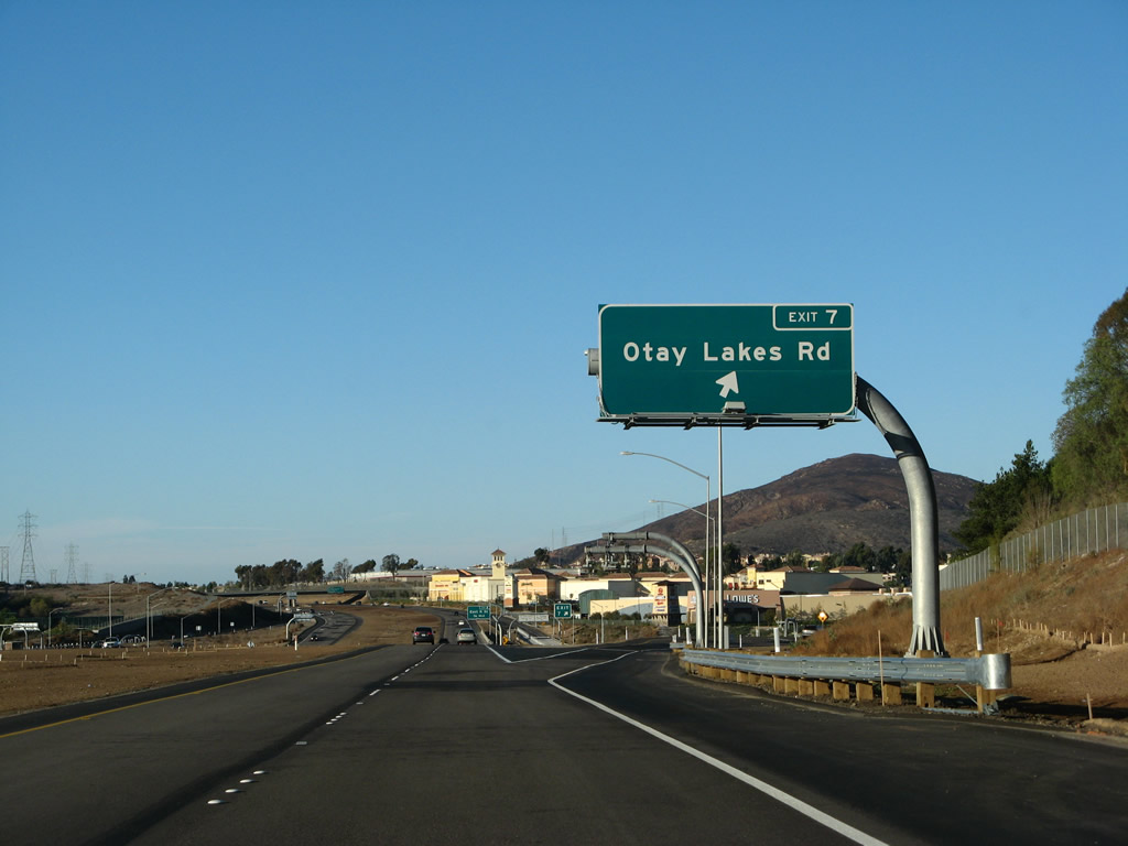
The next exit along California 125 (South Bay Expressway) north is Exit 7, Otay Lakes Parkway. Use Otay Lakes Road northwest to Southwestern College and the unincorporated community of Bonita. Otay Lakes Road serves the community of Eastlake in the city of Chula Vista. Photo taken 12/02/07. |
|
Another reassurance shield for California 125 north is posted after the on-ramp from Olympic Parkway and prior to the off-ramp to Otay Lakes Road. Photo taken 12/02/07. |
|
A San Diego Gas and Electric 230kV power line crosses California 125; these particular lines transmit power generated from Mexico into San Diego County (and vice versa). These lines will closely follow California 125 for the next several miles. Photo taken 12/02/07. |
|
Northbound California 125 (South Bay Expressway) reaches Exit 7, Otay Lakes Road. Photo taken 12/02/07. |
|
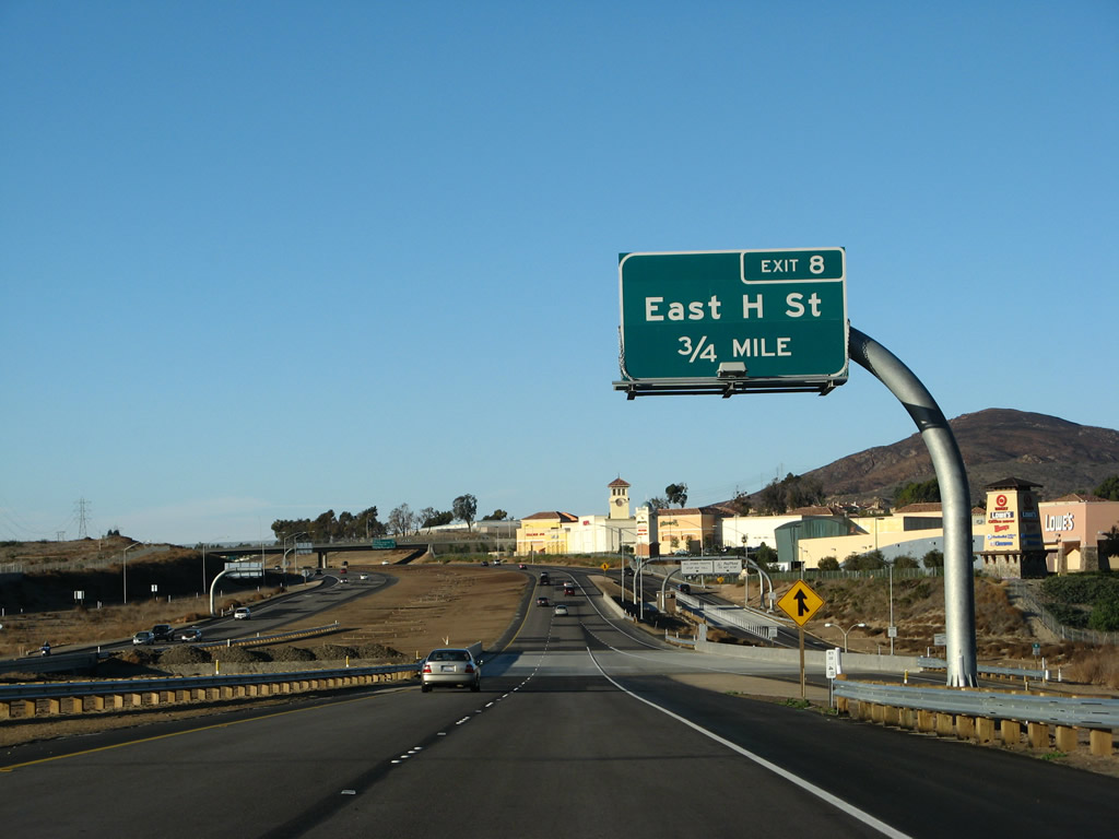
The next exit along California 125 (South Bay Expressway) north is Exit 8, East H Street. This interchange also serves the Eastlake community of Chula Vista. Photo taken 12/02/07. |
|
Toll collection devices are located on each on-ramp, since drivers entering the toll road here did not pass through the mainline toll plaza. Motorists are afforded a choice of Fastrak or cash, but exact change is required in most cases for the cash collection. Photo taken 12/02/07. |
|
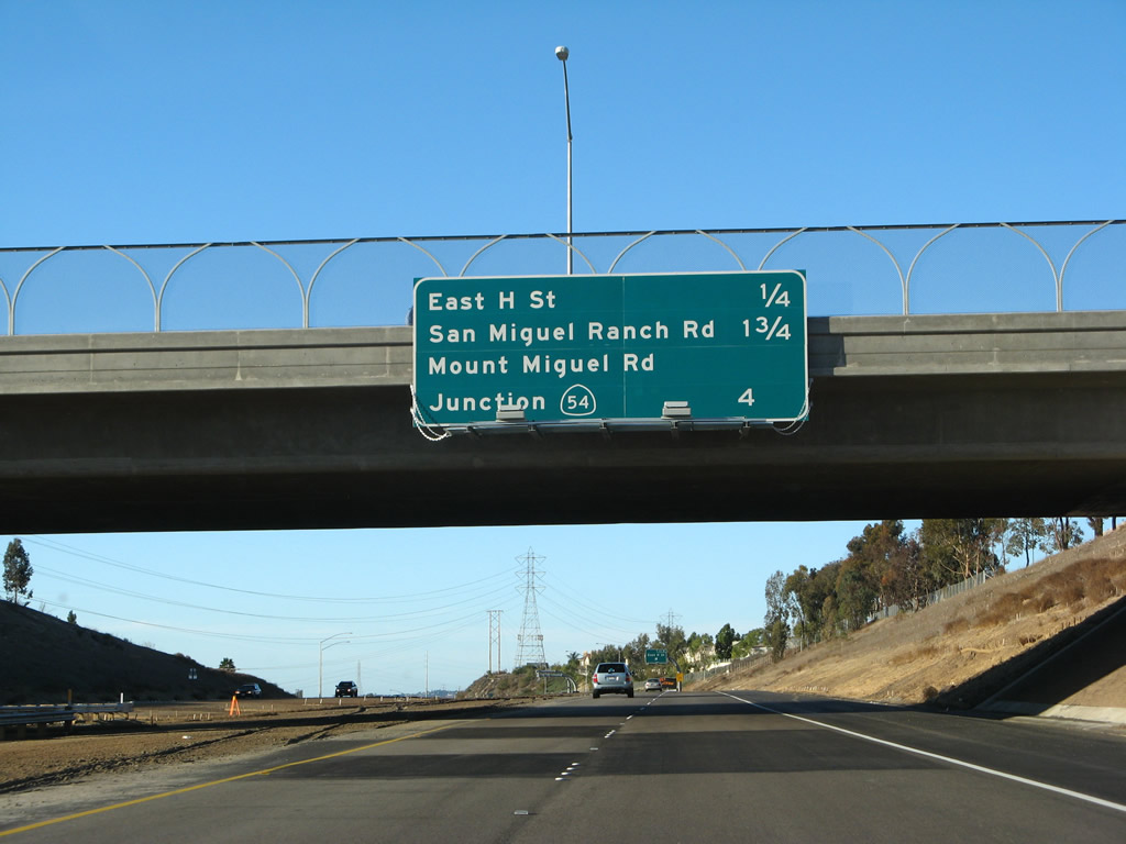
This mileage sign provides the distance to the next three exits along California 125 (South Bay Expressway) north: Exit 8, East H Street; Exit 9, San Miguel Road and San Miguel Ranch Road; and Exit 11, California 54 (Filipino-American Highway). Photo taken 12/02/07. |
|
Northbound California 125 (South Bay Expressway) reaches Exit 8, East H Street. Photo taken 12/02/07. |
|
At the gore point for Exit 8, the same San Diego Gas and Electric power lines cross over California 125. These lines will connect with the San Miguel Substation, which will be visible on the east side of the toll road ahead. Photo taken 12/02/07. |
|
This California 125 reassurance shield is posted after the on-ramp from East H Street. Photo taken 12/02/07. |
|
Since California 125 briefly leaves the city Chula Vista and reenters the county of San Diego, another city limits sign is posted when California 125 reenters the city of Chula Vista a second time. Photo taken 12/02/07. |
|
Another set of San Diego Gas and Electric power lines crosses California 125 prior to the future Exit 9 off-ramp. Photo taken 12/02/07. |
|
Northbound California 125 (South Bay Expressway) reaches future Exit 9, San Miguel Ranch Road and Mount Miguel Road. This interchange was not open at the time this photo was taken. Photo taken 12/02/07. |
|
Traffic from San Miguel Ranch Road and Mount Miguel Road merge onto California 125 north. The San Diego Gas and Electric (SDG&E) San Miguel Substation comes into view on the right (east) side of the freeway. Photo taken 12/02/07. |
|
|
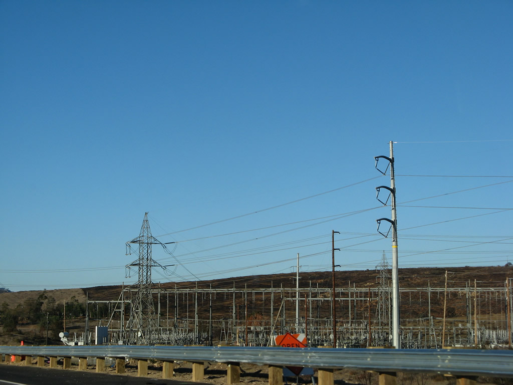
Several 230kV power lines and the 500kV Southwest Powerlink coverge on the San Diego Gas and Electric (SDG&E) San Miguel Substation on the east side of California 125 (South Bay Expressway). Photos taken 12/02/07. |
|
Another California 125 north reassurance shield is posted after the on-ramp from San Miguel Ranch Road. Photo taken 12/02/07. |
|
Pavement changes from asphalt to concrete; this might be the point where the toll-funded section ends and the taxpayer-funded section begins (except that another rack of toll collection devices lies ahead after the overpass). Photo taken 12/02/07. |
|
The aforementioned rack of electronic detection devices comes into view. Photo taken 12/02/07. |
|
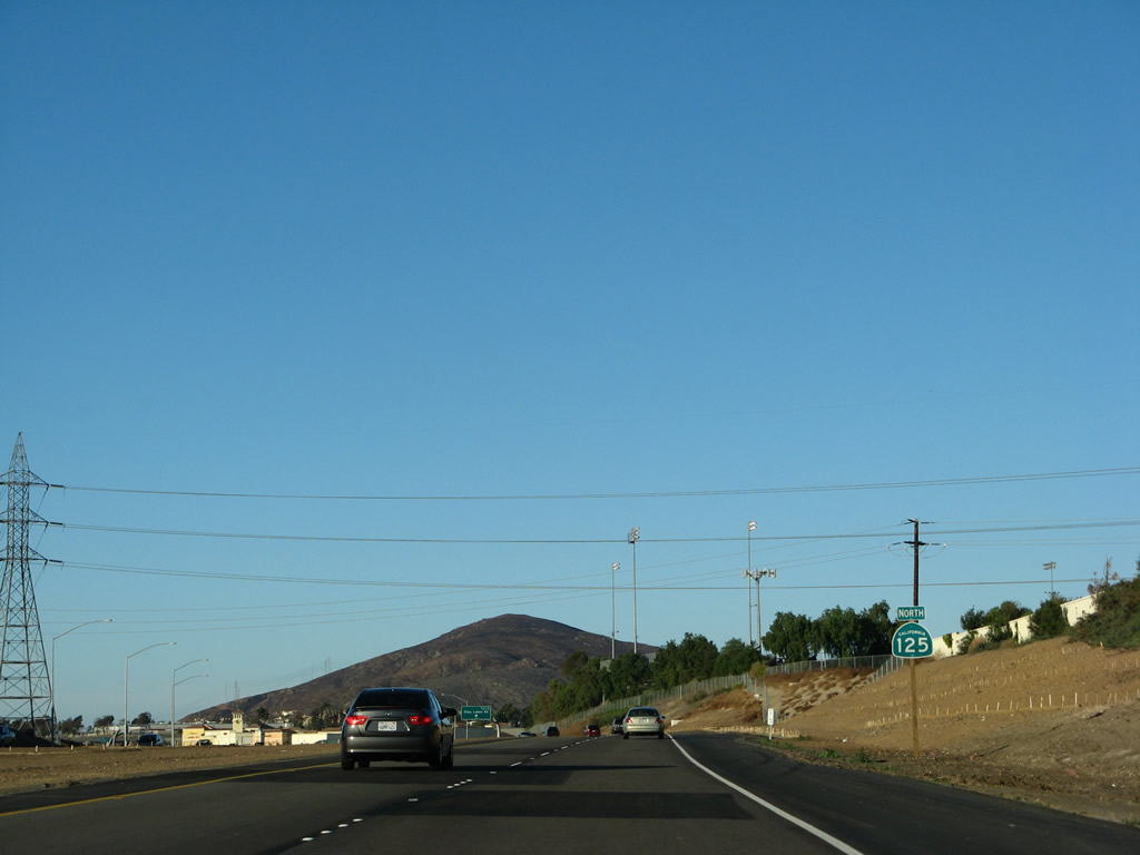
The next exit along California 125 north is Exits 11A-B, California 54. Use California 54 west to National City and Interstate 5; use California 125 north to Spring Valley and La Mesa. Photo taken 12/02/07. |
|
The Sweetwater River bridge as well as the California 54 interchange come into view. Photo taken 12/02/07. |
|
The left lane will depart to Exit 11A, California 54 west to National City and Chula Vista. The right lane continues north on California 125 (and east on California 54) to Spring Valley. Photo taken 12/02/07. |
|
Northbound California 125 reaches Exit 11A, California 54 (Filipino-American Highway) west to National City. The right lane continues north on California 125 and east on California 54 to Spring Valley. Photo taken 12/02/07. |
|
|
|
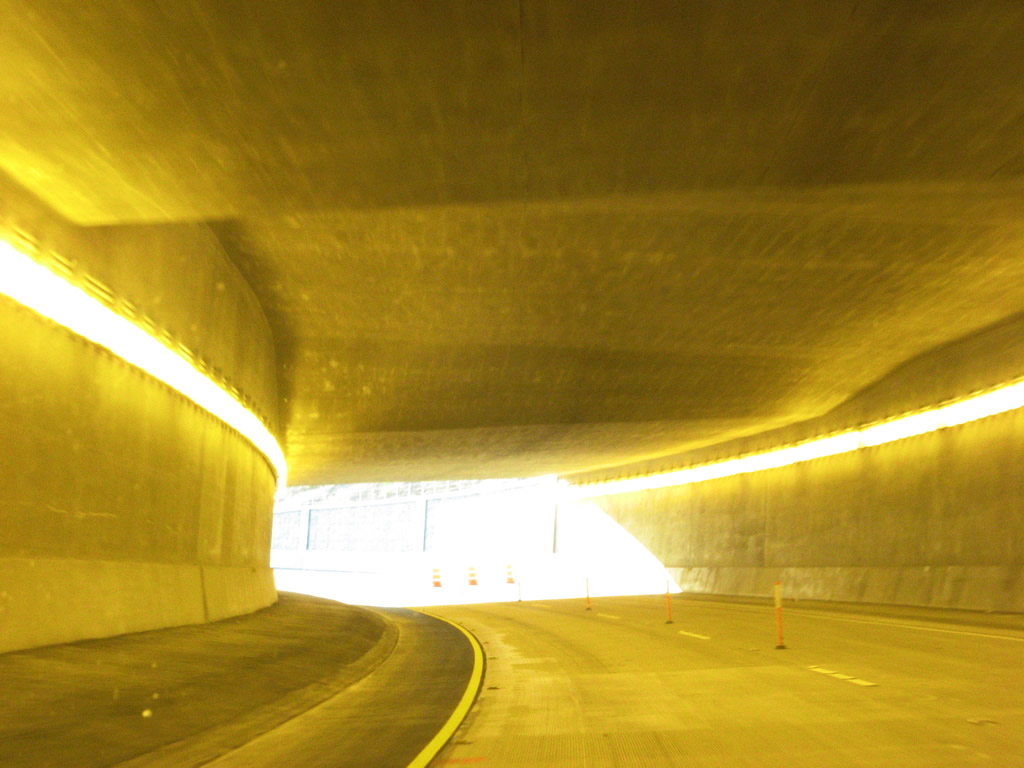
A tunnel serves as the connecting ramp between California 125 north to California 54 west. Photos taken 12/02/07. |
| California 54 east & 125 north |
|
After the California 54 interchange, California 125 is now a toll-free road and approaches its first interchange, Exit 12, Jamacha Boulevard (San Diego County S-17). At Exit 12, in the future California 54 is planned to extend east through Spring Valley, then connect with California 94 near Rancho San Diego. This section of highway is unconstructed, so the continuation of California 54 is not signed from California 125. An extant north-south section of California 54 remains signed between Rancho San Diego and the city of El Cajon, however. Photo taken 12/02/07. |
|
|
Northbound California 125 reaches Exit 12, Jamacha Boulevard (San Diego County S-17 to California 54 east) and Paradise Valley Road. Photo taken 12/02/07 and 07/14/02. |
|
This view shows the gore point at Exit 12. California 54 would depart at this interchange if the eventual state highway is built through Spring Valley along the north edge of Sweetwater Reservoir toward Rancho San Diego. Such an extension is not immediately planned, however. For now, San Diego County S-17 follows Jamacha Boulevard along the proposed state highway's path and serves as the most direct route to the eastern, orphaned section of California 54 between Rancho San Diego and the city of El Cajon. Photo taken 12/02/07. |
|
Now on the off-ramp to Exit 12, a left turn connects to Paradise Valley Road and a right turn connects to San Diego County S-17 (Jamacha Boulevard) east to California 54 east in Rancho San Diego. Continue straight ahead to Sweetwater Road. Photo taken 11/19/07. |
| California 125 north |
|
|
The next three exits along California 125 north are Exit 13, Jamacha Road; Exit 15, California 94/Dr. Martin Luther King, Jr. Freeway; and Exit 17A, Lemon Avenue. Flashing beacons are mounted on top of this sign because it once functioned as a warning that the freeway was about to end. California 125 between Jamacha Boulevard and Jamacha Road was the first section of the Sweetwater segment to be completed and opened to traffic. Photos taken 12/02/07 and 07/14/02. |
|
Through the Sweetwater section of California 125, each direction has three lanes with a landscaped median that allows for eventual addition of high occupancy vehicle (HOV) carpool lanes. Photo taken 03/30/07. |
|
|
Northbound California 125 reaches Exit 13, Jamacha Road. The segment from here north to California 94 is now complete, and it opened in Fall 2003; the 2002 photo shows the signage at the time when the freeway temporarily ended at this point. Photos taken 03/30/07 and 07/14/02. |
|
After Jamacha Road, there are no further exits from California 125 northbound until reaching the mega-interchange at California 94. This reassurance shield is posted after the on-ramp from Jamacha Road. Photo taken 03/30/07. |
|
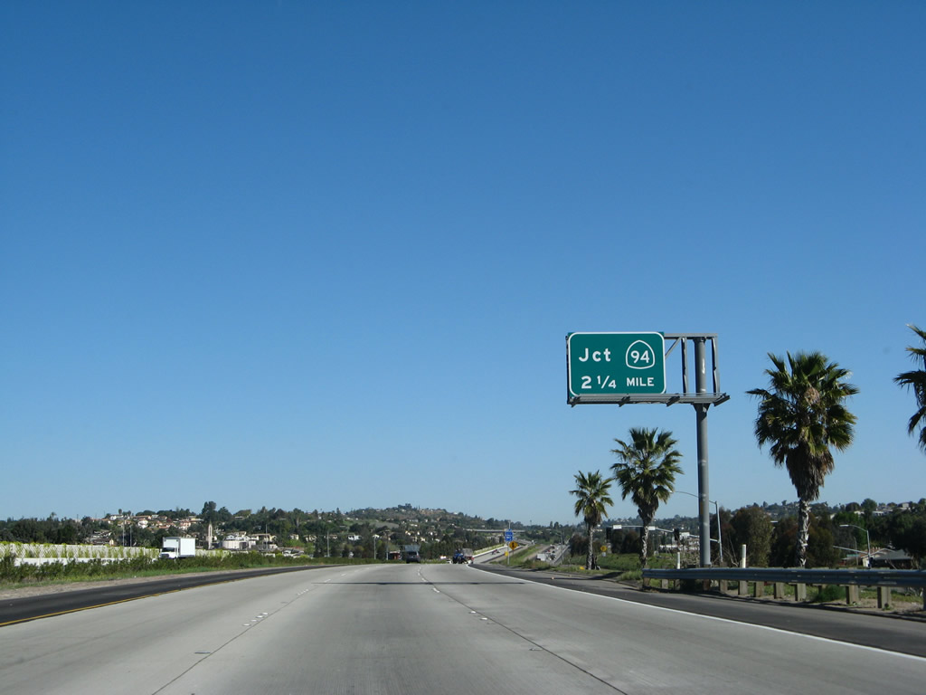
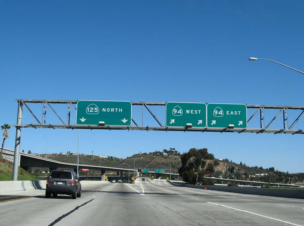
The next exit along California 125 north is Exit 15, California 94 (Martin Luther King, Jr. Freeway) west to San Diego and California 94 east to Rancho San Diego, Jamul, Tecate, and Campo. Photo taken 03/30/07. |
|
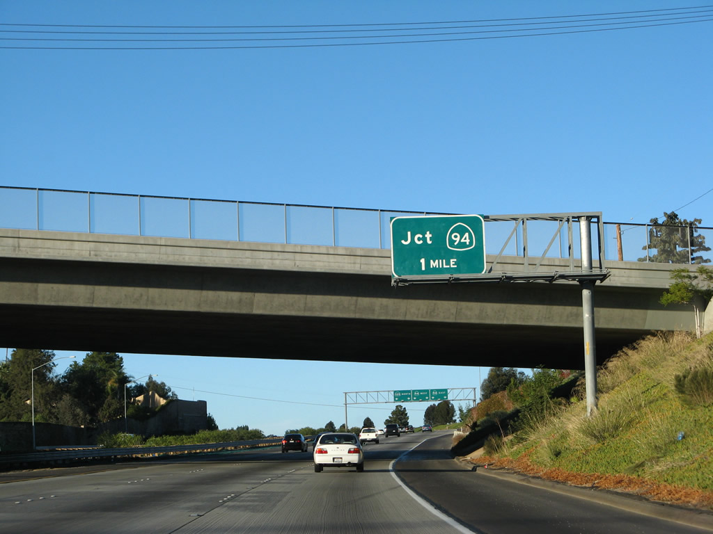
Another California 125 north reassurance shield is posted shortly thereafter. Photo taken 12/02/07. |
|
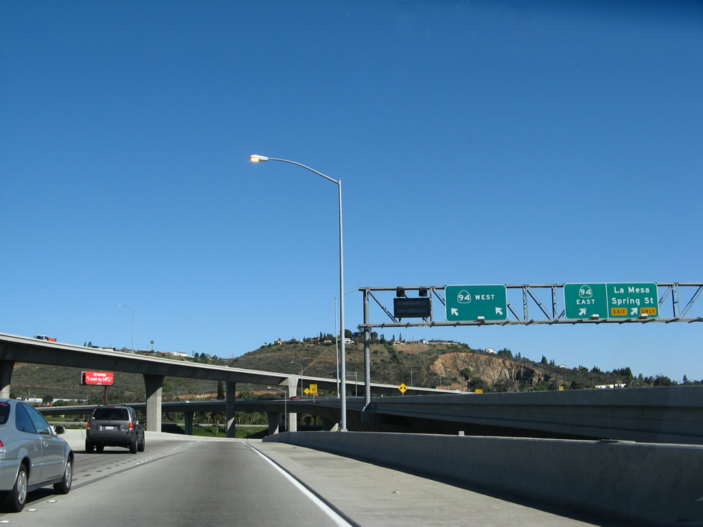
California 94 is a major east-west state route wholly located within San Diego County. Originating as the Martin Luther King, Jr. Freeway in downtown San Diego, California 94 extends east past San Diego communities such as Golden Hill, Fairmount Park, Chollas, and College Grove before entering the city of Lemon Grove. Joining California 125 at a massive stack interchange, California 94 continues east past Mount Helix toward Rancho San Diego and Jamul. The highway narrows to two lanes and enters the mountains. California 94 is part of the National Highway System en route to the border crossing at Tecate, then passes through Campo before merging with Interstate 8 in Boulevard. Photo taken 12/02/07. |
|
Use the left two lanes to continue north on California 125; the right three lanes will connect to California 94 west and east. Use California 94 west to downtown San Diego and east to Rancho San Diego and Jamul. Photo taken 12/02/07. |
|
Northbound California 125 reaches Exit 15, California 94. The left two lanes continue north on California 125 toward La Mesa, while the right two lanes connect to California 94 east to Rancho San Diego and Jamul (with access to Spring Street via this ramp). The middle two lanes connect to California 94 (Martin Luther King Jr. Freeway) west to downtown San Diego. This interchange serves as the eastern terminus of the Dr. Martin Luther King, Jr. Freeway. Photo taken 03/30/07. |
|
Now on the transition ramp from northbound California 125 to California 94 is this division point. The left lanes connect to westbound California 94 (Martin Luther King, Jr. Freeway), and the right lanes transition onto California 94 east. There is access to Spring Street (which leads north to downtown La Mesa) from this exit ramp. Photo taken 09/06/03. |
|
Still on the transition ramp, traffic flies over Sweetwater Road and California 94 to make the connection from California 125 north to California 94 west to downtown San Diego. Photo taken 09/06/03. |
|
Back on the mainline, this view shows the signage for the transition ramp split. From here, California 125 north turns northeast and drops gradually in elevation to merge alongside California 94 east. Photo taken 03/30/07. |
|
The enormity of this interchange is almost partially visible from this perspective, but one must be on California 94 to see the true magnitude and height of the various flyover and transition ramps. Flying above the main lanes of California 125 are the mainline of California 125 south as well as the connecting ramp between California 125 north and California 94 west. Photo taken 03/30/07. |
|
California 125 north merges with traffic from California 94 east. While the right lane ends ahead, the left four lanes continue north on California 125. Previously, motorists could still access California 94 east from this point (see next photobox), but that access has since closed. Photo taken 12/02/07. |
|
|
With the opening of the California 125-94 interchange in 2003, the former access to California 94 east was removed. Now a reassurance shield remains where the overhead sign used to be. From here, California 125 enters the oldest section of freeway, which follows old California 67 north to Interstate 8 at Grossmont Summit in La Mesa. Photos taken 12/02/07 and 03/06/02. |
|
Mount Helix comes into view northeast of California 125. A final flyover ramp for the massive 94-125 interchange passes overhead; this bridge carries California 94 east traffic over California 125. An advance exit sign for California 94 west traffic is also visible, showing how closely aligned the two freeways are through this stretch. Now California 125 will pull away into the city of La Mesa. Photo taken 12/02/07. |
Page Updated August 31, 2008.