| California 126 west |
|
Westbound California 126 (Ventura Street) approaches B Street in Fillmore, about one block west of the California 23 (A Street) intersection. The city of Fillmore, the "Last Best Small Town," is situated at the intersection of California 23 and California 126. The population of Fillmore was 13,643 as of the 2000 Census. The city was incorporated on July 10, 1914. Photo taken 02/02/08. |
|
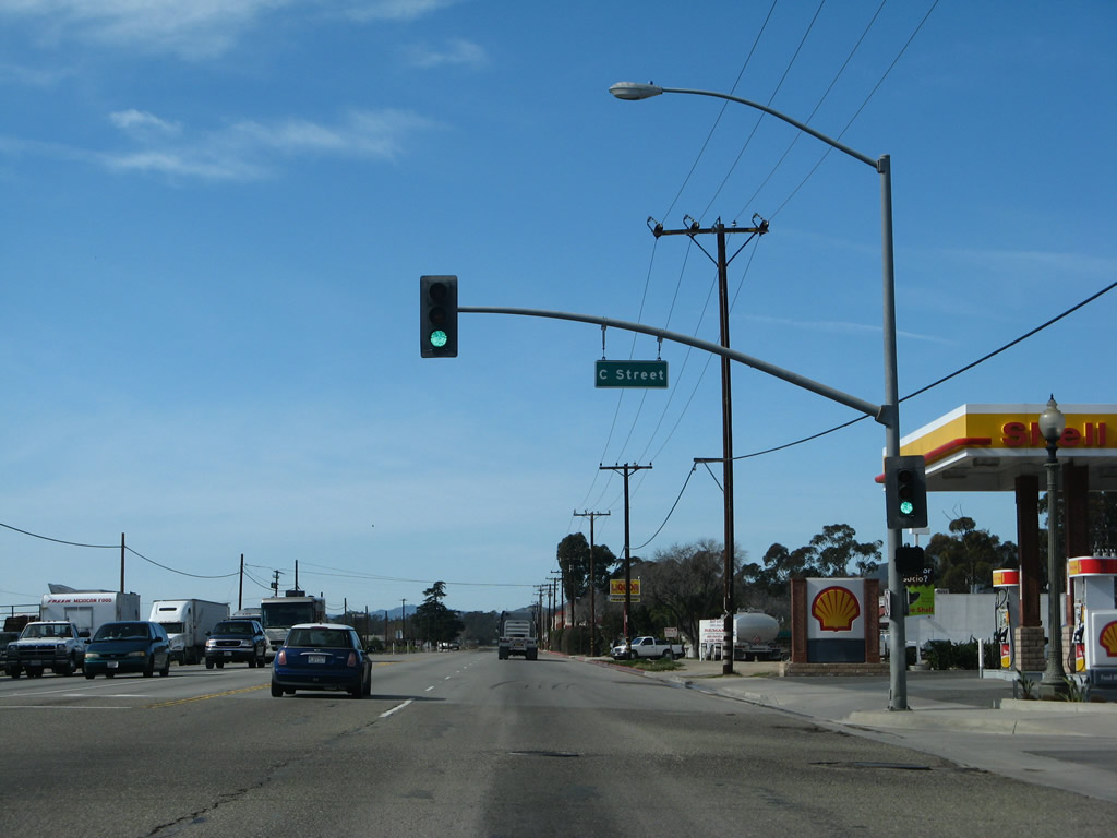
A block west, California 126 (Ventura Street) meets C Street at this traffic signal in Fillmore. Photo taken 02/02/08. |
|
Leaving Fillmore, the upcoming segment of California 126 is also known as the Officer David W. Copleman Memorial Highway. Photo taken 02/02/08. |
|
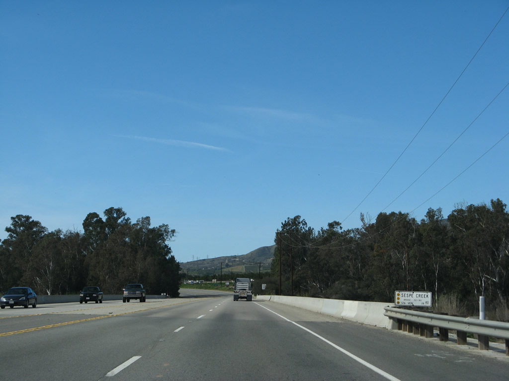
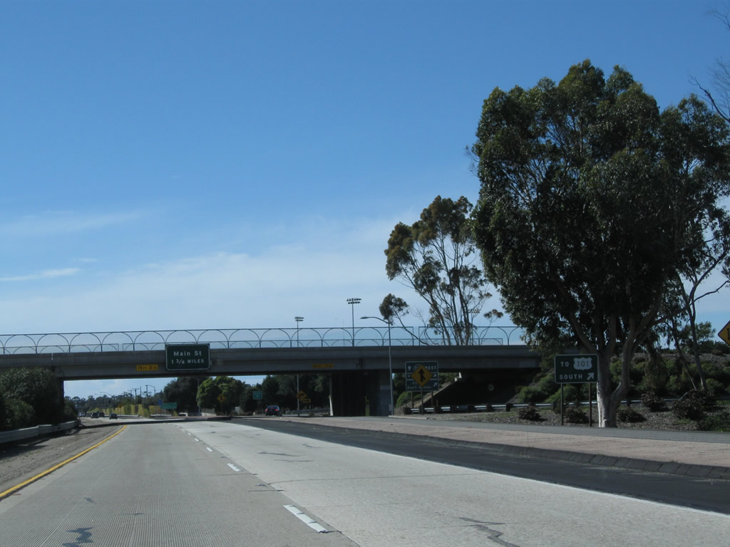
A mileage sign provides the distance to Santa Paula, Ventura, and Santa Barbara via California 126 west and U.S. 101 north. After this sign, California 126 will pass over the Sespe Creek overflow channel. Sespe Creek is part of the Santa Clara River watershed. Photo taken 02/02/08. |
|
The bridge over the Sespe Creek overflow channel is wide enough to accommodate two lanes in each direction plus an ample median and shoulders. Photo taken 02/02/08. |
|
California 126 passes over the main channel for Sespe Creek. Photo taken 02/02/08. |
|
Westbound California 126/Officer David W. Copleman Memorial Highway approaches Old Telegraph Road, which is an old alignment of California 126 that loops northeast and then southeast back into Fillmore. Turn right onto Old Telegraph Road to Kenney Grove Park. Photo taken 02/02/08. |
|
A California 126 west reassurance shield is posted after the Old Telegraph Road turnoff. Photo taken 02/02/08. |
|
After the intersection with Atmore Road, California 126 continues in a west-southwest direction parallel to the Santa Clara River. The river flows parallel to the state highway until reaching the Pacific Ocean between Oxnard and Ventura. True to old Division of Highways standards, planted eucalyptus trees tower over the north side of the expressway. Photo taken 02/02/08. |
|
California 126 is the Korean War Veterans Memorial Highway. Photo taken 02/02/08. |
|
The Fillmore and Western Railway crosses California 126. Photo taken 02/26/11. |
|
On the right side ahead is a historical marker regarding Sycamore Tree, which holds historical signficance to the settlement of this area. Photo taken 02/02/08. |
|
Westbound California 126 approaches Sycamore Road and Hall Road. Sycamore Road travels northeast, while Hall Road turns north. Photo taken 02/02/08. |
|
A California 126 west reassurance shield is posted after the Sycamore Road and Hall Road intersection. Photo taken 02/02/08. |
|
Westbound California 126 approaches Toland Road. Photo taken 02/02/08. |
|
California 126 west Timber Canyon Road. A Southern California Edison 220kV power line passes overhead. next approaches. Photo taken 02/02/08. |
|
This view looks north from California 126 past the orchards toward the rim of the foothills and mountains. Photo taken 02/26/11. |
|
Westbound California 126 approaches Willard Road. Photo taken 02/02/08. |
|
California 126 again crosses over the Fillmore and Western Railwsy. Photo taken 02/26/11. |
|
Prior to the signalized intersection with Hallock Drive and after the railway crossing, California 126 enters the city of Santa Paula, the "Citrus Capital of the World." Its population was 28,598 as of the 2000 Census. It was incorporated on April 22, 1902. In addition to its location amid valuable farmland and orchards, Santa Paula is also notable as the original corporate headquarters for Union Oil Company of California (referred to as Unocal and incorporated on October 17, 1890). The original building for Unocal now houses the California Oil Museum. Photo taken 02/26/11. |
|
Westbound California 126 (Telegraph Road) meets Hallock Drive at this signalized intersection. Turn right on Hallock Drive north to Telegraph Road west for the original alignment of California 126 west through downtown Santa Paula (not signed as a business route). Telegraph Road changes into Main Street. Ahead, California 126 becomes the Santa Paula Freeway and will be limited access from Santa Paula west to Ventura. Photo taken 02/02/08. |
|
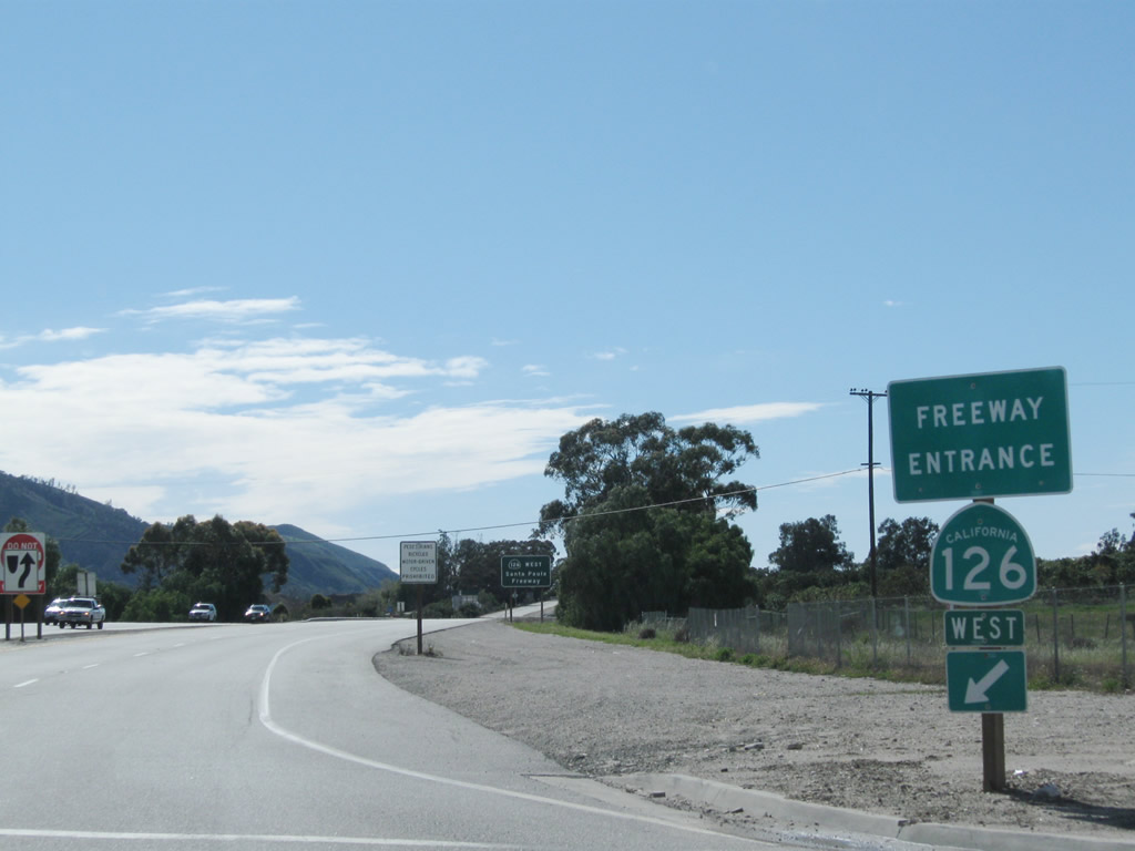
A freeway entrance shield is posted for California 126 west. Photo taken 02/26/11. |
|
California 126 is designated as the Santa Paula Freeway for its final distance from Santa Paula west to Ventura. Photo taken 02/02/08. |
|
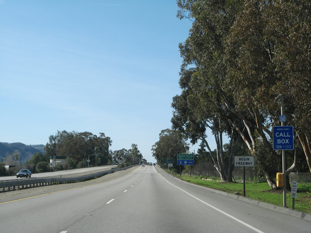
A Begin Freeway sign is posted next to the 13.00 post mile. Photo taken 02/02/08. |
|
The next three exits along California 126 west serve the city of Santa Paula: Exit 12, California 150 (Tenth Street); Exit 11, Palm Avenue; and Exit 10, Peck Road. Photo taken 02/02/08. |
|
The first exit along California 126 (Santa Paula Freeway) west is Exit 12, California 150 (Tenth Street). California 150 is a looping route that extends from California 126 in Santa Paula northwest to Ojai, then curves west to meet U.S. 101 in western Santa Barbara County. Much of this route is a winding, two-lane highway that travels through the foothills. Photo taken 02/02/08. |
|
Use Tenth Street north to the Union Oil Building, a California historic landmark. The California Oil Museum is located inside the original building. Photo taken 02/02/08. |
|
The Santa Paula Historic District incorporates downtown Santa Paula near the intersection of California 150 (Tenth Street) and Main Street (Historic California 126). Photo taken 02/26/11. |
|
Westbound California 126 (Santa Paula Freeway) reaches Exit 12, California 150 (Tenth Street). This is a diamond interchange. Photo taken 02/26/11. |
|
|
|
As Exit 12 serves as the eastern terminus of California 150, traffic for California 150 (Tenth Street) north is directed to turn right at the bottom of the off-ramp. Photos taken 02/02/08. |
|
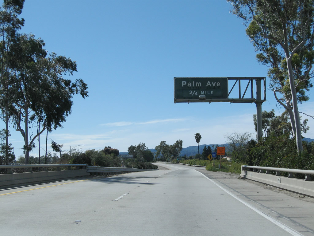
The next exit along California 126 west is Exit 11, Palm Avenue (0.75 mile). As of 2011, nearly all of the original porcelain enamel, overhead guide signs remained in use on the Santa Paula Freeway, unlike many other freeways in the Southland. This particular sign is posted on the Tenth Street overpass. Photo taken 02/26/11. |
|
For the next half mile, California 126 passes alongside the north side of the Santa Paula Airport. This general aviation airport is wedged between the freeway to the north and the Santa Clara River to the south. Use Exit 11 to the airport. Photo taken 02/26/11. |
|
Westbound California 126 (Santa Paula Freeway) reaches Exit 11, Palm Avenue. The next interchange is Exit 10, Peck Road and Faulkner Avenue (1.25 miles). Photo taken 02/26/11. |
|
California 126 west approaches Exit 10, Peck Road and Faulkner Avenue. Photo taken 02/26/11. |
|
Westbound California 126 (Santa Paula Freeway) reaches Exit 10, Peck Road and Faulkner Avenue. The off-ramp connects directly to east-west Faulkner Avenue; turn right upon exiting to connect to north-south Peck Road. California 126 continues west toward Ventura. Photo taken 02/26/11. |
|
The next exit along California 126 (Santa Paula Freeway) west is Exit 9, Briggs Road. Photo taken 02/26/11. |
|
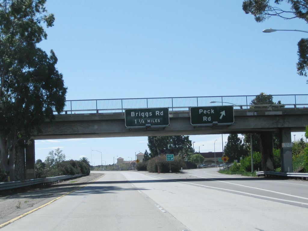
Westbound California 126 (Santa Paula Freeway) reaches Exit 9, Briggs Road. This is one of the few non-porcelain enamel signs posted on the California 126 freeway. Note the porcelain enamel California 126 west pull-through sign (for Ventura). Photo taken 02/26/11. |
|
Between Briggs Road and California 118 is a four-mile gap without any exits. California 126 passes under Edwards Ranch Road. Photo taken 02/26/11. |
|
Another look north shows more farmland and rolling hills. Photo taken 02/26/11. |
|
The fertile Santa Clara River valley offers some excellent growing conditions. Photo taken 02/26/11. |
|
The next exit along California 126 (Santa Paula Freeway) is Exit 5, California 118/Wells Road (Los Angeles Avenue) east to Moorpark, Simi Valley, and Los Angeles (San Fernando Valley). This interchange is the first to serve the city of Ventura, which includes portions of the community of Saticoy. Other portions of Saticoy remain unincorporated. Photo taken 02/26/11. |
|
California 126 enters the city of San Buenaventura (Ventura), which is the seat of Ventura County and home to 100,916 as of the 2000 Census. Although the city is officially San Buenaventura, it is commonly known as Ventura. Father Junipero Serra founded Mission San Buenaventura in 1782, and the city was incorporated in 1866. Oil played a major role in the early development of this area, and exploration reached out from Ventura inland and toward the sea. The city has a downtown dominated by the mission and Grant Park, and a harbor accessible at Exit 68. The Ventura Freeway section around the city of Ventura was constructed between 1961 and 1963. Photo taken 02/26/11. |
|
Westbound California 126 (Santa Paula Freeway) meets Exit 5, California 118/Wells Road. Upon exiting, a collector distributor lane offers two exits. The first connects to Wells Road north, while the second connects to California 118/Wells Road east. Wells Road changes into Los Angeles Avenue upon leaving Ventura. California 118 (Los Angeles Avenue) continues east, initially as a two-lane highway and later as a full freeway, serving the cities of Moorpark, Simi Valley, and Los Angeles (San Fernando Valley). Photo taken 02/26/11. |
|
A California 126 west reassurance shield is posted after the interchange with California 118 (Los Angeles Avenue) (Exit 5). Photo taken 06/01/02. |
|
The next exit along California 126 (Santa Paula Freeway) west is Exit 3, Kimball Road. Photo taken 02/26/11. |
|
Kimball Road serves residential areas of eastern Ventura. Residential developments line both sides of the California 126 freeway. Photo taken 02/26/11. |
|
A landscaped soundwall separates the freeway from the residential areas. Photo taken 02/26/11. |
|
Westbound California 126 (Santa Paula Freeway) reaches Exit 3, Kimball Road. We enter the homestretch as California 126 approaches U.S. 101 and California 1 (Exit 1A). Only U.S. 101 is signed; California 1 is silently merged along with U.S. 101. Photo taken 02/26/11. |
|
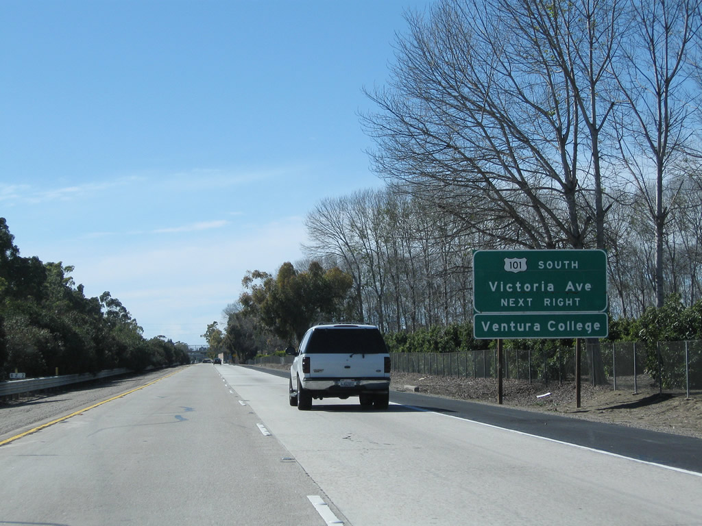
The next exit along California 126 (Santa Paula Freeway) west is Exit 1C, Victoria Avenue. Use Exit 1C to connect from California 126 west to U.S. 101 and California 1 south. Even though U.S. 101 is signed north-south here, in reality it general heads east-west through this area, which is why there is no direct connection to southbound. California 1 is silently merged with U.S. 101 through Ventura, although the state route is occasionally mentioned at certain places on its shared alignment with U.S. 101. Photo taken 02/26/11. |
|
|
Continuing west, California 126 approaches a pedestrian bridge prior to the off-ramp for Exit 1C, Victoria Avenue. Another advance guide sign indicates that Exit 1C connects to U.S. 101 (and California 1) south, but it does not mention that Exit 1C is for Victoria Avenue. The sign was changed between 2002 and 2011. Photos taken 02/26/11 and 06/01/02. |
|
Westbound California 126 (Santa Paula Freeway) reaches Exit 1C, Victoria Avenue, to U.S. 101 (Ventura Freeway) south (east) to Los Angeles. Note the trailblazer for U.S. 101 south, which is mounted on the light pole. While most motorists traveling west on California 126 from Fillmore or Santa Clarita would not logically connect to U.S. 101 and California 1 south, those who live in Saticoy or eastern Ventura would want to connect to U.S. 101 south for the journey to Los Angeles. Photo taken 02/26/11. |
|
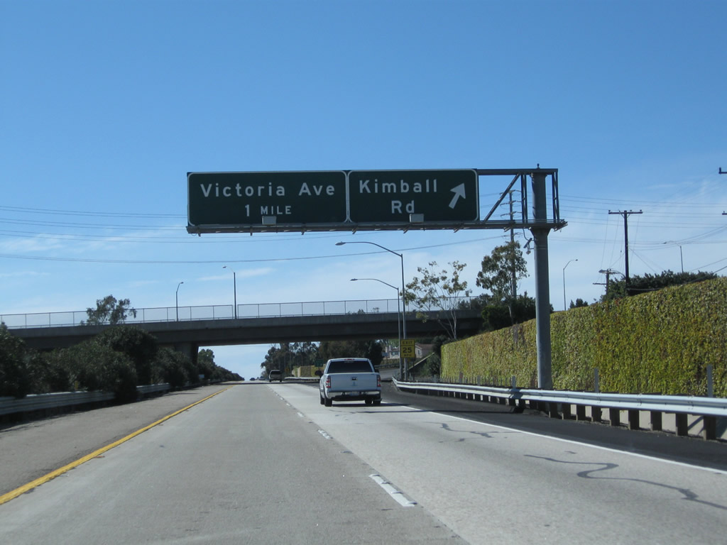
A collector distributor lane connects first to the Victoria Avenue north off-ramp, followed by a link to Victoria Avenue south. Use Victoria Avenue south to U.S. 101 south. Photo taken 02/26/11. |
|
The second ramp connects California 126 west to Victoria Avenue south and U.S. 101 south. Photo taken 02/26/11. |
|
The final independent exit along westbound California 126 is Exit 1B, U.S. 101 Business (Main Street) to downtown Ventura. Another roadside sign is also posted on the collector distributor lanes for the connection to Victoria Avenue south and the return to California 126 west. Photo taken 02/26/11. |
|
An interchange sequence sign provides the distance to the final exit on California 126 west: Exit 1B, U.S. 101 Business (Main Street). Omitted is Exit 1A, which is the connection from California 126 west to U.S. 101 and California 1 north. In addition, the sign provides the distance to the two of the next three exits on U.S. 101 (Ventura Freeway) north: Exit 68, Seaward Avenue and Exit 70A, California Street. Omitted is Exit 69, Sanjon Road and Vista Del Mar Drive. Photo taken 02/26/11. |
|
A California 126 west reassurance shield is posted shortly after the Victoria Avenue interchange. Photo taken 02/26/11. |
|
Main Street is the original alignment of U.S. 101 through Ventura. A business route was designated through Ventura and is well-signed, although it deviates from Main Street via Thompson Boulevard to bypass downtown Ventura. U.S. 101 Business (Main Street) intersects Telgraph Road and Thompson Boulevard at the same intersection in Ventura. This makes this intersection to be the western end of historic California 126. Photo taken 02/26/11. |
|
The fastest route to downtown Ventura is via U.S. 101 and California 1 north to Exit 70B, California Street. However, Main Street will also take motorists into town, albeit at a slower pace. Photo taken 02/26/11. |
|
Westbound California 126 (Santa Paula Freeway) meets Exit 1B, U.S. 101 Business (Main Street) west into Ventura. The left two lanes will transition directly from California 126 west onto U.S. 101 north. Photo taken 02/26/11. |
|
The two remaining lanes of California 126 merge into one lane. Exit 1A is the transition from California 126 (Santa Paula Freeway) west to U.S. 101 (Ventura Freeway) and California 1 north (west). An end California 126 west shield is posted at the merge with northbound U.S. 101 (Ventura Freeway). Photo taken 02/26/11. |
Page Updated March 29, 2011.