|
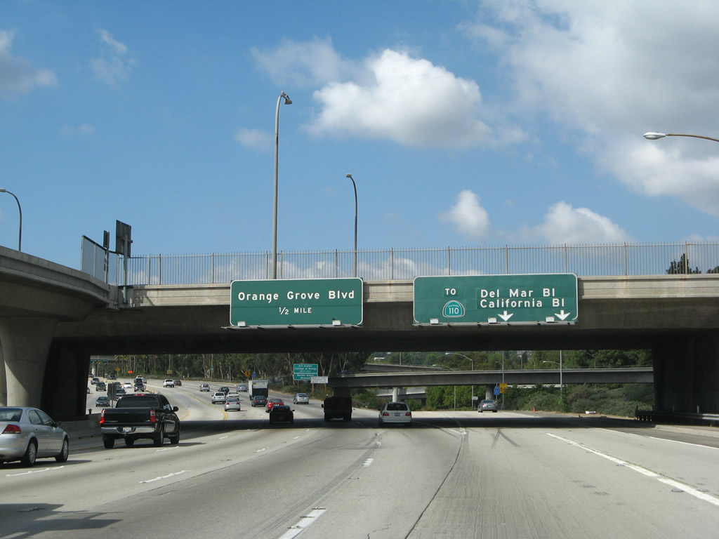
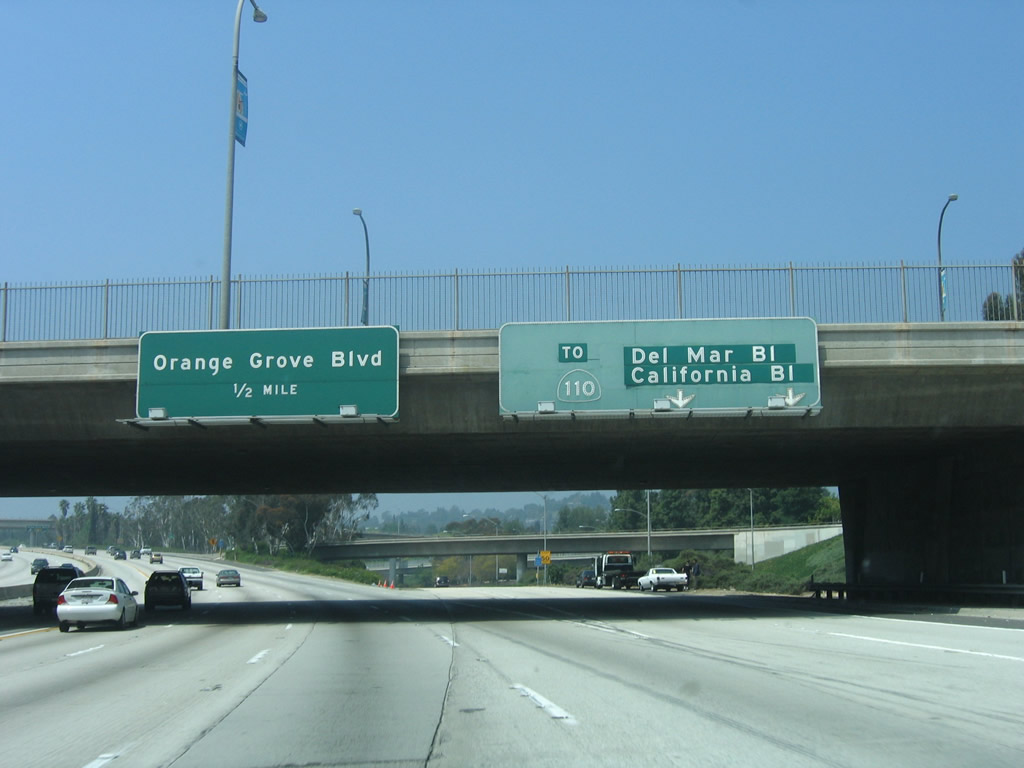
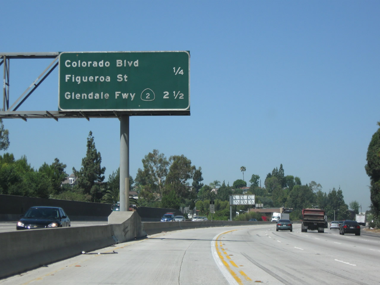
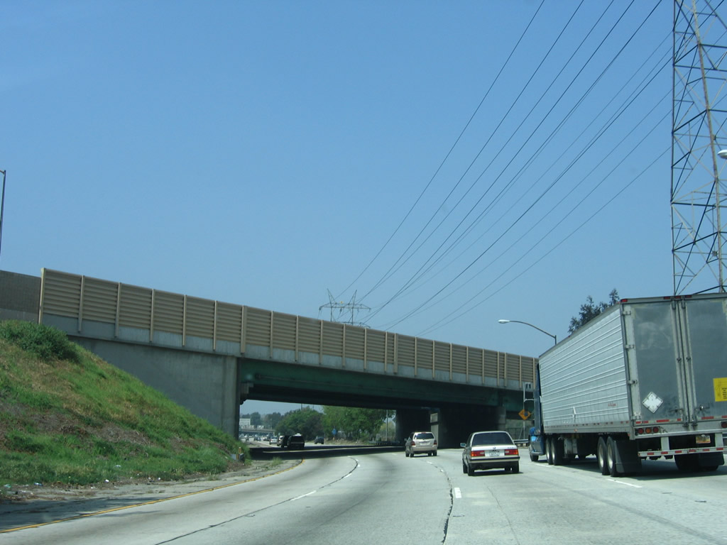
This mileage sign provides the distance to the next two exits along California 134 (Ventura Freeway) west: Exit 12, San Rafael Avenue to Historic U.S. 66 (Colorado Boulevard) and Former California 159/Linda Vista Avenue and Exit 11, U.S. 66/Figueroa Street southwest to downtown Los Angeles, Historic U.S. 66 (Colorado Boulevard) east to Pasadena, and Colorado Boulevard west to Eagle Rock (community of city of Los Angeles) and city of Glendale. Photo taken 09/29/07. |
|
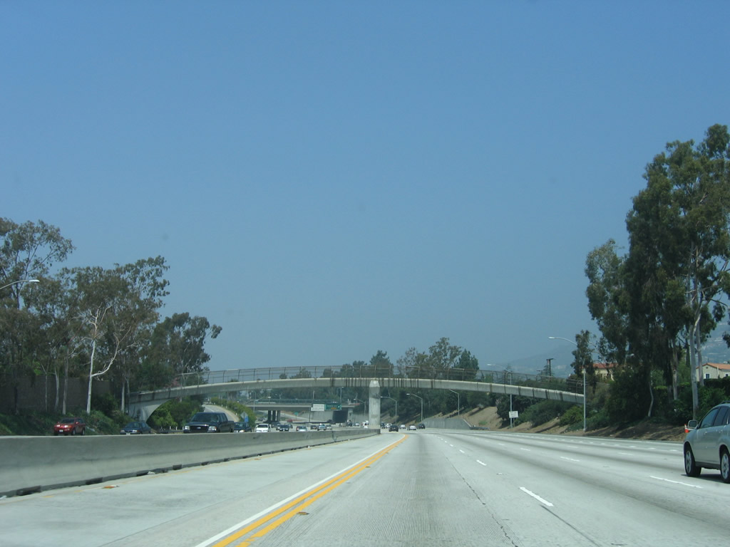
San Rafael Avenue is a north-south city street in western Pasadena. Use San Rafael Avenue south to Colorado Boulevard east to Linda Vista Avenue north. Linda Vista Avenue is the former alignment of California 159, which was relinquished to the city of Pasadena on July 14, 1989, and decommissioned legislatively in 1992.1 Linda Vista Avenue travels north parallel to Interstate 210 past the Rose Bowl (which sits near the Arroyo Seco and is not visible from Interstate 210). There is no direct connection between Linda Vista Avenue and Interstate 210. Photo taken 04/30/06. |
|
California 134 passes over the Arroyo Seco on a massive concrete arch bridge, which is visible from the old Historic U.S. 66 (Colorado Boulevard) bridge that runs parallel to California 134. Look south to see the Colorado Street Pioneer bridge, which is one of the most amazing, graceful, and beautiful bridges in greater Los Angeles. To see this bridge more closely, exit at San Rafael Avenue and follow Colorado Boulevard east. You can also park near the interchange and walk across the bridge if desired. Photo taken 04/30/06. |
|
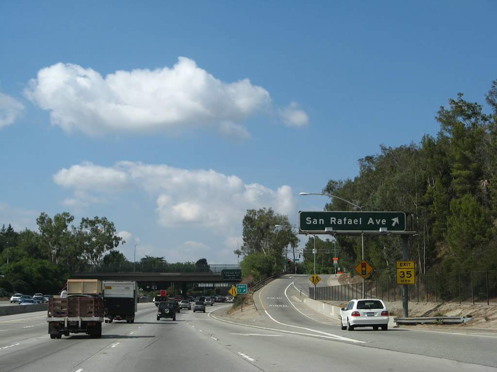
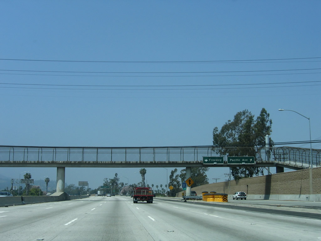
Westbound California 134 (Ventura Freeway) reaches Exit 12, San Rafael Avenue to Historic U.S. 66 (Colorado Boulevard) and Former California 159/Linda Vista Avenue to the Rose Bowl. Photo taken 09/29/07. |
|
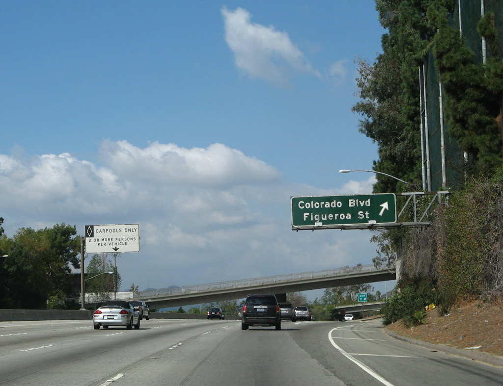
The next exit along California 134 (Ventura Freeway) west is Exit 11, Colorado Freeway to U.S. 66/Figueroa Street southwest to downtown Los Angeles, Historic U.S. 66 (Colorado Boulevard) east to Pasadena, and Colorado Boulevard west to Eagle Rock (community of city of Los Angeles) and city of Glendale. This exit is actually a very brief freeway segment that has an exit ramp to Figueroa Street to U.S. 66, while the freeway ramp continues for about a half mile to merge onto westbound Colorado Boulevard. Photo taken 09/29/07. |
|
A California 134 west reassurance shield is posted shortly thereafter. Photo taken 09/29/07. |
|
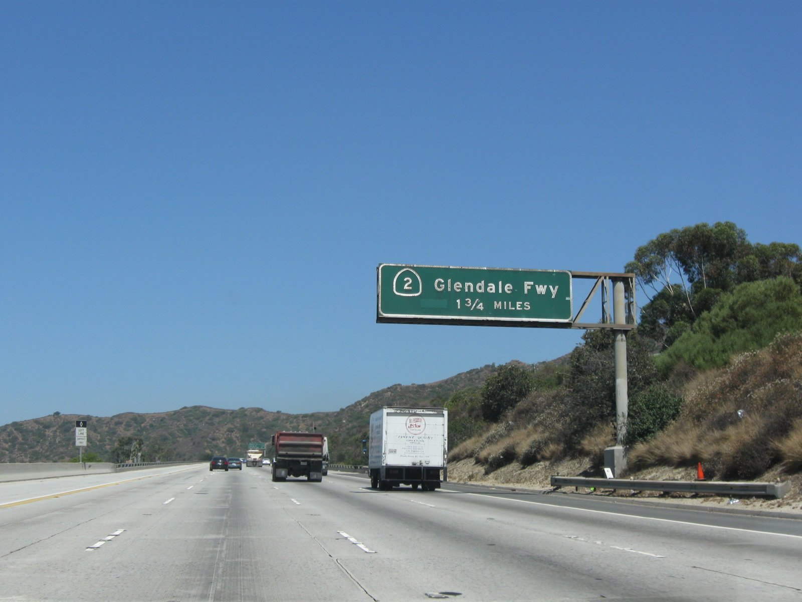
This mileage sign along California 134 (Ventura Freeway) west provides the distance to the next two exits: Exit 11, U.S. 66, Colorado Boulevard, and Figueroa Street and Exit 9B, California 2 (Glendale Freeway). Photo taken 07/15/09. |
|
Use Figueroa Street south to the Eagle Rock community of the city of Los Angeles. Photo taken 09/29/07. |
|
Westbound California 134 (Ventura Freeway) reaches Exit 11, Colorado Freeway west to U.S. 66/Figueroa Street southwest to downtown Los Angeles, Historic U.S. 66 (Colorado Boulevard) east to Pasadena, and Colorado Boulevard west to Eagle Rock (community of city of Los Angeles) and city of Glendale. This exit is actually a very brief freeway segment that has an exit ramp to Figueroa Street to U.S. 66, while the freeway ramp continues for about a half mile to merge onto westbound Colorado Boulevard. Photo taken 09/29/07. |
|
Back on the mainline, the ramp to Colorado Boulevard west flies over westbound California 134 (Ventura Freeway). At this point, California 134 leaves the city of Pasadena and enters the city of Los Angeles. Photo taken 09/29/07. |
|
A road information sign is posted alongside California 134. The sign warns of pending traffic or weather conditions. Unfortunately, there are no lights to flash so the bottom of the sign that states "when flashing" is incorrect. Photo taken 09/29/07. |
|
The next exit along California 134 (Ventura Freeway) west is Exit 10, California 2 (Glendale Freeway) north to La Canada-Flintridge and the Angeles Crest Highway and south to Echo Park (city of Los Angeles). Photo taken 07/15/09. |
|
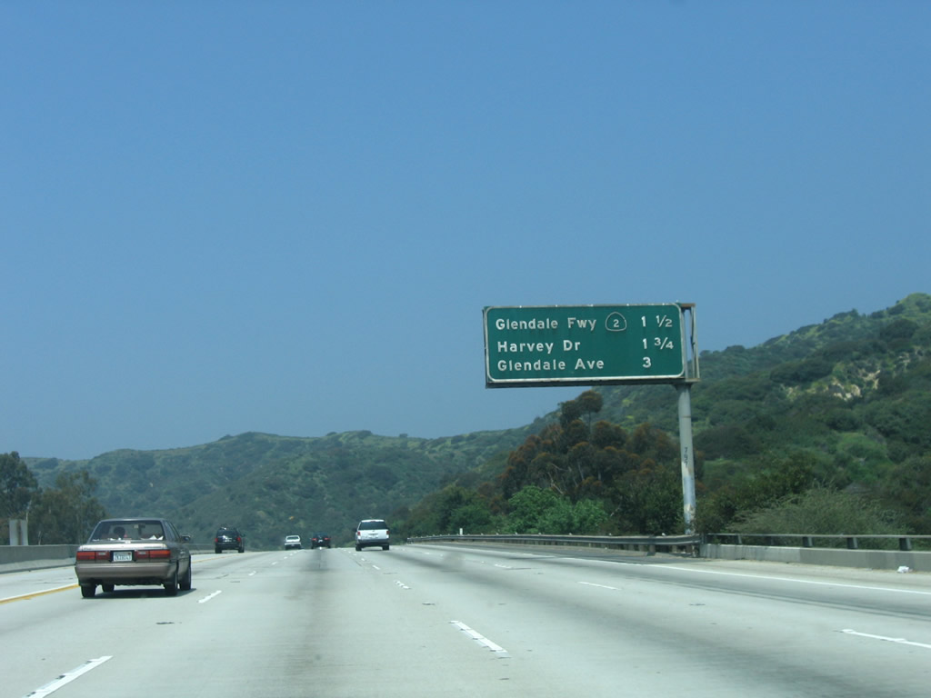
This mileage sign provides the distance to the next three exits along California 134 (Ventura Freeway) west: Exit 9B, California 2 (Glendale Freeway) north to La Canada-Flintridge and south to Echo Park; Exit 9A, Harvey Drive; and Exit 8, Glendale Avenue. Photo taken 04/30/06. |
|
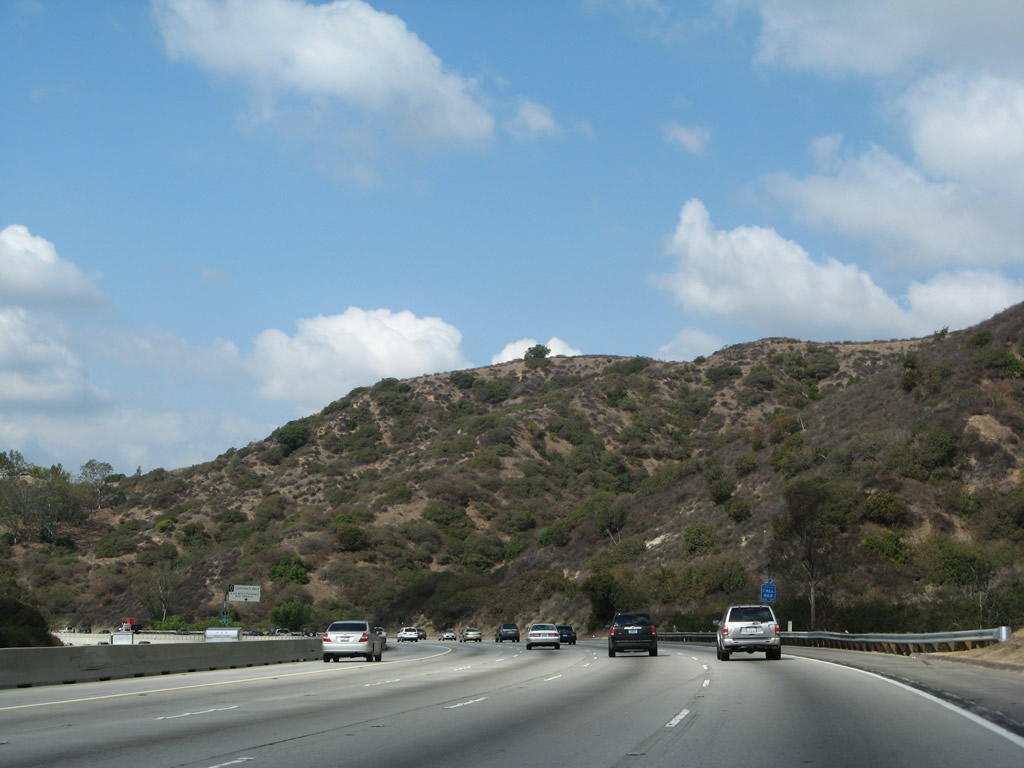
The north side of California 134 is undeveloped open space situated near the point where the cities of Glendale, Pasadena, and Los Angeles meet. Some of this open space is protected as part of Eagle Rock Hillside Park. Photo taken 09/29/07. |
|
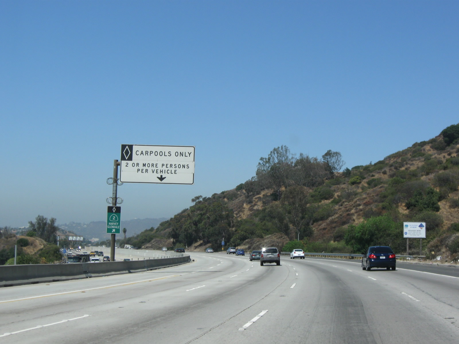
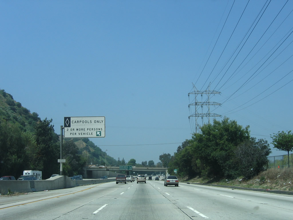
Shortly thereafter is a carpool (high occupancy vehicle or diamond lane) entrance/exit point. Carpools connecting to any of the next three exits including California 2 (Exit 9B) should depart the carpool lane here. Photo taken 07/15/09. |
|
California 2 is a major state highway through Los Angeles, Glendale, and La Canada-Flintridge. The state route ostensibly begins in Santa Monica, but significant sections of the route along Santa Monica Boulevard through Santa Monica, western Los Angeles, Beverly Hills, and West Hollywood are locally (not state) maintained. Between Interstate 5 and Interstate 210, California 2 follows the Glendale Freeway; at La Canada-Flintridge, California 2 becomes the Angeles Crest Highway and travels into the San Gabriel Mountains and Angeles National Forest. This scenic state route (which endured a catastrophic fire in September 2009), travels along the ridge of the San Gabriel Mountains. These mountains separate the Los Angeles basin with the Mojave Desert to the north. Photo taken 09/29/07. |
|
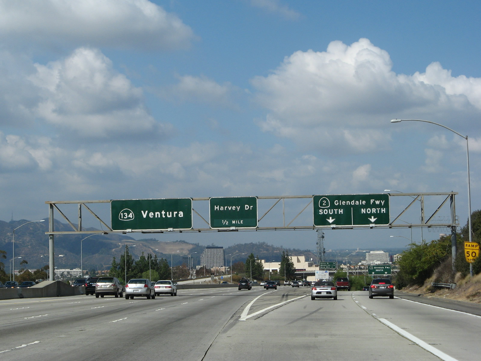
Westbound California 134 (Ventura Freeway) meet Exit 9B, California 2 (Glendale Freeway) north to La Canada-Flintridge and south to Echo Park. The next exit along westbound is Exit 9A, Harvey Drive; this is the first exit to serve the city of Glendale. Photo taken 09/29/07. |
|
Now on the transition ramp from California 134 (Ventura Freeway) west to Exit 9B, California 2 (Glendale Freeway), the left two lanes connect to California 2 south to Echo Park, while the right lane connects to California 2 north to La Canada-Flintridge. Photo taken 09/29/07. |
|
This mileage sign provides the distance to the next three exits along California 134 (Ventura Freeway) west: Exit 9A, Harvey Drive; Exit 8, Glendale Avenue; and Exit 7B, Brand Boulevard and Central Avenue. Photo taken 04/30/06. |
|
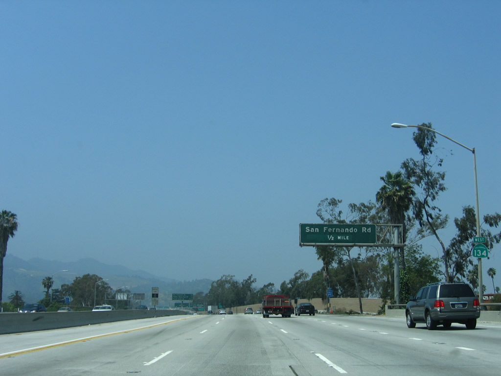
The next five exits along California 134 (Ventura Freeway) west serve the city of Glendale: Exit 9A, Harvey Drive; Exit 8, Glendale Avenue; Exit 7B, Brand Boulevard and Central Avenue; Exit 7A, Pacific Avenue; and Exit 6, U.S. 99/San Fernando Road. Upon passing through the California 2 interchange, westbound California 134 leaves the city of Los Angeles and enters Glendale. Situated at the southeastern end of the San Fernando Valley, Glendale ("The Jewel City") had a population of 194,973 as of the 2000 Census, consists of 30.7 square miles, and was incorporated on February 15, 1906. Photo taken 04/30/06. |
|
Westbound California 134 (Ventura Freeway) reaches Exit 9A, Harvey Drive. The flyover ramps overhead are part of the California 134-California 2 interchange. Photo taken 04/30/06. |
|
The next exit along California 134 (Ventura Freeway) west is Exit 8, Glendale Avenue (one mile). Photo taken 04/30/06. |
|
This mileage sign provides the distance to the next two exits along California 134 (Ventura Freeway) west: Exit 8, Glendale Avenue and Exit 7B, Brand Boulevard and Central Avenue. Photo taken 04/30/06. |
|
The right lane of California 134 (Ventura Freeway) west becomes exit only for Exit 8, Glendale Avenue. Prior to the construction of the Glendale Freeway, California 2 used to follow Glendale Avenue through the city of Glendale. Photo taken 04/30/06. |
|
An arched pedestrian bridge crosses over California 134. Photo taken 04/30/06. |
|
Westbound California 134 (Ventura Freeway) reaches Exit 8, Glendale Avenue. The next exit along westbound is Exit 7B, Brand Boulevard and Central Avenue. Photo taken 04/30/06. |
|
This mileage sign provides the distance to the next two exits along California 134 (Ventura Freeway) west: Exit 7B, Brand Boulevard and Central Avenue and Exit 7A, Pacific Avenue. Photo taken 04/30/06. |
|
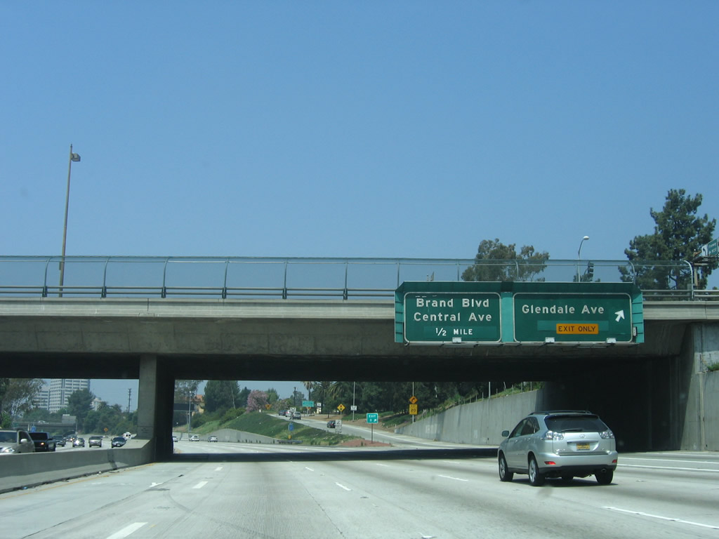
The right lane of California 134 (Ventura Freeway) west becomes exit only for Exit 7B, Brand Boulevard and Central Avenue in downtown Glendale. Photo taken 04/30/06. |
|
Westbound California 134 (Ventura Freeway) reaches Exit 7B, Brand Boulevard and Central Avenue. Both of these roads are north-south arterials that pass through downtown Glendale. This exit leads directly onto Goode Avenue, which is a one-way road going westbound that links Brand Boulevard and Central Avenue. The first intersection is with Brand Boulevard, and the second intersection is with Central Avenue. The next exit along westbound is Exit 7A, Pacific Avenue. Photo taken 04/30/06. |
|
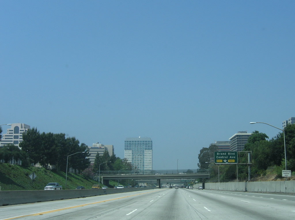
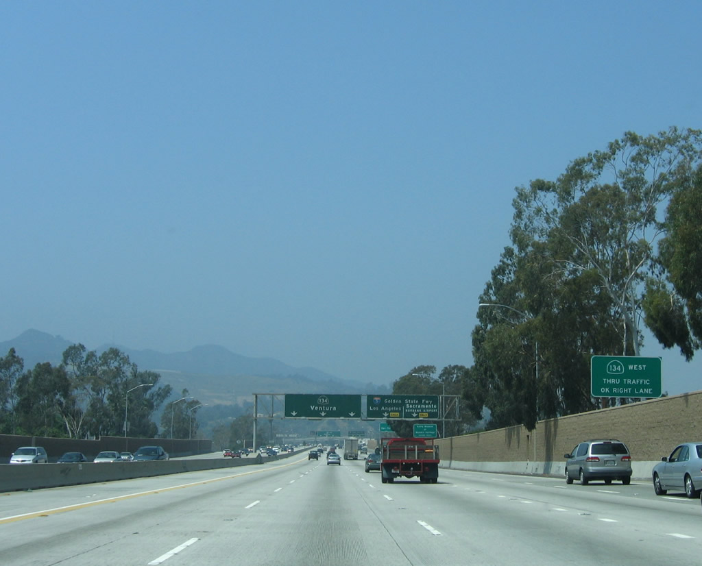
A surprising number of tall buildings line both sides of California 134 as the freeway travels through downtown Glendale. The HOV lane continues west along California 134. Photo taken 04/30/06. |
|
This mileage sign provides the distance to the next three exits along California 134 (Ventura Freeway) west: Exit 7A, Pacific Avenue; Exit 6, U.S. 99/San Fernando Road; and Exit 5, Interstate 5 (Golden State Freeway) to Zoo Drive. Photo taken 04/30/06. |
|
An overhead sign along California 134 (Ventura Freeway) west indicates that we are one mile prior to the off-ramp to Exit 5, Interstate 5 (Golden State Freeway) north to Sacramento and south to Los Angeles. The left four lanes (HOV lane plus three general purpose lanes) continue west along California 134 (Ventura Freeway). Photo taken 04/30/06. |
|
Eastbound California 134 (Ventura Freeway) reaches Exit 7A, Pacific Avenue. A carpool lane access point is ahead; all HOV traffic for San Fernando Road or Interstate 5 should exit the HOV lane at this point. Photo taken 04/30/06. |
|
A brief collector distributor lane segment provides access from California 134 west to Exit 7A and from Central Avenue to California 134 west. Photo taken 04/30/06. |
|
The next exit along California 134 (Ventura Freeway) west is Exit 6, U.S. 99/San Fernando Road. Like most other U.S. routes in California, U.S. 99 was legislatively decommissioned in 1964, and signs were removed in stages thereafter. U.S. 99 originally followed San Fernando Road through Los Angeles, Glendale, and Burbank before it was moved onto the Golden State Freeway (modern Interstate 5). At that time, San Fernando Road was recommissioned as U.S. 99 Business and later as Business Loop I-5 (both of those designations are now gone). Today San Fernando Road is signed with occasional Historic U.S. 99 shields. Photo taken 04/30/06. |
|
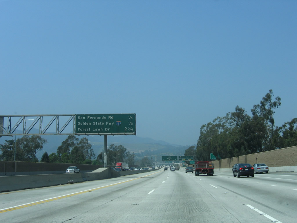
This mileage sign provides the distance to the next three exits along California 134 (Ventura Freeway) west: Exit 6, U.S. 99/San Fernando Road; Exit 5, Interstate 5 (Golden State Freeway) to Zoo Drive; and Exit 4, Forest Lawn Drive. Photo taken 04/30/06. |
|
Since the off-ramp to Exit 5, Interstate 5 (Golden State Freeway) (to Zoo Drive) functions as a collector distributor lane, it is possible to drive through the interchange on the c-d lane rather than use the main lanes in times of heavy traffic. Photo taken 04/30/06. |
|
Another overhead guide sign for both California 134 (Ventura Freeway) and Interstate 5 (Golden State Freeway) is posted prior to the off-ramp to Exit 6, U.S. 99/San Fernando Road. The left three main lanes plus the HOV lane continue west along California 134, while the right two lanes connect both to U.S. 99/San Fernando Road and Interstate 5 (Golden State Freeway). Photo taken 04/30/06. |
|
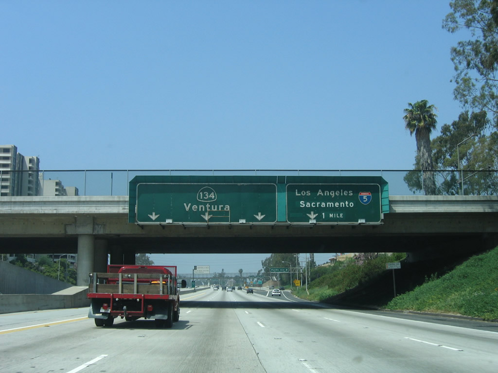
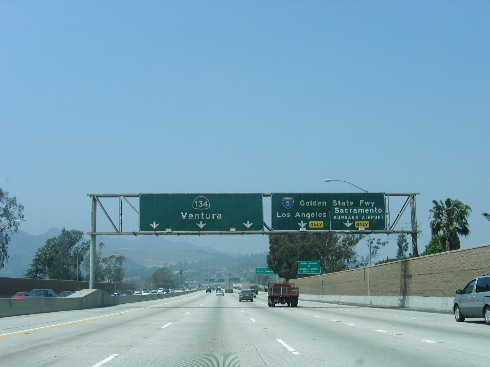
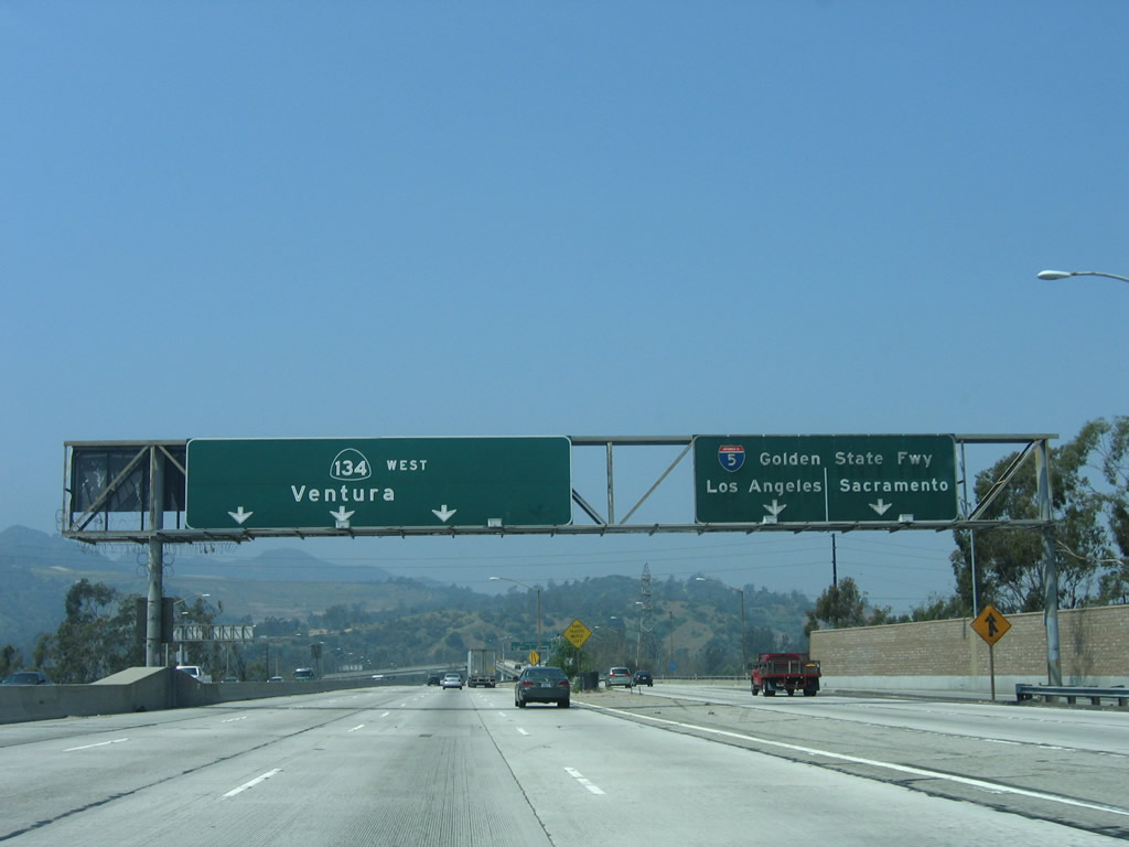
Use Exit 5, Interstate 5 (Golden State Freeway) to Zoo Drive to the Gene Autry Museum of Western Heritage, Los Angeles Zoo, and northern Griffith Park. This interchange also serves Interstate 5, which travels from San Diego north to Blaine, Washington. It is known as the Golden State Freeway from East Los Angeles north to the California 99 split in Kern County. Photo taken 04/30/06. |
|
Westbound California 134 (Ventura Freeway) reaches Exit 6, U.S. 99/San Fernando Road. The next exit from California 134 west is Exit 5, Interstate 5 (Golden State Freeway) to Zoo Drive. Photo taken 04/30/06. |
|
Immediately thereafter, California 134 (Ventura Freeway) west splits: the left four lanes (including the HOV lane, which ends here) continue west on California 134, while the right two lanes connect to Exit 5, Interstate 5 (Golden State Freeway) to Zoo Drive and Griffith Park. Photo taken 04/30/06. |
|
The right lane of California 134 (Ventura Freeway) west ends, leaving only three lanes to continue west through the interchange. Photo taken 04/30/06. |
|
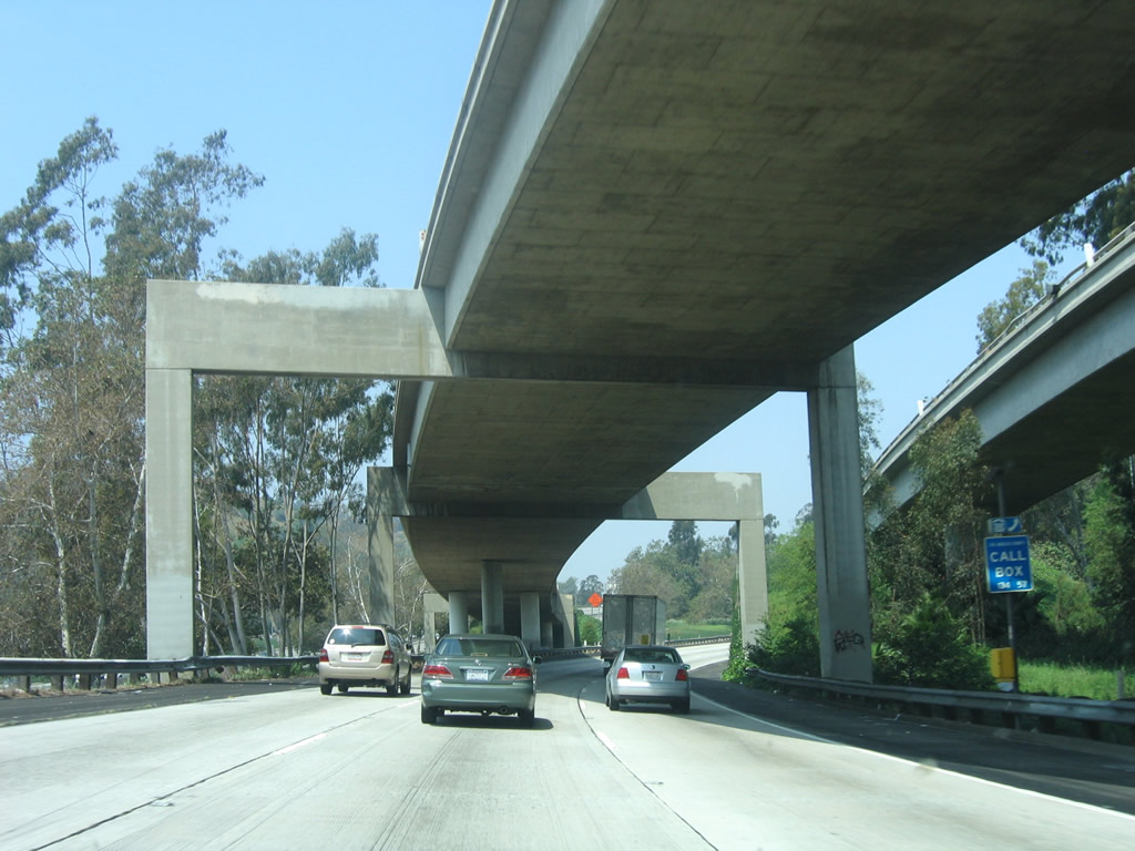
Now with three westbound lanes, westbound California 134 proceeds toward the Interstate 5 interchange. The collector distributor lanes associated with this interchange gain elevation above the main lanes. California 134 re-enters the city of Los Angeles as it crosses the Los Angeles River for the first time. Photo taken 04/30/06. |
|
This view looks at the collector distributor lanes from California 134 (Ventura Freeway) west to Interstate 5 (Golden State Freeway) south to downtown Los Angeles, Interstate 5 (Golden State Freeway) north to Bakersfield and Sacramento, and Zoo Drive to Griffith Park and Autry Museum. A Los Angeles Department of Water and Power (LADWP) power line crosses over the freeway at this point. Photo taken 04/30/06. |
|
The interchange between California 134 and Interstate 5 is known as the Gene Autry Memorial Interchange. Photo taken 04/30/06. |
|
Shortly thereafter the collector distributor lanes rise above the main lanes. At this point, traffic bound for Interstate 5 south split to the left. Photo taken 04/30/06. |
|
Quickly thereafter, the c-d lanes again split, with a left exit to Interstate 5 north and a right exit to Zoo Drive and California 134 west. The ramp from California 134 west to Interstate 5 north splits from the c-d lanes and crosses over the main lanes. The c-d lanes next approach the Zoo Drive off-ramp. Photo taken 04/30/06. |
|
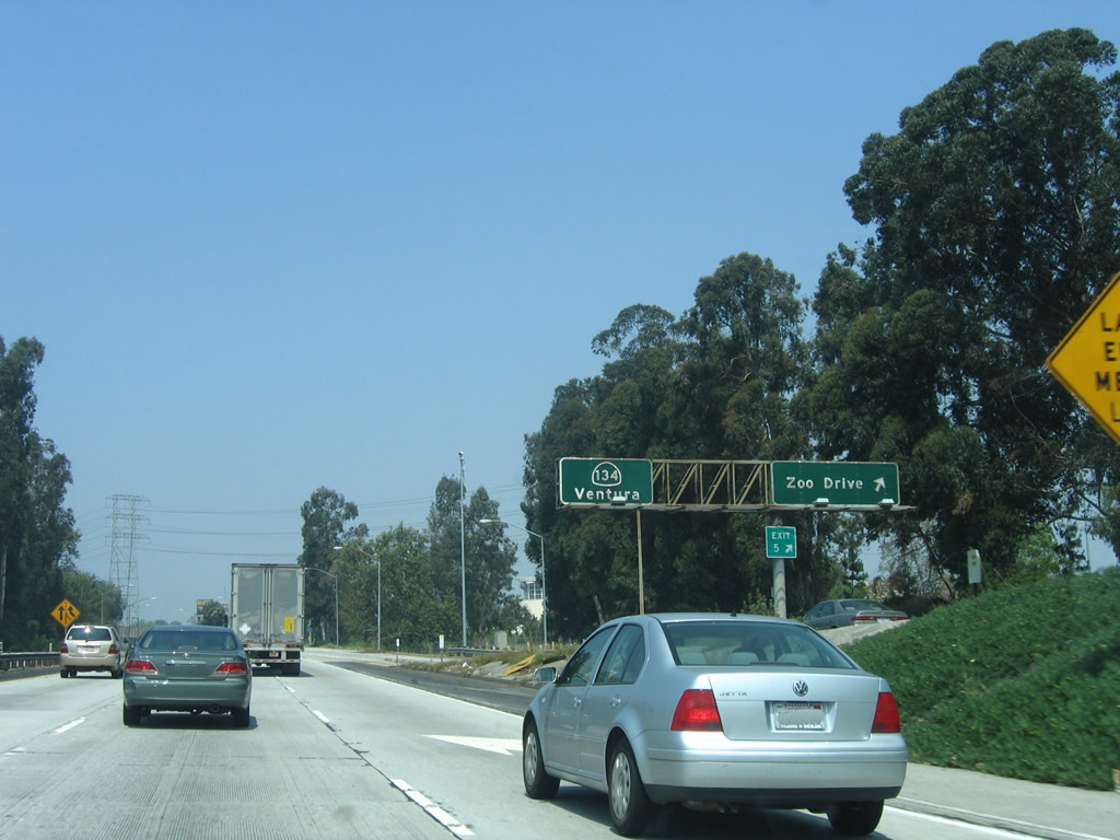
As the c-d lanes merge back onto the main lanes, the c-d lanes meet the Zoo Drive off-ramp. Zoo Drive is the first of two exits to serve sprawling Griffith Park, which is a huge open space park located just north of downtown Los Angeles west and south of the Los Angeles River. The park includes the Autry National Center, Greek Theater, Griffith Merry-Go-Round, Griffith Observatory, Griffith Park Southern Railroad, L.A. Equestrian Center, L.A. Live Steamers, L.A. Zoo, and Travel Town. Use Zoo Drive to Autry National Center and the L.A. Zoo. An old California 134 pull through sign is posted as the c-d lanes merge. Photo taken 04/30/06. |
|
Two new lanes join California 134 (Ventura Freeway) west on the left side of the freeway; these lanes come from Interstate 5 north. Photo taken 04/30/06. |
|
Westbound California 134 passes under Interstate 5. This unusual interchange was built this way partially due to the geography here. The Los Angeles River, which follows Interstate 5 north out of downtown Los Angeles, turns west abruptly at this point to follow California 134 west. In addition, Griffith Park and its mountains constrain the interchange's design. Photo taken 04/30/06. |
|
The Los Angeles River is easily identified because the Los Angeles Department of Water and Power (LADWP) power line follows the river through here. The HOV lanes resume at this point as well, now that we are clear of the Interstate 5 interchange. Photo taken 04/30/06. |
|
This mileage sign provides the distance to the next three exits along California 134: Exit 4, Forest Lawn Drive; Exit 3, Buena Vista Street; and Exit 2, Hollywood Way. Photo taken 04/30/06. |
|
The next exit along California 134 (Ventura Freeway) west is Exit 4, Forest Lawn Drive (one-half mile). Photo taken 11/25/04. |
|
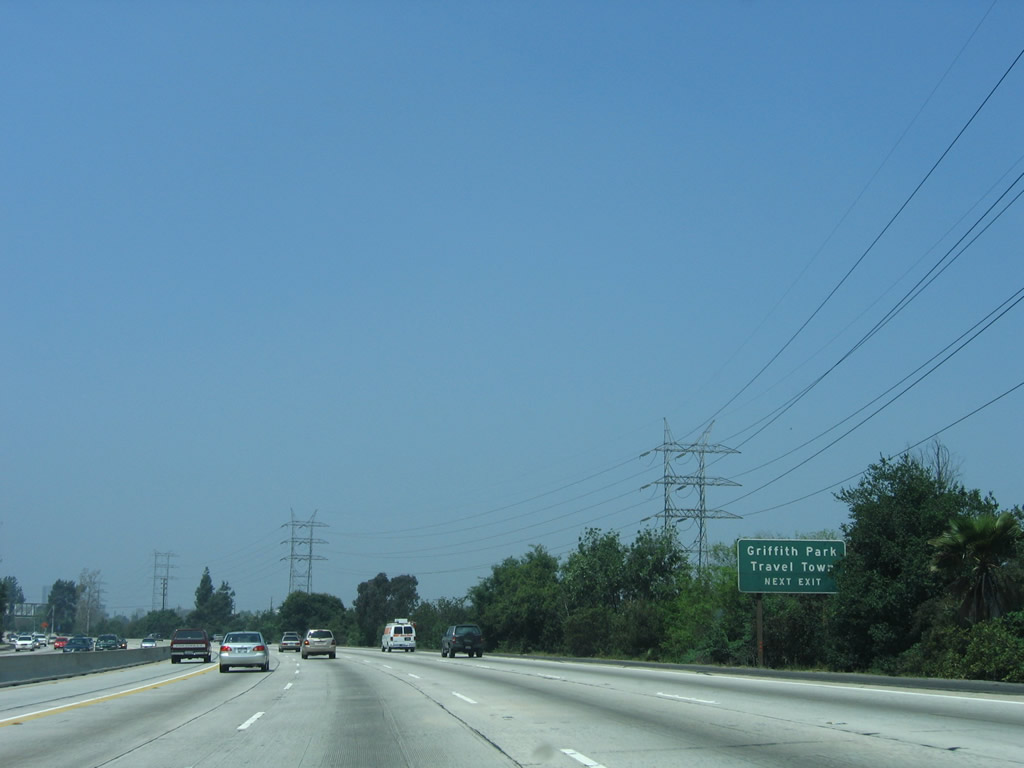
Forest Lawn Drive is the second exit to serve Griffith Park. Use Forest Lawn Drive south to Forest Lawn Memorial Park cemetery, Travel Town (a railroad museum), and Griffith Park Drive southeast through the park. Photo taken 04/30/06. |
|
Westbound California 134 (Ventura Freeway) reaches Exit 4, Forest Lawn Drive. Photo taken 11/25/04. |
|
This mileage sign provides the distance to the next three exits along California 134 (Ventura Freeway) west: Exit 3, Buena Vista Street; Exit 2, Hollywood Way; and Exit 1D, Cahuenga Boulevard. Photo taken 04/30/06. |
|
The Los Angeles River passes underneath and LADWP power lines cross over California 134 (Ventura Freeway) just west of the Forest Lawn Drive interchange. Upon crossing the river, California 134 leaves Los Angeles and briefly skirts the southwestern corner of the city of Burbank (population 100,316 [2000 Census], 17.4 square miles, incorporated on July 8, 1911). Photo taken 04/30/06. |
|
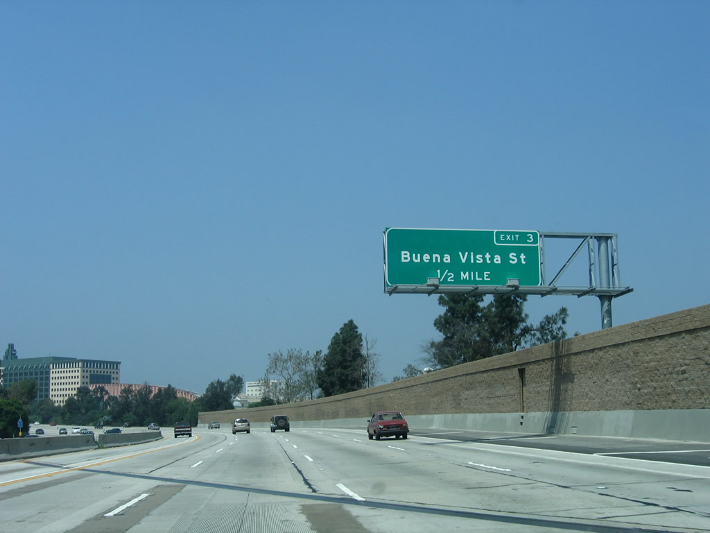
The next exit along California 134 (Ventura Freeway) west is Exit 3, Buena Vista Street (one-half mile). Photo taken 04/30/06. |
|
Westbound California 134 (Ventura Freeway) reaches Exit 3, Buena Vista Street. Look for the Walt Disney Studios on the north side of the freeway prior to the Buena Vista Street off-ramp. This corner of Burbank has multiple television and movie studios due to its proximity to Hollywood. The next exit along westbound is Exit 2, Hollywood Way. Photo taken 11/25/04. |
|
This mileage sign provides the distance to the next three exits along California 134 (Ventura Freeway) west: Exit 2, Hollywood Way; Exit 1D, Cahuenga Boulevard; and Exit 1C, Lankershim Boulevard. Photo taken 11/25/04. |
|
Westbound California 134 (Ventura Freeway) reaches Exit 2, Hollywood Way. The next exit along westbound is Exit 1D, Cahuenga Boulevard. On the north side of the freeway is NBC Studios, and on the south side of the freeway is Warner Brothers Studios. Photo taken 11/25/04. |
|
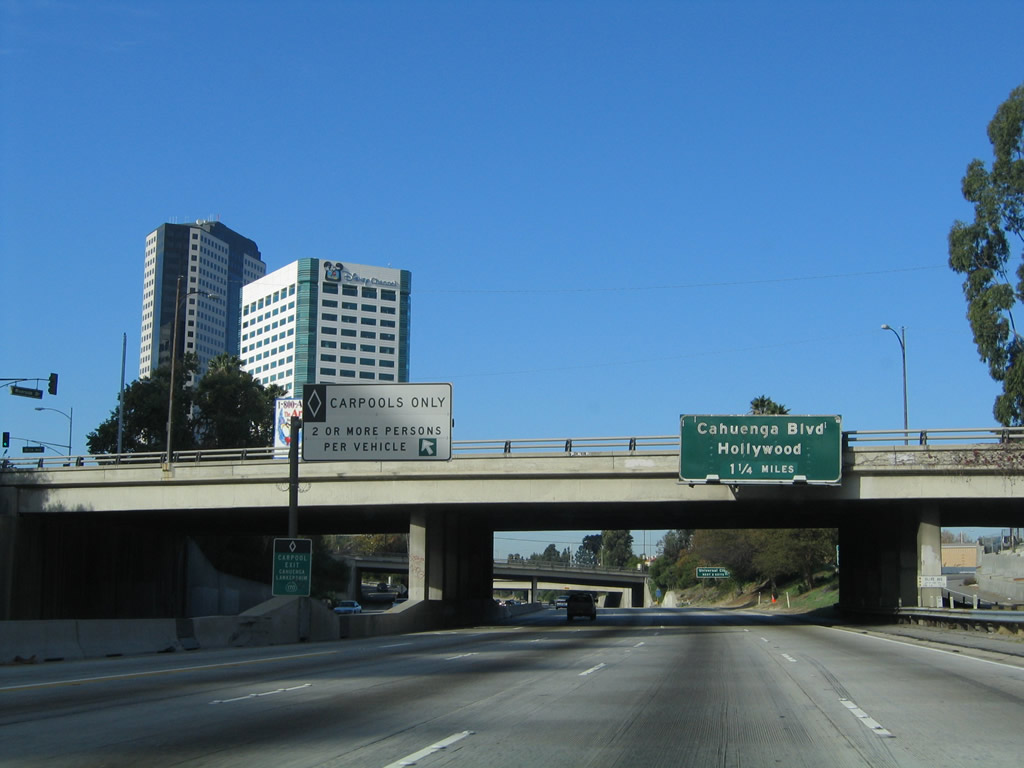
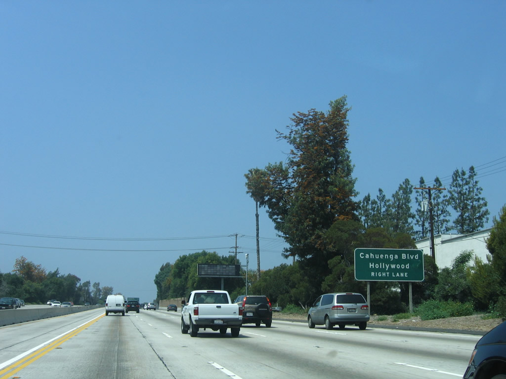
The next exit along California 134 (Ventura Freeway) west is Exit 1D, Cahuenga Boulevard. A carpool lane access is provided for access to the next three exits (Exit 1D, 1C, and 1B). Exit 1B, which has not been announced on an overhead sign yet, is the ramp from California 134 west to California 170 north. Photo taken 11/25/04. |
|
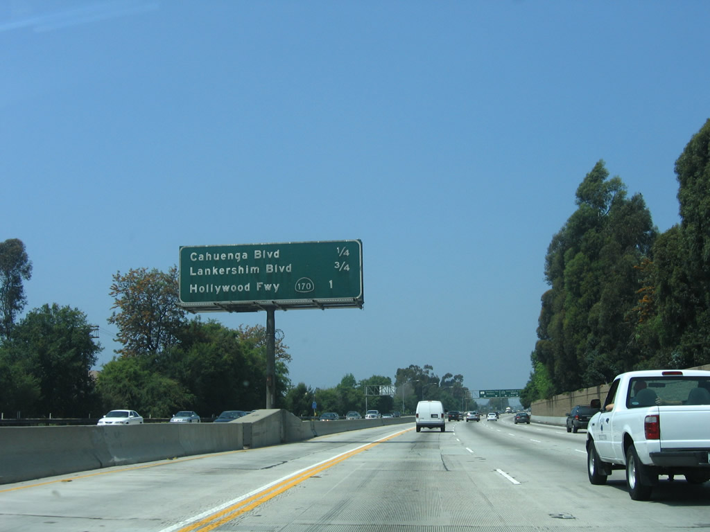
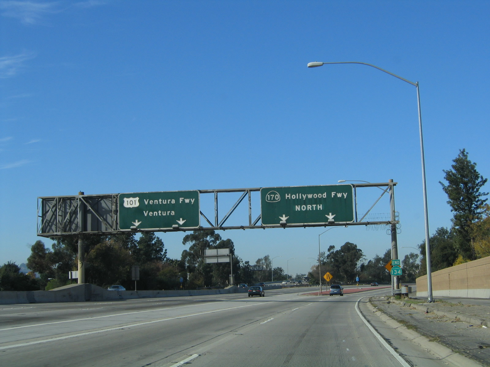
This mileage sign provides the distance to the next three exits along California 134 (Ventura Freeway) west: Exit 1D, Cahuenga Boulevard; Exit 1C, Lankershim Boulevard; and Exit 1B, California 170 (Hollywood Freeway) north. Photo taken 04/30/06. |
|
The final two exits along California 134 (Ventura Freeway) west are Exit 1B, California 170 (Hollywood Freeway) north and Exit 1A, U.S. 101 (Ventura Freeway) north (west) to Ventura and Santa Barbara. Photo taken 11/25/04. |
|
Westbound California 134 (Ventura Freeway) reaches Exit 1D, Cahuenga Boulevard. The next exit is Exit 1C, Lankershim Boulevard. Photo taken 04/30/06. |
|
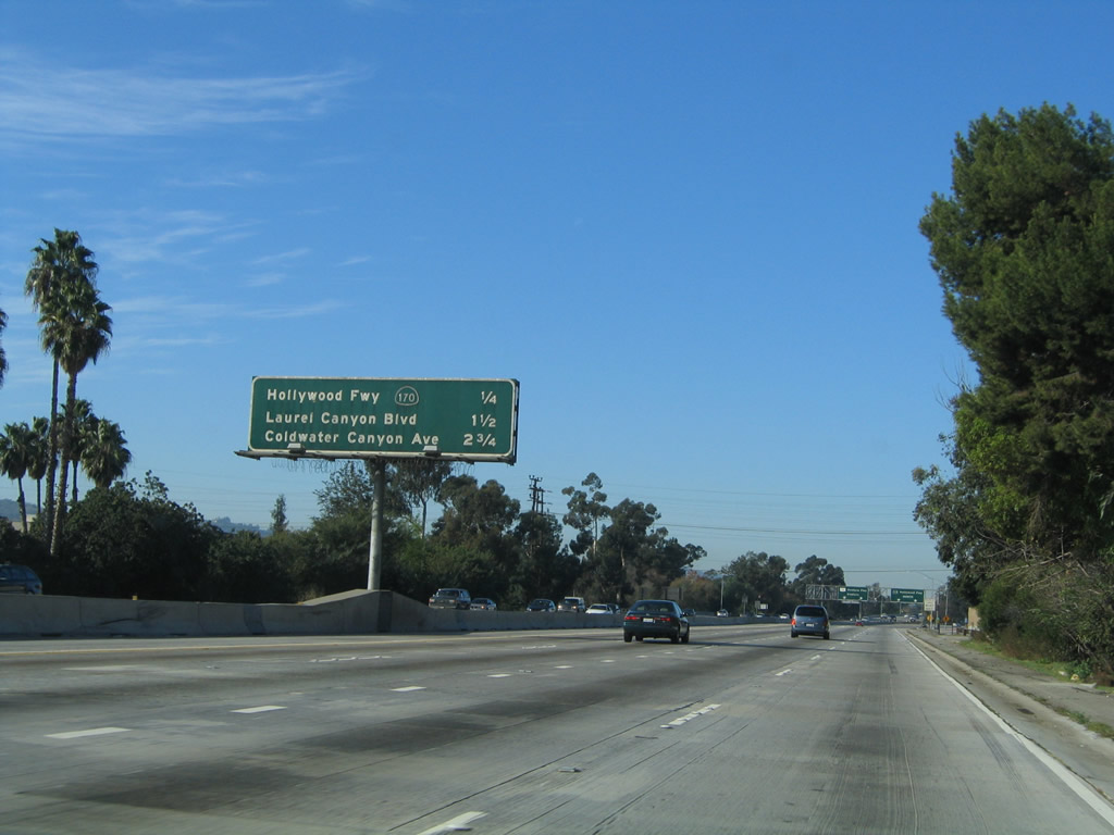
This mileage sign provides the distance to three of the next four exits along California 134 and U.S. 101 (Ventura Freeway) west: Exit 1C, Lankershim Boulevard; Exit 1B, California 170 (Hollywood Freeway) north; (Exit 1A, U.S. 101 (Ventura Freeway) north/west;) and U.S. 101 Exit 14, Laurel Canyon Boulevard. Photo taken 04/30/06. |
|
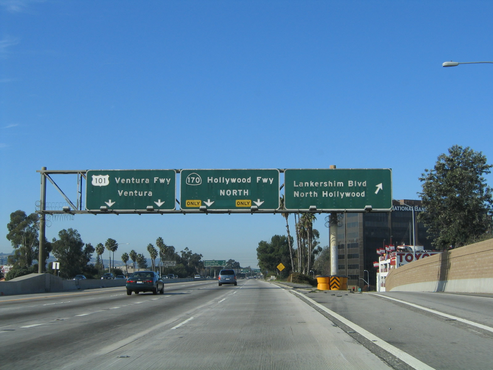
Use Exit 1C, Lankershim Boulevard south to Universal City and north to the Metro Station for the connection to the Red Line subway south to Hollywood and downtown L.A. Photo taken 04/30/06. |
|
To U.S. 101 (Hollywood Freeway) south, use Exit 1C, Lankershim Boulevard south. There is no direct access ramp from California 134 west to U.S. 101 south. Photo taken 11/25/04. |
|
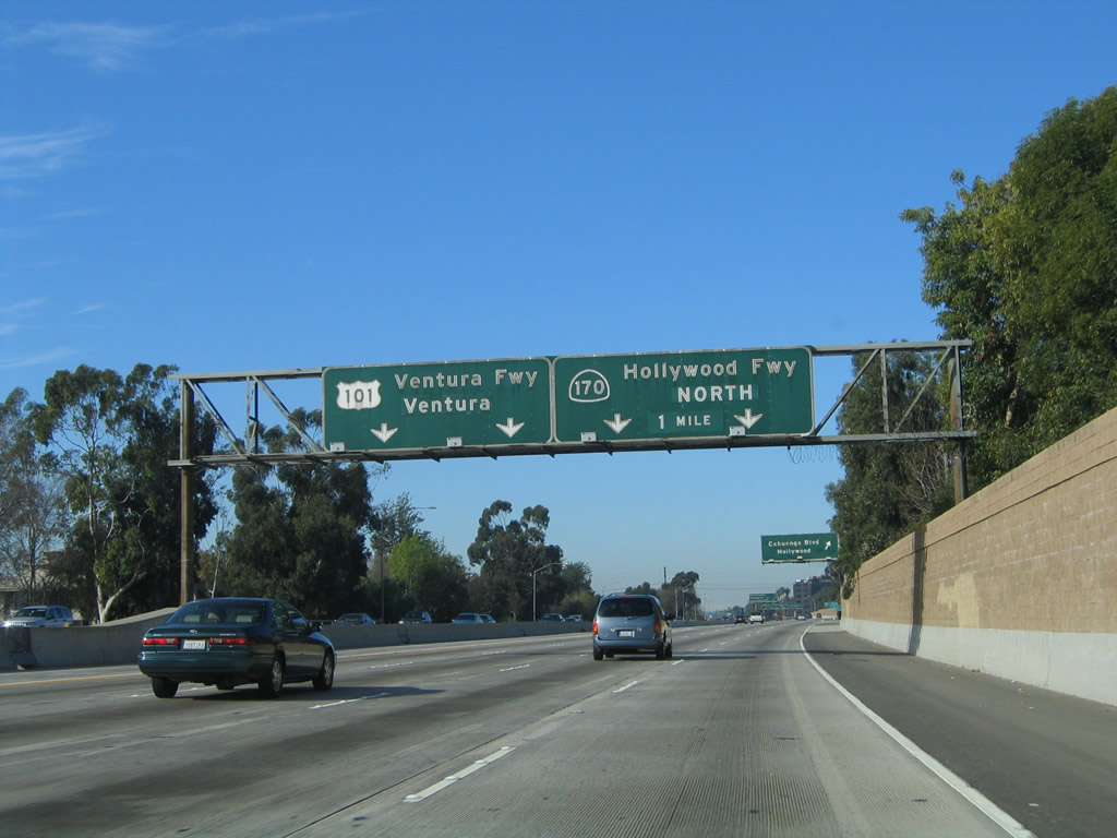
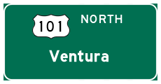
Westbound California 134 (Ventura Freeway) reaches Exit 1C, Lankershim Boulevard. As California 134 comes to its western terminus, the left two lanes (and HOV lane) connect to U.S. 101 north (west), while the right two lanes link to California 170 north. Photo taken 11/25/04. |
|
This mileage sign provides the distance to three of the next four exits along California 134 and U.S. 101 (Ventura Freeway) west: Exit 1B, California 170 (Hollywood Freeway) north; (Exit 1A, U.S. 101 (Ventura Freeway) north/west); U.S. 101 Exit 14, Laurel Canyon Boulevard; and U.S. 101 Exit 15, Coldwater Canyon Road. Photo taken 11/25/04. |
|
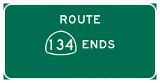
Westbound California 134 reaches Exit 1B, California 170 (Hollywood Freeway) north. An end California 134 shield is posted at the base of this sign bridge. For traffic continuing west on U.S. 101, the right lane will end. Only two lanes make the transition to U.S. 101 west. The HOV lane also ends at this point and becomes a general purpose (main) lane. Photo taken 11/25/04. |
|
Two lanes of westbound California 134 enter the Hollywood Split interchange, which is officially known as the Bruce Hinman Memorial Interchange. Photo taken 04/30/06. |
|
Traffic from U.S. 101 north merges onto the Ventura Freeway from the left. Photo taken 04/30/06. |
Page Updated November 5, 2011.