

Interstate 10 East - Interstate 5 to California 19
| Spur I-10 (California 10)/San Bernardino Freeway (Former Interstate 110) east | |
|---|---|
 |
Spur I-10 begins at the split from U.S. 101 (Santa Ana Freeway) Exit 1D. The two left lanes of U.S. 101 transition to Spur I-10 east, and the two right lanes continue south on U.S. 101 south to connect with Interstate 5. The First Street exit shown is for traffic remaining on U.S. 101 south. Photo taken 11/08/08. |
 |
Since the connection to Spur I-10 east to Interstate 10 east is a left exit, the two lanes immediately cross over the northbound lanes of U.S. 101. The northbound lanes pass through a tunnel below the eastbound lanes of Spur I-10 (California 10). Photo taken 11/08/08. |
 |
 |
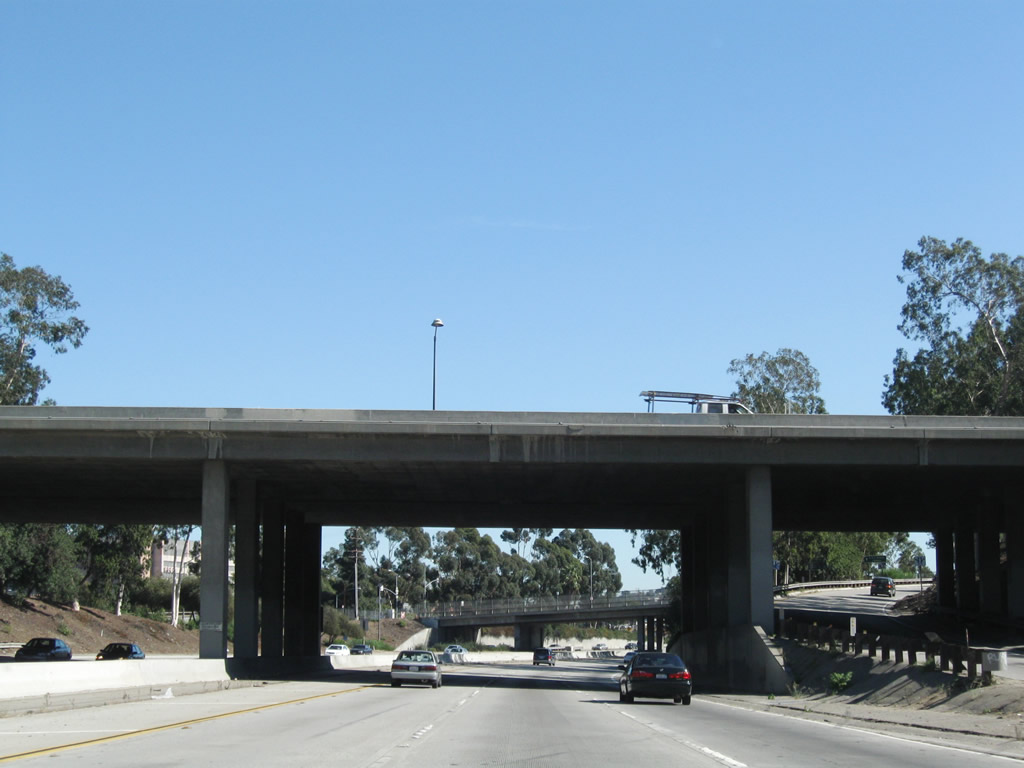
Turning east, the San Bernardino Freeway passes under the historic Macy Street bridge, which currently carries Cesar Chavez Street over Spur I-10 and the Metrolink. Photo taken 11/08/08. |
 |
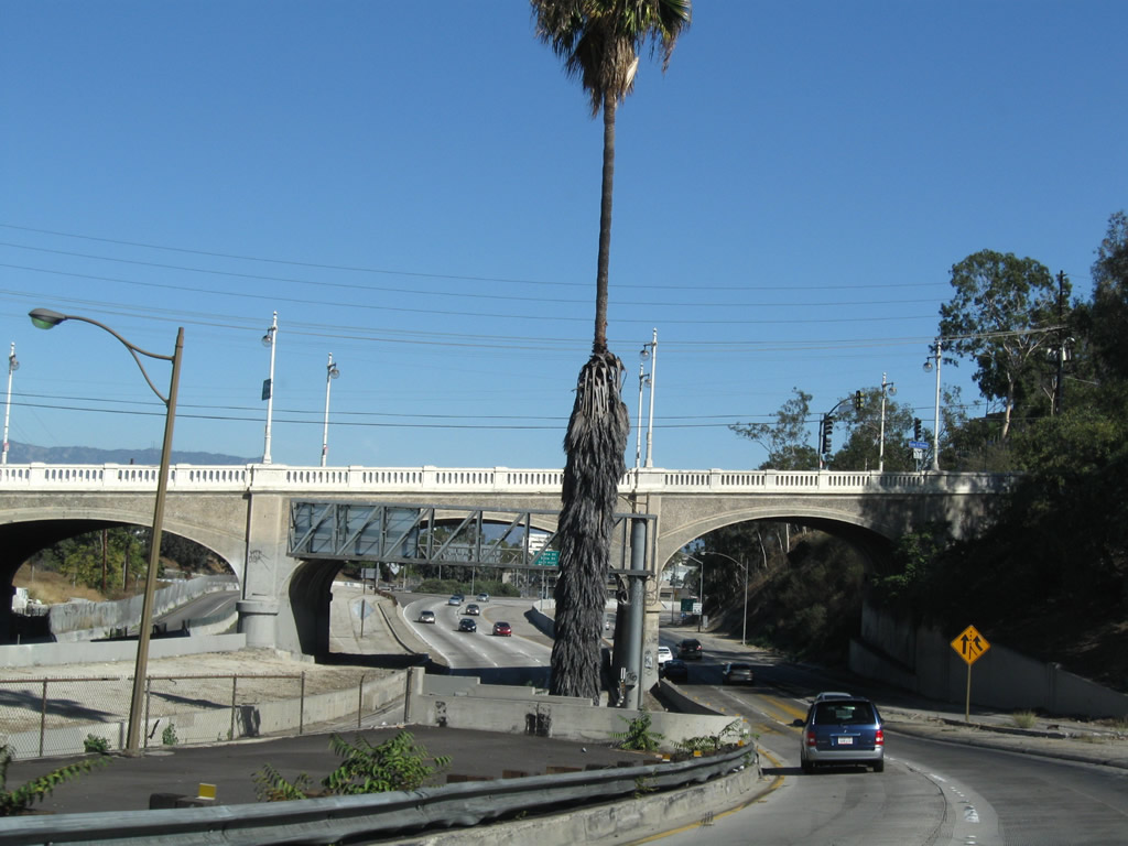
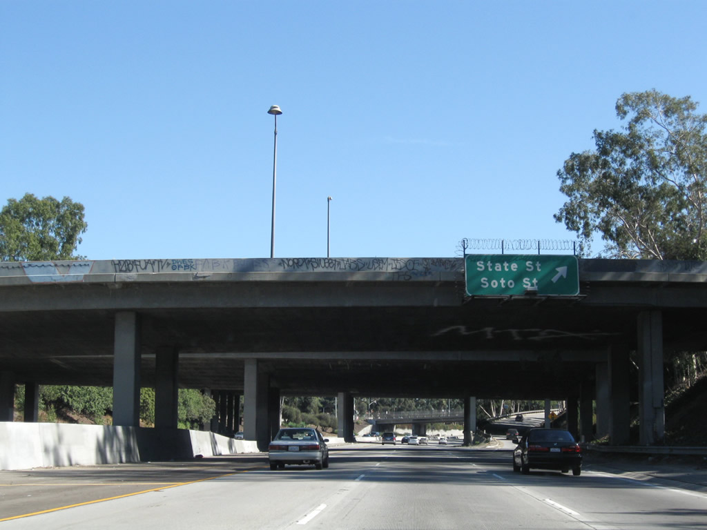
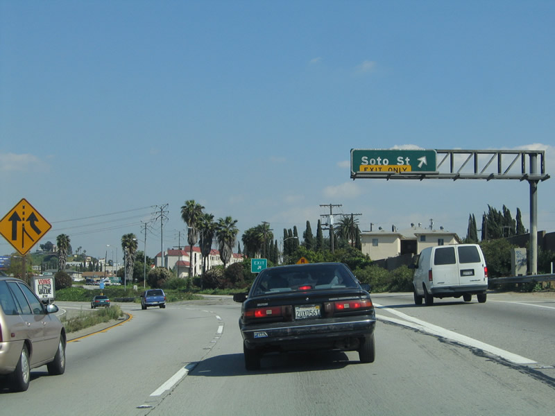
The only standalone exit from eastbound Spur I-10 is to Exit 18, State Street and Soto Street (next right). Photo taken 11/08/08. |
 |
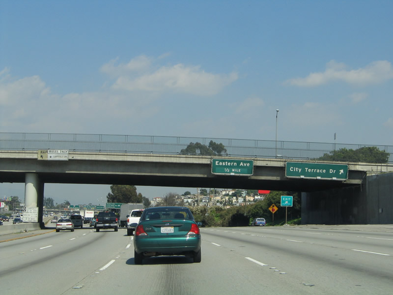
This mileage sign provides the distance to the next three exits along Spur I-10 and Interstate 10 (San Bernardino Freeway) east: Exit 18, Soto Street and State Street; Exit 20A, City Terrace Drive and Herbert Avenue; and Exit 20B, Eastern Avenue to California State University Los Angeles (CSULA). Photo taken 11/08/08. |
 |
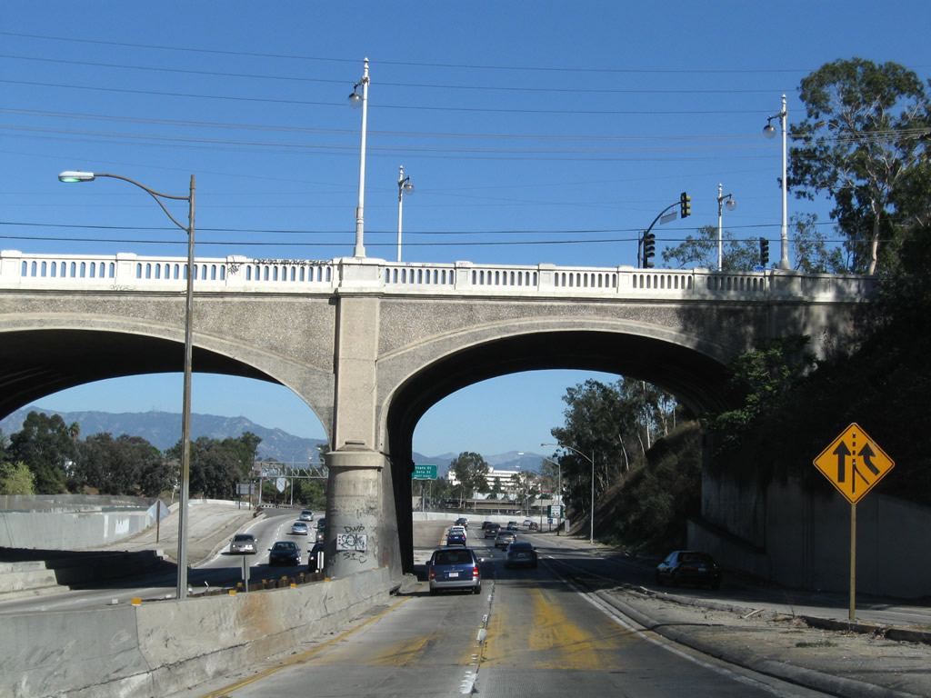
Eastbound Spur I-10/San Bernardino Freeway reaches Exit 18, Soto Street and State Street. This exit ramp leads to a traffic signal at State Street. After that signal, motorists for Soto Street continue straight ahead as if getting back onto the eastbound freeway. The ramp then merges with mainline Interstate 10 traffic as Interstate 10 shifts from the Golden State Freeway to the San Bernardino Freeway, then connects to Exit 19 ramp to Soto Street and Wabash Avenue (see below for a view of this ramp to Soto Street). After this exit ramp, the three lanes of eastbound Spur I-10/San Bernardino Freeway passes under the westbound transition lanes that carry mainline Interstate 10 west from Interstate 10 (San Bernardino Freeway) west to Interstate 5 (Golden State Freeway) south. Photo taken 11/08/08. |
 |
Here, the eastbound lanes of the San Bernardino Freeway next pass under both the south and northbound lanes of Interstate 5 (Golden State Freeway). Photo taken 11/08/08. |
 |
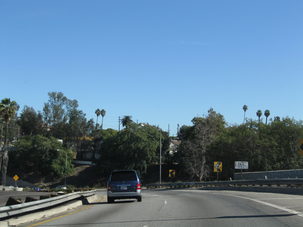
The San Bernardino Freeway passes under State Street. The merge ahead is mainline Interstate 10 coming onto the San Bernardino Freeway. Photo taken 11/08/08. |
 |
Spur I-10 (California 10) ends as Interstate 10 merges onto the San Bernardino Freeway from the right. Photo taken 11/08/08. |
| Interstate 10 (San Bernardino Freeway) east | |
|---|---|
 |
Now back to mainline Interstate 10 at the point where Interstate 10 diverges from Interstate 5: The right two lanes of Interstate 5 (Golden State Freeway) split for Interstate 10 (San Bernardino Freeway) east toward San Bernardino. This major freeway carries a great deal of traffic east and is commonly busy, with delays likely during the height of commuting hours. Nevertheless, Interstate 10 is a major linking corridor between downtown Los Angeles and San Bernardino. Photo taken 03/25/05. |
 |
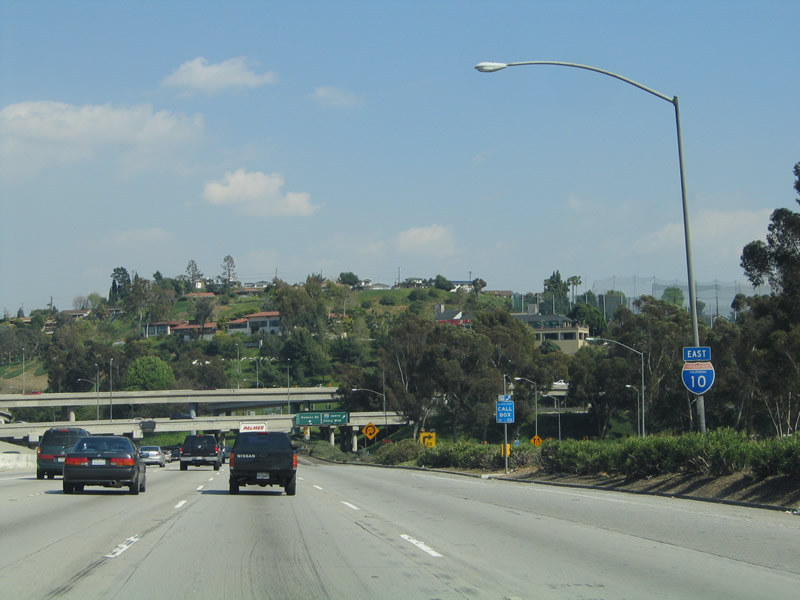
Now on the transition ramp from Interstate 5 north to Interstate 10 east, a reassurance sign assembly advises of Interstate 10's name, which is the San Bernardino Freeway. It will carry this name from here until the Interstate 215 interchange south of downtown San Bernardino. Photo taken 03/25/05. |
 |
Still on the transition ramp, eastbound Interstate 10 (San Bernardino Freeway) reaches Exit 19, Soto Street and Wabash Avenue. Use Soto Street north to the Los Angeles-University of Southern California Medical Center hospital. Several new lanes of traffic merge onto Interstate 10 from the left; these lanes carry the transition from U.S. 101 south to Interstate 10 east. Photo taken 03/25/05. |
 |
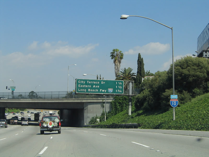 |
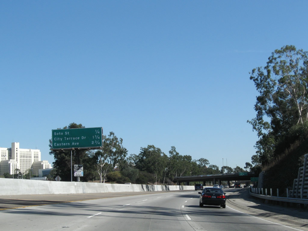
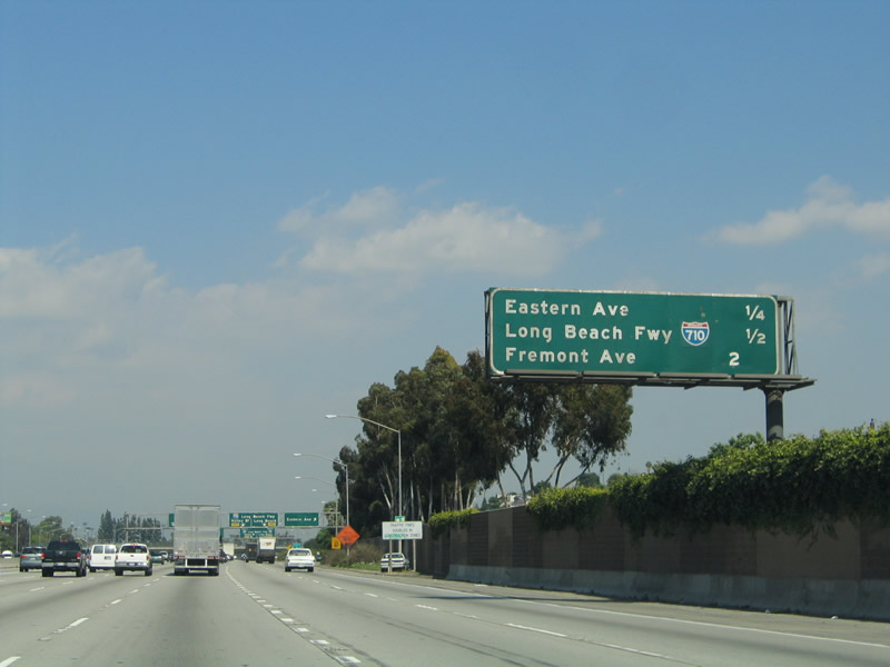
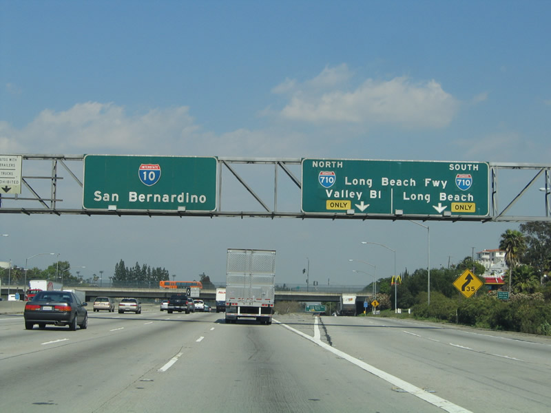
After merging with Spur I-10, this mileage sign provides the distance to the next three exits along Interstate 10 (San Bernardino Freeway) east: Exit 20A, City Terrace Drive and Herbert Avenue; Exit 20B, Eastern Avenue to California State University Los Angeles; and Exit 21, Interstate 710 (Long Beach Freeway) north to Valley Boulevard in Alhambra and south to Long Beach. Interstate 10 follows the alignment of Old U.S. 60-70-99 from Interstate 5 to Pomona, where U.S. 60 historically split from U.S. 70-99. Photos taken 11/08/08 and 03/25/05. |
 |
 |
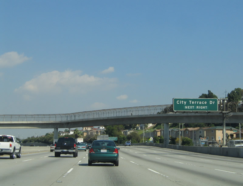
The next exit along eastbound Interstate 10 (San Bernardino Freeway) is Exit 20A, City Terrace Drive and Herbert Avenue. This interchange serves the unincorporated community of City Terrace, which is nestled between the city of Los Angeles and the city of Monterey Park. A new reflective sign was added here by 2008. The 2005 photo shows the original sign with the 1971 exit numbering tab, which was removed. Oddly, the new reflective sign has no replacement exit number! Maybe new exit tabs will be installed later. Photos taken 11/08/08 and 03/25/05. |
 |
 |
The third exit along Interstate 10 is Exit 21, Interstate 710 (Long Beach Freeway). This sign provides lane allocation for the Interstate 710 interchange. A high occupancy vehicle (HOV) lane begins at this point. Photos taken 11/08/08 and 03/25/05. |
 |
 |
City Terrace Drive and Herbert Avenue serve unincorporated City Terrace, which is nestled between the Boyle Heights neighborhood of the city of Los Angeles on the west and the city of Monterey Park to the east. Photos taken 11/08/08 and 03/25/05. |
 |
 |
Eastbound Interstate 10 (San Bernardino Freeway) reaches Exit 20A, City Terrace Drive and Herbert Avenue. Photos taken 11/08/08 and 03/25/05. |
 |
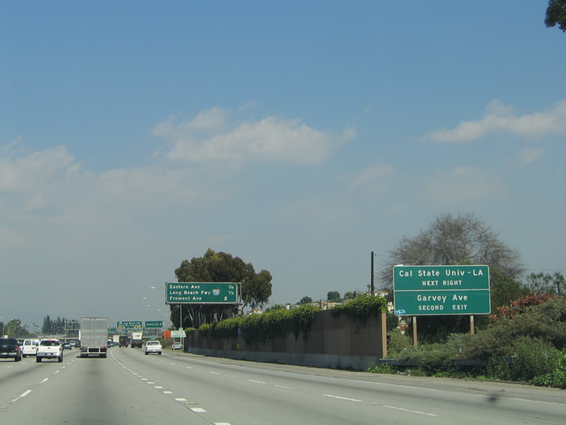 |
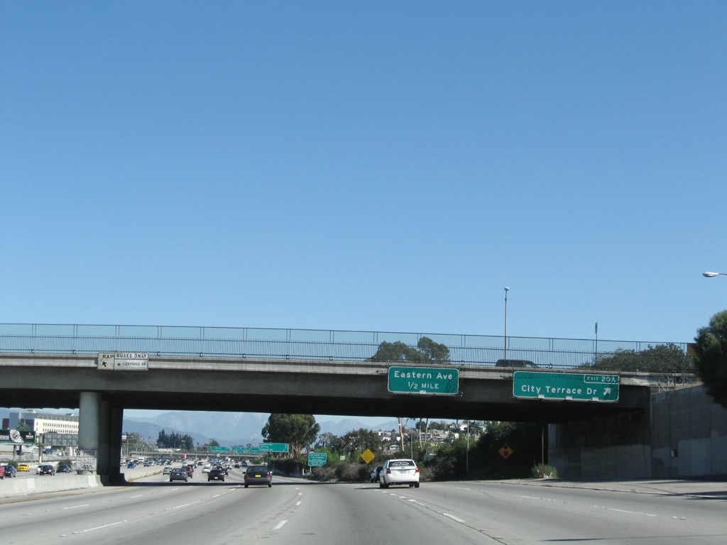
The next exit along Interstate 10 (San Bernardino Freeway) east is Exit 20B, Eastern Avenue to California State University Los Angeles. To Garvey Avenue, use Exit 21, Interstate 710 and follow the ramp toward Interstate 710 north, then depart at the Garvey Avenue off-ramp. The new reflective signs could have used exit numbers here, but they were instead replaced with exactly the same text as the previous signs. Photos taken 11/08/08 and 03/25/05. |
 |
 |
This mileage sign provides the distance to the next three exits along Interstate 10 (San Bernardino Freeway) east: Exit 20B, Eastern Avenue to California State University Los Angeles; Exit 21, Interstate 710 (Long Beach Freeway); and Exit 22, Fremont Avenue. Photos taken 11/08/08 and 03/25/05. |
 |
 |
Eastbound Interstate 10 (San Bernardino Freeway) reaches Exit 20B, Eastern Avenue to California State University Los Angeles. The right two lanes become exit only for Interstate 710. Briefly, Interstate 10 will clip the northwestern corner of Monterey Park, as most of the Interstate 10-710 interchange sits within Monterey Park's limits. This city was home to 60,051 people as of the 2000 Census and incorporated on May 29, 1916. Photos taken 11/08/08 and 03/25/05. |
 |
 |
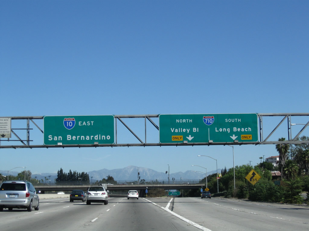
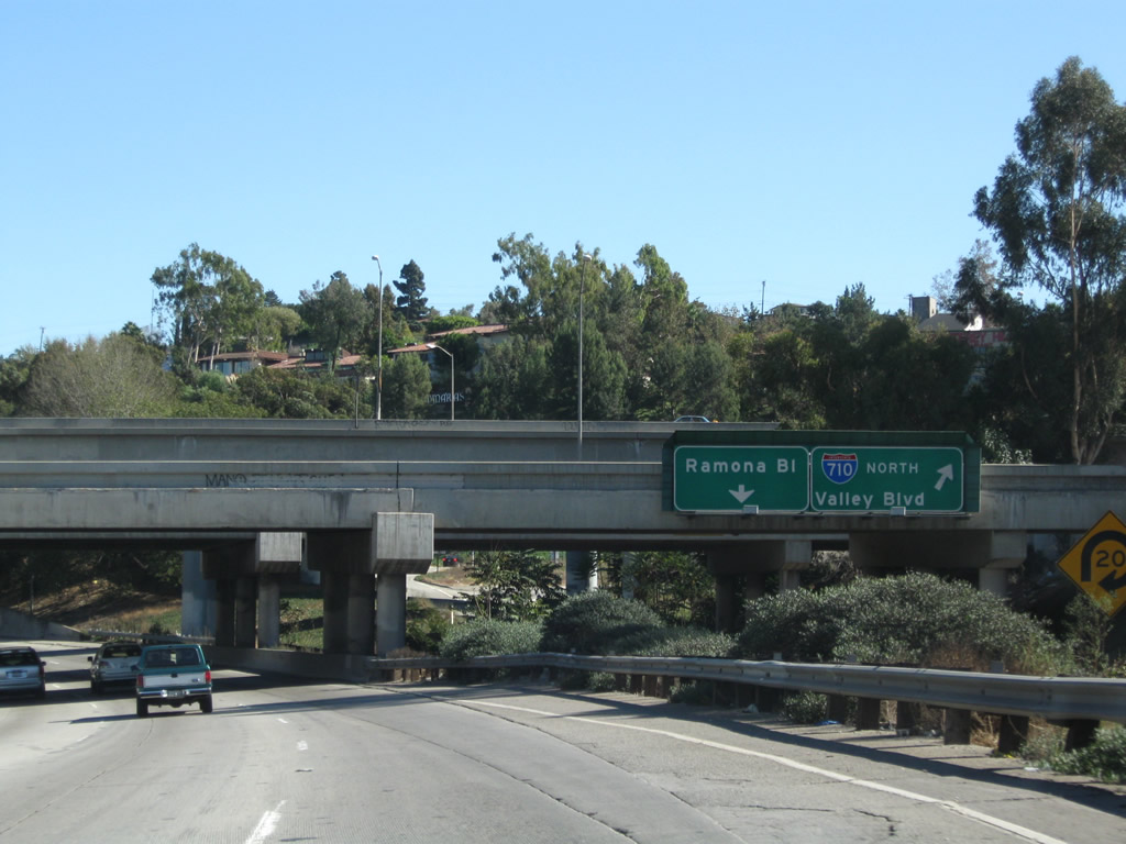
Immediately thereafter, Interstate 10 east meets Interstate 710 at this stack interchange (Exit 21). The control city for Interstate 710 north is "Valley Boulevard" due to the unrealized extension of the freeway north to Pasadena. While plans still call for a tunnel to bring the freeway under the city of South Pasadena, such an extension is years and years (and many lawsuits) away. To the south, Interstate 710 travels through the Los Angeles Basin toward Long Beach. The new signs do not include the "Long Beach Freeway" designation for Interstate 710. Exit 21 also connects to Ramona Boulevard. Photos taken 11/08/08 and 03/25/05. |
 |
Interstate 10 passes under Eastern Avenue. Photo taken 11/08/08. |
 |
This on-ramp carries traffic from Eastern Avenue onto Interstate 10 east. Photo taken 11/08/08. |
 |
An Interstate 10 east reassurance shield is posted after the Eastern Avenue on-ramp. Photo taken 03/25/05. |
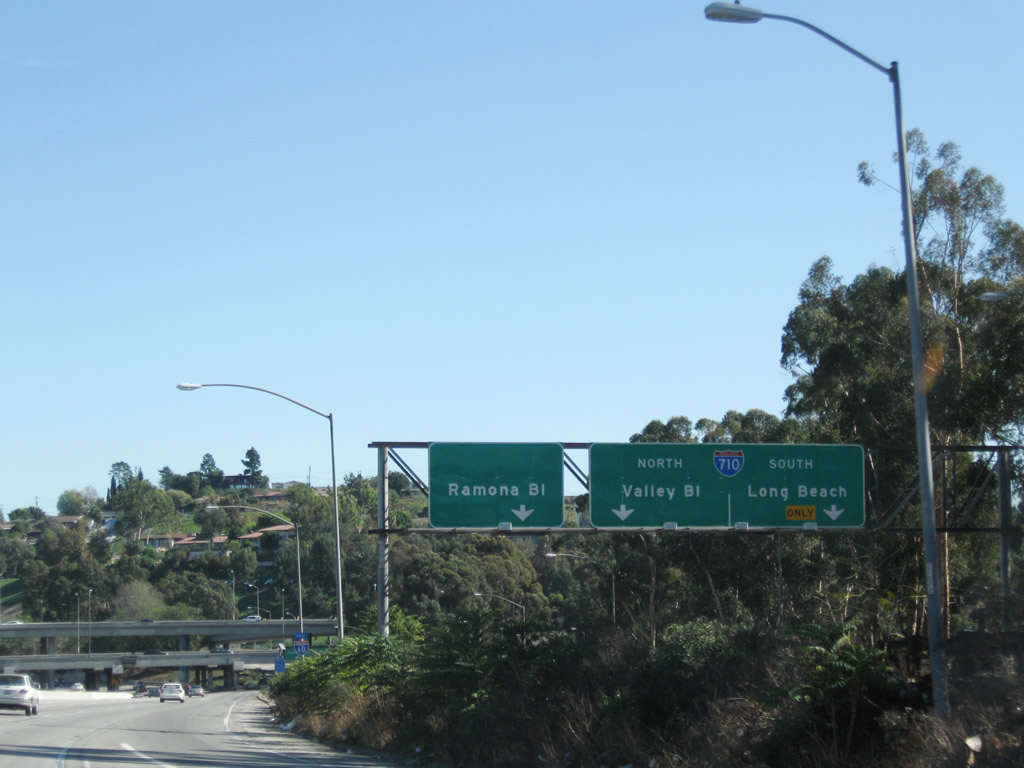 |
Meanwhile, signage for the Interstate 710 transition ramp comes into view. The off-ramp splits into lane allocations for Interstate 710 south, Interstate 710 north to Valley Boulevard, and Ramona Boulevard. Photo taken 11/08/08. |
 |
The stack interchange with Interstate 710 comes into view along Interstate 10 east. Photo taken 03/25/05. |
 |
Approaching the stack interchange, more signs direct motorists on the transition ramp to Interstate 710 north and Ramona Boulevard. Photo taken 11/08/08. |
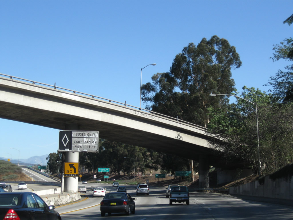 |
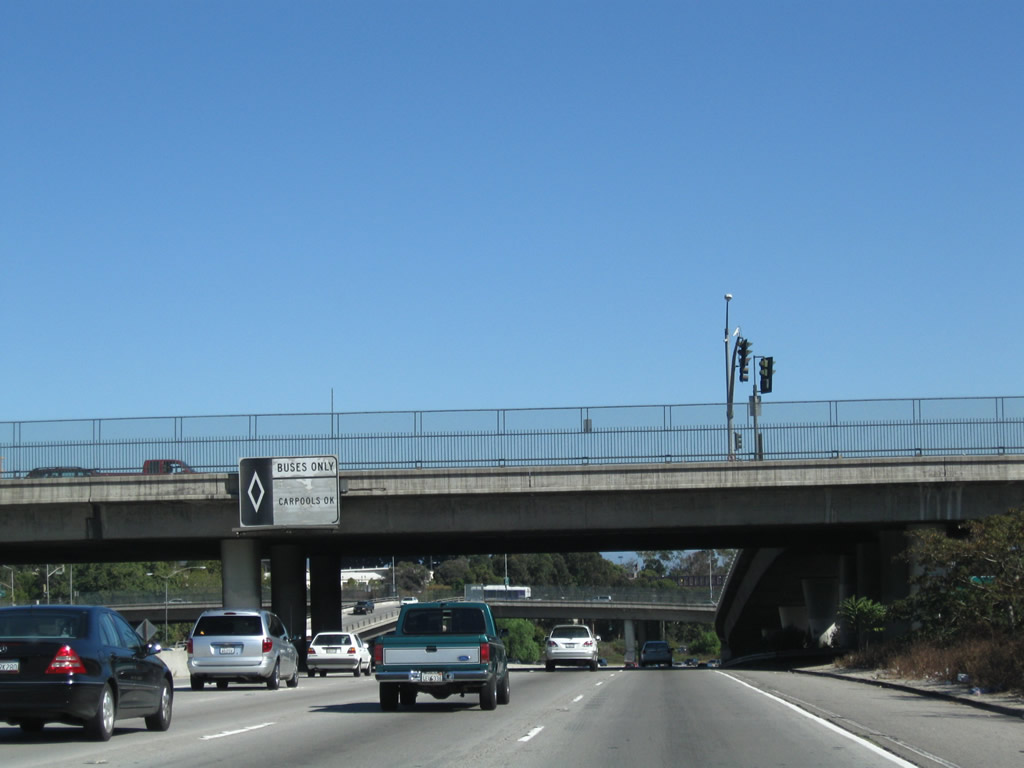
Passing through the Interstate 710 interchange, the carpool (HOV) lane merges with the eastbound Busway, then will return to grade. Photo taken 11/08/08. |
 |
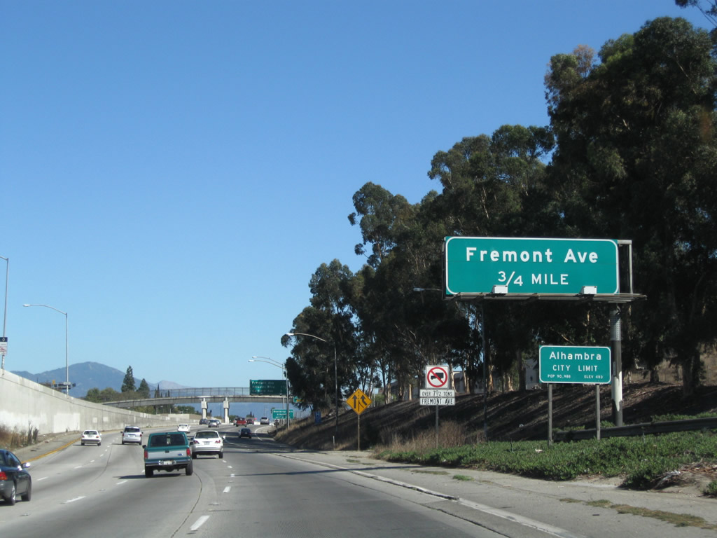
After the Interstate 710 interchange, Interstate 10 turns a bit to the northeast. The next exit along Interstate 10 east is Exit 22, Fremont Avenue. Use Fremont Avenue north to the city of South Pasadena. Photo taken 03/25/05. |
 |
 |
At this point, Interstate 10 leaves Monterey Park and enters the city of Alhambra. Incorporated on July 11, 1903, Alhambra had a population of 85,804 people as of the 2000 Census. Exit 22 (Fremont Avenue) provides access to the city of Alhambra. The 1971 exit number sign for Exit 22 was removed and replaced with a reflective sign with no exit number. Photos taken 11/08/08 and 03/25/05. |
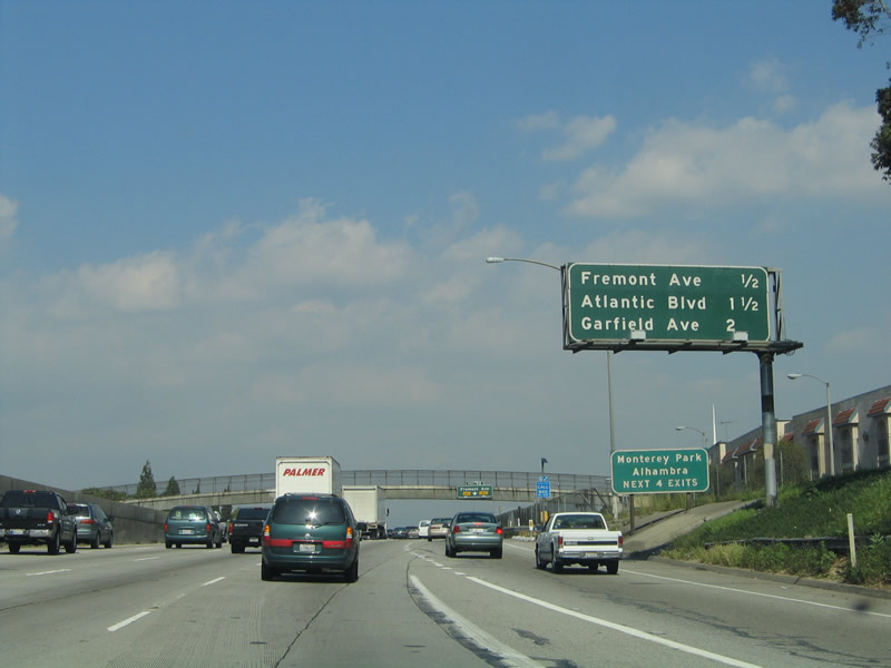 |
This mileage sign provides the distance to the next three exits along Interstate 10 (San Bernardino Freeway) east: Exit 22, Fremont Avenue; Exit 23A, Atlantic Boulevard; and Exit 23B, Garfield Avenue. Photo taken 03/25/05. | |
 |
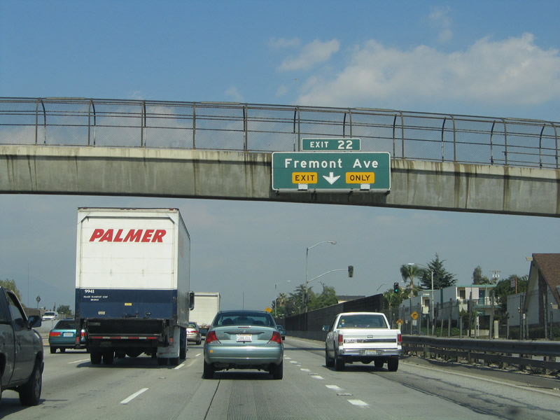 |
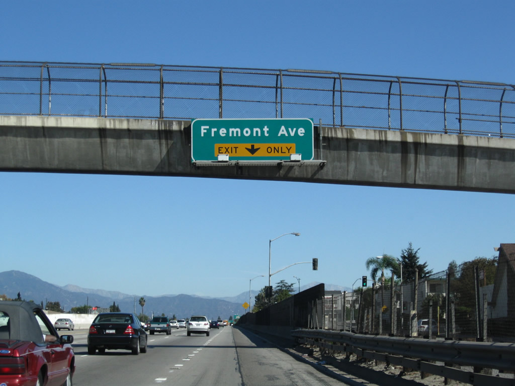
The right lane of Interstate 10 east becomes exit only for Exit 22, Fremont Avenue. Photos taken 11/08/08 and 03/25/05. |
 |
 |
Eastbound Interstate 10 (San Bernardino Freeway) reaches Exit 22, Fremont Avenue. With the sign replacement, the exit number now only shows at the gore point. Photos taken 11/08/08 and 03/25/05. |
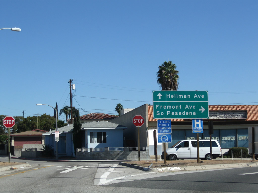 |
At the end of the ramp for Exit 22 is signage for Fremont Avenue and Hellman Avenue. Photo taken 11/08/08. |
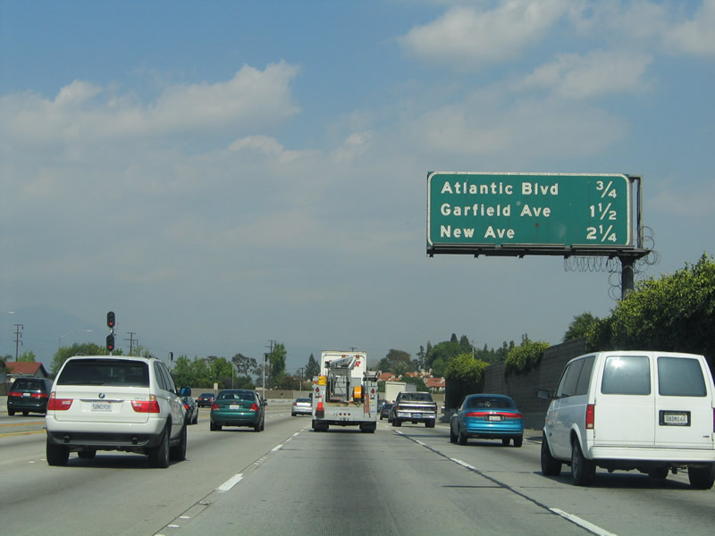 |
This mileage sign provides the distance to the next three exits along Interstate 10 (San Bernardino Freeway) east: Exit 23A, Atlantic Boulevard; Exit 23B, Garfield Avenue; and Exit 24, New Avenue. Photo taken 03/25/05. |
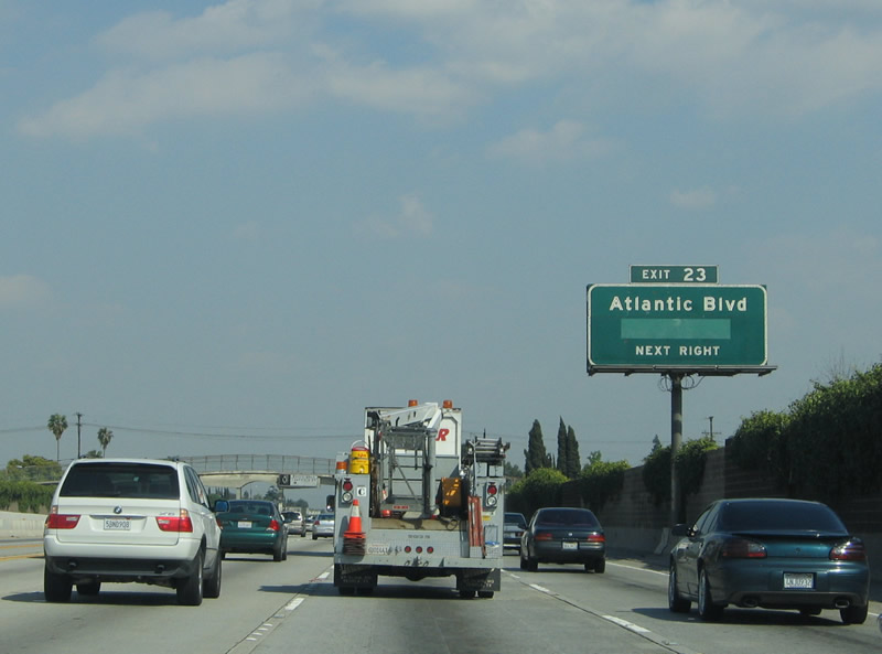 |
The next exit along Interstate 10 east is Exit 23A, Atlantic Boulevard. The exit number on this sign is incorrect, as it was placed during the experimental exit numbering phase in 1971 when the Manual of Uniform Traffic Control Devices (MUTCD) mandated the placement of exit numbers on signs. Due to the volume of freeways already built in California, the federal government granted California an exception to the exit numbering requirement (until Caltrans decided to number exits in 2001 and initiated the California Numbered Exit Uniform System [or "Cal-Nexus"] to that end in February 2002). The San Bernardino Freeway, Pasadena Freeway, Santa Monica Freeway, Santa Ana Freeway, and Harbor Freeway all saw exit numbers added in the 1971 pilot project. While over 300 signs were initially installed, many of those signs are now gone, and some that remain are obsolete (by referring to the wrong exit number, such as the case here). Photo taken 03/25/05. |
 |
Four through lanes carry the mainline of eastbound Interstate 10. The El Monte Transitway, which consists of a high occupancy vehicle (HOV) and bus lane is located in the median (on the left side of the freeway's main lanes). This express route requires at least three passengers per vehicle during commuting hours and at least two passengers during all other times. An arched pedestrian bridge crosses the freeway ahead. Photo taken 03/25/05. |
 |
Eastbound Interstate 10 (San Bernardino Freeway) reaches Exit 23A, Atlantic Boulevard. The next exit along eastbound is Exit 23B, Garfield Avenue. For the next two miles, Interstate 10 remains in the city of Alhambra but will skirt the northern limits of the city of Monterey Park. At Exit 24, this arrangement will end, and Interstate 10 will split the cities of Rosemead on the south and San Gabriel on the north. Interstate 10 through here was constructed on top of former Ramona Boulevard, which was converted into today's freeway alignment. Photo taken 03/25/05. |
 |
This mileage sign provides the distance to the next three exits along Interstate 10 (San Bernardino Freeway) east: Exit 23B, Garfield Avenue; Exit 24, New Avenue; and Exit 25A, Del Mar Avenue. Photo taken 03/25/05. |
 |
Eastbound Interstate 10 (San Bernardino Freeway) reaches Exit 23B, Garfield Avenue. Commuter rail (Metrolink) lines the median of this section of Interstate 10. Photo taken 03/25/05. |
 |
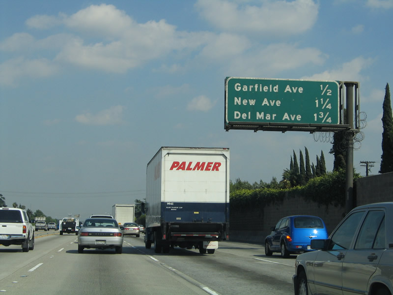
This mileage sign provides the distance to the next three exits along Interstate 10 (San Bernardino Freeway) east: Exit 24, New Avenue; Exit 25A, Del Mar Avenue; and Exit 25B, San Gabriel Boulevard. Photo taken 03/25/05. |
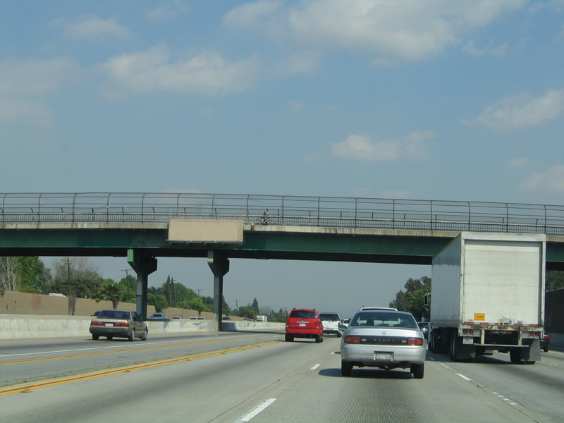 |
A blank sign is mounted on this pedestrian bridge prior to the New Avenue interchange. A wide space of pavement separates the HOV lanes from the main lanes, and a gap for commuter rail is seen in the middle of the overpass. Photo taken 03/25/05. |
 |
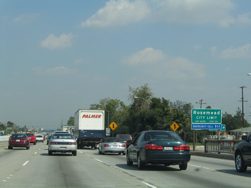
Eastbound Interstate 10 (San Bernardino Freeway) reaches Exit 24, New Avenue. At this interchange, Interstate 10 leaves the city of Alhambra and serves as the boundary between the city of San Gabriel and the city of Rosemead. San Gabriel had a population of 39,804 as of the 2000 Census and was incorporated on April 24, 1913. This city was founded at the time Mission San Gabriel Arcangel was established in 1771. Rosemead had a population of 53,505 as of the 2000 Census and was incorporated on August 4, 1959; much of this area was settled at the same time as San Gabriel due to proximity to the historic mission. Photo taken 03/25/05. |
 |
A dedicated HOV exit for Del Mar Avenue is allocated immediately after the New Avenue interchange. This HOV lane was the first constructed in Southern California and were in service by 1980.1 Photo taken 03/25/05. |
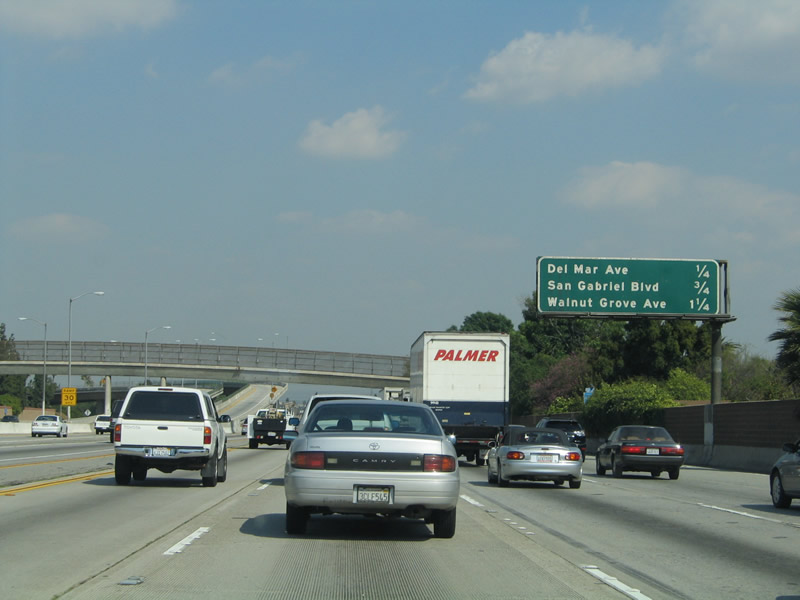 |
This mileage sign provides the distance to the next three exits along Interstate 10 (San Bernardino Freeway) east: Exit 25A, Del Mar Avenue; Exit 25B, San Gabriel Boulevard; and Exit 26A, Walnut Grove Avenue. Photo taken 03/25/05. |
 |
The left exit ramp to Del Mar Avenue provides a direct connection to a park and ride and commercial center in San Gabriel (north side of the freeway). The next four exits all serve the city of Rosemead (south of the freeway). Photo taken 03/25/05. |
 |
Eastbound Interstate 10 (San Bernardino Freeway) reaches Exit 25A, Del Mar Avenue. Photo taken 03/25/05. |
 |
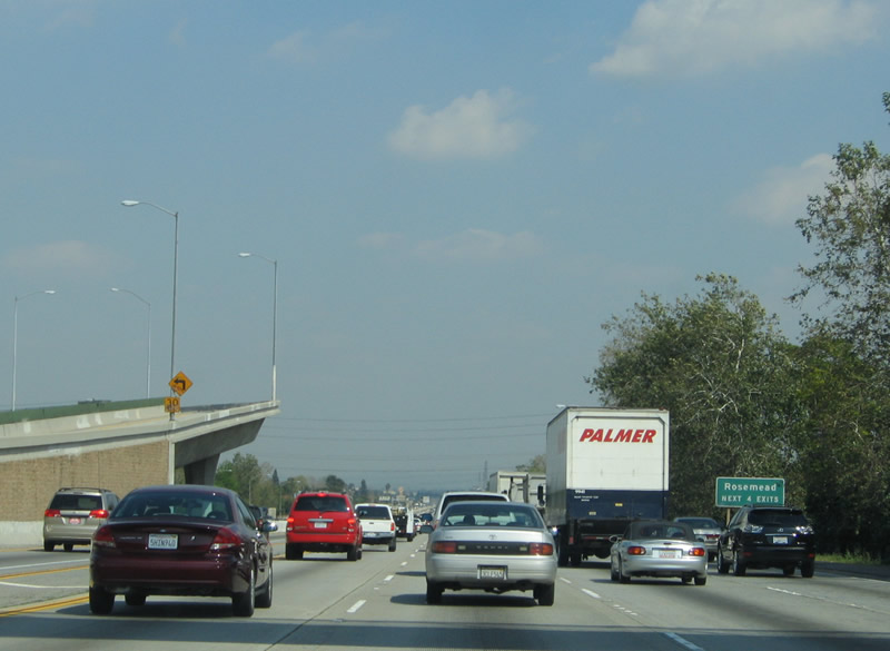
Shortly thereafter, Interstate 10 enters the city of Rosemead, and the freeway will remain in Rosemead until the California 19 (Rosemead Boulevard) interchange (Exit 26B). Photo taken 03/25/05. |
 |
This mileage sign provides the distance to the next three exits along Interstate 10 (San Bernardino Freeway) east: Exit 25B, San Gabriel Boulevard; Exit 26A, Walnut Grove Avenue; and Exit 26B, California 19 (Rosemead Boulevard). Photo taken 03/25/05. |
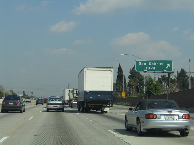 |
Eastbound Interstate 10 (San Bernardino Freeway) reaches Exit 25B, San Gabriel Boulevard. Photo taken 03/25/05. |
 |
This mileage sign provides the distance to the next three exits along Interstate 10 (San Bernardino Freeway) east: Exit 26A, Walnut Grove Avenue; Exit 26B, California 19 (Rosemead Boulevard); and Exit 27, Baldwin Avenue. Soon after this point, Interstate 10 meets Exit 26A, Walnut Grove Avenue (not photographed). Photo taken 03/25/05. |
 |
This mileage sign provides the distance to the next three exits along Interstate 10 (San Bernardino Freeway) east: Exit 26B, California 19 (Rosemead Boulevard); Exit 27, Baldwin Avenue; and Exit 28, Santa Anita Avenue. Photo taken 03/25/05. |
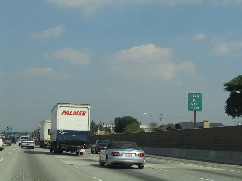 |
Use Exit 26B to Flair Drive, which is the frontage road on the south side of the freeway east of California 19. Otherwise, Exit 26B serves as a modified half-cloverleaf interchange connection to California 19 (Rosemead Boulevard) south to Whittier Narrows and north to Temple City. California 19 is a fairly long surface street alignment that extends south to Long Beach, although certain cities have taken over maintenance of segments of highway relinquished by the state. It is not clear if California 19 will retain most of its route as more relinquishments occur. Photo taken 03/25/05. |
 |
Eastbound Interstate 10 (San Bernardino Freeway) reaches Exit 26B, California 19/Rosemead Avenue. Photo taken 03/25/05. |
Sources:
- Los Angeles Metropolitan Transportation Authority (Metro): Draft 2008 Long Range Transportation Plan - Information retrieved on 09/15/08.

Page Updated December 7, 2008.
|
About Contact Glossary |
In The News Testimonials Interstate Guide |
Social Media:
 |
|
© 2000-23 AARoads.com | All Rights Reserved | Privacy Policy / Terms of Use
|
||