

Interstate 10 West - Arizona state line to Dillon Road
| Interstate 10 west & U.S. 95 north | |
|---|---|
 |
Leaving the Grand Canyon State of Arizona, westbound Interstate 10 crosses the Colorado River and enters the state of California, Riverside County. This bridge was constructed in 1960 (widened in 1974) and initially carried U.S. 60-70 over the river. Note the wide shoulder and tall fence on the north side of the bridge. Photo taken 01/17/05. |
 |
Westbound Interstate 10 and northbound U.S. 95 approach the California Agricultural Inspection Station just after the Colorado River bridge from Arizona before the city of Blythe. The inspection station is in place to guard against infestations of insects and other pests that might negatively impact agriculture in the farmlands of the Colorado River valley, Imperial Valley, and Central Valley. Any fruit grown in backyards should be disposed prior to entering California to avoid infestations of fruit flies and other pests. Similar inspection stations are in place at all major entry points into California. Photo taken 01/17/05. |
 |
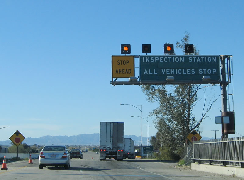
The through lanes for Interstate 10 west are blocked off by orange cones; all through traffic is required to pass through the California Agricultural Inspection Station. Photo taken 01/17/05. |
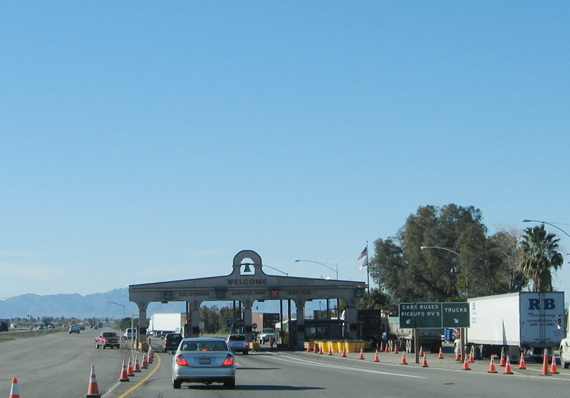 |
An old Spanish mission theme is used for the agricultural inspection station, including a mission bell at the top of the station. Photo taken 01/17/05. |
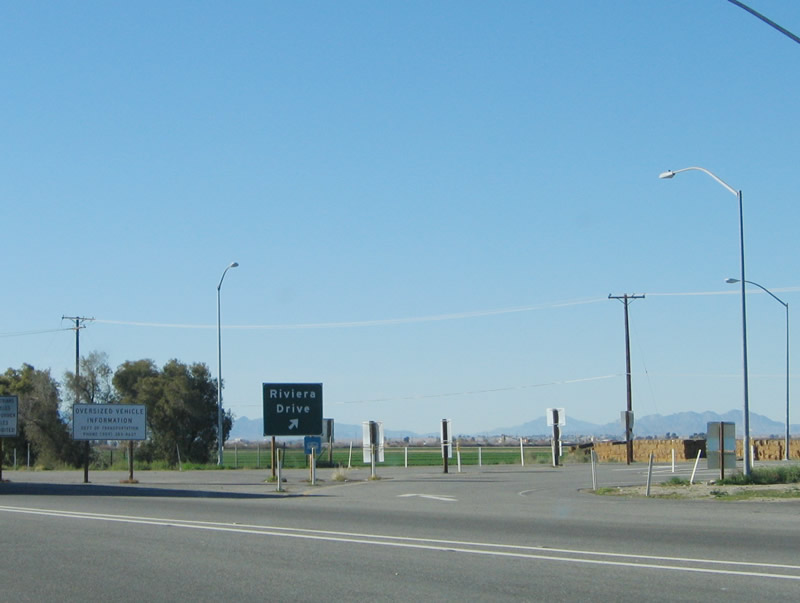 |
If you are planning to depart the freeway at Exit 243, Historic U.S. 60-70, Riviera Drive (with a connection to Business Loop I-10, Hobsonway), be sure to stay in the right lane immediately after leaving the agricultural inspection station. This photo was taken from the left lanes of the freeway after leaving the station. Photo taken 01/17/05. |
 |
This "Welcome to California" sign is posted along westbound Interstate 10 and northbound U.S. 95 after the off-ramp for Exit 243 (Riviera Drive and Business Loop I-10). and the agricultural inspection station. Photo taken 01/17/05. |
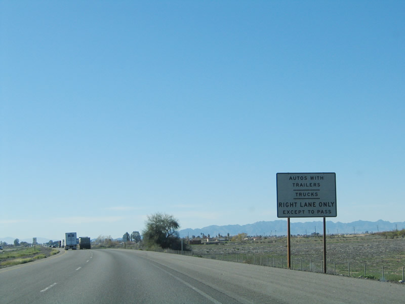 |
As is typical at most state borders, several guide signs provide basic driving laws that may vary from the laws of other states. This sign advises that autos with trailers and trucks must use the right lane except when passing slower vehicles. Photo taken 01/17/05. |
 |
Even though the two routes entered the state together, they immediately separate at Exit 241. U.S. 95 turns north along Intake Boulevard en route to Vidal Junction, Needles, and Las Vegas, while Interstate 10 continues west toward Indio, Palm Springs, the Inland Empire, and Los Angeles. Photo taken 01/17/05. |
 |
Very few reflective signs were placed along Interstate 10 as of May 2003, but this kind of sign profilerated in the desert (and elsewhere in California) through the rest of the decade. No exit numbers were signed along this stretch of Interstate 10 in Riverside County, unlike many of the comparable signs along rural Interstate 8 to the south in Imperial County. Photo taken 01/17/05. |
 |
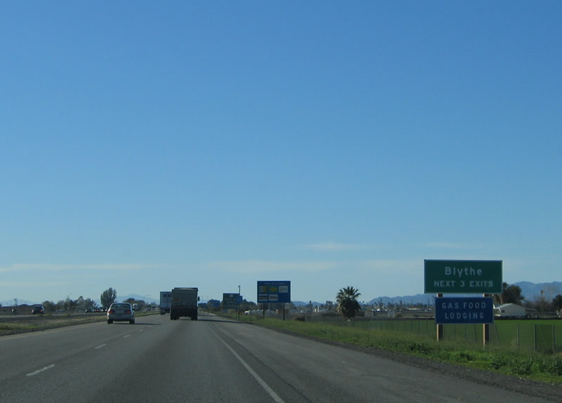
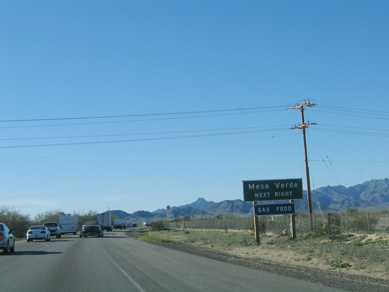
Westbound Interstate 10 approaches U.S. 95 north, Intake Boulevard. Interstate 10 enters the city of Blythe, a "Community with a Charming Past, Compelling Present, and Dynamic Future." Incorporated on July 21, 1916, Blythe is the only incorporated city along Interstate 10 east of the Coachella Valley. Consisting of motorist and traveler services as well as bustling agricultural foundation, Blythe has a population of 12,155 as of the 2000 Census. The city is named for Thomas Blythe, a gold prospector who secured rights to the water of the Colorado River in the late 1800s. The city consists of 25 square miles and is the last stop before Interstate 10 enters the state of Arizona. Photo taken 01/17/05. |
 |
At Exit 241, U.S. 95 departs to the north, while Interstate 10 continues west into the Chuckwalla Valley. Photo taken 01/17/05. |
| Interstate 10 west | |
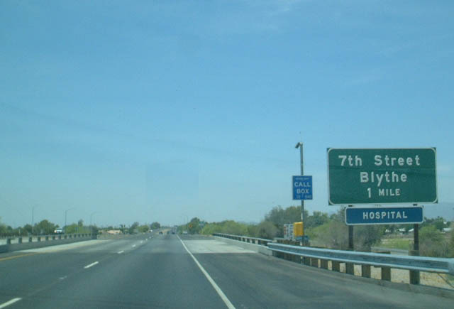 |
The second Blythe exit is Exit 240, Business Loop I-10/7th Street. The business route meets former U.S. 60-70 (Hobsonway) just west of U.S. 95 in downtown Blythe, then turns west to rejoin Interstate 10 at the interchange with California 78. Photo taken 05/27/03. |
 |
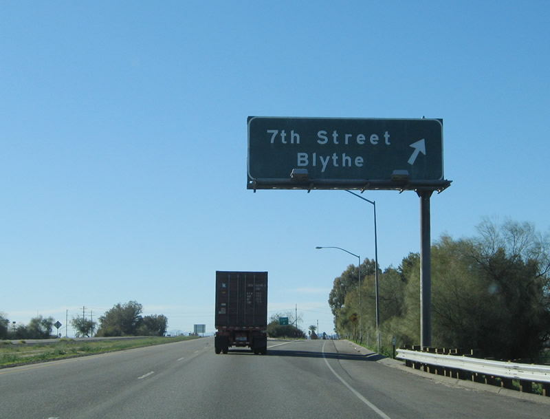
Per California standards for signage for non-state maintained business routes, Business Loop I-10 is only mentioned once on this text sign approaches Exit 240, 7th Street. Photo taken 01/17/05. |
 |
Westbound Interstate 10 reaches Exit 240, Business Loop I-10/7th Street west to Blythe. Photo taken 01/17/05. |
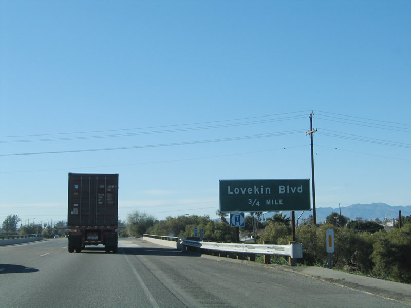 |
The third Blythe exit is Exit 239, Lovekin Boulevard, three-quarters of a mile. Photo taken 01/17/05. |
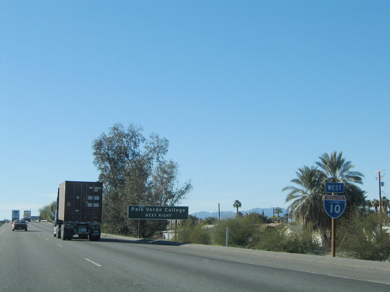 |
This angular reassurance shield is posted on the approach to Lovekin Boulevard. Use Lovekin Boulevard to Palo Verde College and the western portion of Blythe. Photo taken 01/17/05. |
 |
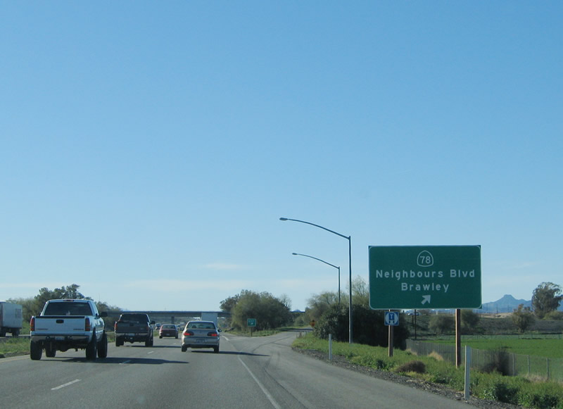
The other end of Business Loop I-10 is at Exit 236, Neighbours Boulevard. In addition, Exit 236 serves as the eastern terminus of California 78, which crosses the state between Blythe and Oceanside via Brawley in the Imperial Valley, Julian in the Cuyamaca Mountains, and Escondido in the inland valleys of San Diego County. Photo taken 01/17/05. |
 |
Westbound Interstate 10 approaches Exit 236, westbound California 78 and Eastbound Business Loop I-10/Neighbours Boulevard. California 78 heads south along the Colorado River, passing through some irrigated farmland prior to turning west near its junction with Imperial County S-34 (Ogilby Road) and entering the Imperial Sand Dunes near Glamis. California 78 reenters a farming region upon descending into the Imperial Valley. Photo taken 01/17/05. |
 |
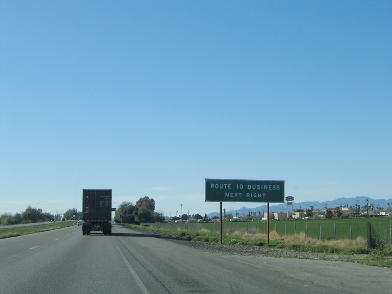
Business Loop I-10 in Blythe is one of four business loops for Interstate 10 in California. The other three are in Indio (along old U.S. 60-70-99), Colton (Valley Boulevard), and Ontario-Pomona (Holt Boulevard). Photo taken 01/17/05. |
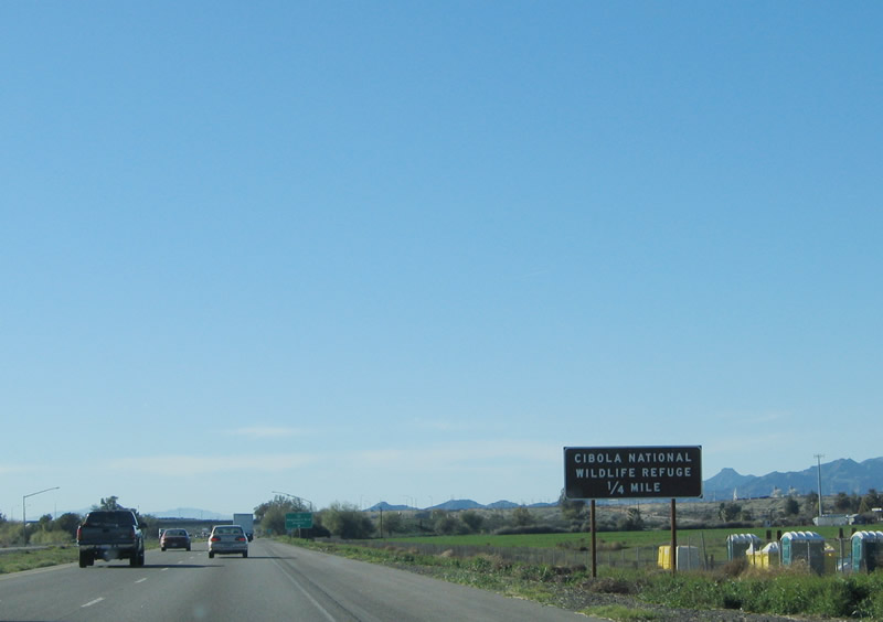 |
Use California 78 west to Cibola National Wildlife Refuge. California 78 travels south from Blythe to the Riverside-Imperial County Line, then turns southwest toward Brawley in the Imperial Valley. Prior to turning west, California 78 passes alongside the preserve, which is located on the Colorado River south of the town of Palo Verde. Photo taken 01/17/05. |
 |
Westbound Interstate 10 reaches Exit 236, California 78 southwest to Palo Verde and Brawley and Business Loop I-10/Neighbours Boulevard (Old U.S. 60-70) east to Blythe. Photo taken 01/17/05. |
 |
Shortly after the California 78 interchange, this mileage sign provides the distance to the town of Desert Center (43 miles), Indio (92 miles), and Los Angeles (219 miles). There are not many services between Blythe and Indio, so motorists should consider getting gas, food, and lodging in Blythe before making the hour and a half drive across the desert. Photo taken 01/17/05. |
 |
Exit 232, the next exit along westbound, leads to the Blythe Regional Airport via Mesa Drive. It is the last exit of metropolitan Blythe. Photo taken 01/17/05. |
 |
If you have any doubts about the amount of fuel remaining in your tank, the number of water bottles you have chilled in the cooler, or the number of miles until the next lodging, this sign provides a reality check: the next services after Exit 232 are 40 miles east of here, at Exit 192/Desert Center. Photo taken 01/17/05. |
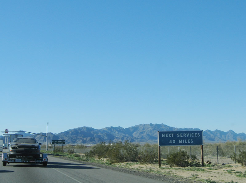 |
As noted previously, no services are available for 40 miles. The next city of significance is Indio in the Coachella Valley. Photo taken 01/17/05. |
 |
Westbound Interstate 10 reaches Exit 232, Mesa Drive and the Blythe Regional Airport. Photo taken 01/17/05. |
 |
Shortly after Exit 232 is the exit for the weigh station. Photo taken 01/17/05. |
 |
The next exit is Exit 222. This interchange connects Interstate 10 to the Chuckwalla Valley State Prison via southbound Wiley's Well Road. This sign advises motorists not to pick up hitchhikers or other people from the side of the road in case they are from the nearby correctional facility. And guess what else this exit features? (See answer in two photoboxes!) Photo taken 01/17/05. |
 |
Looking to the north of Interstate 10, the Chuckwalla Valley spreads out. Sparse sagebrush and tall, distant peaks dominate the horizon in this vast land. Photo taken 01/17/05. |
 |
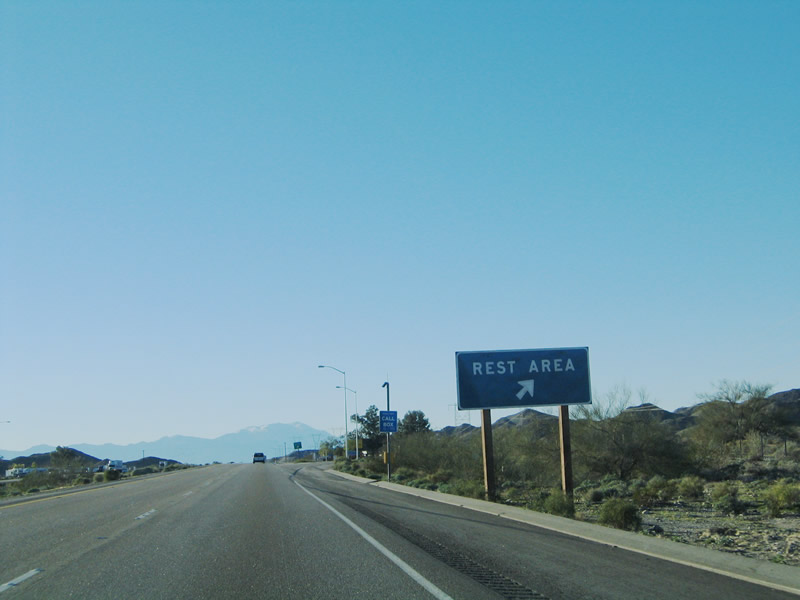
Yes, the first rest area along westbound Interstate 10 is at Exit 222, Wiley's Well Road. Unlike nearly every other state Interstate 10 traverses, California does not feature a welcome center or major tourist information center at its first rest area; instead, this rest area is equipped with standard restrooms, comfort station, water, and telephone. Compared to the hospitality of the welcome centers at the borders of the states of the Deep South (with free drinks, maps, and plantation-style houses), California's rest area is by comparison purely functional -- and very popular in the middle of the desert. Wiley's Well Road, meanwhile, leads south into the vast desert, with a connection to the aforementioned Chuckwalla Valley State Prison several miles south of the freeway and to a variety of Bureau of Land Management recreational areas. Photo taken 01/17/05. |
 |
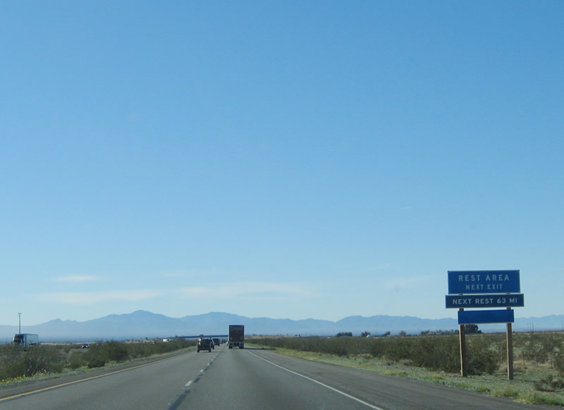
Westbound Interstate 10 reaches Exit 222, Wiley's Well Road. Both directions of Interstate 10 share the Wiley's Well Rest Area. The next rest area is not until Exit 159, the Cactus City Rest Area (a distance of a little more than 60 miles). Coupled with the limited motorist facilities (gas and food) between Blythe and Indio, it is a good idea to stop for the bathroom somewhere in Blythe before entering the desert ahead. Photo taken 01/17/05. |
 |
After Wiley's Well Road, the freeway continues to delve deeper into Chuckwalla Valley. Located within the Sonoran Desert (also called the Colorado Desert within California), the Chuckwalla Valley can be extremely hot during summer months due to the relatively low elevations. The higher elevations to the north of the Chuckwalla Valley begin the transition into the Mojave Desert, which covers most of the land north of Joshua Tree National Park. Photo taken 01/17/05. |
 |
At Exit 217, Ford Dry Lake Road leads north to the dry lake bed, which is visible as a large white area just north of the freeway. The exit also connects to Chuckwalla Road, an old alignment of former U.S. 60-70 that parallels the freeway. For old highway buffs, this extant section of U.S. 60-70 should not be missed! Photo taken 01/17/05. |
 |
Westbound Interstate 10 reaches Exit 217, Ford Dry Lake Road and Junction Old U.S. 60-70 west, Chuckwalla Road. Photo taken 01/17/05. |
 |
 |
Looking north from the westbound lanes, the desert extends in all directions of the Chuckwalla Valley. Photos taken 01/17/05. |
 |
The other end of Chuckwalla Road (former U.S. 60-70) returns to Interstate 10 at Exit 201, Corn Springs Road. Corn Springs Road itself is not an old alignment, and it leads southwest into the Chuckwalla Mountains Wilderness, including Corn Spring and Aztec Well. Photo taken 01/17/05. |
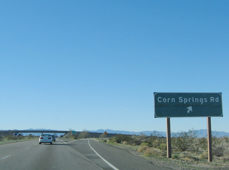 |
Westbound Interstate 10 reaches Exit 201, Corn Springs Road. Much of this section of Old U.S. 60-70 from Blythe to Indio was built in 1936; it was upgraded to Interstate standards between 1964 (east of Dillon Road interchange) and 1972 (Indio Bypass). The Corn Springs Road interchange was built and opened to traffic in 1966. Photo taken 01/17/05. |
 |
Mileage sign along westbound for Desert Center (California 177/Riverside County R-2), Indio (Business Loop I-10/California 86-S), and still distant Los Angeles (Interstate 5). Photo taken 01/17/05. |
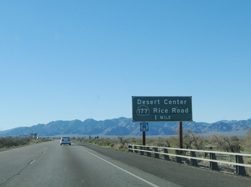 |
Westbound Interstate 10 approaches California 177 (Rice Road)/Riverside County R-2 (Kaiser Road) northbound, to Desert Center and California 62 near Granite Pass, one mile. Photo taken 01/17/05. |
 |
Use California 177 north to Riverside County R-2 north to Lake Tamarisk. Photo taken 01/17/05. |
 |
Although Desert Center is still populated, some amenities that have been constructed in this area have seen better days, such as the palm trees that form the Jojoba Plantations. Desert Center marks the southern terminus of California 177 (Rice Road), which connects Interstate 10 with California 62 east of Joshua Tree National Park. This exit also leads to north Riverside County R-2, which split northwest from California 177 to serve the community of Eagle Mountain. Riverside County R-2 ends in Eagle Mountain; it does not extend into the national park. Photo taken 01/17/05. |
 |
 |
At Exit 192, a paved section of Old U.S. 60-70 acts as a frontage road on the north side of the freeway. Called Ragsdale Road, this old alignment is still in use between Exit 192 (California 177) and Exit 189 (Eagle Mountain Road). Photos taken 01/17/05. |
 |
The next exit along westbound Interstate 10 is Exit 189, Eagle Mountain Road. Photo taken 01/17/05. |
 |
The westbound freeway continues through the eastern end of the Chuckwalla Valley as it approaches Exit 189, Eagle Mountain Road, one mile. At this interchange, the extant section of Old U.S. 60-70 (Ragsdale Road) comes to an end; all through traffic should rejoin Interstate 10 at Exit 189. Photo taken 05/27/03. |
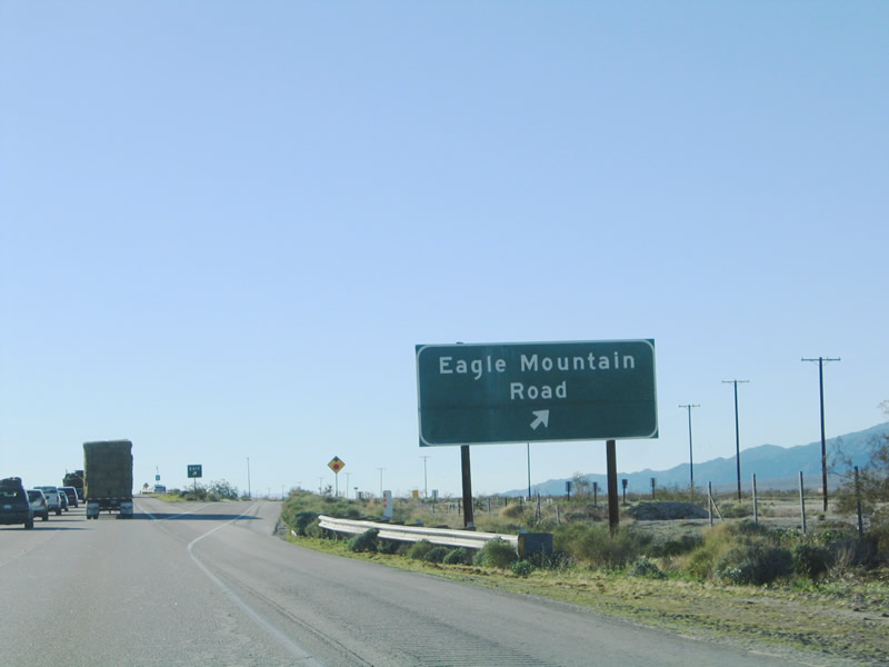 |
Westbound Interstate 10 reaches Exit 189, Eagle Mountain Road. Eagle Mountain Road leads north over Victory Pass to meet Riverside County R-2/Kaiser Road (see Exit 192) southeast of Eagle Mountain. The final several miles of Eagle Mountain Road parallel the Colorado Aqueduct, including the section where Eagle Mountain Road intersects Riverside County R-2/Kaiser Road. Neither Eagle Mountain Road nor Kaiser Road provides paved access from Eagle Mountain to Joshua Tree National Park; continue west on Interstate 10 to the Cottonwood Springs interchange (Exit 168) to Joshua Tree and 29 Palms. Photo taken 01/17/05. |
 |
The next exit along westbound Interstate 10 is Exit 182, Red Cloud Road, one mile. Red Cloud Road travels south from Interstate 10 briefly, then splits into two locally maintained roads. One road follows the Salt Creek Wash to the southwest, while the other follows the Red Cloud Wash to the southeast. Red Cloud Road follows the wash southeast to the Lost Pony Mine and Great Western Mine, both of which are located within the Chuckwalla Mountains. Photo taken 01/17/05. |
 |
Westbound Interstate 10 reaches Exit 182, Red Cloud Road. In addition to the mines listed in the previous photobox, the Red Cloud Road interchange also provides connections to other locations in the valley between the Chuckwalla Mountains in the east and Orocopia Mountains in the west. The valley does not extend very far south, since the Chocolate Mountains and its gunnery range (with active bombings taking place at any given time) blocks the route. For access to the Salton Sea and Imperial Valley, continue west on Interstate 10 to Box Canyon Road. Photo taken 05/27/03. |
 |
This mileage sign provides the distance to Chiriaco Summit (motorist services are available there), Indio (at the eastern end of the Coachella Valley), and the control city of Los Angeles. To the north of the freeway between Red Cloud Road and Hayfield Road, the dry lakebed of Hayfield Dry Lake comes into view. Photo taken 01/17/05. |
 |
North of Interstate 10 is the Hinds Pumping Station along the Colorado River Aqueduct, nestled snug against the Eagle Mountains. This pumping station helps push water through pipes that pass under the Eagle Mountains. Several similar "water tunnels" exist along the route of the Colorado River Aqueduct. Other such tunnels exist when the aqueduct passes through the Iron Mountain Tunnel north of Granite Pass and California 62 and the Coxcomb Tunnel that passes under the Coxcomb Mounatins to the northeast. Another tunnel further west carries water under the Cottonwood Mountains before emerging in the Coachella Valley. As part of the Colorado River aqueduct system, the tunnels were completed and in use in 1941. For more, visit the official site of the Los Angeles Aqueduct from the Colorado River. Photo taken 01/17/05. |
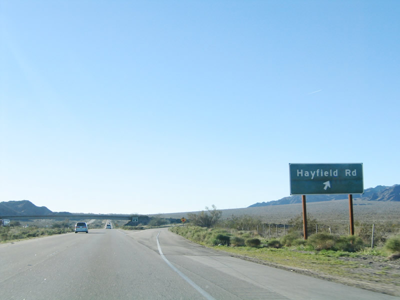 |
The next exit along westbound Interstate 10 is Exit 177, Hayfield Road. Use Hayfield Road north to the Hinds Pumping Station (shown in the previous photograph). No services are available at this exit, and there is no access to Joshua Tree National Park. Photo taken 01/17/05. |
 |
After the on-ramp from Hayfield Road is this sign designating Interstate 10 as the Veterans Memorial Freeway. The freeway has a steeper grade for the next several miles as Interstate 10 ascends to the top of Chiriaco Summit, elevation 1,710 feet. This is an increase of about 800 feet in elevation since leaving Desert Center (California 177). Photo taken 01/17/05. |
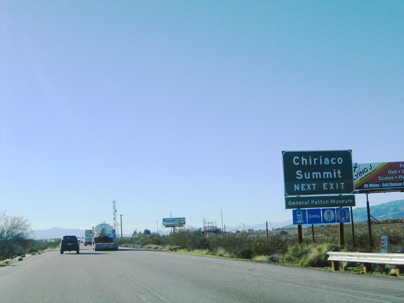 |
Continuing west, the next exit along westbound Interstate 10 is Exit 173, Chiriaco Summit. The interchange itself is with Summit Road, which is a short road that connects with Chiriaco Road to the north (frontage road) and Pinto Road to the south (which begins as a frontage road but eventually connects with Box Canyon Road). Use Summit Road north to Chiriaco Road to motorist services, including food, gas, lodging, and the unique attraction: General George S. Patton Museum. Photo taken 01/17/05. |
 |
Westbound Interstate 10/Veterans Memorial Freeway reaches Exit 173, Summit Road to Chiriaco Summit. Aside from having motorist services (there have not been many services since leaving Blythe, aside from Desert Center), Chiriaco Summit is also a noted roadside attraction for its General George S. Patton Museum. The museum seems like an odd location for anything related to Patton, except that his tank training facility (from the World War II era) was located near here, at Camp Young. When visiting, be sure to check out the large relief map of the surrounding desert, including the Mojave Desert (to the north) and the Colorado/Sonora Desert to the south. Joshua Tree National Park is a transitionary zone between these two great North American deserts. Photo taken 01/17/05. |
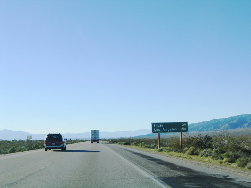 |
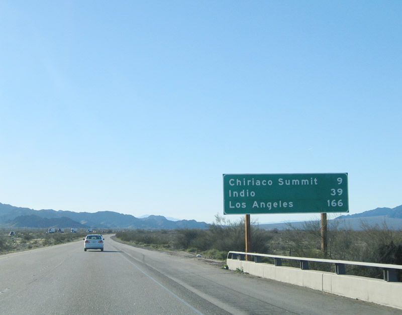
This mileage sign provides the distance to Indio, the second city encountered by westbound Interstate 10 in the Coachella Valley (the first city encountered is a small sliver of the city of Coachella). This sign also provides distance to the control city of Los Angeles. Photo taken 01/17/05. |
 |
The next exit along westbound Interstate 10 is a major interchange. Exit 168 connects to Box Canyon Road (former California 195), which travels southwest toward Mecca and to Cottonwood Springs Road, which travels north into Joshua Tree National Park. Cottonwood Springs Road meanders north through Cottonwood Pass (el. 2,800 feet) before passing through the Cottonwood Springs Visitor Center and Ranger Station. Note that there is a fee (increased to $15 as of March 1, 2006) to enter Joshua Tree National Park, even for through traffic en route to 29 Palms. The connection to 29 Palms is made via Pinto Basin Road, Park Boulevard, and Utah Trail. Photo taken 01/17/05. |
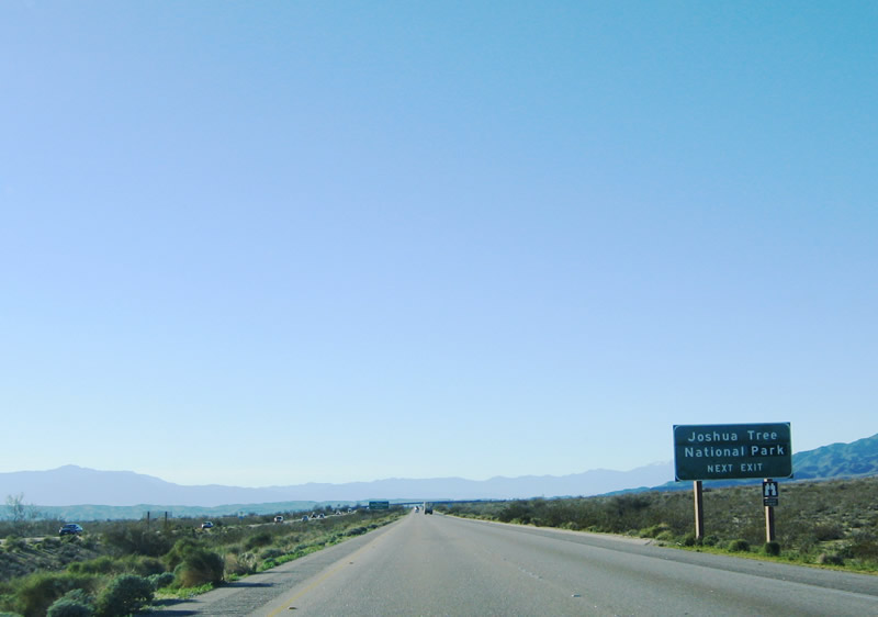 |
The auxiliary signage for Joshua Tree National Park along westbound should be brown, not green. It is a newer sign, since Joshua Tree was promoted from a National Monument to a National Park during the 1990s. Although not clearly noted on this sign, the national park's southern boundary is located just north of Interstate 10, and the mountain to the north is within the boundary. At no point does Interstate 10 enter the national park. Joshua trees, the desert plant that makes this park famous (as featured on the prominently on the cover of rock band U2's 1987 "Joshua Tree" album), are not visible from this stretch of Interstate, but they are visible in plentiful quantities throughout the park. Photo taken 01/17/05. |
 |
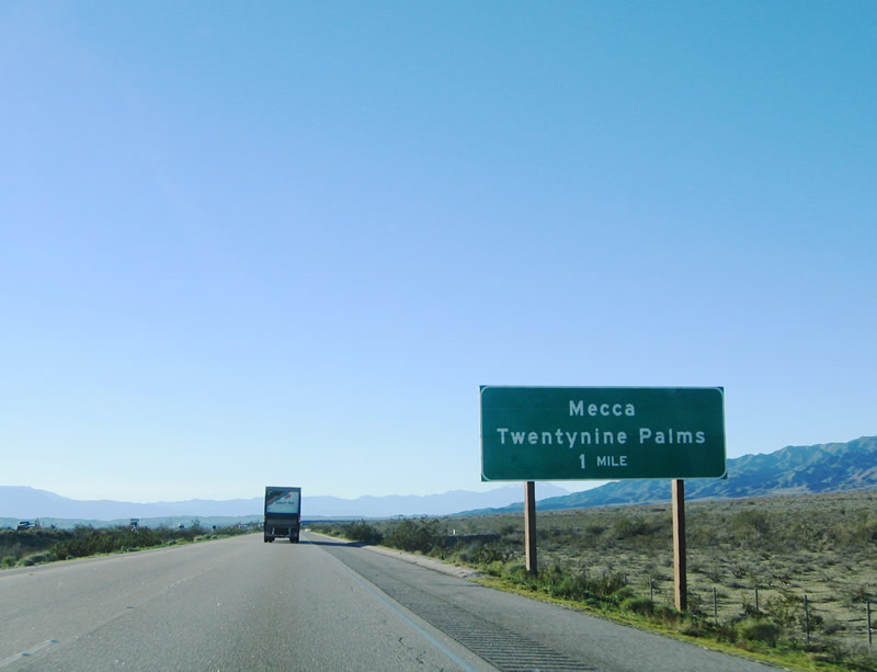
California 195, meanwhile, used to provide the primary access from Interstate 10 to California 86 (Former U.S. 99) and California 111 with service to the Salton Sea resorts and Imperial Valley. In 1972, California 195 was decommissioned between Interstate 10 and California 111, and Box Springs Road was transferred to local maintenance. With the completion of the California 86S expressway, most of the remaining utility of the existing section of California 195 between Mecca and Oasis has been marginalized. State law calls for this stretch (between California 111 and California 86) to be eliminated from the state highway system upon completion of the California 86S expressway between Oasis and Interstate 10. Even though construction of that expressway is now completed, signage for California 195 still remains in place as of February 2006. Photo taken 01/17/05. |
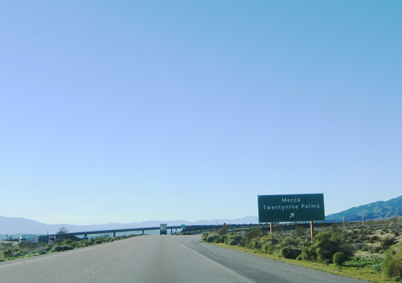 |
Westbound Interstate 10 reaches Exit 168, Shaver's Summit. Turn south here to follow Old California 195 to Mecca and Oasis, as well as the Salton Sea and Imperial Valley via either California 86 or California 111. Turn north here to follow Cottonwood Springs Road north the gorgeous Joshua Tree National Park. If you are willing to pay the entry fee to the park, Cottonwood Springs Road (along with Pinto Basin Road and Park Boulevard) may be used to connect with Twenty-Nine Palms and California 62. Note that there are no services available at this interchange. Photo taken 01/17/05. |
 |
Another mileage sign is posted after the Cottonwood Springs Road/Box Canyon Road interchange, again providing the mileage to Indio and Los Angeles. A call box blocks the mileage information (poor product placement). Photo taken 01/17/05. |
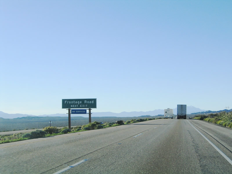 |
The next exit along westbound is for a frontage road near the rest area, approximately 16 miles east of the Dillon Road interchange (Exit 146, which connects Interstate 10 to the Indio Business Loop I-10 and to southbound California 86S expressway). The frontage road has no other official name, and it wraps in a circle to allow for access from both directions of Interstate 10. In addition to the Colorado River Aqueduct, which parallels the freeway to the north, this interchange also connects to the power line roadway that follows the massive 500 kV power line that has generally followed Interstate 10 to the south since leaving Arizona and entering California. From here through the Coachella Valley, the 500 kV line will follow Interstate 10 to the north. Photo taken 01/17/05. |
 |
Westbound Interstate 10 reaches Exit 162, Frontage Road. This frontage road does not go very far from the interchange, and there does not appear to be any old highway relics. Use this exit for access into Shaver Valley, which lies to the south of the freeway (framed by the Orocopia Mountains to the southeast and Mecca hills to the southwest). Photo taken 01/17/05. |
 |
The aforementioned 500 kV power line prepares to cross Interstate 10. This particular line interconnects with electricity incoming from a variety of power plants in the Four Corners area (near Shiprock, New Mexico) as well as the various hydroelectric facilities found along the Colorado River. In addition, the line directly emanates from the Palo Verde Nuclear Power Plant located west of Phoenix and south of Interstate 10 in Arizona. From here, the 500 kV line will continue west through the northern edge of the Coachella Valley, then cross southwest toward northern Orange County and southern Los Angeles County to connect with local transmission systems there. Photo taken 01/17/05. |
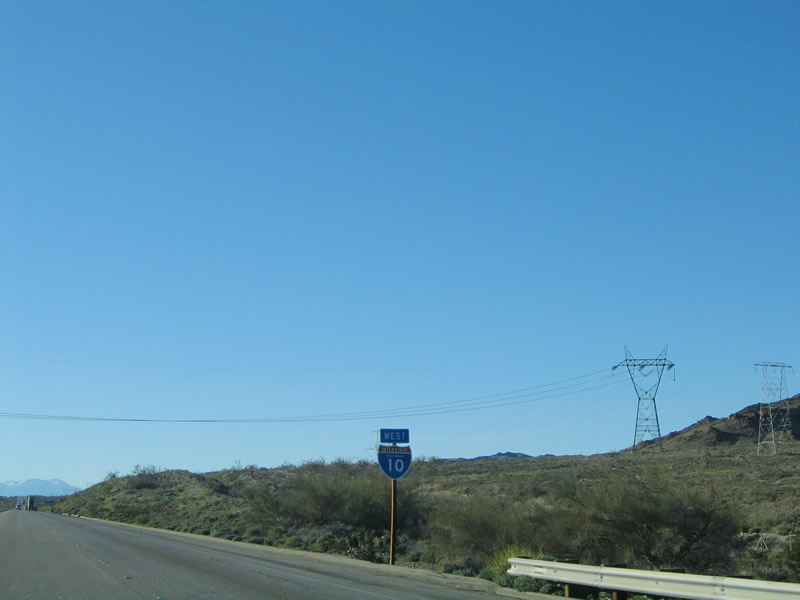 |
An Interstate 10 reassurance shield is posted after the on-ramp from the Frontage Road interchange. The 500 kV line crosses Interstate 10 and turns east here, joining the Colorado River Aqueduct transmission line on a shared right of way heading toward the Coachella Valley. This transmission line was installed in 1936 by the Los Angeles Department of Water and Power to bring hydroelectric power generated by the Colorado River dams. It is about 226 miles long. Photo taken 01/17/05. |
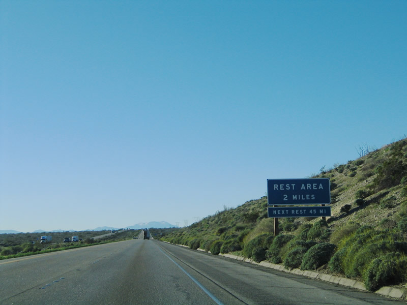 |
The next exit along westbound Interstate 10 is Exit 159, Cactus City Rest Area. This is only the second rest area along westbound; the last one was the Wiley's Well Rest Area near Blythe. Two more rest areas are found along westbound Interstate 10: Whitewater Rest Area at Exit 113 and Brookside Rest Area at Exit 91. After that, there are no further rest areas along Interstate 10. Photo taken 01/17/05. |
 |
For those towing other vehicles, with brake troubles, or with overheating issues, it might be wise to stop briefly at the rest area, since there is a steep drop forthcoming. Elevations will decrease from a high of 1,710 feet at Chiriaco Summit to -14 feet below sea level at Indio (-71 feet at the city of Coachella), thus necessitating a steep grade down for westbound traffic. Photo taken 01/17/05. |
 |
Westbound Interstate 10 reaches Exit 159, Cactus City Rest Area. The next exit is Exit 146, Dillon Road, which is five miles west of here. Photo taken 01/17/05. |

Page Updated February 6, 2009.
|
About Contact Glossary |
In The News Testimonials Interstate Guide |
Social Media:
 |
|
© 2000-23 AARoads.com | All Rights Reserved | Privacy Policy / Terms of Use
|
||