|
After Exit 104 (Morongo Trail) and Exit 103 (Malki Road, formerly Fields Road) is a weigh station (truck scales), signed with a black on white regulatory sign (typically weigh stations are signed with white on green guide signs). Photo taken 04/27/14. |
|
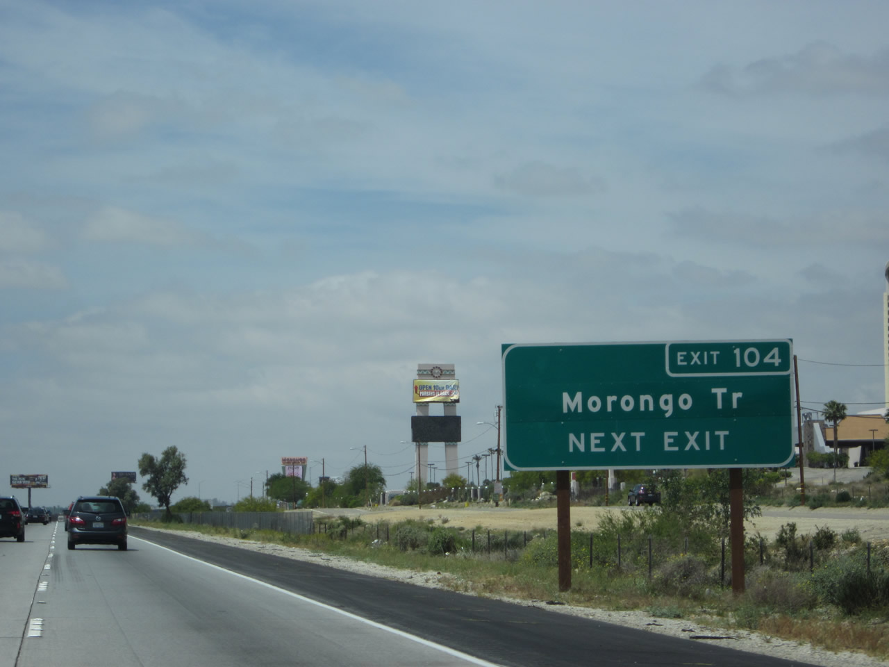
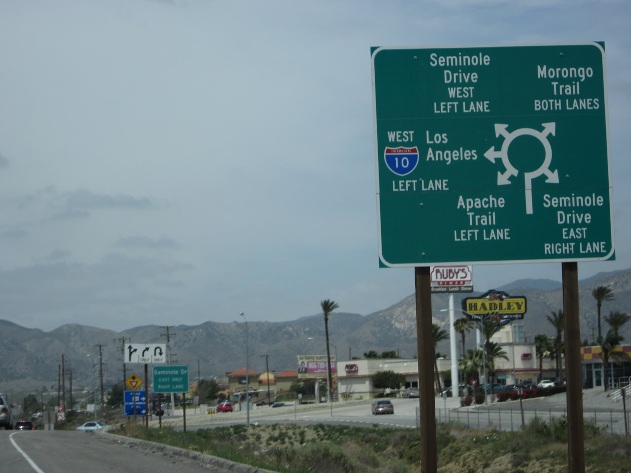
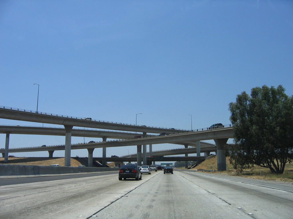
Westbound Interstate 10 reaches Exit 104, Morongo Trail north, Apache Trail south to Main Street (former U.S. 60-70-99 east) through Cabazon, and north to Seminole Drive (northern frontage road for Interstate 10). The Casino Morongo, which is visible in both directions for many miles (especially at night) is located off of Seminole Drive on the north side of the freeway. Photo taken 04/27/14. |
|
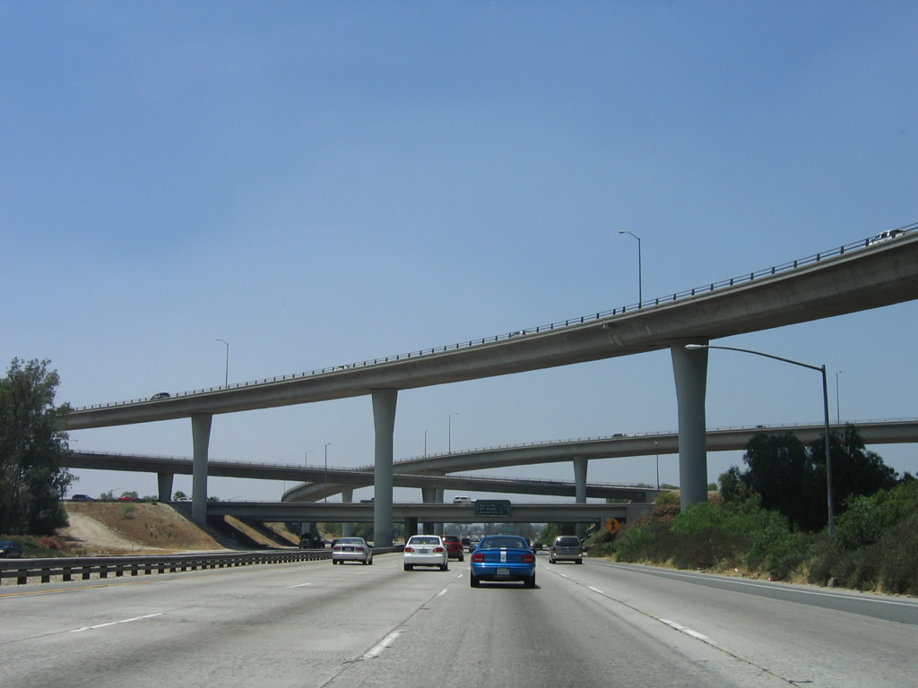
Upon departing the mainline freeway, we find a detailed sign indicating that Exit 104 consists of two roundabouts, one on each side of Interstate 10. The roundabout leads to Seminole Drive east, Morongo Trail north, Seminole Drive west, and Apache Trail south to Main Street. This interchange did not have the roundabouts in 2006; it was reconstructed and opened to its current configuration on July 11, 2008. The project was funded by the Morongo Band of Indians and cost between $8-9 million.1 Photo taken 04/27/14. |
|
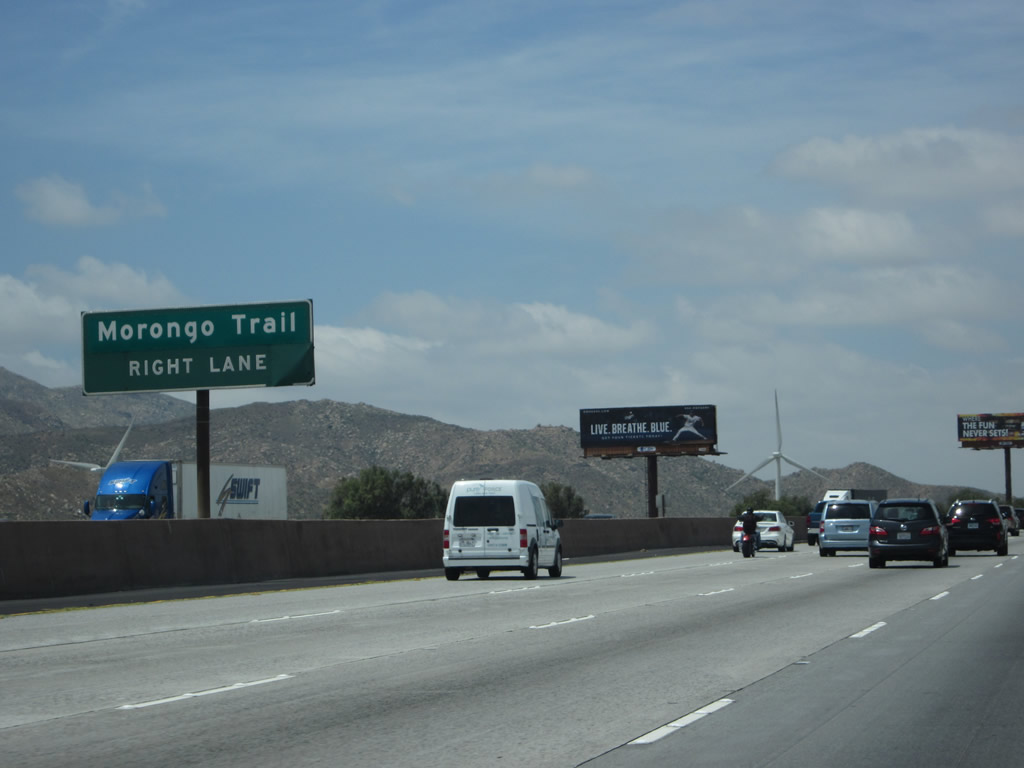
A second sign points the way to Seminole Drive east via the right lane. This interchange has all motorist services, including food, gas, lodging, and ample shopping at outlet stores located along Seminole Drive west. Photo taken 04/27/14. |
|
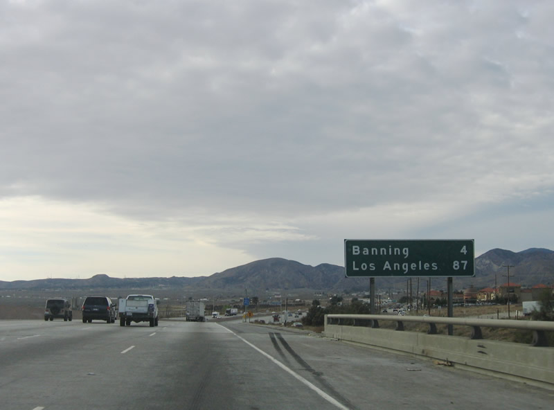
Returning to the mainline, this mileage sign along Interstate 10 west provides the distance to Banning (four miles) and Los Angeles (87 miles). Photo taken 02/26/06. |
|
|
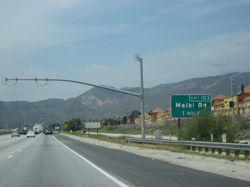
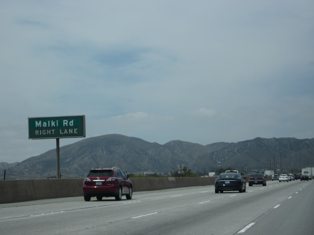
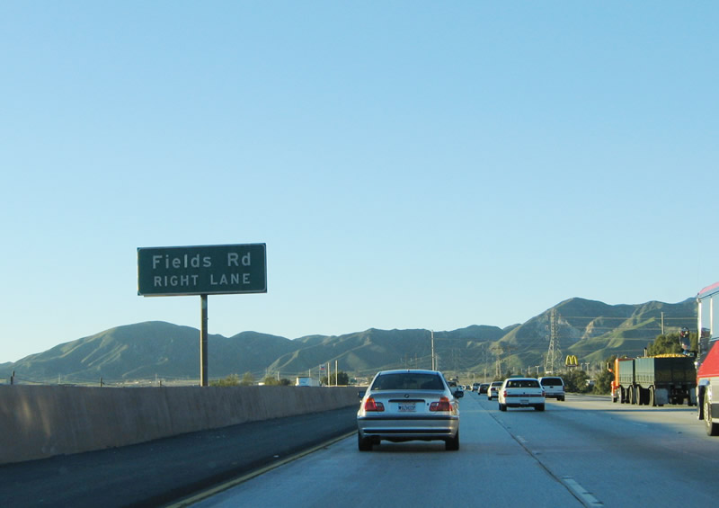
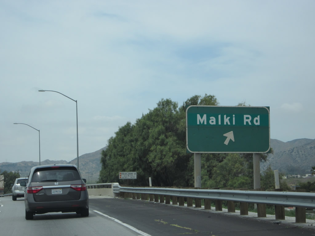
The next exit along westbound Interstate 10 is Exit 103, Malki Road (formerly Fields Road). This exit serves the Desert Hills Premium Outlets (visible on the north side of Interstate 10 off of Seminole Drive and adjacent to the Casino Morongo) as well as the Morongo Indian Reservation, which sits to the north of the freeway. The Seminole Drive frontage road ends at Fields Road and does not continue west into Banning. Photos taken 04/27/14 and 02/26/06. |
|
|
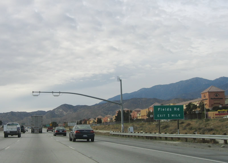
Traffic tends to increase as Interstate 10 continues through San Gorgonio Pass and descends from Cabazon into Banning, the first outpost on the Inland Empire. The freeway carries four lanes in each direction. Exit 103 (for Malki Road formerly Fields Road) is ahead. Photos taken 04/27/14 and 01/17/05. |
|
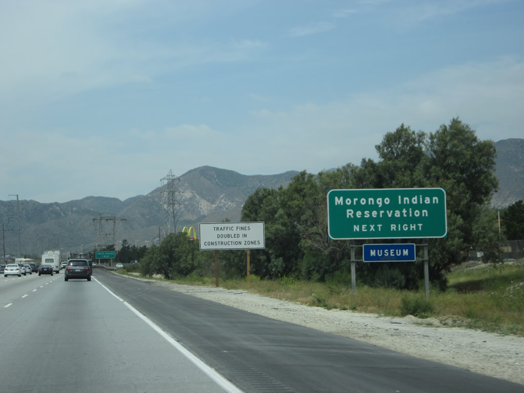
The Morongo Indian Reservation, which is home to both the Desert Hills Premium Outlets and Morongo Casino and Resort, lies north of Interstate 10. Like many bands of Native Americans in California, the Morongo Indians built a casino and outlet shopping center on their sovereign nation lands. This has amounted to a lucrative business that brings millions in gambling revenues to the reservation annually. With the Morongo Indian Reservation located immediately off of Interstate 10 on the way between Los Angeles and Palm Springs, it has certainly been one of the most popular locations for such a gaming enterprise. Other casinos (such as one located on the Viejas Indian Reservation off of Interstate 8 and Old U.S. 80 in Alpine, east of San Diego) has struck similar jackpots with prime locations along freeway corridors. Photo taken 04/27/14. |
|
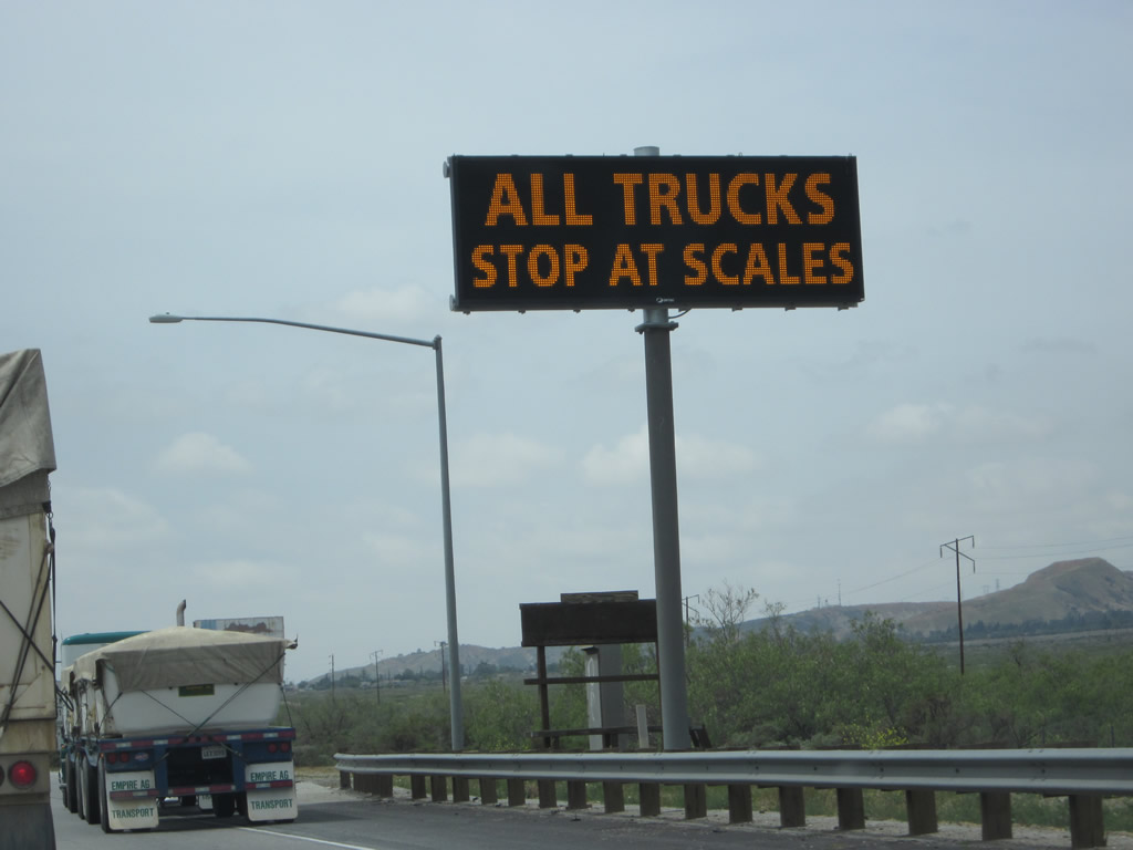
The truck scales (weigh station) is located between Exits 104 and 103. Why these are signed as -truck scales- rather than -weigh station- is not clear, except that the sign may date back to the original freeway construction timeframe. Photo taken 04/27/14. |
|
|
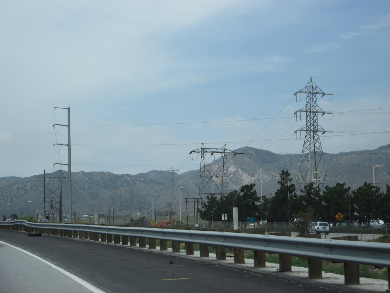
Several power lines -- including a 220kV Southern California Edison double circuit power line and two single circuit power lines (one steel lattice and the other an H frame wood structure) -- bump alongside the north side of Interstate 10. Photos taken 04/27/14. |
|
|
Upon reaching Exit 103, Malki Road (formerly Fields Road, westbound Interstate 10 leaves unincorporated Riverside County and enters the city of Banning. The Morongo Indian Reservation has territory on both sides of the freeway through here. Between Exits 103 and 102, there is no parallel frontage road, so all traffic must use Interstate 10. Photos taken 04/27/14 and 02/26/06. |
|
|
After passing by the off-ramp for Exit 103, Interstate 10 leaves Cabazon and enters the city of Banning. Home to 23,562 people per the 2000 Census, Banning was founded in 1913 and is a gateway into the area popularly known as the Inland Empire. The San Gorgonio Pass is also known as Banning Pass due to Banning-s location within the pass. Banning is named for a Mormon general (Phineas Banning) who operated a stage line from Wilmington to Yuma and also was considered the father of the Port of Los Angeles. Photos taken 04/27/14. |
|
Continuing west on Interstate 10, the next exit is the off-ramp to the weigh station for all trucks. The number five lane (far right lane) becomes exit only for the weigh station (truck scales). Photo taken 04/27/14. |
|
Westbound Interstate 10 reaches the off-ramp to the truck scales and weigh station. During hours of operation, all trucks must exit unless they have pre-approval to proceed without weighing. Photo taken 04/27/14. |
|
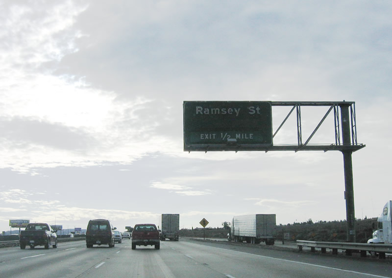
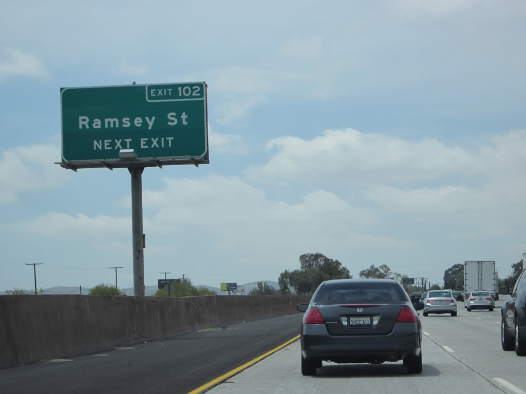
The next exit along westbound Interstate 10 is Exit 102, Ramsey Street. At this interchange, Historic U.S. 60-70-99 again depart from the freeway alignment to follow the business route through the city of Banning. While not signed as Business Loop I-10, the combination of Ramsey Street in Banning and 6th Street in Beaumont follow the old alignment of U.S. 60-70-99 all the way to Exit 93, which is where Interstate 10 and California 60 (Moreno Valley Freeway) diverge. Today, Ramsey Street and 6th Street serve as the de facto business route through Banning and Beaumont, but they are not signed as a business loop for Interstate 10. Photo taken 02/26/06. |
|
Another advance sign for Exit 102 is posted in the median; the exit number was added sometime between 2008 and 2014. Watch for truck traffic merging back onto the freeway from the weigh station. Photo taken 04/27/14. |
|
Westbound Interstate 10 reaches Exit 102, Historic U.S. 60-70-99 (Ramsey Street) west into downtown Banning. Photo taken 04/27/14. |
|
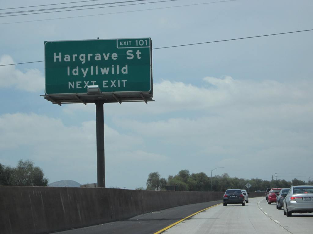
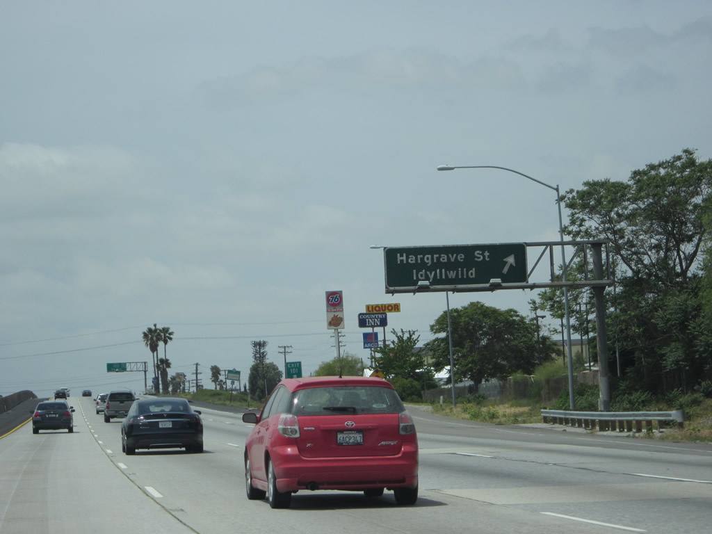
The next exit along westbound Interstate 10 is Exit 101, Hargrave Street. Use Hargrave Street south to connect to California 243 south en route to Idyllwild and to the Banning Airport. The state route climbs onto Mount San Jacinto as it travels toward Idyllwild. California 243 also connects to California 74, the Palms to Pines Highway. Photo taken 04/27/14. |
|
Use Exit 101 to the Banning Municipal Airport. Follow Hargrave Street south to Lincoln Street east. The airport lies south of the freeway and the railroad tracks and north of Barbour Street. Photo taken 04/27/14. |
|
Westbound Interstate 10 reaches Exit 101, Hargrave Street. Use Hargrave Street south to Lincoln Street west to connect with California 243 south to Idyllwild and San Bernardino National Forest. Photo taken 04/27/14. |
|
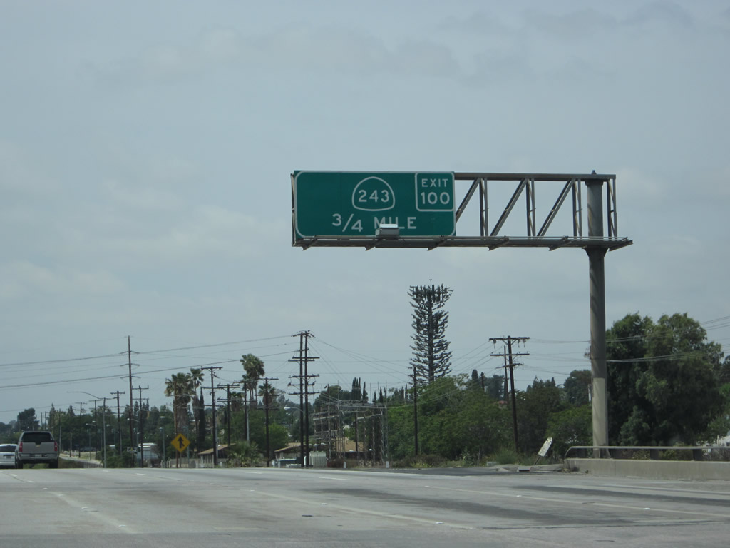
This approach sign for Exit 100, California 243 (8th Street) is an older porcelain enamel sign with an overlay panel for -next right.- Interstate 10 west continues with four lanes through Banning. Photo taken 04/27/14. |
|
Westbound Interstate 10 reaches Exit 100, California 243 (8th Street) to Banning and south to Idyllwild and Mt. San Jacinto. Turn north on 8th Street to connect to Old U.S. 60-70-99 (Ramsey Street), which passes through downtown Banning. Photo taken 04/27/14. |
|
At the base of the ramp for California 243 (8th Street) is this trailblazer. Turn left on 8th Street, then turn left (east) on West Lincoln Street, and then turn south on San Gorgonio Avenue to follow California 243 south toward Idyllwild. Photo taken 01/17/05. |
|
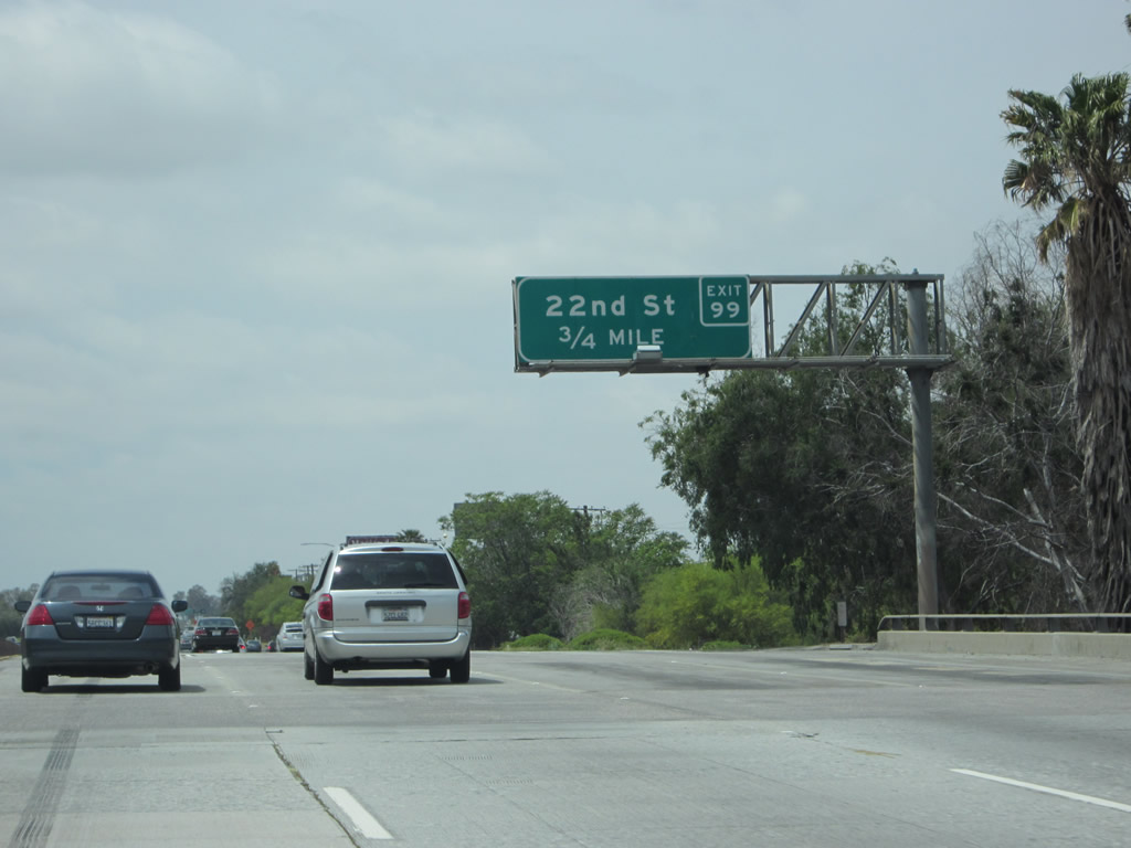
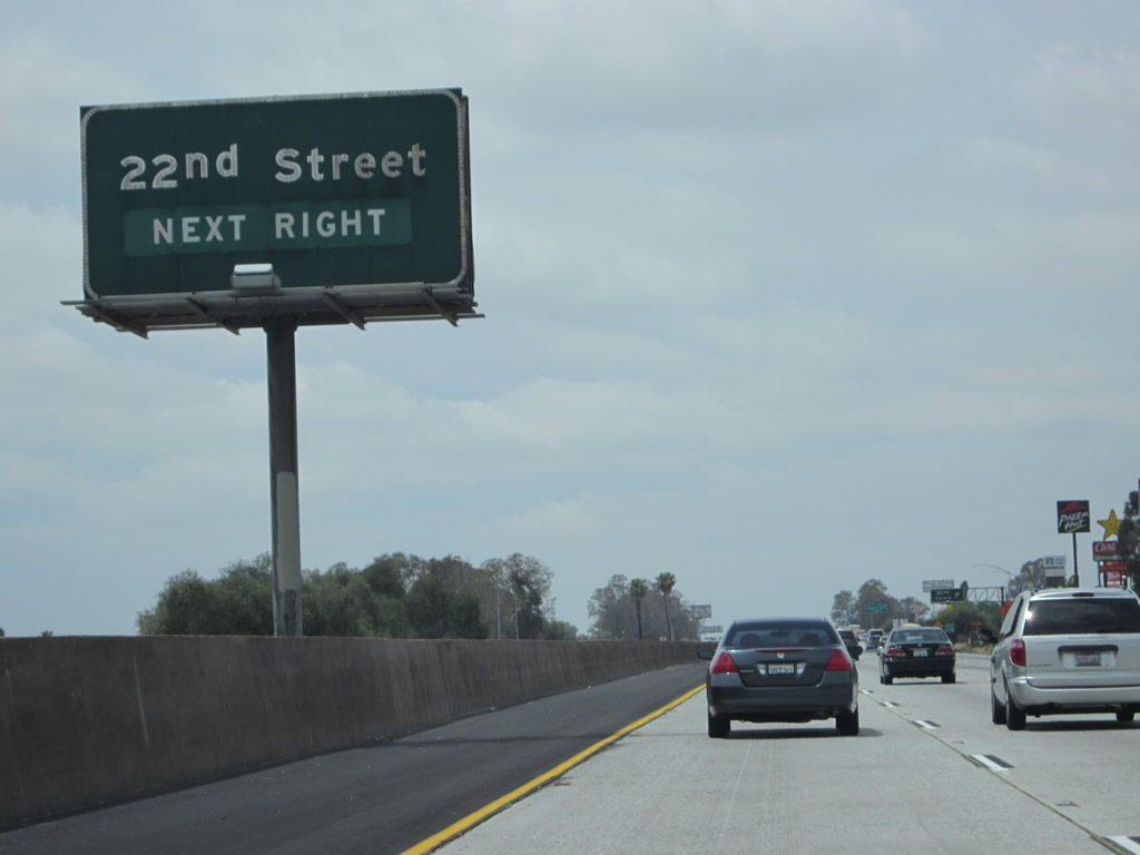
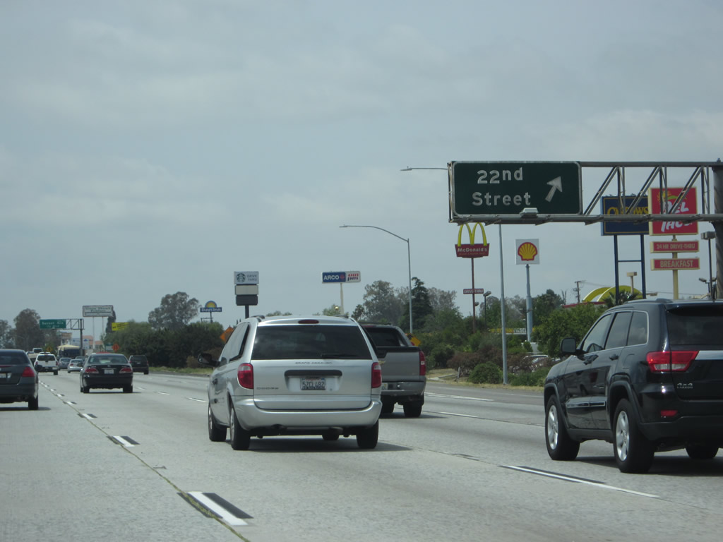
The next exit along westbound Interstate 10 is Exit 99, 22nd Street. This diamond interchange provides access to western Banning, including the Gilman Historic Ranch (abode structure) to the north. Through this area, Interstate 10 is wedged between the railroad on the south and Historic U.S. 60-70-99 (Ramsey Street) on the north. Photo taken 04/27/14. |
|
An older, porcelain-enamel sign remained in place for Exit 99 in the median of westbound Interstate 10. Photo taken 04/27/14. |
|
Westbound Interstate 10 reaches Exit 99, 22nd Street. A variety of restaurants, motels, and gas stations are available on the north side of the freeway. Photo taken 04/27/14. |
|
|
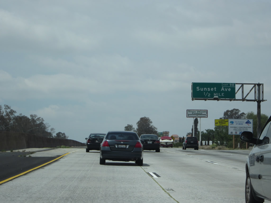
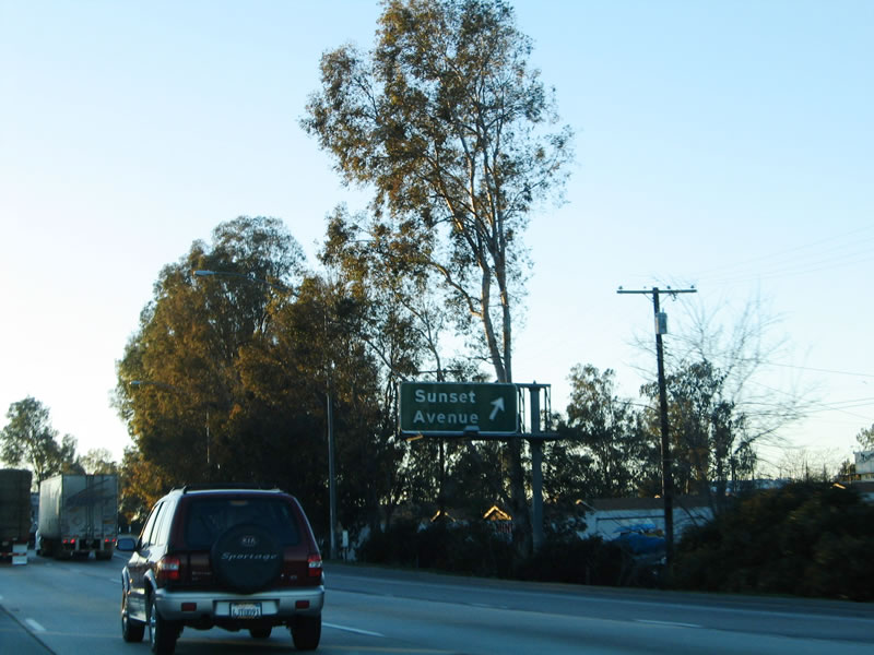
The next exit along westbound Interstate 10 is Exit 98, Sunset Avenue. Travel south to connect to Old Banning-Idyllwild Road, which preceded the current California 243 alignment between Banning and Idyllwild. To the north, Sunset Avenue serves western Banning. Photos taken 04/27/14 and 01/17/05. |
|
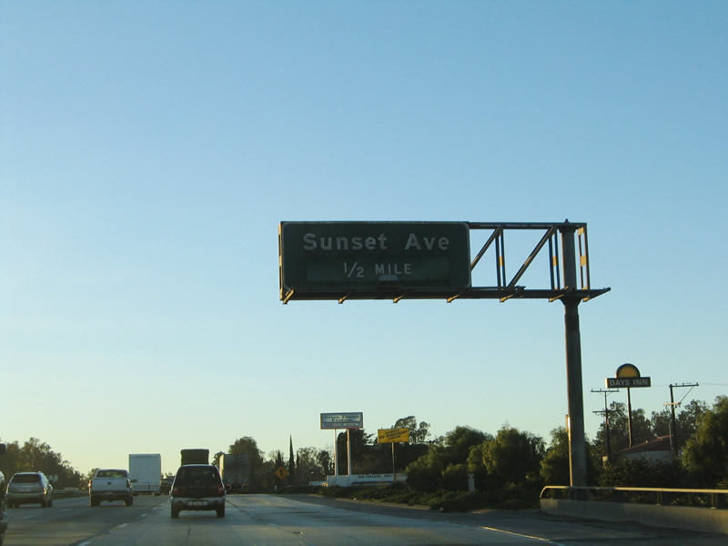
Westbound Interstate 10 reaches Exit 98, Sunset Avenue. This is the final Banning interchange. Photo taken 01/17/05. |
|
This mileage sign provides the distance to Beaumont (four miles) and Los Angeles (81 miles). Omitted are the larger cities in the Inland Empire such as San Bernardino, Ontario, and Riverside (via California 60) as well as larger cities approaching Los Angeles, such as Pomona and Pasadena (via Interstate 210). Photo taken 04/27/14. |
|
|
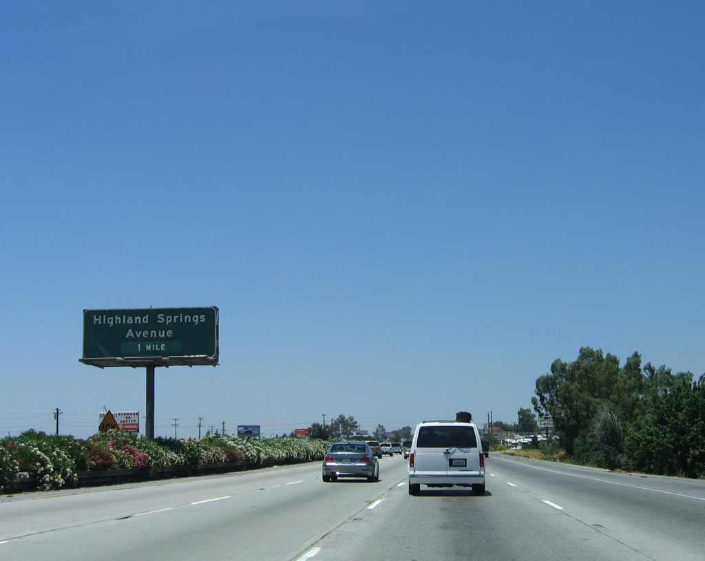
The next exit along westbound Interstate 10 is Exit 96, Highland Springs Avenue (one mile). The overhead sign is posted in the median of the freeway. Use Highland Springs Avenue south to Sun Lakes Country Club and north to Highland Springs Village and Bogart County Park. Photos taken 04/27/14 and 06/17/06. |
|
|
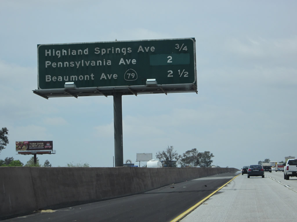
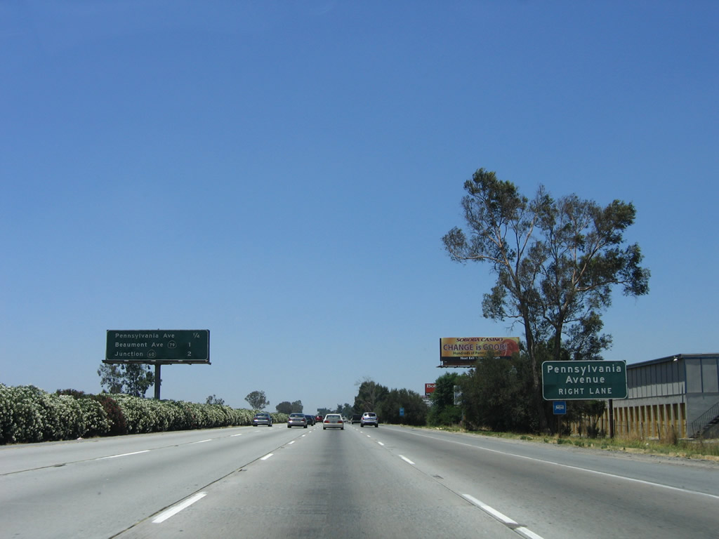
The next three exits along westbound Interstate 10 are Exit 96, Highland Springs Avenue; Exit 95, Pennsylvania Avenue; and Exit 94, California 79 (Beaumont Avenue) south to Hemet. Although the sign didn't change between 2006 and 2014, the median did: Landscaping was removed and a jersey barrier was installed between opposing directions of traffic. Photos taken 04/27/14 and 06/17/06. |
|
Westbound Interstate 10 reaches Exit 96, Highland Springs Avenue; this is the first Beaumont interchange. This exit provides access to Old U.S. 60-70-99, which is known as Ramsey Street to the east of Highland Springs Avenue and as 6th Avenue to the west of Highland Springs Avenue. Photo taken 06/17/06. |
|
|
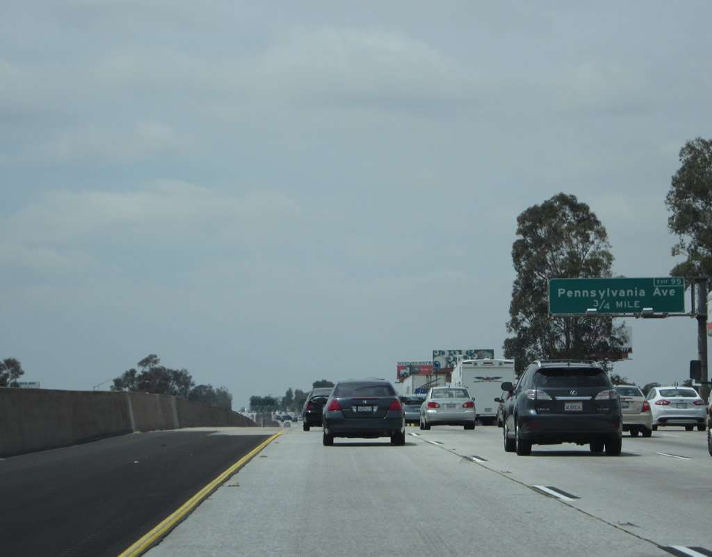
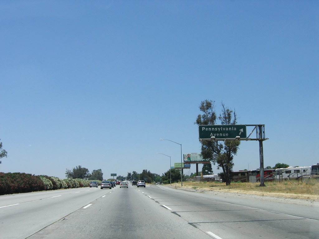
The next exit along westbound Interstate 10 is Exit 95, Pennsylvania Avenue, which serves the city of Beaumont. Located at an elevation of 2,630 feet, Beaumont sits in the San Gorgonio Pass and was incorporated in 1912. As of the 2000 Census, 11,384 people lived in Beaumont, but the area is rapidly growing as more people move to the pass. Beaumont was originally known as San Gorgonio before it incorporated as a city. Photos taken 04/27/14 and 06/17/06. |
|
Oleander, a common freeway landscaping feature, used to line both sides of westbound Interstate 10 in Beaumont. This changed when the concrete median barrier was built. Photo taken 06/17/06. |
|
|
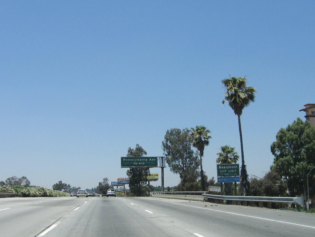
A roadside sign is posted along westbound Interstate 10 for Exit 95, Pennsylvania Avenue. This kind of signage can be difficult to see on a busy highway like Interstate 10 from the left lanes due to line of sight and heavy traffic patterns. A mileage sign for the next three exits is posted in the median ahead. Photos taken 04/27/14 and 06/17/06. |
|
Westbound Interstate 10 reaches Exit 95, Pennsylvania Avenue to Beaumont. Photo taken 06/17/06. |
|
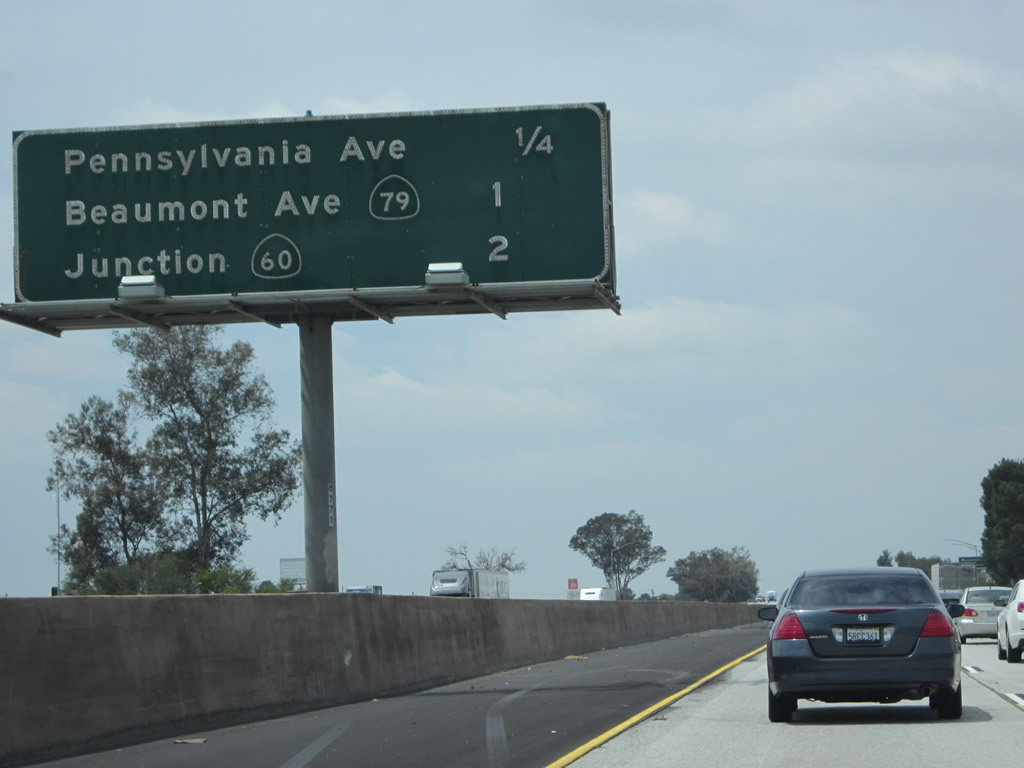
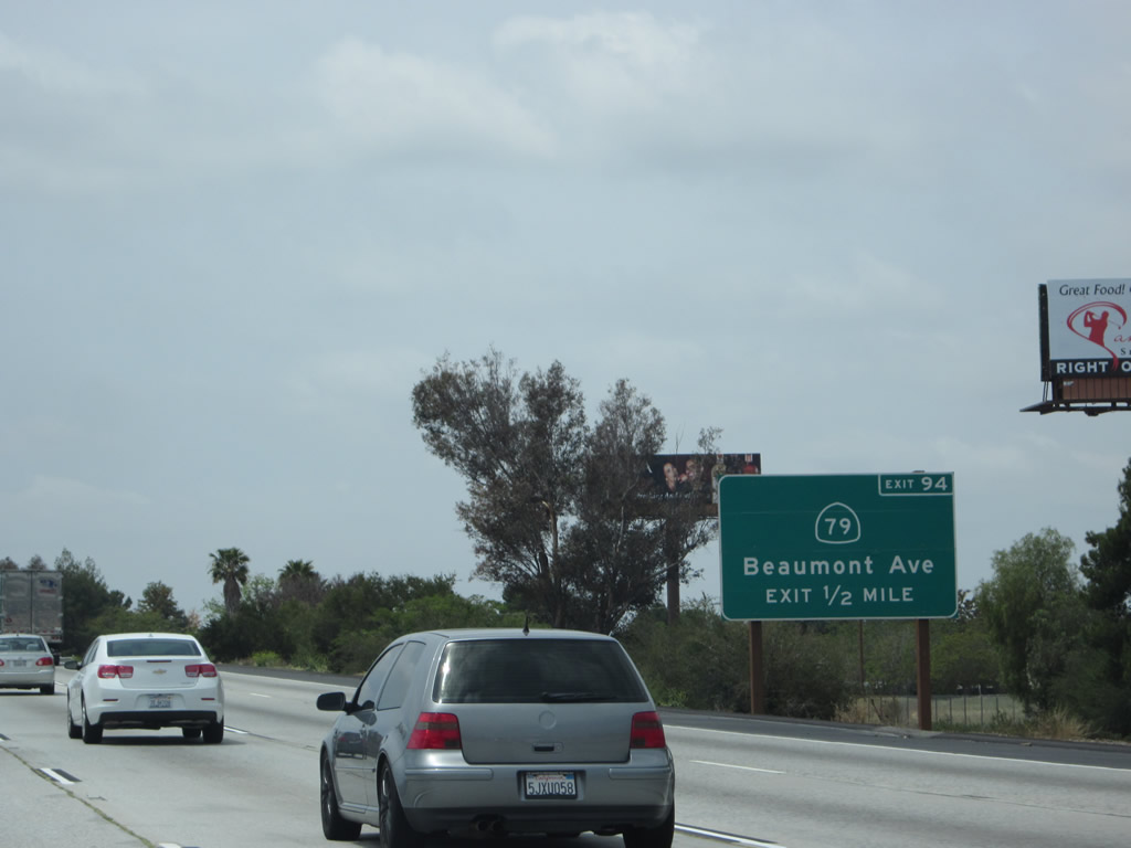
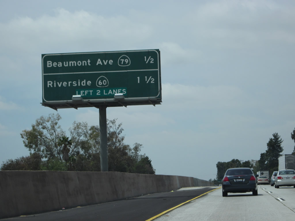
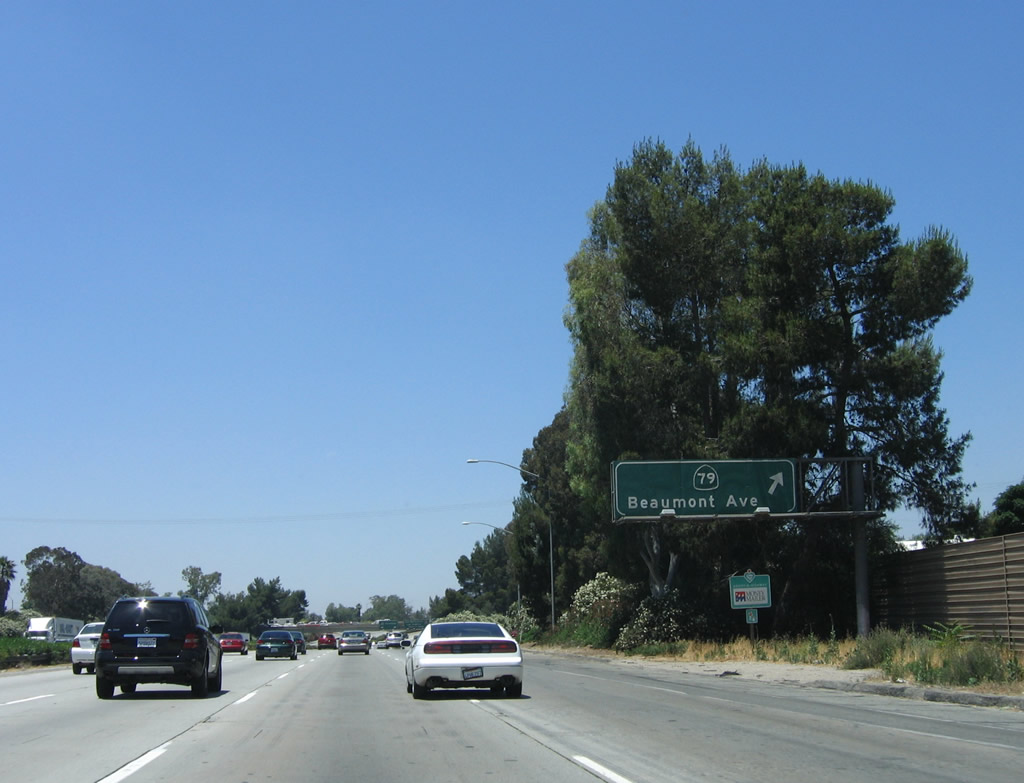
The next exit along westbound Interstate 10 is Exit 94, California 79 (Beaumont Avenue) south to Lamb Canyon. Photo taken 04/27/14. |
|
|
Immediately after Exit 94, California 79 (Beaumont Avenue) south is the left exit to Exit 93, California 60 (Moreno Valley Freeway). At Exit 94, Beaumont Avenue also travels north to Cherry Valley by changing its name to Oak Glen Road. Photos taken 06/17/06 and 04/27/14. |
|
Use California 79 south to Hemet and San Jacinto. Photo taken 06/17/06. |
|
Exit 94 also serves the community of Oak Glen. Photo taken 06/17/06. |
|
|
Use the left two lanes to connect to California 60 (Moreno Valley Freeway) west to Moreno Valley and Riverside. Photos taken 04/27/14 and 06/17/06. |
|
Westbound Interstate 10 reaches Exit 94, California 79 (Beaumont Avenue). Heavy traffic used the exit to California 79 on this evening; it is a primary route south toward Hemet and other Inland Empire cities in the rapidly growing region. Even with a realignment of the highway north of Hemet, California 79 is still a very busy corridor from Interstate 15 near Temecula north to Interstate 10 at Beaumont. South of Temecula, California 79 takes a more leisurely and pleasant turn to explore the backcountry of San Diego County, passing through Julian and Rancho Cuyamaca State Park before culminating its journey at Interstate 8 near Descanso. Photo taken 06/17/06. |
|
|
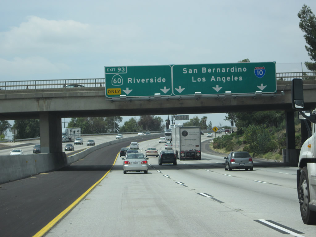
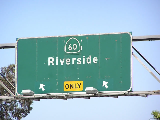
The next exit along westbound Interstate 10 is Exit 93, California 60. This is a left exit. The overhead signs were replaced by 2014 to include the exit number. Photos taken 04/27/14 and 06/17/06. |
|
|
Historically, U.S. 60 split from U.S. 70-99 at this interchange. U.S. 60 headed due west toward Moreno Valley and Riverside via today's California 60, while U.S. 70-99 headed northwest toward San Bernardino. The routes used to rejoin near Pomona, and U.S. 60-70-99 followed the Interstate 10 alignment from there west into downtown Los Angeles. The graphical overhead sign was replaced with a more traditional exit number sign by 2014. Photos taken 04/27/14 and 06/17/06. |
|
|
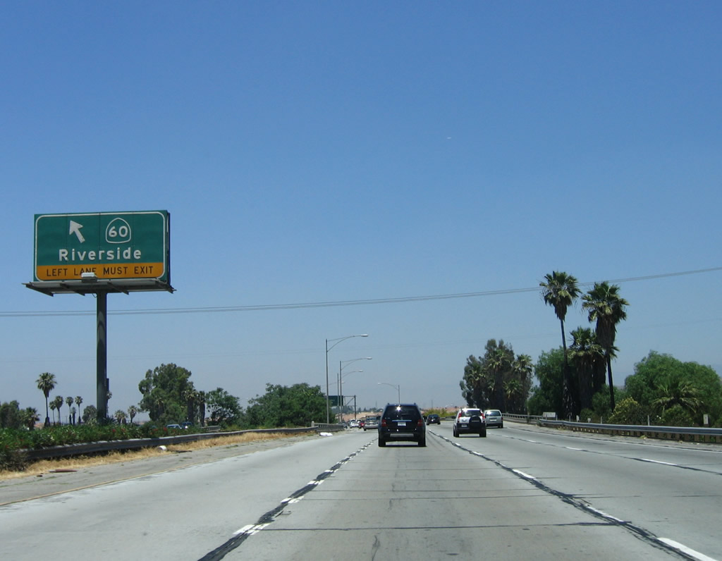
The left lane must exit onto westbound California 60 (Moreno Valley Freeway). A direct connection from Old U.S. 60-70-99 (6th Avenue) is provided to California 60 west at the Exit 93 interchange. However, the old road does not continue northwest along Interstate 10 toward Calimesa. Old road travelers wishing to follow Old U.S. 70-99 must use Interstate 10 west between Exits 93 and 92, then follow Desert Lawn Drive toward Calimesa. Photos taken 04/27/14 and 06/17/06. |
|
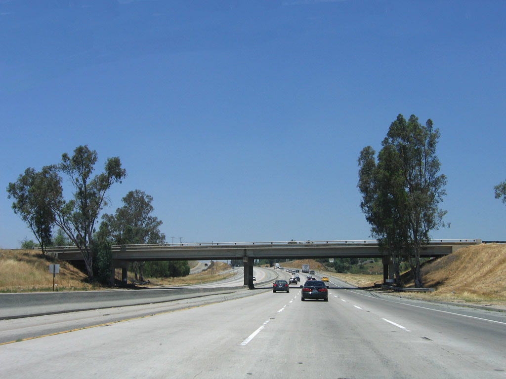
This view shows the split between California 60 (Old U.S. 60) west and Interstate 10 (U.S. 70-99) west after the gore point. California 60 carries two lanes into the Badlands that separate the San Gorgonio Pass from Moreno Valley, and Interstate 10 carries three lanes northwest toward Redlands. Photo taken 06/17/06. |
|
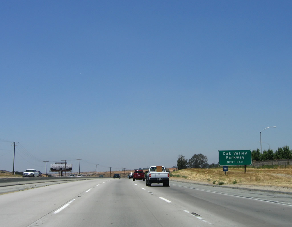
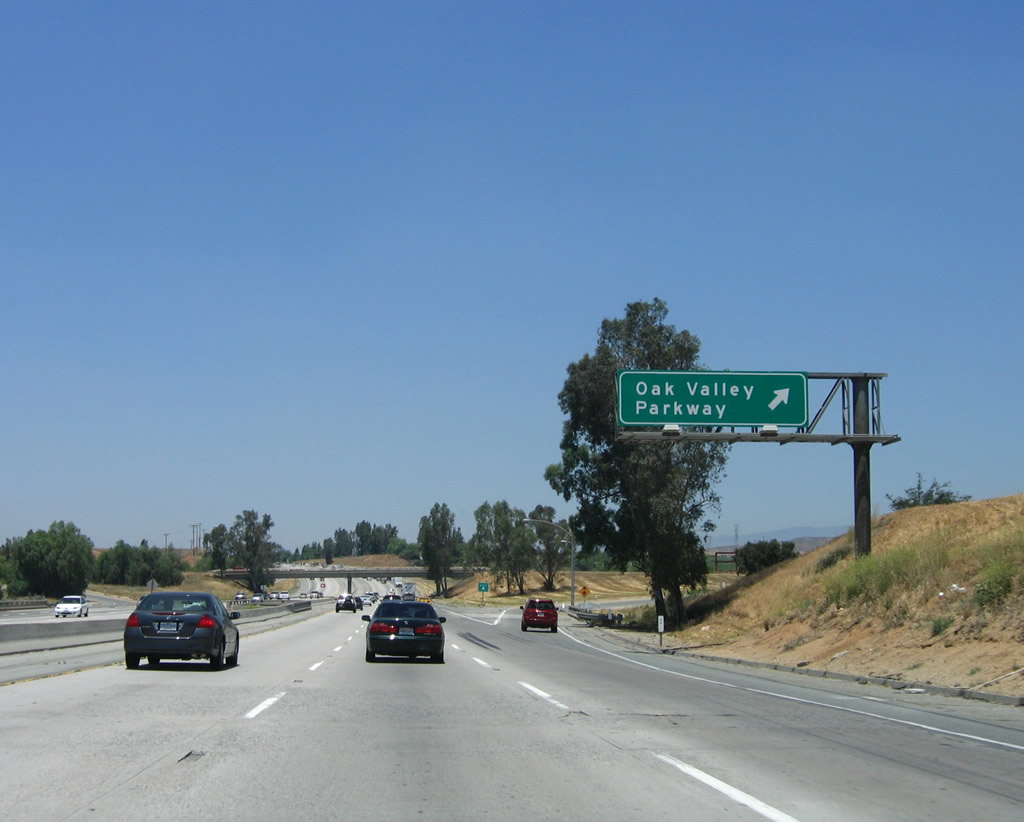
The next exit along westbound Interstate 10 is Exit 92, Oak Valley Parkway. After the California 60 split, Interstate 10 reverts to three lanes in each direction (California 60 has two lanes in each direction at its eastern beginning). Photo taken 06/17/06. |
|
Follow Oak Valley Parkway west to San Timoteo Canyon Road which travels through San Timoteo Canyon parallel to the railroad en route to the city of Redlands. To the east, Oak Valley Parkway travels east to 14th Street en route to Beaumont Avenue. Photo taken 06/17/06. |
|
Westbound Interstate 10 reaches Exit 92, Oak Valley Parkway and San Timoteo Canyon Road. Photo taken 06/17/06. |
|
The interchange between Interstate 10 and Exit 92, Oak Valley Parkway and San Timoteo Canyon Road is a standard diamond. Photo taken 06/17/06. |
|
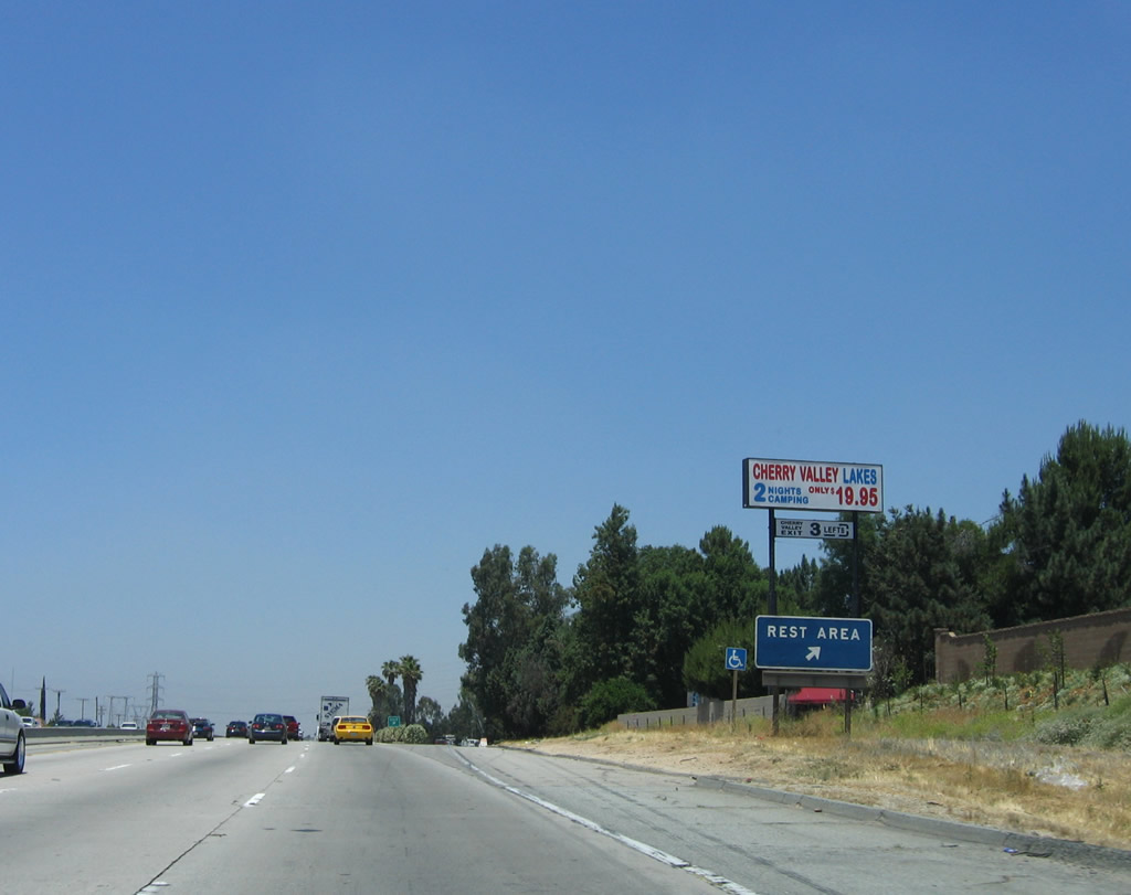
The next exit along westbound Interstate 10 is Exit 91, Rest Area. This is the final rest area on westbound Interstate 10. The speed limit remains 70 miles per hour until we enter San Bernardino County in Yucaipa. Photo taken 06/17/06. |
|
Traveling in a northwesterly direction since splitting from California 60, westbound Interstate 10 enters the city of Calimesa. Situated in Yucaipa Valley on the western descent from the San Gorgonio Pass, Calimesa is home to 7,139 people as of the 2000 Census. After Calimesa, Interstate 10 will leave Riverside County and enter San Bernardino County. Photo taken 06/17/06. |
|
Westbound Interstate 10 reaches Exit 91, the final rest area along the westbound freeway. Restrooms, phone, and other motorist amenities are available. Photo taken 06/17/06. |
|
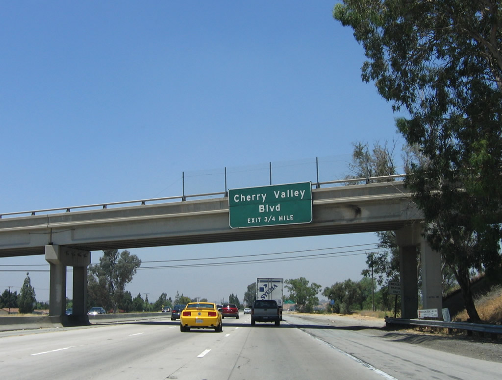
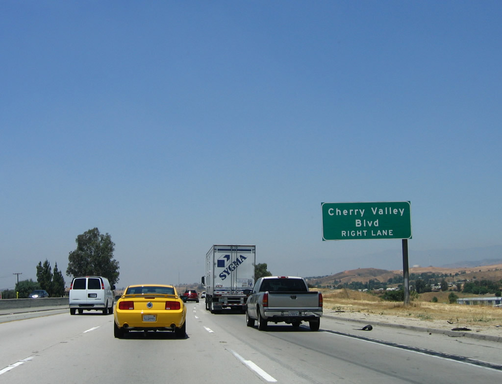
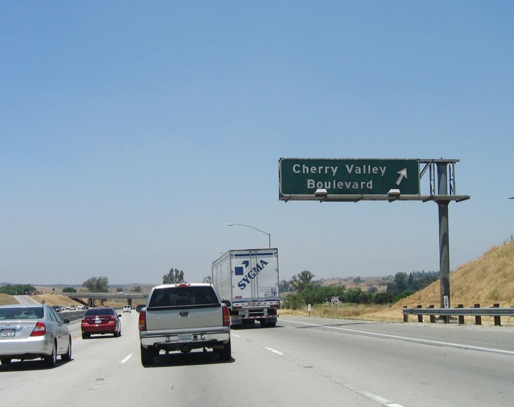
The next exit on westbound Interstate 10 is Exit 90, Cherry Valley Boulevard/Desert Lawn Drive. Cherry Valley Boulevard travels east to Beaumont Avenue, while Desert Lawn Drive serves as the frontage road along Interstate 10. Photo taken 06/17/06. |
|
Desert Lawn Drive follows along Interstate 10 on the south side of the freeway, while Calimesa Boulevard (Old U.S. 70-99) begins on the north side of the freeway at this interchange. Photo taken 06/17/06. |
|
Westbound Interstate 10 reaches Exit 90, Cherry Valley Boulevard. Photo taken 06/17/06. |
|
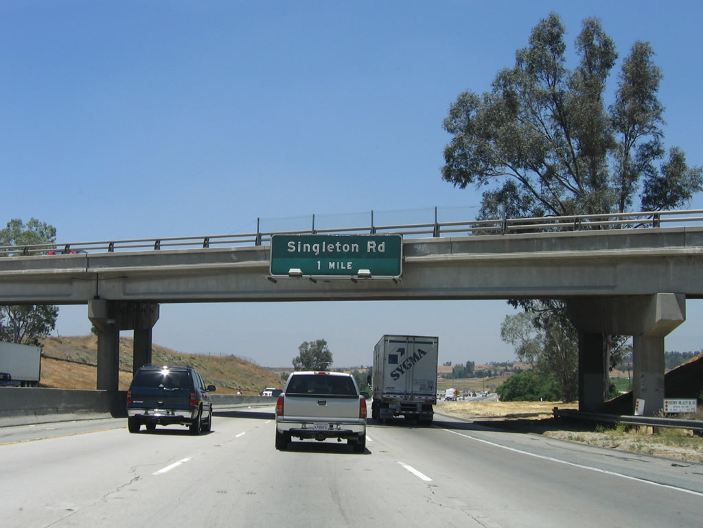
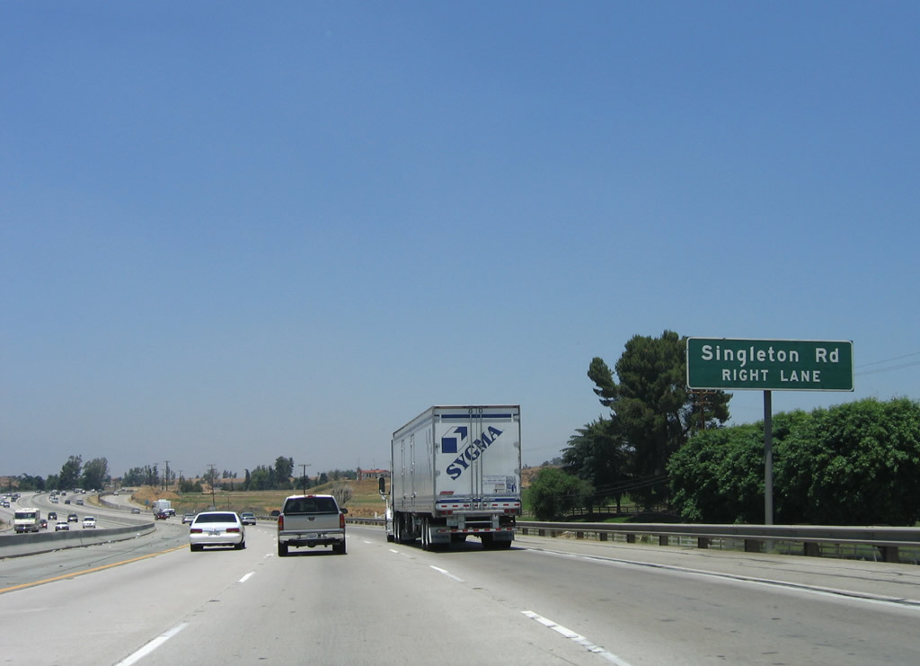
The next exit is Exit 89, Singleton Road (one mile). This sign is mounted on the Cherry Valley Boulevard overpass. Photo taken 06/17/06. |
|
Access to Singleton Road is only provided from westbound Interstate 10. Motorists who exit here cannot reenter Interstate 10 at this interchange; they must follow Calimesa Boulevard northwest to the Calimesa Boulevard interchange. Similarly, there is no access to Exit 89 for eastbound motorists. Photo taken 06/17/06. |
|
Westbound Interstate 10 reaches Exit 89, Singleton Road. Photo taken 06/17/06. |
|
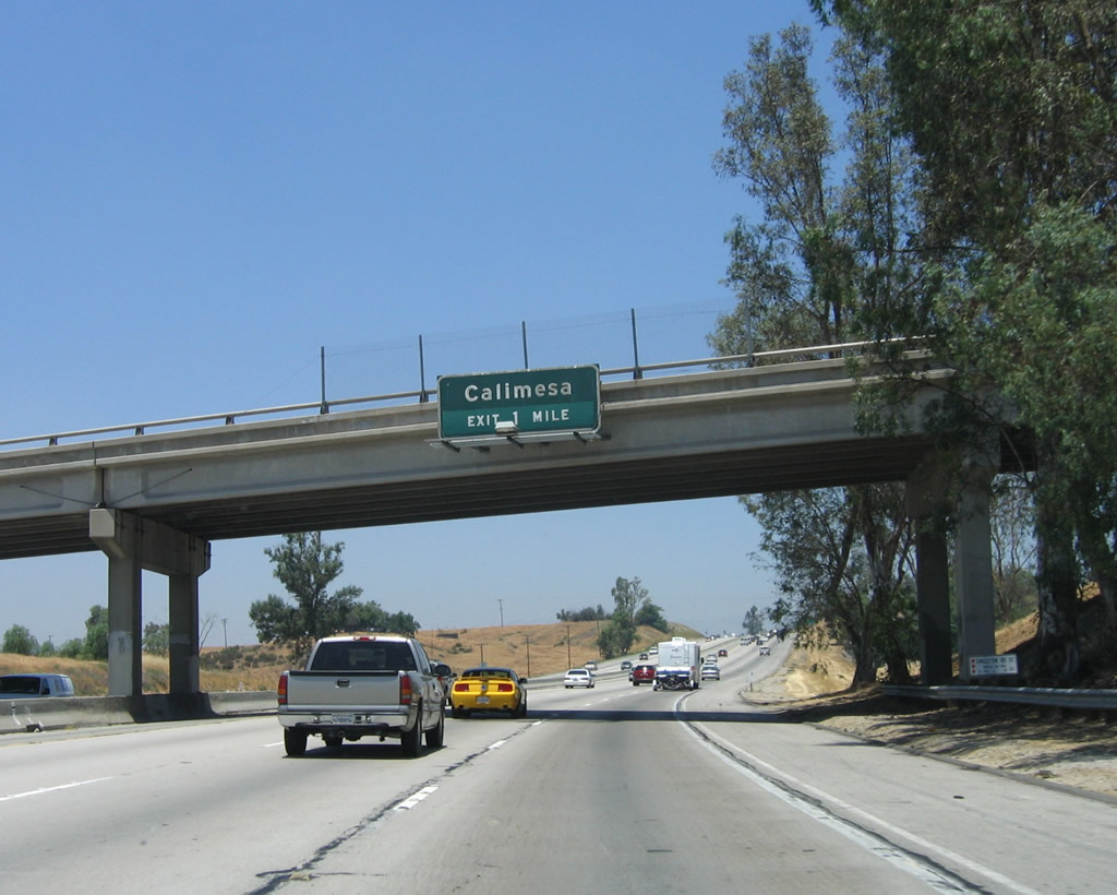
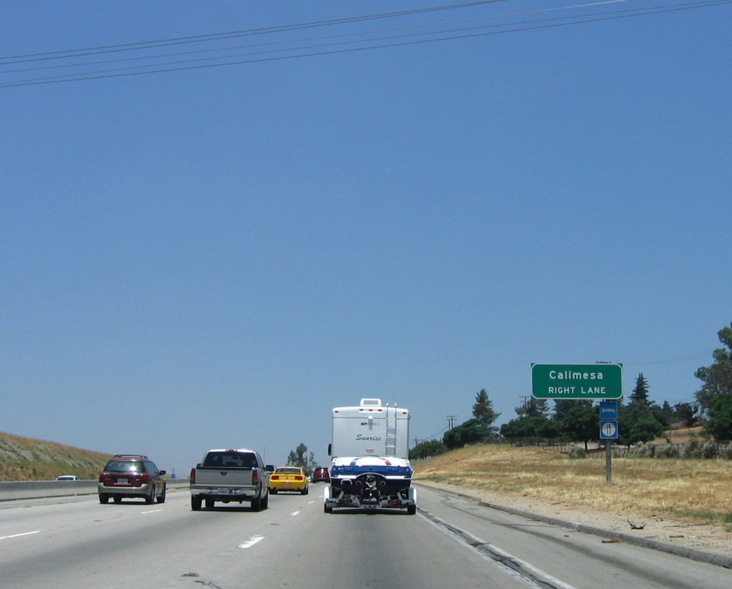
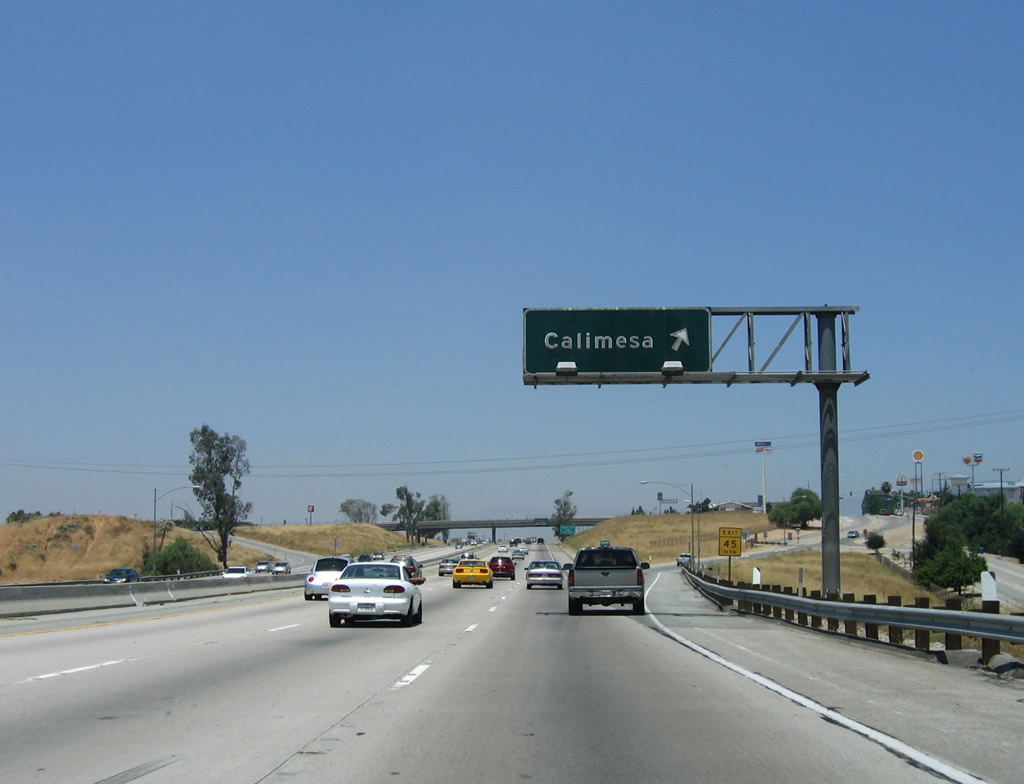
The next exit along Interstate 10 west is Exit 88, Calimesa Boulevard and Fifth Street. Photo taken 06/17/06. |
|
Interstate 10 west approaches Exit 88, Calimesa Boulevard and Fifth Street to Calimesa. Photo taken 06/17/06. |
|
Westbound Interstate 10 reaches Exit 88, Calimesa Boulevard (Old U.S. 70-99). This exit serves downtown Calimesa. Photo taken 06/17/06. |
|
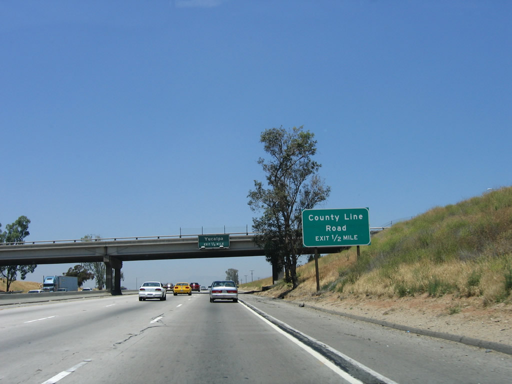
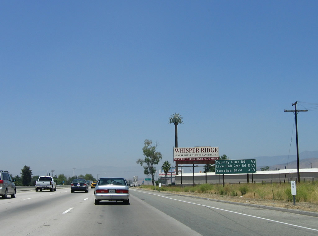
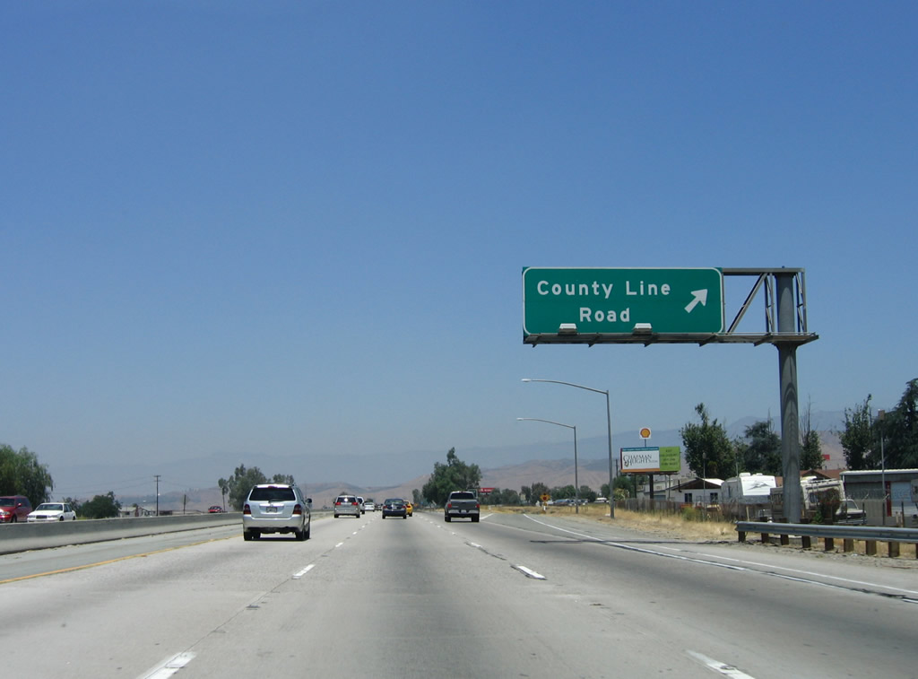
The next exit along Interstate 10 west is Exit 87, County Line Road to the city of Yucaipa in San Bernardino County. As Interstate 10 travels northwest, it will cross the county line between Riverside County and San Bernardino County at Exit 87. Photo taken 06/17/06. |
|
An interchange sequence sign on the side of the road provides the distance to the next three exits along Interstate 10 west: Exit 87, County Line Road to Yucaipa; Exit 85, Live Oak Canyon Road; and Exit 83, Yucaipa Boulevard. Photo taken 06/17/06. |
|
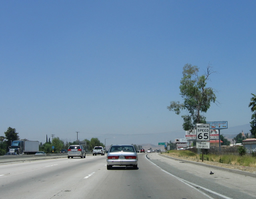
The speed limit drops to 65 miles per hour, and Interstate 10 will not see the 70 mile per hour speed limit again on westbound. Photo taken 06/17/06. |
|
Westbound Interstate 10 reaches Exit 87, County Line Road to Yucaipa. Photo taken 06/17/06. |
|
Crossing over County Line Road, westbound Interstate 10 leaves the city of Calimesa and enters the city of Yucaipa (population 41,207 as of 2000 Census, incorporated in 1989, and elevation of 2,618 feet). Interstate 10 leaves Riverside County and enters San Bernardino County at the same time. Photo taken 06/17/06. |
|
This Interstate 10 west reassurance shield is posted after the on-ramp from County Line Road in Yucaipa. Photo taken 06/17/06. |
|
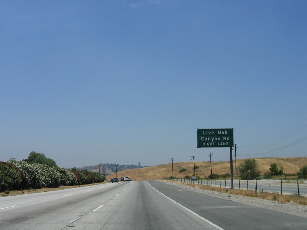
The next exit along Interstate 10 west is Exit 85, Live Oak Canyon Road and Oak Glen Road (one mile). Photo taken 06/17/06. |
|
Rural scenery dominates Interstate 10 west as we approach Exit 85, Live Oak Canyon Road and Oak Glen Road. Photo taken 06/17/06. |
|
Westbound Interstate 10 reaches Exit 85, Live Oak Canyon Road and Oak Glen Road. Photo taken 06/17/06. |
|
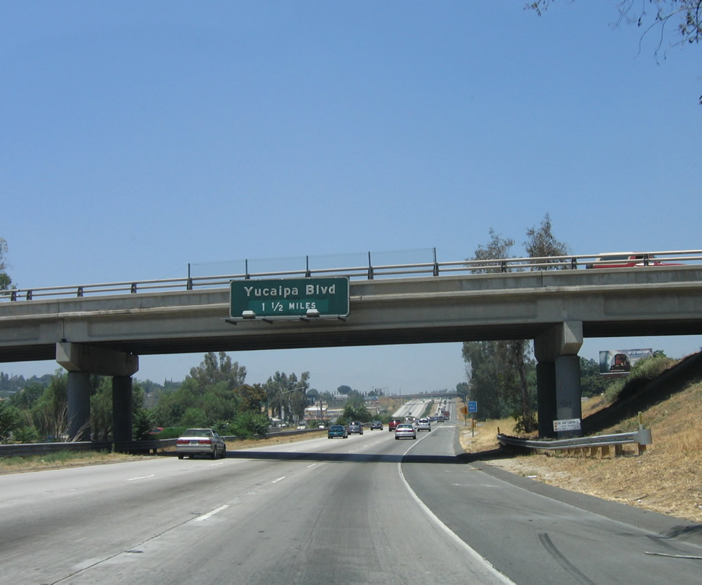
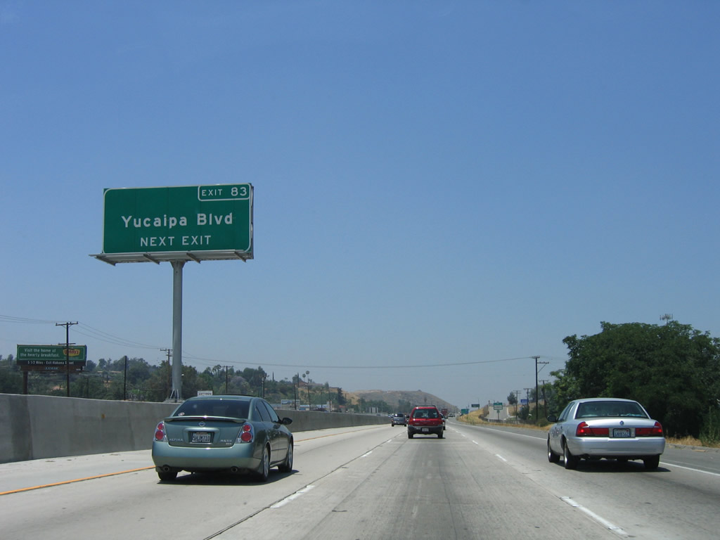
The next exit along Interstate 10 west is Exit 83, Yucaipa Boulevard (1.25 miles). Photo taken 06/17/06. |
|
An Interstate 10 west reassurance shield assembly is posted shortly thereafter. Photo taken 06/17/06. |
|
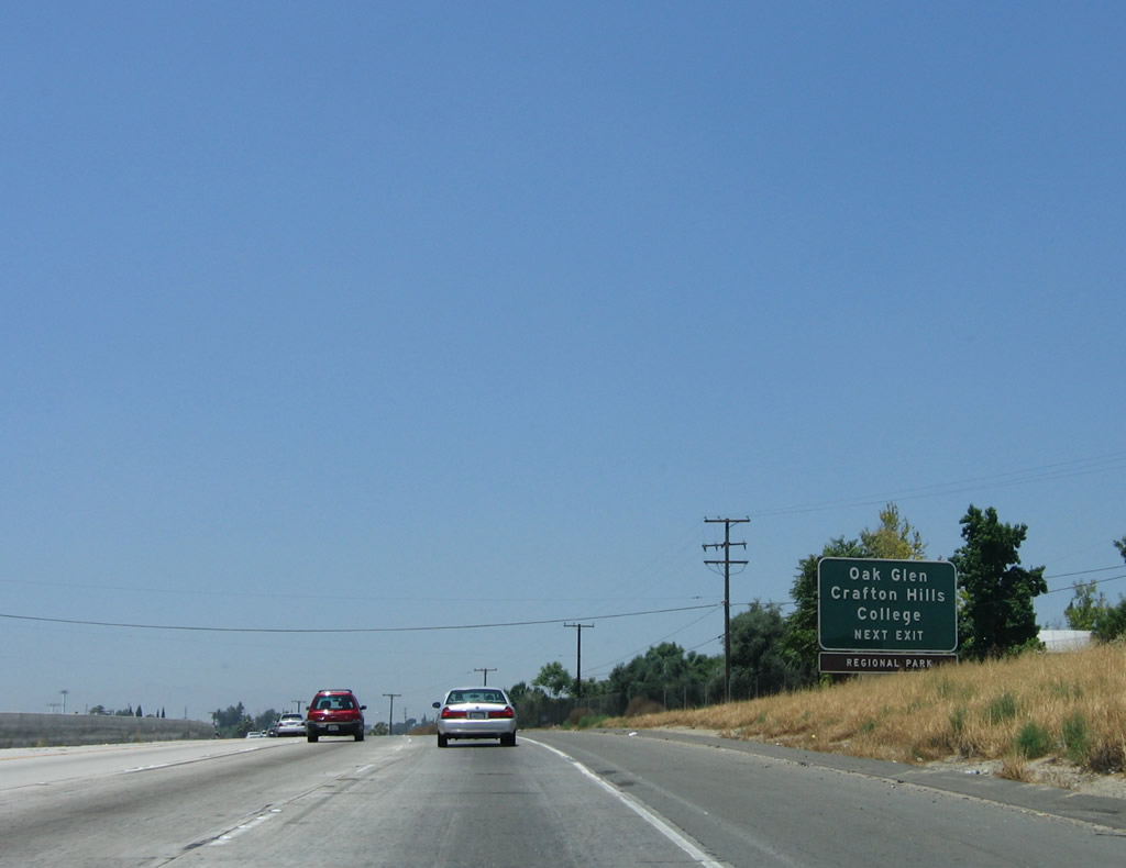
Use Yucaipa Boulevard east to Crafton Hills College. Photo taken 06/17/06. |
|
A recent median reconstruction project resulted in the installation of this newer reflective exit number sign for Exit 83, Yucaipa Boulevard on westbound Interstate 10. Photo taken 06/17/06. |
|
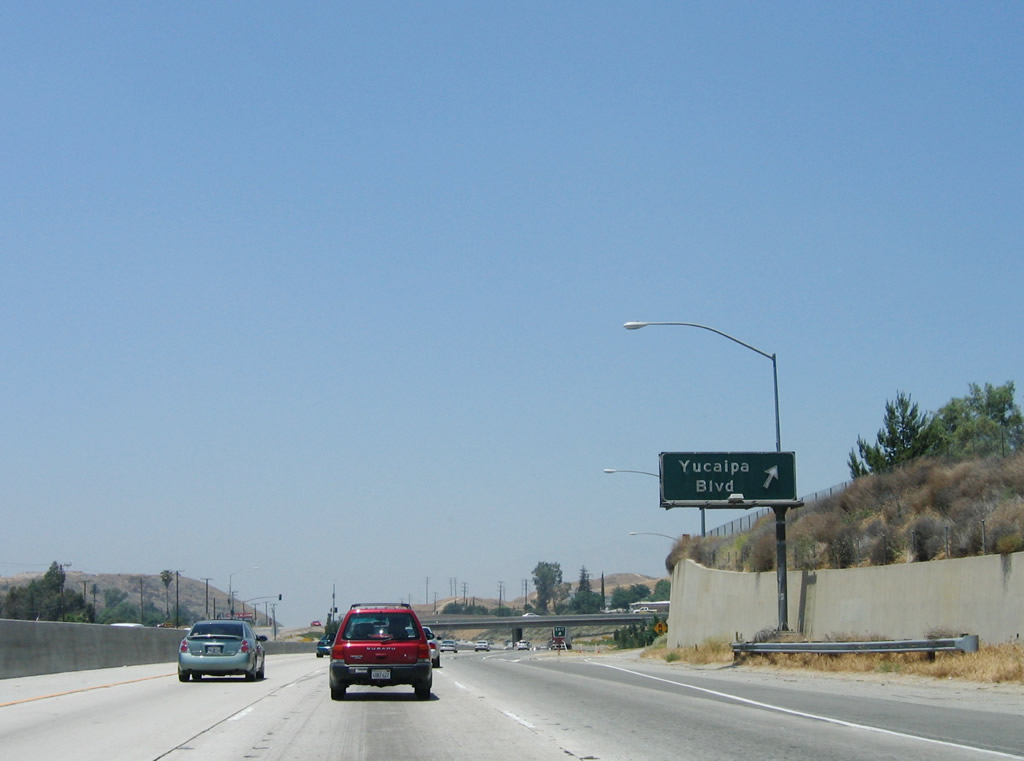
Westbound Interstate 10 reaches Exit 83, Yucaipa Boulevard. Photo taken 06/17/06. |
|
Between Exits 83 and 82 is the downhill descent through the Crafton Hills between Yucaipa and Redlands. Photo taken 06/17/06. |
|
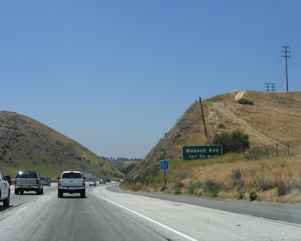
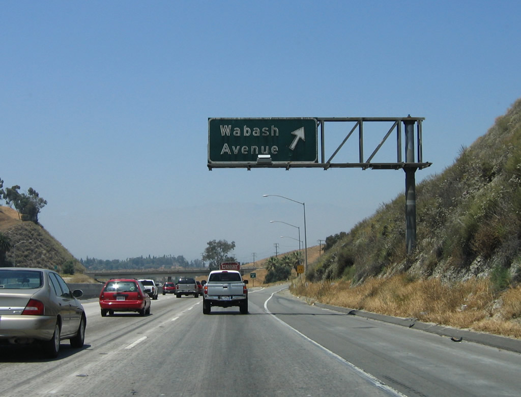
The next exit along Interstate 10 west is Exit 82, Wabash Avenue (0.75 mile). Photo taken 06/17/06. |
|
While there is access to Exit 82 from Interstate 10 west, there is no access to Exit 82, Wabash Avenue from eastbound Interstate 10. Photo taken 01/17/05. |
|
Westbound Interstate 10 reaches Exit 82, Wabash Avenue. Photo taken 06/17/06. |
|
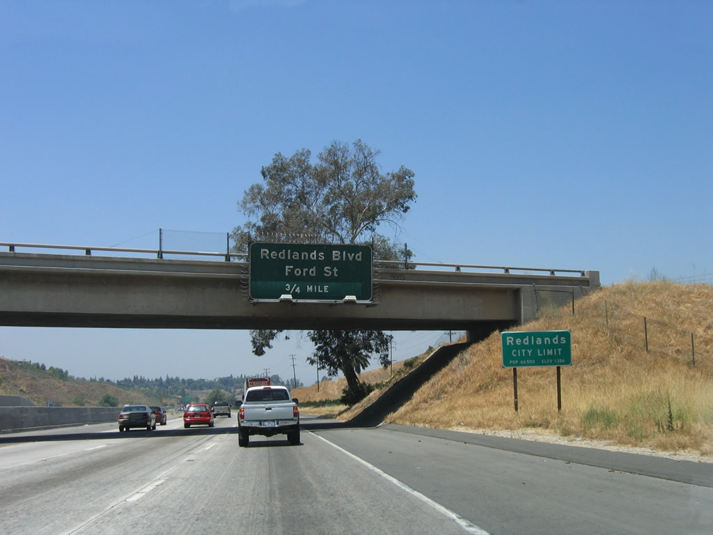
The next exit along Interstate 10 east is Exit 81, Ford Street and U.S. 70-99 Business/Redlands Boulevard. Interstate 10 leaves Yucaipa and enters the city of Redlands (population 63,591 as of the 2000 Census). Redlands was incorporated in 1888. Photo taken 06/17/06. |
|
Redlands Boulevard is the old alignment of U.S. 70-99 through Redlands and southeastern San Bernardino; it was not assigned a business loop designation, but Redlands Boulevard served briefly as U.S. 70-99 Business. The unofficial "business route" merges back onto Interstate 10 again at Exit 73A. Soon after this sign, Redlands Boulevard and Ford Street depart from Interstate 10 west at Exit 81. Photo taken 06/17/06. |
|
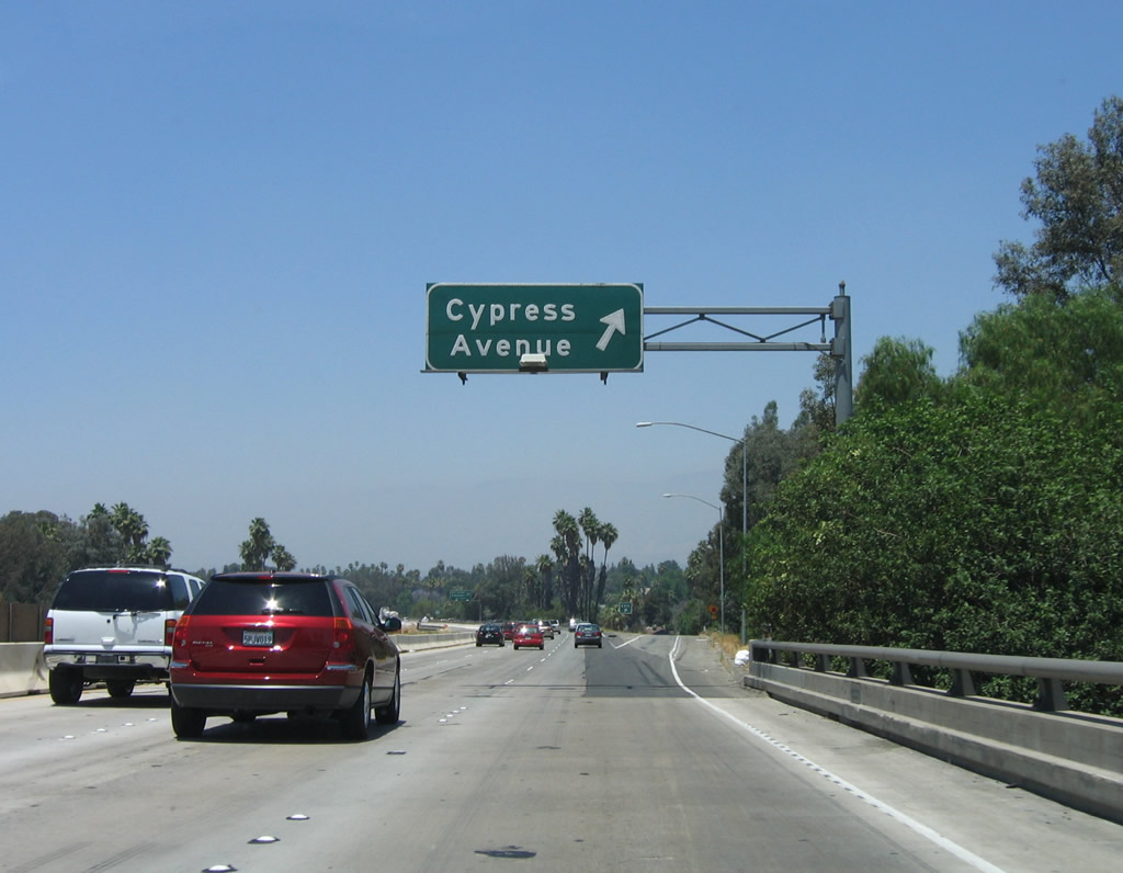
The next exit along Interstate 10 east is Exit 80, Cypress Avenue (1.25 miles). Photo taken 06/17/06. |
|
An Interstate 10 east reassurance shield is posted after the on-ramp from Ford Street. Photo taken 06/17/06. |
|
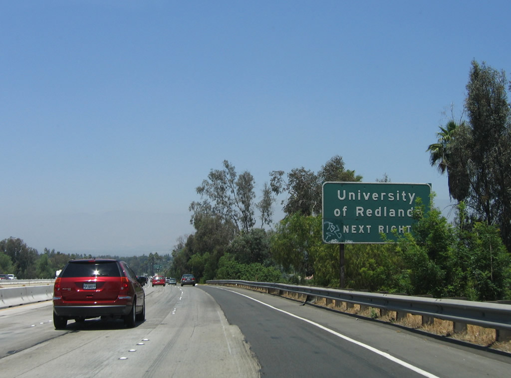
Use Exit 80 to the University of Redlands. Photo taken 06/17/06. |
|
Eastbound Interstate 10 reaches Exit 80, Cypress Avenue. Photo taken 06/17/06. |
|
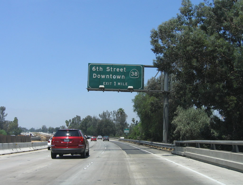
The next exit along Interstate 10 west is Exit 79B, California 38 north to Big Bear and Sixth Street south to downtown Redlands. California 38, along with California 18 and California 330, is a route into the San Bernardino Mountains by way of Onyx Summit. At an elevation of 8,440 feet, California 38 is the highest elevation state highway in Southern California. After traveling east to Onyx Summit, California 38 turns north to meet California 18 in Big Bear City. After a brief overlap, California 38 turns west to traverse the north shore of Big Bear Lake, then ends at its second junction with California 18 near the Big Bear Lake dam. Photo taken 06/17/06. |
|
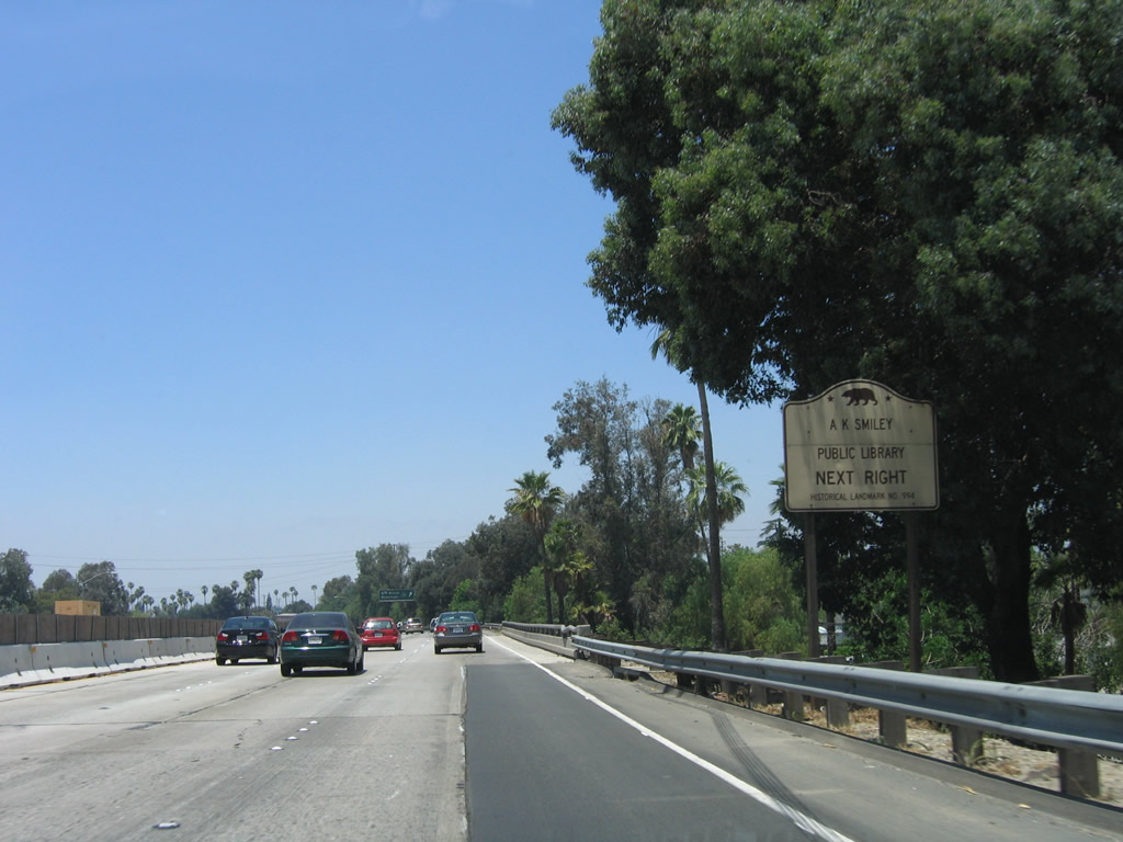
Use Sixth Street to the A.K. Smiley Public Library, a California historic marker. Photo taken 06/17/06. |
|
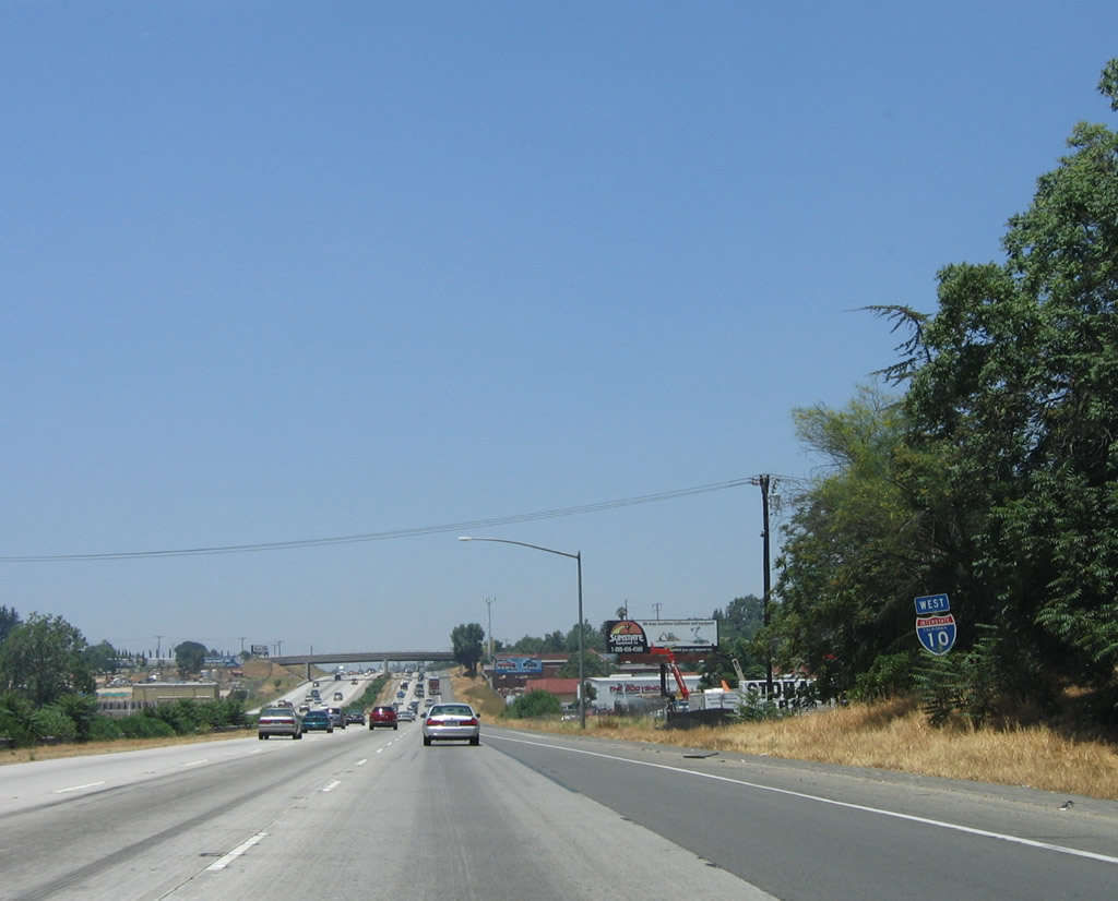
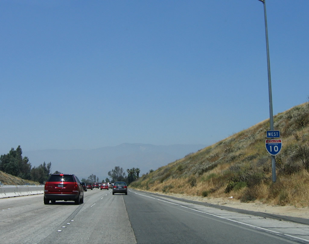
A neutered Interstate 10 shield (without a state name) appears prior to Exit 79B, California 38 north and Sixth Street. Photo taken 09/28/08. |
|
|
Westbound Interstate 10 reaches Exit 79B, California 38 and Sixth Street south to downtown Redlands. There does not appear to be an Exit 79A. Photos taken 09/28/08 and 06/17/06. |
|
|
Upon departing at Exit 79B, a California 38 trailblazer is posted on the off-ramp to Sixth Street. Signage changed between 2006 and 2008. Photos taken 09/28/08 and 06/17/06. |
|
|
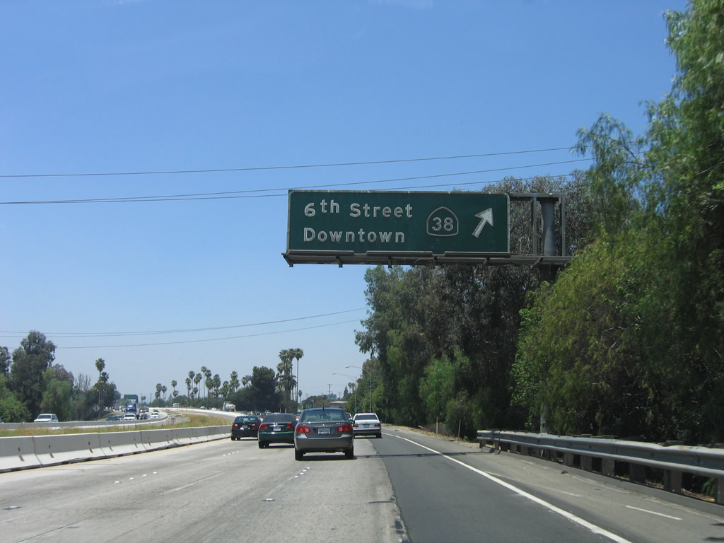
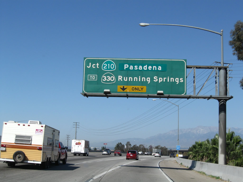
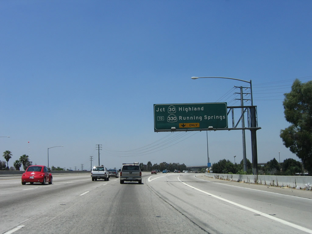
After the Sixth Street interchange, the next exit along Interstate 10 west is Exit 77C, California 210 (Foothill Freeway) west to San Bernardino, Rancho Cucamonga, Pasadena, and San Fernando. A major freeway corridor, California 210 becomes Interstate 210 at the Orange Freeway (California 57) interchange shared between Glendora and San Dimas. Photos taken 09/28/08 and 06/17/06. |
|
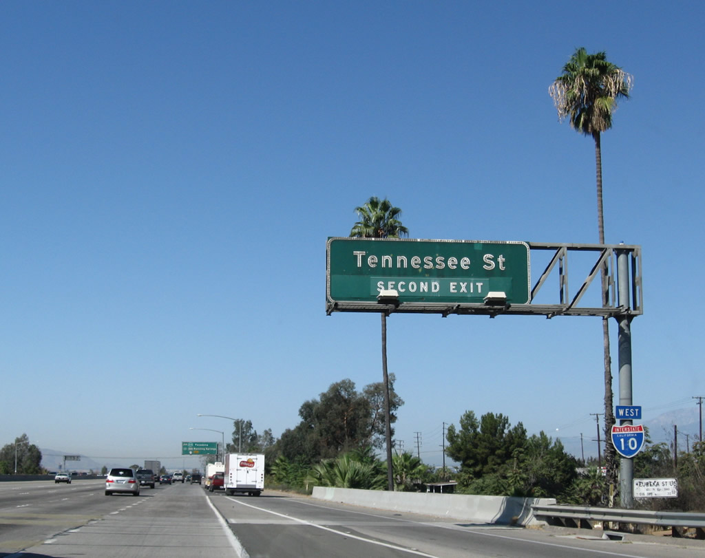
The second exit after Exit 77C, California 210 west is Exit 77B, Tennessee Street. Photo taken 09/28/08. |
|
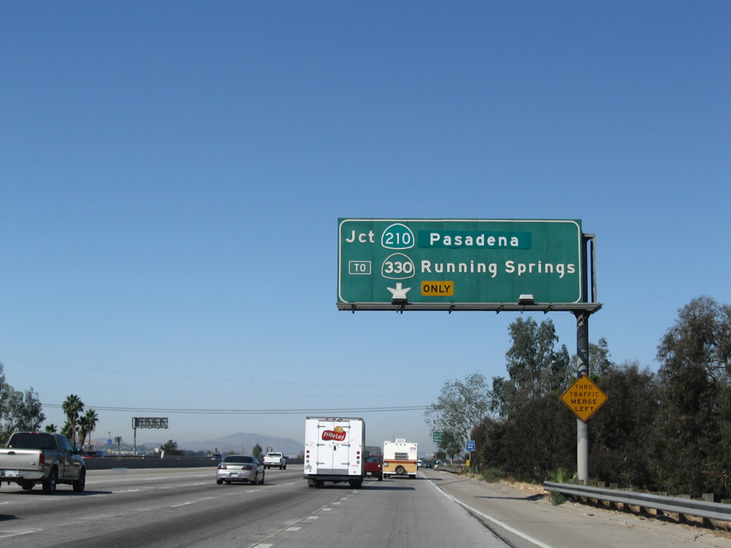
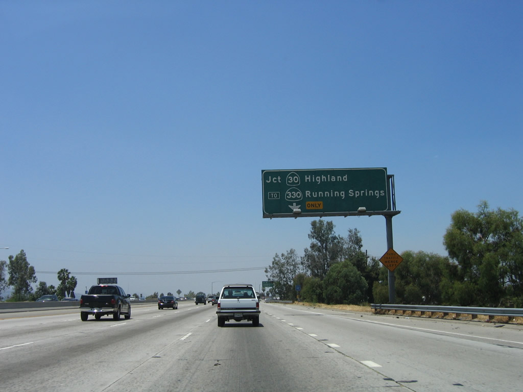
|
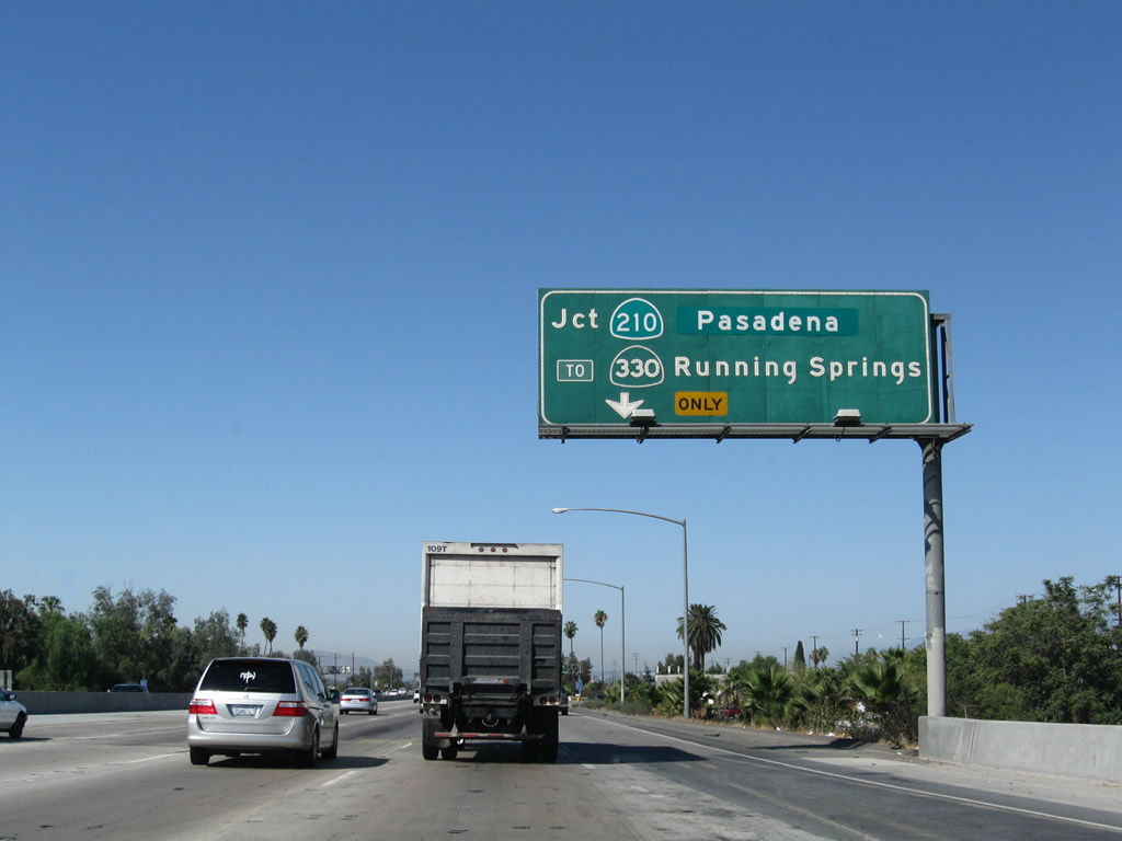
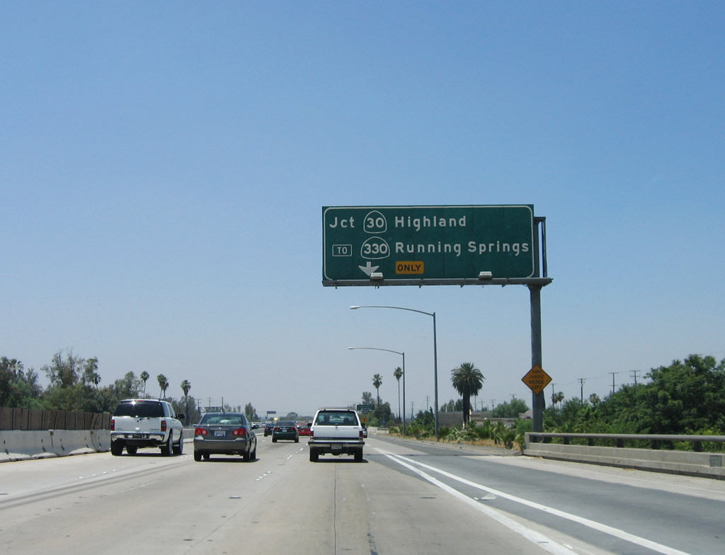
When California 210 was signed over former California 30 in 2007, the shield and control city were replaced, with 30 changing to 210 and Highland changing to Pasadena. The right lane becomes exit only for Exit 77C, California 210 west. Photos taken 09/28/08 and 06/17/06. |
|
|
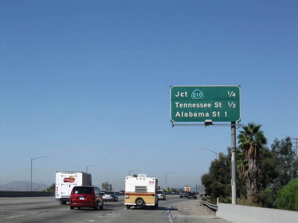
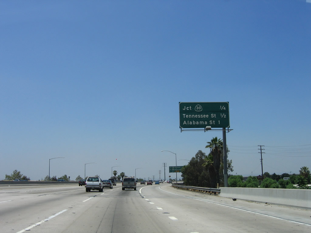
This mileage sign provides the distance to the next three exits: Exit 77C, California 210 west to Highland and Pasadena; Exit 77B, Tennessee Street; and Exit 77A, Alabama Street. Photos taken 09/28/08 and 06/17/06. |
|
|
Westbound Interstate 10 reaches Exit 77C, California 210 (Foothill Freeway) west to Highland, San Bernardino, Rancho Cucamonga, Pasadena, and San Fernando. Photos taken 09/28/08 and 06/17/06. |
|
Transitioning onto California 210 west, this view shows the continuation of Interstate 10 west and the pending off-ramp for Exit 77B, Tennessee Street. Photo taken 09/28/08. |
|
The connecting ramp from westbound Interstate 10 to northbound California 210 (former California 30) is visible in the background as Interstate 10 reaches the next exit, which is Exit 77B connecting to Tennessee Street. Tennessee Street is a north-south street in Redlands that connects to northbound California 210 (former California 30) to the north and Redlands Boulevard to the south. Photo taken 06/17/06. |
|
The next exit along Interstate 10 west is Exit 77A, Alabama Street. Photo taken 06/17/06. |
|
Westbound Interstate 10 reaches Exit 77A, Alabama Street. The off-ramp is situated underneath the transition ramp from California 210 east onto Interstate 10 east. Photo taken 06/17/06. |
|
The next exit along Interstate 10 west is Exit 76, California Street. Photo taken 06/17/06. |
|
California Street is the last exit to serve the city of Redlands. Photo taken 06/17/06. |
|
Eastbound Interstate 10 reaches Exit 76, California Street. Photo taken 06/17/06. |
|
The next exit along Interstate 10 west is Exit 75, Mountain View Avenue to the Bryn Mawr community of the city of Loma Linda. Photo taken 06/17/06. |
|
Westbound Interstate 10 reaches Exit 75, Mountain View Avenue to Bryn Mawr. A set of Southern California Edison power lines crosses the freeway at this point. Photo taken 06/17/06. |
|
Interstate 10 passes along the north side of the city of Loma Linda. Home to Loma Linda University, the city of Loma Linda. The population of Loma Linda was 18,681 as of the 2000 Census and incorporated in 1970. Photo taken 06/17/06. |
|
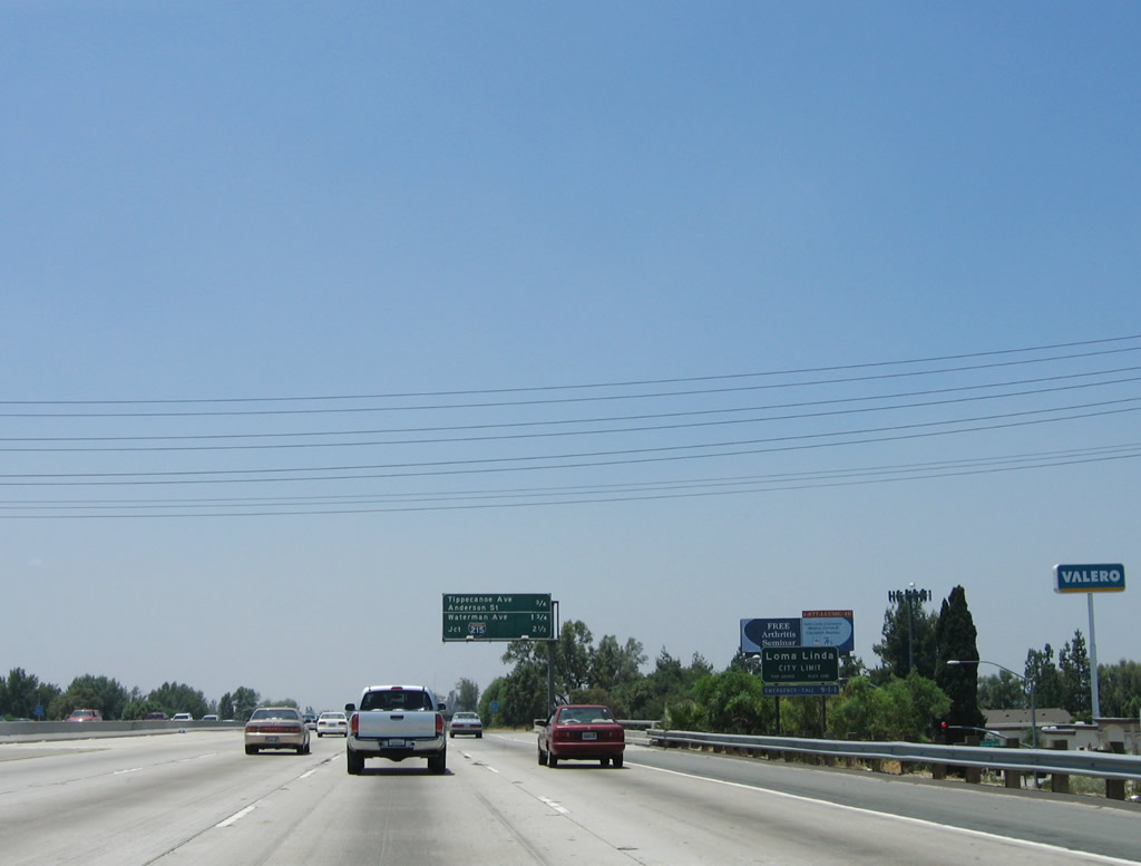
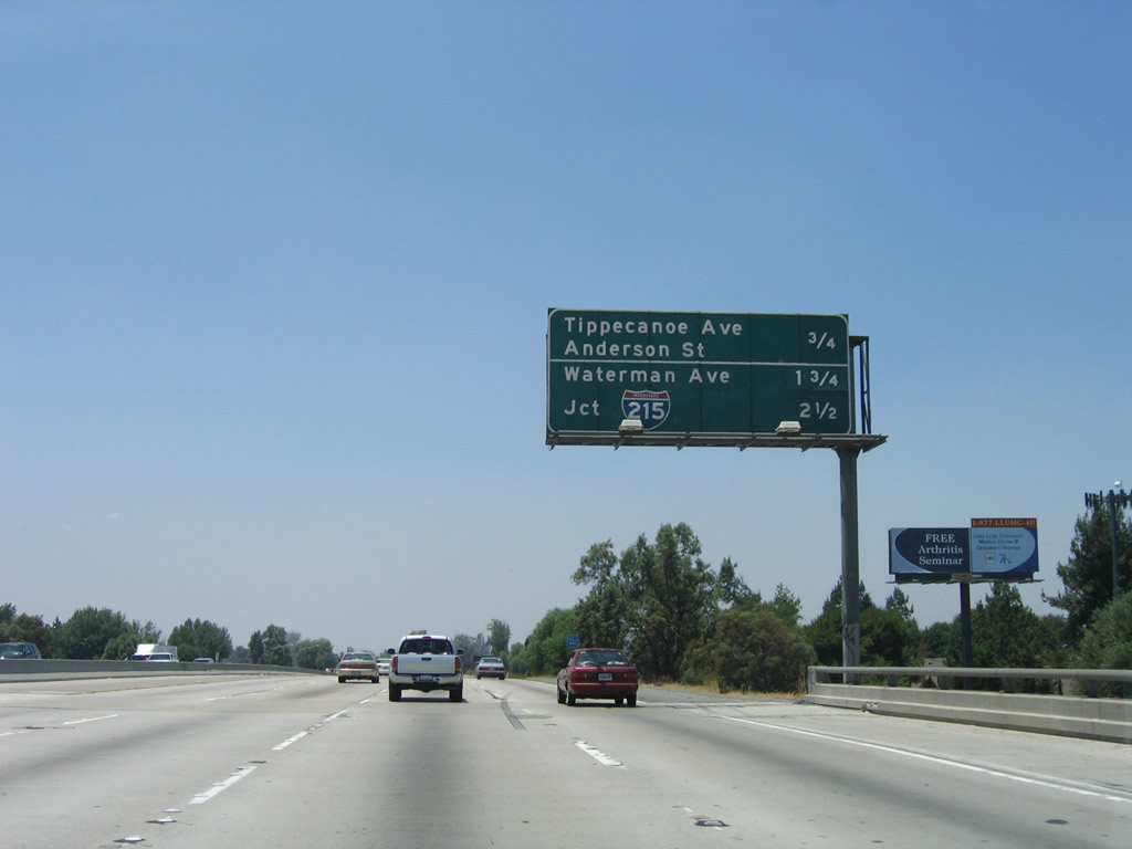
This mileage sign provides the distance to the next three exits: Exit 74, Tippecanoe Avenue and Anderson Street; Exit 73, Waterman Avenue; and Exit 72, Interstate 215/Riverside Freeway south to Riverside and San Diego and Interstate 215 (San Bernardino Freeway) north to San Bernardino and Barstow. Photo taken 06/17/06. |
|
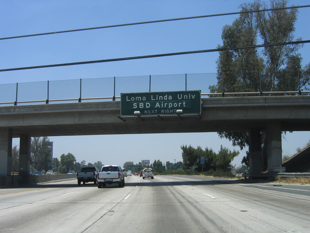
Use Tippecanoe Avenue north to San Bernardino International Airport (former Norton Air Force Base) and Anderson Street south to the city of Loma Linda. Commonly San Bernardino is abbreviated as "SBD." Use Anderson Street south to Loma Linda University. Photo taken 06/17/06. |
|
Westbound Interstate 10 reaches Exit 74, Tippecanoe Avenue north to eastern San Bernardino (SBD) and Anderson Street south to Loma Linda. Photo taken 06/17/06. |
|
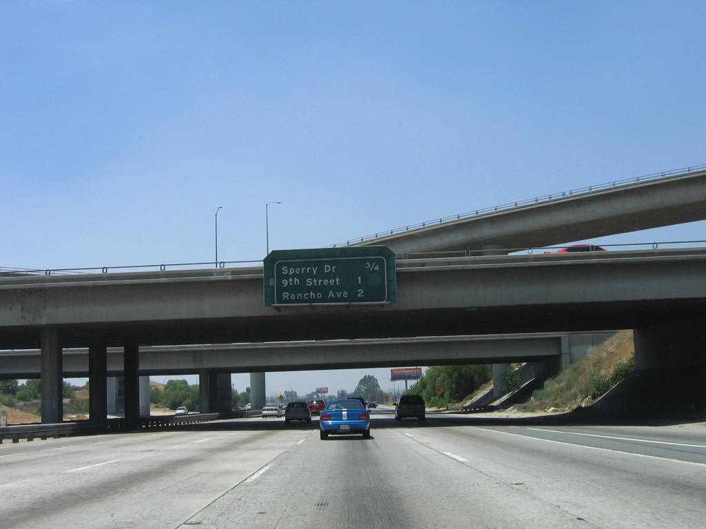
This mileage sign provides the distance to the next three exits: Exit 73, Waterman Avenue; Exit 72, Interstate 215/Riverside Freeway south to Riverside and San Diego and Interstate 215 (San Bernardino Freeway) north to San Bernardino and Barstow; and Exit 71, Sperry Drive to Business Loop I-10/Valley Boulevard west to Colton and to Mount Vernon Avenue. Photo taken 06/17/06. |
|
At this point, Interstate 10 leaves Loma Linda and enters the city of San Bernardino. Named on May 20, 1810 (for Roman Catholic St. Bernardino de Sienna), the city of San Bernardino was incorporated in 1854. Home of the first McDonald's restaurant (opened by the McDonald brothers in 1948 on U.S. 66 Business at 1398 North E Street), San Bernardino is the seat of San Bernardino County. The city consists of 59.2 square miles, has about 16 inches of rainfall annually, sits at an elevation of 1,046 feet, and had a population of 185,401 people as of the 2000 Census. Downtown San Bernardino is located north along Interstate 215. Photo taken 06/17/06. |
|
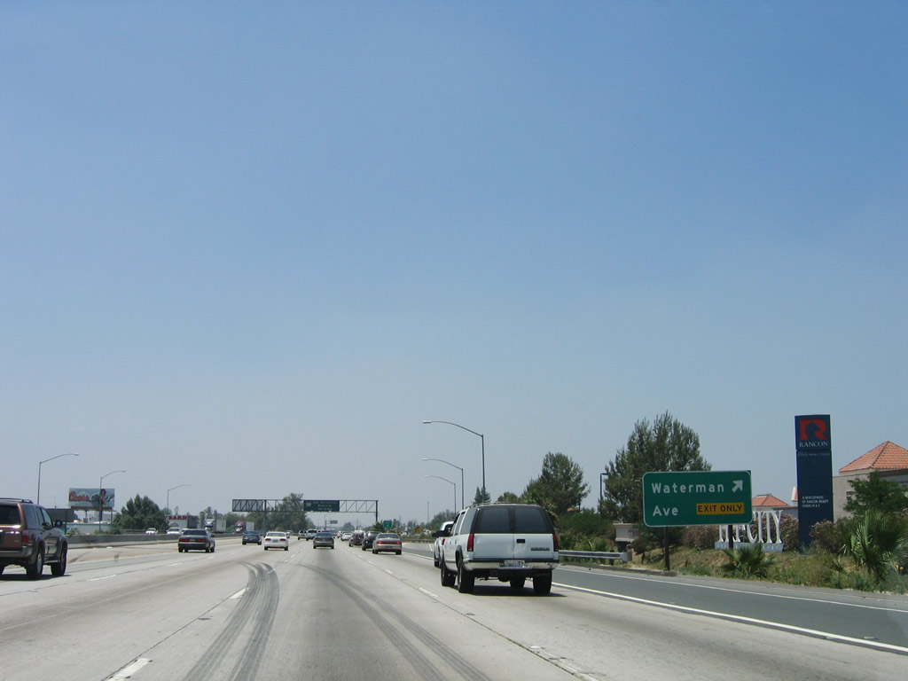
Westbound Interstate 10 reaches Exit 73, Waterman Avenue. To California 18 north, follow Waterman Avenue north through the city of San Bernardino; the state route begins after the California 210 interchange. Photo taken 06/17/06. |
|
The next exit along Interstate 10 west is Exit 72, Interstate 215/Riverside Freeway north to Downtown San Bernardino and south to Riverside and San Diego. Interstate 215 basically follows the path of U.S. 395 through San Bernardino and Riverside. Use Interstate 215 (San Bernardino Freeway) north to downtown San Bernardino and all points north via Interstate 15. To the south, Interstate 215 leads to the cities of Grand Terrace, Riverside, Moreno Valley, Perris, Menifee, Murrieta, Temecula, and San Diego. Photo taken 06/17/06. |
|
The right two lanes connect to Interstate 215, while the left four lanes carry Interstate 10 (San Bernardino Freeway) west to Los Angeles. Interstate 215 (San Bernardino Freeway) leads north into downtown San Bernardino before it joins Interstate 15 north of that city. Heading south, Interstate 215/Riverside Freeway travels to Riverside, connecting with both California 60 (Pomona Freeway) and California 91 (Riverside Freeway). A recent interchange improvement project at the 215-60-91 interchange vastly improved traffic flow through what used to be a cloverleaf interchange. Photo taken 06/17/06. |
|
Eastbound Interstate 10 reaches Exit 72, Interstate 215/Riverside Freeway south to Riverside and Interstate 215 (San Bernardino Freeway) north to downtown. A two-lane off-ramp carries traffic to Interstate 215. At this point, the San Bernardino Freeway designation transfers from Interstate 215 south onto Interstate 10 west. Photo taken 06/17/06. |
|
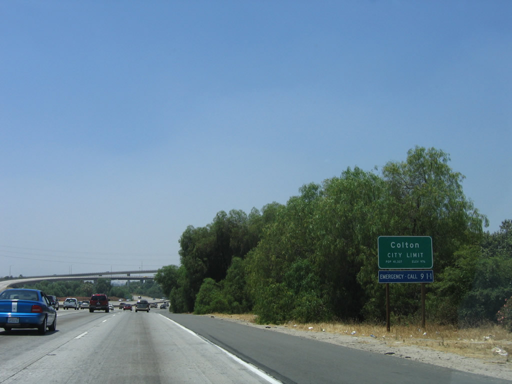
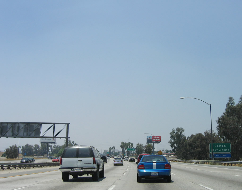
After the Interstate 215 off-ramp, westbound Interstate 10 leaves the city of San Bernardino and enters the city of Colton. The city of Colton had a population of 47,662 as of the 2000 Census and constitutes 15.7 square miles at an elevation of 1,004 feet. The city of Colton is a major transportation crossroads due to the location of the interchange between Interstate 10 and Interstate 215 within its city limits, as well as the connection between the Union Pacific Railroad and Burlington Northern Santa Fe (BNSF) Railroad. Photo taken 06/17/06. |
|
This mileage sign provides the distance to the next three exits: Exit 71, Sperry Drive to Business Loop I-10/Valley Boulevard west to Colton and to Mount Vernon Avenue; Exit 70B, Ninth Street; and Exit 70A, Rancho Avenue. Photo taken 06/17/06. |
| Interstate 10 (San Bernardino Freeway) west |
|
This mileage sign provides the distance to the next three exits: Exit 71, Sperry Drive to Business Loop I-10/Valley Boulevard west to Colton and to Mount Vernon Avenue; Exit 70B, Ninth Street; and Exit 70A, Rancho Avenue. Photo taken 06/17/06. |
|
The next four exits -- Exit 71, Sperry Drive to Business Loop I-10/Valley Boulevard west to Colton and to Mount Vernon Avenue; Exit 70B, Ninth Street; Exit 70A, Rancho Avenue; and Exit 69, Pepper Avenue -- all serve the city of Colton. Photo taken 06/17/06. |
|
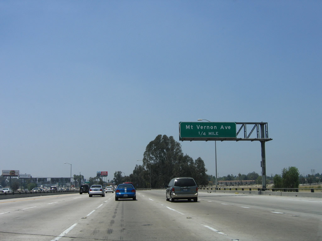
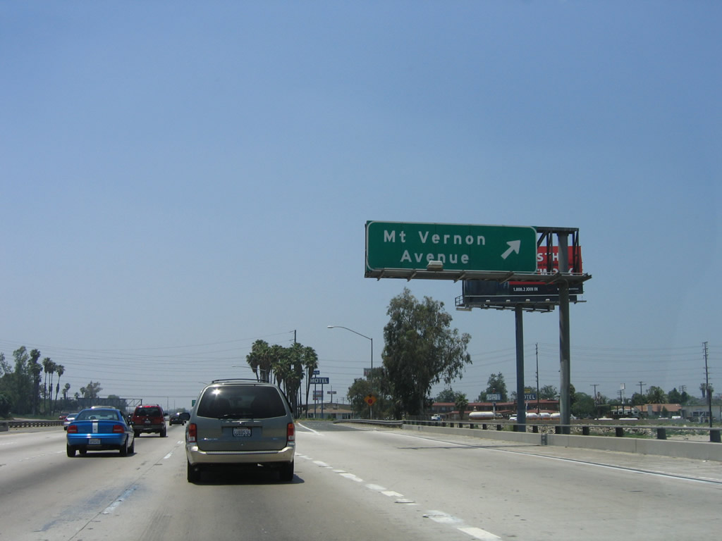
Westbound Interstate 10 (San Bernardino Freeway) reaches Exit 71, Sperry Drive to Business Loop I-10/Valley Boulevard west to Colton and to Mount Vernon Avenue. The business route follows Old U.S. 70-99/Valley Boulevard on the north side of the freeway between Exits 71 and 59. Photo taken 06/17/06. |
|
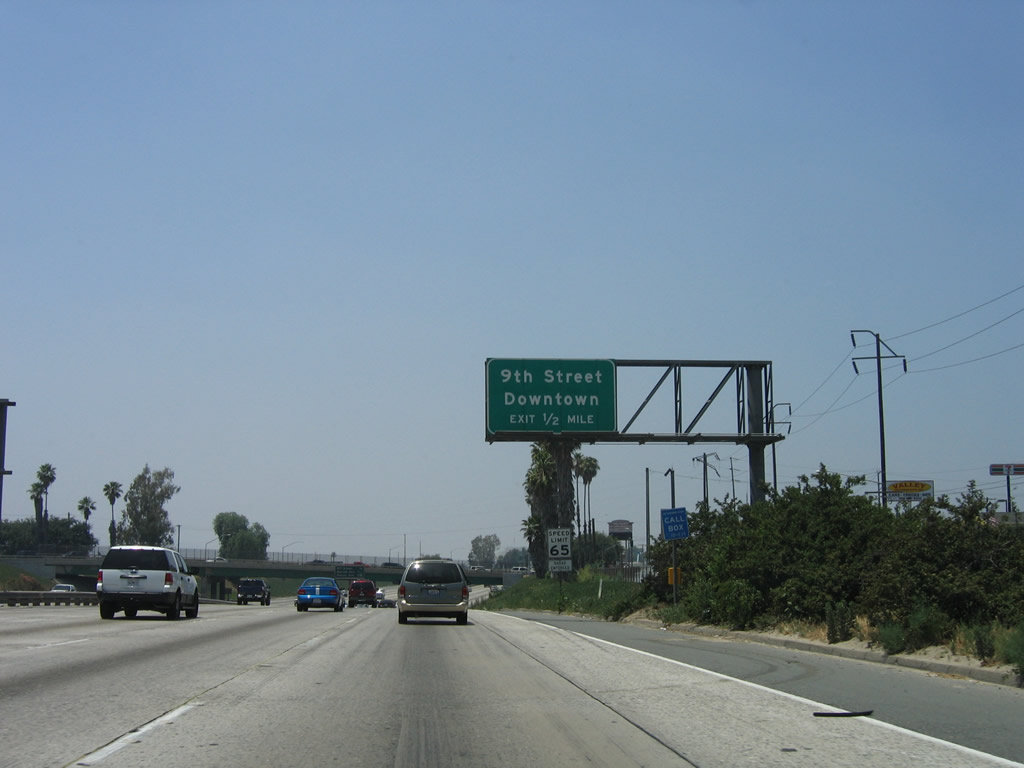
The next exit along Interstate 10 west is Exit 70B, Ninth Street to downtown Colton. Photo taken 06/17/06. |
|
This mileage sign provides the distance to the next three exits on Interstate 10 west: Exit 70B, Ninth Street; Exit 70A, Rancho Avenue; and Exit 69, Pepper Avenue. Photo taken 06/17/06. |
|
Westbound Interstate 10 approaches Exit 70B, Ninth Street. Photo taken 06/17/06. |
|
Immediately thereafter, Interstate 10 (San Bernardino Freeway) west reaches Exit 70B, Ninth Street. Photo taken 06/17/06. |
|
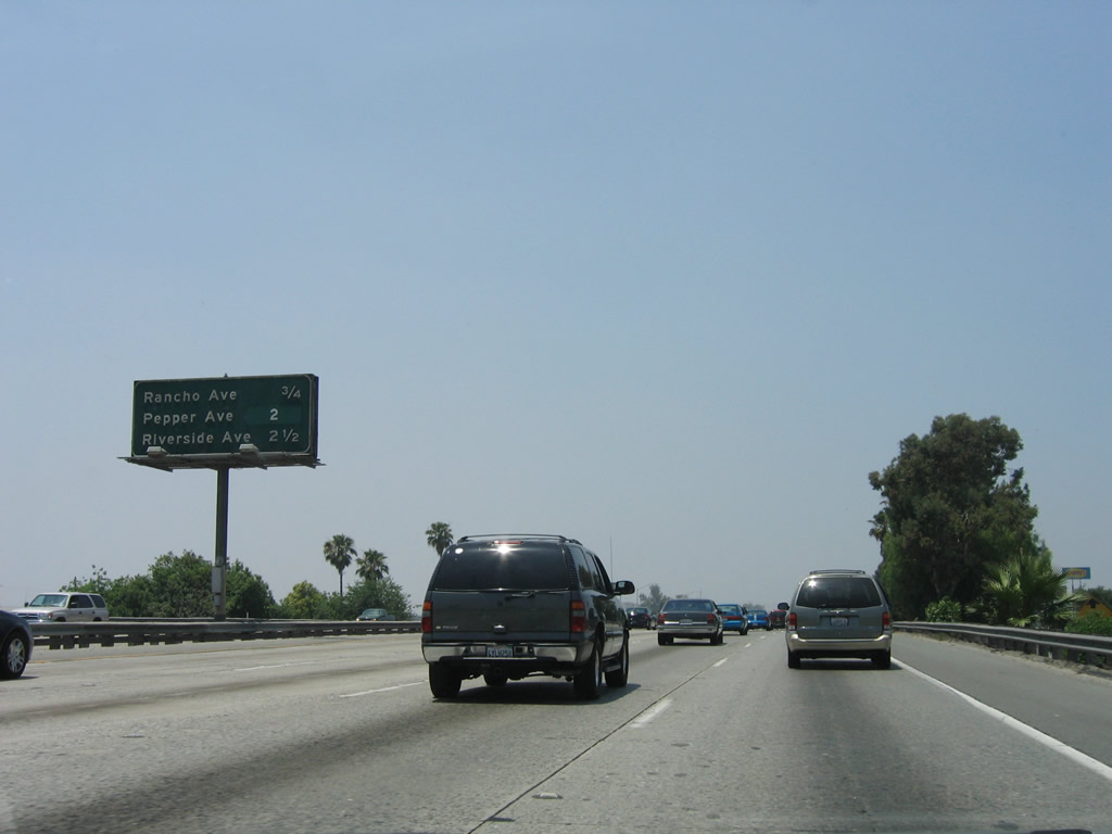
This mileage sign provides the distance to the next three exits on Interstate 10 west: Exit 70A, Rancho Avenue; Exit 69, Pepper Avenue; and Exit 68, Riverside Avenue. Photo taken 06/17/06. |
|
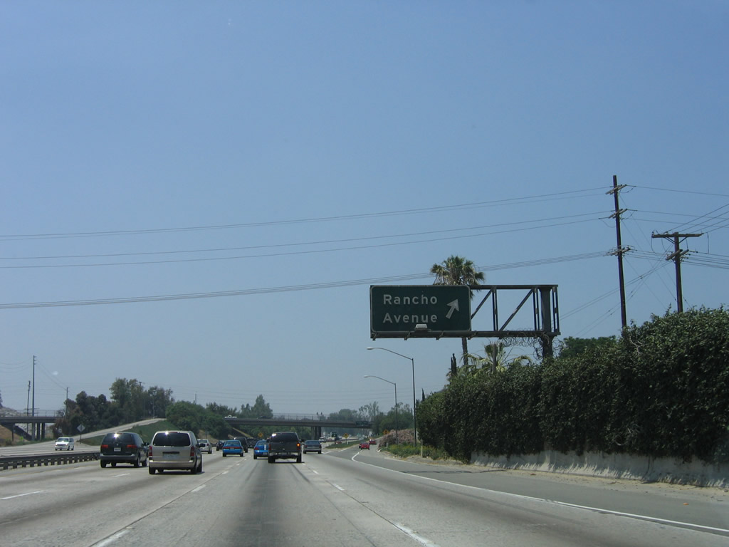
The next exit on Interstate 10 west is Exit 70A, Rancho Avenue (0.50 mile). Photo taken 06/17/06. |
|
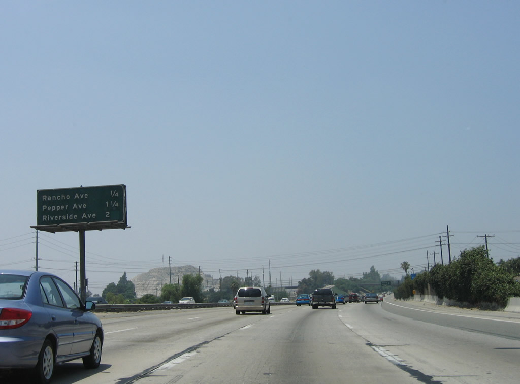
Another mileage sign provides the distance to the same three exits on Interstate 10 west: Exit 70A, Rancho Avenue; Exit 69, Pepper Avenue; and Exit 68, Riverside Avenue. Photo taken 06/17/06. |
|
Westbound Interstate 10 (San Bernardino Freeway) reaches Exit 70A, Rancho Avenue. Photo taken 06/17/06. |
|
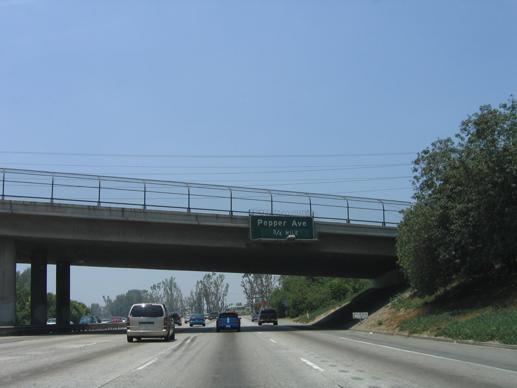
The next exit on Interstate 10 (San Bernardino Freeway) west is Exit 69, Pepper Avenue (0.75 mile). Photo taken 06/17/06. |
|
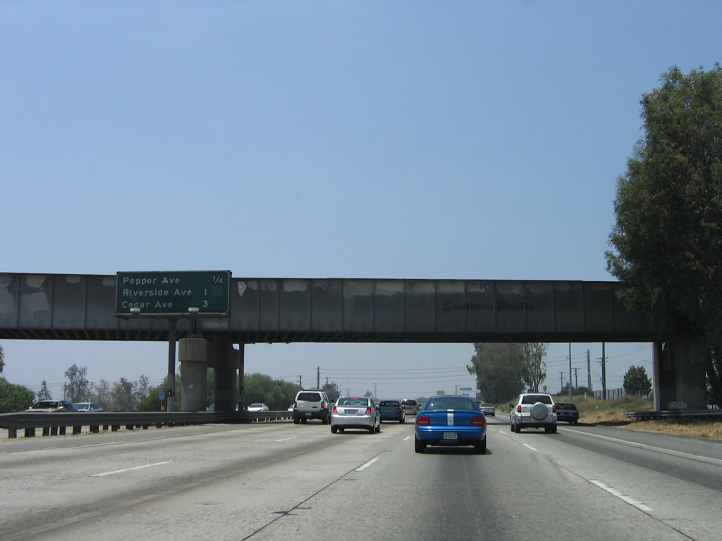
This mileage sign provides the distance to the next three exits on Interstate 10 west: Exit 69, Pepper Avenue; Exit 68, Riverside Avenue; and Exit 66, Cedar Avenue. Photo taken 06/17/06. |
|
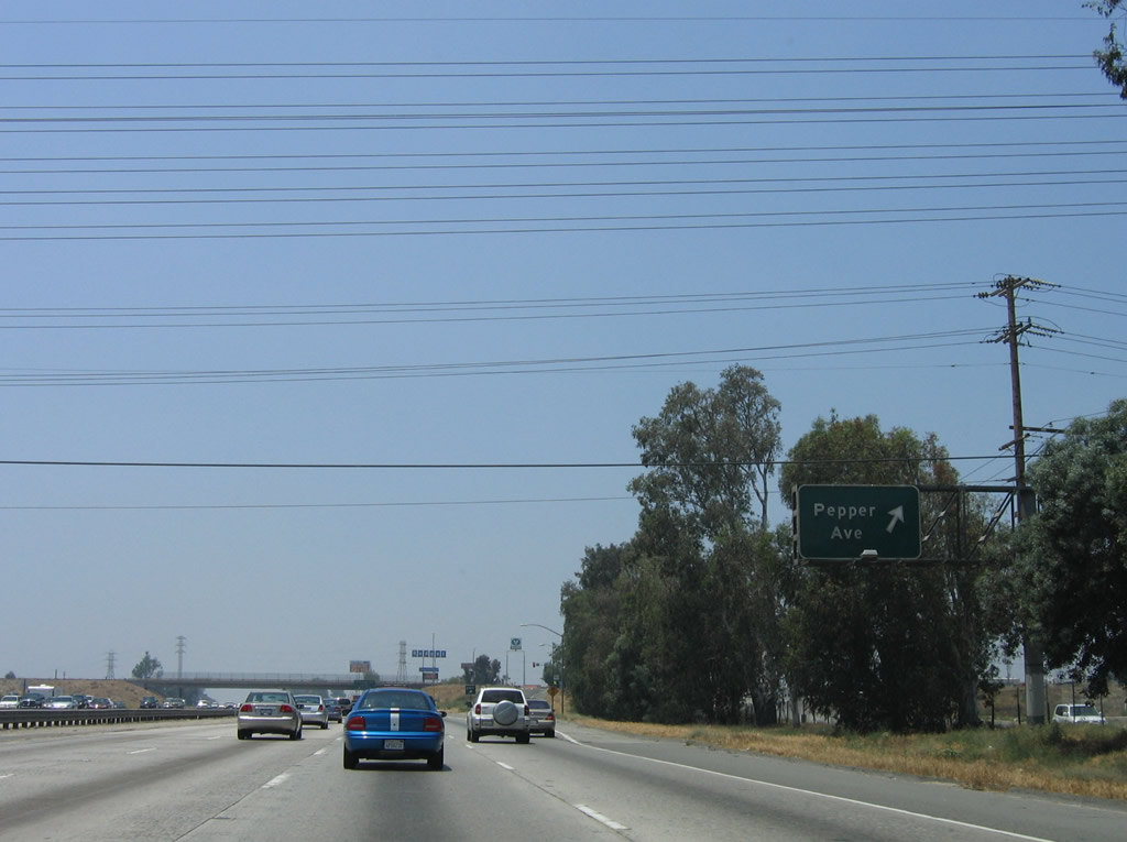
Westbound Interstate 10 (San Bernardino Freeway) reaches Exit 69, Pepper Avenue. Photo taken 06/17/06. |
|
Passing under Pepper Avenue, the next exit on Interstate 10 (San Bernardino Freeway) west is Exit 68, Riverside Avenue. Photo taken 06/17/06. |
|
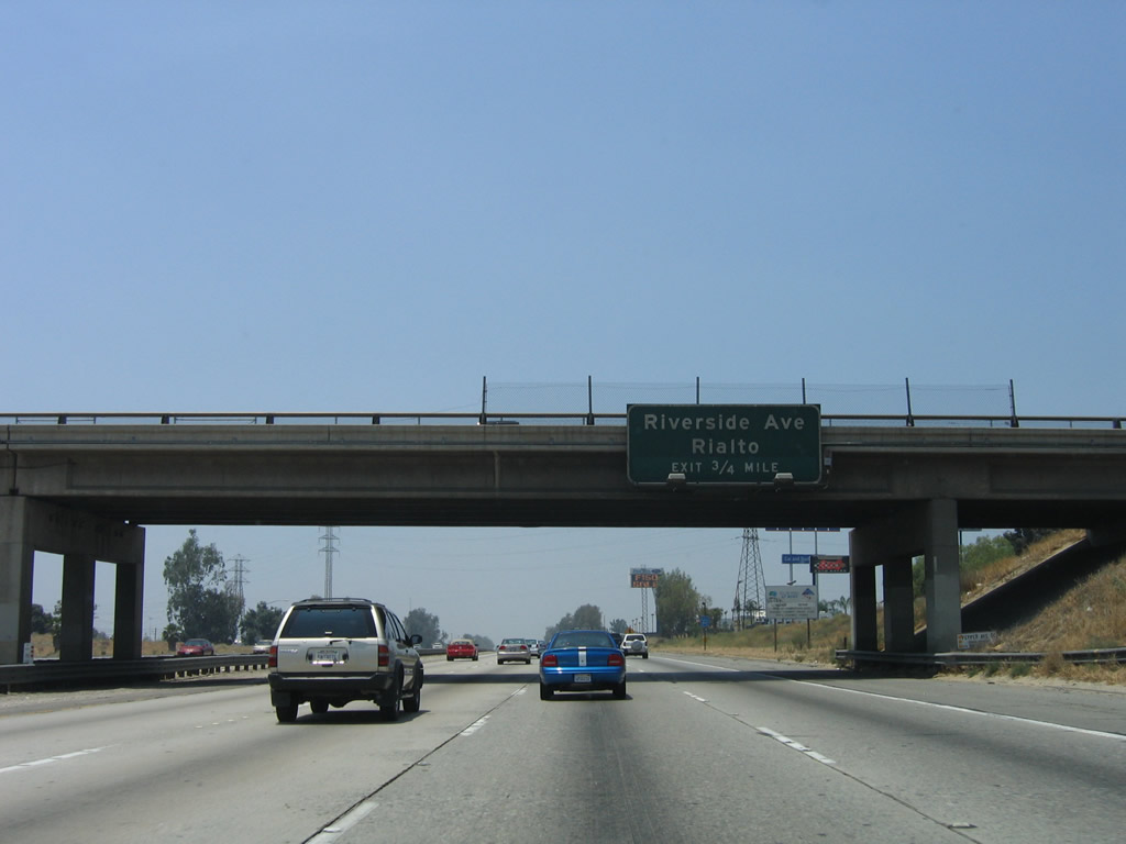
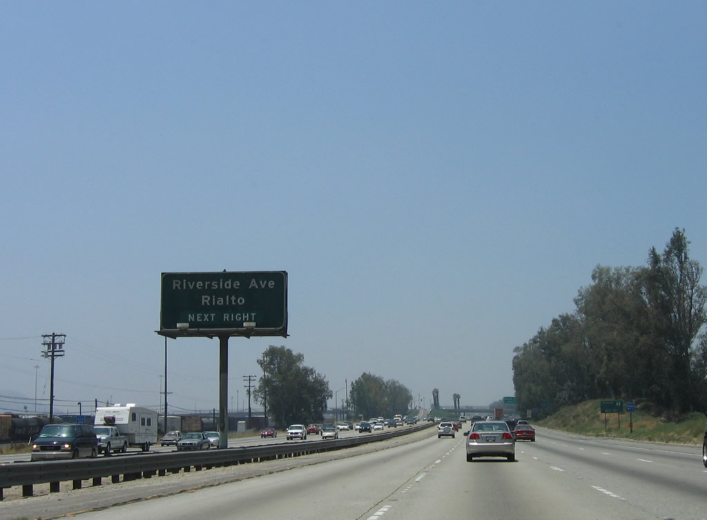
Use Riverside Avenue north into the city of Rialto and south to Riverside. The city of Rialto is known as the "Bridge to Progress" (as Rialto may have been named after a bridge of the same name in Venice, Italy). Rialto was home to 91,873 people as of the 2000 Census and was incorporated on November 17, 1911. To the south, Riverside Avenue becomes Main Street after crossing into the city limits of Riverside. Photo taken 06/17/06. |
|
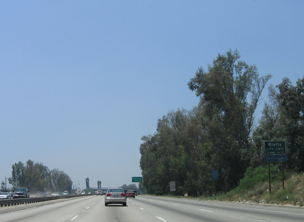
Interstate 10 leaves the city of Colton and enters the city of Rialto. Photo taken 06/17/06. |
|
Westbound Interstate 10 (San Bernardino Freeway) reaches Exit 68, Riverside Avenue. Photo taken 06/17/06. |
|
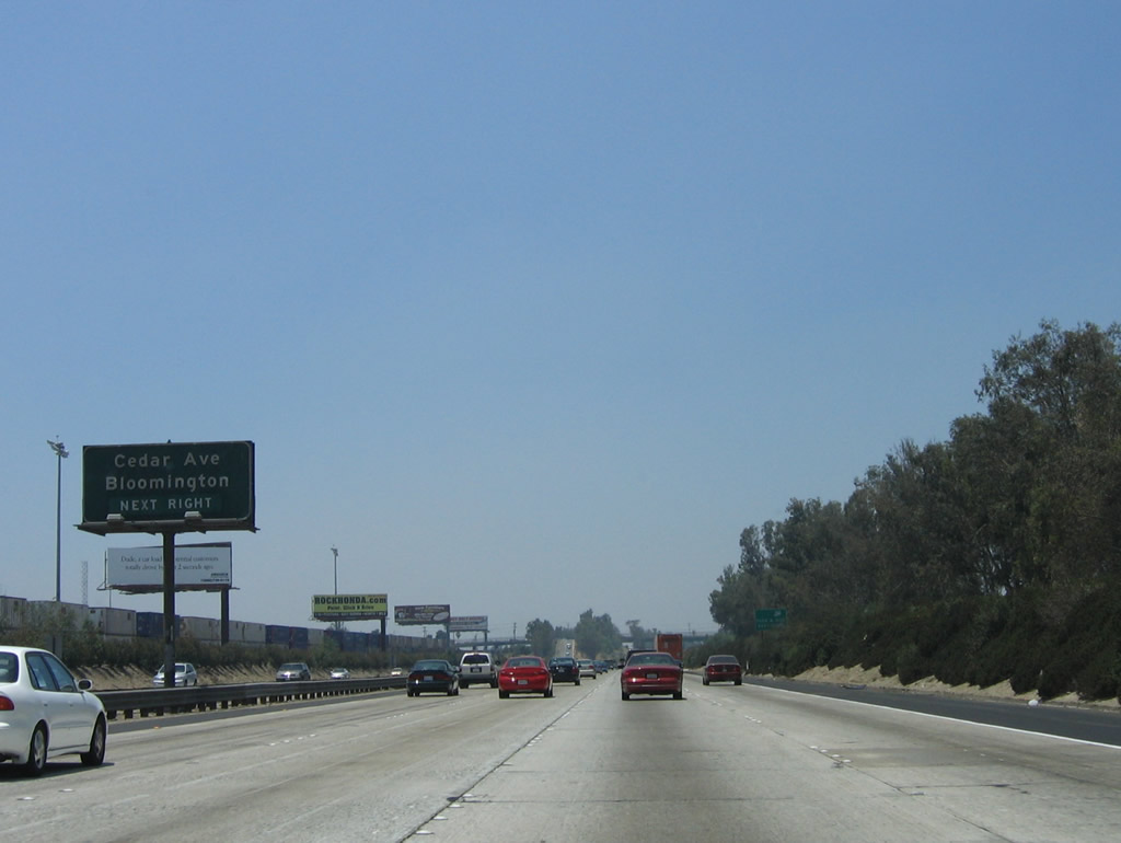
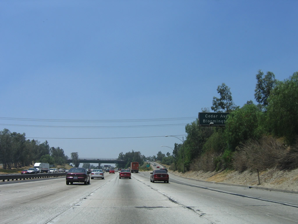
Passing under Riverside Avenue, the next exit on Interstate 10 (San Bernardino Freeway) west is Exit 66, Cedar Avenue to Bloomington Avenue. Photo taken 06/17/06. |
|
Cedar Avenue travels north through Bloomington to western Rialto, while it eventually changes into Rubidoux Boulevard upon crossing the Riverside County line before leading into the community of Belltown. Use Cedar Avenue north to Bloomington Avenue northeast to downtown Rialto. Photo taken 06/17/06. |
|
Westbound Interstate 10 (San Bernardino Freeway) reaches Exit 66, Cedar Avenue to Bloomington Avenue and unincorporated Bloomington. Photo taken 06/17/06. |
|
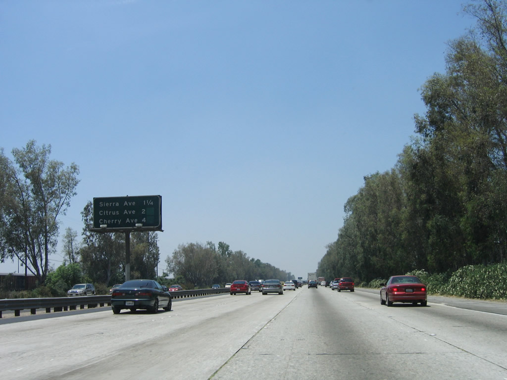
The next exit on Interstate 10 (San Bernardino Freeway) west is Exit 64, Sierra Avenue (two miles). Exit 64 serves the city of Fontana. Photo taken 06/17/06. |
|
This mileage sign provides the distance to the next three exits on Interstate 10 (San Bernardino Freeway) west: Exit 64, Sierra Avenue; Exit 63, Citrus Avenue; and Exit 61, Cherry Avenue. Photo taken 06/17/06. |
|
Use Sierra Avenue north to Inland Empire Center, Kaiser Foundation Hospital, and Sierra Lakes. To the south, Sierra Avenue travels to the unincorporated community of Rubidoux in Riverside County. Photo taken 06/17/06. |
|
Interstate 10 enters the city of Fontana. Founded in 1913 and incorporated on June 25, 1952, Fontana sits along Historic U.S. 66 (Foothill Boulevard). The city's population was 128,929 as of the 2000 Census, but that number is estimated to be 188,498 as of a 2008 Census estimate. The boundaries of Fontana have changed with several annexations in 2006 and 2007, thus helping increase its overall population. Development has also increased through the first decade of the 2000s. Photo taken 06/17/06. |
|
The right two lanes of Interstate 10 west connect to Exit 64, Sierra Avenue. The auxiliary lane was added earlier this decade. Photo taken 06/17/06. |
|
Westbound Interstate 10 meets Exit 64, Sierra Avenue at a single-point urban interchange (SPUI) near the Inland Empire Center. Photo taken 06/17/06. |
|
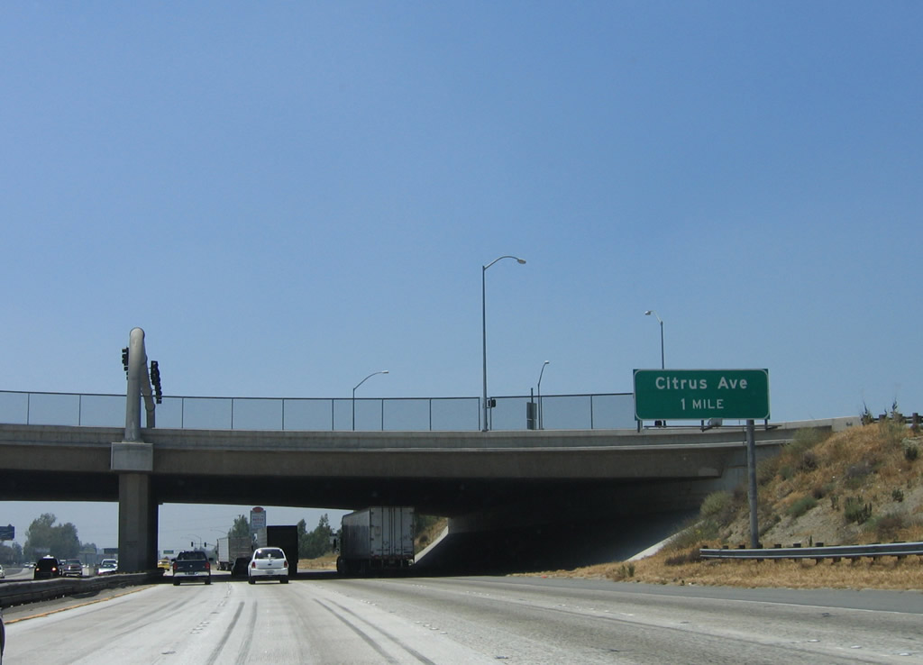
The next exit on Interstate 10 (San Bernardino Freeway) west is Exit 63, Citrus Avenue (one mile). Photo taken 06/17/06. |
|
This mileage sign provides the distance to the next three exits on Interstate 10 (San Bernardino Freeway) west: Exit 63, Citrus Avenue; Exit 61, Cherry Avenue; and Exit 59, Etiwanda Avenue. A roadside mileage sign also provides the distance to Ontario (12 miles) and Los Angeles (48 miles). Photo taken 06/17/06. |
|
The right lane of Interstate 10 (San Bernardino Freeway) west becomes exit only for Exit 63, Citrus Avenue. Photo taken 06/17/06. |
|
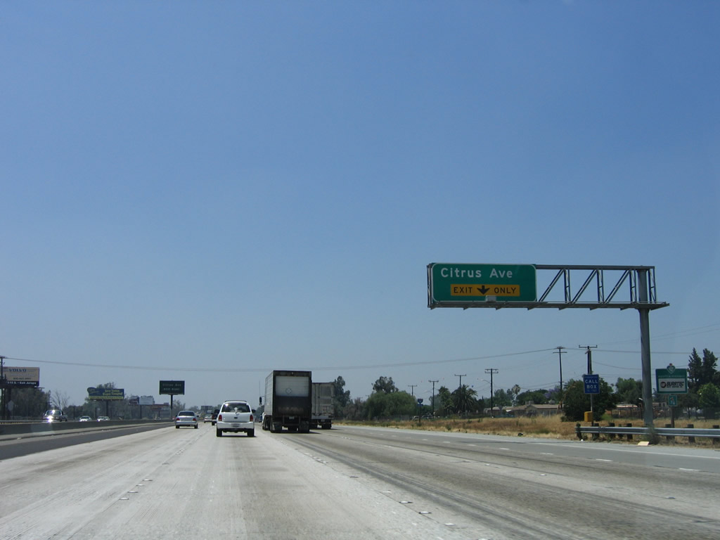
Westbound Interstate 10 (San Bernardino Freeway) reaches Exit 63, Citrus Avenue. Use Citrus Avenue north to Fontana High School and south to Jurupa Hills. At one time, much of this land (known as the Inland Empire) was citrus groves, but some of that agriculture is now located in the Imperial Valley and in the Palm Springs area. The farms that remain are constantly threatened by encroaching suburban development. "Citrus Avenue" is named for the region's former role in that industry. Photo taken 06/17/06. |
|
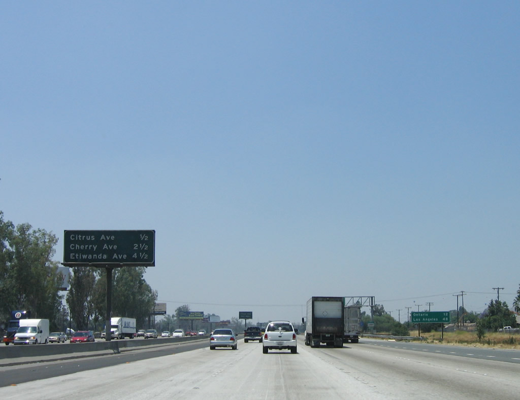
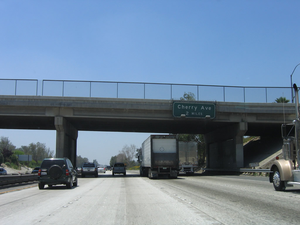
The next exit on Interstate 10 (San Bernardino Freeway) west is Exit 61, Cherry Avenue (two miles). Photo taken 06/17/06. |
|
This mileage sign provides the distance to the next three exits on Interstate 10 (San Bernardino Freeway) west: Exit 61, Cherry Avenue; Exit 59, Etiwanda Avenue; and Exit 58, Interstate 15 (Ontario Freeway) north to Rancho Cucamonga and south to Corona, Temecula, and San Diego. Photo taken 06/17/06. |
|
Cherry Avenue travels north to the California Speedway and south to Jurupa Hills (part of the city of Fontana). On the south side of Interstate 10 through Fontana, Rialto, and Colton is the Union Pacific Railroad, which is visible from Valley Boulevard east to Interstate 215. Photo taken 06/17/06. |
|
Westbound Interstate 10 (San Bernardino Freeway) reaches Exit 61, Cherry Avenue. Photo taken 06/17/06. |
|
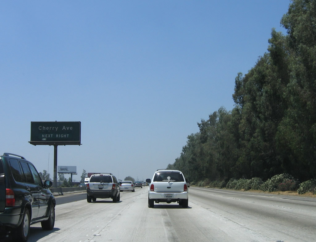
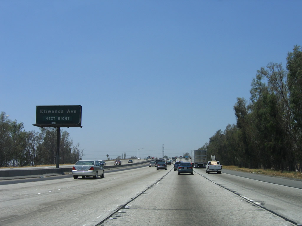
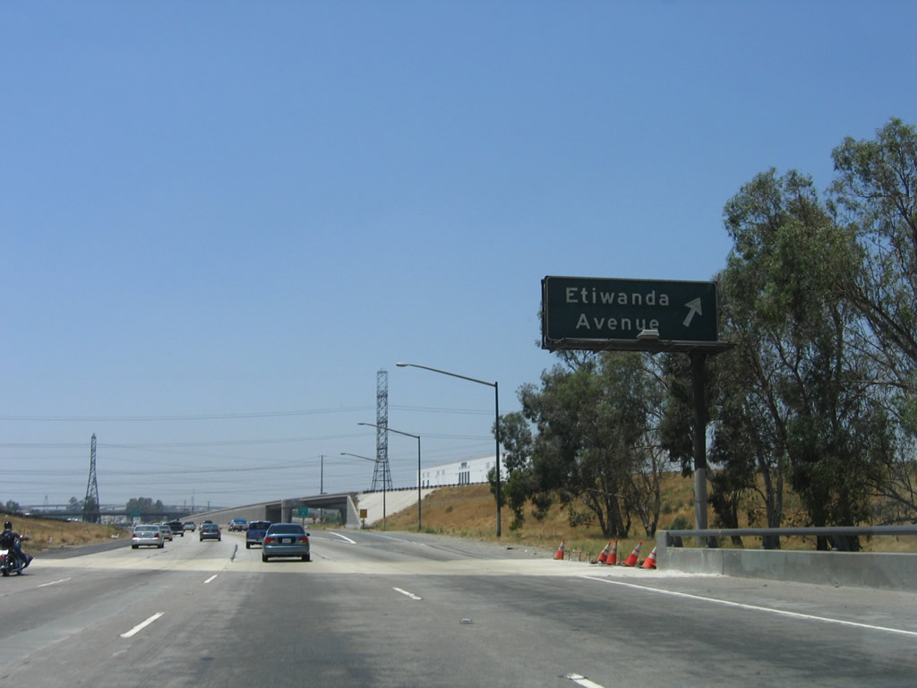
The next exit on Interstate 10 (San Bernardino Freeway) west is Exit 59, Etiwanda Avenue (two miles) to Business Loop I-10/Valley Boulevard east to Fontana and Colton. Photo taken 06/17/06. |
|
This mileage sign provides the distance to the next three exits on Interstate 10 (San Bernardino Freeway) west: Exit 59, Etiwanda Avenue; Exit 58, Interstate 15 (Ontario Freeway) north to Rancho Cucamonga and south to Corona, Temecula, and San Diego; and Exit 57, Milliken Avenue to Ontario Mills Shopping Center. Photo taken 06/17/06. |
|
Westbound Interstate 10 (San Bernardino Freeway) approaches Exit 59, Etiwanda Avenue. Photo taken 06/17/06. |
|
At this point, the westbound lanes of Interstate 10 (San Bernardino Freeway) cross over the fly-under ramp from eastbound Interstate 10 to Valley Boulevard (Business Loop I-10) east. The off-ramp for Exit 59, Etiwanda Avenue lies ahead. Since there is no direct access to Valley Boulevard from this interchange, use Etiwanda Avenue north to Business Loop I-10/Valley Boulevard east to Fontana and Colton. Photo taken 06/17/06. |
|
The off-ramp to Etiwanda Avenue passes under the connecting ramp from westbound Business Loop I-10/Valley Boulevard (old U.S. 70-99) to Interstate 10 west. Photo taken 06/17/06. |
|
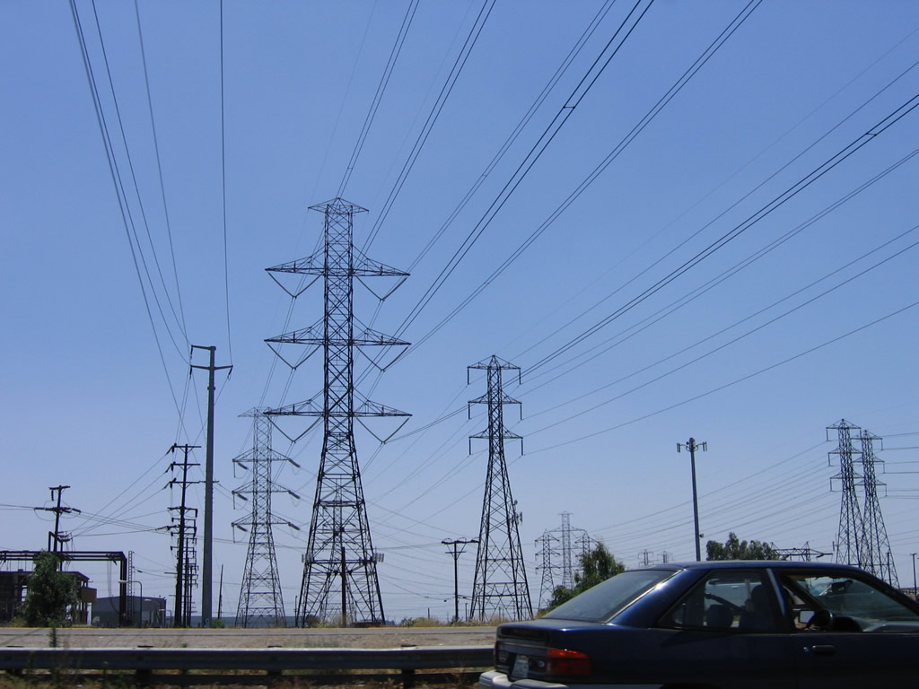
A series of Southern California Edison high-voltage power lines cross Interstate 10 at the Etiwanda Avenue interchange, including a rare double-circuit 500kV tower that carries a portion of Path 46 (West of Colorado River to Los Angeles) from the Mojave Desert into the Inland Empire. Other Path 46 corridors include the lines emanating from Adelanto roughly parallel to Interstate 15 and the 500kV corridors that parallel Interstate 10 and Interstate 8 from Palo Verde Nuclear Generating Station in Arizona. Photo taken 06/17/06. |
|
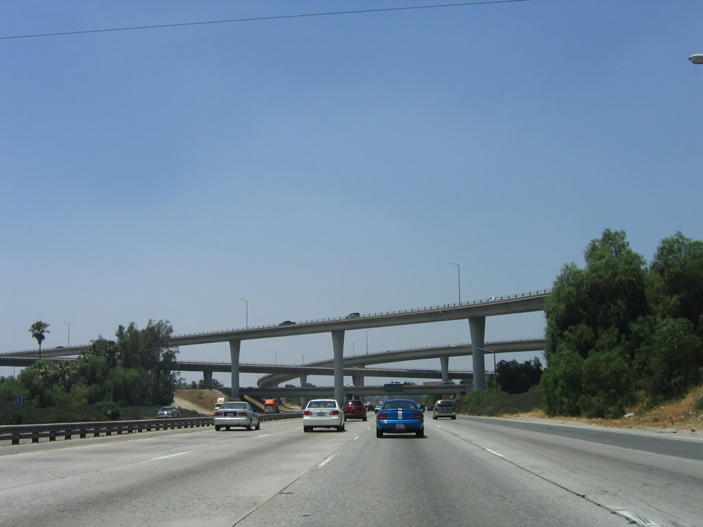
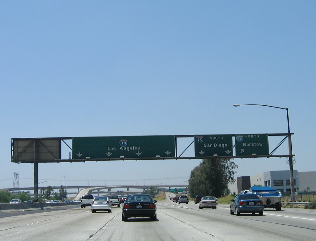
The next exit on Interstate 10 (San Bernardino Freeway) west is Exit 58, Interstate 15 (Ontario Freeway) north to Barstow, Las Vegas, and Salt Lake City and south to Corona, Temecula, and San Diego. Interstate 15 is a major north-south freeway corridor through the Inland Empire and serves as a bypass of Interstate 215 (Old U.S. 395), which provides access through the cities of San Bernardino and Riverside. At this point, Interstate 15 enters the city of Ontario, starting with Exit 50 (Mountain Avenue). As of the 2000 Census, the city had a total population of 158,007 and incorporated in 1891. Ontario is home to the regionally significant Ontario International Airport. The city consists of 49.9 square miles and sits at 925 feet. Historic U.S. 66 (National Trails Highway) passes through town along Foothill Boulevard. Photo taken 06/17/06. |
|
This mileage sign provides the distance to the next three exits on Interstate 10 (San Bernardino Freeway) west: Exit 58, Interstate 15 (Ontario Freeway) north to Rancho Cucamonga and south to Corona, Temecula, and San Diego; Exit 57, Milliken Avenue to Ontario Mills Shopping Center; and Exit 56, a partial cloverleaf interchange for Haven Avenue. Photo taken 06/17/06. |
|
The right lane of Interstate 10 (San Bernardino Freeway) west becomes exit only for Exit 58, Interstate 15 (Ontario Freeway) north to Rancho Cucamonga and Barstow. The right two lanes connect to Interstate 15 south to Corona, Temecula, and San Diego. Use the left four lanes to continue west on Interstate 10. Photo taken 06/17/06. |
|
A small roadside sign for the ramp to Interstate 15 (Ontario Freeway) south to Corona is posted shortly thereafter. Photo taken 06/17/06. |
|
The right two lanes of Interstate 10 (San Bernardino Freeway) west depart to Exit 58, Interstate 15 (Ontario Freeway) north to Rancho Cucamonga and Barstow and south to Corona, Temecula, and San Diego. Use the left four lanes to continue west on Interstate 10 toward Los Angeles. Photo taken 06/17/06. |
|
Looking at the transition ramp to Interstate 15, the first right connects to northbound Interstate 15 (Ontario Freeway) to Barstow, while the left two lanes of the transition ramp carry over to Interstate 15 south to San Diego. Photo taken 06/17/06. |
|
The next exit along Interstate 10 west is Exit 57, Milliken Avenue (0.75 mile). Photo taken 06/17/06. |
|
The massive interchange between Interstate 10 and Interstate 15 is a symmetrical stack interchange, with high speed movements in all directions. Interstate 10 forms the lowest level of this four-level interchange. Photo taken 06/17/06. |
|
Passing through the heart of the Interstate 10 and Interstate 15 interchange, this mileage sign provides the distance to the next three exits on Interstate 10 (San Bernardino Freeway) west: Exit 57, Milliken Avenue; Exit 56, Haven Avenue; and Exit 55B, Archibald Avenue. Photo taken 06/17/06. |
Page Updated May 3, 2014.