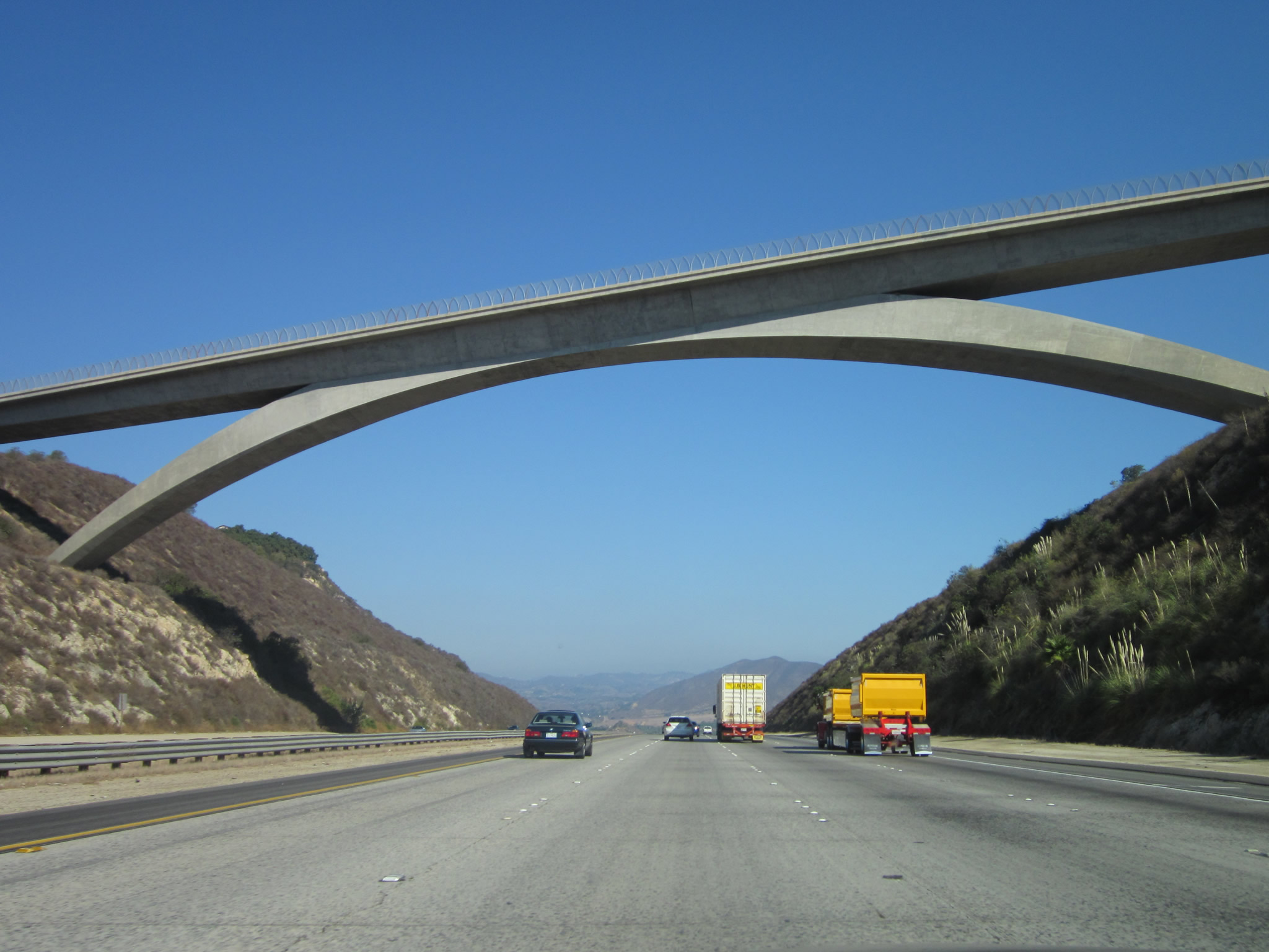
Interstate 15 north passes below the high level Lilac Road overpass. A gateway into San Diego County from the north, this massive bridge carries Lilac Road high above a deep cut made to lessen the ascent along I-15 from the San Luis Rey River south toward Hidden Valley and Escondido. Photo taken 10/13/12.
| Interstate 15 (Escondido Freeway) north |
|
|
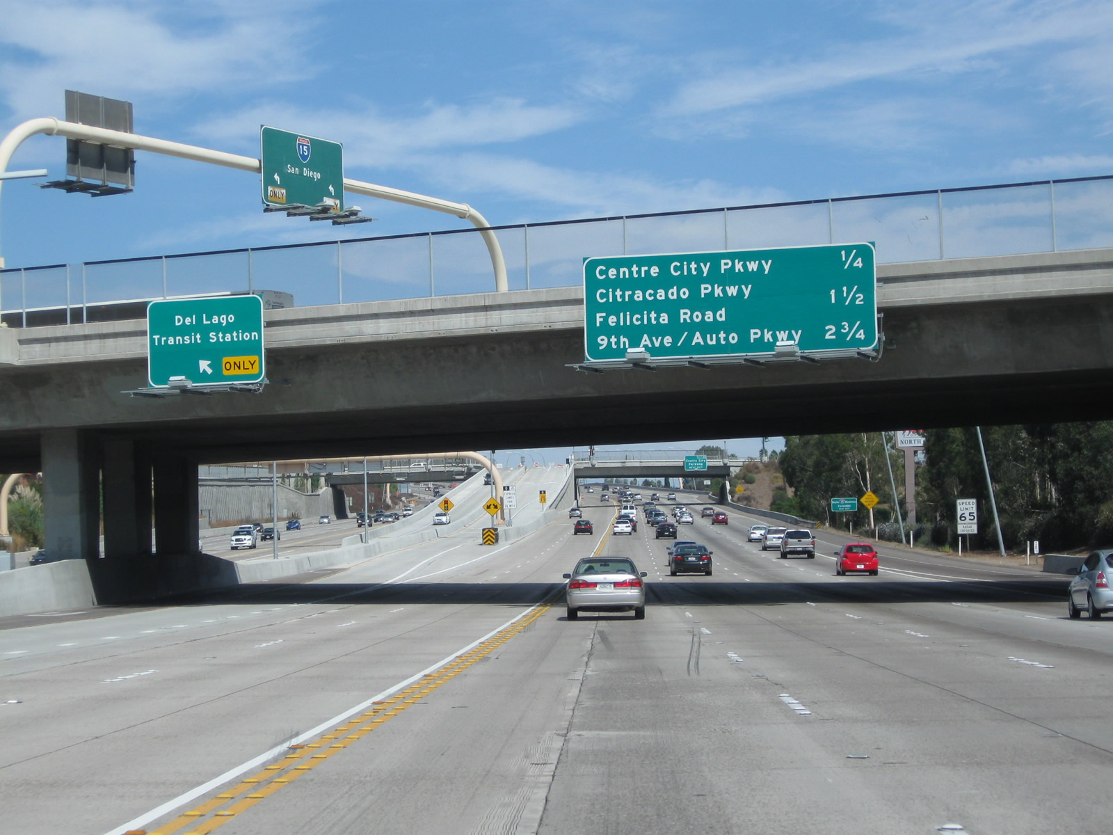
Passing under the Via Rancho Parkway overpass, northbound Interstate 15 (Escondido Freeway) approaches Exit 28, Business Loop I-15 (Centre City Parkway). This is the main exit into downtown Escondido, via the original U.S. 395 expressway. Centre City Parkway has many of the features of a vintage 1950s-era California expressway, so it is an enjoyable side trip off of the mainline. This sign is posted on the Via Rancho Parkway overpass. Photos taken 10/02/11 and 06/03/06. |
|
A roadside advance sign for Exit 28 is for Business Loop I-15 (Centre City Parkway) is posted shortly thereafter. Centre City Parkway is a bypass itself (it is an expressway for much of its route). Parallel Escondido Boulevard is the north-south historic route into downtown Escondido. Both roads are worth the drive. Photo taken 06/03/06. |
|
Back on the left side of the northbound lanes is the gore point for the Del Lago transit center. Photo taken 10/02/11. |
|
|
In standard Caltrans practice, this advance signage for Business Loop I-15 is the only indication that Exit 28 is for Business Loop I-15, which follows Old U.S. 395 along Centre City Parkway. This sign was removed in 2008 due to the managed lanes project, and the 2011 photo shows the replacement signage that uses an Interstate 15 shield along with the business loop designation. A green business loop shield would be preferable, even if it were temporary. There are no shields present on the approach signs, even though the business loop is well-signed through the city of Escondido. The exit is visible in the distance. Photos taken 10/02/11 and 06/03/06. |
|
|
The next exit along Interstate 15 north is Exit 28, Business Loop I-15 north/Centre City Parkway (Old U.S. 395) into Escondido. This sign changed with the Express Lanes project. Photos taken 10/02/11 and 06/03/06. |
|
Northbound Interstate 15 reaches Exit 28, Business Loop I-15 north/Centre City Parkway (Old U.S. 395) into Escondido. Photo taken 09/28/08. |
|
A temporary gore point sign is posted for Exit 28, Business Loop I-15 (Centre City Parkway). Photo taken 09/28/08. |
|
|
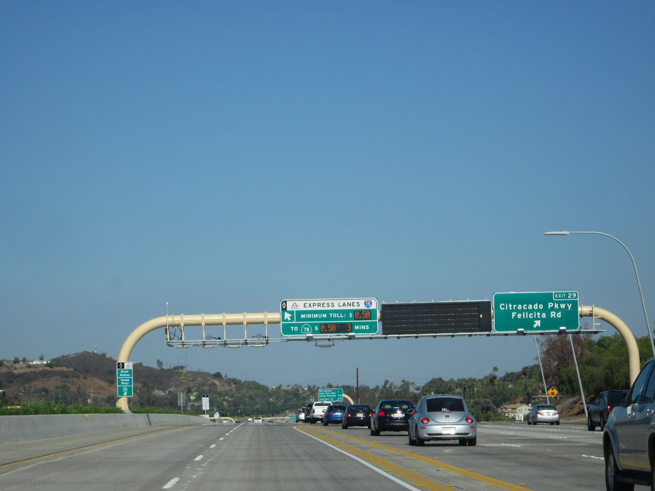
The next exit along northbound Interstate 15 (Escondido Freeway) is Exit 29, Felicita Road and Citracado Parkway. This sign was moved back and relocated to the right side as a result of freeway expansion due to the Managed Lanes project. Felicita Road is the third of seven exits that serves the city of Escondido. Photo taken 10/02/11. |
|
This mileage sign provides the distance to the next three exits along Interstate 15 north: Exit 29, Felicita Road and Citracado Parkway; Exit 30, Ninth Avenue/Auto Park Way; and Exit 31, San Diego County S-6/Valley Parkway. Photo taken 01/25/07. |
|
A roadside exit number sign for Exit 29 is posted shortly after the mileage sign. Felicita Road intersects Interstate 15 at an angle, as it runs north-south when it crosses Interstate 15. Felicita Road continues south to meet Via Rancho Parkway north of Lake Hodges, while it heads northeast to meet Business Loop I-15 (Centre City Parkway) near downtown Escondido. Photo taken 01/25/07. |
|
|
Northbound Interstate 15 reaches Exit 29, Felicita Road and Citracado Parkway. This exit also connects to Citracado Parkway, which is proposed to be a semi-belt route surface street across southwestern Escondido. Completed portions of the parkway exist near the California 78/Nordahl Road interchange, near Valley Parkway (San Diego County S-6), and between Interstate 15 at Felicita Road and Business Loop I-15 (Centre City Parkway). Photos taken 10/13/12 and 01/25/07. |
|
|
The next exit along Interstate 15 (Escondido Freeway) north is Exit 30, Ninth Avenue/Auto Park Way. In a manner similar to San Diego's Auto Circle in Mission Valley and National city's Mile of Cars, Escondido's sales-tax generator is Auto Park Way off Interstate 15. Auto Park Way connects Vineyard Avenue with Ninth Avenue. Ninth Avenue leads east from this interchange into downtown Escondido. Photos taken 10/02/11 and 07/27/02. |
|
|
Interstate 15 (Escondido Freeway) approaches Exit 30, Ninth Avenue and Auto Park Way. Back in 2007, a mileage sign provided the distance to the next three exits along Interstate 15 north: Exit 30, Ninth Avenue/Auto Park Way; Exit 31, San Diego County S-6/Valley Parkway; and Exit 32, California 78. Photos taken 10/13/12 and 01/25/07. |
|
|
Northbound Interstate 15 reaches Exit 30, Ninth Avenue and Auto Park Way. The next exit is for Valley Parkway (San Diego County S-6) and California 78 (Ron Packard Parkway). Signs changed between 2007 and 2012 as a result of the managed lanes that extend north to California 78. Photos taken 10/13/12 and 01/25/07. |
|
This mileage sign provides the distance to the next three exits along Interstate 15 north: Exit 31, San Diego County S-6/Valley Parkway; Exit 32, California 78; and Exit 33, El Norte Parkway. Note the sign was not set correctly, so the two panels are a bit lopsided. Photo taken 01/25/07. |
|
|
Use San Diego County S-6/Valley Parkway east to downtown Escondido. Shortly after the Interstate 15 interchange, San Diego County S-6 splits into a one-way couplet. Eastbound traffic follows Second Avenue, while westbound traffic uses Valley Parkway. The Escondido civic center, California Center for the Arts, Heritage Walk Museum, and Grape Day Park are all located on the north side of Valley Parkway between Broadway and Escondido Boulevard. To this complex, follow Valley Parkway east to the transition to Second Avenue, then turn north on either Escondido Boulevard or Broadway. Parking is available along Woodward Avenue at the north end of the civic center complex. (A new overhead sign was added here in 2011, and the roadside guide sign was replaced.) Photos taken 10/02/11 and 06/03/06. |
|
An exit number sign for Exit 31 is posted on the side of the freeway; the hospital is Palomar Medical Center, located just east of downtown near where the one-way couplet merges back together. Omitted is any mention of the county route designation. To the west, San Diego County S-6 travels southwest along Valley Parkway to Del Dios Highway, which in turn leads south toward Olivenhain and Rancho Santa Fe. San Diego County S-6 again turns west onto Via de la Valle en route to the coastal cities of Del Mar and Solana Beach. To the east, the county route passes through downtown Escondido, then turns northeast toward Valley Center and ultimately Palomar Mountain, ending at the observatory parking lot. Photo taken 01/25/07. |
|
|
|
Northbound Interstate 15 (Escondido Freeway) meets Exit 31, San Diego County S-6/Valley Parkway. To follow historic U.S. 395 on its journey through Vista, San Marcos, Bonsall, and Fallbrook, exit Valley Parkway west to Auto Park Way north. Auto Park Way changes into Vineyard Avenue, which connects to Citracado Parkway and Mission Road (San Diego County S-14, which is 1930s-era old U.S. 395). Photos taken 10/13/12, 10/02/11, and 01/25/07. |
|
|
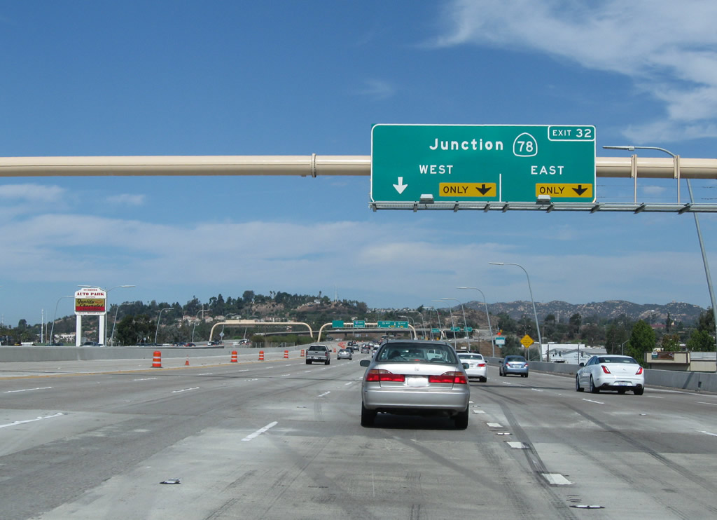
The next exit on Interstate 15 north is Exit 32, California 78 (Packard Freeway). These signs were replaced in 2011 as work continued on the Express Lanes project. Photos taken 10/13/12 and 01/25/07. |
|
California 78 is major east-west state route across Southern California. Originating in Oceanside, California 78 is a freeway from Oceanside east to Escondido via the cities of San Marcos and Vista along the way. East of this interchange, California 78 quickly becomes a surface street, skirting downtown Escondido via Broadway and Washington Avenue. East of Escondido, California 78 gains a rural character, passing the Wild Animal Park and the San Pasqual Valley before entering unincorporated Ramona. Passing through foothills, California 78 is the primary route from Ramona to Julian, then descends to the Anza-Borrego Desert State Park. From there, California 78 has a straight shot across the Imperial Valley, edging near the Salton Sea, then crossing the Imperial Sand Dunes. California 78 ends at Interstate 10 in Blythe only a short distance from the Colorado River and the state of Arizona. This sign was gone by 2011. Photo taken 01/25/07. |
|
|
The right two lanes of Interstate 15 become exit only for the connection to California 78 east to Escondido and west to Oceanside. Navigating California 78 east through Escondido can be time consuming during commuting hours due to extensive traffic. Plans at one time called for an extension of the California 78 freeway through Escondido, but that plan was derailed due to community opposition. Photos taken 10/02/11 and 01/25/07. |
|
|
|
Northbound Interstate 15 reaches Exit 32, California 78. There are plans to extend California 78 as a freeway east of here, but such an extension would be costly both in terms of land acquisition and the movement of people along the right of way. As such, an eastbound California 78 freeway extension is unlikely to occur anytime soon. Photos taken 10/13/12, 10/02/11, and 01/25/07. |
|
|
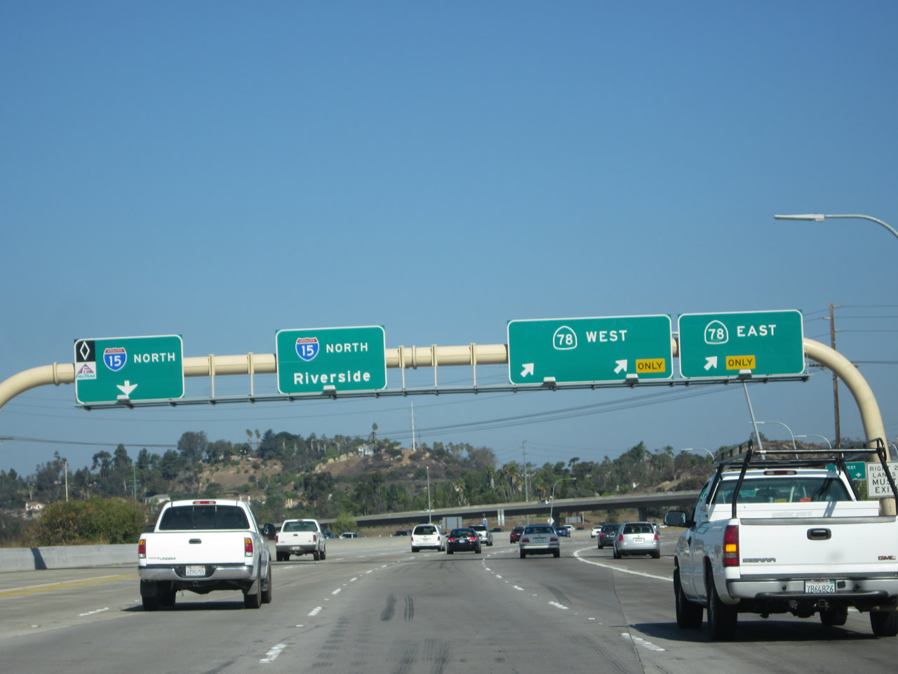
Now on the transition ramp, the left two lanes connect to California 78 west to Oceanside, while the right lane connects to California 78 east to Escondido and Ramona. Photos taken 10/02/11 and 01/25/07. |
|
|
The next exit along Interstate 15 north is Exit 33, El Norte Parkway (1.25 miles) as seen within the California 78 interchange complex in Escondido. Photos taken 10/02/11 and 01/28/06. |
|
|
Ramps for California 78 pass over Interstate 15. Photos taken 10/02/11. |
|
This mileage sign is posted for the next two exits on northbound Interstate 15: Exit 33, El Norte Parkway (final Escondido exit) and Exit 37, Deer Springs Road and Mountain Meadow Road. Photo taken 06/03/06. |
|
Blooming oleander bushes grace the median of Interstate 15 prior to the El Norte Parkway interchange. Photo taken 06/03/06. |
|
Northbound Interstate 15 (Escondido Freeway) reaches Exit 33, El Norte Parkway. This exit is the last Escondido exit, and it is the last exit for the next four miles. It connects to the northern end of Business Loop I-15 (Centre City Parkway). Photo taken 06/03/06. |
|
A 230kV San Diego Gas and Electric power line passes over Interstate 15 near the El Norte Parkway interchange. Photo taken 06/03/06. |
|
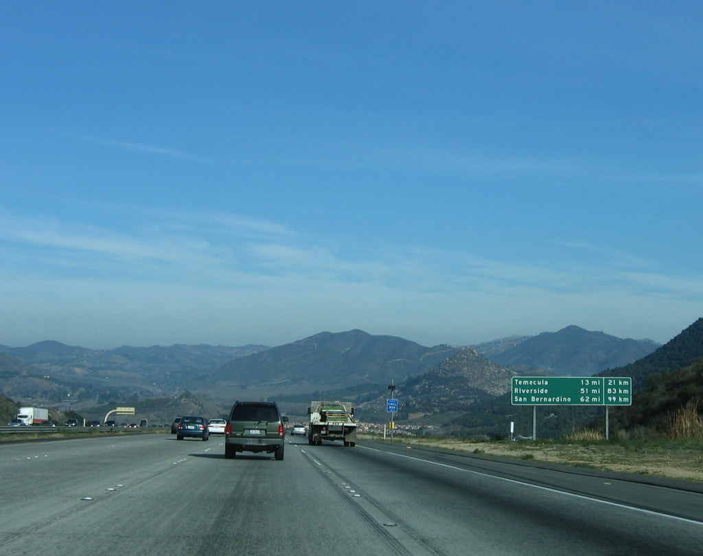
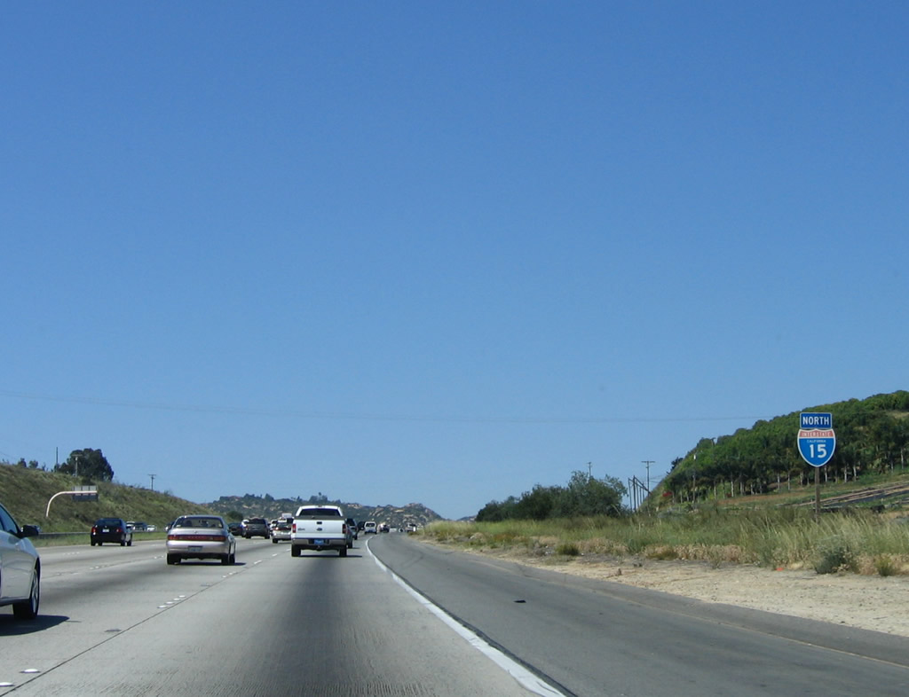
North of Escondido, the three destination cities are Temecula, Riverside, and San Bernardino, even though Interstate 15 only enters Temecula. The other two cities are served by Interstate 215, and the other cities along Interstate 15 in the Inland Empire (such as Corona, Norco, Ontario, Rancho Cucamonga) are all ignored. In addition, it seems like a better control city might well be Barstow or even Las Vegas, since there is a heavy demand to reach the desert gambling mecca. Photo taken 06/03/06. |
| Interstate 15 (Escondido Freeway) (Avocado Highway) north |
|
An Interstate 15 reassurance shield is posted after the on-ramp from El Norte Parkway. The next exit is about four miles ahead, as there is no access to Centre City Parkway south from Interstate 15 north. Photo taken 01/28/06. |
|
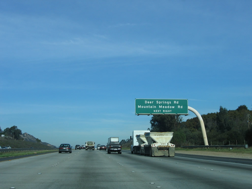
This mileage sign displays the distance to Exit 37, San Diego County S-12/Deer Springs Road and Mountain Meadow Road but omits any other exits, perhaps to allow for another new exit to be added later. In the late 1990s, Interstate 15 from here north to the Riverside County line was designated as the Avocado Highway, since Interstate 15 passes by a variety of avocado orchards along this rural stretch of freeway. Photo taken 01/28/06. |
|
Another Interstate 15 reassurance shield is posted after the on-ramp from Business Loop I-15/North Centre City Parkway. There is no access from Interstate 15 north to Business Loop I-15 south. Photo taken 01/28/06. |
|
Exit 37 leads to San Diego County S-12/Deer Springs Road and Mountain Meadow Road as well as the Lawrence Welk Resort. Photo taken 01/28/06. |
|
Northbound Interstate 15 approaches Exit 37, Deer Springs Road and Mountain Meadow Road, next right. Photo taken 01/28/06. |
|
A roadside exit number sign for Exit 37, Deer Springs Road and Mountain Meadow Road is posted along Interstate 15 north. Photo taken 06/03/06. |
|
This exit serves four separate roadways. Champagne Boulevard is old U.S. 395, which parallels Interstate 15 on the east side of the freeway. Deer Springs Road and Mountain Meadow Road lead east-west across the valley. Lawrence Welk Drive connects to the resort center and museum. Photo taken 06/03/06. |
|
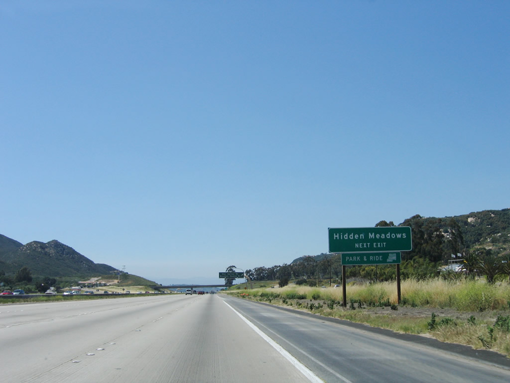
In addition to a park and ride, Exit 37 also serves Hidden Meadows, which includes the Welk Resort, Champagne Meadows, and other nearby areas. Champagne Boulevard is also part of the 1950s-era old U.S. 395 alignment. While the 1930s alignment of U.S. 395 took a westerly detour through Vista and San Marcos, the 1950s alignment more closely emulated the path now used by Interstate 15 through rural northern San Diego County. Photo taken 06/03/06. |
|
Northbound Interstate 15 (Escondido Freeway) (Avocado Highway) meets Exit 37, San Diego County S-12/Deer Springs Road and Mountain Meadow Road. Photo taken 01/28/06. |
|
|
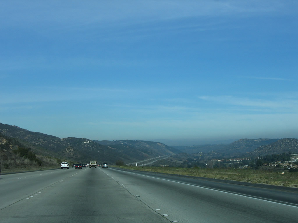
Hidden Meadows and Champagne Village come into view as Interstate 15 descends into a beautiful valley north of Mountain Meadow Road and Deer Springs Road. It is about four miles between Exits 37 and 41. The Oat Hills rise to the northeast of the freeway. Photos taken 01/28/06 and 06/03/06. |
|
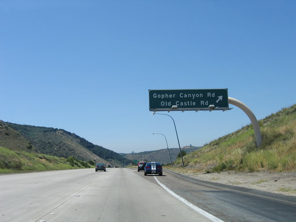
Northbound Interstate 15 approaches Exit 41, Gopher Canyon Road west and Old Castle Road east (one mile). Photo taken 06/03/06. |
|
Gopher Canyon Road leads west to meet California 76 and San Diego County S-13 southwest of Bonsall and north of Vista. Old Castle Road heads west to join Lilac Road en route to San Diego County S-6/Center Valley Road in Valley Center. Photo taken 01/28/06. |
|
A newer exit number roadside guide sign is posted for Exit 41, Gopher Canyon Road and Old Castle Road. Photo taken 06/03/06. |
|
Northbound Interstate 15 (Escondido Freeway) (Avocado Highway) reaches Exit 41, Gopher Canyon Road west and Old Castle Road east. Photo taken 06/03/06. |
|
View of northbound Interstate 15 as it passes through the Champagne Valley east of the Merriam Mountains. Note Old U.S. 395/Champagne Boulevard staying to the east of the freeway. The speed limit is 70 miles per hour through this stretch. Photo taken 06/03/06. |
|
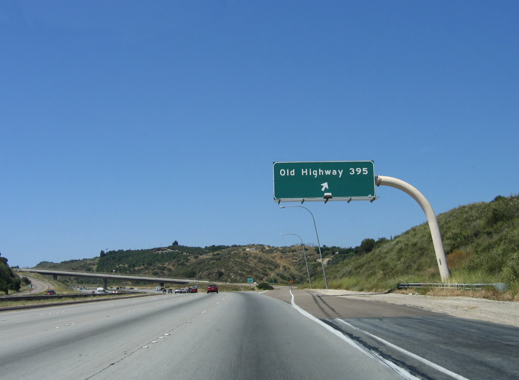
The next exit along Interstate 15 north is Exit 43, Junction Old U.S. Highway 395, one mile. The old route crosses from the east to the west side of the freeway at this interchange. Photo taken 06/03/06. |
|
Old Highway 395 is the 1950s route (second generation) of U.S. 395. It was relocated onto this alignment in order to provide a more direct route from Escondido to Temecula without having to pass through Vista, San Marcos, or Fallbrook. Use Exit 43 to connect with Old Highway 395 north en route Lilac Road and California 76. The old road continues north of California 76 past intersections with San Diego County S-15 and San Diego County S-13 before meeting Interstate 15 again at Exit 54. Photo taken 06/03/06. |
|
This roadside exit number sign (added in late 2003) appears immediately after the previous overhead sign for Old Highway 395. The additional sign seems duplicative since it is so close to the overhead sign shown previously. Photo taken 06/03/06. |
|
Northbound Interstate 15 reaches Exit 43, Old Highway 395. Old Highway 395 is the frontage road that parallels Interstate 15 between the northern end of Centre City Parkway (Business Loop I-15) in Escondido north to Rainbow and the San Diego-Riverside County Line. Photo taken 06/03/06. |
|
View of the gore point signage along northbound for Exit 43, Junction Old U.S. 395. Photo taken 06/03/06. |
|
This bridge carries Old Highway 395 over Interstate 15. Its design features are similar to the Lilac Road Overcrossing, which comes into view next. Photo taken 06/03/06. |
|
|
The Lilac Road overcrossing comes into view after the Old Highway 395 bridge. A reassurance shield for Interstate 15 (compare difference between 2006 and 2004) is posted after the on-ramp from Old Highway 395, and the Lilac Road bridge, one of the most scenic bridges in San Diego County, comes into view. The top of the bridge itself may be reached via Old Highway 395 (Exit 43 or 46). Photos taken 06/03/06 and 01/18/04. |
|
|
Built in 1978, the Lilac Road Bridge is one of two reinforced concrete arch bridges on San Diego County's Interstate Highway System. The other carries Eastgate Mall over Interstate 805 between the Miramar Road/La Jolla Village Drive and Mira Mesa Road interchanges near Sorrento Valley in the city of San Diego. Photos taken 06/03/06 and 01/28/06. |
|
After passing under the Lilac Road Bridge, this mileage sign along northbound for Temecula, Riverside, and San Bernardino. The latter two destinations are afforded via Interstate 215 (Old U.S. 395) north; Interstate 15 follows a path that bypasses both major cities (yet serves other major cities such as Corona, Norco, Ontario, and Rancho Cucamonga). Note the use of kilometers on this sign; this is one of a few remaining late-1970s vintage signs that show metric distances in San Diego County. Photo taken 01/28/06. |
|
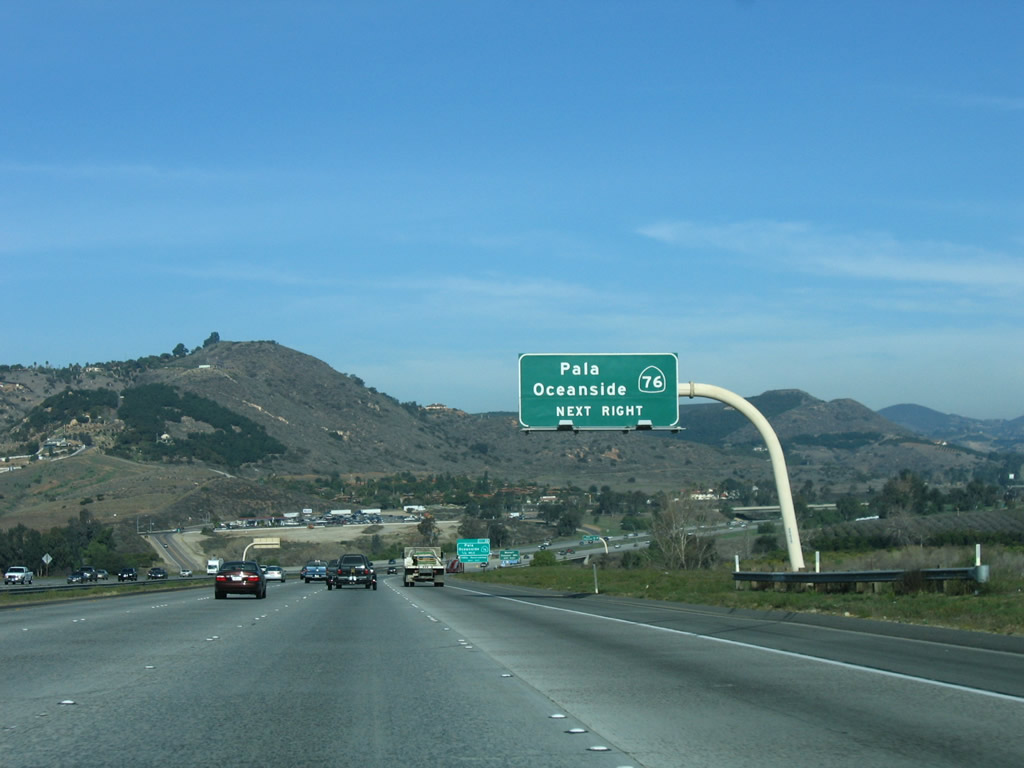
The next exit along northbound is Exit 46, California 76, which connects to Old U.S. 395 to the west of the freeway. Photo taken 09/28/08. |
|
Prior to California 76, Interstate 15 enters the unincorporated community of Fallbrook. Photo taken 09/28/08. |
|
California 76 leads east to Pala, Rincon Springs, Palomar Mountain, and Lake Henshaw before reaching its end at California 79 north of Santa Ysabel. California 76 west follows a congested two-lane alignment through Bonsall before heading southwest to Oceanside. While the westernmost segment of California 76 is an expressway, the section between the eastern limits of Oceanside and Interstate 15 are very congested, and plans call for the construction of a freeway or tollway that could handle more capacity. Of course, such a proposal has drawn intense controversy. Photo taken 01/28/06. |
|
An exit number sign (also placed in late 2003) is posted for Exit 46, California 76. Photo taken 01/28/06. |
|
|
Use California 76 west to Bonsall and east to Palomar Mountain (via a connection with San Diego County S-6). This section of California 76 is extremely busy, and as a two-lane highway, it is unable to handle the consistent traffic flow. Plans call for expansion of California 76 east of Interstate 15 to expressway standards, and a freeway alignment has not been ruled out. At this point, Interstate 15 crosses the San Luis Rey River. Photos taken 09/28/08 and 10/13/12. |
|
Northbound Interstate 15 reaches Exit 46, California 76. Throughout northern San Diego County, Interstate 15 retains four through lanes along northbound. This section of the freeway was mostly built to this standard in the 1970s. Photo taken 03/28/08. |
|
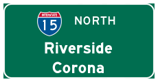
This overhead mileage sign provides the distance to Temecula, Riverside (the current control city), and San Bernardino. Photo taken 06/03/06. |
|
Spring wildflowers bloom along both sides of Interstate 15 in the Witch Creek Fire burn areas. Photo taken 03/28/08. |
|
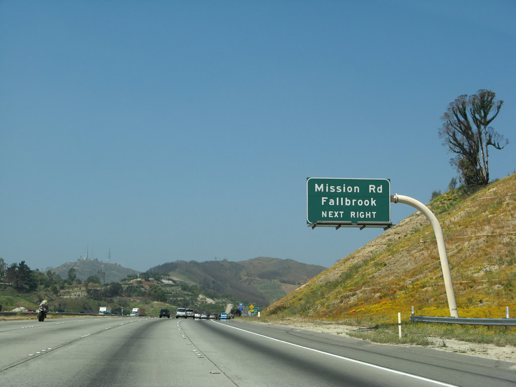
The next exit along Interstate 15 (Escondido Freeway) (Avocado Highway) is Exit 51, San Diego County S-13 (Mission Road) to Fallbrook and San Diego County S-15 (Reche Road) to Live Oak Park, one mile. Photo taken 01/28/06. |
|
|
San Diego County S-13 (Mission Road) leads due west into the community of Fallbrook then south to meet California 76 in Bonsall. San Diego County S-15 also leads to Fallbrook, but it takes Reche Road, which passes through Live Oak Park. County Route S-15 ends at its junction with County Route S-13 in Fallbrook. Photos taken 03/28/08 and 01/28/06. |
|
|
The Witch Creek Fire of October 2007 ripped through this area and destroyed much of the landscape along this section of Interstate 15. This particular roadside sign was destroyed and had to be replaced in 2008. Photos taken 03/28/08 and 01/28/06. |
|
Use Exit 51 to Rainbow, an unincorporated community located near the San Diego-Riverside County Line. Photo taken 06/03/06. |
|
Northbound Interstate 15 reaches Exit 51, San Diego County S-13 (Mission Road) to Fallbrook and San Diego County S-15 (Reche Road) to Live Oak Park. Photo taken 06/03/06. |
|
Now on the off-ramp, a trailblazer for San Diego County S-13 (Mission Road) leads due west into the community of Fallbrook then south to meet California 76 in Bonsall. Photo taken 06/03/06. |
|
A second sign points the way from the off-ramp to the community of Rainbow east of the freeway. Exit 51 is the first of two exits to serve Rainbow. Photo taken 06/03/06. |
|
A Rainbow community limits sign is posted on Interstate 15 north after the on-ramp from Mission Road. Photo taken 06/03/06. |
|
Another Interstate 15 reassurance shield is posted soon thereafter. Photo taken 06/03/06. |
|
The next exit along Interstate 15 north is Exit 54, Rainbow Canyon Boulevard. The community of Rainbow is located east of Interstate 15 via this exit. Photo taken 06/03/06. |
|
The Rainbow area made the news in the early 2000s with San Diego Gas & Electric plans to construct a new high-voltage, electrical transmission line (500kV). That project would have provided a third corridor of electricity into San Diego County from the rest of California (the other two portals are Path 44 along the Interstate 5 corridor and the 500kV Southwest Powerlink along the Interstate 8 and California 94 corridors; there are also connections from Mexico leading north into San Diego). This idea was eliminated due to local opposition, and San Diego Gas and Electric instead constructed a 500kV power transmission line (the Sunrise Powerlink) from the Imperial Valley to a substation near Alpine. Photo taken 01/28/06. |
|
A standalone exit number sign (placed in 2003-2004) is posted for Exit 54, Rainbow Canyon Boulevard. Each of the roadside exit number signs from Escondido north to the county line were placed around the same time. This is the last of that series of signs, as Interstate 15 will enter another Caltrans maintenance district after crossing into Riverside County. Photo taken 06/03/06. |
|
|
Northbound Interstate 15 reaches Exit 54, Rainbow Valley Boulevard east to Old U.S. 395/Rainbow Canyon Boulevard north. Rainbow Canyon Boulevard follows Historic U.S. 395 north to meet Riverside County S-16 in Temecula, thus providing an alternate route into Riverside County. Exit 54 is the second interchange to serve the unincorporated community of Rainbow, and it is the last San Diego County exit along northbound Interstate 15. Photos taken 03/28/08 and 06/03/06. |
|
After Exit 54 (Rainbow Valley Boulevard) and prior to the weigh station, Interstate 15 leaves San Diego County and enters Riverside County. The Avocado Highway and Escondido Freeway designations continue north into Riverside County, and the Temecula Valley Freeway designation is added starting at the county line. Photo taken 06/07/08. |
Page Updated January 6, 2013.