| Interstate 15/Mojave Freeway south |
|
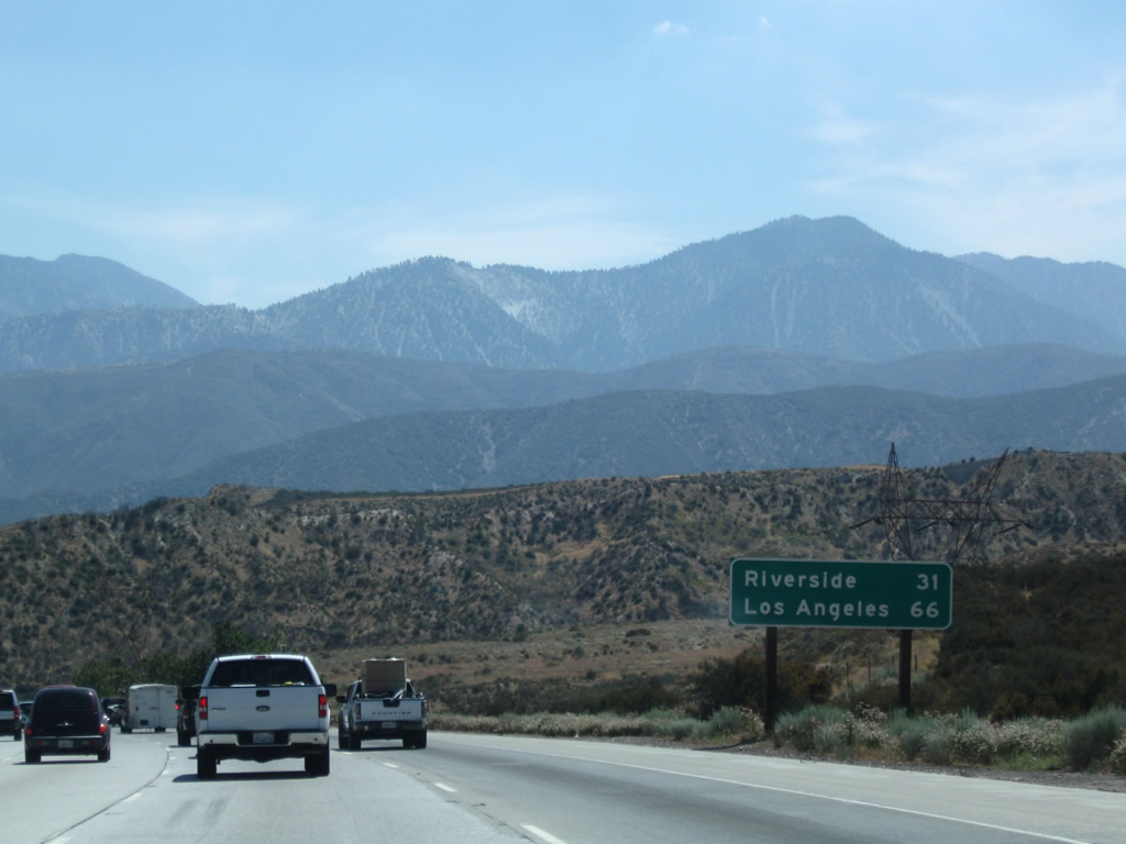
After the merge with U.S. 395 south, this mileage sign provides the distance to San Bernardino (28 miles) and Los Angeles (73 miles). Photo taken 10/19/04. |
|
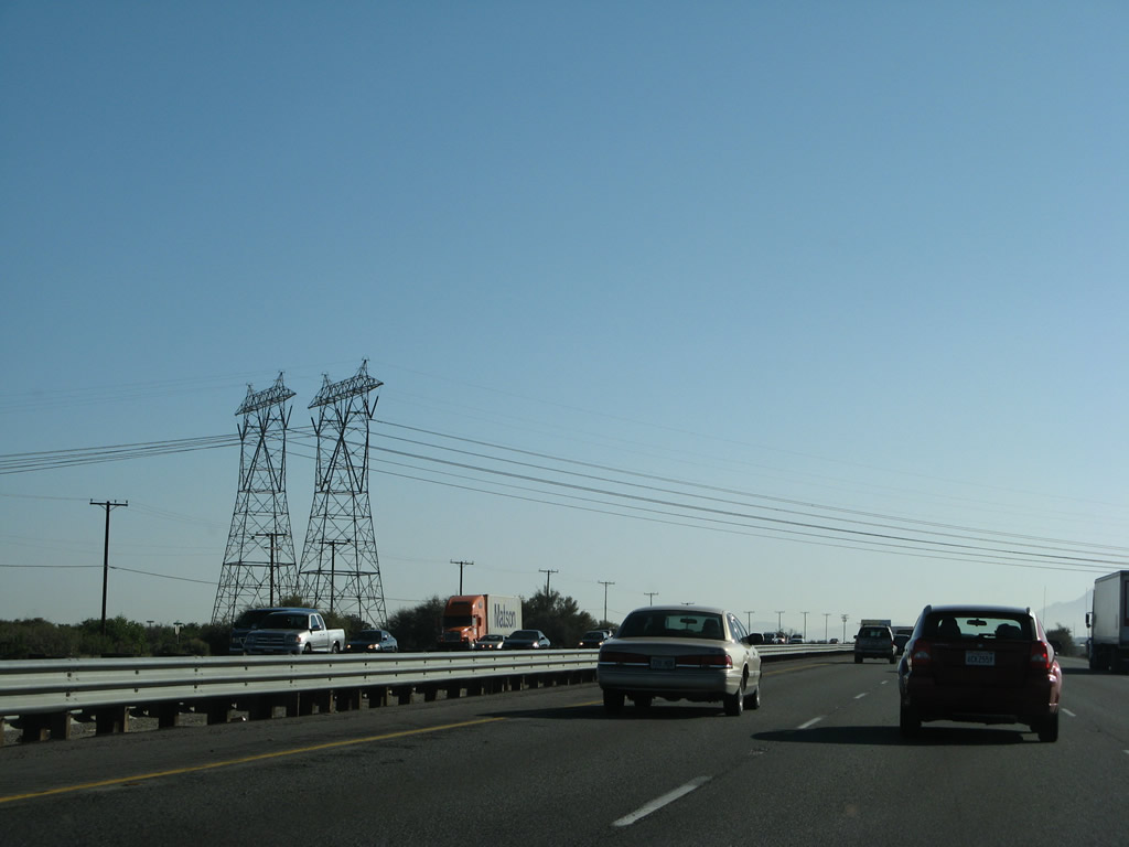
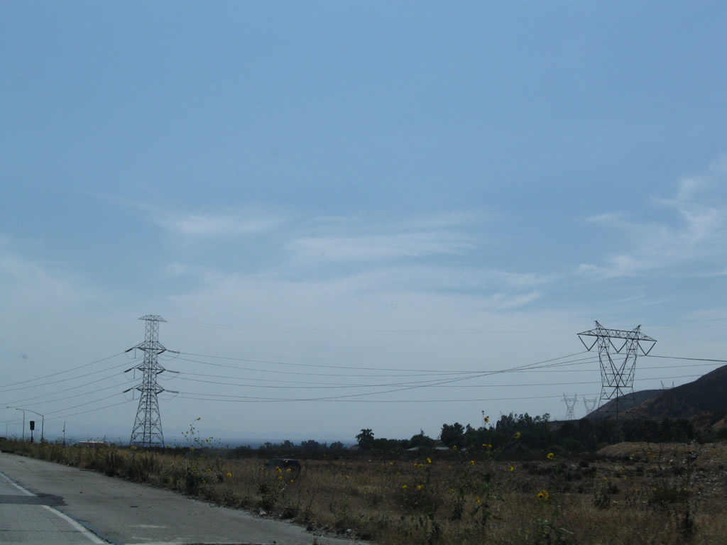
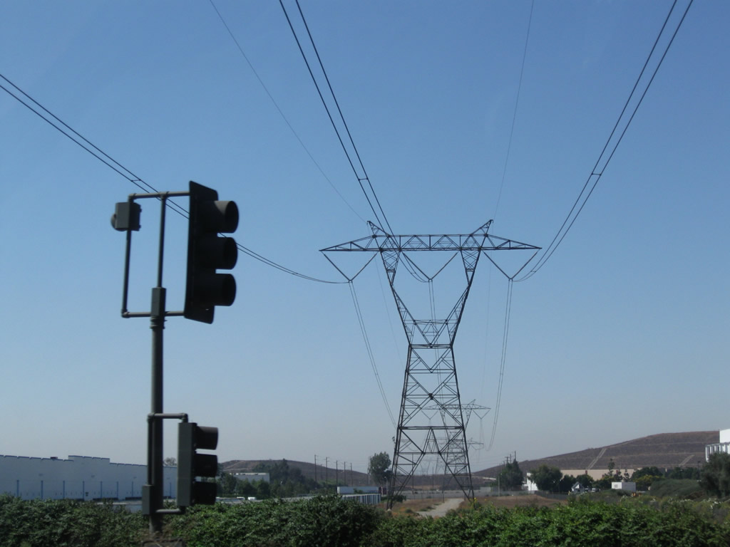
A pair of Southern California Edison 500kV power lines cross Interstate 15. These lines are part of Path 26, which travel east toward the Lugo Substation to meet Paths 46 and 61 and west toward the Vincent Substation off of California 14 and Angeles Forest Highway (Los Angeles County N-3). From Vincent, the two 500kV power lines continue northwest to the massive Midway Substation near Buttonwillow, where they meet Path 15 in the Central Valley. Photo taken 03/31/08. |
|
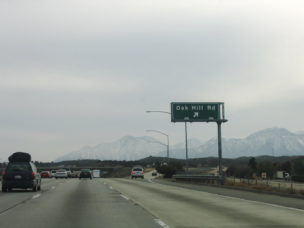
The next interchange along Interstate 15/Mojave Freeway south is Exit 138, Oak Hill Road. Oak Hill Road flows northward to Ranchero Road in Hesperia. The diamond interchange otherwise ties into the parallel frontage roads of Caliente Road and Mariposa Road. Photo taken 03/31/08. |
|
Exit 138 departs Interstate 15/Mojave Freeway southbound at Oak Hill Road. Caliente Road stems west into the Baldy Mesa area and San Bernardino National Forest. Mariposa Road continues south from Oak Hill Road to Forestry Road within the National Forest east of the freeway. The freeway climbs southward to Cajon Summit. Photo taken 04/01/06. |
|
The next exit along Interstate 15 south is a brake check area prior to Cajon Summit and the descent to Devore, San Bernardino, and Rancho Cucamonga. Photo taken 07/14/08. |
|
The steep downgrade lasts for 12 miles, from the summit to Devore (which is the location of the split between Interstate 15 and Interstate 215). Photo taken 07/14/08. |
|
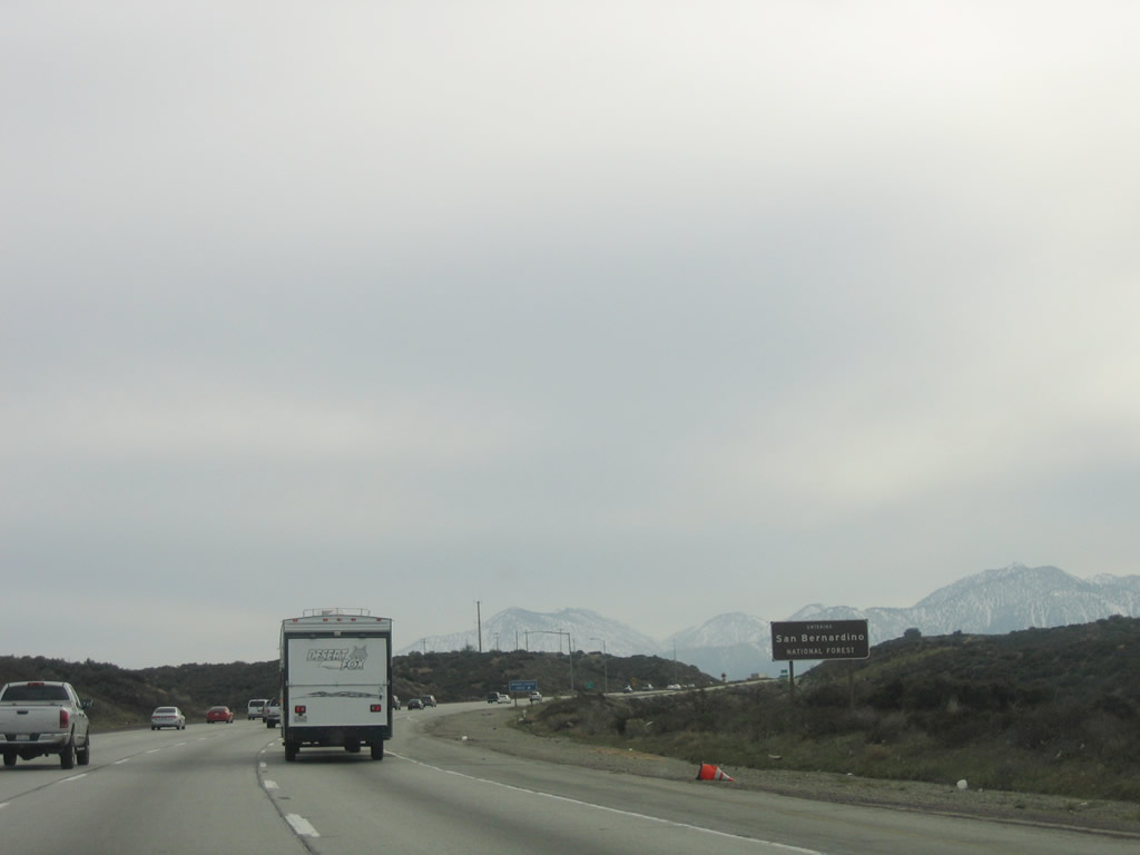
Interstate 15 enters San Bernardino National Forest. Photo taken 04/01/06. |
|
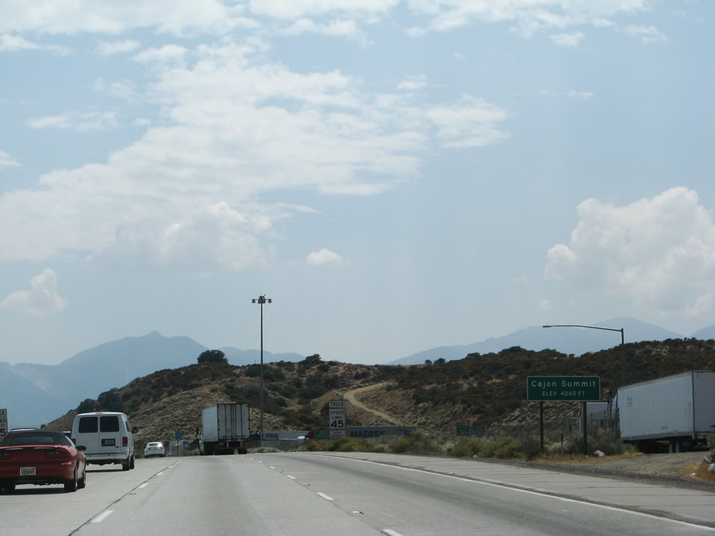
Southbound Interstate 15 reaches Exit 137, which is a brake check area near Cajon Summit. Photo taken 07/14/08. |
|
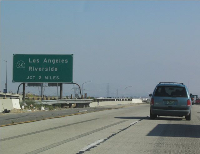
Next to the brake check area, Interstate 15 crosses Cajon Summit (el. 4,190 feet). The is not the highest summit on Interstate 15 in Southern California; that honor goes to Mountain Pass (el. 4,730 feet) northeast of Baker. However, this summit separates the Mojave Desert from the Inland Empire basin that contains several large cities, including San Bernardino and Riverside. Since those cities are at a much lower elevation, the downgrade from Cajon Summit (4,190 feet) to San Bernardino (el. 1,200 feet) feels much more dramatic. Photo taken 07/14/08. |
|
|
|
|
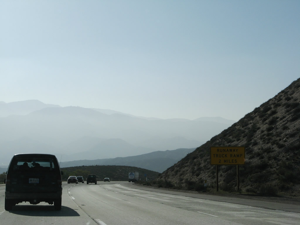
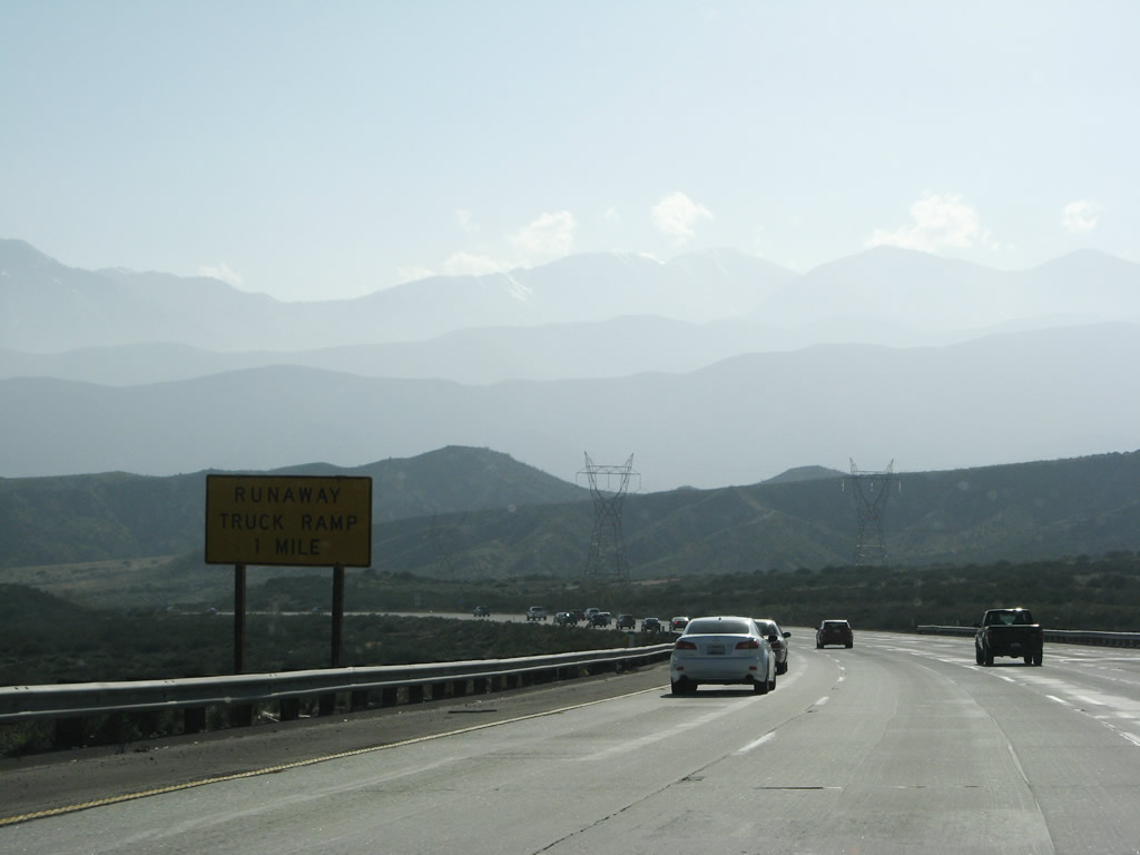
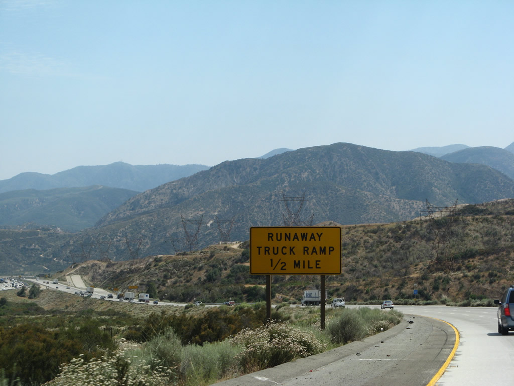
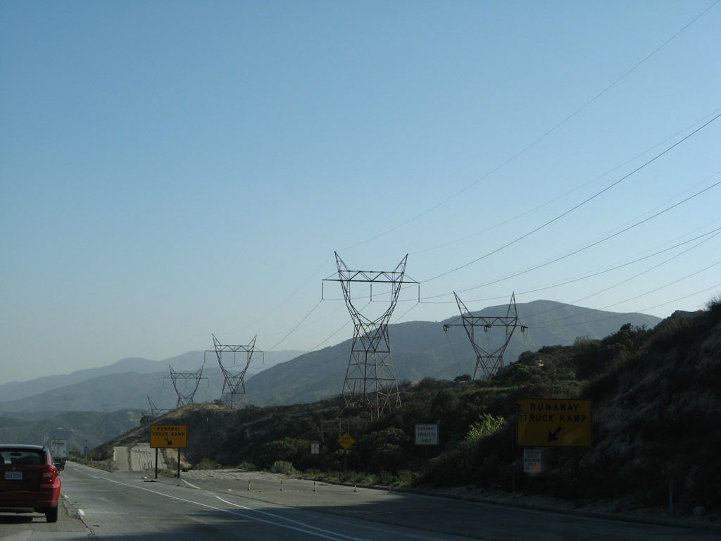
Now south of Victorville and Hesperia, this suite of photos shows the route of Interstate 15 southbound from Cajon Summit toward Cajon Junction (Exit 131, California 138). Two power lines follow Interstate 15 down the initial descent from Cajon Summit. The freeway features a runaway truck ramp and four southbound lanes. The northbound lanes separate significantly from the southbound lanes. Photos taken 03/31/08, 07/14/08, and 07/26/09. |
|
|
|
|
|
|
|
|
|
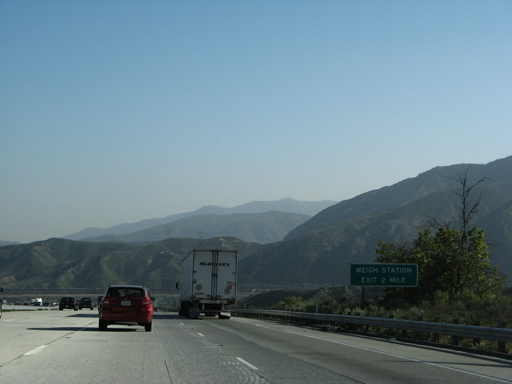
The next two exits along Interstate 15 south are Exit 131, California 138 (Cajon Junction) and Exit 130, Weigh Station. Photo taken 03/31/08. |
|
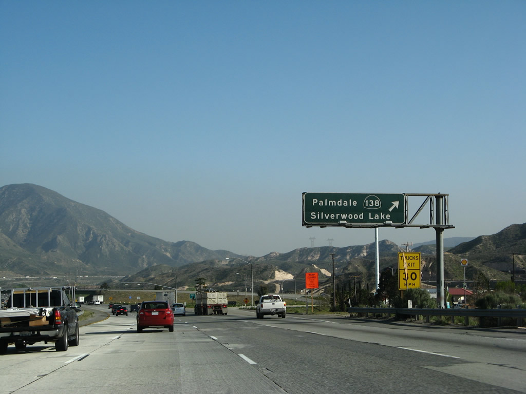
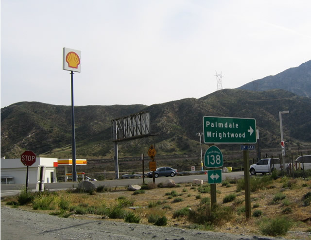
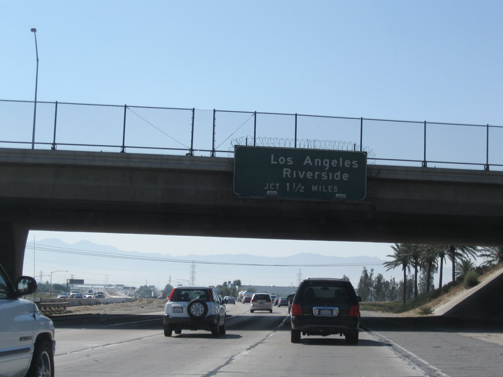
Southbound Interstate 15/Mojave Freeway next approaches Exit 131, California 138. California 138 was originally proposed as a freeway between Interstate 5 and Interstate 15 to be known as the Metropolitan Bypass. This proposal was dropped years ago, and it seems unlikely to be resurrected at this time. California 138 generally follows the San Andreas fault. Photo taken 04/01/06. |
|
Use California 138 west to Mormon Rocks, Wrightwood, Phelan, and Pearblossom. Photo taken 07/14/08. |
|
The right lane exits onto California 138; watch for slowing traffic. California 138 begins in Crestline at its junction with California 18, then travels west past Interstate 15 to connect with California 2 (Angeles Crest Highway) and California 14 (Antelope Valley Freeway) near Lancaster-Palmdale area. California 138 merges with California 14 north, then turns west again toward its terminus at Interstate 5 south of Tejon Pass. Photo taken 03/31/08. |
|
The off-ramp to California 138 has a five percent grade. Photo taken 03/31/08. |
|
Southbound Interstate 15/Mojave Freeway reaches Exit 131, California 138 at Cajon Junction. Photo taken 03/31/08. |
|
At the end of the exit ramp from southbound Interstate 15 to California 138 is this exit ramp. A left turn follows California 138 east over the Cajon Pass to Silverwood Lake, Enchanted Forest, and California 18 at Crestline. Photo taken 04/18/04. |
|
California 138 passes over Interstate 15. The next exit along Interstate 15/Mojave Freeway south is Exit 130, Cajon Junction Weigh Station. Photo taken 07/14/08. |
|
All commercial and rental trucks must enter the weigh station. Watch for stopped trucks along Interstate 15 south. Photo taken 07/26/09. |
|
A rare Series E Interstate 15 California shield is posted after the on-ramp from California 138. Photo taken 07/14/08. |
|
Southbound Interstate 15/Mojave Freeway reaches Exit 130, Cajon Junction Weigh Station. Photo taken 03/31/08. |
|
|
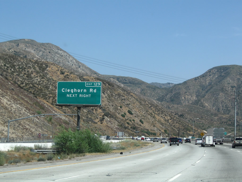
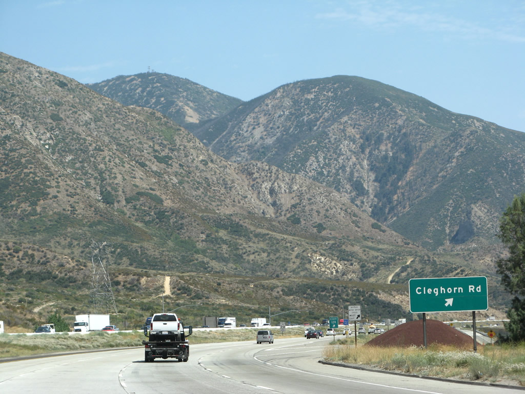
Passing through the weigh station, the next exit along Interstate 15/Mojave Freeway south is Exit 129, Cleghorn Road, which is an old section of U.S. 66-91-395. Route 66 adventurers would be well-served to travel this section of Cajon Boulevard. Photos taken 07/26/09 and 03/31/08. |
|
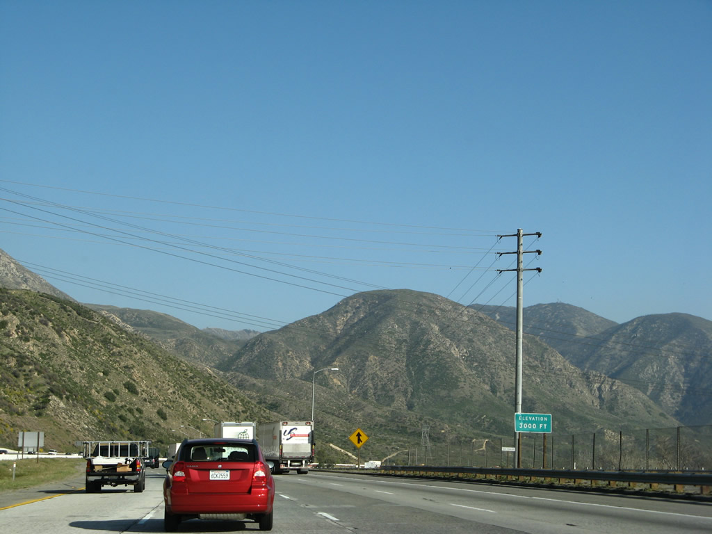
The 3,000-foot elevation sign indicates that Interstate 15 has lost over 1,000 feet in elevation since Cajon Summit. Photo taken 03/31/08. |
|
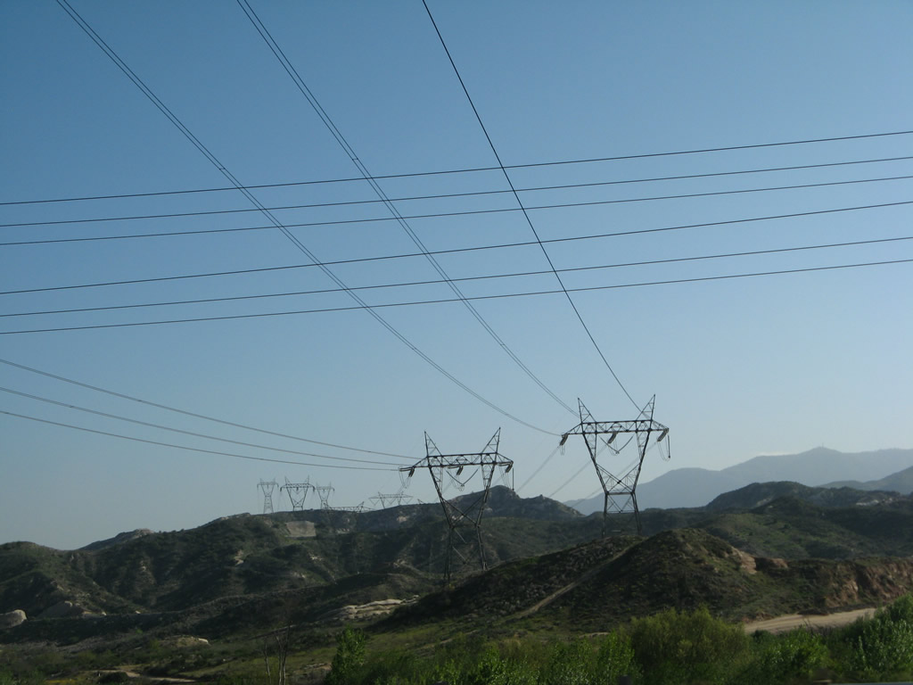
Another set of 500kV Southern California Edison power lines cross Interstate 15 near the 3,000-foot elevation sign. A total of three single-circuit 500kV lines leave Lugo Substation and travel south toward San Bernardino and the Inland Empire. Photo taken 03/31/08. |
|
Cleghorn Road is an old section of U.S. 66-91-395 that features a 1930s-era bridge and an old expressway configuration. It is like a step back in time to see the older high-speed expressway and to see the older design specifications still in use today as a local access road. Photo taken 07/14/08. |
|
Southbound Interstate 15/Mojave Freeway reaches Exit 129, Cleghorn Road (Old U.S. 66-91-395). Photo taken 07/14/08. |
|
An exit number gore point is signed at Exit 129 for Cleghorn Road. Photo taken 03/31/08. |
|
|
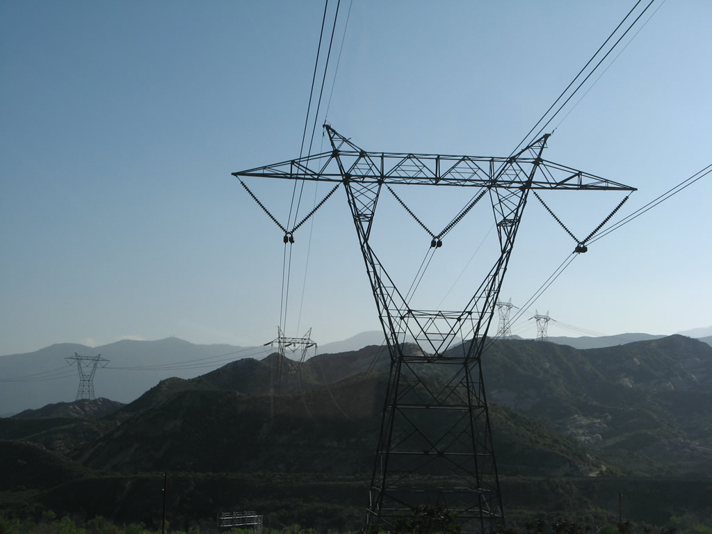
Passing over the Cleghorn Road interchange, another 500kV power line crosses over the freeway. This line, along with the other 500kV power lines that intersect Interstate 15 through the Cajon Summit and Cajon Grade area, form Path 46, which connects a variety of power generating facilities along the Colorado River with customers in the greater Los Angeles area. Some of the power generation facilities include fossil fuel plants and hydroelectric plants at Hoover Dam along the border of Nevada and Arizona and Glen Canyon Dam in Arizona. Photos taken 03/31/08. |
|
|
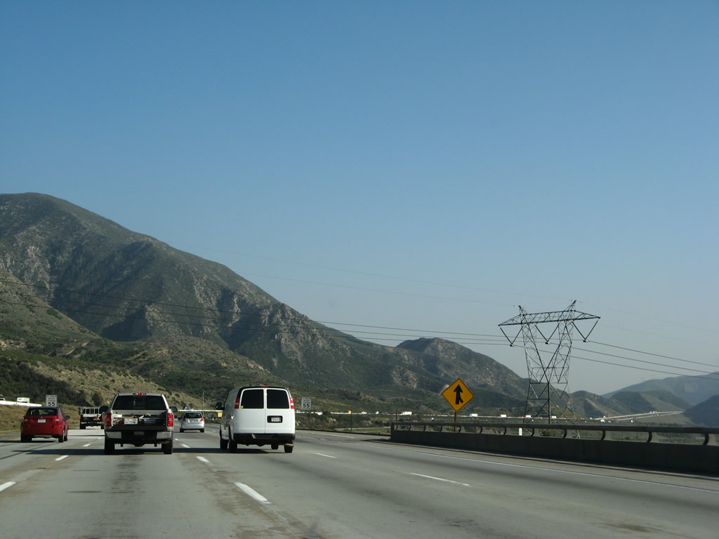
Interstate 15 continues south on its downward trend from Cajon Summit. A variable message sign is in place if traffic or weather conditions warrant. Photos taken 03/31/08. |
|
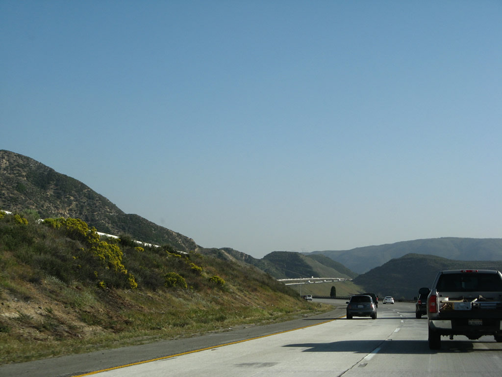
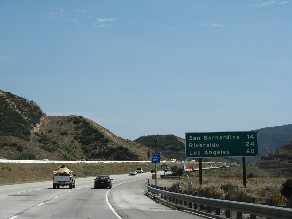
This mileage sign provides the distance to San Bernardino (14 miles), Riverside (24 miles), and Los Angeles (60 miles). Interstate 15 does not pass through the city limits of any of these destinations; instead, it follows a path through Rancho Cucamonga, Ontario, Norco, Corona, and Temecula before entering San Diego County. Photo taken 07/14/08. |
|
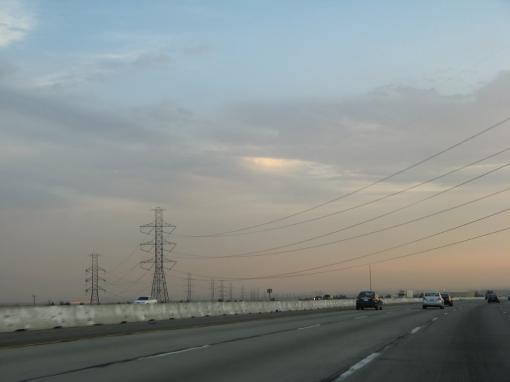
The 500kV power line seen crossing at Cleghorn Road turns to parallel Interstate 15. Along with the other two power lines that crossed Interstate 15 at the weigh station, all three 500kV power lines will follow Interstate 15 south toward Rancho Cucamonga and Fontana. Photo taken 03/31/08. |
|
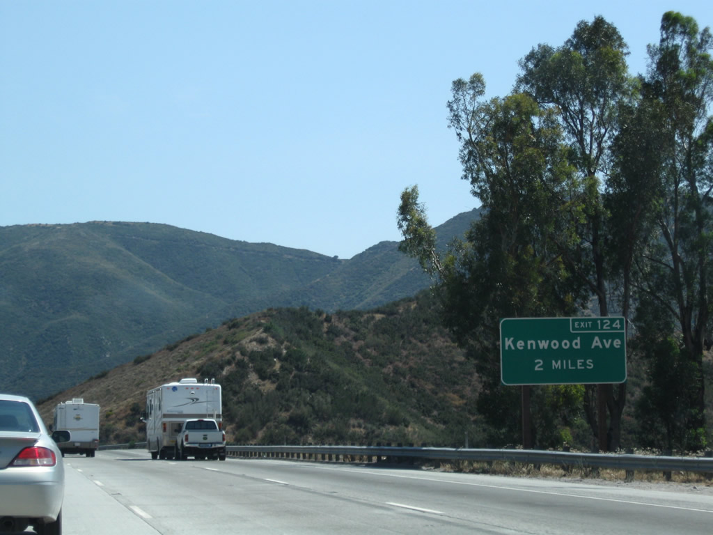
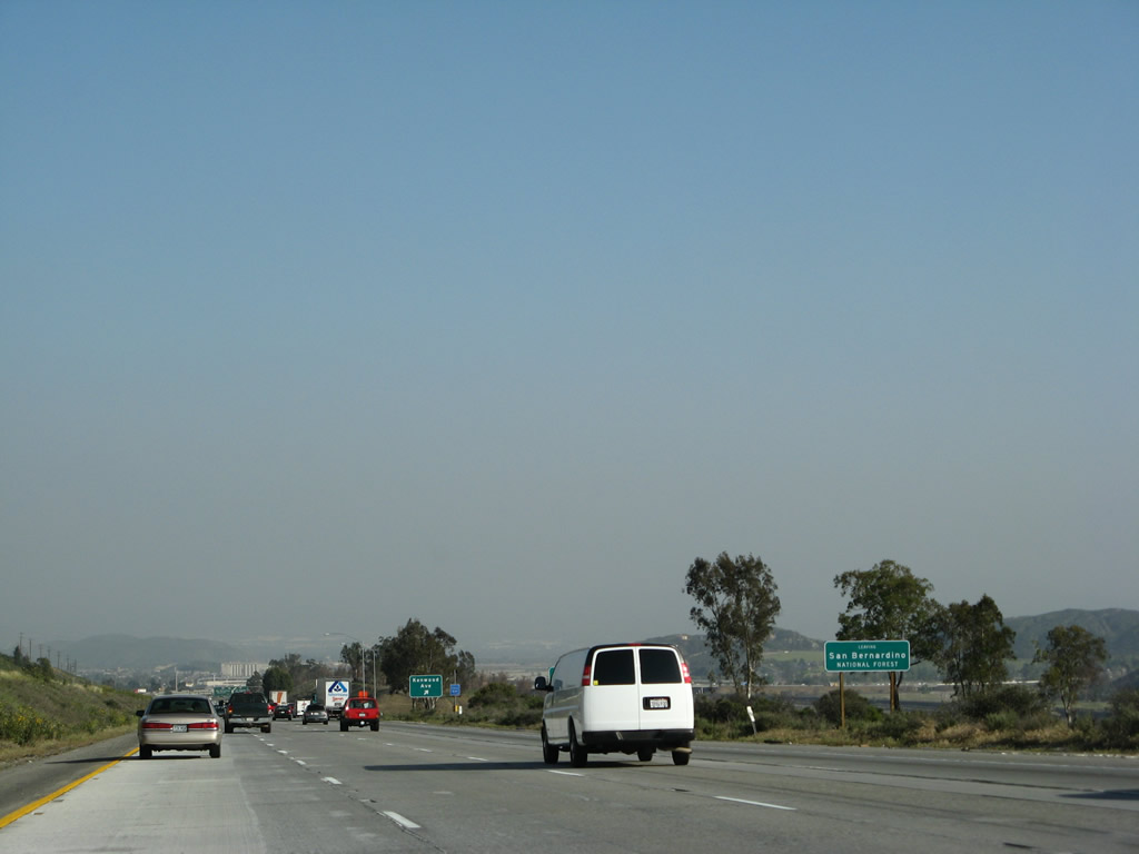
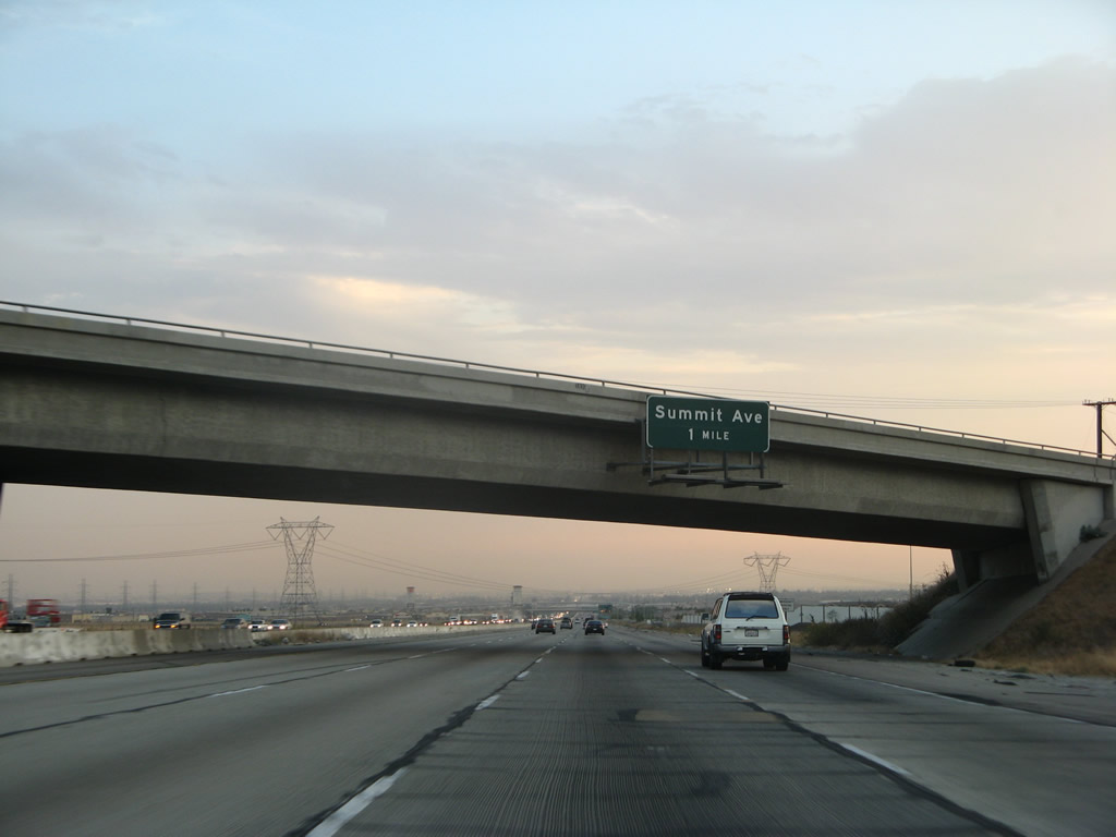
A two-mile advance sign for Exit 124, U.S. 66/Kenwood Avenue is posted next. Photo taken 07/29/09. |
|
|
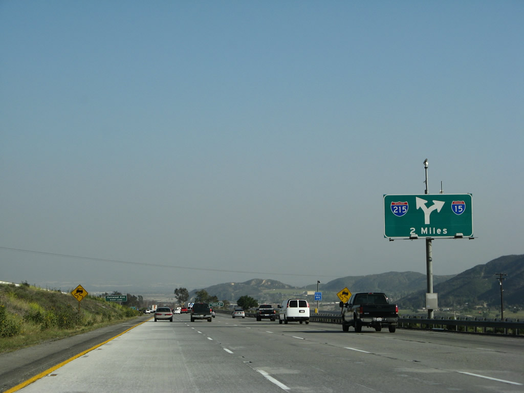
Winding down from the Cajon Summit, the next two exits along Interstate 15 south are Exit 124, Kenwood Avenue to U.S. 66-91-395 and Exit 123, Interstate 215 south to San Bernardino and Riverside. The 2004 guide sign made the interchange appear like the southbound freeway ends at a T-intersection, but the 2008 sign shows the split is much gentler than that! Photos taken 03/31/08 and 06/27/04. |
|
The next exit along southbound is Exit 124, Kenwood Avenue. This interchange directly connects to the south end of the remnant U.S. 66-91-395 expressway. Photo taken 03/31/08. |
|
Another roadside guide sign for Exit 124, Kenwood Avenue is posted shortly thereafter. Photo taken 03/31/08. |
|
Nearing Exit 124, Kenwood Avenue, Interstate 15 south leaves the San Bernardino National Forest. Photo taken 03/31/08. |
|
Southbound Interstate 15/Mojave Freeway reaches Exit 124, Kenwood Avenue to the U.S. 66-91-395 expressway. Photo taken 03/31/08. |
|
|
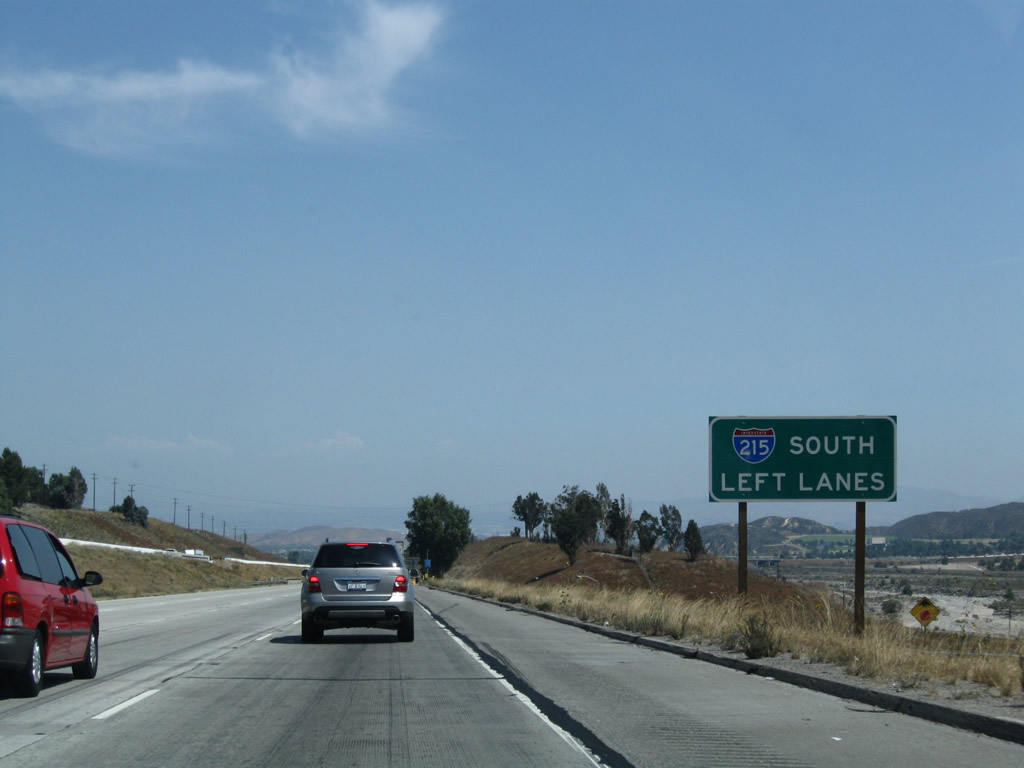
A relatively new roadside sign was posted on either side of the freeway to remind motorists to use the left lanes to Interstate 215 south. Photos taken 07/14/08 and 07/29/09. |
|
The second guide sign for the pending Interstate 215 (Exit 123) interchange is more illustrative of the interchange, as the freeway will split, with Interstate 215 following the left lanes and Interstate 15 taking the right lanes. Photo taken 03/31/08. |
|
Use Interstate 215 south to San Bernardino and Riverside. Photo taken 03/31/08. |
|
|
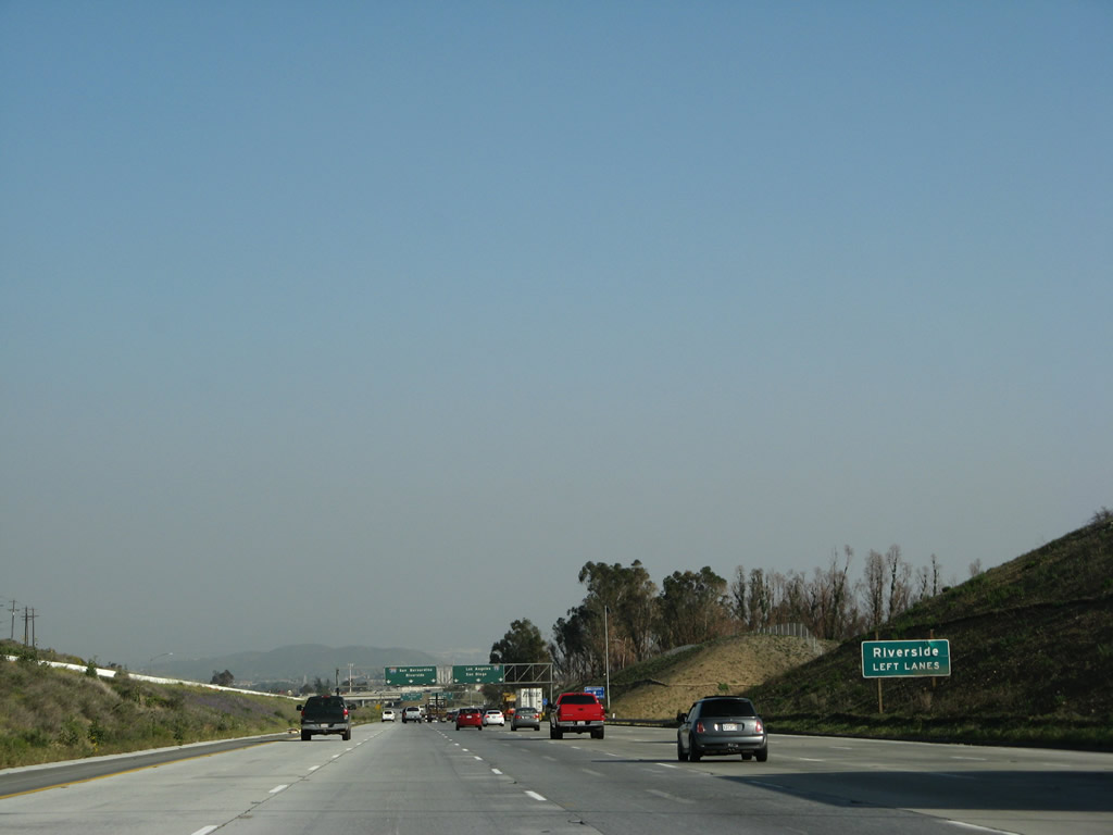
Interstate 15 widens into six lanes, with the three left lanes heading toward Interstate 215 and the three right lanes heading toward Interstate 15 south. Interstate 215 follows old U.S. 66-91-395 south through downtown San Bernardino, then heads south to Colton, Riverside, Moreno Valley, Perris, Sun City, Murrieta, and Temecula. Photos taken 07/29/09 and 03/31/08. |
|
|
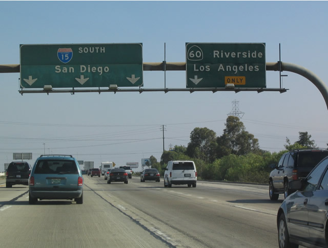
At this point, Interstate 15 and Interstate 215 split. Through traffic en route to San Diego, Corona, Los Angeles (via California 210, Interstate 10, or California 60), or Orange County (via California 91) is best served by Interstate 15. An archaic interchange between Interstate 215/California 60/California 91 in Riverside (it is a cloverleaf!) generally causes daily traffic delays, and a construction project to reconfigure the interchange will likely result in further delays during the short-term. Photos taken 03/31/08 and 07/09/07. |
| Interstate 15 (Ontario Freeway) south |
|
After splitting with Interstate 215, southbound Interstate 15 carries three lanes southwest toward Rancho Cucamonga. The freeway changes names to the Ontario Freeway after splitting from Interstate 215. This freeway segment is much newer than Interstate 215 into San Bernardino. Photo taken 07/26/09. |
|
|
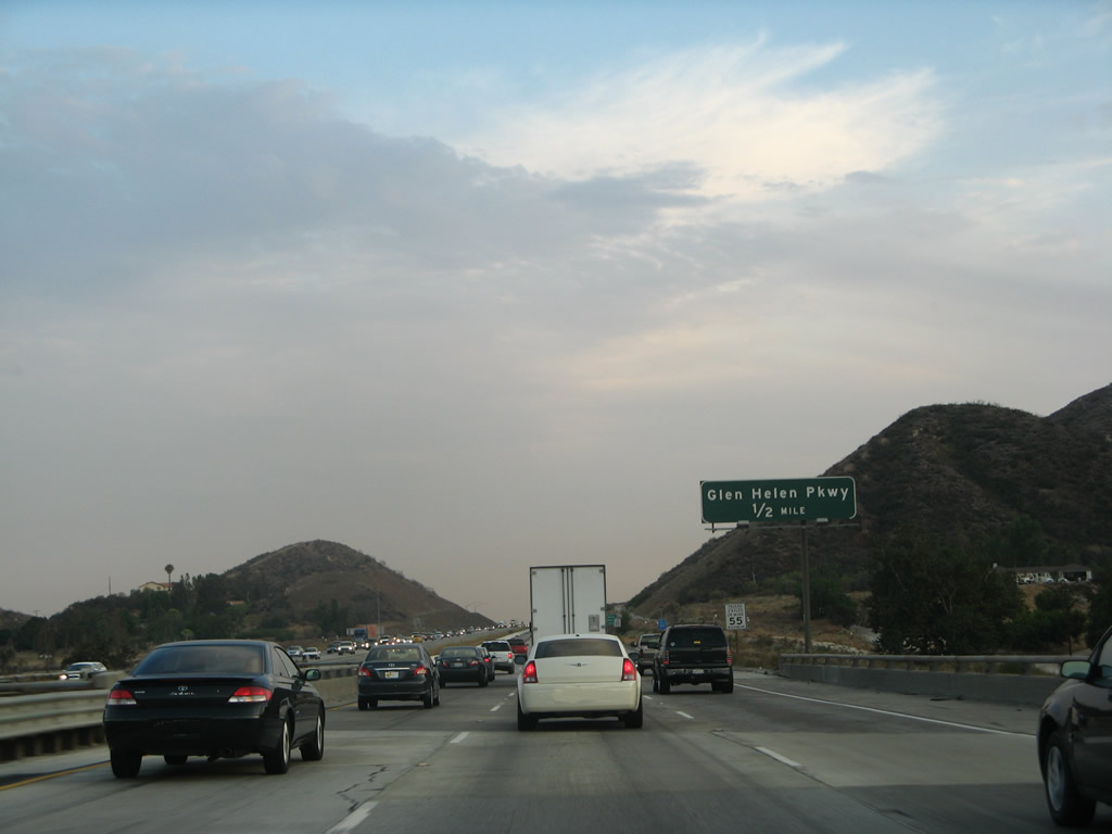
The next exit along Interstate 15 south is Exit 122, Glen Helen Parkway (one-half mile). Photos taken 07/26/09 and 07/09/07. |
|
Use Exit 122 to Glen Helen Pavilion. Photo taken 07/26/09. |
|
Southbound Interstate 15 meets Exit 122, Glen Helen Parkway. Photo taken 07/26/09. |
|
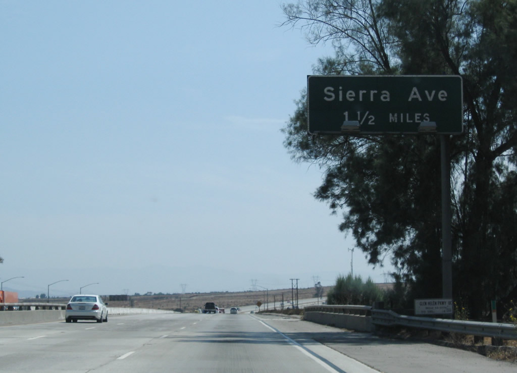
The next exit along Interstate 15 (Ontario Freeway) south is Exit 119, Sierra Avenue (1.50 miles). Photo taken 07/26/09. |
|
Southbound Interstate 15 widens to four through lanes after the Glen Helen Parkway on-ramp. Photo taken 07/26/09. |
|
Use Sierra Avenue to Fontana and Rialto. Photo taken 07/26/09. |
|
The next advance sign for Exit 119 is posted one-half mile prior to the off-ramp from Interstate 15 (Ontario Freeway) south. Photo taken 07/26/09. |
|
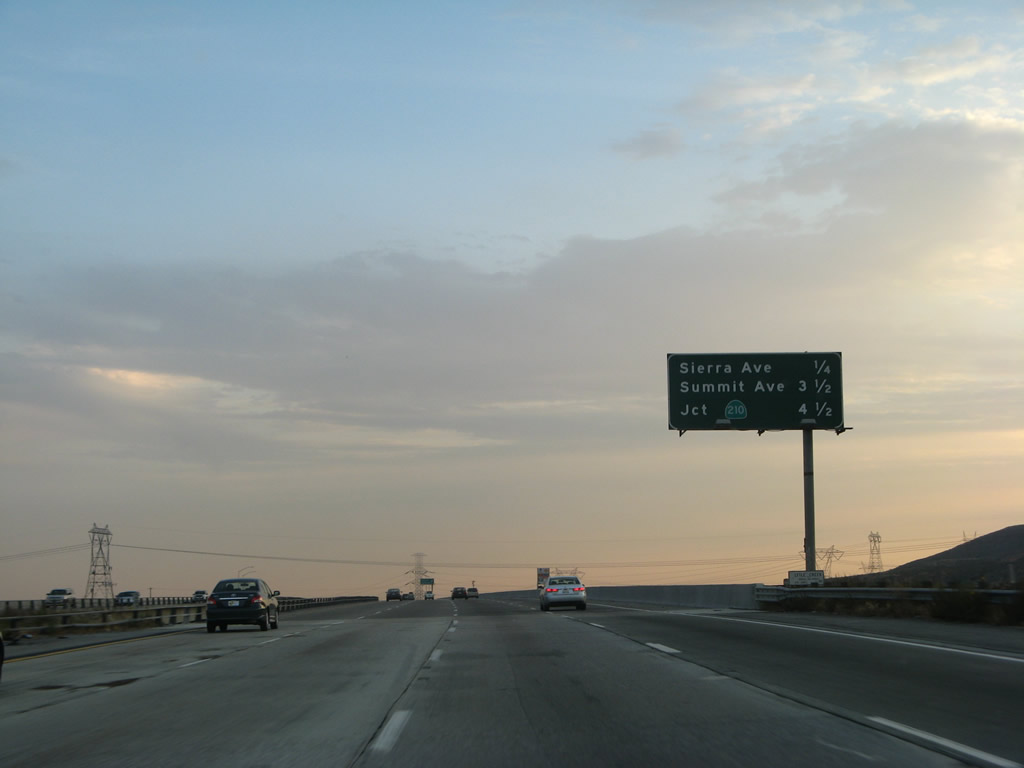
This mileage sign along Interstate 15 (Ontario Freeway) south provides the distance to the next three exits: Exit 119, Sierra Avenue; Exit 116, Summit Avenue; and Exits 115B-A, California 210 (Future Interstate 210). Photo taken 07/09/07. |
|
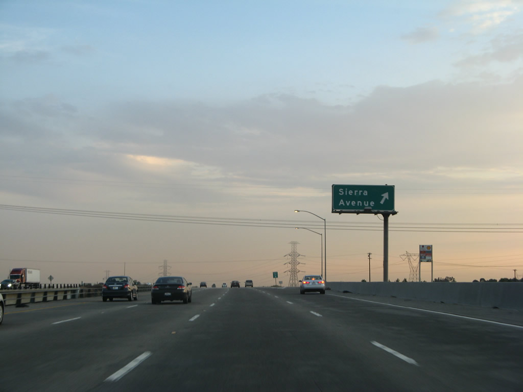
Southbound Interstate 15 (Ontario Freeway) reaches Exit 119, Sierra Avenue. Photo taken 07/09/07. |
|
|
|
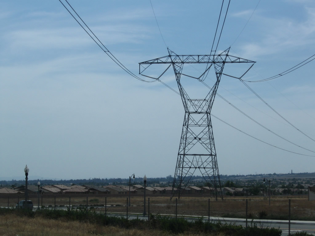
Two 500kV Southern California Edison power lines join together into a rare, double-circuit tower configuration. These lines will travel south through the Inland Empire, then eventually connect southwest to a substation in Orange County. Photos taken 07/09/07 and 07/26/09. |
|
The next exit along Interstate 15 south is Exit 116, Summit Avenue (one mile). Photo taken 07/09/07. |
|
An exit number sign for Exit 116 (Summit Avenue) is posted 0.75 mile prior to the off-ramp. Photo taken 07/26/09. |
|
This mileage sign along Interstate 15 south provides the distance to the next several exits: Exit 116, Summit Avenue; Exits 115B-A, California 210 (Foothill Freeway); and Exit 113, Base Line Road/Base Line Avenue. Photo taken 07/09/07. |
|
A single-circuit 500kV Southern California Edison power line crosses over the freeway. Photo taken 07/26/09. |
|
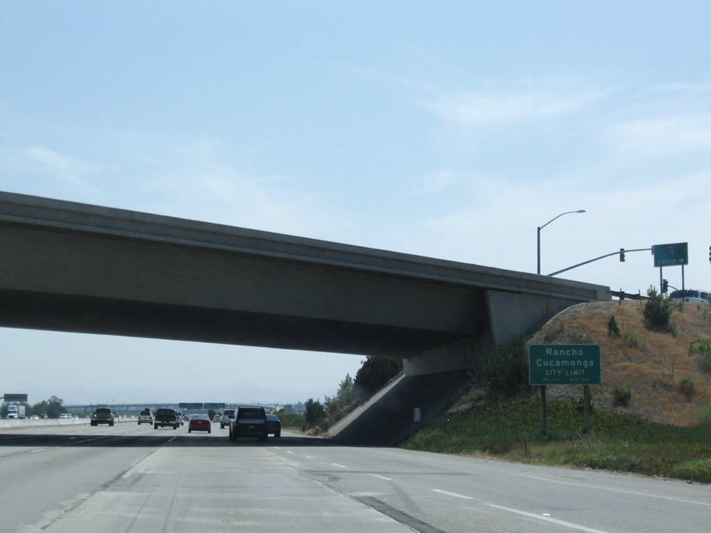
The next five exits serve the city of Rancho Cucamonga. Photo taken 07/09/07. |
|
Southbound Interstate 15 reaches Exit 116, Summit Avenue. Photo taken 07/09/07. |
|
California 210, the next exit after Summit Avenue, is the next freeway-to-freeway interchange along southbound Interstate 15. A fairly new freeway, California 210 provides an alternative to Interstate 10 between Fontana and San Dimas. The only remaining unconstructed segment is the section through Rialto (Sierra Avenue) and Muscoy (Interstate 215). Old California 30 acts as a temporary route to connect California 210 with the existing California 30 freeway around San Bernardino. Photos taken 07/26/09 and 07/09/07. |
|
|
Interstate 15 enters the city of Rancho Cucamonga. Photo taken 07/26/09. |
|
|
These California 210 reflective shields overlay the original button copy California 30 shields that were placed on these signs originally. When the decision was made in 1999 to renumber the Foothill Freeway as California 210 (with hopes for a future redesignation as Interstate 210), California 30 was hastily removed from some signs along the stretch completed in 2001 just east and west of Interstate 15 (between Dry Creek Boulevard and Sierra Avenue). Photos taken 07/29/09 and 06/27/04. |
|
|
Southbound Interstate 15 reaches Exit 115B, California 210 (Foothill Freeway) east to San Bernardino. Notice that local traffic is advised for the route, even though the highway connects to that city via old California 30/Highland Avenue. Photos taken 07/29/09 and 06/27/04. |
|
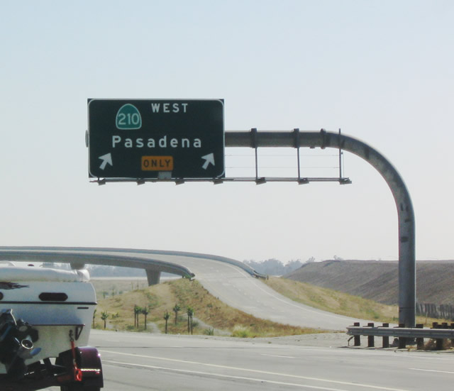
The second ramp in the California 210 interchange connects southbound Interstate 15 with westbound California 210 (Foothill Freeway) to Rancho Cucamonga, Upland, Claremont, La Verne, and San Dimas. The freeway then meets California 57, where California 210 converts into Interstate 210, and the Interstate continues west to Pasadena and ultimately Sylmar (Interstate 5). Photo taken 06/27/04. |
|
|
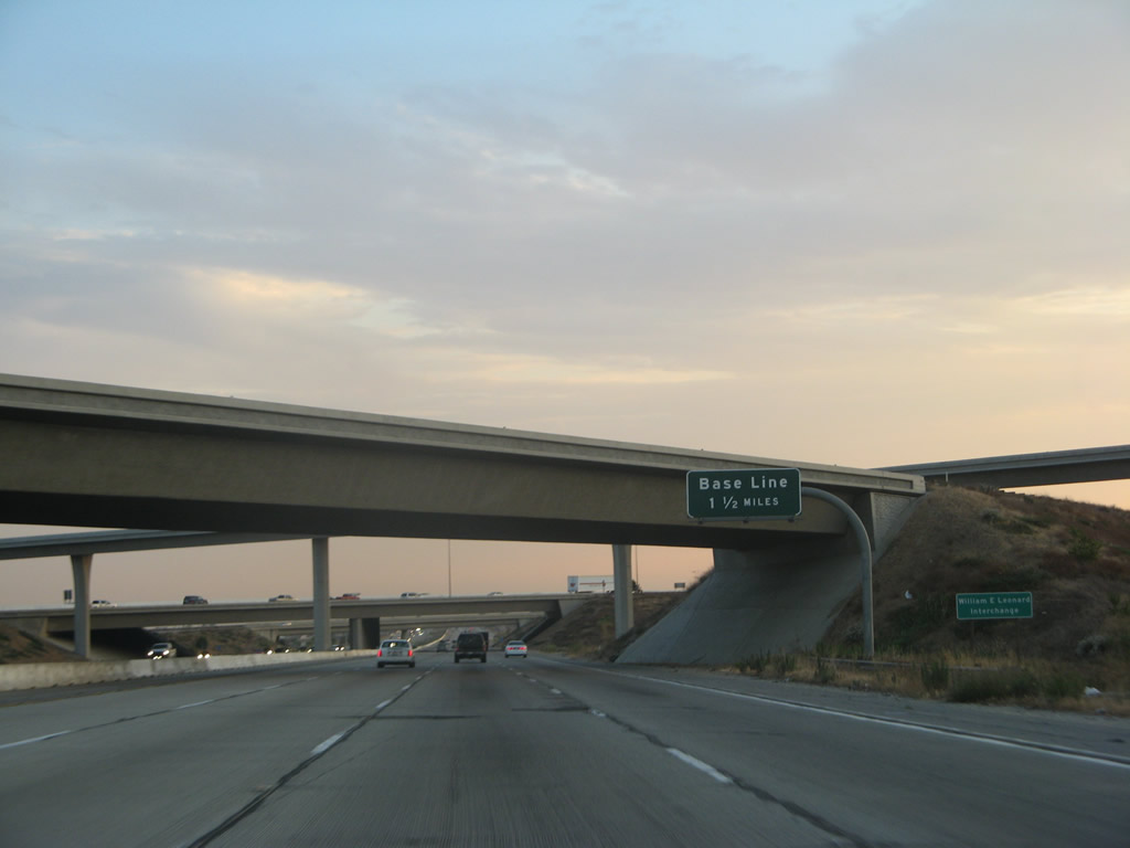
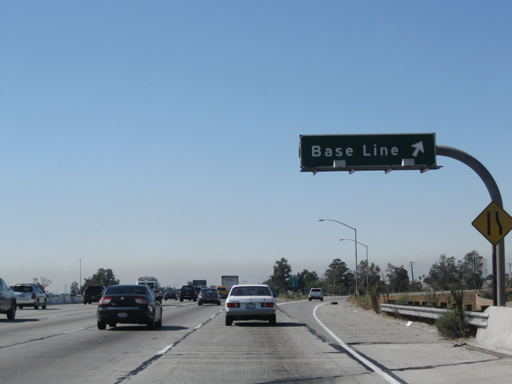
The next exit along Interstate 15 south is Exit 113, Base Line Road/Base Line Avenue. Photos taken 07/29/09 and 07/09/07. |
|
This mileage sign provides the distance to the next three exits after California 210: Exit 113, Base Line Road/Base Line Avenue; Exit 112, California 66/Foothill Boulevard (Historic U.S. 66); and Exit 110, Fourth Street. Photo taken 09/28/08. |
|
Although it is signed only as "Base Line," the next exit along southbound (Exit 113) serves Base Line Road west through Rancho Cucamonga to Upland and Claremont. It also serves Base Line Avenue east into Fontana and Rialto. By the time it enters the city of San Bernardino, it becomes Base Line Street. Photo taken 09/28/08. |
|
Southbound Interstate 15 (Ontario Freeway) reaches Exit 113, Base Line Road and Base Line Avenue. Photo taken 09/28/08. |
|
The next exit along southbound Interstate 15 is Exit 112, California 66/Foothill Boulevard, one mile. Photo taken 09/28/08. |
|
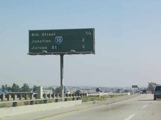
This mileage sign provides the distance to the next three exits: Exit 112, California 66/Foothill Boulevard (Historic U.S. 66); Exit 110, Fourth Street; and Exits 109B-A, Interstate 10 (San Bernardino Freeway) east to Palm Springs and Phoenix and west to Los Angeles. Photo taken 09/28/08. |
|
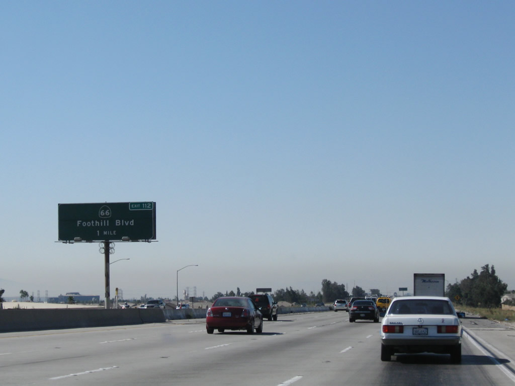
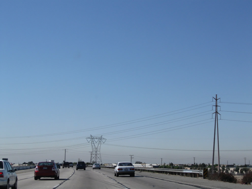
Southbound Interstate 15 reaches Exit 112, California 66/Foothill Boulevard. California 66 is one of the few state-maintained segments of Old U.S. 66 that are left in the Los Angeles Basin. With the recent resurgence of U.S. 66 in the popular culture, U.S. 66 shields greatly outnumber California 66 shields through Rancho Cucamonga and Upland. U.S. 66 used to follow Foothill Boulevard east to San Bernardino via Fontana and Rialto, then joined U.S. 91-395 north (Interstate 215 today) north toward Cajon Summit. Photo taken 09/28/08. |
|
An Interstate 15 south reassurance shield is posted after the on-ramp from Foothill Boulevard. Photo taken 09/28/08. |
|
|
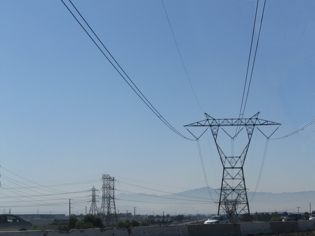
A set of power lines (230kV and 500kV - Southern California Edison) crosses over Interstate 15 between Exits 112 and 110. A new power plant connects to the 500kV system, and the realignment of lines is visible in this series of photos. Photos taken 09/28/08. |
|
|
|
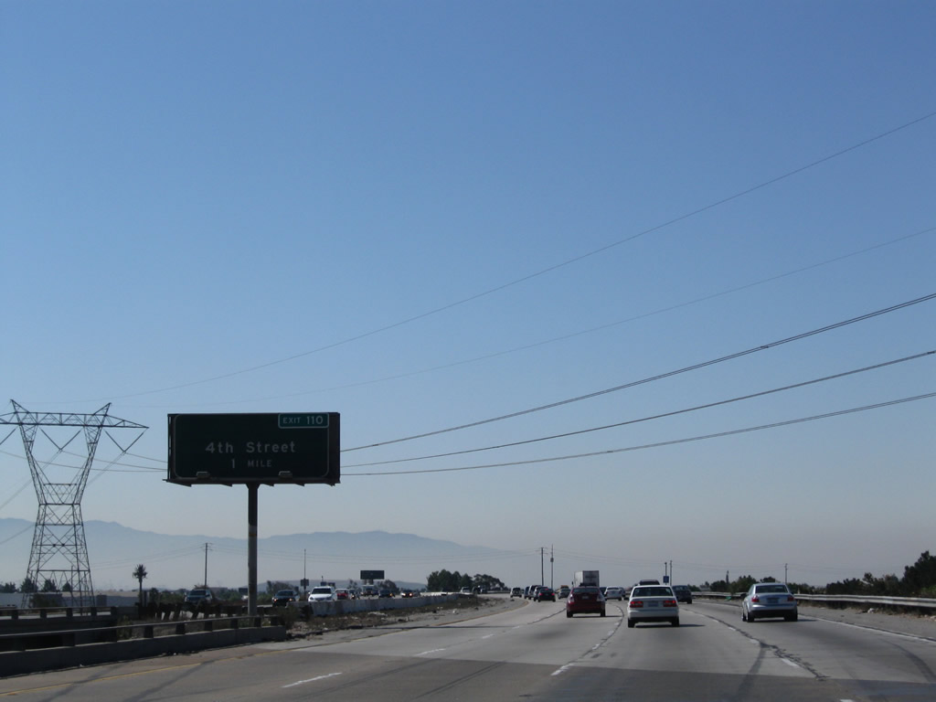
The next exit along Interstate 15 (Ontario Freeway) south is Exit 110, Fourth Street (one mile). An exit number tab was affixed to this existing sign. Photo taken 09/28/08. |
|
This mileage sign provides the distance to the next three exits along southbound Interstate 15: Exit 110, Fourth Street; Exits 109B-A, Interstate 10 (San Bernardino Freeway); and Exit 108, Jurupa Street. Photo taken 06/27/04. |
|
The next exit along southbound is Exit 110, Fourth Street west into Rancho Cucamonga and San Bernardino Avenue east to Fontana and Bloomington. Photo taken 06/27/04. |
|
Southbound Interstate 15 reaches Exit 110, Fourth Street. The next interchange is Exits 109B-A, Interstate 10 (San Bernardino Freeway). Interstate 15 departs Rancho Cucamonga and enters Ontario. Photo taken 07/09/07. |
|
Interstate 10 (San Bernardino Freeway) heads east to Colton, Palm Springs, Indio, and Phoenix. It travels west through Ontario, Montclair, and Pomona en route to Los Angeles County. Photo taken 07/09/07. |
|
The first exit from southbound Interstate 15 connects to eastbound Interstate 10 to San Bernardino and Indio (Exit 109B) followed by the ramp to westbound Interstate 10 to Los Angeles and Santa Monica. Photo taken 07/09/07. |
|
Immediately thereafter, southbound Interstate 15 (Ontario Freeway) reaches Exit 109A, Interstate 10 (San Bernardino Freeway) west to Los Angeles. The next off-ramp along southbound is Exit 108, Jurupa Street. Photo taken 07/09/07. |
|
|
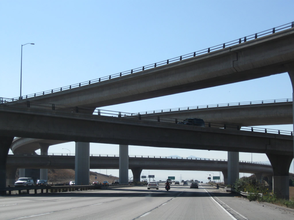
Interstate 15 forms the second level of the symmetrical stack interchange with Interstate 10. The bottom level is the Interstate 10 mainline, and the top two levels are the high-speed connecting ramps between the two freeways. Photos taken 07/09/07 and 09/28/08. |
|
|
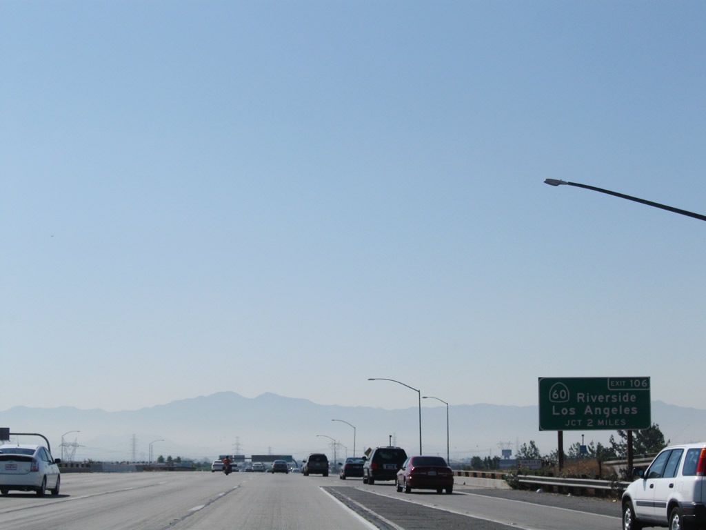
A distance sign for Exit 106, California 60 (Pomona Freeway) (two miles) is posted prior to the Jurupa Street interchange (Exit 108). Photos taken 09/28/08 and 06/27/04. |
|
|
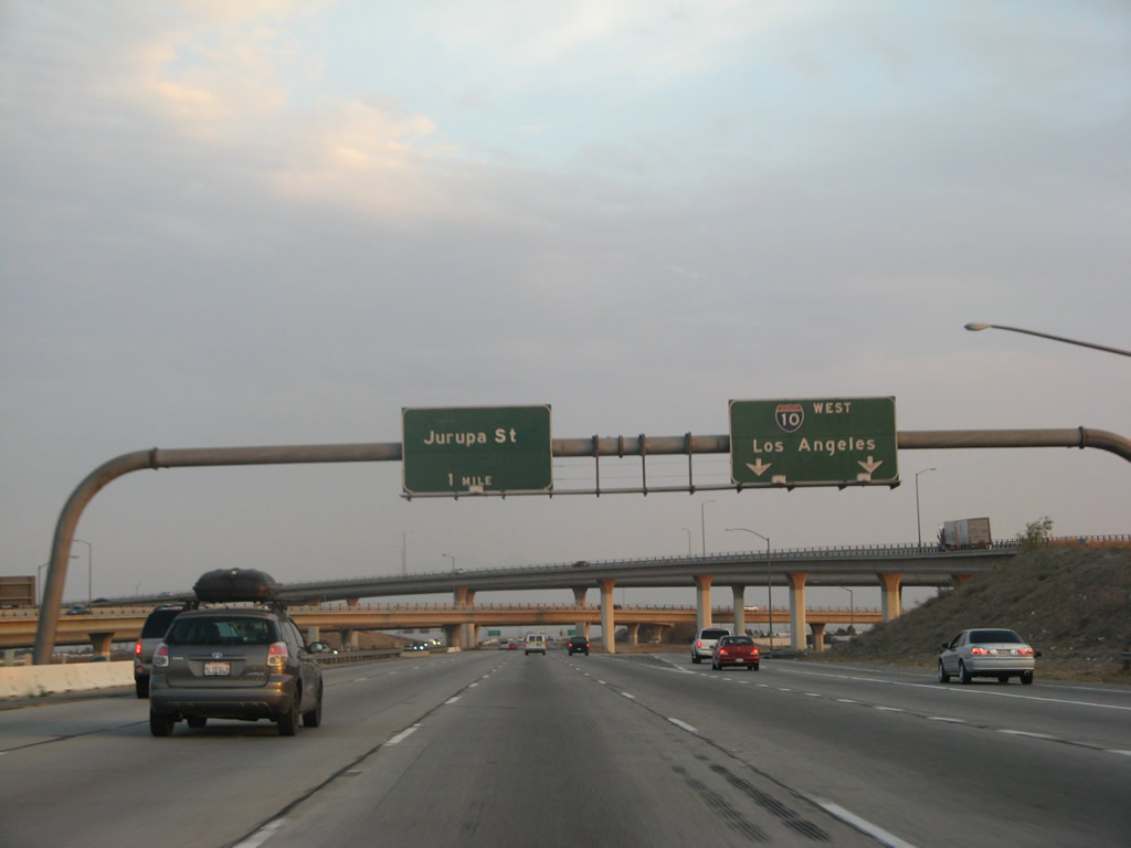
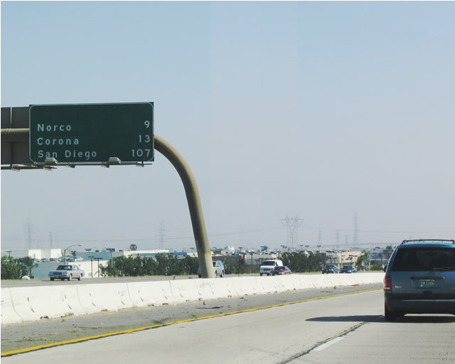
This mileage sign provides the distance to the next three exits along southbound Interstate 15 (Ontario Freeway): Exit 108, Jurupa Street; Exit 106, California 60; and Exit 105, Cantu-Galleano Ranch Road. This sign was replaced when the new Exit 105 interchange opened. Previously, this mileage sign provided the distance to the cities of Norco (9 miles), Corona (13 miles), and San Diego (107 miles). Photos taken 09/28/08 and 06/27/04. |
|
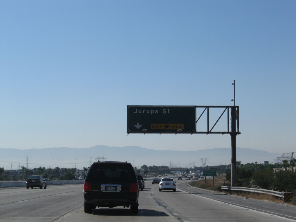
The right two lanes of Interstate 15 south connect to Exit 108, Jurupa Street. Photo taken 09/28/08. |
|
Southbound Interstate 15 reaches Exit 108, Jurupa Street. Jurupa Street is an east-west street that connects Ontario with the southern reaches of Fontana and Crestmore. Photo taken 09/28/08. |
|
The next exit along southbound is Exit 106, California 60 (Pomona Freeway) east to Riverside and west to Los Angeles. This sign dates back to when the Interstate 15 freeway was constructed. For at least the past ten years, this overhead sign has omitted the California 60 shield. Photo taken 09/28/08. |
|
Another 500kV power line crosses over Interstate 15 at the Jurupa Street interchange; this power line is also part of aforementioned Path 46. This view also shows the ramp metering lights for the connection from Jurupa Street to Interstate 15 south. Photo taken 09/28/08. |
|
|
Between Jurupa Street and the California 60 interchange, southbound Interstate 15 (Ontario Freeway) departs San Bernardino County and enters Riverside County. The right lane becomes exit only for Exit 106, California 60. Photos taken 07/26/09 and 06/27/04. |
Page Updated May 24, 2010.