| Interstate 80/Alan S. Hart Freeway west |
|
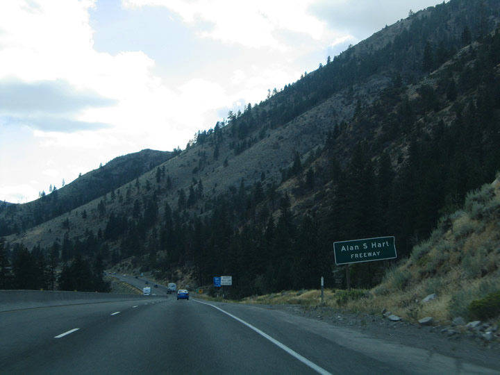
Interstate 80 is both the Alan S. Hart Freeway and Purple Heart Trail in California. A pair of small guide signs proclaim the designations as the freeway enters Sierra County from Verdi, Nevada. Hart was a former Caltrans district head and worked for the department for over 40 years. His resume includes the overseeing of both the construction of Interstate 280 in San Francisco and Interstate 80 from Sacramento to the Nevada state line. The Purple Heart Trail designation was applied to parts of Interstate 80 between Interstate 5 and the state line in 2001. Photos taken 09/09/05. |
|
|
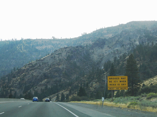
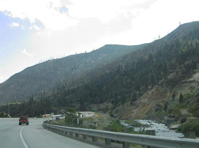
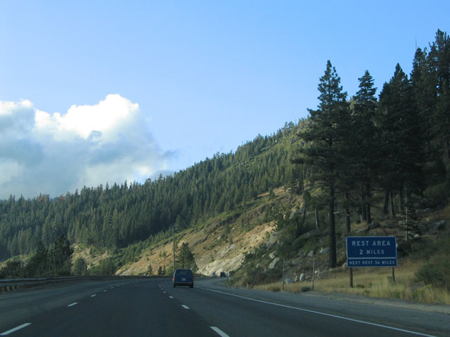
Interstate 80 travels parallel to the Truckee River between the state line and Donner Lake. The four-lane freeway uses a barrier median. Note the "bridges may be icy" sign referencing all of the over and underpasses along Interstate 80 between Verdi and Crystal Lake, a distance of 40 miles. This style of sign was borrowed from NDOT standards, where the sign references all of the bridges along a set number of miles. The narrow nature of the valley essentially curtails any notion of freeway widening. Photos taken 09/09/05. |
|
|
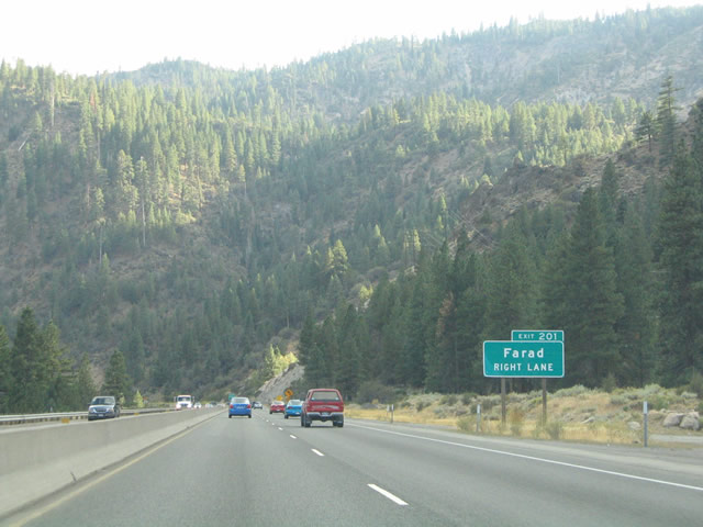
The first interchange along Interstate 80 within the Golden State serves the isolated area of Farad at Exit 201. Farad constitutes a small settlement along the Truckee River accessible only by the freeway. Photo taken 09/09/05. |
|
A compact partial-cloverleaf interchange joins Mystic Road with Interstate 80 at Farad. The Exit 201 off-ramp essentially represents a right-hand turn lane from Interstate 80 west. Mystic Road spurs east to the Truckee River. Photo taken 09/09/05. |
|
|
The beauty of the Sierra Nevada continues to set the tone along Interstate 80 westbound beyond the Farad interchange. Photos taken 09/09/05. |
|
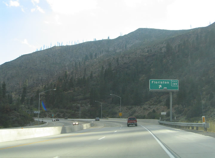
Interstate 80 travels north-south between Verdi, Nevada and Iceland. The freeway approaches Floriston (Exit 199) ahead of the western turn toward Truckee. Meeting the freeway at Exit 199 is Floriston Way, a short connector between the freeway and Floriston itself. Photo taken 09/09/05. |
|
|
The concrete freeway, recently repaved in 2004-05, of Interstate 80 meandering along the Truckee River toward Floriston. The surface here is in much better shape than the rutted large-aggregate concrete at and beyond Donner Pass. Photos taken 09/09/05. |
|
Westbound Interstate 80/Alan S. Hart Freeway reaches Exit 199 Floriston Way (partial-cloverleaf interchange). Photo taken 09/09/05. |
|
The California-standard angular shield debuts as Interstate 80's first westbound reassurance shield near Floriston; many of these t through the mountains are neutered (without a state name within the route marker). These types of signs are found throughout the freeway between the California-Nevada state line and Sacramento. Photo taken 09/09/05. |
|
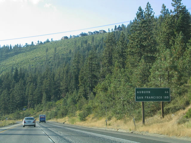
Interstate 80 mileage sign featuring the next destinations of significance, Truckee, Auburn, and Sacramento. The freeway travels through sparsely populated areas from Donner Pass westward toward Auburn and the Central Valley. Photo taken 09/09/05. |
|
|
Interstate 80 rounds the bend between Iceland and Hinton alongside both the Truckee River and Union Pacific Railroad. Photos taken 09/09/05. |
|
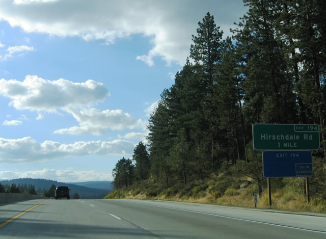
Nearing the folded-diamond interchange (Exit 194) with Hirschdale Road along Interstate 80 westbound. Hirschdale Road flows south 1.3 miles from Exit 194 to Hirschdale. Photo taken 09/09/05. |
|
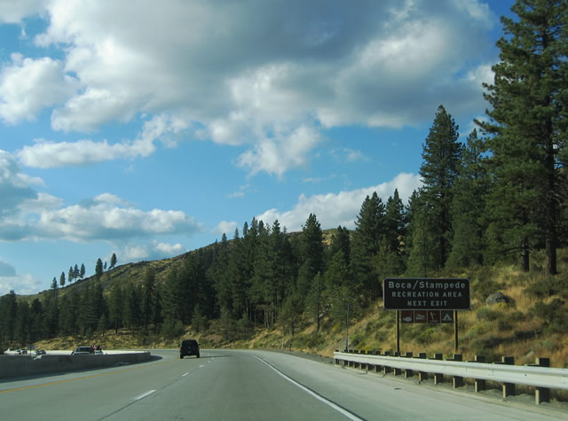
Travel north from Interstate 80 toward the Tahoe National Forest Boca and Stampede Recreation Areas. Stampede Meadow Road travels northwest from Exit 194 to Boca Road alongside the Boca Reservoir. Boca Road heads west to Old Reno and Prosser Dam Roads. Stampede Meadow Road heads north along the east side of Boca Reservoir to Stampede Reservoir in Sierra County. Photo taken 09/09/05. |
|
Interstate 80 passes over both the Union Pacific Railroad line and Truckee River ahead of the Exit 194 ramp departure to Hirschdale Road south and Boca Road north. Glenshire Drive extends west from Hirschdale Road nearby to the community of Glenshire and California 267 at Truckee. Parts of Glenshire Drive follow the original alignment of U.S. 40. Photo taken 09/09/05. |
|
|
A truck weigh station lies along the stretch between Hirschdale Road (Exit 194) and Prosser Village Road (Exit 190). Interstate 80 passes by nearby Glenshire at an elevation of 5,680 feet. Photos taken 09/09/05. |
|
Westbound at the Exit 190 diamond interchange with Prosser Village Road. Prosser Village Road links Interstate 80 with Prosser Dam Road and Prosser Creek Reservoir to the north and Glenshire Drive via Highland Avenue to the south. Photo taken 09/09/05. |
|
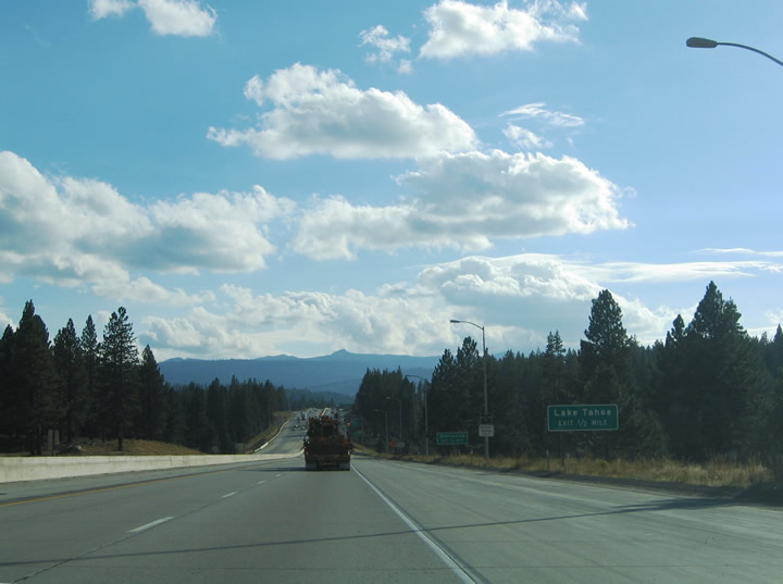
Approaching the town of Truckee and California 89 & 267 (Exit 188) on Interstate 80 westbound. California 267 constitutes the Truckee Bypass between Interstate 80 & California 89 and Brockway Road east of town. The state route joins Truckee with Kings Beach and Lake Tahoe (California 28 (North Lake Boulevard). Photo taken 09/09/05. |
|
A pair of small guide signs remind motorists of the Exit 188 connections to Lake Tahoe (via California 267 south) and Sierraville (via California 89 north). Lake Tahoe is a 12-mile drive to the south. Sierraville resides 23 miles to the north at the California 89 junction with California 49. Photo taken 09/09/05. |
|
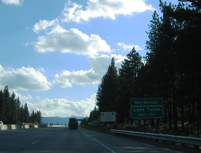
Nearing the Exit 188 diamond interchange with California 89 north and California 267 (Glen Carlson Memorial Bypass) south. California 28 (North Lake Boulevard) encircles Lake Tahoe from between U.S. 50 (via Nevada 28) and Nevada 89 at Tahoe City. Photo taken 09/09/05. |
|
Exit 188 (California 89 north and California 267 south) departs Interstate 80 westbound at the Truckee Bypass. The Truckee Bypass replaced the California 267 routing along Donner Pass Road and Brockway Road to the west. The diamond interchange with Donner Pass Road was partially removed due to the construction of the interchange with the newer Truckee Bypass. A half-diamond interchange still serves Donner Pass Road from Interstate 80 east. California 89 southbound merges onto Interstate 80 between Exits 188 and 185. Photo taken 09/09/05. |
|
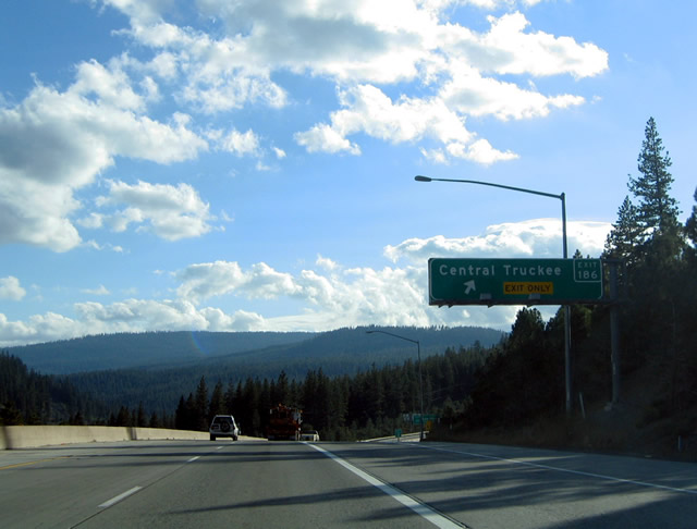
The next exit along Interstate 80/Alan S. Hart Freeway west is Exit 186, Donner Pass Road (former California 267 and former Business Loop I-80) passes through downtown Truckee and emerges near High and River Streets at Interstate 80 & California 89. Signed simply as Central Truckee, Exit 186 joins Donner Pass Road with the freeway via a partial-diamond interchange. Donner Pass Road represents the original U.S. 40 alignment through Truckee. Photo taken 09/09/05. |
|
An angular Interstate 80 west reassurance shield is posted after the Exit 188 on-ramp from Donner Pass Road at Truckee. This style of shield, which is more angular than older shields, has become more prominent on California's freeways. While it is not the best-looking shield, at least it retains the state name. Photo taken by Jeff Royston, 01/00. |
|
One half mile west from the California 89 southbound departure from Interstate 80 westbound at Exit 185. California 89 travels south along the Truckee River to California 28 at Tahoe City, a distance of 14 miles. Photo taken 09/09/05. |
|
Interstate 80 westbound at the split with California 89 south (Exit 185). California 89 meets U.S. 50 at South Lake Tahoe in 41 miles. The state route follows West Lake Boulevard south along the lake between Tahoe City, Meeks Bay, and South Lake Tahoe. California 89 follows U.S. 50 west briefly before continuing south to its end at California 88, 57 miles south of Truckee. Photo taken 09/09/05. |
|
Donner Pass Road (Historic U.S. 40) crosses paths with Interstate 80 again at Exit 184. The parallel roadway leaves Truckee and skims the shore of Donner Lake en route to Donner Pass. Photo taken 09/09/05. |
|
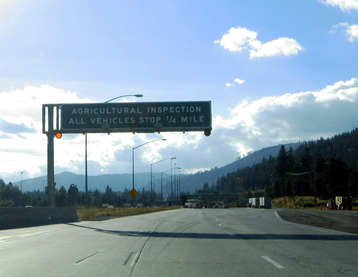
Before Interstate 80 passes Donner Lake, a California Agricultural Inspection Station awaits. The facility requires all vehicles to stop for inspection of any agriculture brought from out of state. This facility was relocated and remodeled; we'll have to return here to get new pictures. Note that commercial trucks and vehicles carrying livestock must still stop. Photo taken 09/09/05. |
|
Entering the former California Agricultural Inspection Station booths along Interstate 80 westbound, the inspection procedure normally takes a short amount of time, and when inspectors are not on the scene, vehicles may proceed through at a much reduced speed (normally about 5 mph). Photo taken 09/09/05. |
|
A button copy overhead remains in use at the Historic U.S. 40 (Donner Pass Road) (Exit 184) off-ramp of Interstate 80 west. Donner Pass Road passes over the freeway between west Truckee and Donner Memorial State Park. The road is signed with brown Historic U.S. 40 signs. Travelers taking the road west from Donner Lake have a steep climb toward Donner Pass itself. A concrete arch bridge dating from 1925 still carries motorists over a ravine at McGlashen Point. This interchange would serve as the west end of the business loop if it were still routed through Truckee (now it is decommissioned). Photo taken 09/09/05. |
|
The rutted concrete begins along Interstate 80 westbound on the drive toward Donner Pass. The concrete is notoriously bad through this stretch of the High Sierra due to heavy truck traffic and age. Pictured here is an older mileage sign listing the distance to Auburn and Sacramento. Photo taken 09/09/05. |
|
|
Beginning the climb toward Donner Summit along Interstate 80 westbound. The freeway sees a vista point between the Donner Pass Road (Historic U.S. 40) interchange and Donner Lake Exit. The view area allows motorists to enjoy the scenery of nearby Donner Lake. Photos taken 09/09/05. |
|
|
Interstate 80 west approaches the Donner Lake view area. Motorists needing rest facilities should continue four miles ahead to the Donner Pass Rest Area. Photos taken 09/09/05. |
|
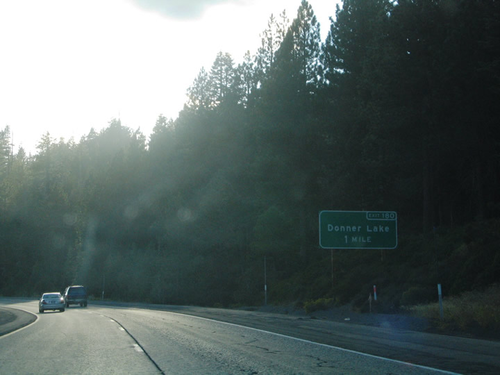
Westbound Interstate 80/Alan S. Hart Freeway meets Exit 180, a partial-cloverleaf interchange with Donner Lake Road. Donner Lake Road meanders 1.1 miles south to Donner Pass Road (Historic U.S. 40) at Donner Lake. Photo taken 09/09/05. |
|
|
|
|
|
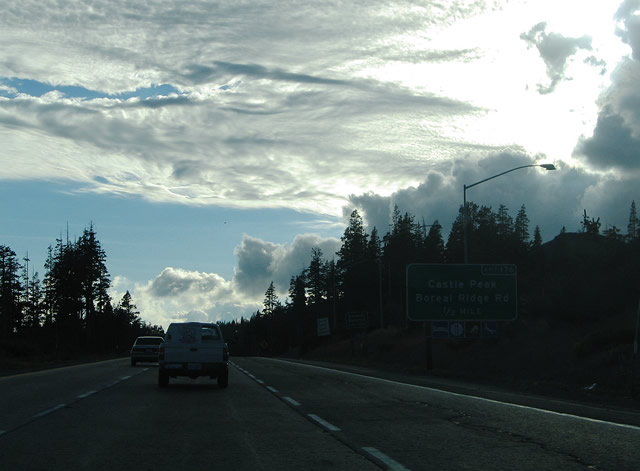
Castle Peak rises to a height of 9,103 feet in the distance as Interstate 80 climbs toward Donner Pass (el. 7,239 feet). The Donner Pass Rest Area lies at the summit itself. Don't travel through this area during the winter without your snow chains handy as Donner Summit averages 54 inches of precipitation per year. The pass itself derives its name from the Donner family tragedy of November 1, 1846. Five feet of snow fell on the party of 87 and only 47 pioneers survived the 30 to 40-foot drifts. Photos taken 09/09/05. |
|
Interstate 80 nears the Exit 176 diamond interchange with Boreal Ridge Road at Donner Summit. Boreal Ridge Road serves the Castle Peak area north of the freeway and the Pacific Crest National Scenic Trail. Photo taken 09/09/05. |
|
Westbound at the Exit 176 sign bridge between the Donner Summit Rest Area and Boreal Ridge Road. Interstate 80 begins a 40-mile descent from Donner to Colfax Canyon. Drivers are reminded quite often of the varying grades between here and Auburn. Photo taken 09/09/05. |
|
Exit 176 leaves Interstate 80 westbound for Boreal Ridge Road. There is no outlet from Boreal Ridge Road to the north at Castle Peak. Bunny Hill Road ties into the interchange from Donner Pass Road (Historic U.S. 40) to the southwest. Photo taken 09/09/05. |
|
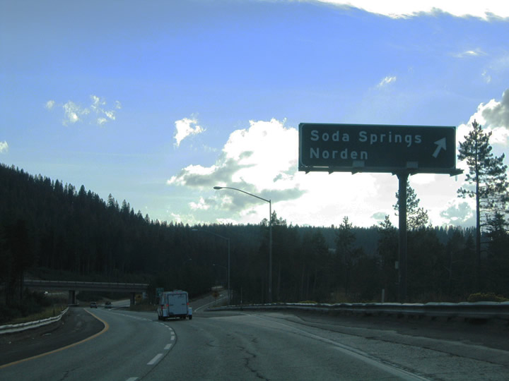
Historic U.S. 40 again meets Interstate 80 at Soda Springs via Exit 174. Donner Pass Road travels a narrow, steep, and convoluted path westward from Donner Lake to Norden and Soda Springs. Photo taken 09/09/05. |
|
|
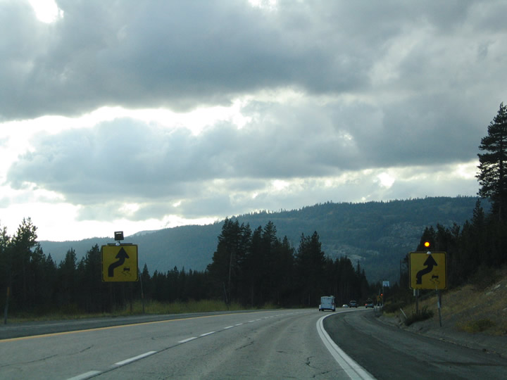
Warning signs and flashers posted along Interstate 80 westbound ahead of the Soda Springs diamond interchange (Exit 174). Signs such as this are common along the trek toward Auburn and the Central Valley. Photos taken 09/09/05. |
|
Interstate 80 westbound at the Exit 174 off-ramp to Soda Springs (Historic U.S. 40). Donner Pass Road shifts to north of the freeway between here and Exit 171. The two-lane road travels through Kingvale between its two interchanges with Interstate 80. Norden lies two miles to the east along Historic U.S. 40. Photo taken 09/09/05. |
|
|
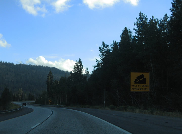
Interstate 80 continues to descend along a 5% grade between Soda Springs and milepost 172. Trucks are advised to slow to 50 mph during these stretches. Photos taken 09/09/05. |
|
One mile east of the Exit 171 diamond interchange to Donner Pass Road (Historic U.S. 40) on Interstate 80 west. The freeway enters Placer for the first time near Kingvale. The small settlement of Kingvale (el. 6,118 feet) lies east of the Exit 171 connector road to the adjacent Historic U.S. 40. Photo taken 09/09/05. |
|
Continuing west toward the Big Bend interchange with Rainbow Road (Historic U.S. 40) on Interstate 80 west. Donner Pass Road becomes Rainbow Road and crosses paths with the freeway again between Kingvale and Big Bend. Photo taken 09/09/05. |
|
Westbound Interstate 80/Alan S. Hart Freeway meets Exit 168, a standard diamond interchange with Historic U.S. 40/Rainbow Road. Rainbow Road loops south of the freeway to Big Bend and Cisco before again traveling across Interstate 80 at Cisco Grove. Photo taken 09/09/05. |
|
The steeper grades of Interstate 80 continue between Cisco (el. 5,710 feet) and Cisco Grove (el. 5,650 feet). Trucks are advised to remain at or below 50 mph. Photo taken 09/09/05. |
|
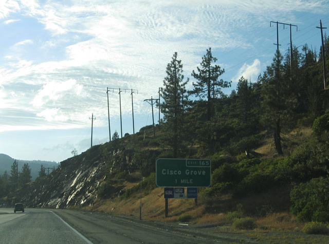
Interstate 80 follows the trek of the South Yuba River along the Nevada and Placer line. The freeway intersects Cisco Road via the Exit 165 diamond interchange near Cisco Grove. Cisco Road spurs south from Historic U.S. 40 (Rainbow Road) to the Union Pacific Railroad at Cisco. Photo taken 09/09/05. |
|
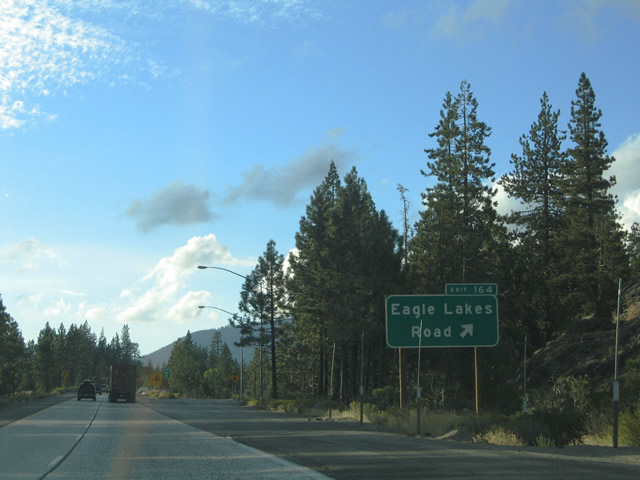
Interstate 80 curves northwest ahead of the Eagle Lakes Road diamond interchange. Eagle Lakes Road meanders northward from Crystal Lake to Carlyle Road and the Eagle Lakes area. Photo taken 09/09/05. |
|
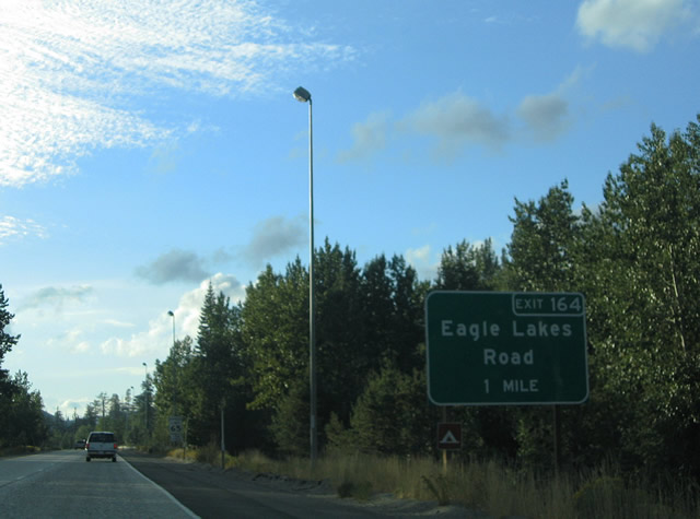
Worn concrete continues along Interstate 80 at the Exit 164 off-ramp to Eagle Lakes Road. The east and westbound carriageways diverge for a short distance through the Crystal Lake area. Photo taken 09/09/05. |
|
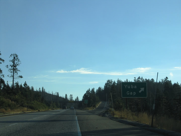
California 20 begins its westward journey at the Exit 161 folded-diamond interchange near Yuba Gap. The state route comprises the Tahoe Ukiah Highway between the Sierra Nevada (Interstate 80) and U.S. 101 (Calpella). California 20 descends 66 miles from Yuba Gap to Nevada City, Grass Valley, Marysville, and Yuba City. From there the route continues west to Williams (Interstate 5), Clearlake, Lakeport, Calpella, and Fort Bragg along the Pacific Coast (California 1). California 20 follows the Golden Center Freeway through Nevada City, Town Talk and Grass Valley. Photos taken 09/09/05. |
|
|
Interstate 80 heads toward Yuba Gap and Exit 160 (Crystal Lake Road). A small guide sign lies within the freeway median ahead of the diamond interchange with Crystal Lake Road. The Union Pacific Railroad again crosses Interstate 80 parallel to California 20. Photo taken 09/09/05. |
|
Mileage sign posted between California 20's split and the Yuba Gap exit on Interstate 80 west. The freeway begins its long southwesterly swing toward both Auburn and Sacramento at Yuba Gap. Photo taken 09/09/05. |
|
Exit 160 departs Interstate 80 westbound for Crystal Lake Road south. Crystal Lake Road splits with Lake Valley Road just south of Yuba Gap. From there Crystal Lake Road heads east to Crystal Lake. Lake Valley Road meanwhile flows southward to the Lake Valley Reservoir and 6 Mile Valley Road. Photo taken 09/09/05. |
|
|
Additional warning signs posted on Interstate 80 between Yuba Gap (el. 5,800 feet) and Emigrant Gap (e. 5,243 feet). Photos taken 09/09/05. |
|
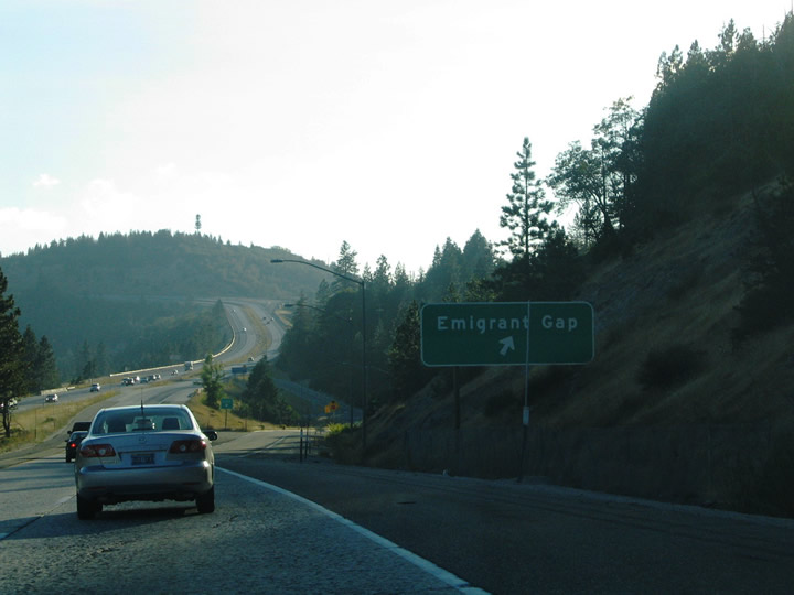
Interstate 80 reaches Emigrant Gap and the Exit 158 diamond interchange with Bear Valley Road. Bear Valley Road links the freeway with Texas Hill Road / Laing Road and California 20. Texas Hill Road (National Forest Road 19) travels south from Emigrant Gap toward Quartz Mountain (el, 6,931 feet). Photo taken 09/09/05. |
|
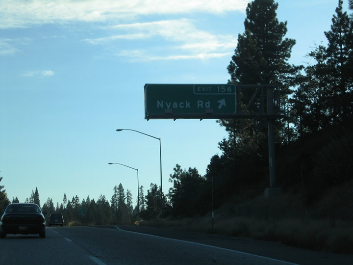
Interstate 80 and the Union Pacific Railroad again cross paths ahead of Nyack (Exit 156). Intersecting the freeway ahead is Nyack Road, a local road connecting Interstate 80 with the railroad and a nearby pond. Photo taken 09/09/05. |
|
Westbound Interstate 80/Alan S. Hart Freeway meets Exit 156, a diamond interchange with Nyack Road. Nyack Road provides no connections to any other through road. Photo taken 09/09/05. |
|
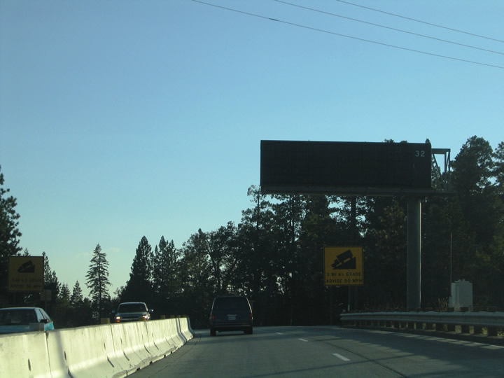
Next in line for westbound travelers is the Blue Canyon interchange (Exit 155). Airport Road travels south from the Exit 155 diamond interchange to Blue Canyon - Nyack Airport and Blue Canyon Road. Checking the current weather at Blue Canyon Airport is a good way to gauge the travel conditions on Interstate 80 through the Sierra Nevada. Photo taken 09/09/05. |
|
Motorists bound for Blue Canyon depart Interstate 80 westbound at the Exit 155 diamond interchange. Airport intersects the adjacent Putt Road south of the freeway and Blue Canyon Road east of the airport. Blue Canyon Road ventures south to the settlement of Blue Canyon (located at elevation 5,273 feet). Photo taken 09/09/05. |
|
|
Interstate 80 leaves Tahoe National Forest on the descent between Blue Canyon (Exit 155) and Drum Forebay Road (Exit 150). The freeway drops from 5,273 feet at Blue Canyon to 3,886 feet at Baxter (Exit 148). Photo taken 09/09/05. |
|
Westbound at the Exit 150 diamond interchange with Drum Forebay Road. Drum Forebay Road meanders northward to Drum Forebay and Culberson Road. Kearsarge Mill Road ties into the road south of Interstate 80 near Forebay. Photo taken 09/09/05. |
|
Attached to the Drum Forebay Road over crossing is a mileage sign featuring Colfax, Auburn, and Sacramento. Colfax represents the Interstate 80 junction with California 174. Photo taken 09/09/05. |
|
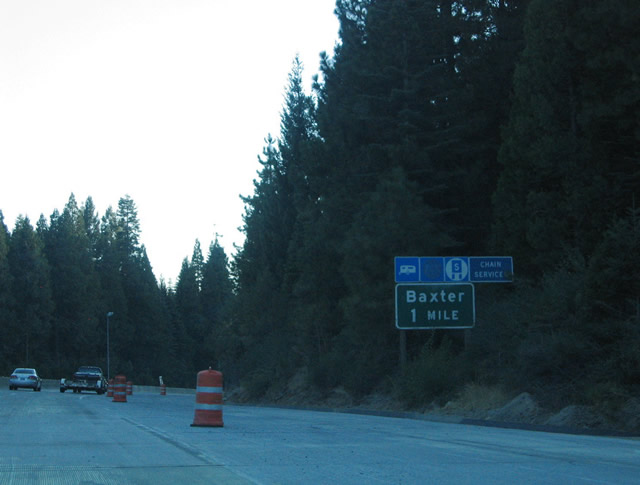
Nearing the Baxter Road interchange (Exit 148B) on Interstate 80 westbound. Baxter Road stems east from Crystal Spring and Alta Bonnybrook Roads (Historic U.S. 40) to Exit 148B and Lukens Lane. This is the first Baxter Road interchange along Interstate 80 since Exit 111 in the state of Wyoming. Photo taken 09/09/05. |
|
Exit 148B leaves Interstate 80 westbound for Baxter Road. The settlement of Baxter lies along Baxter Road ahead of its intersection with Crystal Springs Road. Photo taken 09/09/05. |
|
Exit 148A quickly follows the precession from Interstate 80 west to Crystal Springs Road. Crystal Springs Road joins the freeway with Baxter and Alta Bonnybrook Roads at Crystal Springs. Use Alta Bonnybrook Road (Historic U.S. 40) west to Towle and Alta. Photo taken 09/09/05. |
|
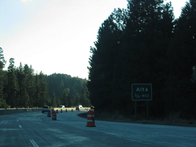
Alta Bonnybrook Road loops through Alta (el. 3,590 feet) from Crystal Springs westward two miles. The road meets Interstate 80 at the Exit 146 diamond interchange adjacent to Casa Loma and Morton Roads. Historic U.S. 40 travels Ridge road west from Alta to Dutch Flat. Photo taken 09/09/05. |
Page Updated October 27, 2005.