| Interstate 80 west and Eastshore Freeway south |
|
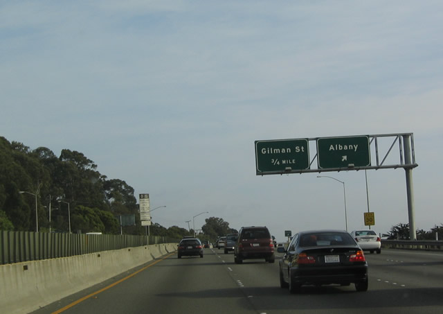
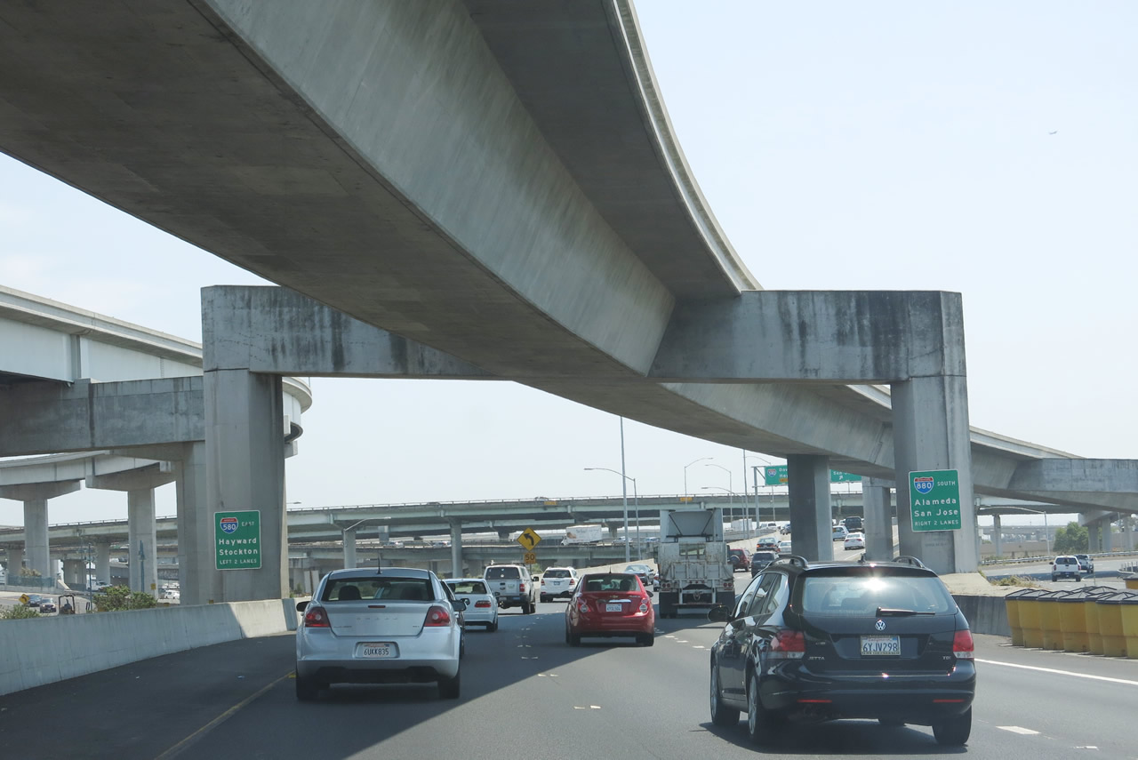
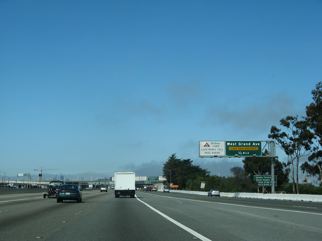
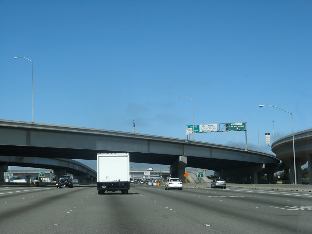
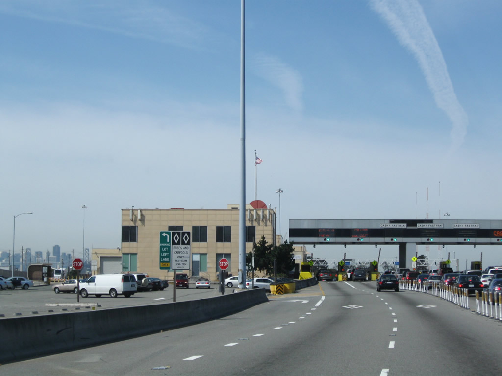
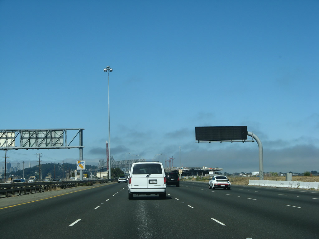
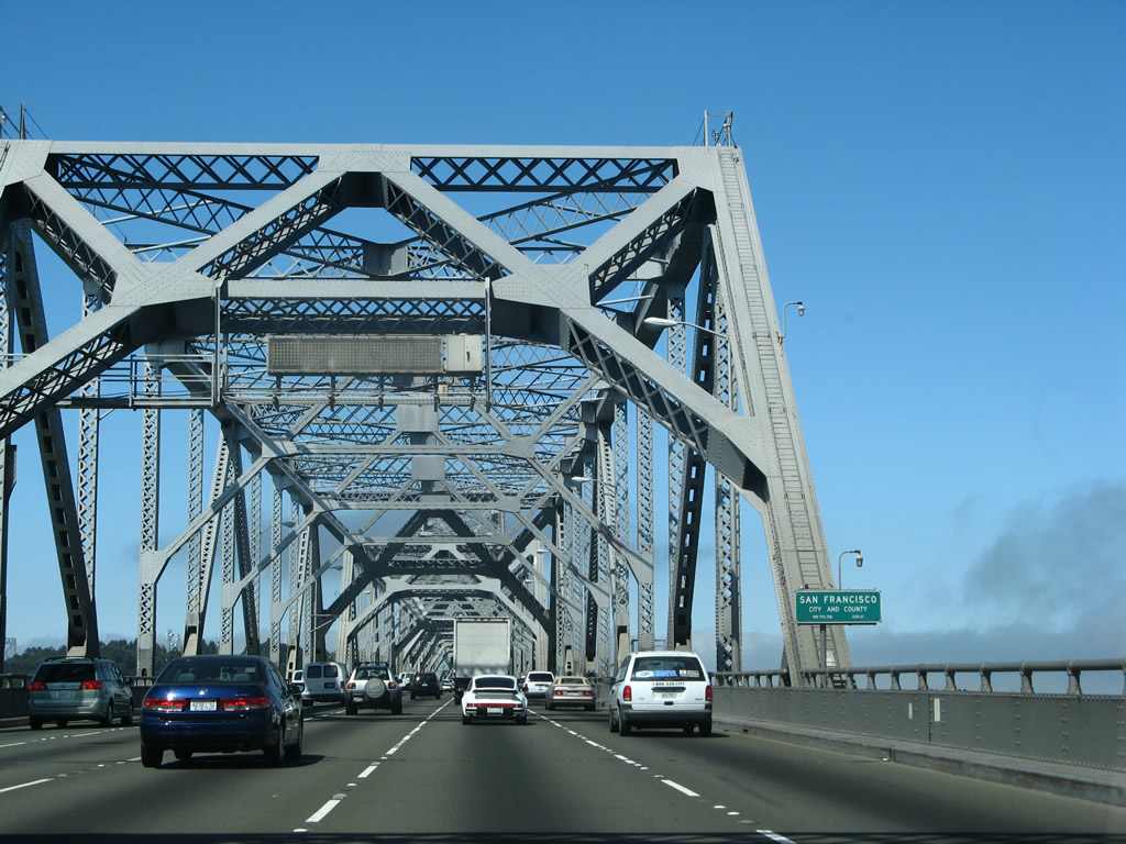
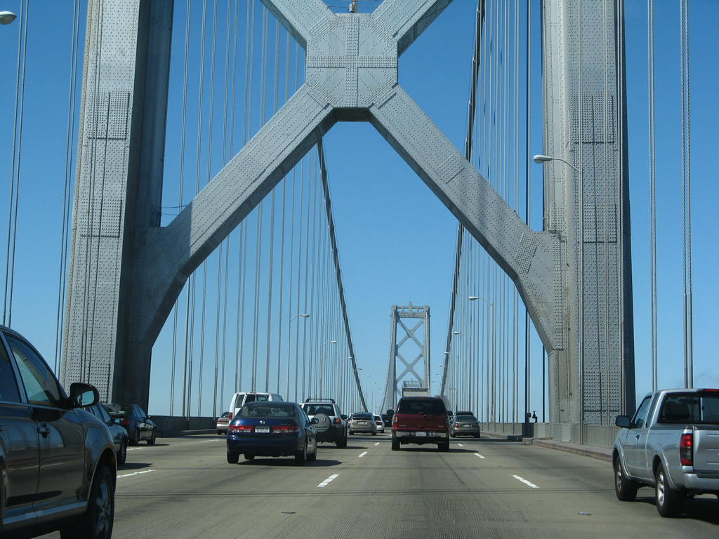
Continuing in Alameda County, westbound Interstate 80 reaches Exit 13, Cleveland Avenue/Buchanan Street. Cleveland Street follows Interstate 80 south to Buchanan Street, which in turn heads east to meet California 123/San Pablo Avenue (Historic U.S. 40) in downtown Albany. In addition, Buchanan Street heads west to reach Eastshore State Park and Golden Gate Fields, both situated on a peninsula jutting into the bay. Finally, this exit may be used to reach westbound Interstate 580 by taking Cleveland Avenue south to Buchanan Street and then Buchanan Street west to the freeway entrance. The next exit is Exit 12, Gilman Street. Photo taken 04/04/04. |
| Interstate 80 west, Interstate 580 east, and Eastshore Freeway south |
|
Traffic from eastbound Interstate 580 merges onto westbound Interstate 80 between Exits 13 and 12. This view shows the merge from the perspective of Interstate 580 east. Photo taken 07/02/13. |
|
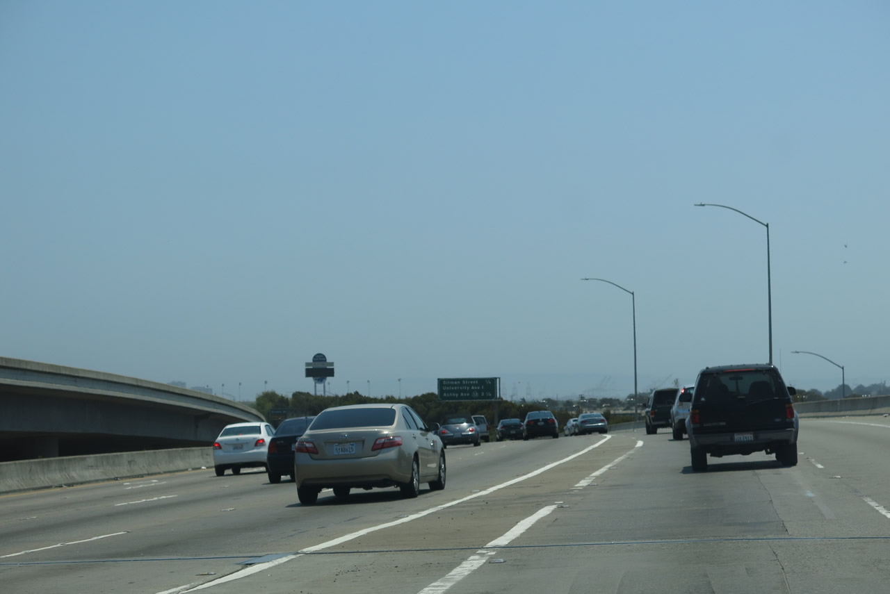
This interchange sequence sign provides the distance to the next three exits along Interstate 80 (Eastshore Freeway) west and Interstate 580 east: Exit 12, Gilman Street; Exit 11, University Avenue; and Exit 10, California 13 (Ashby Avenue). Photo taken 07/02/13. |
|
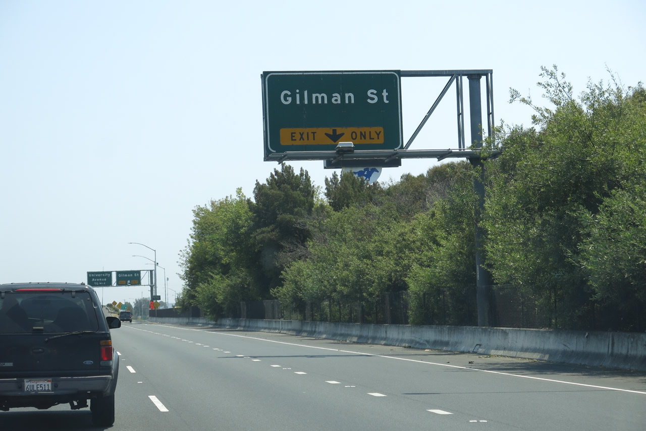
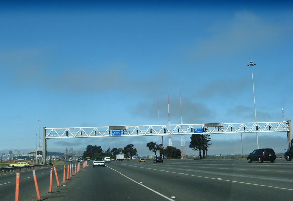
The right lane of Interstate 80 west and Interstate 580 east becomes exit only for Exit 12, Gilman Street. Photo taken 07/02/13. |
|
Eastbound Interstate 580 and westbound Interstate 80 meet Exit 12, Gilman Street. The following interchange is Exit 11, University Avenue. Interstate 80 now enters the city of Berkeley (population 112,580 as of the 2010 Census and incorporated on April 4, 1878). Berkeley is perhaps best known as the home of the University of California and secondarily as a bastion of liberalism. Gaining notoriety during the tumultuous 1960s, Berkeley today remains a home for alternative thinking and individuality, making it unlike most other California cities. Photo taken 07/02/13. |
|
This interchange sequence sign provides the distance to the next three exits along Interstate 80 (Eastshore Freeway) west and Interstate 580 east: Exit 11, University Avenue; Exit 10, California 13 (Ashby Avenue); and Exit 9, Powell Street. Photo taken 07/02/13. |
|
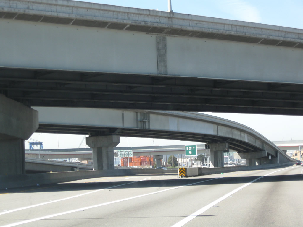
From here we look south along the Eastshore Freeway as we cross over Gilman Street. Photo taken 07/02/13. |
|
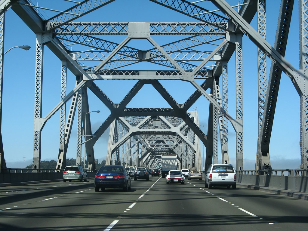
Westbound Interstate 80 and eastbound Interstate 580 are signed in opposite directions on this single stretch of road, which known by roadgeeks as is a "wrong-way multiplex" since it's technically impossible for someone to travel both east and west at the same time. The two Interstates share alignment for a little more than four miles. In spite of the signs, motorists are really traveling south on the Eastshore Freeway; at Exits 8B-A, Interstate 580 turns southeast, while Interstate 80 turns west to cross the San Francisco Bay. Note that the Interstate 580 shield is neutered (i.e., no state name). These signs were both replaced with state-named shields by 2013. Photo taken 11/28/03. |
|
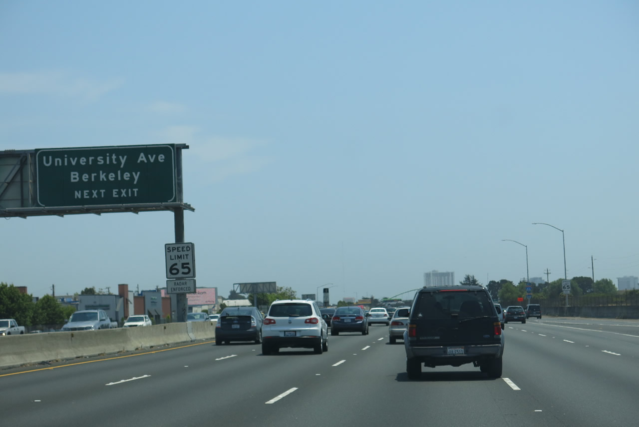
Use Exit 11 to follow University Avenue east to the University of California at Berkeley or west to the Berkeley Yacht Harbor on the east shore of San Francisco Bay. Photo taken 07/02/13. |
|
Westbound Interstate 80 and eastbound Interstate 580 meets Exit 11, University Avenue. Exit 11 provides the most direct route from westbound Interstate 80 and eastbound Interstate 580 to the University of California at Berkeley (UCB), Memorial Stadium (home of the NCAA's Cal Golden Bears), and downtown Berkeley. Photo taken 07/02/13. |
|
This mileage sign provides the distance to the next three exits along Interstate 80 west and Interstate 580 east: Exit 10, California 13 (Ashby Avenue); Exit 9, Powell Street/Emeryville; and Exit 8B, Interstate 580/MacArthur Freeway east and Interstate 880 (Nimitz Freeway) south. This porcelain-enamel sign has a route marker for Interstate 880 that covers an original California 17 shield; California 17 was the original designation for what is now Interstate 580 from Marin County to Richmond and also covered the entire length of Interstate 880. The next mileage sign reports the distance to Interstate 580 rather than Interstate 880; both routes depart Interstate at Exits 8B-A. The next exit is Exit 10, California 13 (Ashby Avenue). Photo taken 07/02/13. |
|
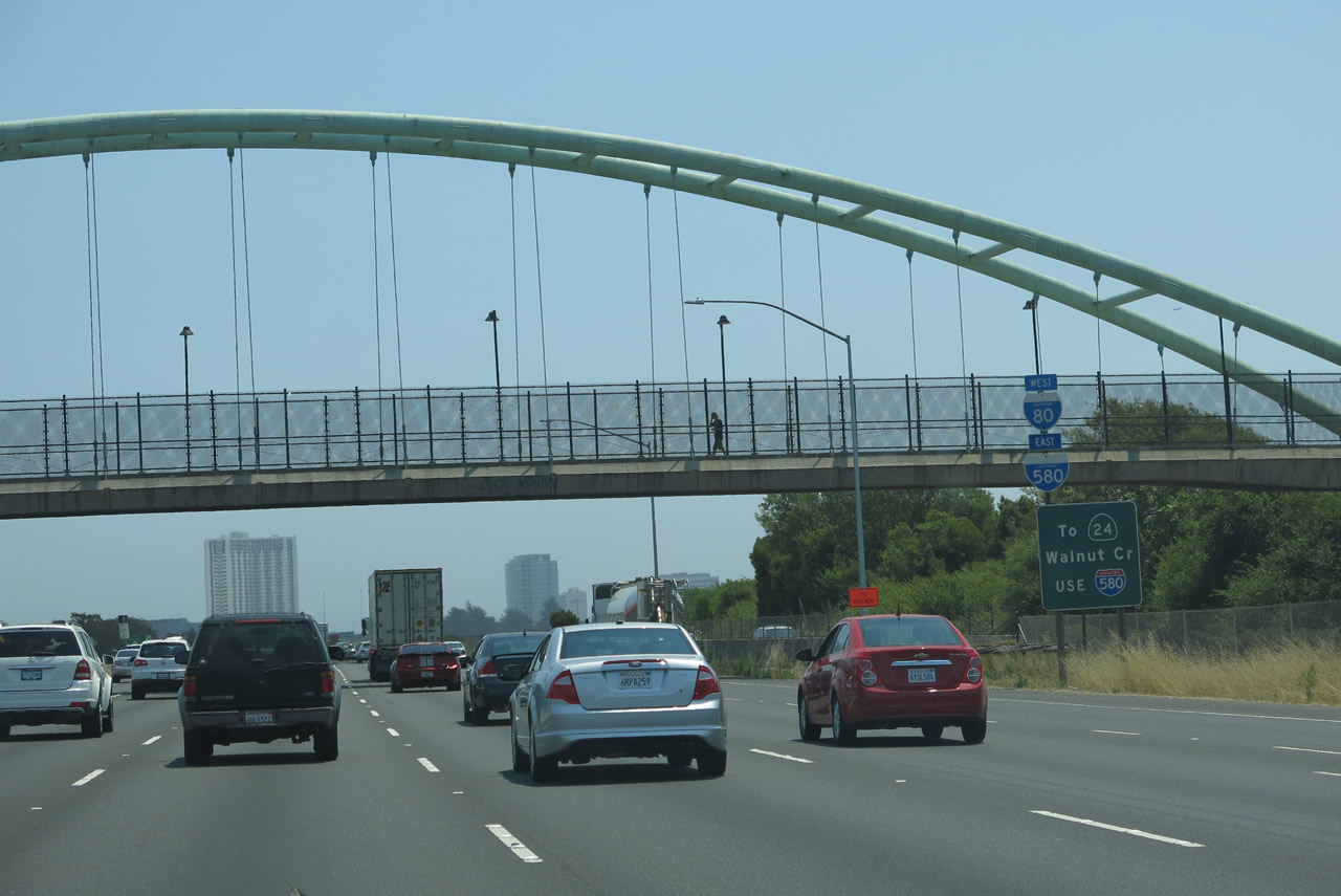
This reassurance shield assembly along westbound Interstate 80 and eastbound Interstate 580 is mounted on top of a sign advising motorists headed for California 24 east to use Interstate 580 rather than California 13 (Ashby Avenue) or Interstate 880 south. California 13 follows a city street (Ashby Avenue) through Berkeley, and it is not a fast route to the San Ramon Valley and Walnut Creek. It is much quicker to take Interstate 580 to California 24. Interstate 880 southbound has no direct connection to Interstate 980 and California 24 east in downtown Oakland. Photo taken 07/02/13. |
|
California 13 is a fairly short state route with two major components. The first segment, which travels east-west through Berkeley, follows two arterial streets: Ashby Avenue and Tunnel Road. California 13 then crosses California 24 and becomes a freeway from that point southeast to rejoining Interstate 580 at Exit 26. Photo taken 07/02/13. |
|
I-80 west & 580 (Eastshore Freeway) east enter the turbine interchange (Exit 10) with California 13 (Ashby Street). This configuration may be due to the original proposal to make California 13 into a freeway between I-80 and California 24. Photo taken 07/02/13. |
|
As we approach the Maze Interchange and the confluence of several freeways (Interstate 80, Interstate 580, Interstate 880, Interstate 980, and California 24), we start to see signs pointing the way to several destinations along these routes. To Oakland International Airport, use Exit 8B, Interstate 880 (Nimitz Freeway) south. Exit 8B is a left exit and serves both Interstate 880 south and Interstate 580 east. Photo taken 07/02/13. |
|
A second sign advises travelers along eastbound Interstate 580/MacArthur Freeway to migrate to the left lanes in advance of Exit 8B, Interstate 580 east and Interstate 880 south. The right lanes continue along westbound Interstate 80 to the Bay Bridge and San Francisco. These signs are posted as Interstate 80 enters the turbine interchange with California 13. Note the older concrete bridge railing in use on the flyover ramps that connect Interstate 80 with California 13. Photo taken 07/02/13. |
|
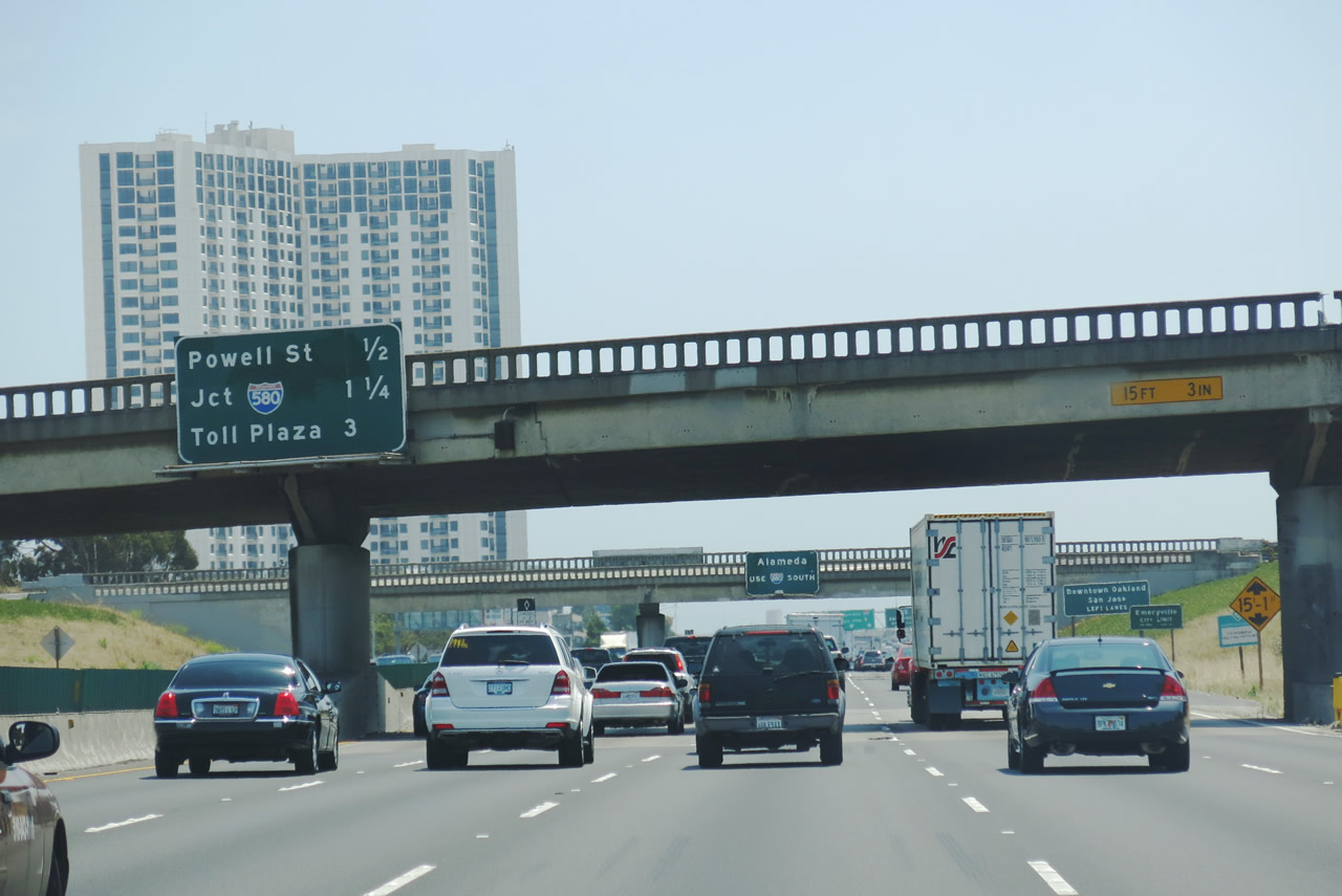
This mileage sign along Interstate 80 west and Interstate 580 east provides the distance to the next two exits: Exit 9, Powell Street to Emeryville and Exit 8B, Interstate 580/MacArthur Freeway east and Interstate 880 (Nimitz Freeway) south. The sign omits the distance to Exit 8A, Grand Avenue but includes the distance to the San Francisco-Oakland Bay Bridge toll plaza. The toll was $5 per vehicle in 2013 in non-commuting hours but was as low as $2 as of January 2004. The toll is charged for westbound traffic only. Photo taken 07/02/13. |
|
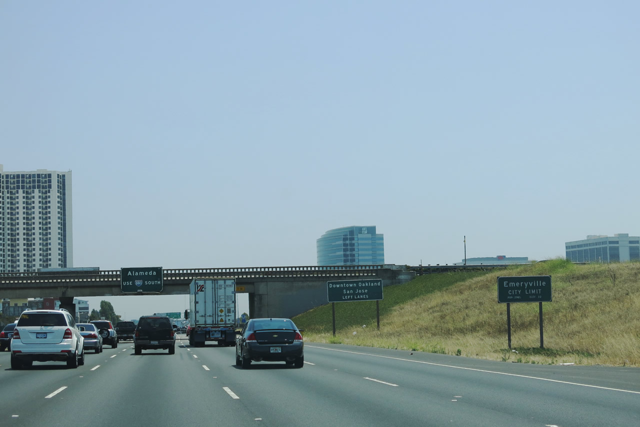
Interstate 80 and Interstate 580 enter the city of Emeryville (population of 10,080 as of the 2010 Census and incorporated on December 8, 1896). Photo taken 07/02/13. |
|
Stay left for Exit 8B to Interstate 880 (Nimitz Freeway) south. Interstate 880 (former California 17) serves the East Bay and South Bay, and it closely follows the east shore of the San Francisco Bay en route to San Jose. Photo taken 07/02/13. |
|
To the city of Alameda, use Exit 8B, Interstate 880 (Nimitz Freeway) south (left exit) to Exit 42 (Broadway) and follow the signs to the Webster Street Tube (California 260) and California 61. Photo taken 07/02/13. |
|
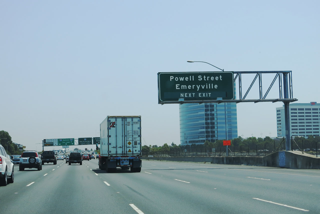
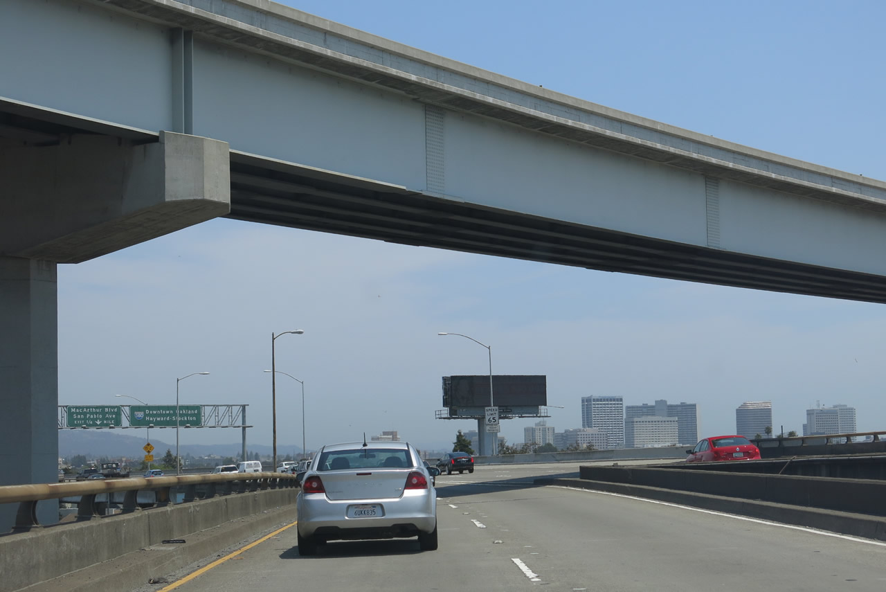
The next exit along westbound Interstate 80 and eastbound Interstate 580 is Exit 9, Powell Street. This is the last off-ramp before we enter the MacArthur Maze, a confluence of freeways and surface streets that can be confusing to someone new to the area. Powell Street travels east into Emeryville and ultimately Berkeley. Photo taken 07/02/13. |
|
Westbound Interstate 80 and eastbound Interstate 580 reach Exit 9, Powell Street to Emeryville. To the east of here, Powell Street has one signalized intersection with Christie Avenue, and ascends onto a viaduct that carries Powell Street over Shellmound Street, the railroad, and Horton Street. Back on Interstate 80-580, the next off-ramp is a left exit to Exit 8B, Interstate 580/MacArthur Freeway east and Interstate 880 (Nimitz Freeway) south. Photo taken 07/02/13. |
|
As we pass over Powell Street, this overhead sign advises that trucks are prohibited on Interstate 580 east of the Interstate 980 interchange; trucks are advised to use Interstate 880 and Interstate 238 as an alternate route to Tracy, Stockton, and Los Angeles. Photo taken 07/02/13. |
|
Westbound Interstate 80 and eastbound Interstate 580 prepare to split at Exit 8B. Stay in the right lanes for Interstate 80 west to San Francisco via the San Francisco-Oakland Bay Bridge. Stay in the left lanes for Interstate 580/MacArthur Freeway east to Hayward, Stockton, and Los Angeles or Interstate 880 (Nimitz Freeway) south to Alameda, downtown Oakland, and San Jose. The far left lane is the high occupancy vehicle lane, which provides direct access onto the San Francisco-Oakland Bay Bridge and avoids much of the delay frequently found at the bridge toll plazas each weekday morning. Photo taken 07/02/13. |
|
Westbound Interstate 80 splits with Interstate 580 east at this point. The left exit (Exit 8B) connects to Interstate 580/MacArthur Freeway east to Hayward, Stockton, and Los Angeles or Interstate 880 (Nimitz Freeway) south to Alameda, downtown Oakland, and San Jose. Interstate 80 enters the city of Oakland (population of 390,724 per the 2010 Census and incorporated on May 4, 1852). Photo taken 07/02/13. |
|
Quite a bit of traffic passes through this interchange daily. The three left lanes carry Interstate 580 east and Interstate 880 south, while the three right lanes follow Interstate 80 west toward the bay bridge. Photo taken 07/02/13. |
|
Now on the transition ramp from Interstate 80, stay left for Interstate 580 east or right for Interstate 880 south. The carpool (high occupancy vehicle) lanes fly over the transition ramp from westbound Interstate 80 to eastbound Interstate 580 and southbound Interstate 880. These roadside signs remind motorists to choose the proper lane for either Interstate 580 east or Interstate 880 south. Photo taken 07/02/13. |
|
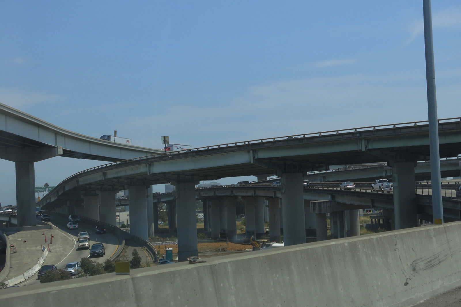
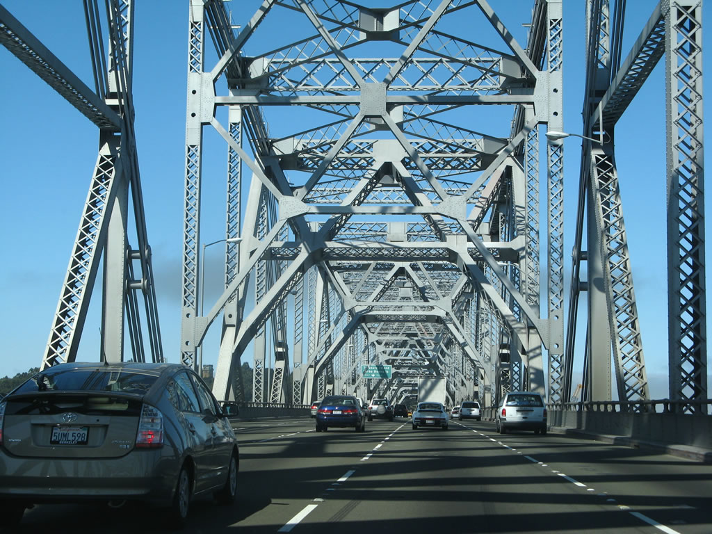
The confluence of ramps surrounding the various freeways that converge here -- Interstate 80-580/Eastshore Freeway (former U.S. 40), Interstate 580/MacArthur Freeway (former U.S. 50), Interstate 880 (Nimitz Freeway) (former California 17), and Interstate 80/San Francisco Oakland Bay Bridge (former U.S. 40-50) -- helps explain why this area is called the MacArthur Maze Interchange. Photo taken 07/02/13. |
|
The transition ramp splits between Interstate 580 east and Interstate 880 south. Use Interstate 580 east to Interstate 980 west to downtown Oakland. Photo taken 07/02/13. |
|
|
|
These views look east, initially toward the westbound lanes of Interstate 580. The confluence of ramps here again remind us of the Maze description of this complicated interchange complex. The second two pictures show the remaining transition of Interstate 580 east onto the MacArthur Freeway. Photos taken 07/02/13. |
| Interstate 80 west |
|
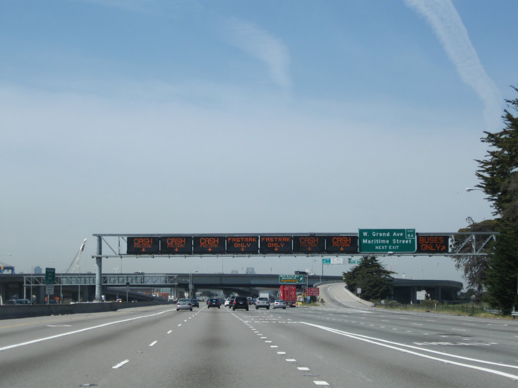
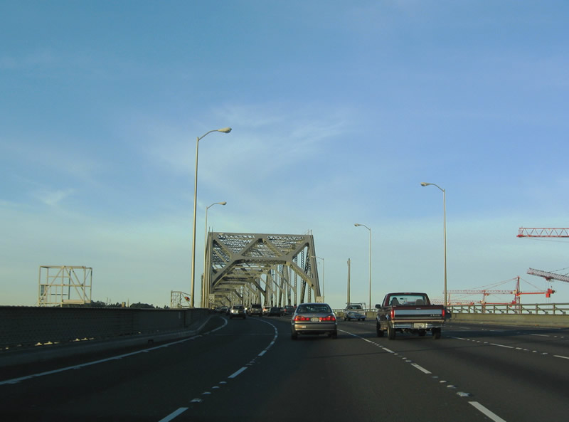
After Interstates 580-880 depart, the Interstate 80 mainline turns west and descends from "The Maze" toward San Francisco Bay. The final Oakland interchange serves the former Oakland Army Base and Naval Supply Center (Exit 8A). The Oakland Army Base was transferred from the Military to the city of Oakland on August 6, 2003. Plans for the 364-acre parcel include expansion of the Port of Oakland and the construction of commercial "Gateway" development as part of the Oakland Redevelopment Agency. Photo taken 07/06/07. |
|
The only exit between Interstate 580 ("The Maze") and the bay bridge is Exit 8A for West Grand Avenue. The influx of traffic from the right is from Interstate 80; this picture is taken from the transition ramp from westbound Interstate 580 to westbound Interstate 80. Photo taken 07/06/07. |
|
|
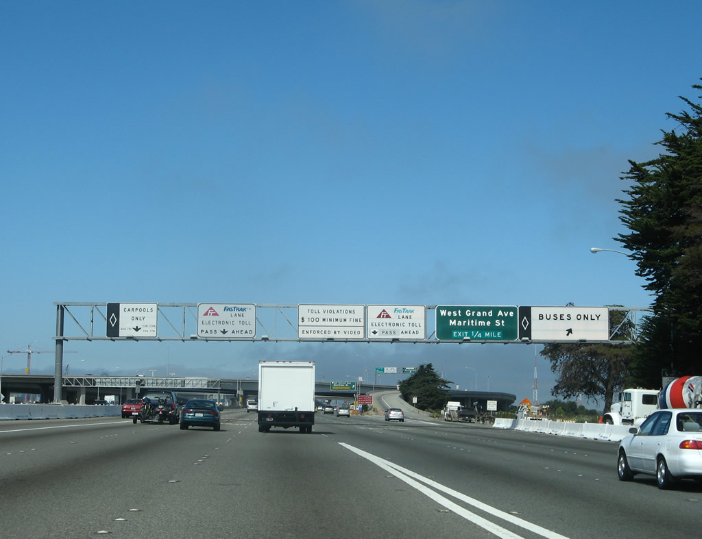
Westbound Interstate 80 approaches the toll plaza for the San Francisco-Oakland Bay Bridge. The last free exit, for Exit 8A/West Grand Avenue and Maritime Street, is available at the far right lane. The overpass ahead carries the transition lanes from northbound Interstate 880 to westbound Interstate 80. Photos taken 04/06/09 and 07/06/07. |
|
|
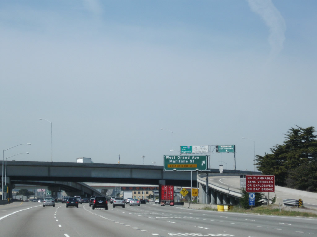
Exit 8A departs Interstate 80 westbound and loops east onto Grand Avenue ahead of its intersection with Maritime Street. Maritime Street travels southwest through the former Oakland Army Base to the former Oakland Naval Supply Center. Grand Avenue meanwhile continues southeast to Interstate 880 south and central Oakland. Photos taken 04/06/09 and 07/06/07. |
|
|
At the Grand Avenue exit, the flyover transition ramp from Interstate 880 (Nimitz Freeway) north passes over Interstate 80 and prepares to merge onto Interstate 80 west. Photos taken 04/06/09 and 07/06/07. |
|
A left exit for access to the Bay Bridge headquarters for employees and toll takers is available after the Exit 8A off-ramp on the right side of this very wide freeway. Photo taken 04/06/09. |
| Interstate 80 - San Francisco-Oakland Bay Bridge west |
| The eastern span of the San Francisco-Oakland Bay Bridge was realigned and moved onto a new, self-anchored suspension span on September 3, 2013. The new span includes a pedestrian/bicycle path to Yerba Buena Island. The following suite of photos covers the since demolished steel cantilever truss bridge on the eastern span. |
|
|
|
|
|
|
|
|
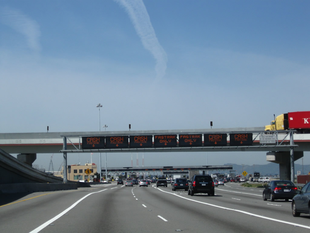
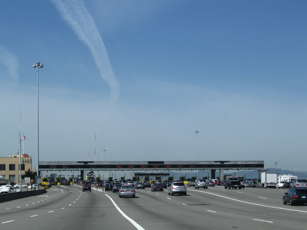
| These views of the San Francisco-Oakland Bay Bridge Toll Plaza are on Interstate 80 westbound between Exit 8A and the bridge itself. A toll is required for all westbound travelers bound for San Francisco. The toll plaza accepts FasTrak, California's electronic toll collection system. The cantilever truss bridge that carried Interstate 80 over the eastern half of San Francisco Bay was permanently closed on August 28, 2013, and on September 3, 2013, a new self-anchored suspension bridge opened in its place. Photos taken 04/06/09, 11/26/04, and 07/06/07. |
|
|
|
|
| Westbound Interstate 80 approaches the old San Francisco-Oakland Bay bridge's eastern span as seen after the toll booths. Large cranes and pier supports rise alongside the bridge to the north. These were the first signs of the San Francisco-Oakland Bridge replacement. An often controversial project due to the $6.4 billion price tag and 11-year construction timeframe, the replacement span for Interstate 80 has varied in design from a standard elevated causeway to a self-anchored suspension (SAS) bridge. Debate about cost and aesthetic beauty of the eastern span of the bridge ensued in 2004. A final resolution to the design came about in 2005 when then-Governor Arnold Schwarzenegger signed a law that supports the self-anchored suspension bridge originally considered in 1998. The SAS bridge gives the new span a signature look with a single tower supported by a web of cables that cradle the roadway. To help pay for the 2013 opening, tolls increased on the seven state-owned Bay area bridges to $4 per passenger vehicle on January 1, 2007 and later to $5 (with congestion pricing for peak periods). Evidence of the new construction including the skyway segment is clearly evident when looking north of the existing bay bridge. This old bridge from Oakland to Yerba Buena Island was decommissioned and will be removed in stages after the new SAS span opened on September 3, 2013.1, 2, 3, 4, 5 Photos taken 07/06/07, 11/26/04, and 11/29/04. |
|
|
The Bay Bridge first opened to traffic on November 12, 1936, after three years of construction (which began on July 9, 1933). This massive bridge gradually ascends from the tollbooths to a considerable height; here, the freeway approaches the steel superstructure that covers and supports the bridge at its highest point on the eastern span. The top deck carries westbound traffic, while the bottom deck carries eastbound traffic. The new SAS bridge opened to traffic on September 3, 2013. Photos taken 07/06/07 and 11/29/04. |
|
|
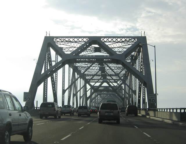
We cross the steel, cantilever truss bridge on Interstate 80 westbound; this view will change with the opening of the new SAS span on September 3, 2013. A portion of the top deck of this portion of the bridge had collapsed onto the lower deck during the 1989 Loma Prieta earthquake. There is no evidence of the exact location of that collapse. Photos taken 07/06/07 and 11/29/04. |
|
|
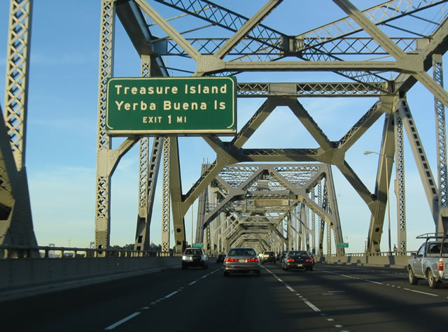
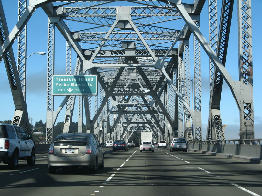
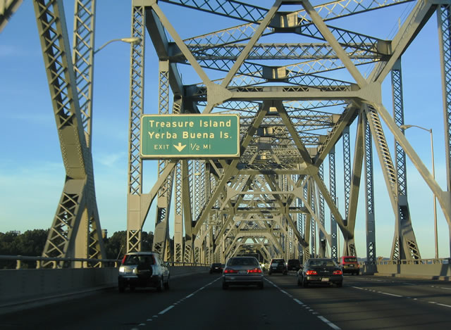
Westbound Interstate 80 approaches its first off-ramp in about four miles: Exit 4, Treasure Island and Yerba Buena Island (one mile). This exit is consolidated to provide access to both islands along westbound. This varies from eastbound, where there are two exits, one for each island. For westbound traffic, Exit 4 traffic will exit left on a fairly sharp turn. Photos taken 07/06/07 and 11/29/04. |
|
|
Immediately after the first advance sign for Treasure Island/Yerba Buena Island, the interstate leaves Alameda County and enters the city and county of San Francisco. The city of San Francisco is the only city-county combined jurisdiction in the state of California. Due to its location on a peninsula surrounded by the Pacific Ocean, Golden Gate, and San Francisco Bay, fog is common especially in summer months when colder oceanic area collides with hot dry air from inland (Central Valley). The city also sits near the San Andreas Fault, which spans the state of California and is capable of producing a large-scale earthquake. San Francisco was founded on June 29, 1776 and incorporated on April 15, 1850. The city is home to a large minority population (including immigrants) and is likely the most densely populated city in California. As of the 2000 Census, San Francisco was home to 776,733 people. As of the 2010 Census, San Francisco had a population of 805,235. With 46.87 square miles of land, San Francisco is one of the most densely populated cities in the United States. Photos taken 07/06/07 and 11/29/04. |
|
|
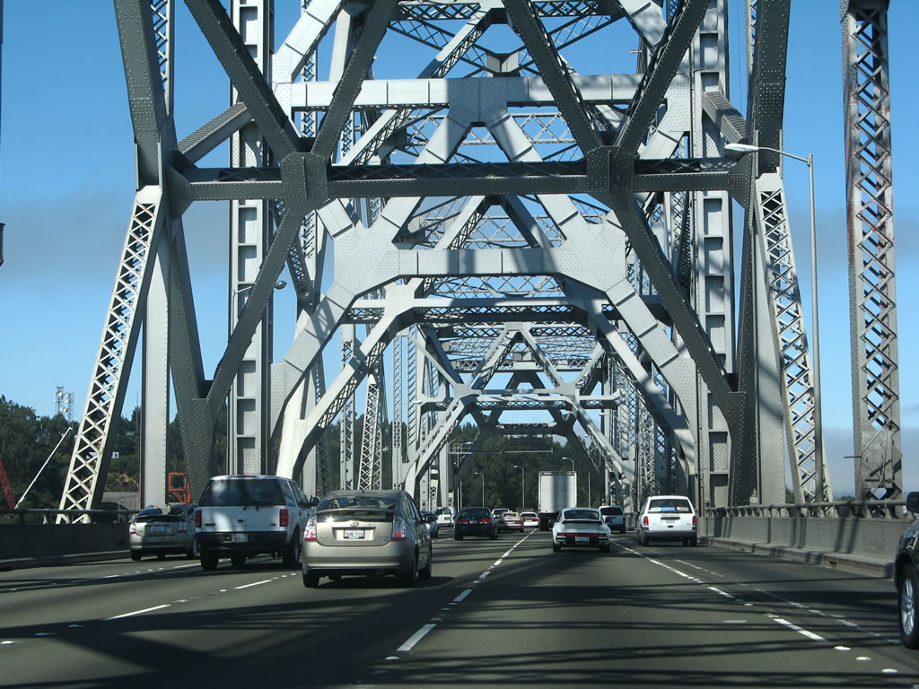
We continue west under the steel superstructure of the cantilever truss bridge. Due to cost-prohibitive earthquake retrofitting costs, this portion of the bridge (between Yerba Buena Island and Oakland) will be replaced with the aforementioned self-anchored suspension (SAS) bridge. Photos taken 07/06/07 and 11/29/04. |
|
|
|
Passing through the tallest point of the superstructure, the cantilever section of the Bay Bridge bends a bit to the southwest for the connection to Yerba Buena Island. Photos taken 07/06/07. |
|
|
|
One-half mile east of the Exit 4, Treasure Island and Yerba Buena Island off-ramp on Interstate 80 west. Like the other signs of this series, this overhead sign is internally lit. Photos taken 04/06/09, 07/06/07, and 11/29/04. |
|
|
Interstate 80 westbound leaves the superstructure of the steel bridge and approaches Yerba Buena Island. A left-hand off-ramp (Exit 4) departs the freeway ahead for Hillcrest Road. Hillcrest Road loops southwest to Treasure Island Road and north to Macalla Road and North Gate Road to the United States Coast Guard-Group San Francisco. Photos taken 07/06/07 and 11/29/04. |
|
Interstate 80 leaves the bridge and enters Yerba Buena Island. The small rocky island includes the Yerba Buena Island tunnel for the eight-lane freeway. Treasure Island is to the north, connected by an isthmus to Yerba Buena island. The man-made island was created with fill dredged from the San Francisco Bay in 1939 for the "Golden Gate International Exposition". Treasure Island was a Navy facility until 1996. Photo taken 07/06/07. |
|
|
The next exit along Interstate 80/San Francisco-Oakland Bay Bridge west is Exit 4, Yerba Buena Island. Due to the realignment constructed in September 2009, a curve is now located here. This curve will be removed when the new eastern span is ready for service in 2013. Photos taken 04/06/09 and 07/06/07. |
|
|
Exit 4 departs Interstate 80 westbound for Hillcrest Road at the portal to the Yerba Island tunnel. If you intend to exit the bridge at this point, slow down and prepare for a sharp left exit. This exit connects to two islands connected by an isthmus in the middle of the bay; they are part of San Francisco City and County. Parts of Treasure Island are being redeveloped now that military use has significantly reduced. Photos taken 07/06/07. |
|
Now inside the Yerba Island tunnel on Interstate 80 westbound, we are in one of the widest and tallest vehicle tunnels in country (in terms of diameter). The eastbound lanes are hidden from view on the lower deck. This tunnel was constructed at the same time the Bay Bridge itself was built. A dramatic view of the western span of the Bay Bridge awaits on the other side of this tunnel. Photo taken 11/26/04. |
|
|
|
|
|
|
|
|
|
|
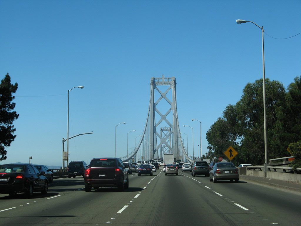
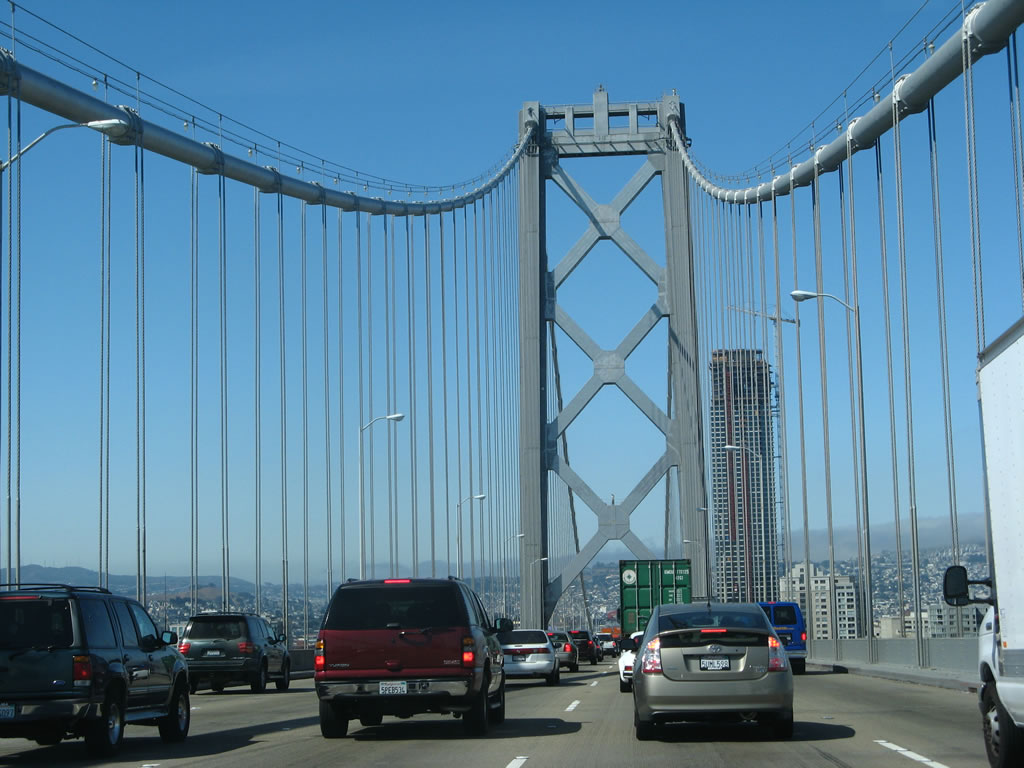
| Upon leaving the Yerba Buena Island tunnel, westbound Interstate 80 immediately connects to the western span, which is a suspension bridge. These photos show some of the towers along the San Francisco-Oakland Bay Bridge between the island and San Francisco. Originally, plans called for the lower deck to carry a double track railway and the top deck would carry cars. The configuration was changed in 1958, when the lower deck started to carry eastbound traffic and the upper deck carried westbound traffic. Eventually, with the construction of the Trans-Bay Tube, the Bay Area Rapid Transit (BART) trains cross the bay underwater, not on the cross-bay bridges. Photos taken 07/06/07. |
|
|
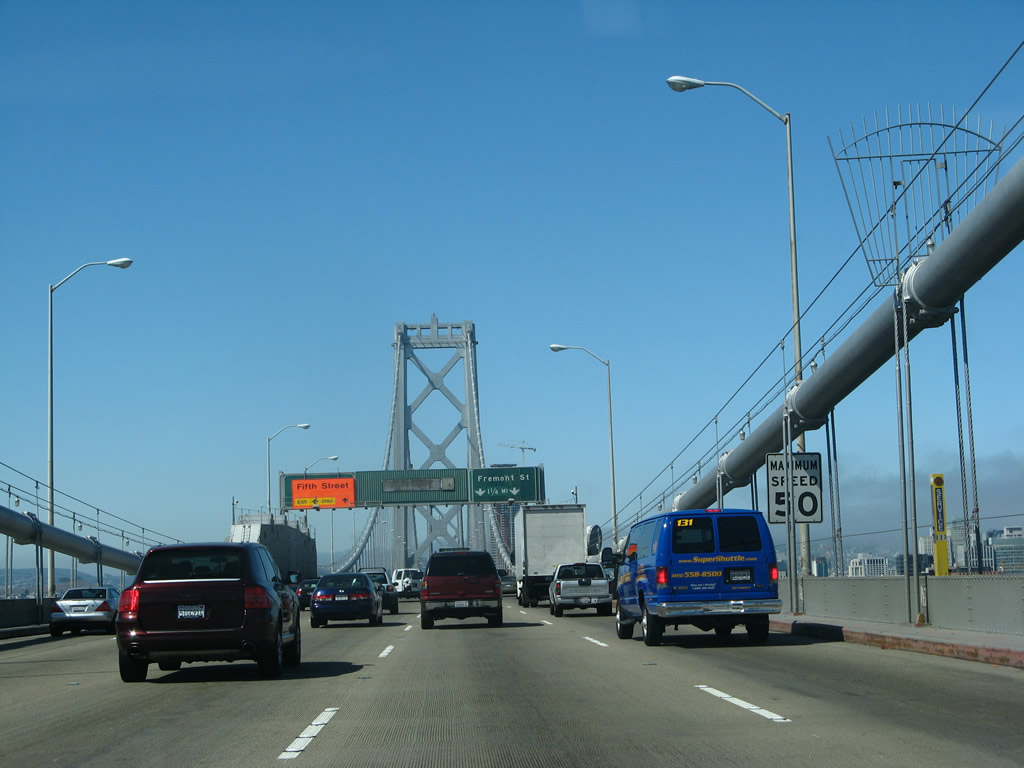
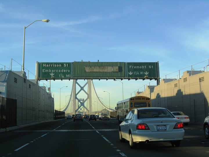
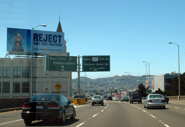
Westbound Interstate 80 signage for the first two San Francisco exits: Fremont Street (Exit 2C) and Harrison Street (Exit 2B to the Embarcadero). As shown by the sign arrangement here, the Harrison Street exit is a left exit, and it is the fastest way to reach the main tourist attractions along the Embarcadero and bayfront as well as some points downtown. In 2007, the Harrison Street exit was closed due to replacement of the James Lick Skyway and western approach structure. At this point, the Bay Bridge crosses the anchorage that marks the mid-point of the suspension bridge. Photos taken 04/06/09, 07/06/07, 11/29/04, and 11/26/04. |
|
|
|
|
|
|
|
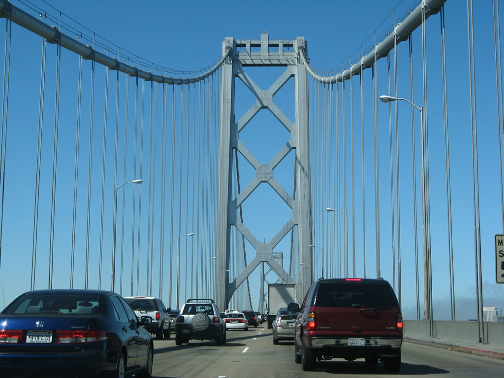
| The distinctive silver-gray towers that support the bridge are internationally known as the gateway to San Francisco. It is only slightly less famous than its sister, the Golden Gate Bridge. The suspension portion of the Bay Bridge is actually two separate suspension bridges, with an anchorage between the two sets of towers. Anchorages are also located at the two ends of the bridge. Photos taken 07/06/07. |
|
|
|
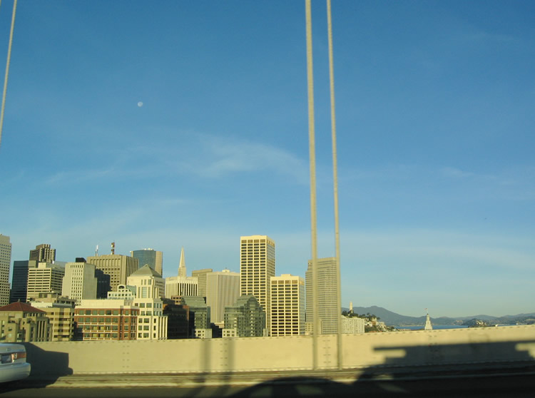
The skyline of San Francisco (affectionately known as just "the City" or "the City by the Bay") is dominant on the north side of the Bay Bridge. Motorists can see these views from the right lanes of Interstate 80 west along the top deck of the San Francisco-Oakland Bay Bridge. Photos taken 11/29/04 and 11/26/04. |
|
|
Passing under the fourth and final suspension tower of the San Francisco-Oakland Bay Bridge, westbound Interstate 80 approaches land and downtown San Francisco. The freeway is often busy, since this is one of few access portals to the City by the Bay. Trucks, buses, taxis, cars all jockey for position in advance of the various ramps that serve downtown San Francisco. Traffic en route to San Francisco International Airport and the Golden Gate Bridge can stay left for now. Follow U.S. 101 south to the airport and U.S. 101 north to the Golden Gate Bridge. Photos taken 07/06/07. |
|
|
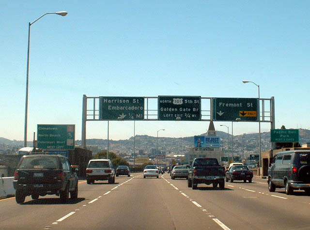
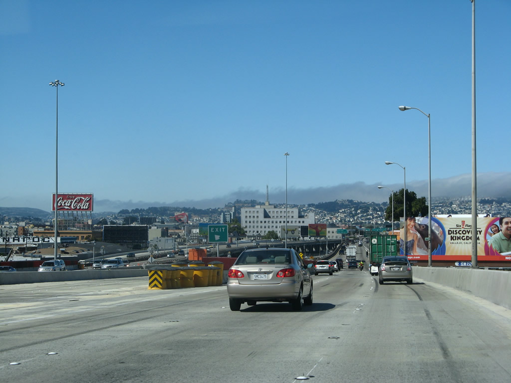
Now in the city limits of San Francisco, the remainder of Interstate 80 follows the James Lick Skyway across the southern edge of downtown. The aging viaduct has several connections to surface streets that lead into downtown and adjacent areas, including the Embarcadero, SBC Ballpark (home of Major League Baseball's San Francisco Giants), the Mission District, and Twin Peaks. This photo shows westbound Interstate 80 approaching Exit 2C, Fremont Street (right exit), and Exit 2B, Harrison Street (left exit). A new sign bridge replaced the 2003 assembly by 2004 and again in 2007 and 2009 as a result of the western approach reconstruction project. Photos taken 04/06/09, 07/06/07, 11/26/04, and 08/16/03. |
|
|
|
Another view of the San Francisco city skyline taken from near the west end of the San Francisco-Oakland Bay Bridge. Photo taken 11/26/04. |
| Interstate 80/James Lick Skyway west |
|
|
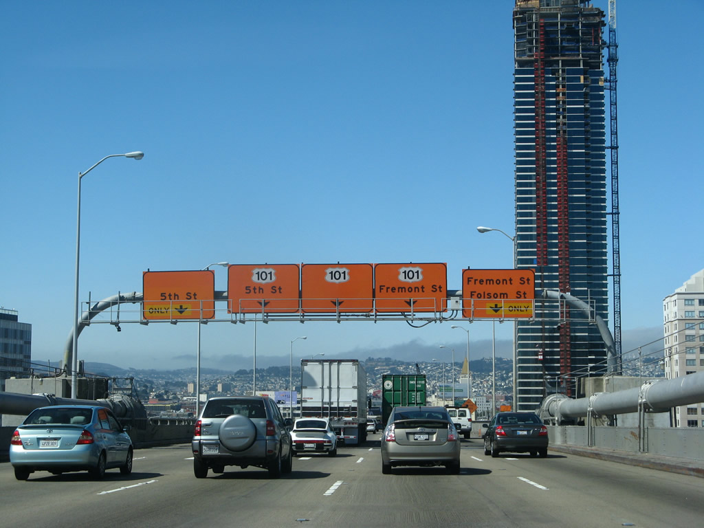
To Fisherman's Wharf, Pier 39, Chinatown, the Embarcadero, and Golden Gate University, use Exit 2C, Fremont Street/Folsom Street. Exit 2B is also available to access the Embarcadero, but this sign seems to imply that Exit 2C is the better choice. A tall new skyscraper was under construction at the time the 2007 photo was taken (and it is now complete and occupied), adding a new dimension to the view of San Francisco upon departing the Bay Bridge. The Folsom-Fremont exit is also the site of the former California 480/Embarcadero Freeway interchange. The former California 480 freeway spur was dismantled after sustaining fatal damage during the 1989 Loma Prieta Earthquake. Photos taken 04/06/09 and 07/06/07. |
|
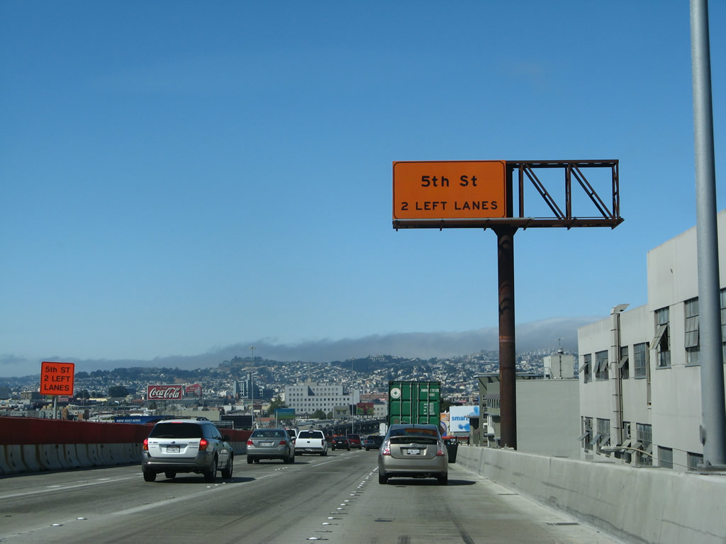
During the skyway reconstruction and retrofit project, the left two lanes of Interstate 80 west became exit only for Exit 2A, Fifth Street. The Fifth Street exit is the original end of the western approach to the Bay Bridge; it was also the route U.S. 40-50 took off the bridge to their joint terminus at U.S. 101. Today, the original approach is an off-ramp to Fifth Street, and Interstate 80 continues west for another couple of miles. Photo taken 07/06/07. |
|
|
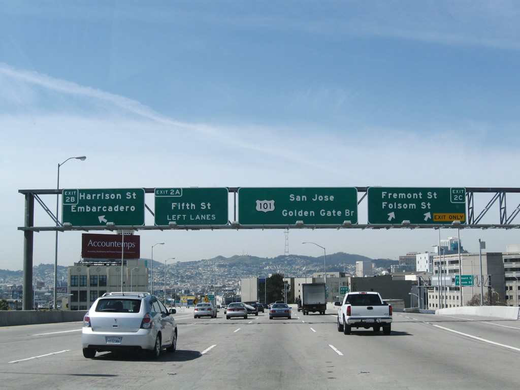
Upon departing the bridge, the first exit along westbound Interstate 80/James Lick Skyway is right off-ramp for Exit 2C, Fremont Street and Folsom Street, followed by the left exit for Exit 2B, Harrison Street/To Interstate 280 south. Note the sign changes and construction differences between these images. Photos taken 04/06/09, 07/06/07, 11/26/04, and 08/16/03. |
|
|
|
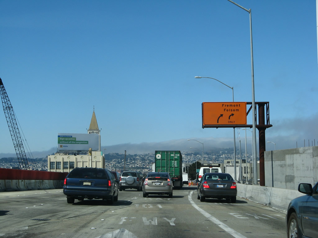
This is the gore point connection for Exit 2C, Fremont Street and Folsom Street to downtown San Francisco (right exit). Photo taken 04/06/09. |
|
|
Even though the freeway is now off of the Bay Bridge, it is still in a double-deck viaduct configuration. As a result, Exit 2B for Harrison Street off of westbound Interstate 80 is a left exit that does not cross over oncoming traffic lanes. Instead, this exit wraps around the southern edge of the freeway and travels down to the surface from the elevated freeway. This exit serves Harrison Street and the Embarcadero, and it also connects to the northern terminus of Interstate 280 via 6th Street. The exit was briefly closed between 2004-2008. Photos taken 04/06/09, 07/06/07, 11/26/04, and 08/16/03. |
|
|
|
Shortly thereafter, a temporary exit sign was briefly posted for Exit 2A, 5th Street. This exit used to be signed as the connection to U.S. 101 north, but now that the Octavia Boulevard project is complete, U.S. 101 traffic may continue west to the Central Freeway spur. Photo taken 07/06/07. |
|
|
|
|
|
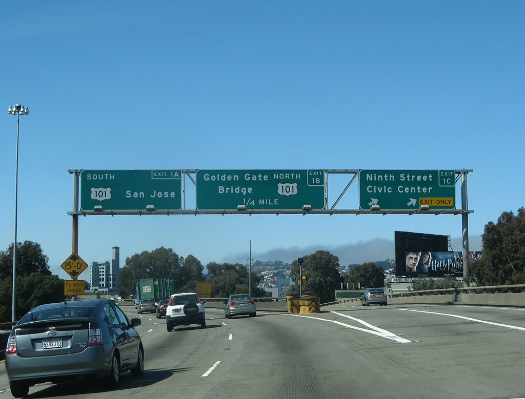
| There are two ways to reach north U.S. 101 from westbound Interstate 80. The first is Exit 2A, which leads to 5th Street with connections to Van Ness Avenue. The second option is to use Exit 1A, which is the Central Freeway. There are two ways to northbound U.S. 101 because of the truncation of the Central Freeway. However, the Central Freeway still connects to Van Ness Avenue via a brief stint on northeastbound Mission Street. The temporary routing changes seen in the 2003 were gone by 2007. Interstate 80 itself has not changed; it is designated all the way to U.S. 101 (Central Freeway). As a side note, when the original skyway was constructed from the San Francisco-Oakland Bay Bridge, the skyway used to end at the base of this ramp. In fact, the base of this ramp marks the original western terminus of former U.S. 40-50 back when they reached San Francisco before the construction of the connecting U.S. 101 freeway. Photos taken 04/06/09, 07/06/07, 11/29/04, 11/26/04, and 08/16/03. |
|
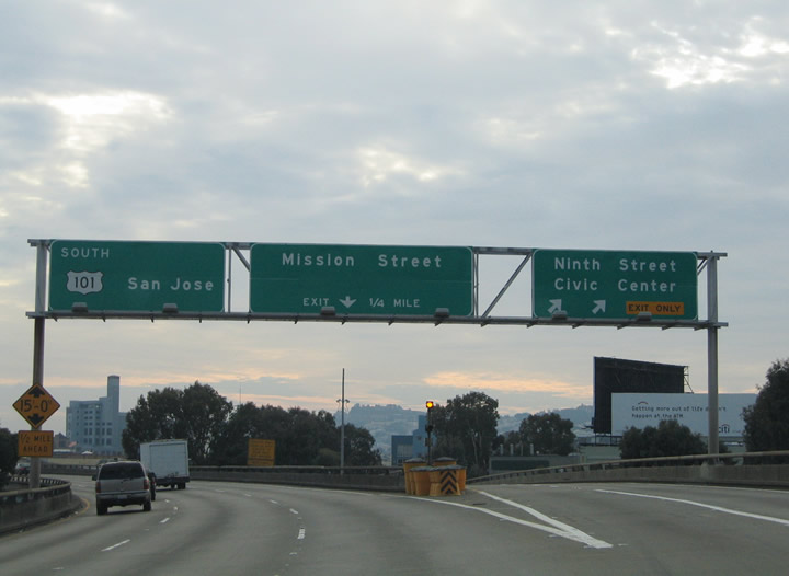
The next exit after 5th Street is Exit 1C, 9th Street/Civic Center. This is the last remaining porcelain enamel sign on westbound Interstate 80 west of the Bay Bridge (as of April 2009, it's still there). Ninth Street leads northwest from the freeway, and it changes into Larkin Street after crossing Mission Street and Market Street. The Civic Center is located on the west side of the Larkin Street (one-way northbound) and east side of Polk Street (one-way southbound) just north of Grove Street and south of McAllister Street. Photo taken 07/06/07. |
|
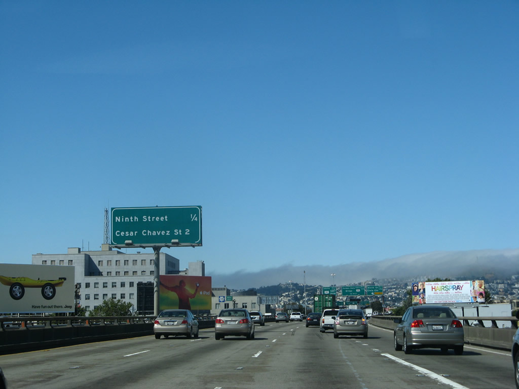
This mileage sign along westbound Interstate 80/James Lick Skyway provides the distance to the last standalone exit from Interstate 80 west (Exit 1C, 9th Street) but omits the distance to the final two exits (Exit 1B [U.S. 101 (Central Freeway) north] and Exit 1A [U.S. 101 (Bayshore Freeway) south]). The first exit from U.S. 101 south after the end of Interstate 80 is listed on this sign (Cesar Chavez Street, formerly Army Street). Photo taken 07/06/07. |
|
|
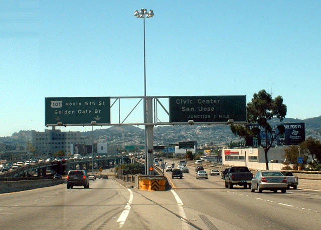
The next overhead presents an array of options for the westbound traveler: exit the freeway at Exit 1C for 9th Street/Larkin Street en route to the Civic Center; take Exit 1B to Mission Street (northbound U.S. 101 (Central Freeway)) to Twin Peaks, Golden Gate Park, and Ocean Beach; or remain in the left lanes for Exit 1A, Southbound U.S. 101. Photos taken 07/06/07 and 11/26/04. |
|
|
Westbound Interstate 80 at Exit 1C, Ninth Street/Civic Center. The freeway turns due south at this point, and it continues in that direction until its western terminus. Photos taken 07/06/07 and 11/26/04. |
|
U.S. 101 follows city streets between the Central Freeway spur and the Golden Gate Bridge approach, and this yellow warning sign advises trucks not to use U.S. 101 north due to limited sight distance and turning radius. At one time, U.S. 101 was planned for a freeway north to the Golden Gate Bridge; this freeway is very unlikely for construction due to the high density of communities at the northern end of the peninsula. U.S. 101 travels on the Central Freeway for a short distance, but it quickly exits onto Market Street to reach Van Ness Avenue. A portion of the Central Freeway was demolished recently, thus shortening the freeway segment of U.S. 101 within the City of San Francisco. Photo taken 07/06/07. |
|
The viaduct bends toward the southwest as I-80 west approaches the final interchange. Photo taken 07/06/07. |
|
|
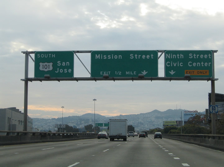
The next exit comes quickly. Westbound Interstate 80 splits into northbound U.S. 101/Mission Street/Central Freeway (Exit 1B, right exit) or southbound U.S. 101 (Bayshore Freeway) to San Jose (Exit 1A, left/through lanes). The official end of Interstate 80 is at its junction with U.S. 101. Upon passing the last exit along westbound, which is Exit 1A for northbound U.S. 101, Interstate 80 transitions into southbound U.S. 101. Photos taken 07/06/07 and 11/26/04. |
|
Now on the transition ramp from Interstate 80 west to U.S. 101 north, this ramp carried the continuation of Interstate 80 in the early 1960s. When the freeway west to Golden Gate Park was eliminated from local freeway plans, Interstate 80 was truncated to the Central Freeway interchange with U.S. 101. Photo taken 07/06/07. |
Page Updated August 25, 2013.