

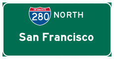
Interstate 280 North - San Mateo County
| Interstate 280/Junipero Serra Freeway north | |
|---|---|
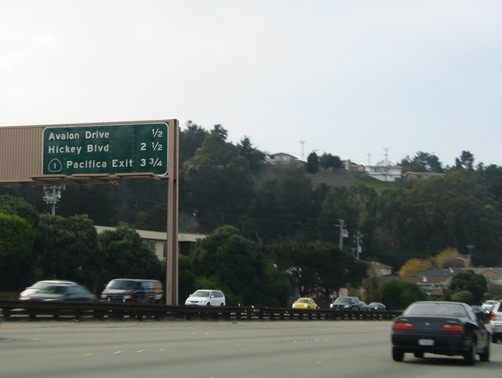 |
Continuing the journey along northbound just after the Interstate 380 interchange in San Bruno, Interstate 280 returns to the city, now entering the city of South San Francisco (still within the northern part of San Mateo County). The next exit is Exit 44, Avalon Drive/Westborough Boulevard, followed by Hickey Boulevard and southbound California 1. Photo taken 11/26/04. |
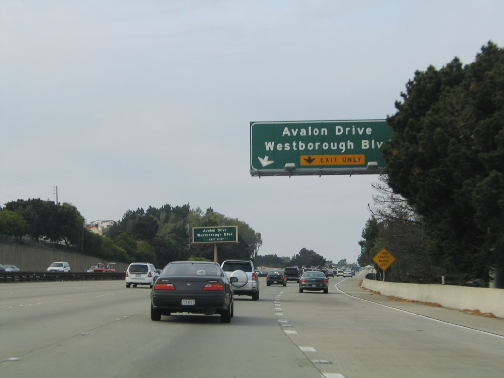 |
The right lane of Interstate 280 north becomes exit only for Exit 44, Avalon Drive/Westborough Boulevard. Photo taken 11/26/04. |
 |
Northbound Interstate 280 approaches Exit 44, Avalon Drive/Westborough Boulevard. Westborough Boulevard leads east into South San Francisco. Photo taken 11/26/04. |
 |
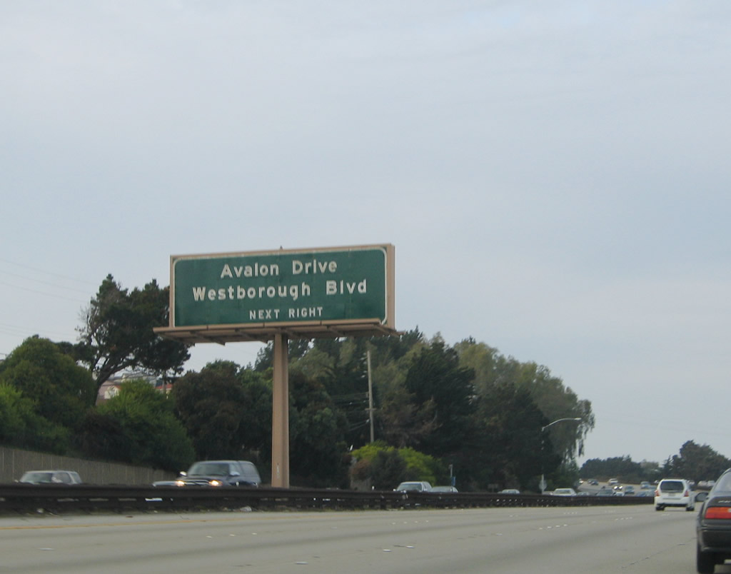
Northbound Interstate 280/Junipero Serra Freeway reaches Exit 44, Avalon Drive/Westborough Boulevard. Photo taken 11/26/04. |
 |
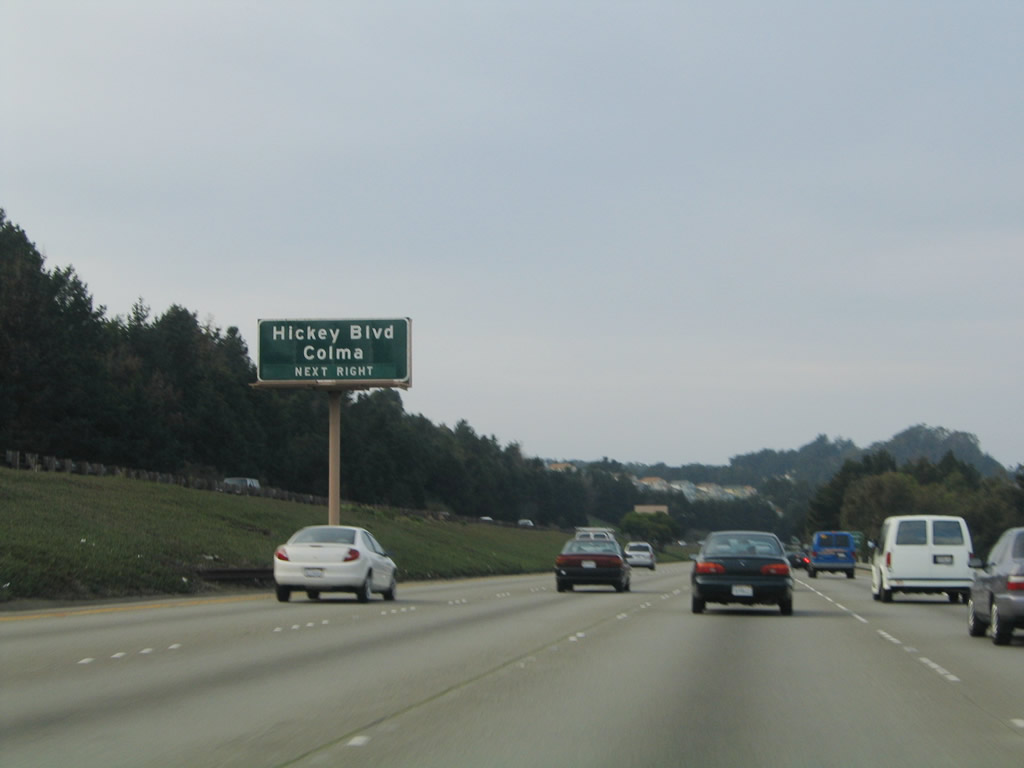
The next exit along northbound Interstate 280 is Exit 46, Hickey Boulevard, which provides an east-west connection between South San Francisco, Colma, and the southern portion of Daly City. Photo taken 11/26/04. |
 |
This Interstate 280 reassurance shield is posted after the on-ramp from the Avalon Drive and Westborough Boulevard interchange. Photo taken 11/26/04. |
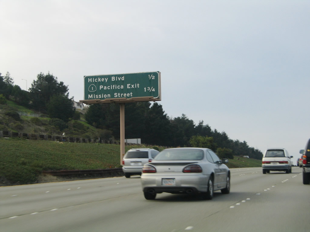 |
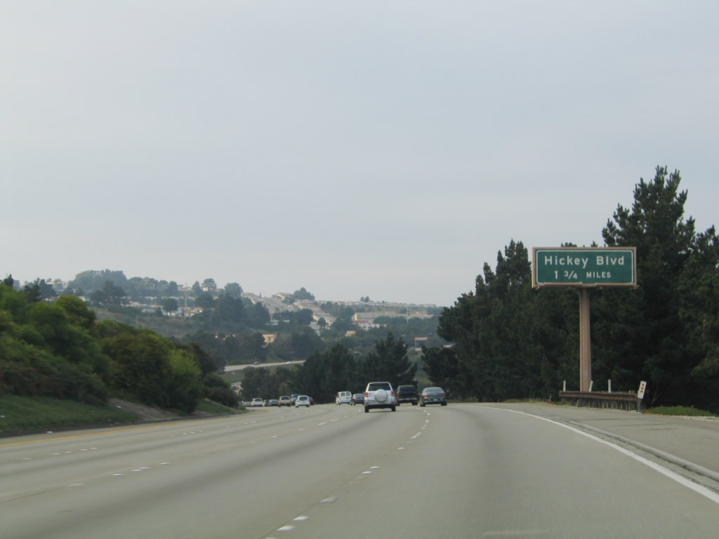
This mileage sign along northbound Interstate 280 provides the distance to Exit 46, Hickey Boulevard and Exit 47, California 1/Mission Street south to Pacifica. Photo taken 11/26/04. |
 |
Northbound Interstate 280 approaches Exit 46, Hickey Boulevard, which leads into Colma. Colma may be best known to residents of the Bay Area as the former terminus of the Bay Area Rapid Transit (BART) system on the San Francisco peninsula. The BART was extended southeast earlier this decade to connect its system with San Francisco International Airport. Photo taken 11/26/04. |
 |
Interstate 280 continues to live up to its designation as a scenic route, with plentiful trees and rolling hills as it passes by Exit 46, Hickey Boulevard. Photo taken 11/26/04. |
 |
From here, the most practical way to cross the City to reach points north of San Francisco would be to use California 1 (19th Avenue). U.S. 101 is a narrower, busier route, but both highways are frequently congested. Another option for this truck would be to take the San Francisco-Oakland Bay Bridge (Interstate 80) east to Oakland, then turn northwest on Interstate 580 (paying a toll at the Richmond-San Rafael Bridge) before meeting U.S. 101 in Marin County. While adding miles to the journey, it may actually be faster at some times during the day. Photo taken 11/26/04. |
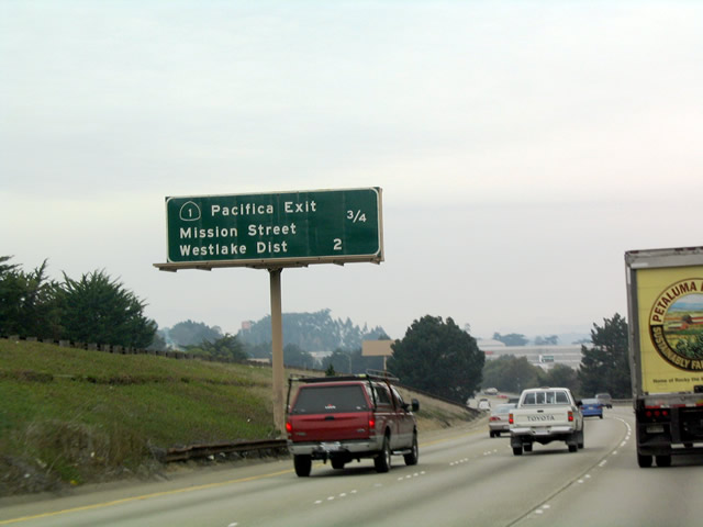 |
Mileage sign along northbound Interstate 280 for Exit 47, California 1 south and Exit 49A, Westlake District/Daly City. Photo taken 11/28/03. |
 |
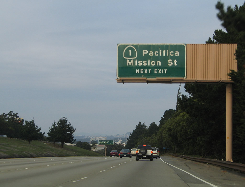
Northbound Interstate 280 reaches Exit 47, Junction South California 1/Mission Street. California 1 continues north cosigned with Interstate 280; the routes divide upon reaching the city and county of San Francisco. Yes, this is the same Mission Street that ultimately reaches downtown San Francisco. For a much slower route through the colorful neighborhoods of San Francisco, a trip down Mission Street rather than Interstate 280 to downtown is recommended. Mission Street reaches its southwestern terminus in Daly City, at the intersection with Market Street and San Pedro Road. However, plan to spend a lot of time moving slowly. Photo taken 11/28/03. |
 |
Exit 49B splits California 1 from Interstate 280. Interstate 280 turns northeast toward downtown San Francisco, Pacific Bell Ballpark (home of baseball's San Francisco Giants), and the Embarcadero. Together with U.S. 101, Interstate 280 provides a direct freeway connection to the San Francisco-Oakland Bay Bridge. California 1, meanwhile, heads due north through the western neighborhoods of San Francisco, such as Parkside, Sunset, Golden Gate Heights, Golden Gate Park, Richmond District, and Lake District, before merging with U.S. 101 in the Presidio. Photo taken 11/26/04. |
 |
This Interstate 280 and California 1 shield assembly is located after the on-ramp from Exit 47. Photo taken 11/26/04. |
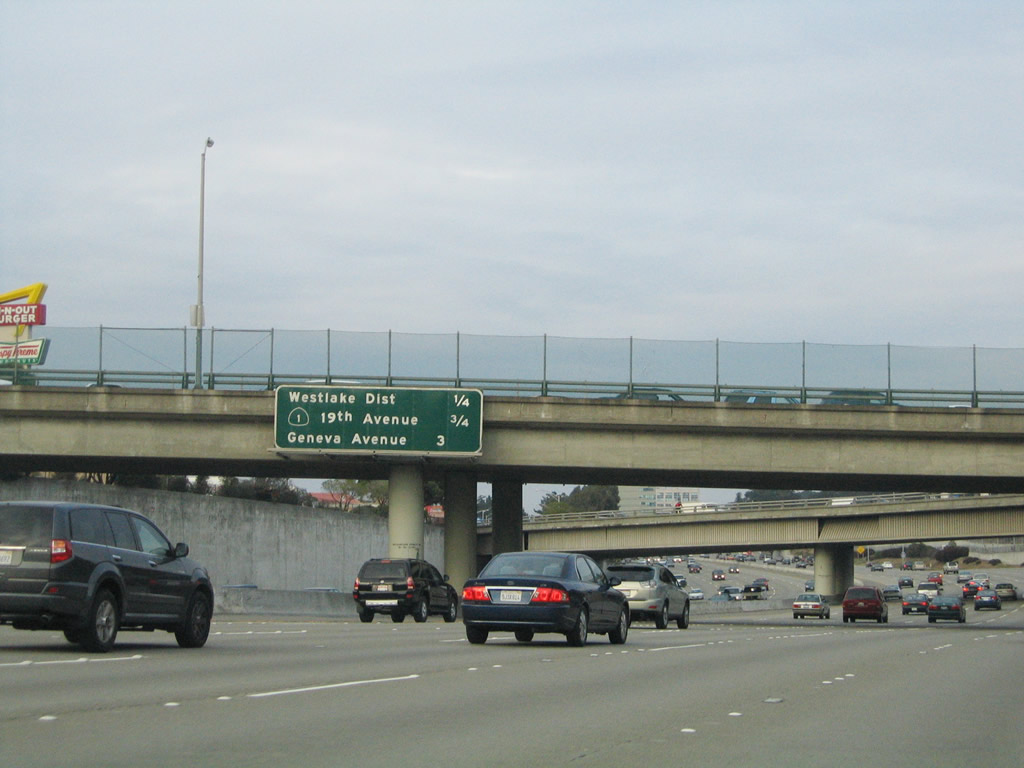 |
Mileage sign along northbound Interstate 280 and California 1 for Exit 49A, John Daly Boulevard to Westlake District/Daly City; Exit 49B, California 1 north/19th Avenue; and Exit 51, Geneva Avenue/Ocean Avenue. Photo taken 11/26/04. |
 |
Northbound Interstate 280 and California 1 reach Exit 49A, John Daly Boulevard to Westlake District/Daly City. The other signs at this interchange advise motorists to select lanes for the upcoming route split. The left three lanes are signed for northbound California 1, and the right three lanes are signed for Interstate 280. For a brief time in the 1960s, when Interstate 280 was planned to extend north to the Golden Gate Bridge approach via the current California 1 (19th Avenue and Presidio Boulevard) corridor, the Southern Freeway corridor was designated as California 82 (with a plan to eventually redesignate California 82/Southern Freeway as Interstate 480). With the cancellation of the 19th Avenue Freeway and cancellation of the extension of the old Embarcadero Freeway, Interstate 480 was shifted to California 480, and Interstate 280 was rerouted to its current alignment (including the unconstructed section that would have connected Interstate 280 with Interstate 80 at the western approach to the Bay Bridge). A remnant of the California 82 designation is shown on this porcelain enamel overhead sign, with the Interstate 280 shield covering most, but not all, of the original shield. Photo taken 11/26/04. |
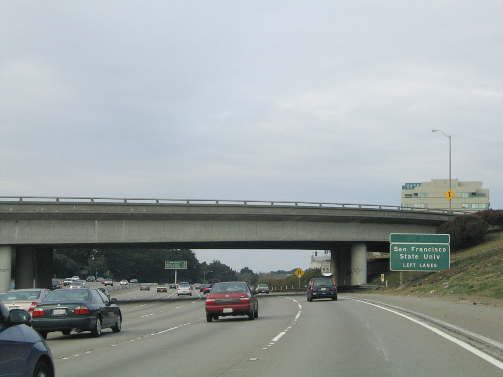 |
Use California 1 north to San Francisco State University. Note that the freeway carries six northbound lanes at this point. Photo taken 11/26/04. |
 |
This mileage sign along Interstate 280 and California 1 north provide the distance to the next three exits: Exit 49B, California 1 north/19th Avenue; Exit 51, Geneva Avenue/Ocean Avenue; and Exit 52, San Jose Avenue/Bosworth Street. Photo taken 11/28/03. |

Page Updated February 24, 2008.
|
About Contact Glossary |
In The News Testimonials Interstate Guide |
Social Media:
 |
|
© 2000-23 AARoads.com | All Rights Reserved | Privacy Policy / Terms of Use
|
||