| U.S. 50 east |
|
|
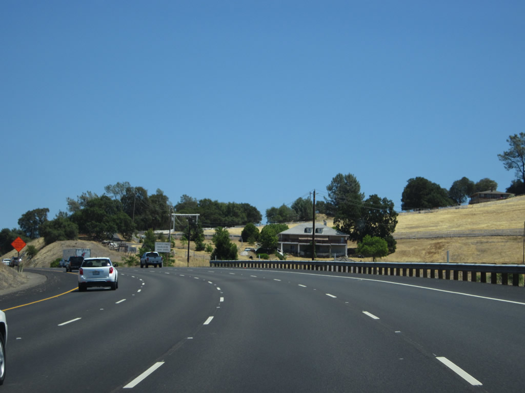
U.S. 50 leaves Sacramento County and enters El Dorado County. The section of U.S. 50 between El Dorado Hills Boulevard and Bass Lake Road was built in 1965-1966. Photos taken 07/28/12 and 02/17/07. |
|
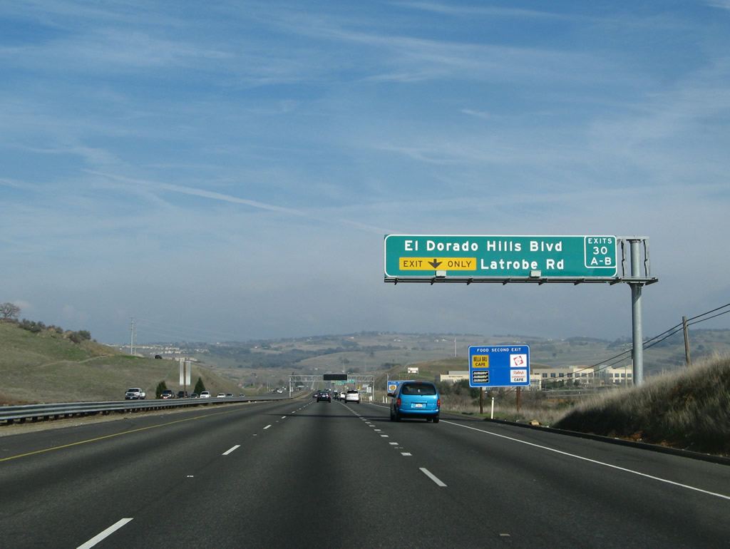
The right lane becomes exit only for the next interchange: Exit 30A, Latrobe Road south to Ione and Exit 30B, El Dorado Hills Boulevard north to El Dorado Hills. Photo taken 02/17/07. |
|
|
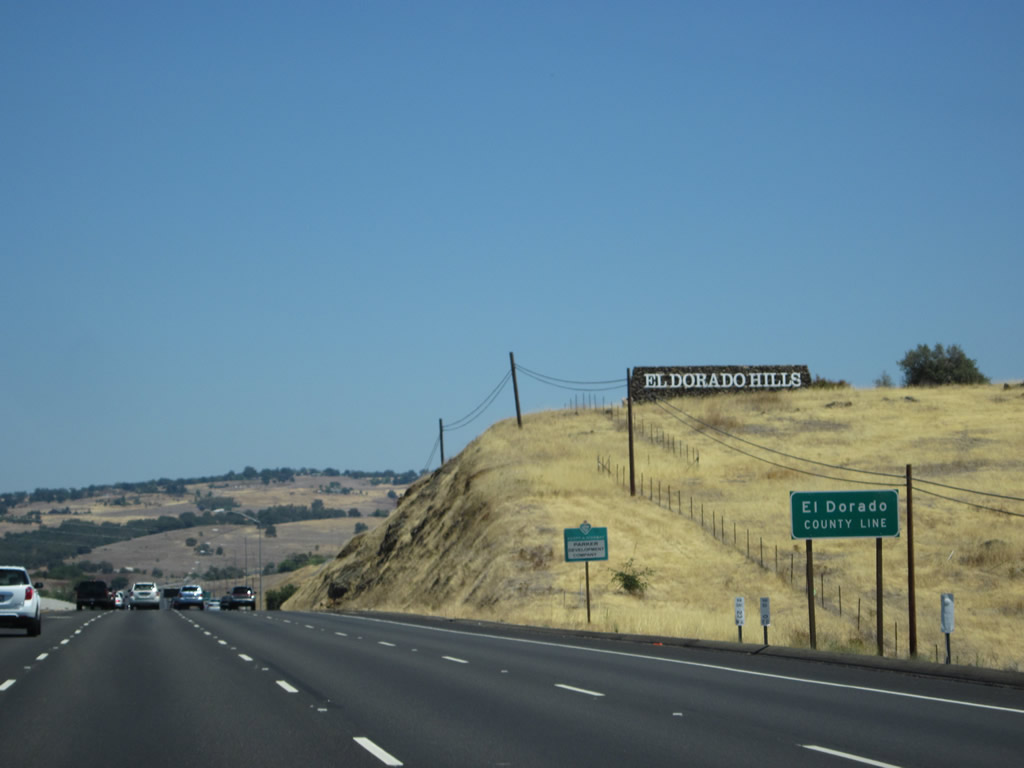
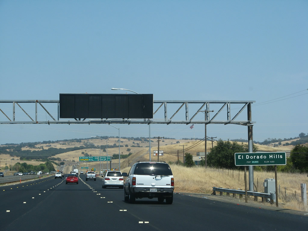
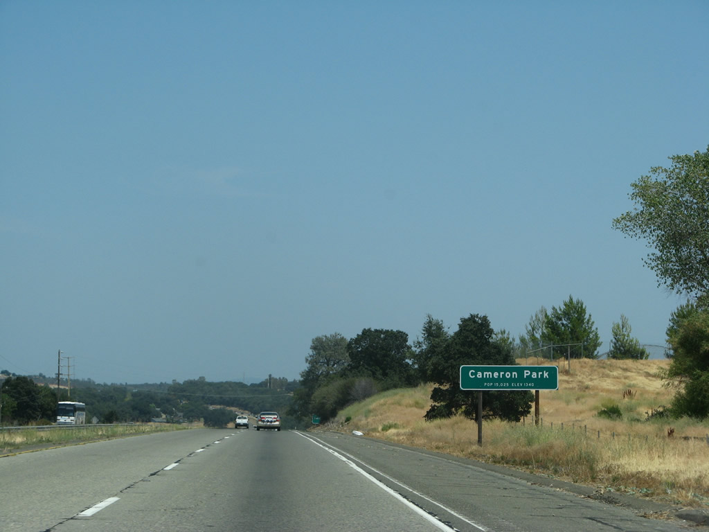
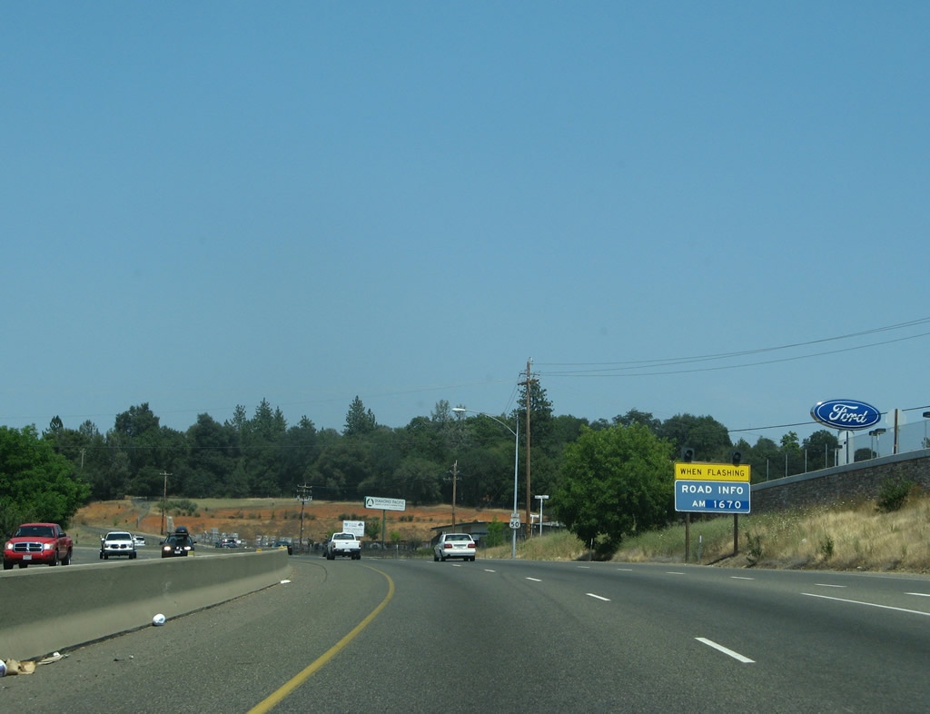
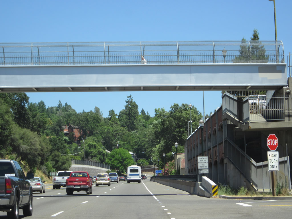
U.S. 50 enters the unincorporated community of El Dorado Hills. A growing community of master planned residential developments, El Dorado Hills had a population of 18,016 people as of the 2000 Census. Most residents associate with the amenities in nearby Folsom, and some housing developments come very close to the Sacramento-El Dorado County line, helping to blur the distinction between the two areas. Photos taken 07/28/12 and 07/08/07. |
|
|
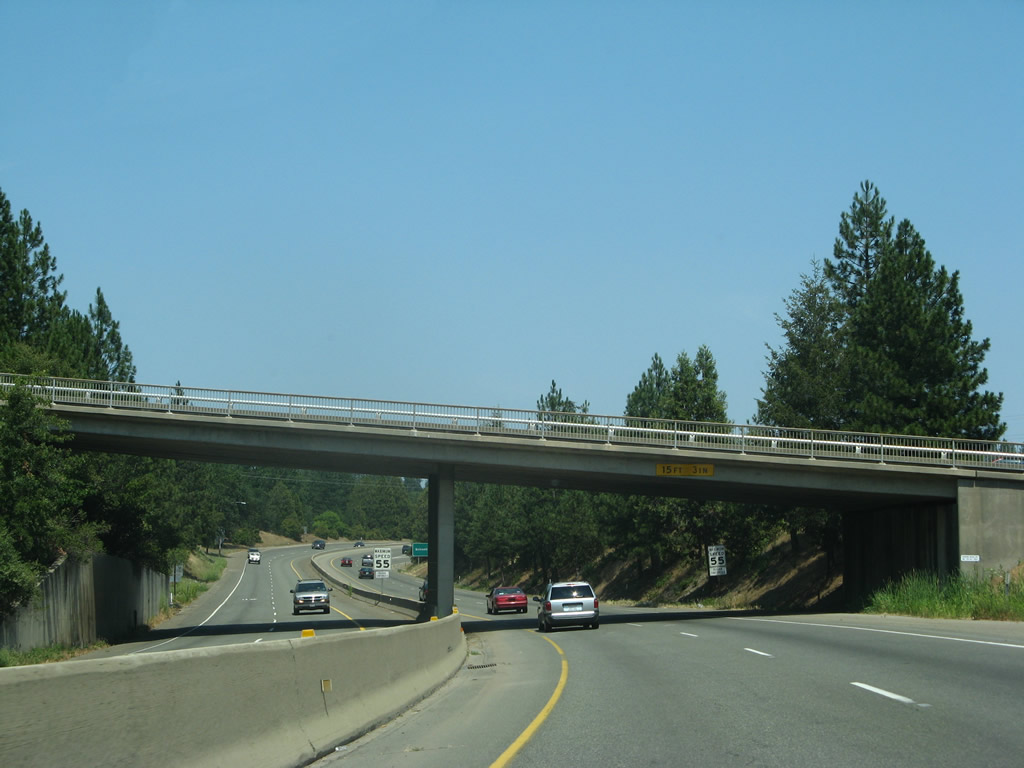
Eastbound U.S. 50 reaches Exit 30A, Latrobe Road south. Use Latrobe Road south to California 16 (Jackson Road) east to Jackson and California 124 (Plymouth Highway) south to Ione. The next off-ramp is Exit 30B, El Dorado Hills Boulevard. This sign bridge was replaced between 2007 and 2012 as a result of a project to increase freeway capacity by adding more lanes. Photos taken 07/28/12 and 02/17/07. |
|
|
Immediately thereafter, eastbound U.S. 50 reaches Exit 30B, El Dorado Hills Boulevard north to El Dorado Hills. Again, this sign was replaced when the overhead sign support structure was also replaced. Photos taken 07/28/12 and 02/17/07. |
|
U.S. 50 passes through the El Dorado Hills Boulevard interchange and begins its ascent into the foothills. Four lanes travel uphill. Photo taken 07/28/12. |
|
Climbing away from Exits 30A-B, U.S. 50 east used to reduce to two lanes in 2007, but was expanded to four lanes uphill by 2012. Photo taken 02/17/07. |
|
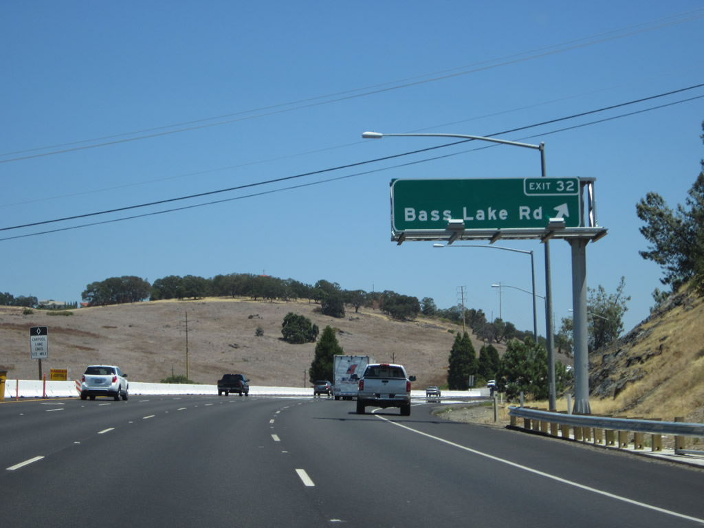
The next exit along U.S. 50 east is Exit 32, Bass Lake Road (one mile). This sign was removed when the freeway was expanded. Photo taken 02/17/07. |
|
A newer, overhead sign along U.S. 50 east is posted for Exit 32, Bass Lake Road (0.75 mile). Photo taken 07/28/12. |
|
This view looks at El Dorado Hills as seen from U.S. 50 eastbound lanes. This view looks toward the west while the eastbound lanes travel south briefly. Photo taken 07/28/12. |
|
|
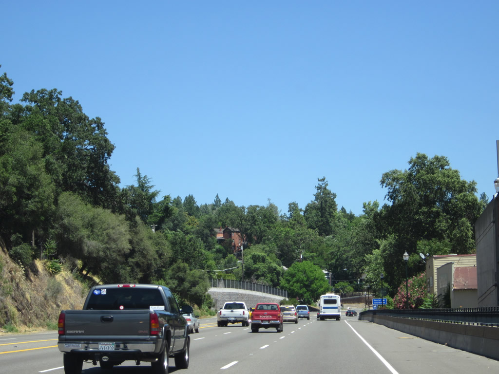
U.S. 50 continues its sweeping climb uphill, retaining four lanes along eastbound. Back in 2007, a third lane began here that used to serve as a climbing lane. Photos taken 07/28/12 and 07/08/07. |
|
|
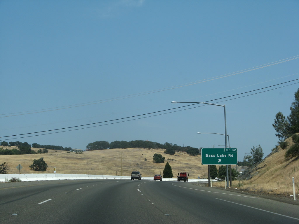
Eastbound U.S. 50 (El Dorado Freeway) reaches Exit 32, Bass Lake Road north and Marble Valley Road southeast. Photos taken 07/28/12 and 07/08/07. |
|
This U.S. 50 reassurance shield is posted after the on-ramp from Bass Lake Road. The four eastbound lanes temporarily narrow to two lanes as we pass through the Bass Lake Road interchange. However, work was underway in 2012 to expand the freeway to accommodate more travel lanes. Photo taken 07/08/07. |
|
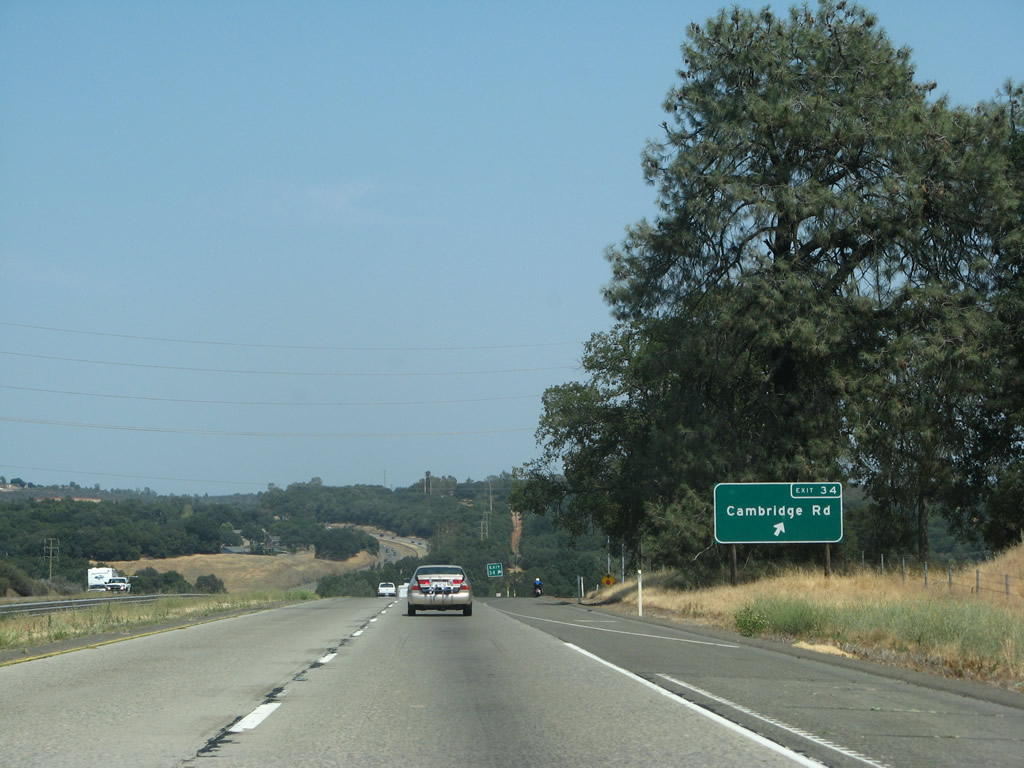
The next exit along U.S. 50 (El Dorado Freeway) is Exit 34, Cambridge Road to Cameron Park (0.75 mile). Photo taken 07/08/07. |
|
The next two exits along U.S. 50 east serve Cameron Park: Exit 34, Cambridge Road and Exit 35, Cameron Park Drive. Photo taken 07/08/07. |
|
U.S. 50 enters the unincorporated community of Cameron Park, which sits at an elevation 1,340 feet and has a population of 14,549 as of the 2000 Census. Photo taken 07/08/07. |
|
Eastbound U.S. 50 (El Dorado Freeway) reaches Exit 34, Cambridge Road to Cameron Park. Photo taken 07/08/07. |
|
|
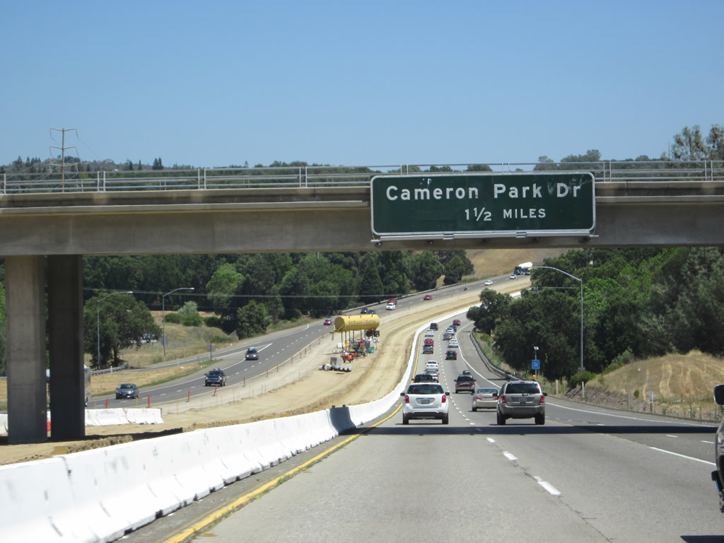
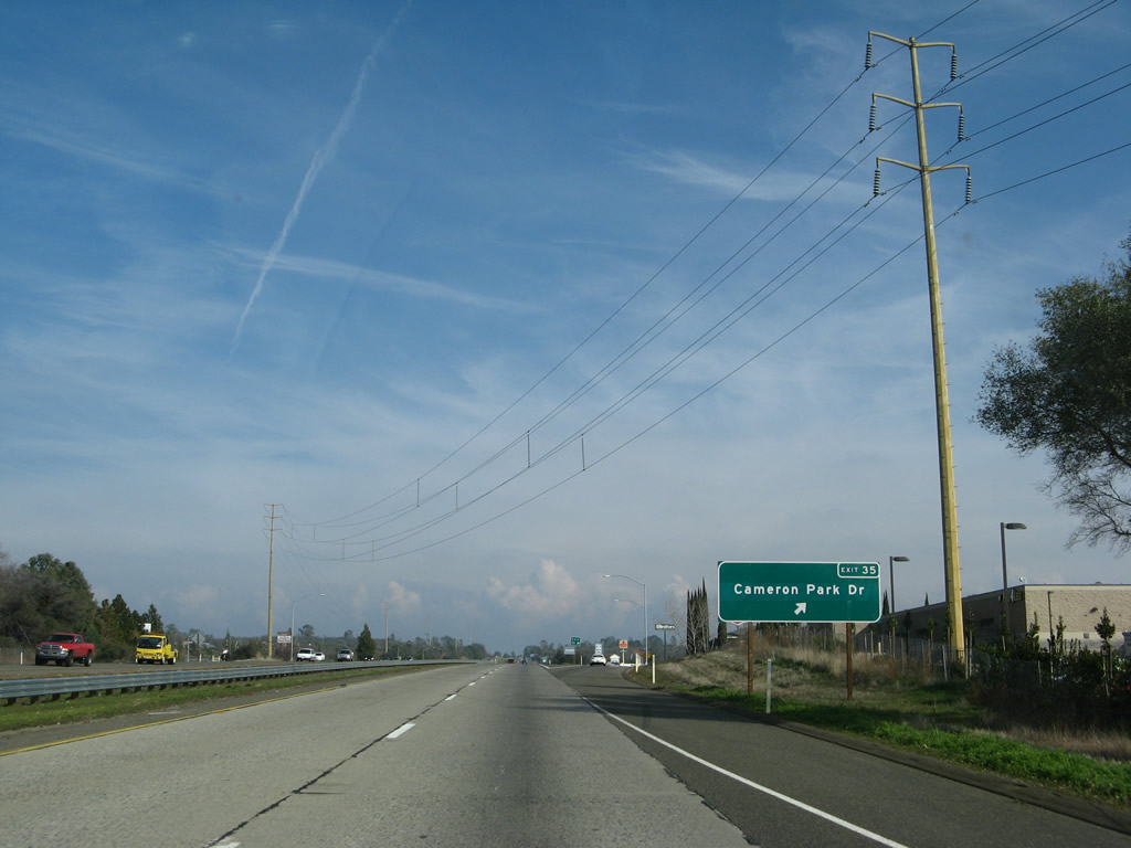
The next exit along U.S. 50 (El Dorado Freeway) is Exit 35, Cameron Park Drive (1.50 miles). The section of U.S. 50 between Cambridge Road and Missouri Flat Road was built in 1969-1970. Note the freeway expansion work underway in 2012. Photos taken 07/28/12 and 07/08/07. |
|
|
U.S. 50 east was expanded between Cambridge Road and Cameron Park Drive in 2012. Photos taken 07/28/12 and 02/17/07. |
|
Eastbound U.S. 50 (El Dorado Freeway) reaches Exit 35, Cameron Park Drive. Most motorist services (food, gas) are available here. Photo taken 02/17/07. |
|
A U.S. 50 reassurance shield is posted after the on-ramp from Cameron Park Drive. Photo taken 02/17/07. |
|
The next exit along U.S. 50 east is Exit 37, Ponderosa Road, Shingle Road, and Mother Lode Drive (one mile). Photo taken 07/08/07. |
|
Eastbound U.S. 50 enters the unincorporated community of Shingle Springs. Like nearby Placerville, Shingle Springs has its history steeped in the California Gold Rush of 1849. Shingle Springs has a population of 2,643 as of the 2000 Census. Photo taken 07/08/07. |
|
At the bottom of the exit ramp, turn left to Ponderosa Road north or right to Shingle Road south. Continue straight ahead at the light onto Mother Lode Drive east. The Shingle Springs Plaza (shopping center) is located at the end of the off-ramp. Photo taken 07/08/07. |
|
Eastbound U.S. 50 (El Dorado Freeway) reaches Exit 37, Ponderosa Road, Shingle Road, and Mother Lode Drive. Photo taken 07/08/07. |
|
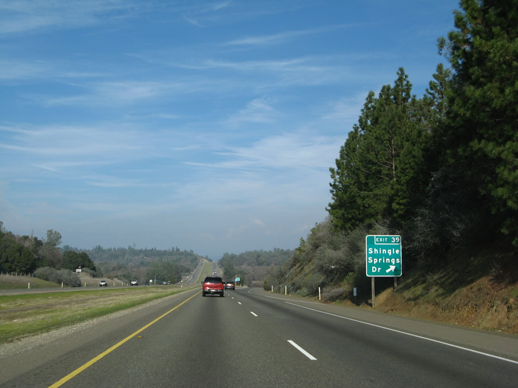
The next exit along U.S. 50 east is Exit 39, Shingle Springs Drive (1.50 miles). Photo taken 02/17/07. |
|
A U.S. 50 reassurance shield is posted after the on-ramp from Ponderosa Road and Shingle Road. Photo taken 02/17/07. |
|
|
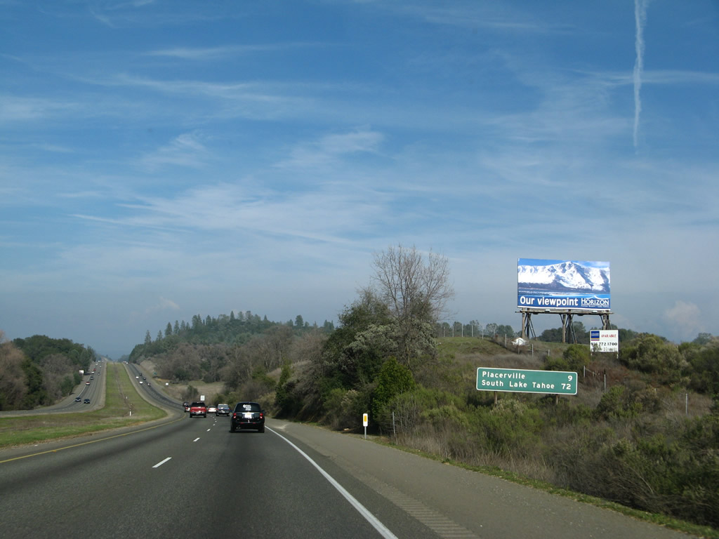
This mileage sign provides the distance to Placerville (county seat of El Dorado County, nine miles) and South Lake Tahoe (72 miles). The sign was changed (button copy to reflective) between 2007 and 2012. Photos taken 07/28/12 and 02/17/07. |
|
Eastbound U.S. 50 reaches Exit 39, Shingle Springs Drive. Photo taken 02/17/07. |
|
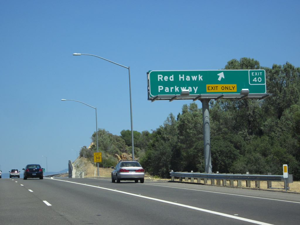
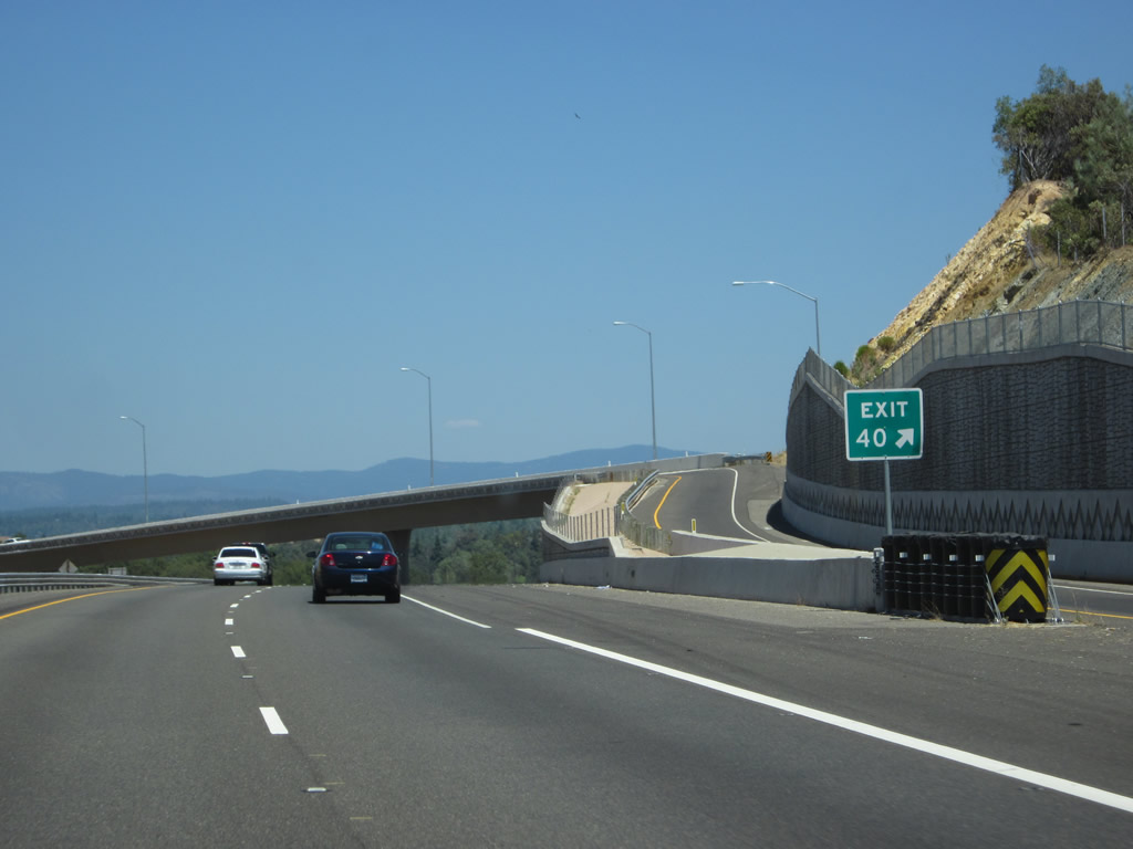
The next exit along U.S. 50 east is Exit 40, Red Hawk Parkway (0.75 mile). This interchange serves the Red Hawk Casino on the north side of U.S. 50. The interchange did not exist in 2007 but was fully in use by 2012. Photo taken 07/28/12. |
|
U.S. 50 passes over Shingle Springs Drive. Ahead, an auxiliary lane will serve upcoming Exit 40. Photo taken 07/28/12. |
|
The right lane of U.S. 50 east becomes exit only for Exit 40, Red Hawk Parkway. This high-speed, directional interchange is almost a stack interchange except for the spacing of the bridges not stacked on top of each other. A departure for Exit 40 will default drivers onto the driveway leading into the casino's parking area. Photo taken 07/28/12. |
|
Eastbound U.S. 50 meets Exit 40, Red Hawk Parkway. This interchange was built between 2008 and 2010 by Mark Thomas & Company at a cost of $45 million at the request of the Shingle Springs Band of Miwok Indians.1 Photo taken 07/28/12. |
|
|
The right lane departs for Exit 40, while the left two lanes continue east along U.S. 50 toward Placerville. Photos taken 07/28/12. |
|
|
Immediately after passing under the flyover ramp to Red Hawk Parkway, this sign advises that the next exit along U.S. 50 (El Dorado Freeway) east is Exit 41, Greenstone Road (one mile). This sign was changed between 2007 and 2012, most likely as part of the new Red Hawk Parkway interchange project. Photos taken 07/28/12 and 02/17/07. |
|
This view looks east along U.S. 50 between Red Hawk Parkway interchange and Greenstone Road. Photo taken 07/28/12. |
|
Eastbound U.S. 50 reaches Exit 41, Greenstone Road. Photo taken 07/08/07. |
|
The next exit along U.S. 50 east is Exit 43, El Dorado Road (one mile). Photo taken 07/08/07. |
|
Use Exit 43 (El Dorado Road south) to El Dorado, an unincorporated community in the Sierra Nevada foothills. El Dorado sits at an elevation of 1,608 feet and had a population of 4,096 as of the 2000 Census. The community sits at the intersection between El Dorado Road, Pleasant Valley Road, and California 49 (Gold Country Highway). To California 49 south, use this exit rather than drive into Placerville. Photo taken 02/17/07. |
|
Eastbound U.S. 50 reaches Exit 43, El Dorado Road. Photo taken 07/08/07. |
|
Continuing east through the interchange, the next exit (Exit 44A) serves Folsom Lake College and El Dorado Center. Photo taken 02/17/07. |
|
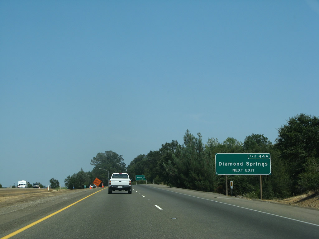
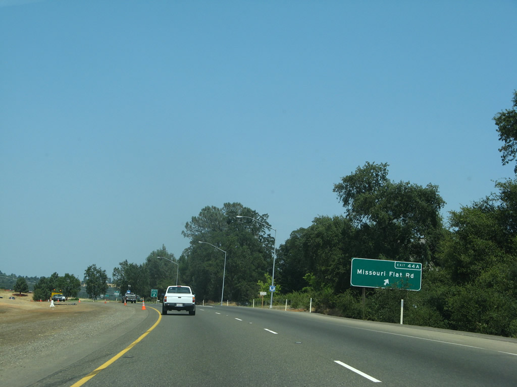
The next exit along U.S. 50 (El Dorado Freeway) east is Exit 44A, Missouri Flat Road (one mile). Photo taken 02/17/07. |
|
Use Missouri Flat Road southeast to the unincorporated community of Diamond Springs, which sits at the intersection with California 49 (Pleasant Valley Road). Photo taken 07/08/07. |
|
|
Eastbound U.S. 50 (El Dorado Freeway) reaches Exit 44A, Missouri Flat Road. An overhead sign structure was in place here by 2012, thus eliminating the roadside exit sign. Photos taken 07/28/12 and 07/08/07. |
|
At the top of the off-ramp for Exit 44A is a traffic signal with Missouri Flat Road. Photo taken 07/28/12. |
|
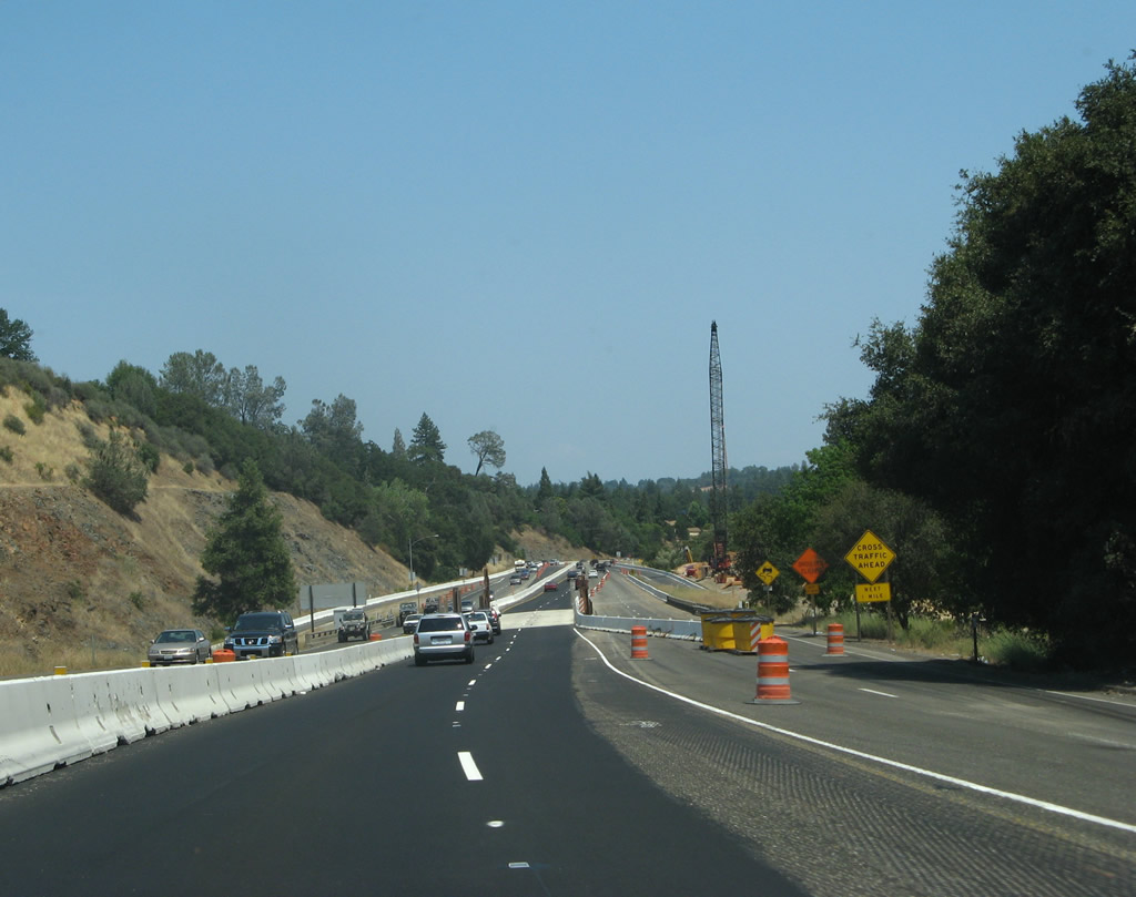
For the first time on its eastbound journey, the freeway segment of U.S. 50 ends in Placerville. As a result, traffic congestion may occur for the next couple of miles. Photo taken 07/08/07. |
|
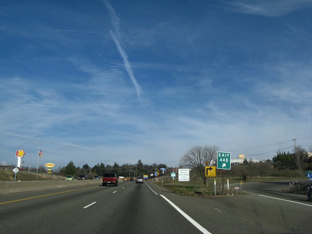
The next exit along U.S. 50 (El Dorado Freeway) east is Exit 44B, Forni Road and Placerville Drive (0.75 mile). Through Placerville, U.S. 50 was built in 1955. Photo taken 07/28/12. |
|
Before the Exit 44B sign was posted in its current location, it used to be mounted on the Missouri Flat Road overpass as shown here. Photo taken 02/17/07. |
|
The Missouri Flat Road overpass was widened, as compared to the prior version of the overpass. Widening work was evident with the goal to accommodate additional lanes on U.S. 50. Photo taken 07/28/12. |
|
U.S. 50 enters the city of Placerville, the seat of El Dorado County. Home to 9,610 people as of the 2000 Census, Placerville was founded during the 1849 California Gold Rush and was briefly known as "Hangtown" during that colorful era in California history. The city was incorporated on May 13, 1854. Located in the Sierra Nevada foothills, Placerville sits at an elevation of 1,867 feet and is an important stop on the way to Lake Tahoe. All motorist services (gas, food, and lodging) are available in Placerville, and shops line the historical downtown area. Photo taken 02/17/07. |
|
|
Continuing east, U.S. 50 (El Dorado Freeway) crosses El Dorado Vietnam Veterans Bridge. This 1963 bridge carries the freeway over Weber Creek. Significant work was underway in 2012 to widen and improve the bridge. Photos taken 07/28/12 and 02/17/07. |
|
Eastbound U.S. 50 (El Dorado Freeway) approaches Exit 44B, Forni Road and Placerville Drive. Photo taken 02/17/07. |
|
Use Exit 44B to El Dorado County Fairgrounds, Highway Patrol Station, Sheriff Station, and Ranger Station. Photo taken 02/17/07. |
|
Eastbound U.S. 50 (El Dorado Freeway) reaches Exit 44B, Forni Road and Placerville Drive. This is the first of several exits (and intersections) to serve the city of Placerville. Photo taken 02/17/07. |
|
The loop ramp links directly to Forni Road; turn right (west) on Forni Road to Placerville Drive. Photo taken 02/17/07. |
|
After the Forni Road and Placerville Drive interchange (Exit 44B), a road conditions sign advises of the AM Radio Station for obtaining travel and weather conditions along U.S. 50 over the Sierra Nevada. Photo taken 07/08/07. |
|
A U.S. 50 reassurance shield is posted after the on-ramp. Photo taken 02/17/07. |
|
The freeway ends in one-half mile; through Placerville, U.S. 50 is an expressway with several traffic lights that serve historic, downtown Placerville. Photo taken 07/08/07. |
|
An overhead sign advises that the next several intersections will serve Central Placerville in one mile. Photo taken 07/08/07. |
|
U.S. 50 narrows significantly yet still retains two lanes in each direction. The expressway has been under construction coming into Placerville from the west. Photo taken 02/17/07. |
|
|
Construction was underway in 2007 to provide new access via Placerville Drive (Old U.S. 50) into downtown Placerville. The work was completed by 2012. Photos taken 07/28/12 and 07/08/07. |
|
|
A new bridge carries Placerville Drive into downtown Placerville, while U.S. 50 stays to the north of the old road. Traffic merges onto U.S. 50 from eastbound Placerville Drive. Photos taken 07/28/12 and 07/08/07. |
|
An end freeway sign is posted along U.S. 50 east prior to entering downtown Placerville. This is the first section of non-freeway U.S. 50 since its western terminus in West Sacramento. Photo taken 07/28/12. |
|
|
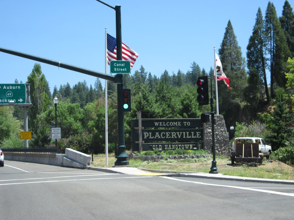
The first intersection along U.S. 50 east is with Canal Street in Placerville. A ramp now exists here that connects directly onto eastbound Main Street to provide more direct access into downtown Placerville. Photos taken 07/28/12 and 07/08/07. |
|
|
A third lane is added as eastbound U.S. 50 approaches Canal Street. This is the first intersection to serve downtown Placerville; the second traffic signal will be with California 49 (Spring Street). Photos taken 07/28/12 and 07/08/07. |
|
|
Eastbound U.S. 50 meets Canal Street at this signalized intersection. This intersection changed between 2007 and 2012, with new permanent traffic signal arms and clean lane demarcations. A postmile for U.S. 50 used to be located at the intersection, but it was gone by 2012. A welcome sign for Placerville ("Old Hangtown") is also posted here; this sign changed as well during this timeframe. Photos taken 07/28/12 and 02/17/07. |
|
This is a closer look at the Old Hangtown welcome sign situated at the southeastern corner of the U.S. 50 and Canal Street intersection. Photo taken 07/28/12. |
|
|
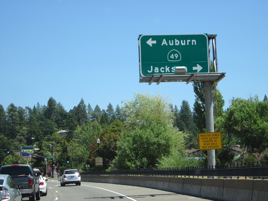
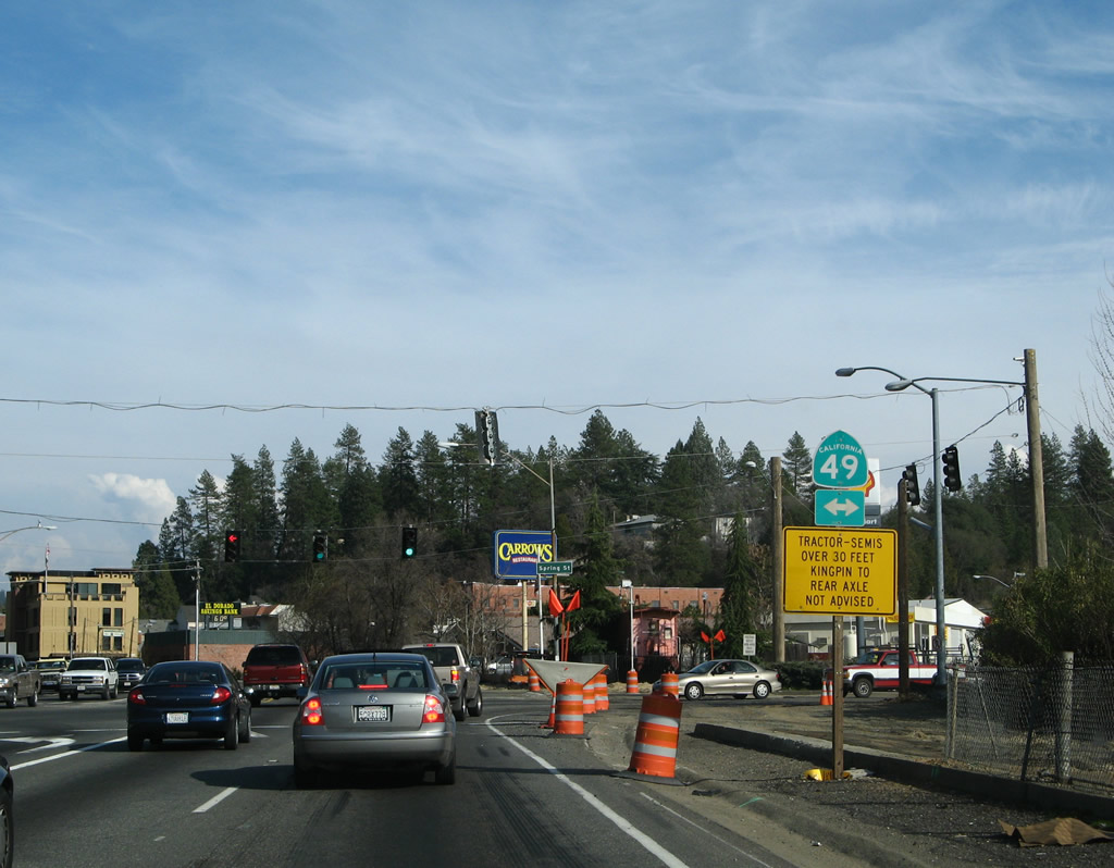
The next intersection along U.S. 50 east is with California 49 (Spring Street) (Gold Country Highway). U.S. 50 was improved as a result of the construction project, including a new overhead sign. Note the change in destinations listed on the old and new signs. Photos taken 07/28/12 and 07/08/07. |
|
California 49 is a major north-south state route that passes through the foothills of the Sierra Nevada. The highway is known as the Gold Country Highway since it connects many of the historic mining towns along the foothills. Turn left for California 49 north to Auburn or right for California 49 south to Jackson and Sonora. Photo taken 07/08/07. |
|
|
Eastbound U.S. 50 meets California 49 (Spring Street) at this traffic signal. A ground-mounted California 49 shield was replaced with a trailblazer sign to Coloma, the Marshall Gold Discovery Site State Historic Park, and Sutter's Mill. Photos taken 07/28/12 and 02/17/07. |
|
|
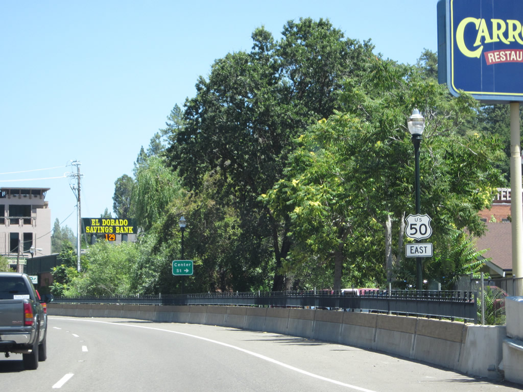
Turn right (south) on Spring Street to downtown Placerville. Continue straight ahead on U.S. 50 to Pollock Pines and South Lake Tahoe. Photo taken 02/17/07. |
|
|
|
|
|
| Immediately after the California 49 (Spring Street) intersection, we find this U.S. 50 east reassurance shield. The following intersection is not signalized, but it connects U.S. 50 east with Center Street south. U.S. 50 will stay to the north of downtown Placerville, skirting the edge of the historic city center. The road was built as a bypass of downtown, but with limited real estate, the highway is squeezed between downtown and a hill. Converting this road to a freeway would not only be costly but would make significant impact to the historic downtown and nearby terrain. Streetscape and safety improvements by 2012 made for a nicer passage along this busy segment of U.S. 50. Photos taken 07/28/12, 07/08/07, and 02/17/07. |
|
|
|
|
|
|
|
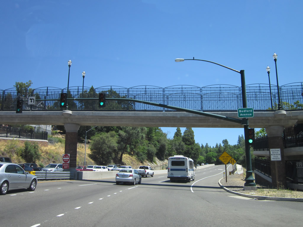
The third and final traffic signal along U.S. 50 east in downtown Placerville is with Bedford Avenue. Turn right here for tourist information. Photos taken 07/28/12 and 02/17/07. |
|
|
Use Bedford Avenue north to Hangtown's Gold Bug Park and south to Old Dry Diggins Old Hangtown. Photos taken 07/28/12 and 02/17/07. |
|
|
Eastbound U.S. 50 meets Bedford Avenue at this traffic signal. Intersection improvements included sidewalks, new traffic signal mast arms, and a pedestrian overpass. Photos taken 07/28/12 and 02/17/07. |
|
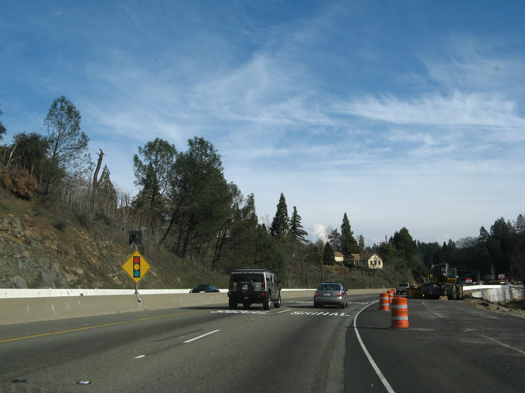
After Bedford Avenue, U.S. 50 again becomes a freeway. It initially has a narrow concrete barrier (K rail) serving as the median, but it will eventually widen out. Traffic frequently delays in both directions through here due to the three traffic signals. Not much changed here by 2012. Photo taken 02/17/07. |
|
The next exit along U.S. 50 (El Dorado Freeway) is Exit 47, Broadway (next right). This section of freeway was built in 1961. Photo taken 07/08/07. |
|
|
Eastbound U.S. 50 (El Dorado Freeway) reaches Exit 47, Broadway. Construction resulted in the removal of old-style bridge railing that dates to the mid-1950s. Photos taken 02/17/07 and 07/08/07. |
|
Over the next ten miles, U.S. 50 passes through the Apple Hill area, which is known for its farms, orchards, wineries, antique stores, and craft markets. This is a popular weekend destination for families visiting from Sacramento, especially in the fall harvest months. Photo taken 02/17/07. |
|
The next exit along U.S. 50 east is Exit 48, Schnell School Road (one-quarter mile). Photo taken 02/17/07. |
|
U.S. 50 passes under Lucky Street (bridge built in 1961). Photo taken 07/08/07. |
|
Eastbound U.S. 50 reaches Exit 48, Schnell School Road. Photo taken 07/08/07. |
|
The next exit along U.S. 50 east is Exit 49, Point View Drive (one mile). Photo taken 07/08/07. |
|
This reassurance shield for U.S. 50 east is posted after the on-ramp from Schnell School Road. Photo taken 07/08/07. |
|
Twelve miles ahead, the truck route designation for U.S. 50 will end. U.S. 50, which travels over Echo Pass along a winding and curving route, may not be the best route for through trucks. Photo taken 07/08/07. |
|
Use Exit 49 for Smith Flat, Newtown Road, and Point View Drive. Photo taken 07/08/07. |
|
Eastbound U.S. 50 reaches Exit 49, Point View Drive. Photo taken 07/08/07. |
|
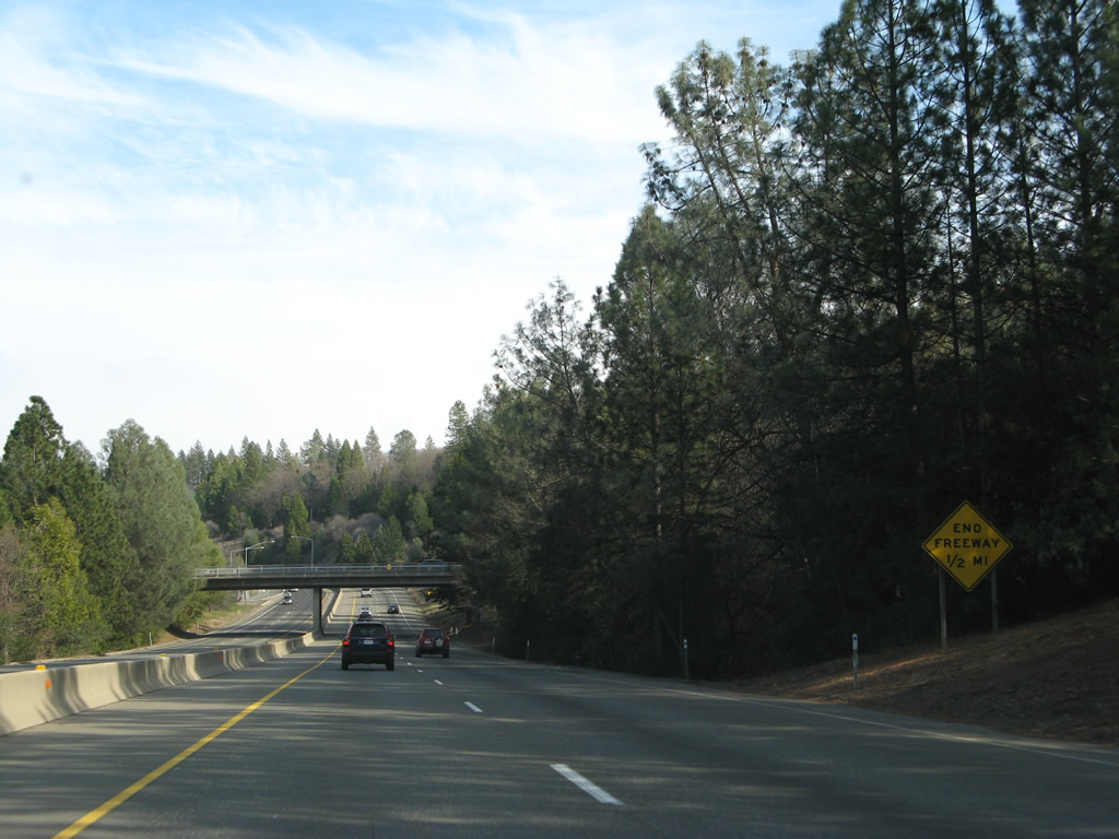
The U.S. 50 freeway again ends after Exit 49, but it remains an expressway with four lanes. Photo taken 07/08/07. |
|
A U.S. 50 east reassurance shield is posted shortly thereafter. Photo taken 07/08/07. |
|
|
This mileage sign provides the distance to Pollock Pines (eight miles), Kyburz (27 miles), and South Lake Tahoe (57 miles). Photos taken 07/28/12 and 07/08/07. |
|
An end freeway sign precdes the U.S. 50 eastbound transition to an at-grade highway. Photo taken 07/28/12. |
|
El Dorado Trail crosses over U.S. 50 on this pedestrian bridge built in 2000. Photo taken 02/17/07. |
|
The next right turn connects U.S. 50 east to Parkway Drive east. Photo taken 07/08/07. |
|
Eastbound U.S. 50 approaches Still Meadows Road (next right) in Apple Hill. Photo taken 07/08/07. |
|
Watch for cross traffic over the next two miles. Photo taken 02/17/07. |
|
Eastbound U.S. 50 approaches Five Mile Road and Paul Bunyan Road. Photo taken 07/28/12. |
|
Cross traffic is possible for the next mile (between Five Mile Road and Camino Heights Road). Photo taken 07/28/12. |
|
The next right turn connects U.S. 50 with Camino Heights Road. Photo taken 07/08/07. |
|
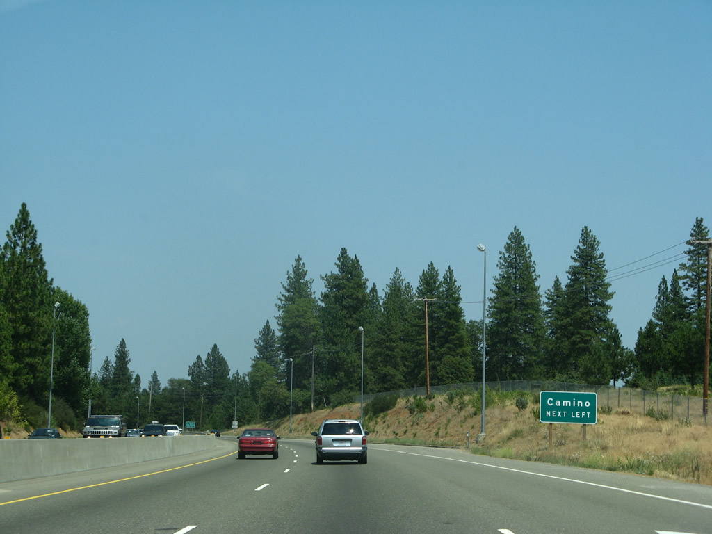
Carson Road is the next left; this old alignment of U.S. 50 features some of the orchards, vineyards, and shops of Apple Hill. Photo taken 07/08/07. |
|
Eastbound U.S. 50 meets Carson Road in Apple Hill. Photo taken 07/08/07. |
|
|
|
The next left connects U.S. 50 with Apple Hill Drive and Camino. This is the last at-grade intersection before U.S. 50 again becomes a freeway. Photos taken 07/08/07. |
|
Eastbound U.S. 50 meets Apple Hill Drive and Camino at this intersection. A center median barrier comes into play as U.S. 50 resumes (briefly) its freeway status. Photo taken 07/28/12. |
|
This U.S. 50 east reassurance shield is posted after the Camino turnoff. Ahead, U.S. 50 resumes its freeway configuration. Photo taken 07/08/07. |
|
U.S. 50 reaches 3,000 feet. Photo taken 07/28/12. |
|
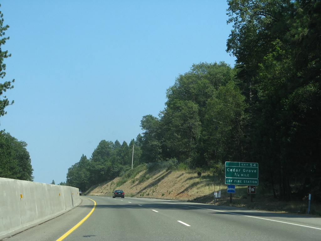
The next exit along U.S. 50 east is Exit 54, Carson Road (Old U.S. 50) to Cedar Grove (0.75 mile). Photo taken 07/08/07. |
|
Prior to Exit 54, a few driveways and other local access points line U.S. 50 (note the opening to the right in this photo). Photo taken 07/08/07. |
|
Eastbound U.S. 50 meets Seven Ridges Road, then resumes as a freeway with limited access. Photo taken 07/08/07. |
|
Shortly thereafter, eastbound U.S. 50 (El Dorado Freeway) reaches Exit 54, Carson Road (Old U.S. 50) to Cedar Grove. Photo taken 07/08/07. |
|
This U.S. 50 east reassurance shield is posted after the Carson Road interchange in Cedar Grove. A scenic route marker is posted along with the U.S. 50 route marker. Photo taken 07/08/07. |
|
U.S. 50 proceeds east toward Pollock Pines in the Sierra Nevada foothills. Photo taken 07/08/07. |
|
With all the elevation gain since leaving El Dorado Hills, U.S. 50 is now in snow country. Winter restrictions may be in place during storm events, and snow removal equipment including plows may be found on the highway during winter months. Photo taken 07/28/12. |
|
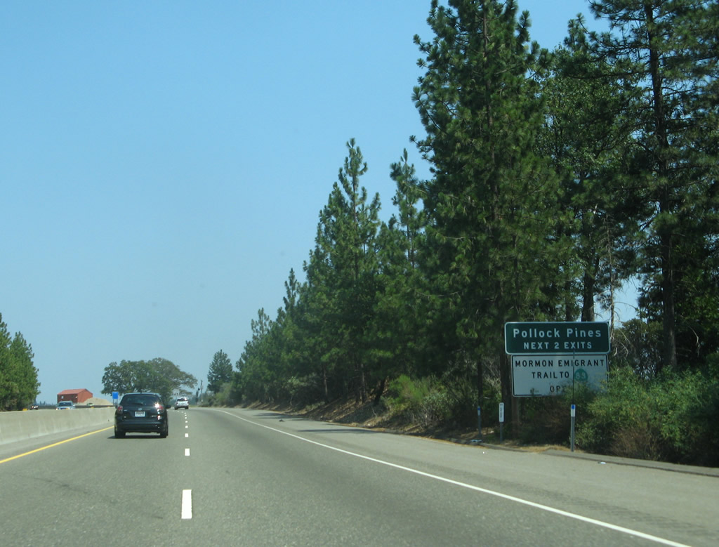
The next two exits along U.S. 50 east serve the unincorporated community of Pollock Pines: Exit 57, Ridgeway Drive and Pony Express Trail and Exit 60, El Dorado County E-16 (Sly Park Road) and U.S. 50 Alternate/Mormon Emigrant Trail east to Carson Pass. Photo taken 07/08/07. |
|
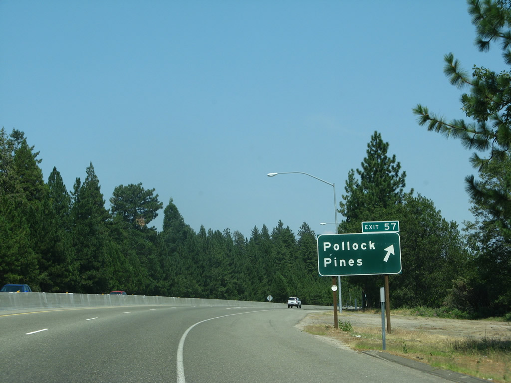
The next exit along U.S. 50 east is Exit 57, Ridgeway Drive and Pony Express Trail (0.75 mile). Photo taken 07/08/07. |
|
The unincorporated community of Pollock Pines had a population of 4,728 people as of the 2000 Census and sits at elevation of 3,980 feet. Photo taken 07/08/07. |
|
Eastbound U.S. 50 reaches Exit 57, Ridgeway Drive to Pony Express Trail, which is Historic U.S. 50. The old road stays north of the freeway along this stretch. Photo taken 07/08/07. |
|
The interchange between U.S. 50 and Ridgeway Drive is a diamond interchange. With a tall tree canopy, the interchange is covered in foliage. Photo taken 07/28/12. |
Page Updated August 25, 2012.