
U.S. 50 West - El Dorado Hills to Sacramento
| U.S. 50 west | |
|---|---|
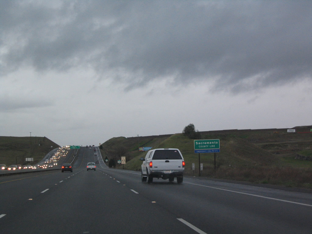 |
U.S. 50 leaves El Dorado County and enters Sacramento County (population was 1,418,788 as of the 2010 Census). The next interchange is Exit 27, East Bidwell Street (Old U.S. 50) northwest to Folsom and Scott Road south to White Rock, although a future interchange (Exit 26) is planned at Empire Ranch Road just west of the county line (part of the Folsom South project).1 Photo taken 12/28/04. |
 |
The next exit along U.S. 50 (El Dorado Freeway) west is Exit 27, East Bidwell Street (Old U.S. 50) northwest to Folsom and Scott Road south to White Rock. Historically, U.S. 50 used to directly serve Folsom by following East Bidwell Street and Riley Street into downtown Folsom (Old Folsom), turning onto Sutter Street and continuing west out of Old Folsom via Folsom Boulevard. Photo taken 12/28/04. |
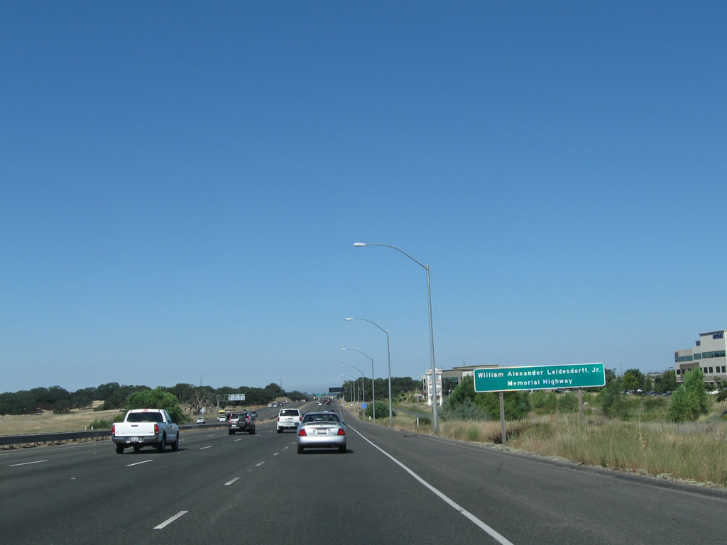 |
Leaving the East Bidwell Street and Scott Road interchange, U.S. 50 becomes designated as the William Alexander Leidesdorff, Jr. Memorial Highway. Photo taken 08/02/11. |
 |
A U.S. 50 reassurance shield is posted shortly after the on-ramp from East Bidwell Street and Scott Road. Photo taken 08/02/11. |
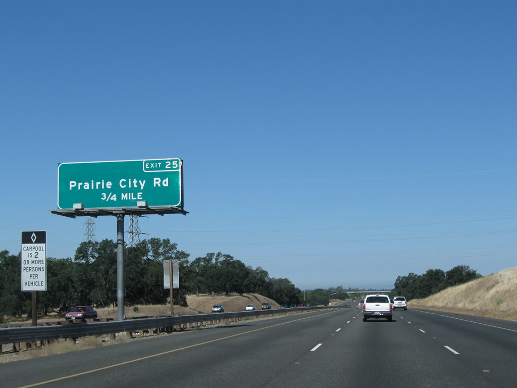 |
The next exit along U.S. 50 (El Dorado Freeway) is Exit 25, Prairie City Road (0.75 mile). Photo taken 08/02/11. |
 |
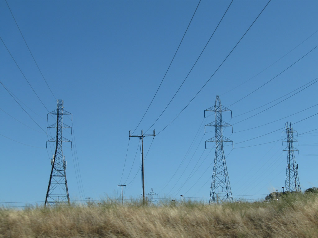 |
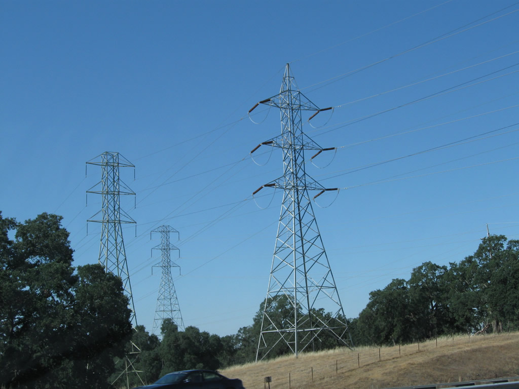
A set of Sacramento Municipal Utility District (SMUD) and Pacific Gas & Electric (PG&E) power lines pass above U.S. 50. These lines interconnect the hydroelectric power generation facility at Folsom Dam, a power substation just north of U.S. 50, and a power substation located southeast of sacramento near the intersection of Elder Creek Road and Hedge Avenue. There are plans to eventually construct an Exit 24 for Oak Avenue Parkway near the point where these power lines cross over the freeway, although the interchange has not been constructed. This interchange would serve a large development planned south of U.S. 50 between the freeway and White Rock Road.1 Photos taken 08/02/11. |
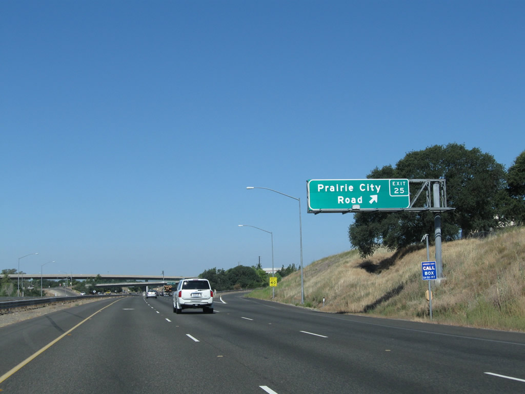 |
Westbound U.S. 50 (El Dorado Freeway) meets Exit 25, Prairie City Road. Use Prairie City Road north into the city of Folsom ("Distinctive by Nature"). Folsom had a population of 72,203 as of the 2010 Census and sits at an elevation of 220 feet. This is significantly lower than Placerville, and much of the elevation loss came as U.S. 50 descended between Cameron Park and El Dorado Hills in El Dorado County. Although being founded and settled in the 1840s, Folsom incorporated as a city on April 20, 1946. A major annexation is planned south of U.S. 50 that would bring a new development (Folsom South) into the city of Folsom.1 U.S. 50 currently serves as the southern boundary of the city of Folsom until when and if that annexation occurs. Photo taken 08/02/11. |
 |
The interchange between U.S. 50 and Prairie City Road includes a flyover ramp that connects northbound Prairie City Road with U.S. 50 east and a loop ramp from northbound Prairie City Road to U.S. 50 west. Photo taken 08/02/11. |
 |
The next two exits along U.S. 50 (El Dorado Freeway) are Exit 23, Folsom Boulevard (Historic U.S. 50) and Exit 21, Hazel Avenue. Photo taken 08/02/11. |
 |
This view looks west along U.S. 50 (El Dorado Freeway) between Exit 25, Prairie City Road and Exit 23, Folsom Boulevard. The left lane can be restricted during commuting hours to high occupancy vehicle (HOV/carpool) traffic. Photo taken 08/02/11. |
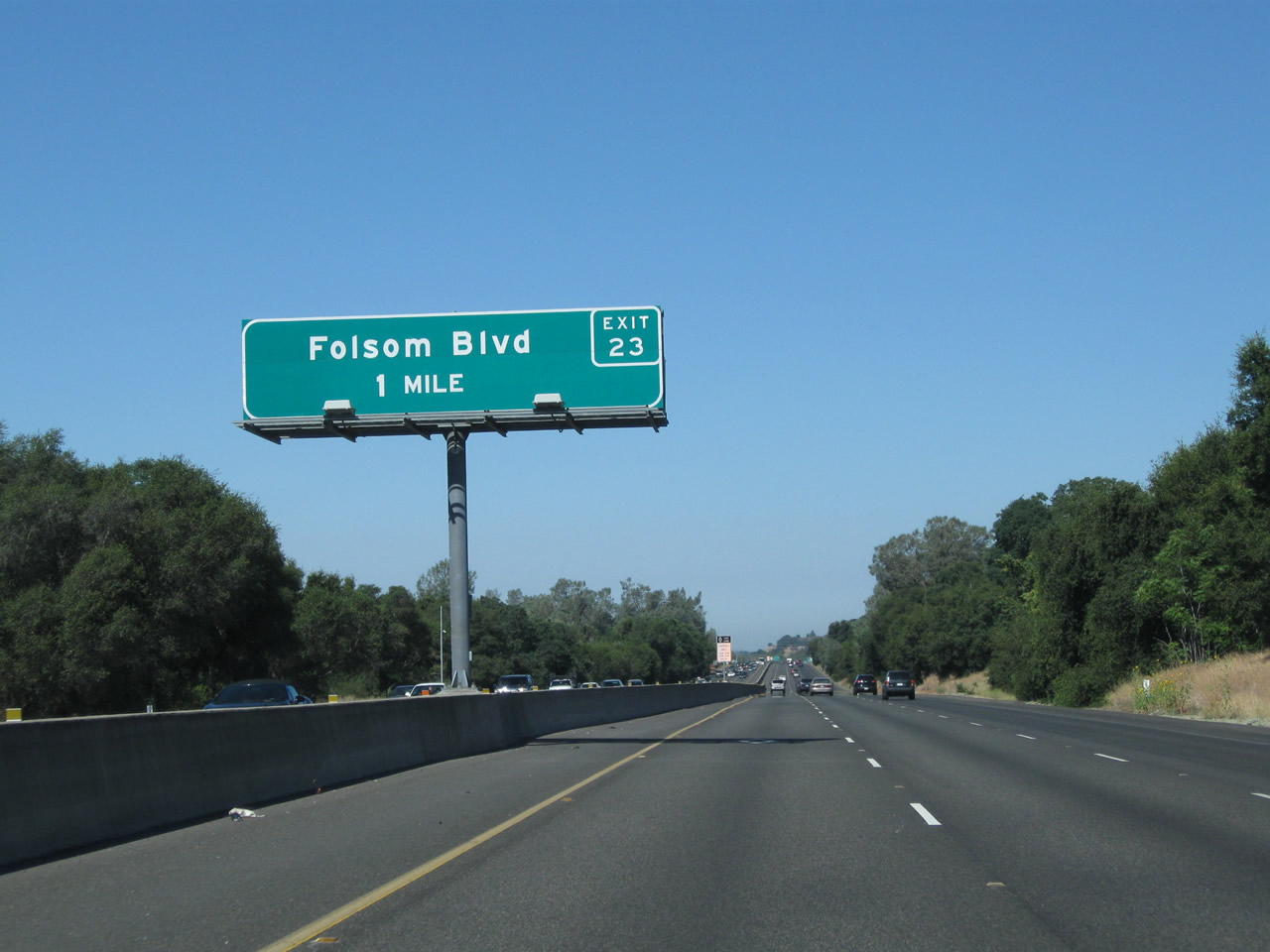 |
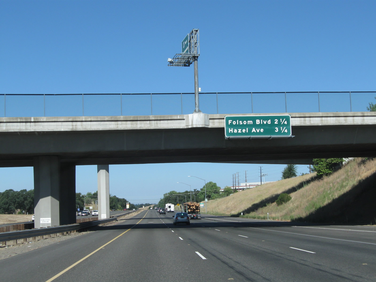
The next exit along U.S. 50 (El Dorado Freeway) west is Exit 23, Folsom Boulevard (Historic U.S. 50), one mile. Folsom Boulevard travels northeast into Old Folsom and west to Nimbus. Since there is no access from U.S. 50 west to Aerojet Drive south (Exit 22), use Exit 23 (Folsom Boulevard to the Aerojet Drive signalized intersection. Photo taken 08/02/11. |
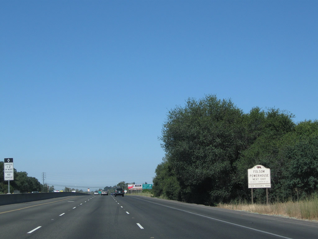 |
Use Folsom Boulevard east to the Folsom Powerhouse State Historic Park, which features a power generation facility built in 1895 that harnessed the power of the American River as it cascaded through Folsom on its way to its rendezvous with the Sacramento River in the city of Sacramento. Water was diverted from the river into a canal that passed through hydroelectric turbines to generate electricity, which in turn was transmitted downstream via power line to Sacramento. Although this facility no longer generates power, visitors can see the original powerhouse with its turbines used to generate electricity. Photo taken 08/02/11. |
 |
A tourist information center is located just north of the freeway at the Folsom Premium Outlets. This interchange is a half-cloverleaf, so exiting traffic will loop to a traffic signal with Folsom Boulevard. Turn left for Folsom Boulevard east to Old Folsom, the outlet mall, and the Folsom Powerhouse. Turn right for Folsom Bouelvard west to Nimbus and Aerojet Drive. Light rail parallels Folsom Boulevard, with a station at the outlet mall. Photo taken 08/02/11. |
 |
The left lane remains restricted to high occupancy vehicles (carpools) during commuting hours Monday through Friday. Photo taken 08/02/11. |
 |
Westbound U.S. 50 (El Dorado Freeway) meets Exit 23, Folsom Boulevard (Historic U.S. 50) east to Old Folsom and west to Nimbus and Aerojet Drive. Photo taken 08/02/11. |
 |
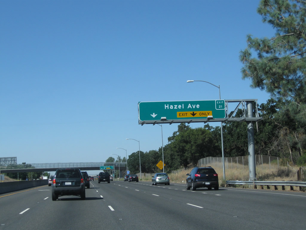
The next exit along U.S. 50 (El Dorado Freeway) west is Exit 21, Hazel Avenue (one mile). Photo taken 08/02/11. |
 |
This view looks west along U.S. 50 between the Folsom Boulevard and Hazel Avenue interchanges. Photo taken 08/02/11. |
 |
A U.S. 50 west reassurance shield is posted after the on-ramp from Folsom Boulevard and prior to Exit 21, Hazel Avenue. The lane striping here has changed, as the right lane no longer becomes exit only for Hazel Avenue (see changes in next two pictures). Photo taken 04/03/05. |
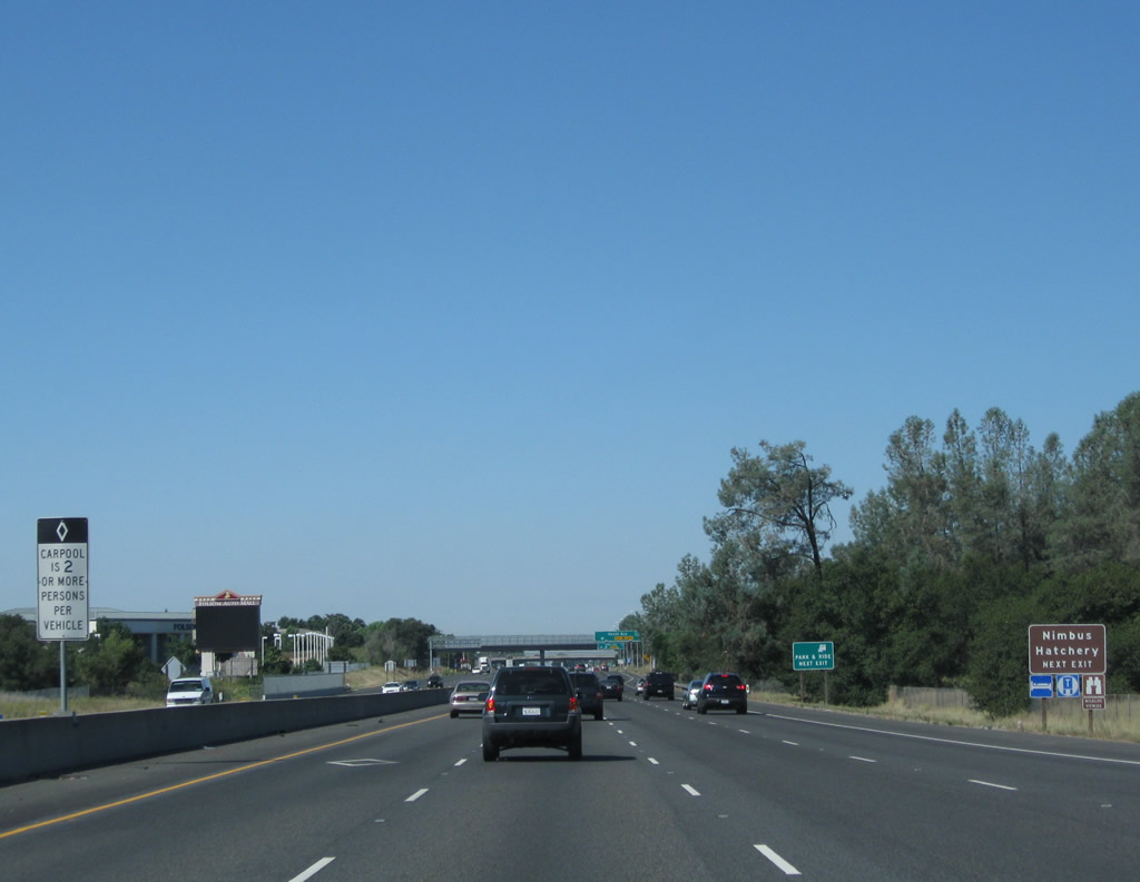 |
Use Hazel Avenue north to the Nimbus Fish Hatchery (operated by the California Department of Fish and Game). This facility is located along the American River, which parallels U.S. 50 just north of the freeway. Photo taken 08/02/11. |
 |
 |
The right two lanes of U.S. 50 (El Dorado Freeway) west connect to Exit 21, Hazel Avenue. A major north-south arterial in eastern Sacramento County, Hazel Avenue travels north to Gold River and Orangevale, then becomes Sierra College Boulevard via Woodbridge Ranch en route to Rocklin and Loomis. This configuration changed when the carpool lane opened; compare the 2005 and 2011 pictures. Photos taken 08/02/11 and 04/03/05. |
 |
 |
Westbound U.S. 50 (El Dorado Freeway) meets Exit 21, Hazel Avenue. To the south, Hazel Avenue travels into Nimbus, connecting to old U.S. 50 (Folsom Boulevard) on the south side of the freeway. Photos taken 08/02/11 and 04/03/05. |
 |
This mileage sign along U.S. 50 west provides the distance to the next three exits: Exit 18, Sacramento County E-2 (Sunrise Boulevard); Exit 17, Zinfandel Drive; and Exit 15, Mather Field Road. Photo taken 08/02/11. |
 |
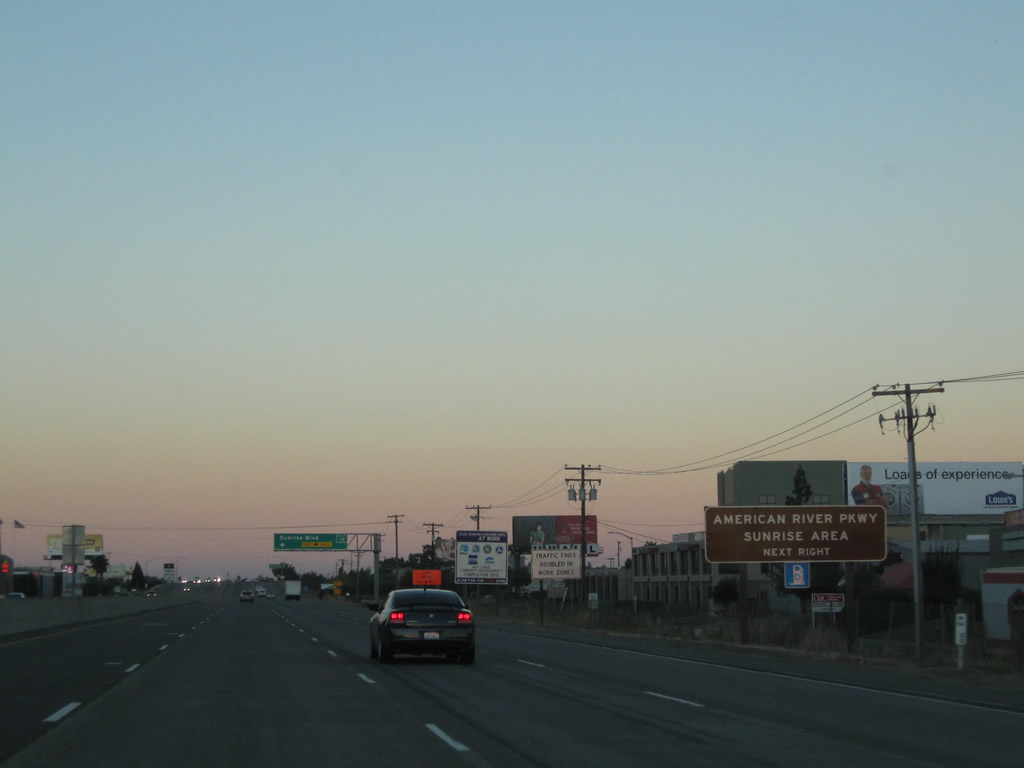
The next exit along U.S. 50 west is Exit 18, Sacramento County E-2 (Sunrise Boulevard) (one mile). Sacramento County E-2 begins at California 99 Exit 284 in Elk Grove, then follows Grant Line Road northeast to Sunrise Boulevard. E-2 then follows Sunrise Boulevard to Anatolia, White Rock, Zinfandel, Fair Oaks, Citrus Heights, and Roseville. Photo taken 08/02/11. |
 |
U.S. 50 enters the city of Rancho Cordova ("City Life. Reinvented."). Rancho Cordova had a population of 64,776 as of the 2010 Census and incorporated on July 4, 2003. In addition to serving as a suburb of Sacramento, Rancho Cordova also has an active employment center. Photo taken 08/02/11. |
 |
Since Sacramento County E-2 (Sunrise Boulevard) is one of a few north-south corridors that cross the American River, it is a major through route. It also connects to the American River Parkway, a continuous greenway along the river between Rancho Cordova and Folsom. This area features hiking, picnicking, and other recreational activities along the river. Photo taken 09/04/10. |
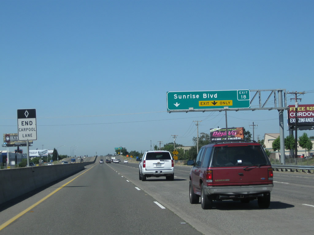 |
The right two lanes of U.S. 50 west connect to Exit 18, Sacramento County E-2 (Sunrise Boulevard). For a time in the early 1970s, E-2 south of this interchange was signed as California 65, but the route was relinquished when freeway plans to connect the section of California 65 north of Interstate 80 with U.S. 50 were eliminated. On the base of the pillars visible from U.S. 50 is a marking saying that the Sunrise Boulevard overpass is the "50-65 Separation" structure. Photo taken 08/02/11. |
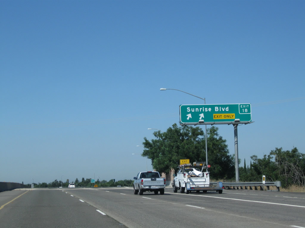 |
Westbound U.S. 50 (El Dorado Freeway) reaches Exit 18, Sacramento County E-2 (Sunrise Boulevard). The northbound county route passes through a variety of suburban areas between the American River crossing and Interstate 80 near the Douglas Boulevard exit near Citrus Heights and Roseville. E-2 ends at Interstate 80. After this interchange, Folsom Boulevard (Old U.S. 50) shifts from the south side of the freeway to the north side of the freeway. Photo taken 08/02/11. |
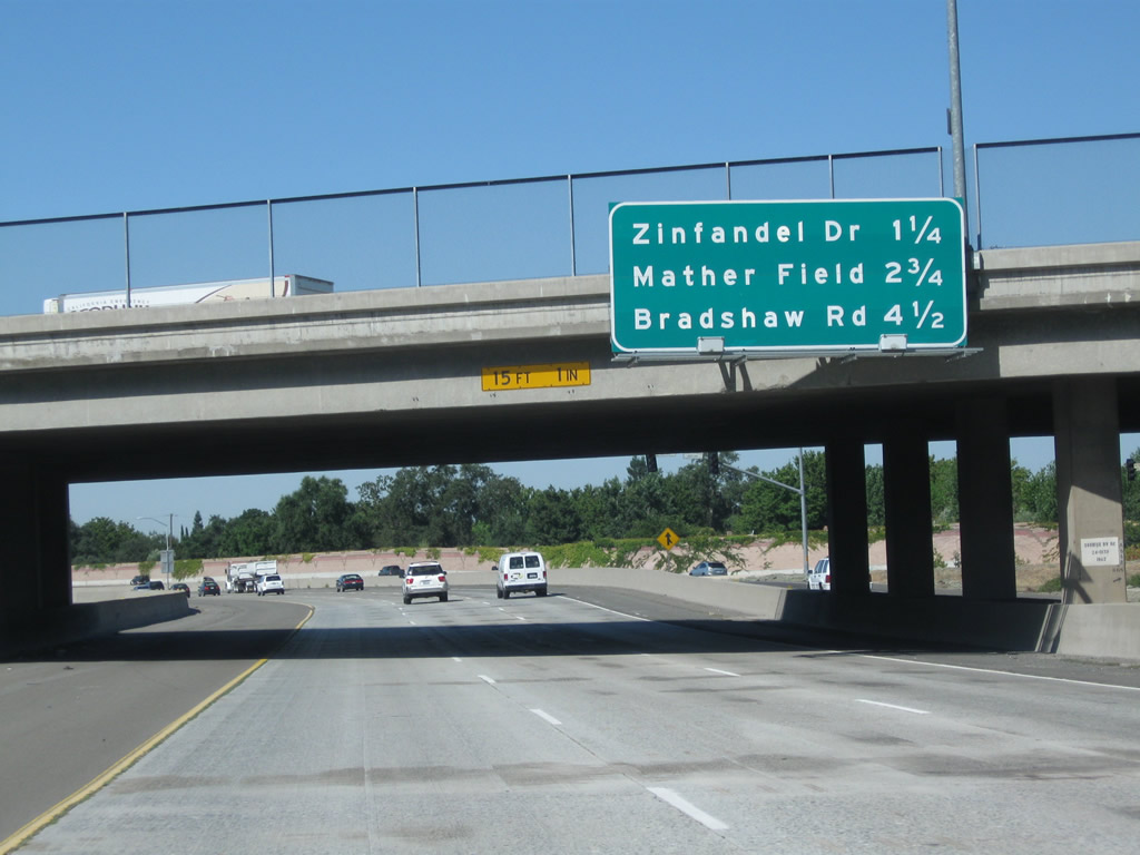 |
This mileage sign along U.S. 50 west provides the distance to the next several exits: Exit 17, Zinfandel Drive; Exit 15, Mather Field Road; and Exit 13, Bradshaw Road. Photo taken 08/02/11. |
 |
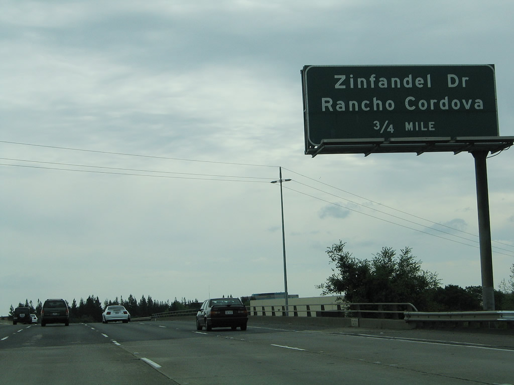 |
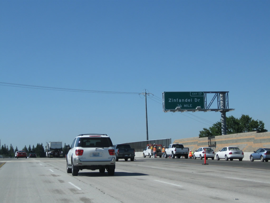
The next exit along U.S. 50 west is Exit 17, Zinfandel Drive (0.75 mile). Photos taken 08/02/11 and 04/03/05. | |
 |
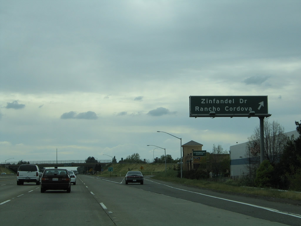 |
Westbound U.S. 50 (El Dorado Freeway) reaches Exit 17, Zinfandel Drive in Rancho Cordova. This sign was replaced as a result of the high occupancy vehicle (carpool) lane project in 2011. Photos taken 08/02/11 and 04/03/05. | |
 |
This mileage sign along westbound U.S. 50 shows the distance to Exit 15, Mather Field; Exit 13, Bradshaw Road; and Exit 11, Watt Avenue. Photo taken 08/02/11. | ||
 |
 |
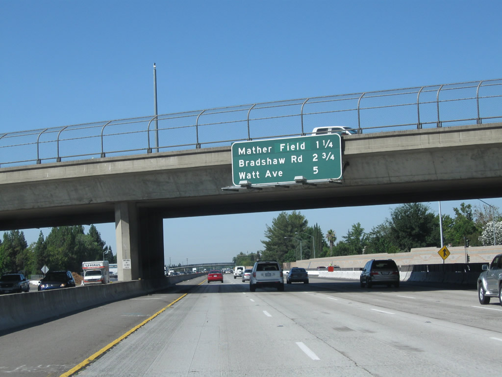
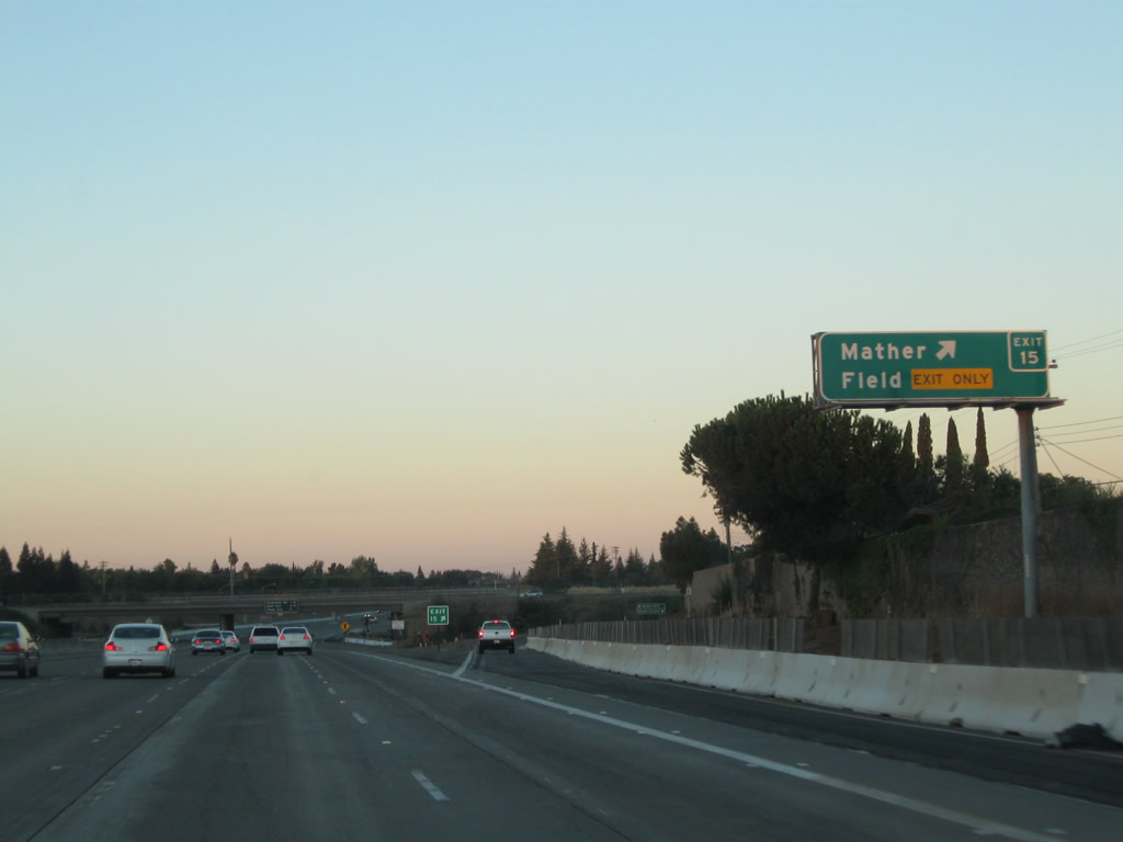
The next exit along U.S. 50 west is Exit 15, Mather Field Road (three-quarters of a mile). Mather Airport is located south of the freeway. Photos taken 08/02/11 and 04/03/05. | |
 |
Use Mather Field Road south to Mather Field Aiport (former Air Force Base) and Mather Regional Park. Photo taken 04/03/05. | ||
 |
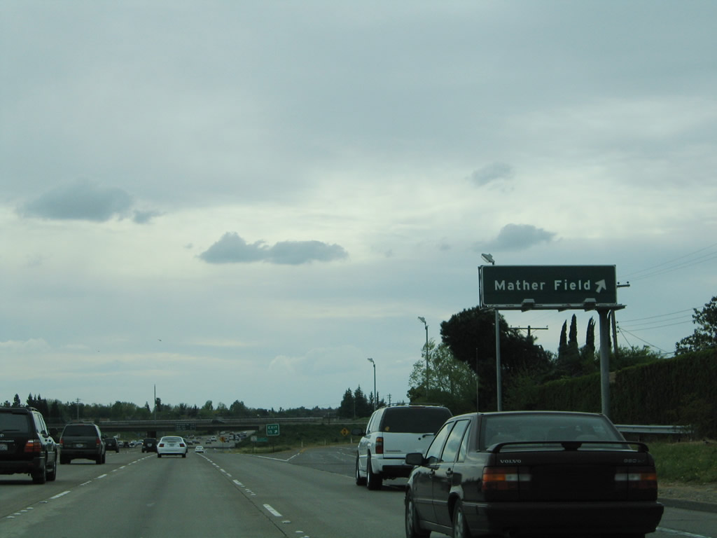 |
Westbound U.S. 50 (El Dorado Freeway) meets Exit 15, Mather Field Road. Take Mather Field Road north to a light rail station. The overhead guide sign changed as a result of the carpool lane construction in 2011. Photos taken 09/04/10 and 04/03/05. | |
 |
This mileage sign along westbound U.S. 50 shows the distance to Exit 13, Bradshaw Road; Exit 11, Watt Avenue; and Exit 9, California 16 (Jackson Road) east, Power Inn Road south, and Howe Avenue north. Photo taken 08/02/11. | ||
 |
This U.S. 50 west shield is posted after the on-ramp from Mather Field Road. Photo taken 08/02/11. | ||
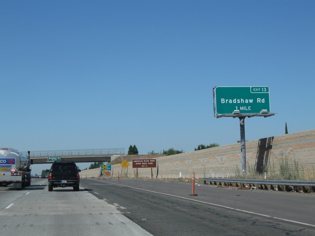 |
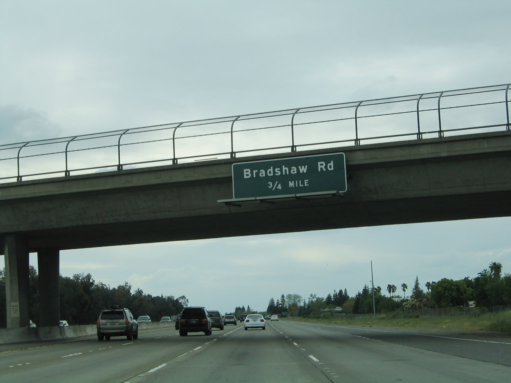
The next exit along U.S. 50 west is Exit 13, Bradshaw Road. This north-south arterial leads south to Rosemont and north to Folsom Boulevard (historic U.S. 50). Photo taken 08/02/11. | ||
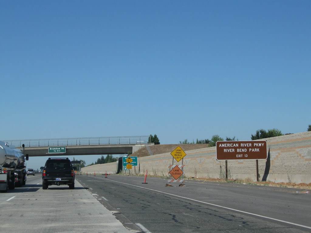 |
Use Bradshaw Road north to another access point to the American River Parkway at River Bend Park. Photo taken 08/02/11. | ||
 |
A Sacramento County government center is located south of U.S. 50 at the intersection of Bradshaw Road and Kiefer Boulevard, and a light rail station is located north of the freeway along Folsom Boulevard between Bradshaw Road and Mayhew Road. Photo taken 08/02/11. | ||
 |
An older overhead guide sign for Exit 13, Bradshaw Road (0.75 mile) was mounted on the Routier Road overpass. Photo taken 04/03/05. | ||
 |
Prior to the installation of the HOV lanes, the American River Parkway and Sacramento County government offices signs were posted a further down the freeway as shown here. Photo taken 04/03/05. | ||
 |
 |
The right two lanes of U.S. 50 (El Dorado Freeway) west will connect to Exit 13, Bradshaw Road. Photos taken 08/02/11 and 04/03/05. | |
 |
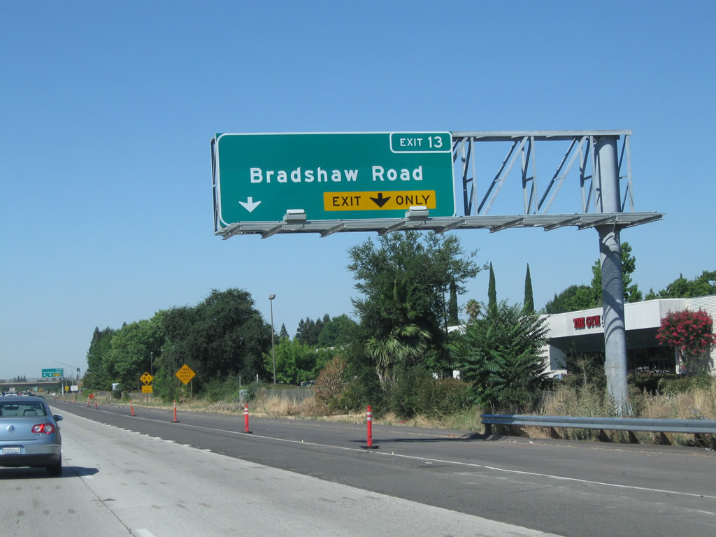
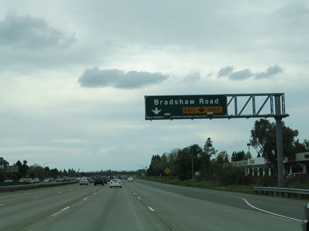
 |
Westbound U.S. 50 (El Dorado Freeway) meets Exit 13, Bradshaw Road. Photos taken 08/02/11 and 04/03/05. | |
 |
This U.S. 50 west shield is posted after the on-ramp from Bradshaw Road. Photo taken 08/02/11. | ||
 |
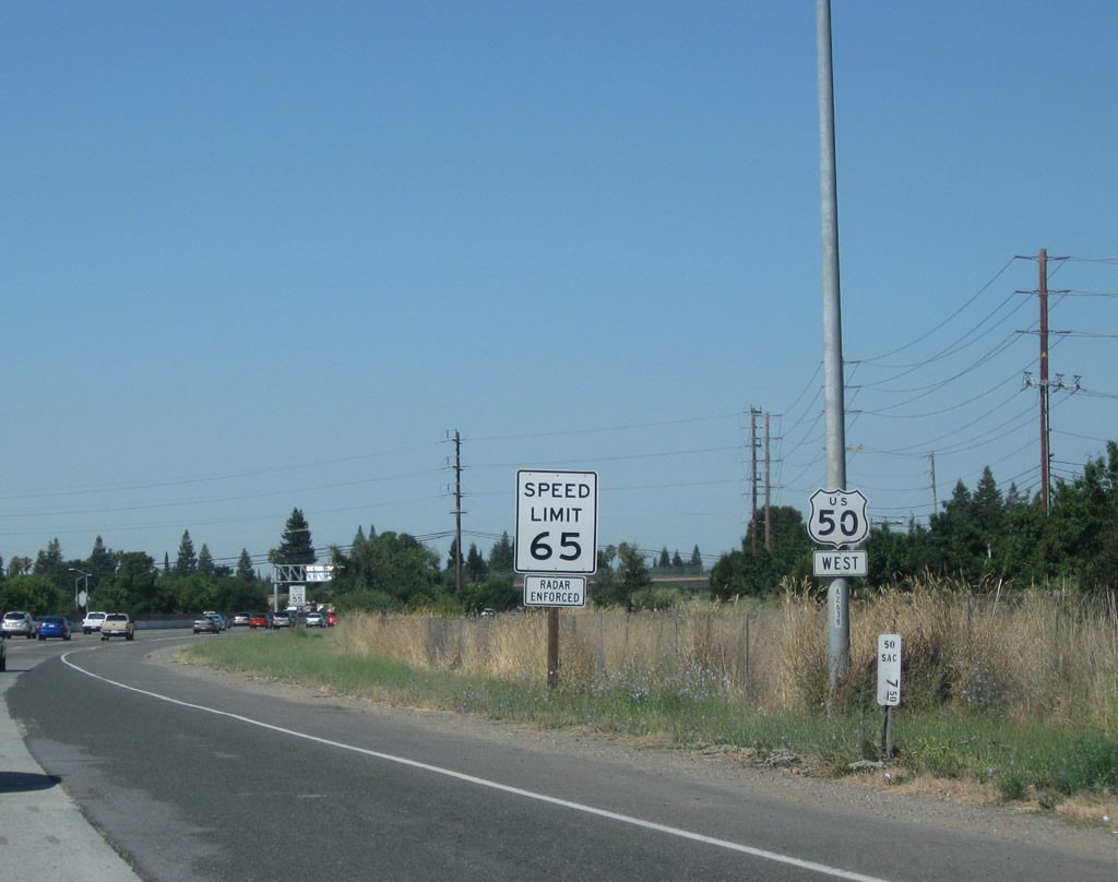
Use Watt Avenue north to the unincorporated community of Carmichael (population 61,762 as of the 2010 Census). This large suburb receives its services from the county of Sacramento and is not part of any incorporated city despite its large population. Photo taken 08/02/11. | ||
 |
 |
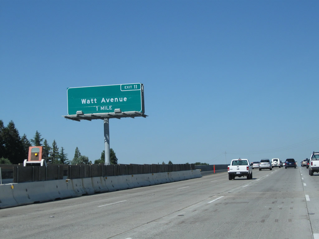
The next exit along U.S. 50 west is Exit 11, Watt Avenue (one mile). The overhead guide sign was replaced and relocated from the sign of the road and moved into the median. Photos taken 08/02/11 and 04/03/05. | |
 |
This mileage sign along U.S. 50 west provides the distance to the next several exits: Exit 11, Watt Avenue and Exit 9, Howe Avenue north and Power Inn Road south to California 16 (Jackson Road) east. Photo taken 08/02/11. | ||
 |
 |
The right two lanes of U.S. 50 west connect to Exit 11, Watt Avenue at the upcoming modified cloverleaf interchange. Use Watt Avenue north to Arden-Arcade, Carmichael, and North Highlands or south to Florin and Elk Grove. Photos taken 08/02/11 and 04/03/05. | |
 |
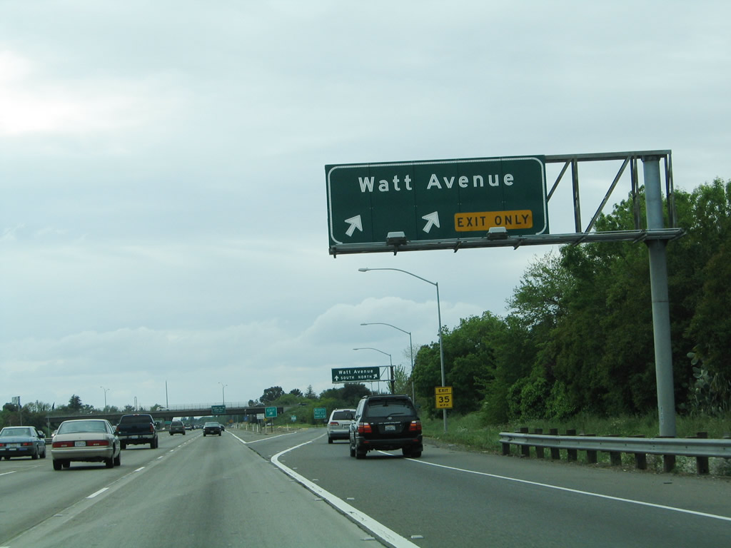 |
Westbound U.S. 50 reaches Exit 11, Watt Avenue. The permanent guide sign had not been installed by August 2011, although a new pedestrian bridge spanned the freeway. Photo taken 04/03/05. | |
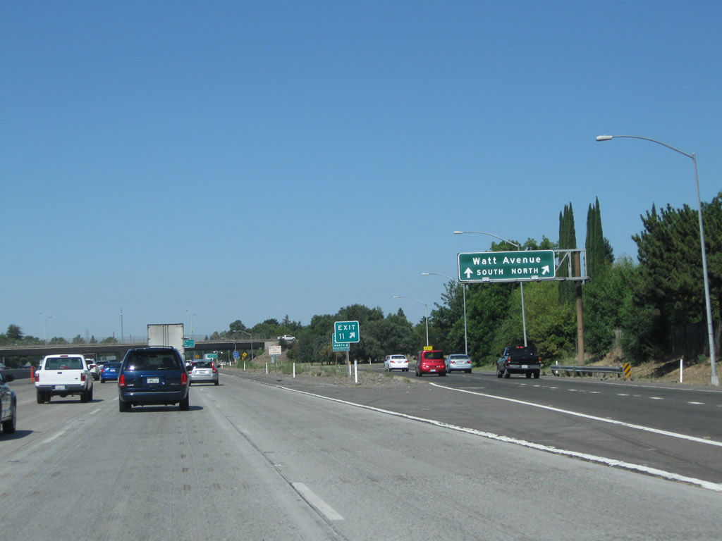 |
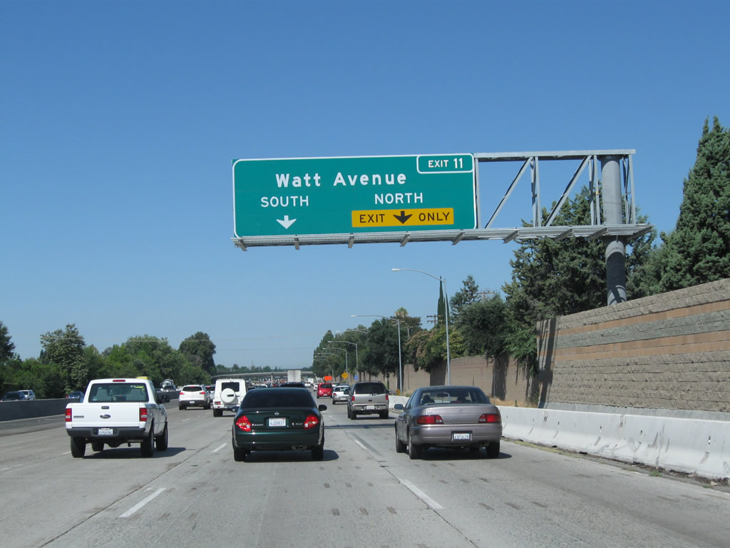
Upon exiting at Exit 11, the off-ramp will split between Watt Avenue north to Arden-Arcade, Carmichael, and North Highlands (first right) or south to Florin and Elk Grove (second right). Photo taken 08/02/11. | ||
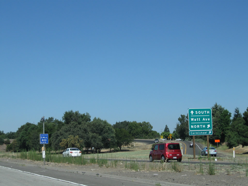 |
This sign is posted at the point where the off-ramp splits between Watt Avenue north and south in this modified cloverleaf interchange. Photo taken 08/02/11. | ||
 |
At the Watt Avenue interchange, U.S. 50 enters the city of Sacramento. Located at the confluence of the Sacramento and American Rivers in the Central Valley near the California Delta, Sacramento had a population of 466,488 as of the 2010 Census, which represents an increase from the 2000 city population of 407,018. Not counted in this total are the nearby suburban cities and unincorporated communities. Sitting at an elevation of 25 feet, Sacramento lays at the valley floor. It incorporated as a city on February 27, 1850. The centerpiece of downtown is the state capitol building, which lays at the end of Capitol Mall. The state capitol building was constructed between 1860 and 1874. This city limits sign used to be posted in the median but was relocated to this spot in 2010. Photo taken 08/02/11. | ||
 |
 |
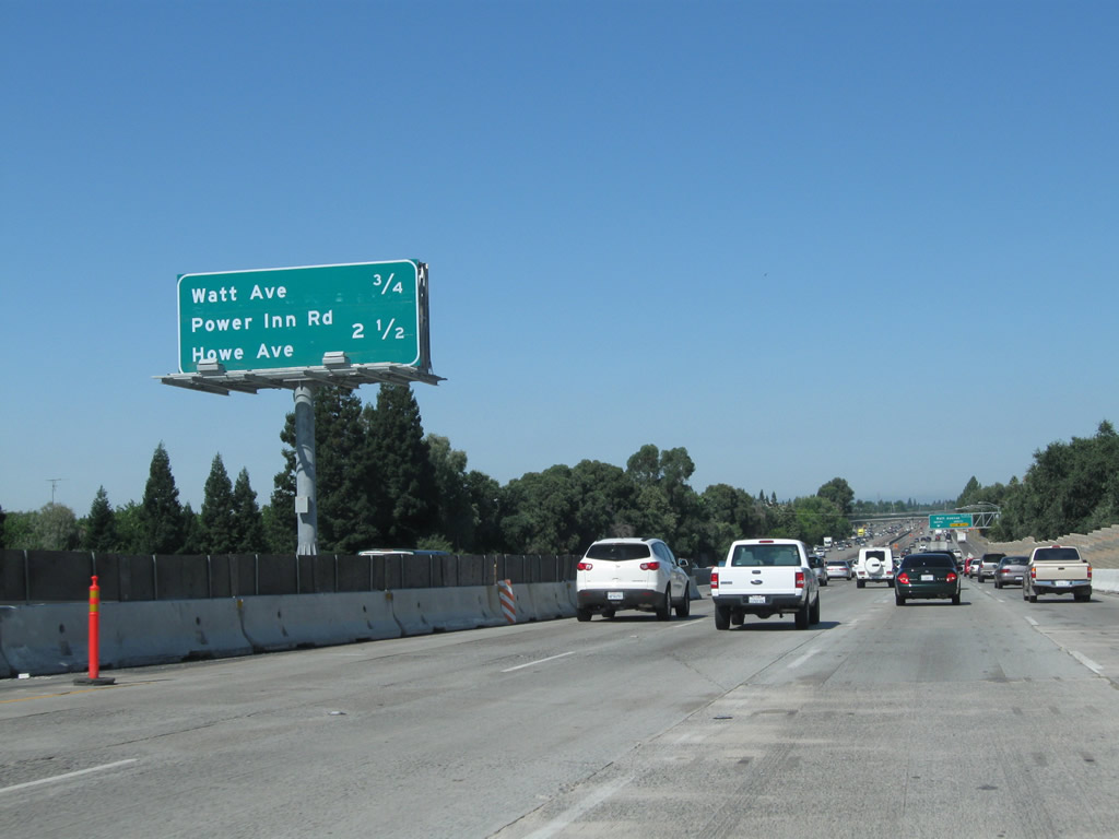
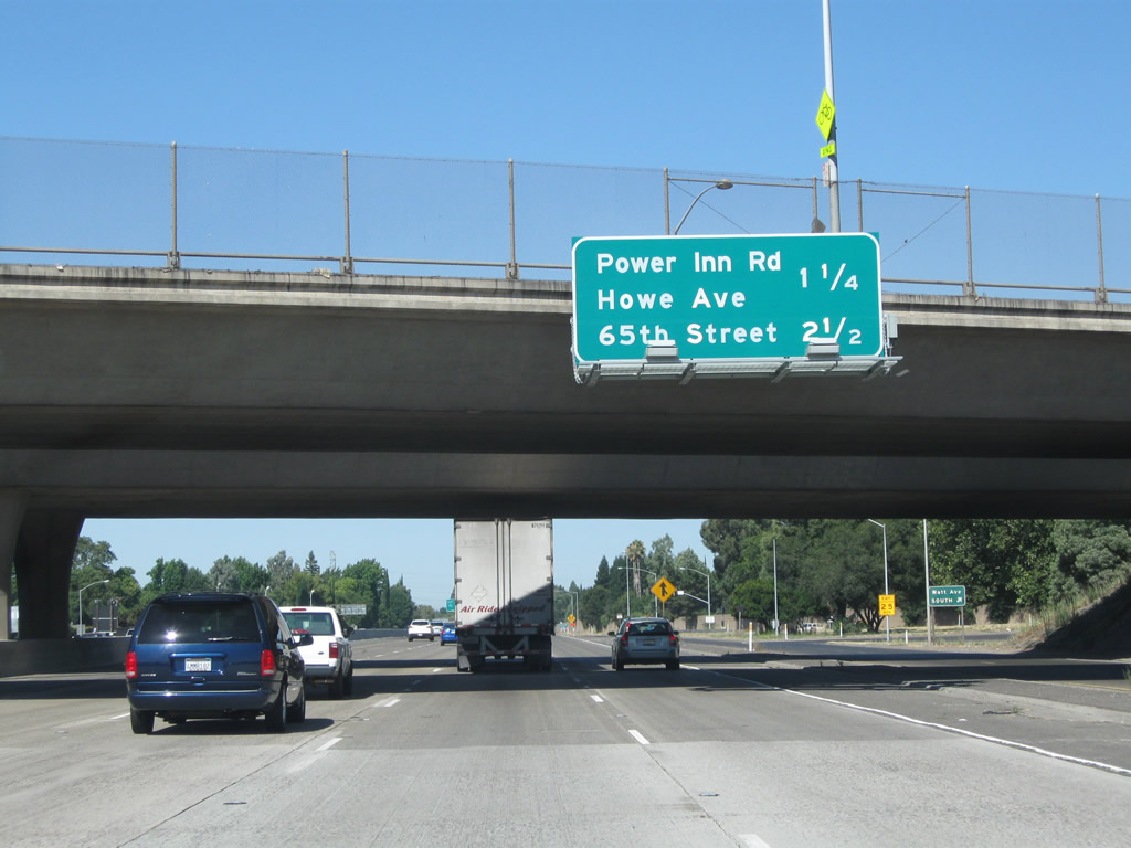
The next exit along U.S. 50 west is Exit 9, Power Inn Road south and Howe Avenue north (1.50 miles). To California 16 eastbound, take Power Inn Road south from Exit 9. This sign is mounted on the overpass for Watt Avenue. Photos taken 08/02/11 and 04/03/05. | |
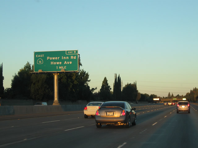 |
The next exit along U.S. 50 (El Dorado Freeway) west is Exit 9, Power Inn Road south and Howe Avenue north. Photo taken 09/04/10. | ||
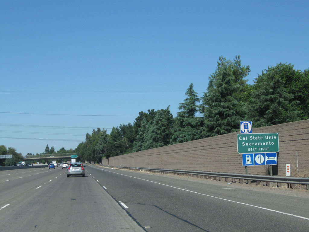 |
Use Exit 9 to California State University at Sacramento (Sacramento State). All motorist services (food, gas, lodging) are available at this interchange. Photo taken 08/02/11. | ||
 |
A set of Sacramento Municipal Utility District power lines cross over U.S. 50. Photo taken 08/02/11. | ||
 |
 |
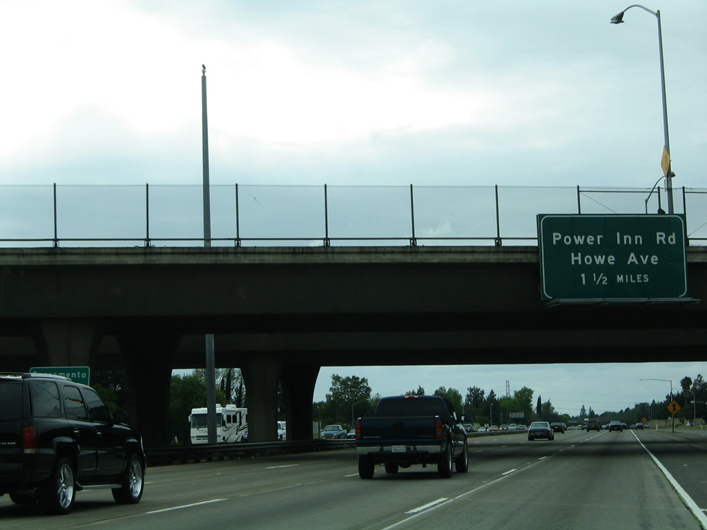
This interchange sequence sign along U.S. 50 west provides the distance to the next two exits: Exit 9, Power Inn Road south and Howe Avenue north with a connection to California 16 east and Exit 8, 65th Street. Power Inn Road leads south to meet California 99 near Exit 289 via Calvine Road, and Howe Avenue leads north toward Arden Fair Mall and Business Loop I-80 via Marconi Avenue and Arden Way. Photos taken 08/02/11 and 04/03/05. | |
 |
 |
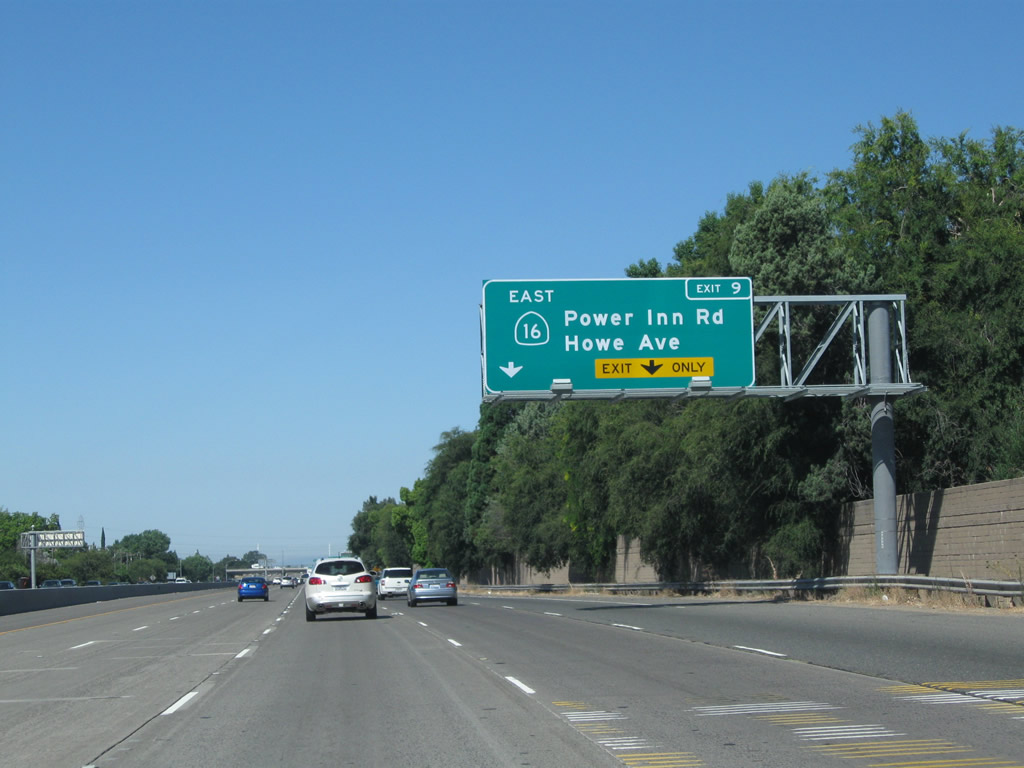
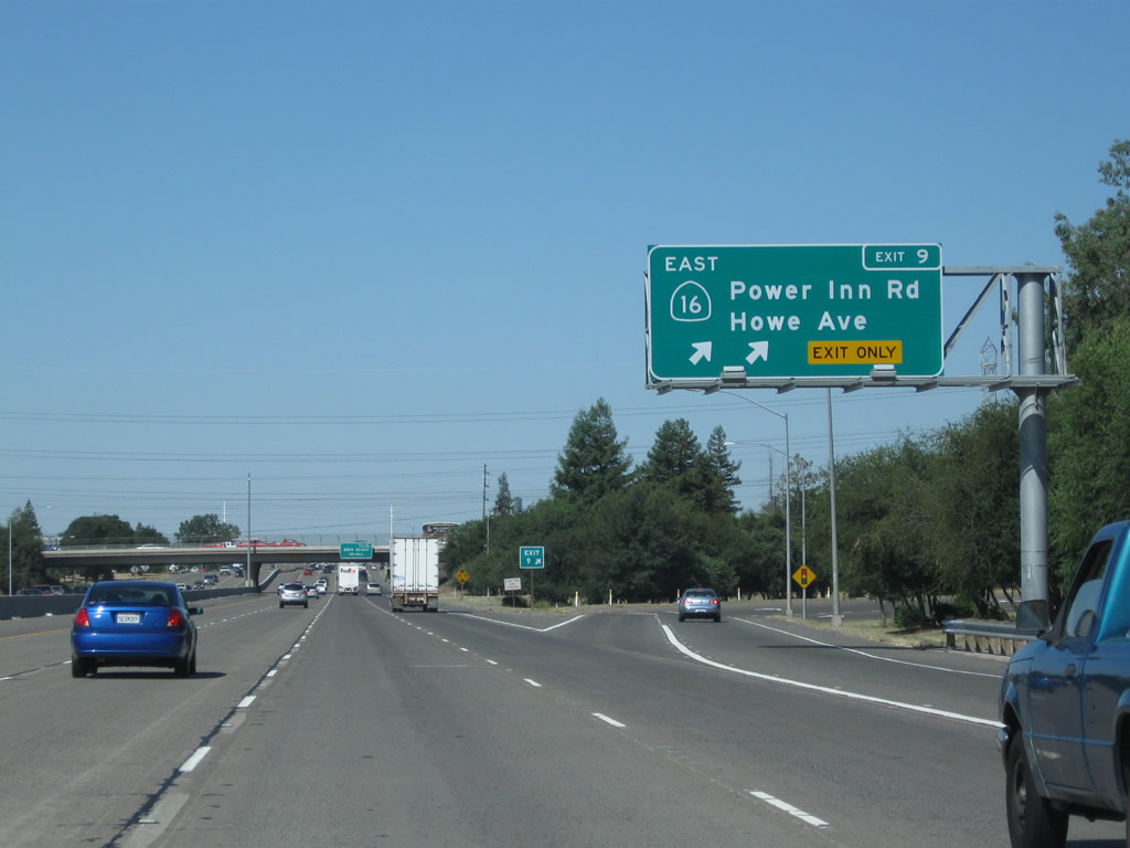
The right two lanes will connect to Exit 9, Howe Avenue north and Power Inn Road south. In the 2005 picture, note that no mention of California 16 was made. We suspect this was because it is a somewhat illogical connection to travel west along U.S. 50 and then shift onto California 16, which angles southeast toward Drytown and Jackson. The assumption is that no one headed west on U.S. 50 would want to turn around 300 degrees to go back to the foothills. California 16 is divided into two pieces: This segment between U.S. 50 and California 49, and a northeastern segment that connects Interstate 5 in Woodland with California 20 via Cache Creek. While California 16 used to have a signed route between here and Woodland, nowadays it is implied (but not signed) that through traffic on California 16 (a relatively minor route) use U.S. 50 west, Business 80 west, and Interstate 5 north to make the connection between the two segments. There are no signs that connect the two discontinuous segments of California 16. Photos taken 08/02/11 and 04/03/05. | |
 |
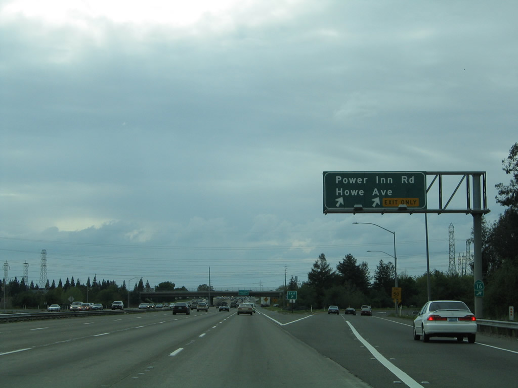 |
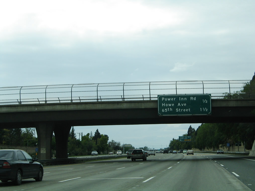
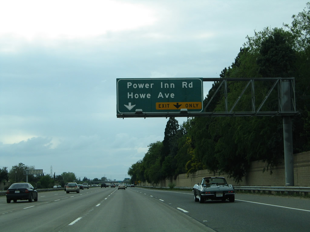
Westbound U.S. 50 (El Dorado Freeway) meets Exit 9, Power Inn Road south and Howe Avenue north with a connection to California 16 east. This sign was replaced by 2010 (and now has California 16 in the overhead guide sign). Photos taken 08/02/11 and 04/03/05. | |
 |
Upon departing U.S. 50 (El Dorado Freeway) west at Exit 9, stay left to follow Power Inn Road south to California 16 or turn right for Howe Avenue north. Photo taken 09/04/10. | ||
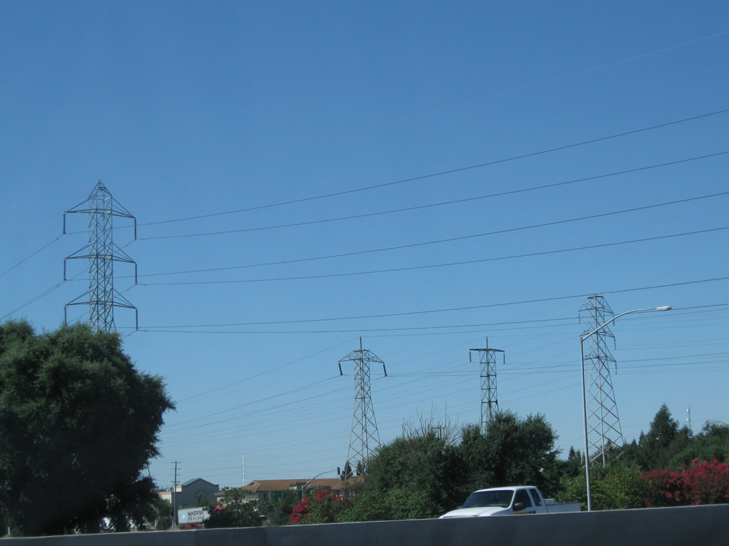 |
More power lines cross over U.S. 50 (El Dorado Freeway) west at the Howe Avenue and Power Inn Road interchange. Photo taken 08/02/11. | ||
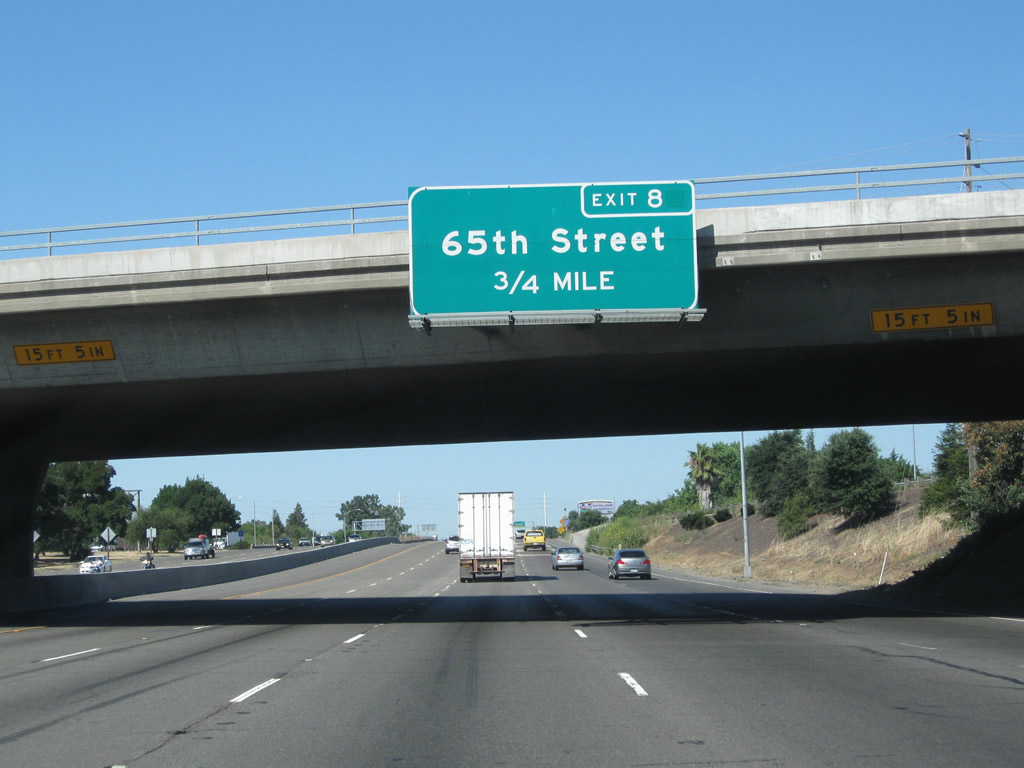 |
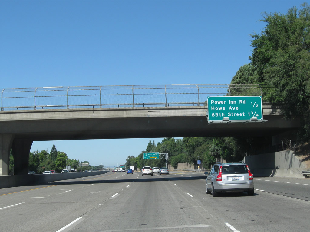
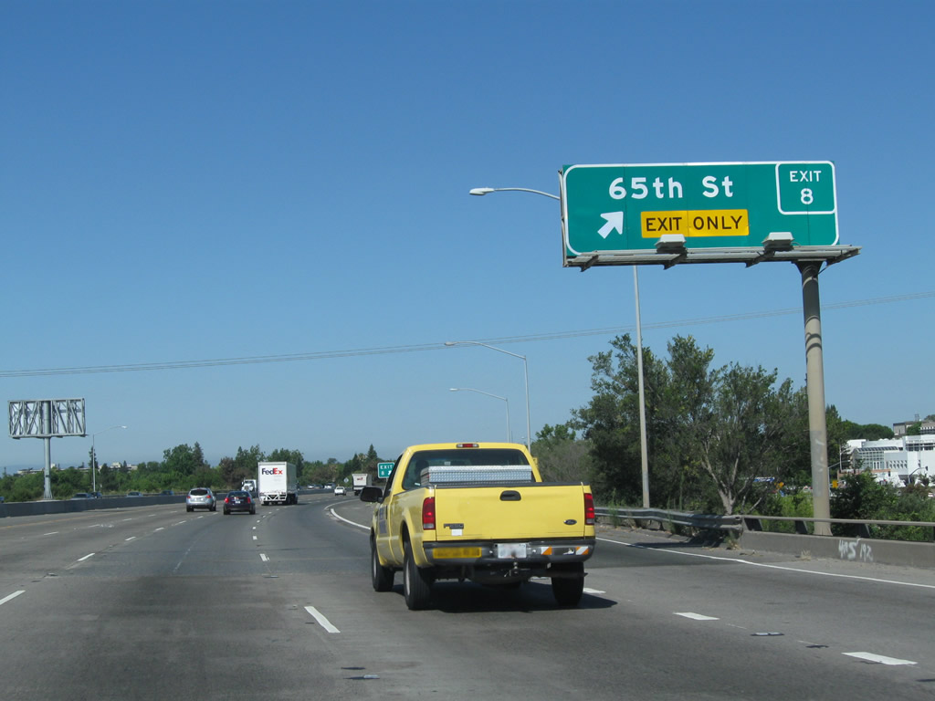
The next exit along U.S. 50 (El Dorado Freeway) west is Exit 8, 65th Street (0.75 mile). When first installed in 2003, the sign said Exit 8B, but that was corrected with a green patch overlay as seen here to say Exit 8. Photo taken 08/02/11. | ||
 |
The right lane of U.S. 50 (El Dorado Freeway) west becomes exit only for Exit 8, 65th Street. Photo taken 09/03/10. | ||
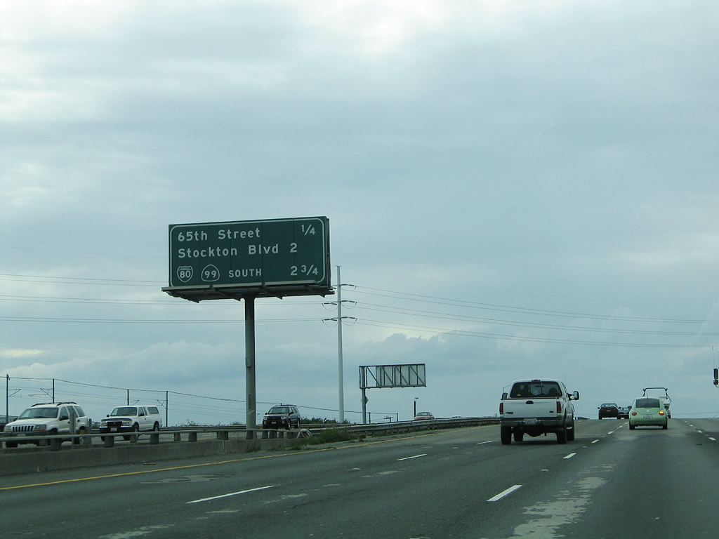 |
This mileage sign along U.S. 50 west provides the distance to the next several exits: Exit 8, 65th Street; Exit 7, Stockton Boulevard; and Exit 6, Business Loop I-80 and California 99. Interstate 305, the phantom Interstate highway that overlays U.S. 50 and Business Loop I-80 for a little more than eight miles per the U.S. highway log, could possibly starts its journey as far east as 65th Street, even though conventional wisdom suggests that Interstate 305 begins at the 50-99-Biz 80 (WX-29/30th) interchange. It's hard to tell precisely, since there are no signs to indicate the route. Photo taken 04/03/05. | ||
 |
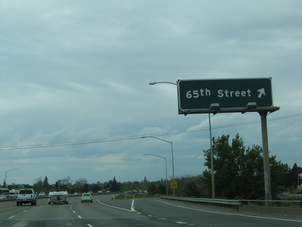 |
Westbound U.S. 50 reaches Exit 8, 65th Street. The 65th Street Expressway leads south from here, connecting to California 99 near Parkway. Heading north, 65th Street bends into J Street near California State University at Sacramento (commonly abbreviated to "Sac State"). J Street continues west into downtown Sacramento, connecting with state governmental buildings, Interstate 5, the Sacramento River, and the Eye Street Bridge. Photos taken 08/02/11 and 04/03/05. | |
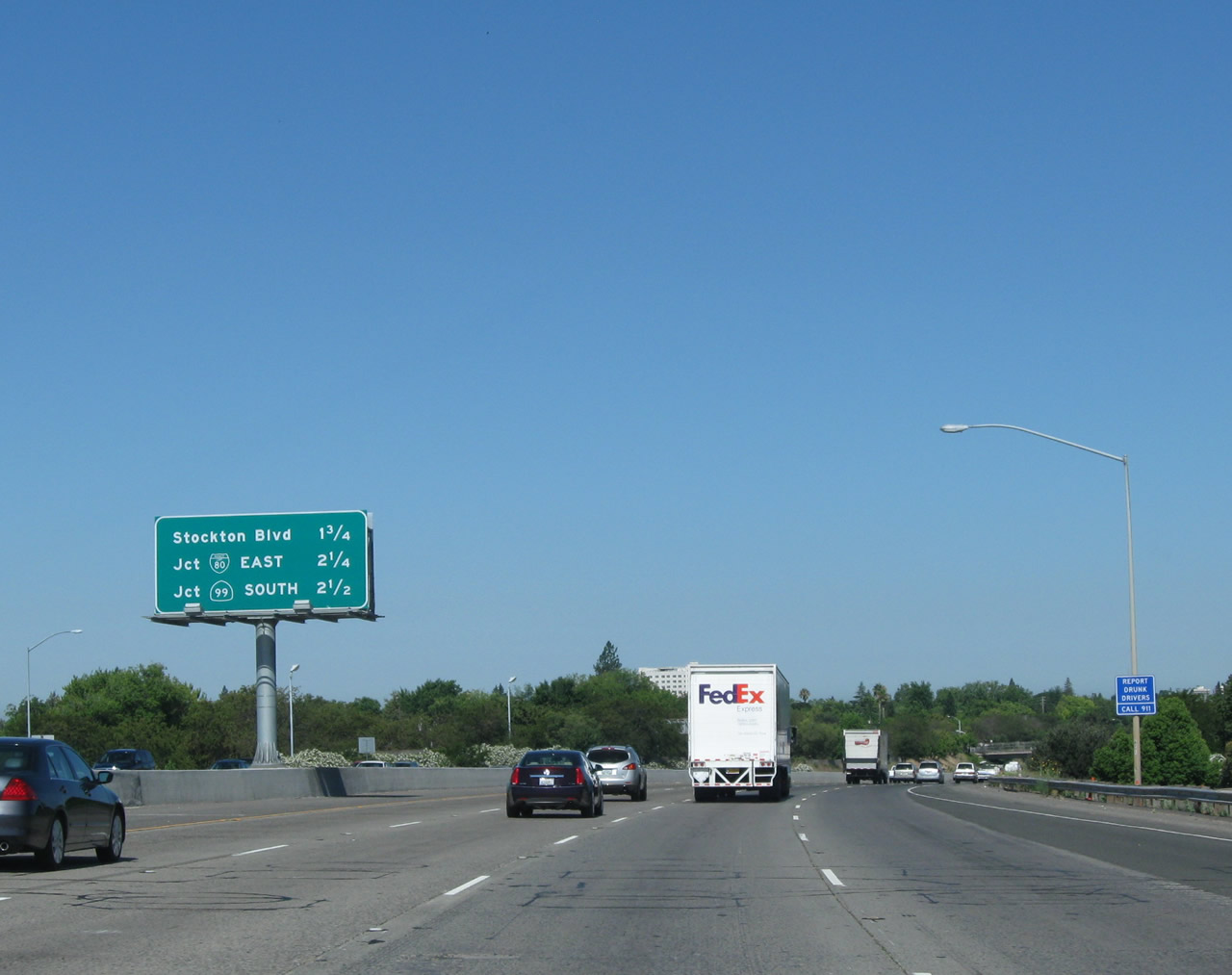 |
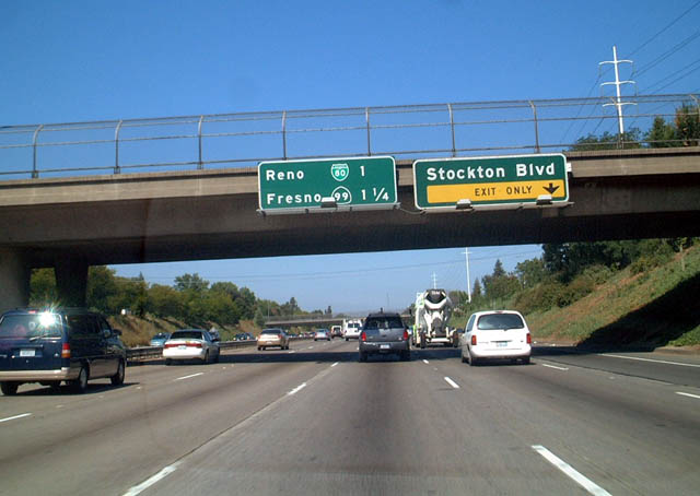
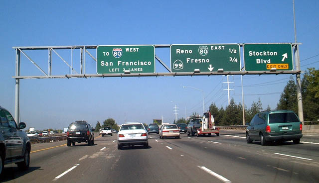
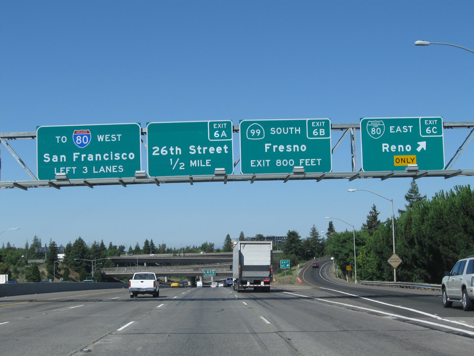
The next four exits along westbound U.S. 50 are Exit 7, Stockton Boulevard (former U.S. 50-99 Business); Exit 6C, Business Loop I-80 (Capital City Freeway) northeast to Roseville, Auburn, Truckee, and Reno; Exit 6B, California 99 south to Lodi, Stockton, Modesto, and Fresno; and Exit 6A, 26th Street. The interchange with Business Loop I-80 and California 99 are part of the WX/29th-30th interchange. Photo taken 08/02/10. | ||
 |
The next exit along U.S. 50 (El Dorado Freeway) is Exit 7, Stockton Boulevard (former U.S. 50-99 Business). Prior to the completion of the Sacramento freeway network, U.S. 50 used to turn south from Folsom Boulevard to 34th Street to Stockton Boulevard. It shared pavement with U.S. 99 as it used to head south toward Galt, Lodi, and Stockton. U.S. 50 no longer goes south out of Sacramento; it was decommissioned from Sacramento to San Francisco in 1964, and it was extended in 1980 to West Sacramento when Interstate 80 was rerouted onto the northern belt route around Sacramento. Photo taken 08/02/10. | ||
 |
 |
The right lane of U.S. 50 west becomes exit only for Exit 7, Stockton Boulevard. The next two exits after Stockton Boulevard are Exit 6C for Business Loop I-80 east (California 51 north) and Exit 6B for California 99 south. After the Stockton Boulevard interchange, it is possible that we could be on hidden Interstate 305, even though there are no signs heralding this invisible route. Also note that California 99 north and Business Loop I-80 west both merge onto westbound U.S. 50 at this upcoming interchange. Photos taken 04/03/05 and 08/22/03. | |
 |
Another mileage sign along U.S. 50 west provides the distance to the next three exits: Exit 7, Stockton Boulevard (former U.S. 50-99 Business); Exit 6C, Business Loop I-80 (Capital City Freeway) northeast to Roseville, Auburn, Truckee, and Reno; and Exit 6B, California 99 south to Lodi, Stockton, Modesto, and Fresno. Photo taken 08/02/10. | ||
 |
 |
Westbound U.S. 50 reaches Exit 7, Stockton Boulevard. Stockton Boulevard is historic U.S. 50-99 prior to the construction of the freeway network, and it was briefly commissioned as a business route for both highways. (Keep in mind that prior to 1964, U.S. 50 used to turn south along U.S. 99 to serve Stockton before crossing the Altamont Pass via Interstates 205 and 580). Today, no signage for either designation remains along Stockton Boulevard, although it has been reported that some of the last known cutout shields for U.S. 50 and U.S. 99 used to be posted along Stockton Boulevard until as late as 1983, long after most such signs were removed from service. Photos taken 08/02/10 and 08/22/03. | |
 |
Use Business Loop I-80 (Capital City Freeway) northeast to merge onto Interstate 80 east en route to Reno, Nevada. Photo taken 08/02/10. | ||
 |
 |
Another mileage sign along U.S. 50 west provides the distance to the next three exits: Exit 6C, Business Loop I-80 (Capital City Freeway) northeast to Roseville, Auburn, Truckee, and Reno; Exit 6B, California 99 south to Lodi, Stockton, Modesto, and Fresno; and Exit 6A, 26th Street. Photos taken 08/02/10 and 04/03/05. | |
 |
 |
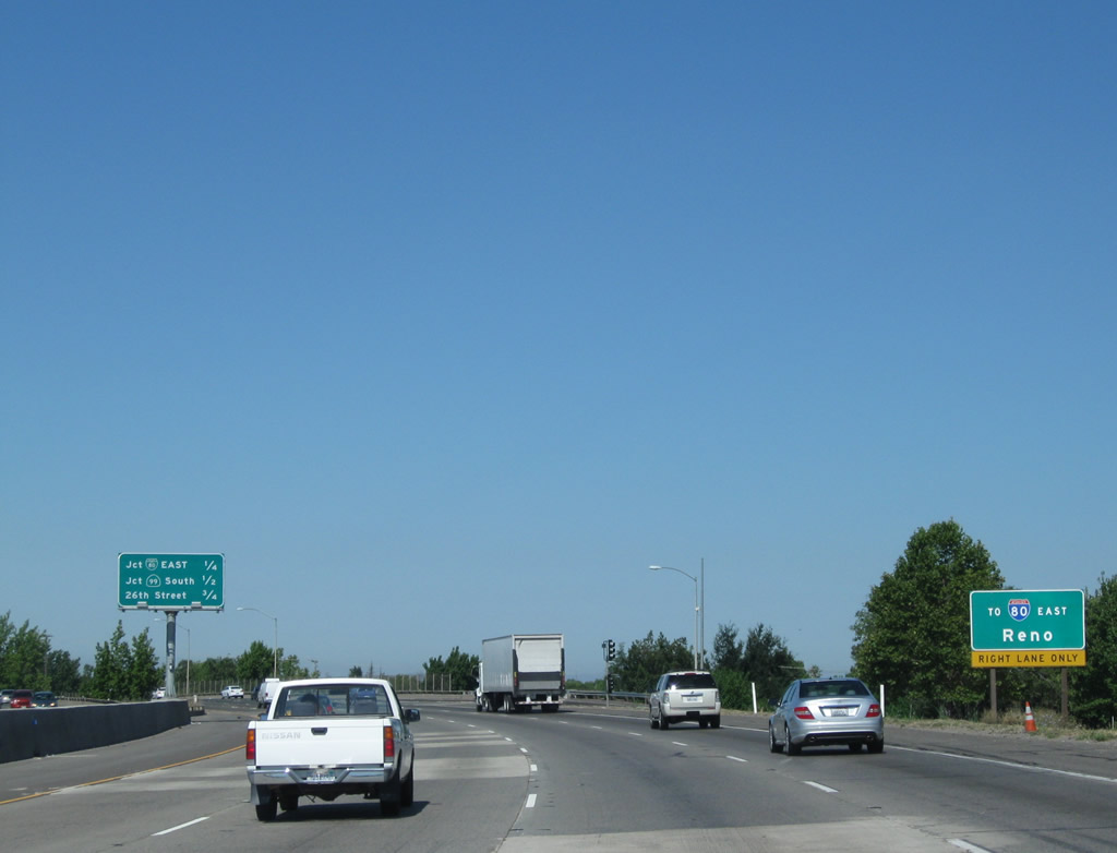
Westbound U.S. 50 (El Dorado Freeway) meets Exit 6C, eastbound Business Loop I-80 to Reno. Note how the through route overhead signage has changed: U.S. 50 is eliminated, and the sign instead points to northbound California 99, westbound Interstate 80, and both directions of Interstate 5, with a control city of San Francisco. Also, the Capital City Freeway designation, added in 1996, is not included on any of these signs approaching Business Loop I-80. These signs were replaced in 2005, with the Exit 6A guide sign added in 2010. Photos taken 08/02/10 and 08/22/03. | |
 |
This view looks west along U.S. 50 as we approach the WX - 29/30th interchange near downtown Sacramento. Photo taken 09/04/10. | ||
 |
 |
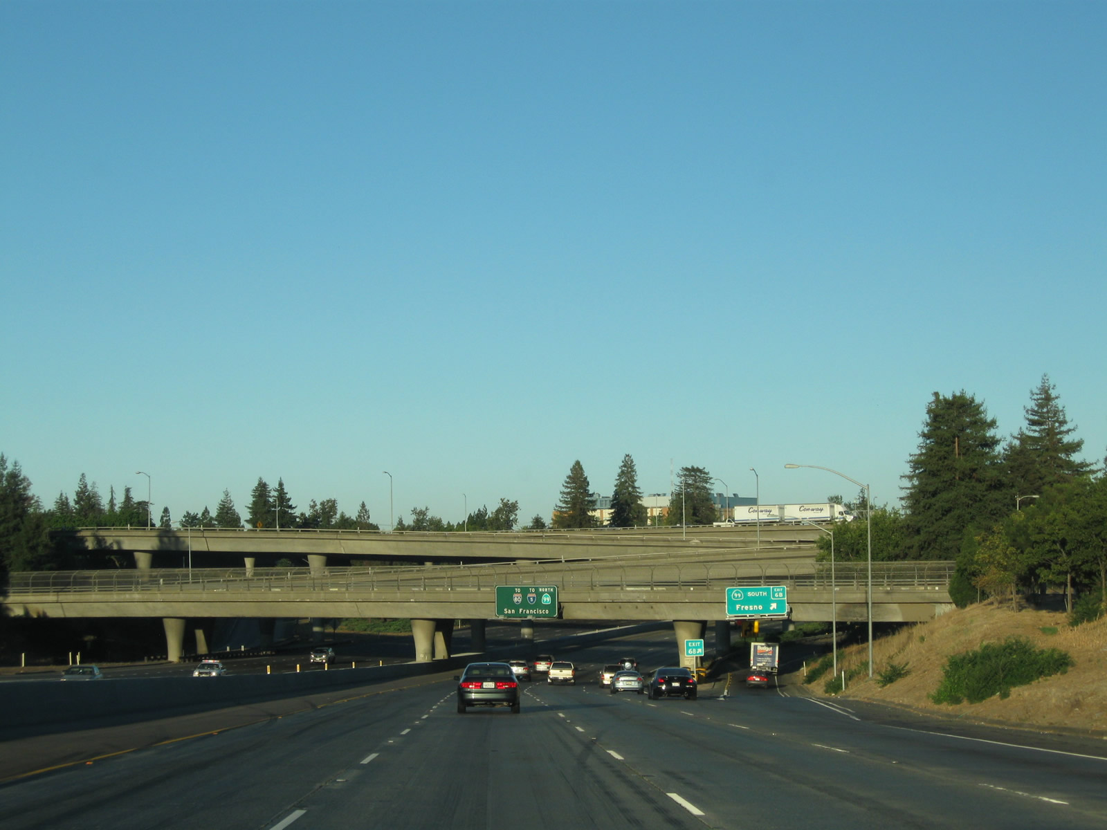
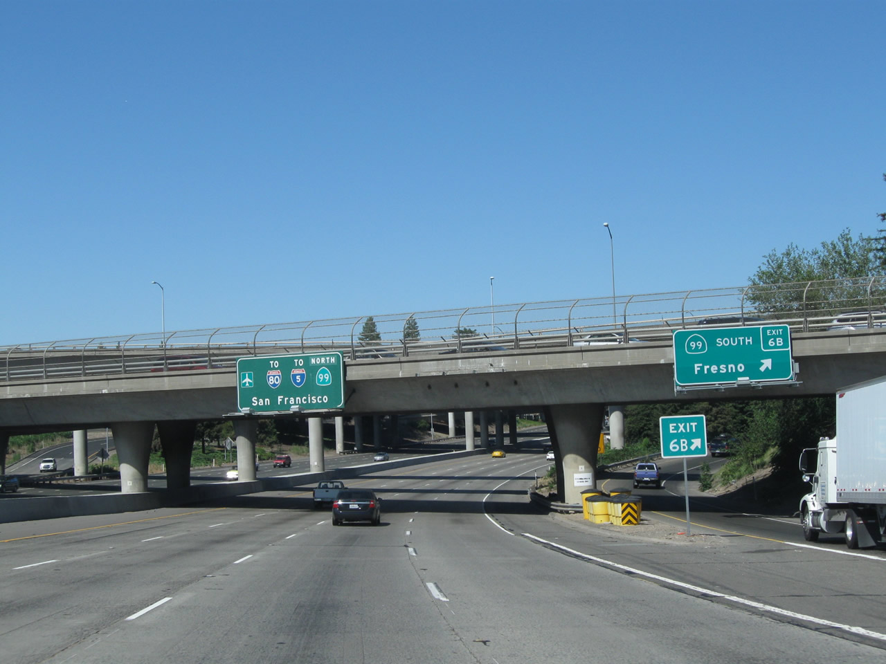
Westbound U.S. 50 (El Dorado Freeway) reaches Exit 6B, southbound California 99. California 99 follows old U.S. 99 as a freeway corridor, serving Lodi, Stockton, Modesto, Fresno, and Bakersfield before merging with Interstate 5 near Wheeler Ridge. Photos taken 08/02/11 and 08/22/03. | |
 |
 |
On a wet and rainy day in the spring, we follow the connecting ramp from U.S. 50 west to California 99 south. The second picture shows the view looking west on U.S. 50 and Business Loop I-80 toward downtown Sacramento. Photos taken 05/15/11. | |
 |
 |
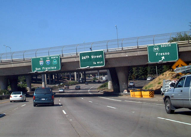
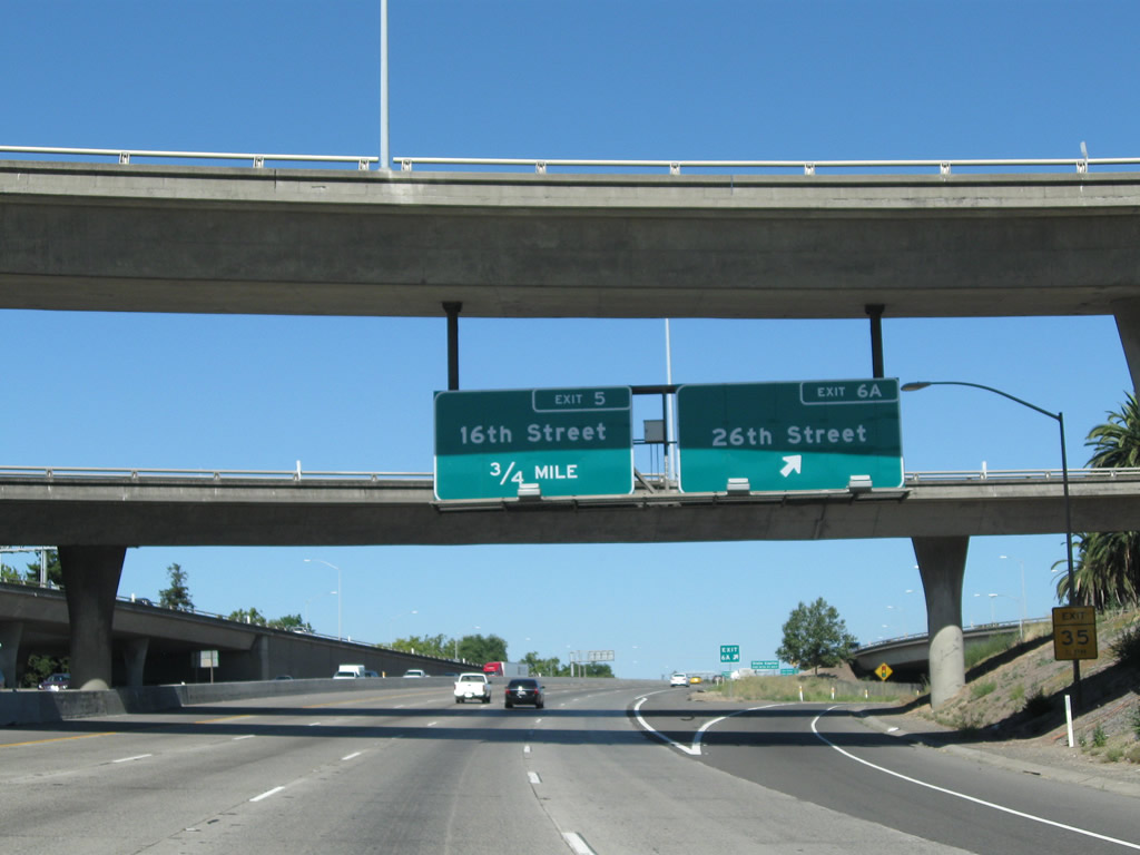
Back on the mainline, westbound U.S. 50 (El Dorado Freeway) reaches Exit 6A, 26th Street. Check out the supports that hold this sign bridge in place, attached to the flyover ramp. Most numbered streets in Sacramento lead north-south; lettered streets lead east-west. This city street leads into the eastern edge of downtown Sacramento. After this interchange, traffic joins U.S. 50 west from Business Loop I-80 west and California 99 north. Photos taken 08/02/11 and 04/03/05. | |
 |
As traffic departs the El Dorado Freeway for Exit 6A (26th Street), all through traffic merges onto U.S. 50 (Capital City Freeway) west. Traffic from westbound Business Loop I-80 transitions onto U.S. 50 west via a ramp that is visible here crossing over the off-ramp to 26th Street. Photo taken 08/02/11. | ||
 |
 |
Traffic from westbound Business Loop I-80 merges with U.S. 50 on the right. The El Dorado Freeway designation comes to an end, and the Capital City Freeway (also known as the WX Freeway between California 99 and Interstate 5) begins. California 99 also silently merges onto this busy stretch of freeway, so ahead Business 80, U.S. 50, and California 99 press ahead toward the Interstate 5 interchange. Photos taken 08/02/11 and 04/03/05. | |
Sources:
- Notice of Preparation of a Joint Draft Environmental Impact Report/Environmental Impact Statement for the Folsom South of U.S. Highway 50 Specific Plan Project - City of Folsom dated September 12, 2008

Page Updated December 5, 2011.
|
About Contact Glossary |
In The News Testimonials Interstate Guide |
Social Media:
 |
|
© 2000-23 AARoads.com | All Rights Reserved | Privacy Policy / Terms of Use
|
||