This page showcases extant segments of Historic U.S. 80 in the Imperial Valley from Winterhaven west to Ocotillo via Imperial Sand Dunes, Holtville, El Centro, Seeley, and Plaster City.
| Historic U.S. 80 west |
|---|
|
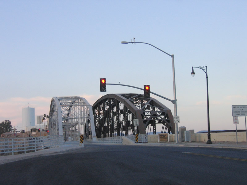
U.S. 80 leaves Yuma, Arizona, and proceeds into Winterhaven, California. We begin the westbound journey of U.S. 80 by crossing over the Colorado River on its original alignment, the Ocean to Ocean Highway Bridge. This bridge today only one way, so a traffic signal allows alternating directions of traffic to use the bridge. Later iterations of U.S. 80 sent the route along today's Business Loop I-8, and eventually it was subsumed by modern Interstate 8. However, the bridges for all three alignments remain in use today. Photo taken 01/27/06. |
|
|
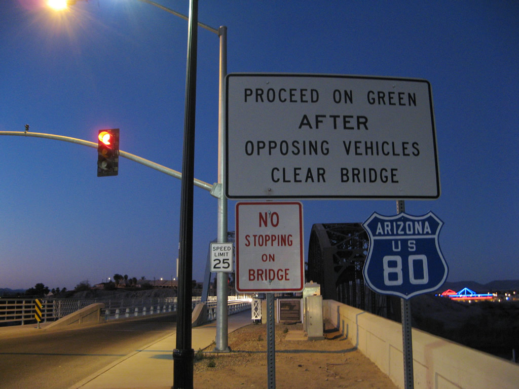
This sign advises motorists on how to proceed across the old bridge (alternating directions). Note the (temporary) addition of a replica Historic U.S. 80 shield, which uses historically accurate blue coloring for the westbound direction of U.S. 80 over the bridge. The historical route marker for U.S. 80 is no longer in place. Photos taken 01/27/06 and 01/15/07. |
|
|
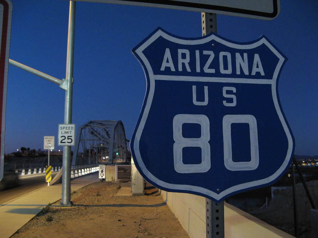
A plaque identifies the people responsible for the refurbishment of the Ocean to Ocean Highway Bridge over the Colorado River. The bridge was built in 1915 (prior to the establishment of U.S. 80 in 1926) and refurbished in 2002. A close-up of the aforementioned U.S. 80 Arizona shield is shown here as well; the plaque is located behind the U.S. 80 shield. Photos taken 01/27/06 and 01/15/07. |
|
|
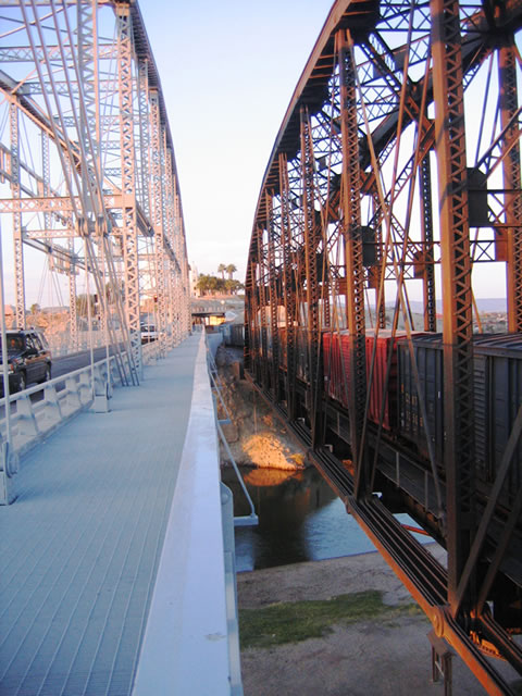
These pictures show the side by side view of the Ocean to Ocean Bridge and the railroad bridge. The railroad bridge crosses the Colorado River on the north side of the Ocean to Ocean Highway Bridge. Photos taken 01/27/06. |
|
|
This plaque identifies the age of the superstructure for the bridge; the superstructure was manufactured in 1914, just prior to the bridge opening in 1915. Photos taken 01/27/06. |
|
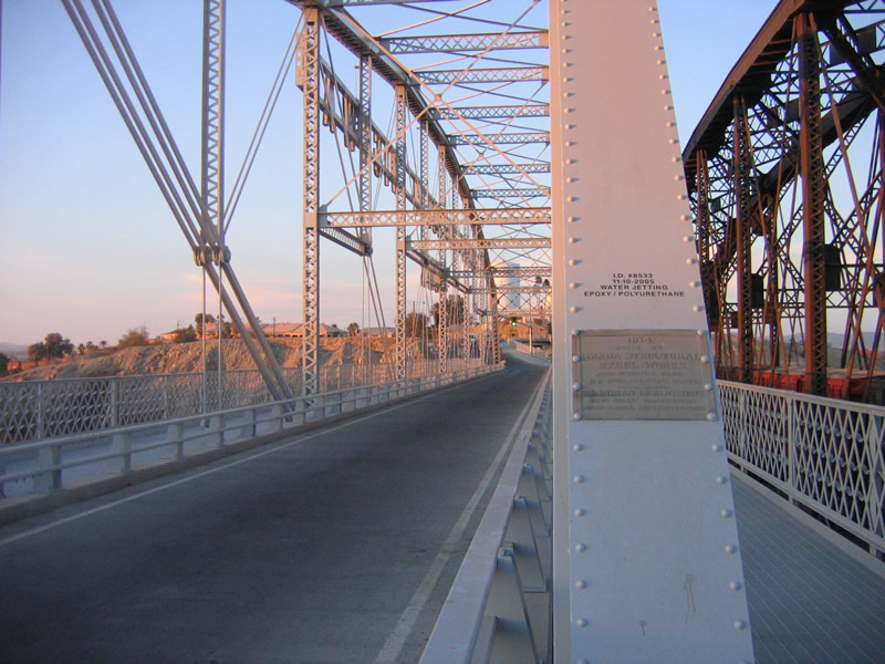
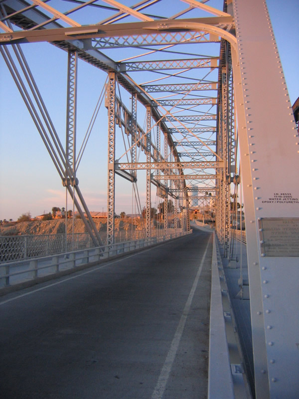
The bridge deck is only one lane wide with limited shoulders on either side of the travel lane. Originally, this bridge was built to handle two directions of traffic. Pedestrian pathways line both sides of the bridge. Photo taken 01/27/06. |
|
|
|
Bridge walkways were added to both sides of the Ocean to Ocean Highway Bridge in 2002 as part of the refurbishment project. Prior to the rehabilitation project, the bridge was closed to motorized vehicles and open only to pedestrians and bicyclists. Photos taken 01/27/06. |
|
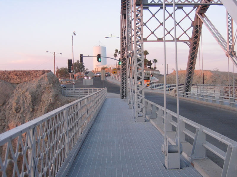
Looking into California, the Ocean to Ocean Highway bridge splits, with the right fork (Quechan Drive) crossing over the railroad before descending to the Quechan Indian Reservations. The left fork (Quechan Road) connects to Imperial County S-24 (Picacho Road). Photo taken 01/27/06. |
|
To get to the Grays Well Section of Old U.S. 80, use Exit 156 and turn west onto the frontage road that is on the south side of Interstate 8. Old U.S. 80 serves several points of interest: Buttercup Valley Off Road Vehicle Recreation Area, Midway Campground, and the Old Plank Road. The old highway dead ends after the parking area near the Old Plank Road. This view shows westbound Historic U.S. 80 (Grays Well Road) looking toward the Midway campground. Continue straight ahead along Old U.S. 80 to the Old Plank Road. Photo taken 01/27/06. |
| Historic U.S. 80 - Old Plank Road (1916-1926) west |
|
Looking downhill is this view of the Old Plank Road to the west. Since U.S. 80 was designated in 1926, it is possible yet unlikely that the Plank Road was signposted as U.S. 80. Remnants are fenced off from the adjacent sand dunes in Buttercup Valley. Photo taken 01/27/06. |
| Historic U.S. 80 west |
|
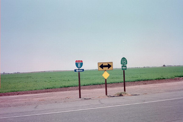
Much further west, westbound U.S. 80/Evan Hewes Highway meets California 115 at this intersection southeast of Holtville. This intersection is just north of the southern terminus of California 115 (located at the Interstate 8 interchange). From here, U.S. 80 turns north onto California 115, and they stay merged through the town of Holtville. After Holtville, California 115 turns north toward Calipatria, while U.S. 80 continues west toward El Centro via Imperial County S-80 (Evan Hewes Highway). Photo taken 09/00. |
| Historic U.S. 80 & Imperial County S-80 west |
|
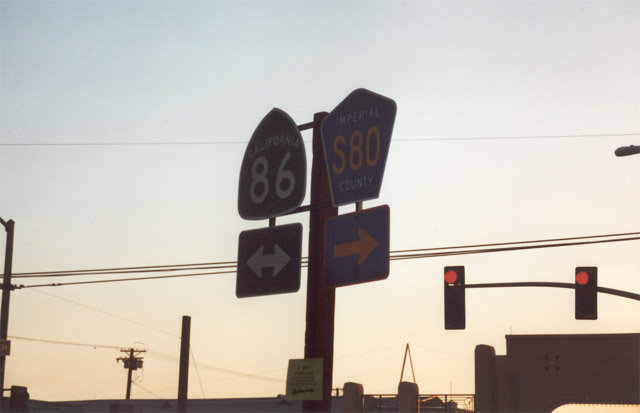
Now in El Centro, Imperial County S-80 (Evan Hewes Highway) meets California 86 and Business Loop I-8 near downtown El Centro. Turn left for California 86 (Historic U.S. 99) south and Business Loop I-8 west to Interstate 8 and Calexico. Turn right for the continuation of Historic U.S. 80 west, Historic U.S. 99 north, Business Loop I-8 west, Imperial County S-80 west, and California 86 north into downtown El Centro and points west (Plaster City, Ocotillo, Interstate 8 west) and north (Imperial, Brawley, Salton Sea, Coachella Valley, Interstate 10). Photo taken 11/11/00. |
| Historic U.S. 80 west & Historic U.S. 99 north |
|
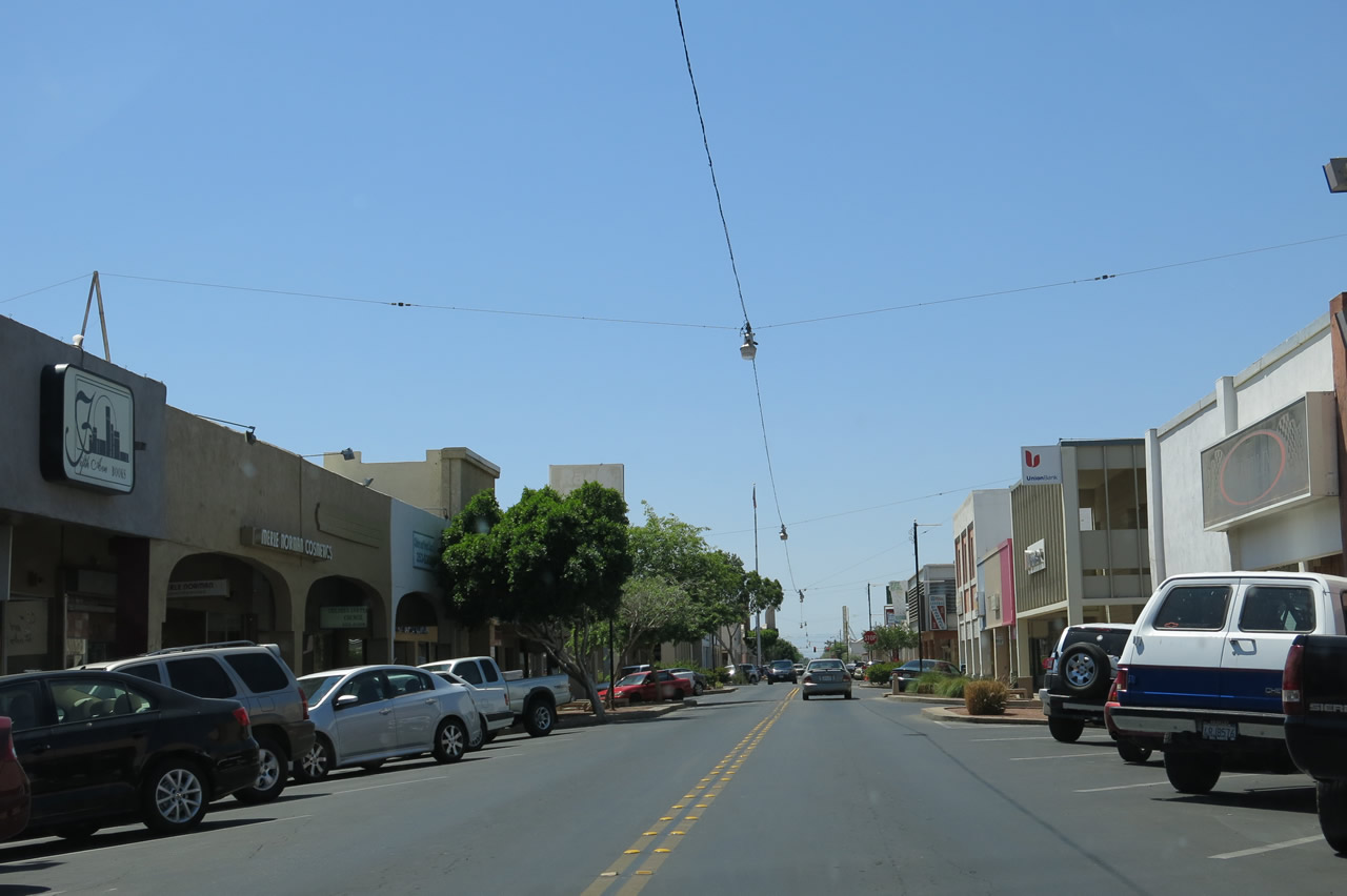
Leaving the Fourth Street intersection, Historic U.S. 80 and Historic U.S. 99 proceed via Main Street into downtown El Centro by passing under this arch. Imperial County S-80, California 86, and Business Loop I-8 avoid Main Street by following Fourth Street and Adams Avenue around the city center. Photo taken 04/20/13. |
|
|
|
|
|
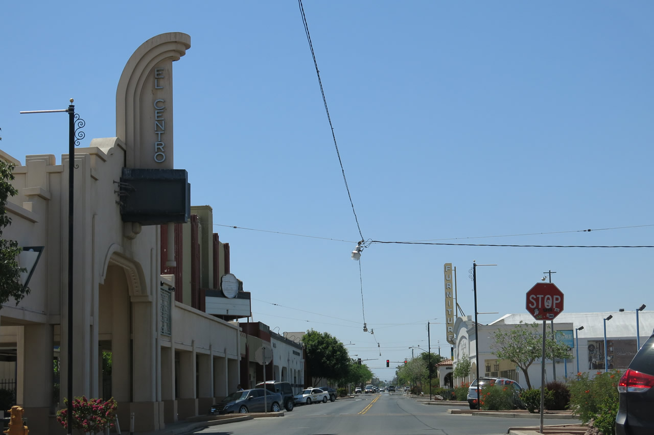
| Westbound Historic U.S. 80-99 (Main Street) proceed through downtown El Centro. This portion of Main Street was likely to have been signed as both U.S. 80 and U.S. 99, although neither route is currently signed on Main Street. Photos taken 04/20/13. |
|
|
|
|
|
| Historic U.S. 80 west |
|
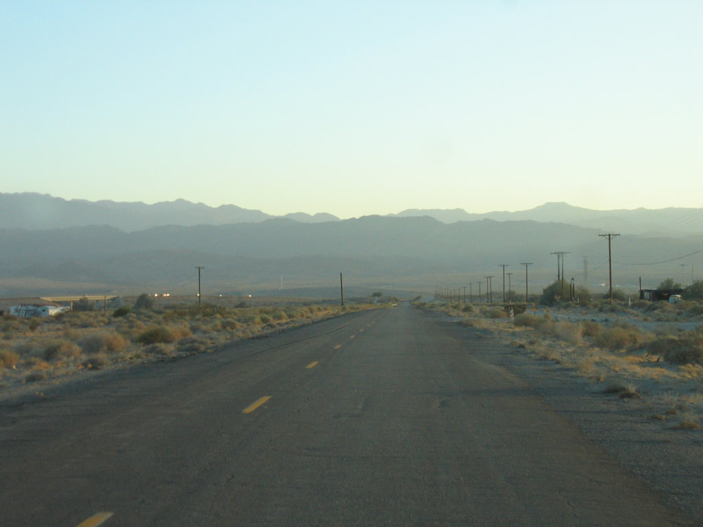
Skipping ahead and now west of El Centro and Seeley, this view shows westbound Imperial County S-80 (Evan Hewes Highway) as it travels toward Plaster City. Several "C-block" monuments line this stretch of Historic U.S. 80; this is one of the best places in the state to find these old right-of-way markers. Photo taken 08/20/06. |
|
Now beyond Plaster City, Imperial County S-80 (Evan Hewes Highway) proceeds southwest toward Ocotillo and Interstate 8. At this early evening hour, headlights along Interstate 8 are readily visible in the distance. Ahead, S-80 will proceed through the dry Yuha Desert parallel to the San Diego & Arizona Eastern Railroad. Watch for old alignments of U.S. 80 and its predecessor auto trail mostly on the south side of CR S-80. Beyond the desert lie the formidable Laguna Mountains. Photo taken 08/20/06. |
|
Several bridges line CR S-80 through the Yuha Desert, mostly to allow mostly dry washes to pass under the county highway. These bridges largely date from the 1940s. Photo taken 08/20/06. |
|
|
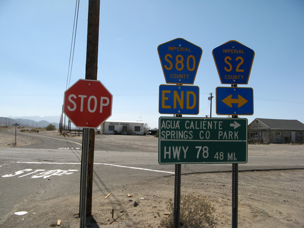
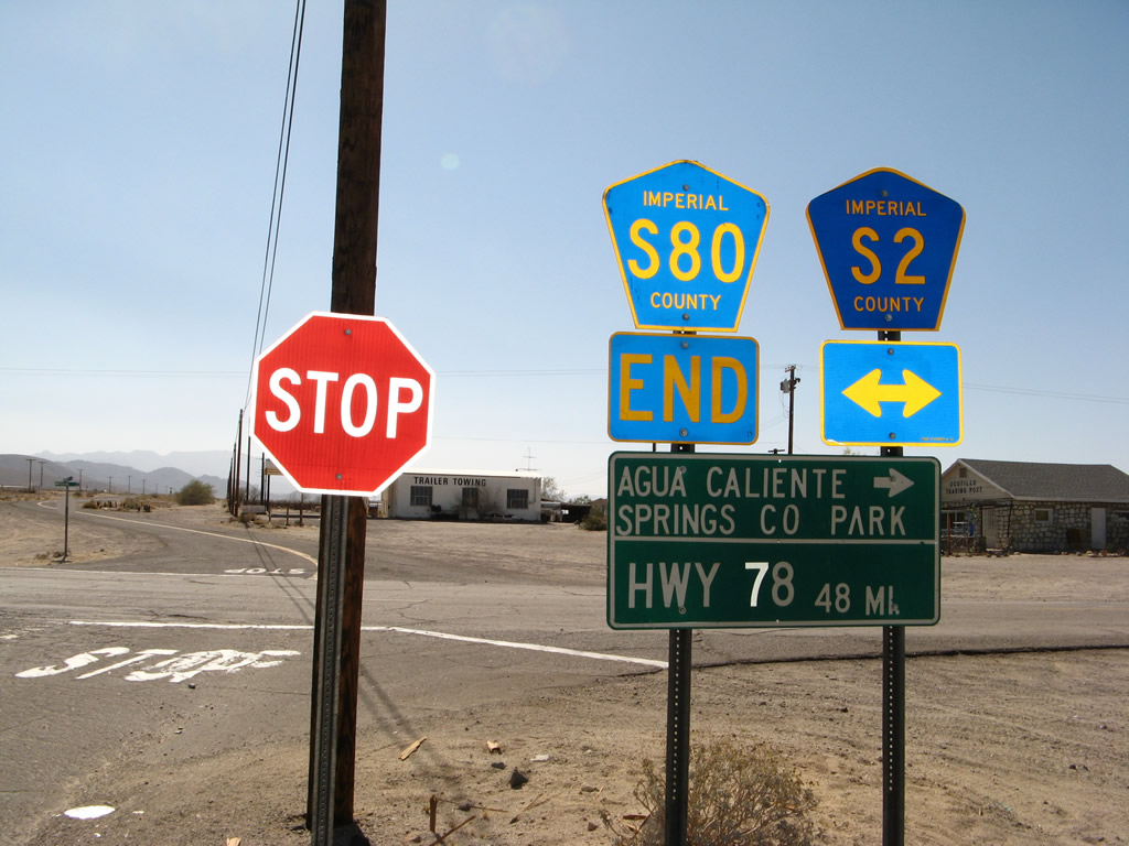
Much further west, Imperial County S-80 (Evan Hewes Highway) comes to its end at the intersection with Imperial County S-2 is signed with an end shield in Ocotillo. Extant segments of Old U.S. 80 can be driven west of here, but they eventually peter out before the old road is no longer passable due to the presence of Interstate 8. Since the original alignment of U.S. 80 used to pass through In-Ko-Pah Gorge (through which the westbound lanes of Interstate 8 now pass), only certain segments of U.S. 80 remain between here and the Desert View Tower on top of the grade. Most of these segments can be seen by eastbound travelers on Interstate 8, but most are not open for motorist traffic. Some of the old road segments can be completely off-limits to the public as they are on private property. A good place to see some of these segments is the Mountain Springs interchange. Photos taken 04/19/08. |
|
|
|
|
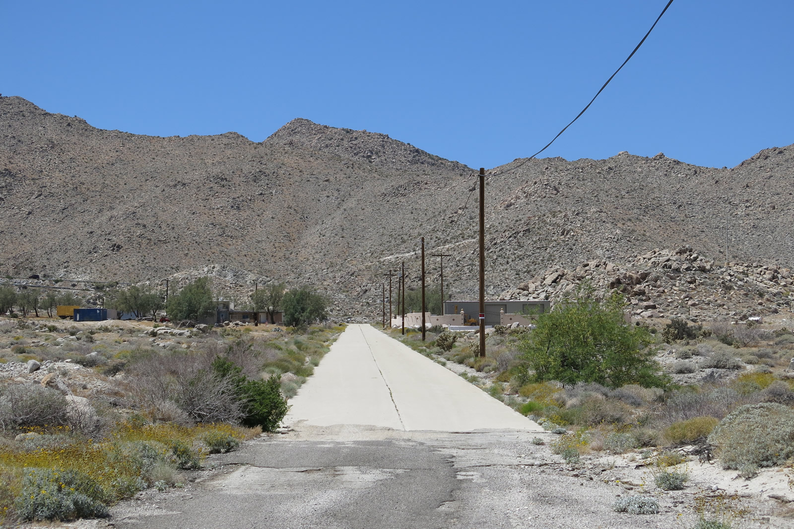
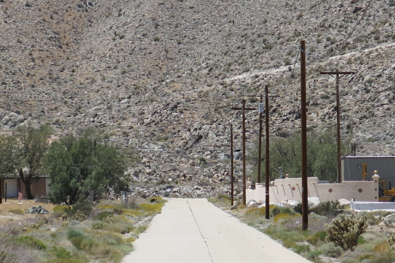
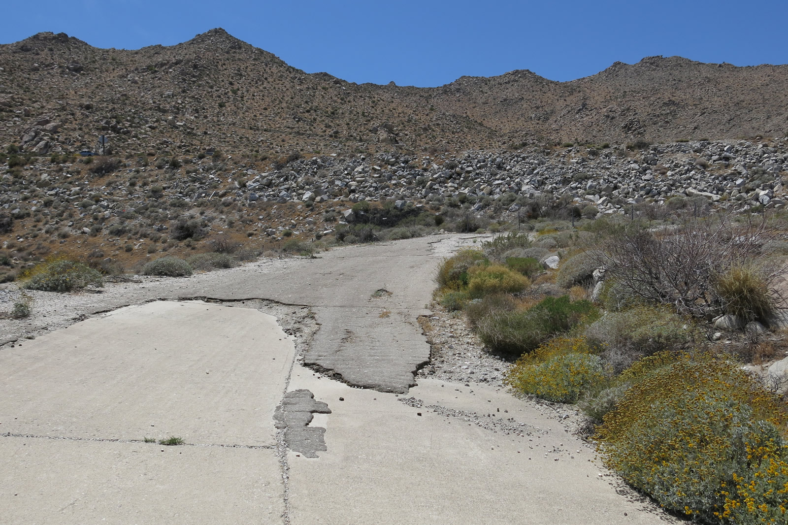
| At Exit 80 (Mountain Springs Road) from Interstate 8, motorists can find several extant segments of traverseable yet disconnected U.S. 80 segments. On the west side of the interchange, two alignments wind their way uphill. The original alignment, with concrete dating from the late 1920s, proceeds in a more direct line uphill. This segment is now closed to through traffic (note the "No Trespassing" signs ... the concrete road is now on private property). Adjacent to this stretch is a 1940s alignment that swoops around the older alignment to offer a gentler uphill grade (see next picture set). Photos taken 04/20/13. |
|
|
|
|
|
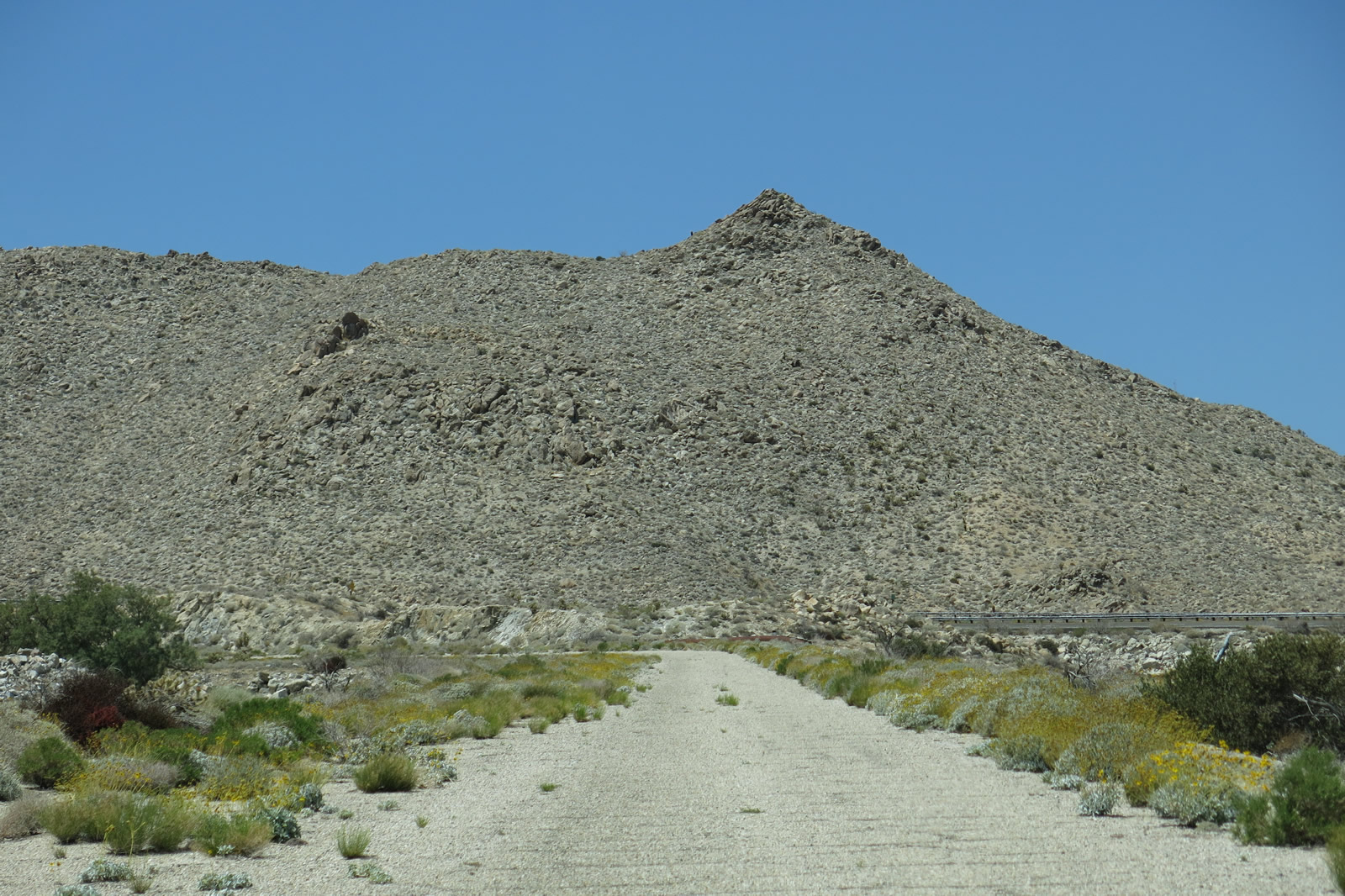
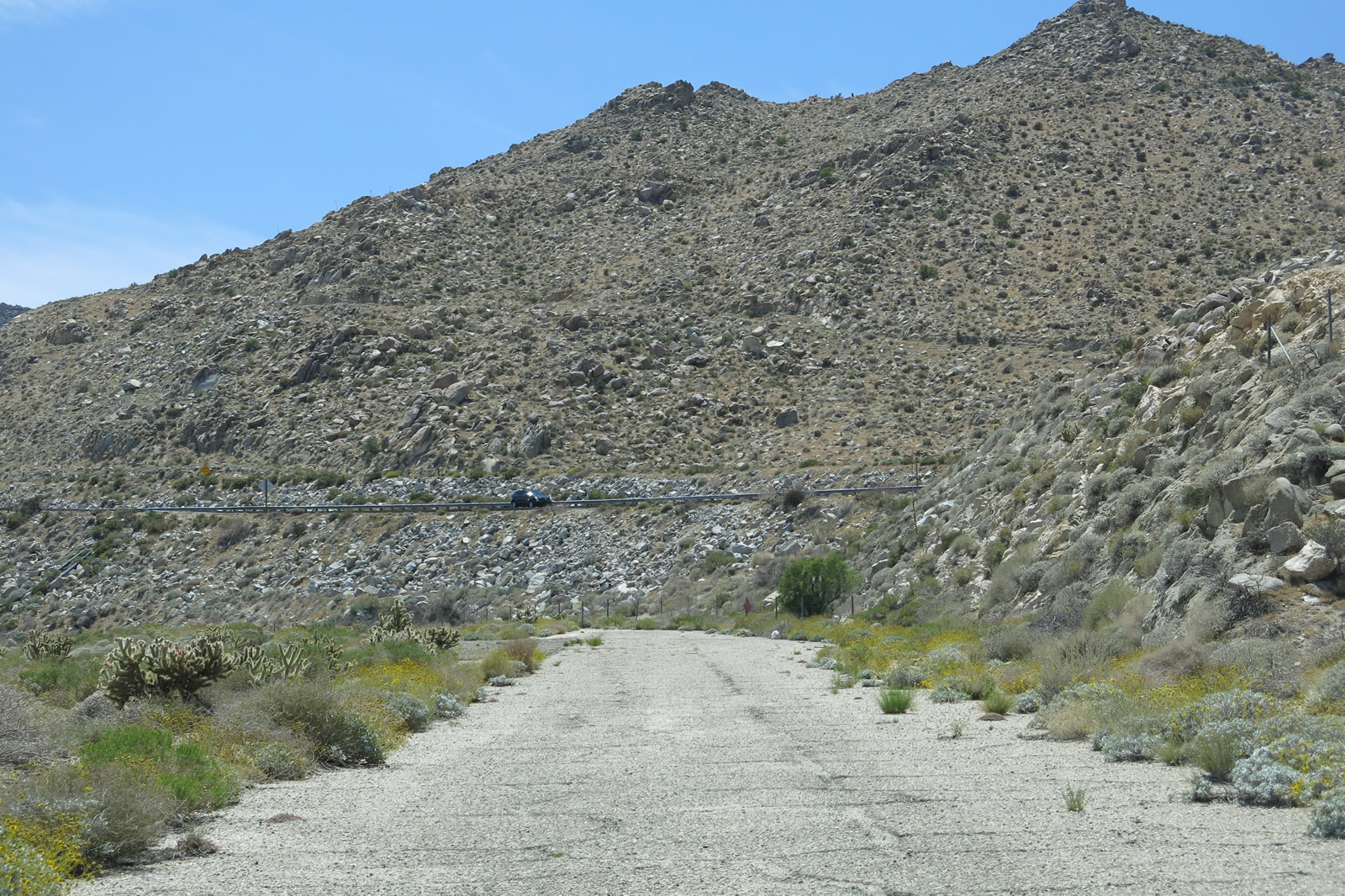
| Leaving the Exit 80 interchange, the 1940s Mountain Springs Road alignment also proceeds uphill but does so by paralleling the sweeping curves of the nearby Interstate 8 freeway rather than following the uphill route of the older, concrete alignment. This series of pictures follows Mountain Springs Road as it proceeds uphill until it reaches a dead end at a point near where the 1940s asphalt and 1920s concrete used to reconnect (but don't anymore due to adjacent freeway construction). Note the old guardrail, superelevated curves, and old, white centerline striping. At the end of this series, the road dead ends into a freeway embankment. A trail connects this segment with the nearby older, concrete segment. Photos taken 04/20/13. |
|
|
|
|
|
Page Updated April 27, 2013.