| Historic U.S. 101 north |
|
Harbor Drive north after Vesta Street near the San Diego Naval Station. Photo taken 12/03/06. |
|
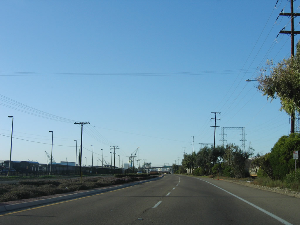
The next intersection along Harbor Drive north is with 32nd Street. Use 32nd Street north to Wabash Boulevard and the southern end of California (Interstate) 15. The San Diego Naval Station lines both sides of this section of Harbor Drive. Photo taken 12/03/06. |
|
Northbound Harbor Drive meets 32nd Street at this traffic signal. Turn right to follow 32nd Street north to Wabash Boulevard; turn left to follow 32nd Street south into the main entrance gate for the San Diego Naval Station. To Interstate 15 north, turn right here. Photo taken 12/03/06. |
|
|
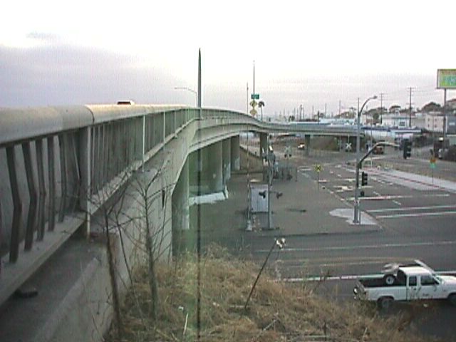
Much of the original Harbor Drive expressway concrete is still in place along Harbor Drive between Interstate 5 Exit 11A and the San Diego Convention Center (just north of the California 75/San Diego-Coronado Bay Bridge overcrossing). This concrete has expansion joints that cause a familiar "bump-bump" noise as cars travel over it. This particular stretch of concrete is located just north of 32nd Street and the southern terminus of California 15. Photos taken 06/23/08 and 08/08/04. |
|
|
The towering cranes and facilities of the Naval Shipyards loom on the horizon as Harbor Drive, which carried U.S. 101 until 1964 and was briefly designated as Business Loop I-5 in the late 1960s, heads north toward downtown San Diego. Photos taken 06/23/08 and 08/08/04. |
|
|
In some cases, the concrete from the days that Harbor Drive carried much of the through traffic has been poured over with asphalt. Most of this corridor is industrial, especially between 32nd Street and the San Diego Coronado Bay Bridge. The industry is primarily based on the shipyards for the U.S. Navy, but private enterprise also has a significant presence here. Photos taken 06/23/08 and 08/08/04. |
|
|
Northbound Harbor Drive meets 28th Street at this traffic signal. In other areas, the asphalt patches has again given way to the virgin concrete beneath. Note the concrete berm on the median, which has divots. Divots in median concrete berms was a design feature of 1940s and 1950s state route expressways. Photos taken 06/23/08 and 08/08/04. |
|
Northbound Harbor Drive meets Schley Street at this traffic signal. Use Schley Street to cross the trolley tracks and connect to 26th Street. Photo taken 06/23/08. |
|
|
After the Schley Street traffic signal, Harbor Drive again reverts to original concrete as it plies through the industrial corridor. On the east side of the highway is the trolley tracks, along with the sole north-south commercial rail corridor in San Diego County. Power lines carry electricity from a generating facility in Chula Vista, which is located along southern San Diego Bay. Photos taken 06/23/08 and 08/08/04. |
|
The San Diego Trolley uses the railroad lines to carry passengers between San Ysidro and downtown San Diego. The red cars have become synonymous with San Diego's public transportation system. Photo taken 08/08/04. |
|
|
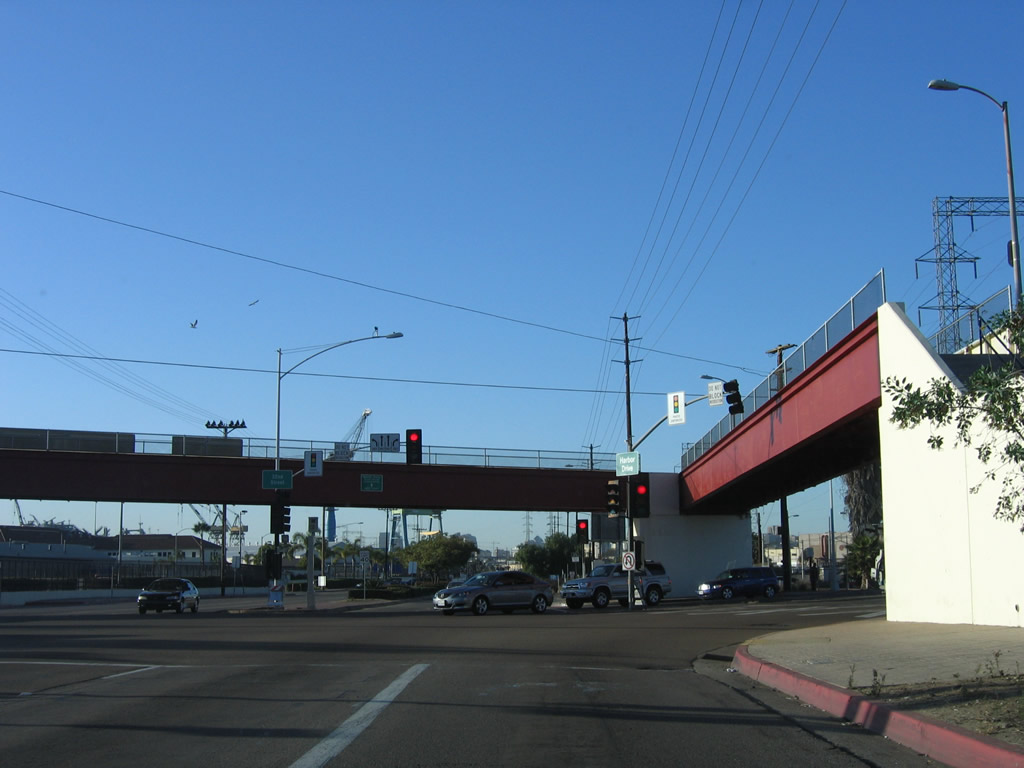
Northbound Harbor Drive (Historic U.S. 101) reaches Sampson Street. The San Diego-Coronado Bay Bridge (California 75) dominates the scene ahead. Photos taken 06/23/08 and 08/08/04. |
|
Power lines criss-cross old U.S. 101 near the old Kelco facility. The San Diego-Coronado Bay Bridge comes into view. Photo taken 06/23/08. |
|
Passing under the bay bridge, the San Diego downtown skyline comes into view. Photo taken 06/23/08. |
|
After the San Diego-Coronado Bay Bridge, northbound travelers may turn right from Harbor Drive onto Cesar E. Chavez Parkway (former Crosby Street) to get onto the bridge. Harbor Drive, meanwhile, continues north along the path of old U.S. 101 toward downtown, which looms in the horizon. Photo taken 06/23/08. |
|
The next intersection along northbound Harbor Drive is with Beardsley Street. Photo taken 06/23/08. |
|
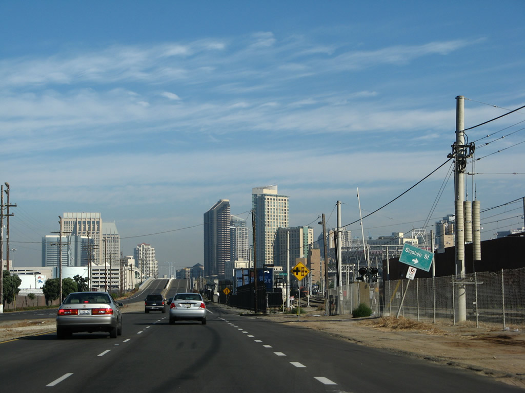
Immediately thereafter, northbound Harbor Drive intersects Sigsbee Street. Photo taken 06/23/08. |
|
Looking to the northwest, the newest Hilton hotel comes into view (Campbell Shipyard) next to the convention center. Photo taken 06/23/08. |
|
|
|
As downtown grows closer, northbound Harbor Drive crosses over several sets of railroad tracks on this grade separation structure. Petco Park, home of Major League Baseball's San Diego Padres, is visible to the northeast of Harbor Drive. Photos taken 06/23/08. |
|
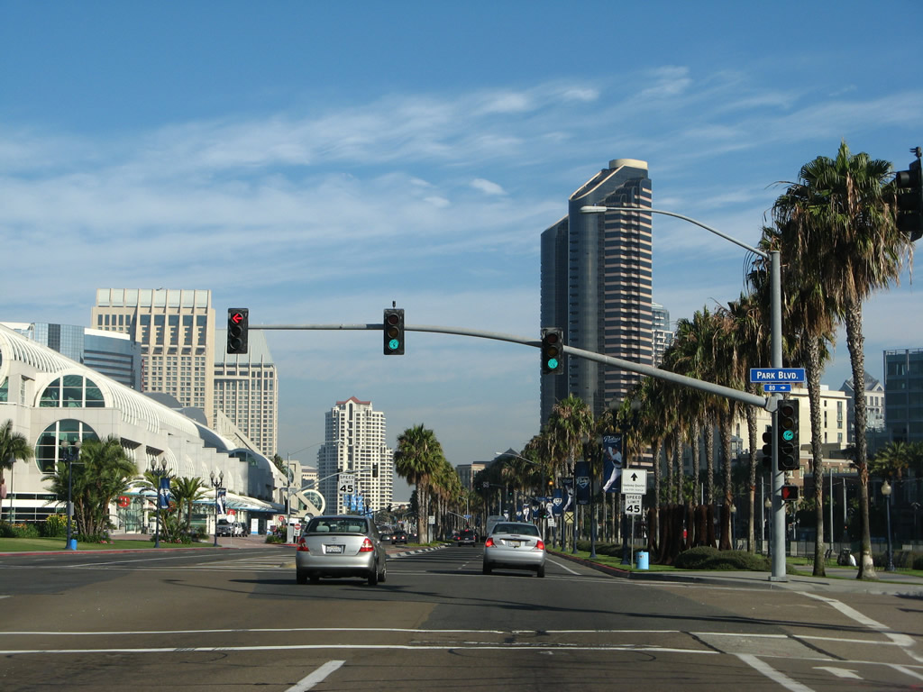
Northbound Harbor Drive (former U.S. 101 and Business Loop I-5) meets Park Boulevard (former 12th Avenue) at this traffic signal. Photo taken 06/23/08. |
|
Passing by the convention center, northbound Harbor Drive meets Fifth Avenue at this traffic signal. Turn right here to the Gaslamp Quarter. Photo taken 06/23/08. |
|
This left turn provides direct access to an underground garage located below the San Diego Convention Center. Photo taken 06/23/08. |
|
Northbound Harbor Drive meets First Avenue. Turn right on First Avenue for the most direct route to Interstate 5; continue straight ahead for the Embarcadero and airport. Photo taken 06/23/08. |
|
Shortly thereafter, Harbor Drive meets Front Street, which is one-way southbound. No turns are allowed here. A palm promenade is showcased on the next block. Photo taken 06/23/08. |
|
Harbor Drive north meets Market Street (old U.S. 80-395). At this intersection, Historic U.S. 101 continues north on Harbor Drive, while U.S. 80 and U.S. 395 travel east on Market Street. This intersection served as the eastern and southern terminus of U.S. 80 and U.S. 395 after U.S. 101 was realigned onto Harbor Drive. Historic U.S. 80 and U.S. 395 travel together through the Marina District and Gaslamp Quarter before turning north on Park Boulevard (12th Avenue) toward Balboa Park and University Heights. In 1948, the two routes were realigned to turn north on 11th Avenue to follow the Cabrillo Freeway north into Hillcrest, dividing at the U.S. 80/Washington Street interchange in Hillcrest. The Harbor Drive/Market Street intersection was the western end of U.S. 80 until June 1953, when U.S. 80 was rerouted onto Mission Valley Road (later Mission Valley Freeway) to end at U.S. 101 near Mission Bay Park. The Harbor Drive/Market Street intersection remained as the southern terminus of U.S. 395 until 1972 or 1973, when the route was retracted to its current terminus in San Bernardino County. California 163, which was designated in 1969 and cosigned with U.S. 395 for about three or four years, was briefly signed to end here, but the state relinquished Market Street thereafter. Photo taken 02/27/11. |
|
At the Harbor Drive intersection with Market Street, the San Diego Trolley and companion railroad line curves toward the north, while Harbor Drive continues northwest. U.S. 101 will continue to parallel the tracks by turning north onto Pacific Highway. Photo taken 02/27/11. |
|
Northbound Harbor Drive (Historic U.S. 101) meets Kettner Street at this intersection. Turn right to follow Kettner Street north toward Little Italy; continue northwest on Harbor Drive toward the airport. Photo taken 06/23/08. |
|
At Pacific Highway, Old U.S. 101 (and Business Loop I-5) turned north toward Middletown; Harbor Drive continues north toward San Diego International Airport, Shelter Island, and Point Loma. Note that neither the Market Street intersection nor this intersection are configured the way they were historically. When the Seaport Village development was constructed, the old alignment of U.S. 101 was made into part of the parking lot for Seaport Village, and Harbor Drive was relocated to its present location. Photo taken 06/23/08. |
|
After turning from Harbor Drive, old U.S. 101 turns north toward Middletown along Pacific Highway. Note that this is not "Pacific Coast Highway," even though it is commonly called that by mistake. Photo taken 06/23/08. |
|
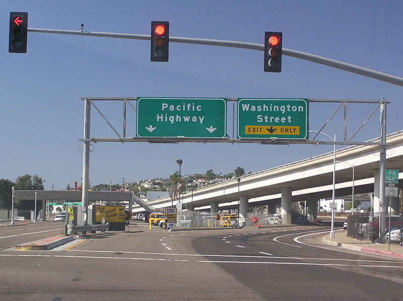
Leaving downtown San Diego about a half-mile north of the previous photo on northbound Pacific Highway, U.S. 101 merges onto the freeway section near Washington Street. Until 2002, these signs were nonreflective signs without button copy, dating to the mid-1960s. They have since been replaced by reflective signs (as shown here). Photo taken 09/23/06. |
|
|
|
|
This series of photos follows the high-speed ramp from Interstate 5 north to Pacific Highway north. San Diego International Airport is located to the west of Pacific Highway and is visible from the freeway ramp. Photos taken 10/19/07. |
|
|
|
|
|
The first exit on northbound Historic U.S. 101 (Pacific Highway) after traffic merges in from Interstate 5 is the "Roadside Business" exit, which connects to the Pacific Highway frontage road and Washington Street. This was a black button copy sign until 2002 when it was replaced with this reflective sign. See the next photo for the old sign. Use this exit to a remnant button copy "curve ahead" sign with a California Division of Highways logo. Photo taken 10/19/07. |
|
The ramp to "Roadside Business" is winding as it descends from Pacific Highway. An old "California Division of Highways" button copy yellow warning sign is still posted at this interchange. Photo taken 10/19/07. |
|
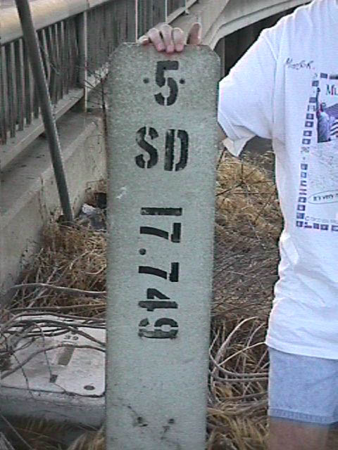
This is the same off ramp about seven years earlier. The postmile (17.749 miles) is an original marker placed from when Interstate 5 was routed on this stretch of Pacific Highway; it had fallen down the embankment and had to be replaced next to the exit sign. Shortly after we replaced the milepost alongside the highway, someone removed the postmile permanently. In early 2003, the original "Roadside Business" sign was replaced with a reflective green sign. Photo taken 06/99. |
|
Close-up of the old Interstate 5 postmile marker along northbound Historic U.S. 101 (Pacific Highway) at the Washington Street/Roadside Business interchange. Photo taken 06/99. |
|
On the ramp to the Pacific Highway frontage road was this "End One Way" sign at the Roadside Business off-ramp. The sign has since been removed. Photo taken 06/99. |
|
This is a view of the bridge over Washington Street as seen from the shoulder of the road, just behind the "Roadside Business" sign. Photo taken 06/99. |
|
Pacific Highway carries three lanes of traffic in each direction. This view is taken after the Roadside Business off-ramp. Photo taken 10/19/07. |
|
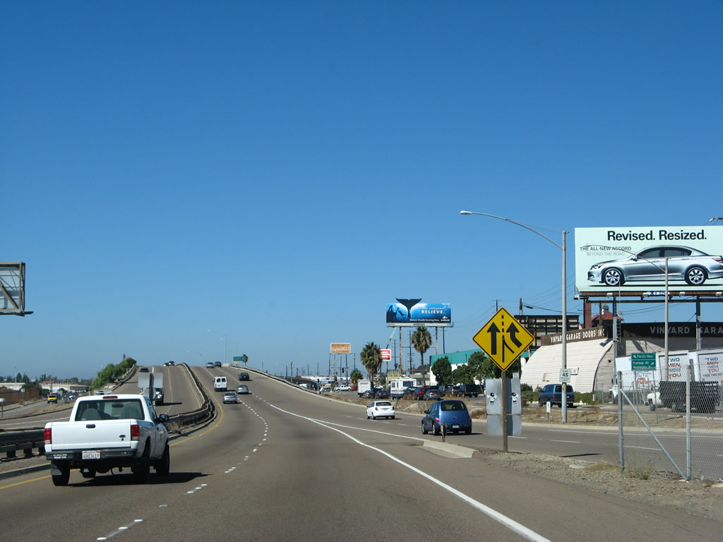
An auxiliary lane joins northbound Pacific Highway. The frontage road provides direct business access. Photo taken 10/19/07. |
|
The left lane of northbound Pacific Highway becomes exit only for the next left off-ramp, to Barnett Avenue west. No mention is made for either Couts Street or Witherby Street, which are the next two right exits and are located prior to the Barnett Avenue left off-ramp. Photo taken 10/19/07. |
|
A right turn to Couts Street is provided from this pseudo-freeway prior to the Witherby Street interchange; Couts Street connects to the frontage road and nearby businesses. Photo taken 10/19/07. |
|
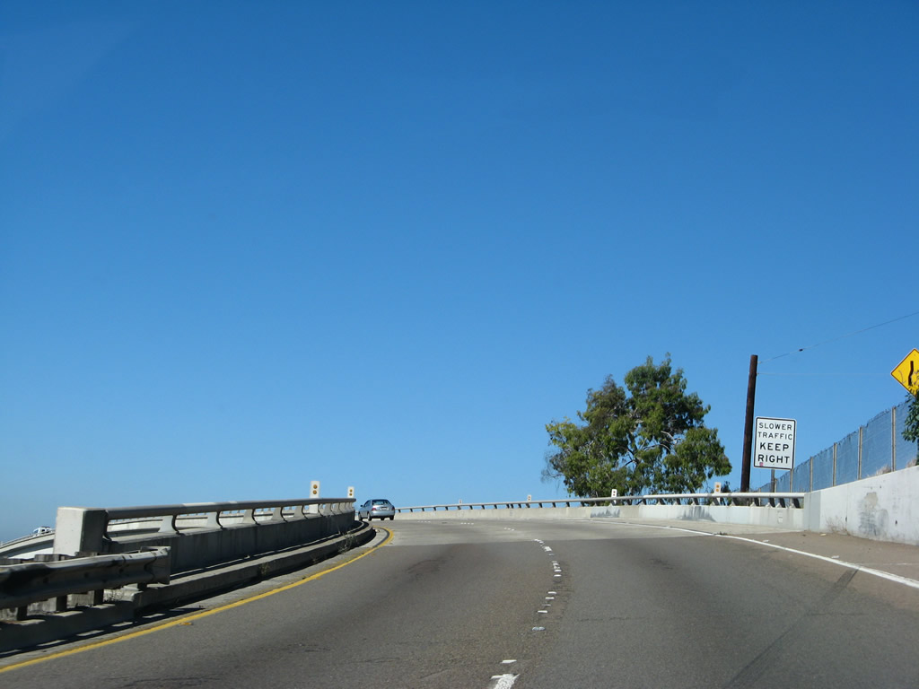
The median barrier is primarily guardrail with some chain link fence. Photo taken 10/19/07. |
|
The next interchange after Washington Street is largely below grade, and it connects Historic U.S. 101 with Witherby Street and the Marine Corps Recruit Depot. This date stamp of 1942 is located on the side of the bridge over the Witherby Street subway. Photo taken 09/23/06. |
|
|
Northbound Pacific Highway meets the Witherby Street off-ramp to the Marine Corps Recruit Depot. Ahead, the sprawling SPAWAR complex emerges on the east side of Pacific Highway. Photos taken 10/19/07. |
|
Markers separate the off-ramp to Barnett Avenue from the main lanes of northbound Historic U.S. 101 (Pacific Highway). Imagine this interchange if Pacific Highway had become Interstate 5 instead of taking its new alignment that's still in use today. Photo taken 10/19/07. |
|
|
Northbound Historic U.S. 101 (Pacific Highway) splits with Barnett Avenue at this point. Barnett Avenue was proposed for a possible extension of U.S. 80 west to the tip of Point Loma, but that extension was never signed. Photos taken 10/19/07 and 03/10/05. |
|
A 1942 date stamp is located at the gore point for the split between Pacific Highway north and Barnett Avenue west. In the distance is the Enterprise Street traffic signal. Photo taken 09/23/06. |
|
|
This view of southbound Historic U.S. 101 (Pacific Highway) is afforded from the Barnett Avenue overcrossing. Photos taken 09/23/06. |
|
The Barnett Avenue Overcrossing is signed with a state bridge number as shown here on the overcrossing. Photo taken 09/23/06. |
|
|
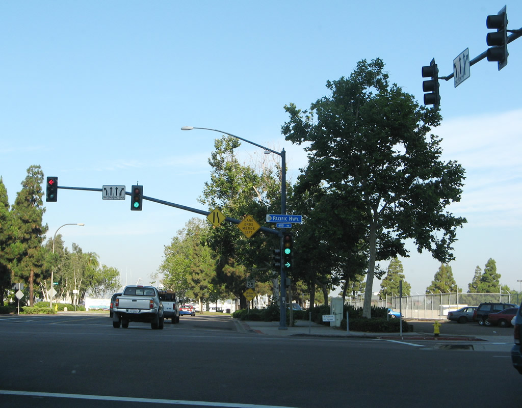
Northbound Pacific Highway meets Enterprise Street in front of SPAWAR at this traffic signal. The signal was added in 2003. An overhead sign advises that Interstate 8 is forthcoming, but the path to Interstate 8 from northbound Pacific Highway is fairly convoluted (follow Taylor Street east and follow the signs). Photos taken 09/23/06 and and 03/10/05. |
|
|
A pedestrian bridge crosses over Pacific Highway at the Enterprise Street intersection. A relatively new sign indicates that access to Interstate 8 via the right lane ... follow Pacific Highway north to Taylor Street east to Interstate 8. Photos taken 10/09/10. |
|
After the Enterprise Street intersection, the sprawling SPAWAR complex lies on the east side of Pacific Highway, separating it from the trolley/railroad tracks and Interstate 5. Photo taken 03/18/09. |
|
|
Northbound Historic U.S. 101 (Pacific Highway) (former Business Loop I-5) approaches the driveway for the Old Town Transit Center parking lot; at the station are connections to the city's bus system, trolley line to Mission Valley and downtown San Diego, and rail for the Coaster north to North San Diego County. The transit lot also serves as a parking lot for Old Town State Historic Park. Photos taken 03/18/09. |
|
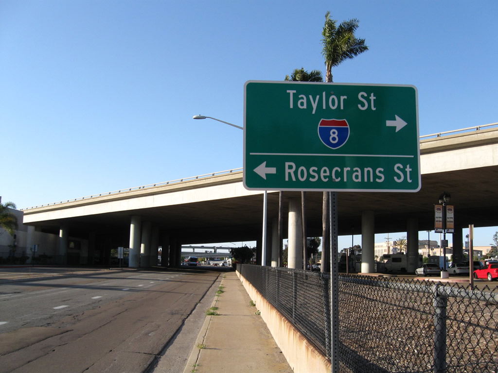
Pacific Highway passes under the Interstate 5 viaduct that extends across the transit center's parking lot. The next intersection along northbound Pacific Highway is with Taylor Street east and Rosecrans Street southwest. To Interstate 8, turn right on Taylor Street and follow it to the Interstate 8 interchange. Photo taken 03/18/09. |
|
Northbound Historic U.S. 101 (Pacific Highway) meets Taylor Street east and Rosecrans Street southwest at this traffic signal. To Interstate 8, turn right on Taylor Street and follow it to the Interstate 8 interchange. Continue straight to follow Pacific Highway north to Interstate 5 and Mission Bay Park. Photo taken 03/10/05. |
|
Pacific Highway passes under Interstate 8 and ramps associated with the Interstate 5 and Interstate 8 interchange. Photo taken 03/10/05. |
|
Northbound Historic U.S. 101 (Pacific Highway) crosses over the San Diego River and Friars Road; there is no direct access to Friars Road. Photo taken 03/10/05. |
|
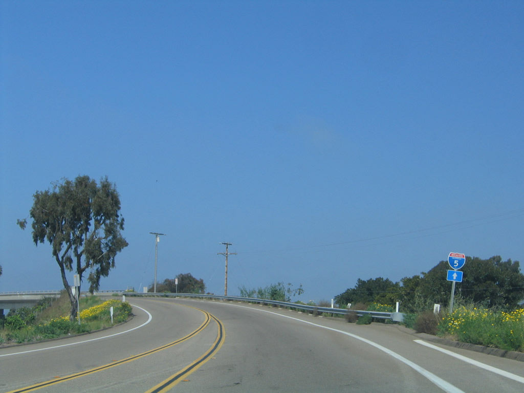
Pacific Highway reduces to two lanes for the first time since leaving downtown San Diego. An Interstate 5 trailblazer is posted prior to crossing over the Interstate 5 freeway. Access to Interstate 5 is available via Sea World Drive. Photo taken 03/10/05. |
|
|
Leaving Old Town, old U.S. 101 connects to Morena Boulevard by way of a demolished section of Pacific Highway (due to the construction of the Interstate 5 and Interstate 8 interchange). As a detour, follow Taylor Street east to Morena Boulevard north. Here Morena Boulevard passes under Interstate 8 (former U.S. 80), then prepares to cross the San Diego River. Look for the overhead porcelain enamel overheads that grace the southbound direction of Morena Boulevard. Photos taken 09/23/06 and 03/18/09. |
|
Northbound Morena Boulevard crosses over the San Diego River on this modern bridge. After this crossing, U.S. 101 joins Morena Boulevard. Photo taken 09/23/06. |
|
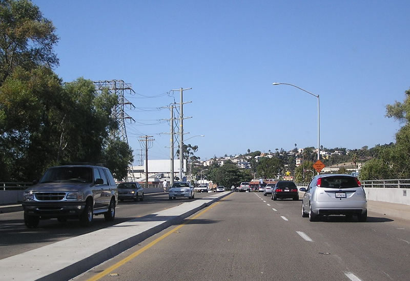
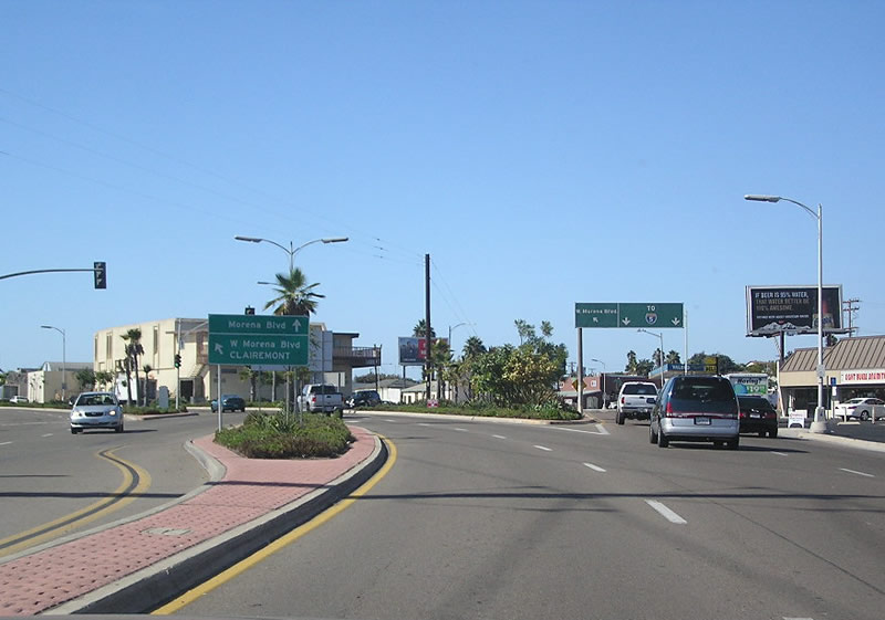
After the Linda Vista Road turnoff, northbound Morena Boulevard splits: through traffic should stay left on West Morena Boulevard, while local traffic should trend right to continue on Morena Boulevard. To Interstate 5, use Morena Boulevard (bear right). Photo taken 09/23/06. |
|
Traffic from Turquoise Street merges onto northbound La Jolla Boulevard. Photo taken 01/21/11. |
|
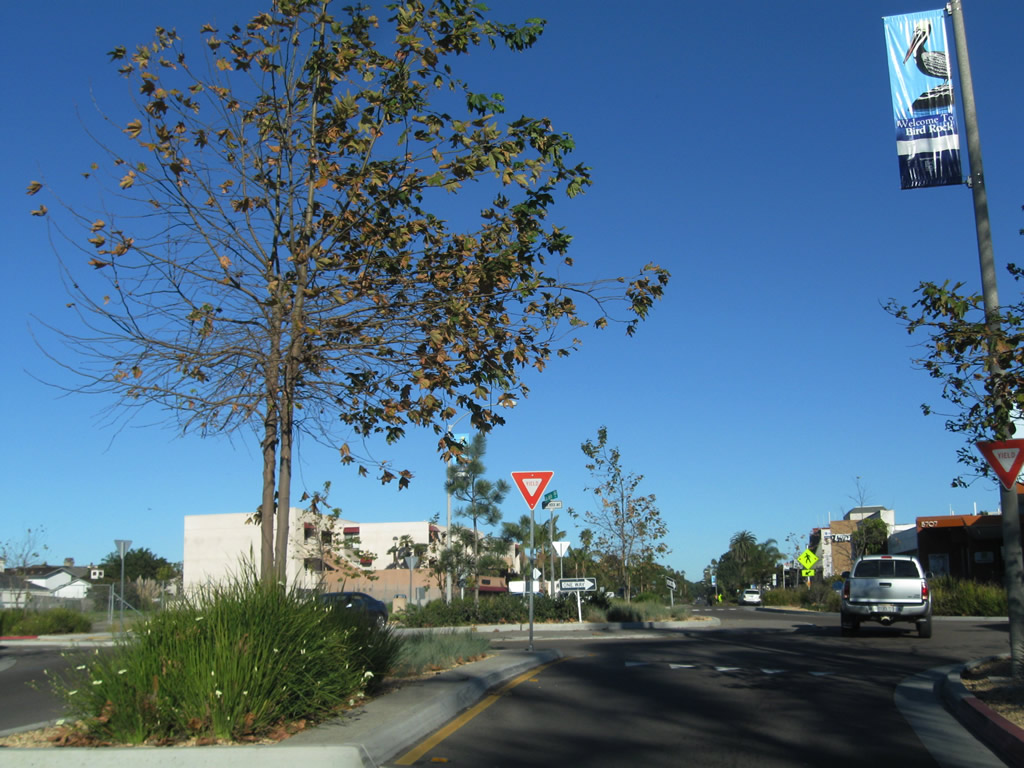
La Jolla Boulevard connects Pacific Beach with La Jolla via Bird Rock and Windansea Beach. Once part of the U.S. 101 coastal route (before it was realigned through Rose Canyon), La Jolla Boulevard saw a major construction project to add roundabouts through the commercial area of Bird Rock. Here, northbound La Jolla Boulevard approaches Colima Street. Photo taken 01/21/11. |
|
Each landscaped roundabout is surrounded by a concrete apron to allow larger vehicles such as buses and fire trucks to pass through the intersection. The net effect is slower traffic. Photo taken 01/21/11. |
|
One block north, La Jolla Boulevard meets Midway Street. Photo taken 01/21/11. |
|
Northbound La Jolla Boulevard (Historic U.S. 101) meets Forward Street. Photo taken 01/21/11. |
|
This view looks northeast from the west sidewalk along La Jolla Boulevard at Forward Street. Photo taken 01/21/11. |
|
Continuing north, La Jolla Boulevard approaches Bird Rock Avenue. This is the fourth of five roundabouts on La Jolla Boulevard through Bird Rock. Photo taken 01/21/11. |
|
Northbound La Jolla Boulevard approaches Camino de la Costa. Photo taken 01/21/11. |
|
Leaving the confluence of Torrey Pines Road, Hidden Valley Road, La Jolla Parkway (former Ardath Road), and La Jolla Shores Road, northbound Torrey Pines Road will follow a canyon northeast and then north toward the University of California at San Diego. Photo taken 11/11/12. |
|
The original alignment of U.S. 101 followed La Jolla Shores Drive; a later realignment moved Historic U.S. 101 onto Torrey Pines Road. Photo taken 11/11/12. |
|
This section of Torrey Pines Road has four lanes, with occasional median divider. Photo taken 11/11/12. |
|
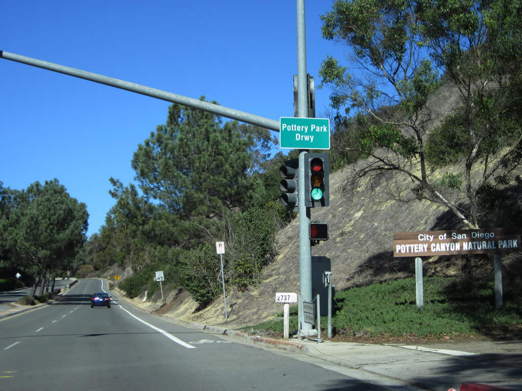
Northbound Torrey Pines Road meets the driveway into Pottery Canyon, an open space preserve. Photo taken 11/11/12. |
|
Namesake Torrey Pines line the median of Torrey Pines Road. Photo taken 11/11/12. |
|
|
|
|
|
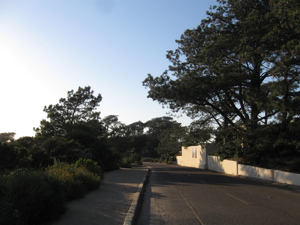
| As Torrey Pines Road ascends out of the canyon, a concrete barrier separates the two directions of traffic. A few curves help Torrey Pines Road gain elevation onto Torrey Pines Mesa. Photos taken 11/11/12. |
|
Torrey Pines Road (Historic U.S. 101) approaches the top of the grade. Photo taken 11/11/12. |
|
At the top of the grade, northbound Historic U.S. 101 (Torrey Pines Road) approaches Dunaway Drive and Glenbrook Way. Torrey Pines Road will pass through a residential area between here and the University of California at San Diego. Photo taken 11/11/12. |
|
Northbound Historic U.S. 101 (Torrey Pines Road) approaches its intersection with La Jolla Village Drive. Ahead is the University of California at San Diego. Turn left for North Torrey Pines Road to Historic U.S. 101 or turn right on La Jolla Village Drive east to Interstate 5 and the community of University City. Photo taken 11/11/12. |
|
Northbound Genesee Avenue approaches North Torrey Pines Road. While Genesee Avenue is not an old alignment of U.S. 101, a small green guide sign advises that North Torrey Pines Road will take travelers north to Torrey Pines and the city of Del Mar. Photo taken 01/20/11. |
|
Shortly thereafter, northbound Genesee Avenue meets North Torrey Pines Road. Although mostly not signed, San Diego County S-21 transitions from Genesee Avenue onto North Torrey Pines Road. Despite the county designation, North Torrey Pines Road is better known for its prior designation as U.S. 101. Photo taken 01/20/11. |
|
Genesee Avenue and North Torrey Pines Road merge together at the northern corner of the University of California at San Diego (UCSD). This intersection was realigned to facilitate a direct transition between Genesee Avenue and North Torrey Pines Road in the early 1990s. As a result, the alignment of the intersection does not demonstrate its original intended route through UCSD before that segment was removed as the campus expanded. Photo taken 01/20/11. |
|
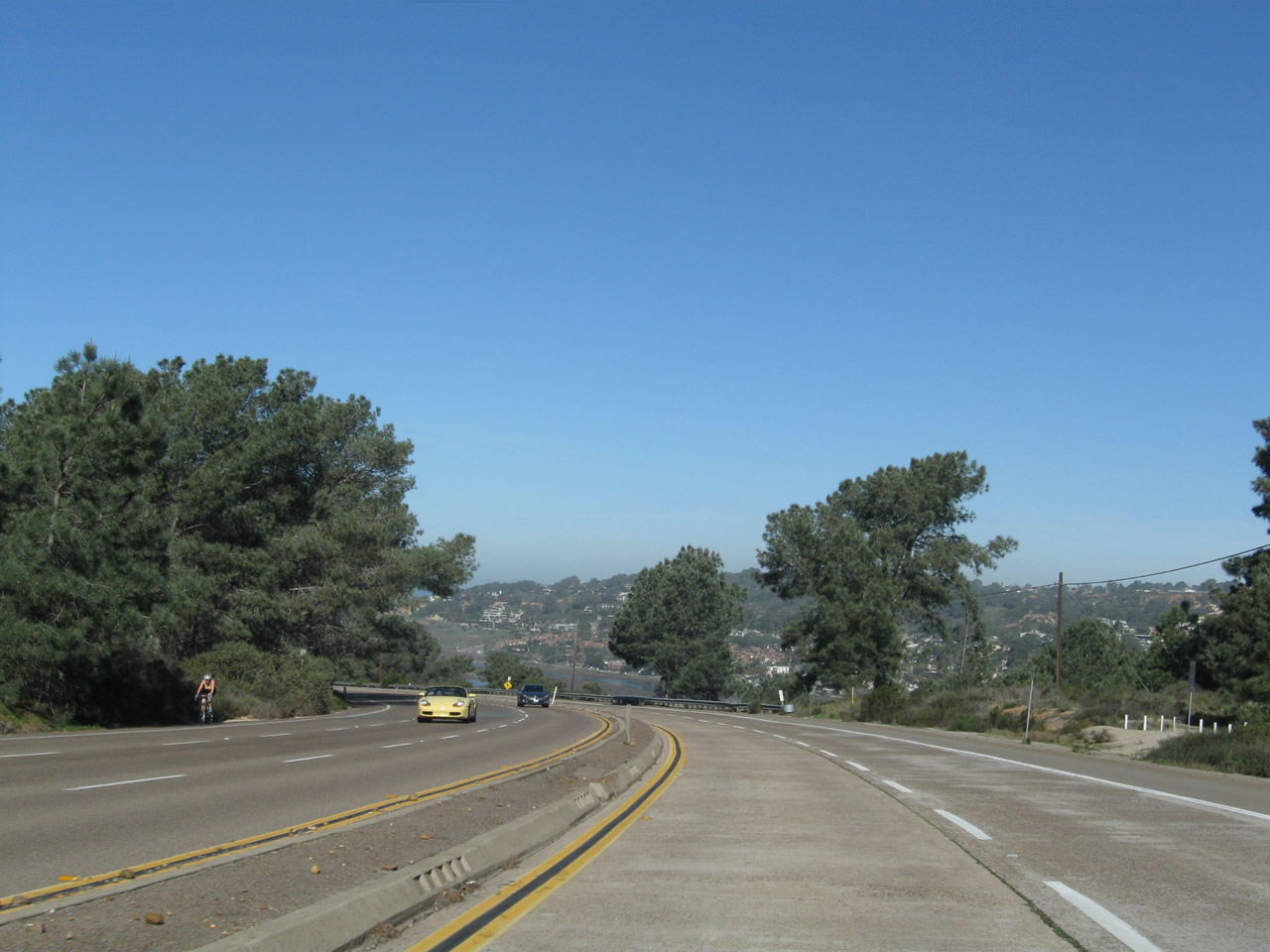
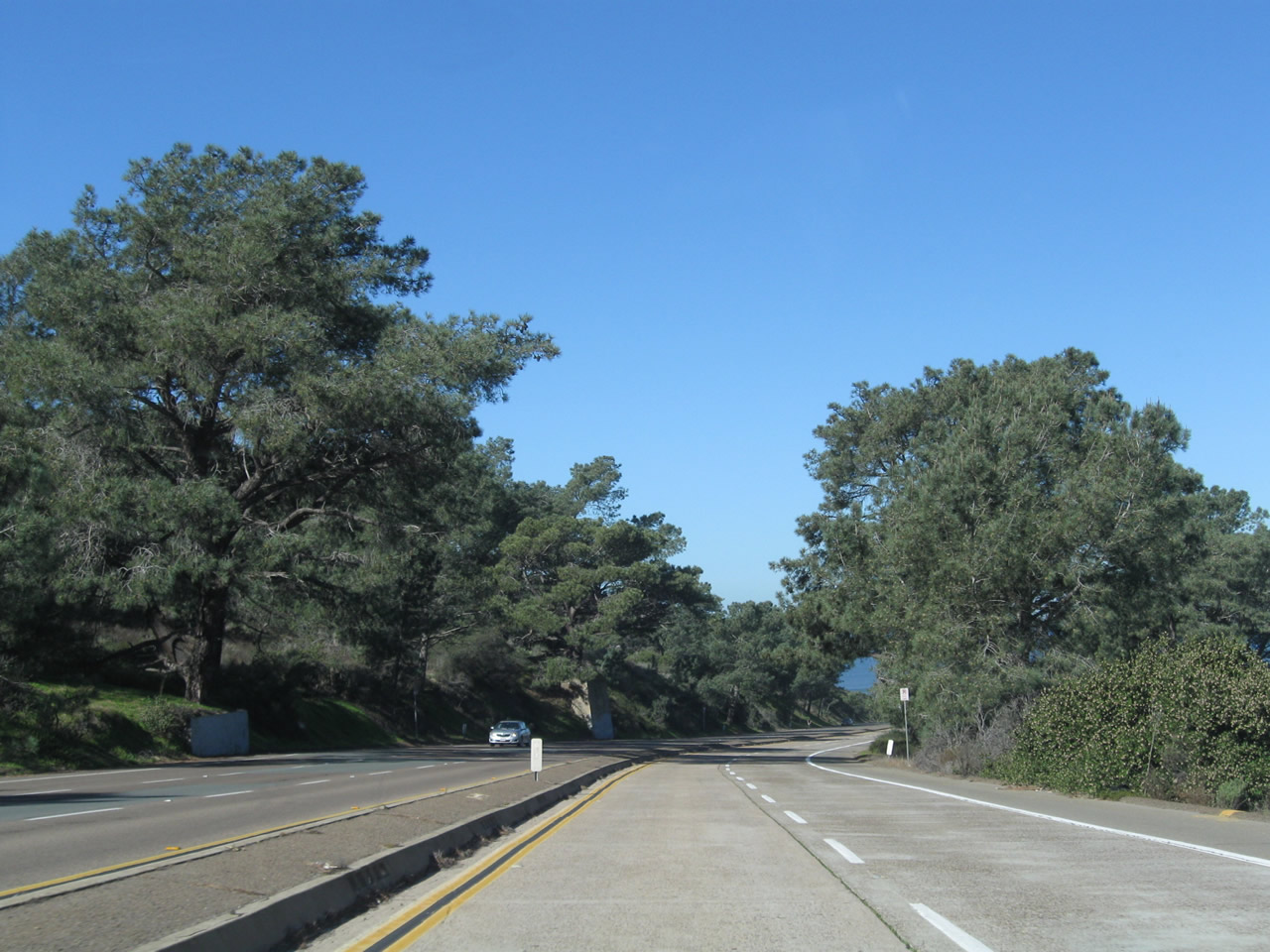
Between Genesee Avenue and the Callan Road interchange, northbound Historic U.S. 101 (North Torrey Pines Road) has three northbound lanes. A wide, landscaped median features eucalyptus trees that likely date back to the highway's original construction. Photo taken 01/20/11. |
|
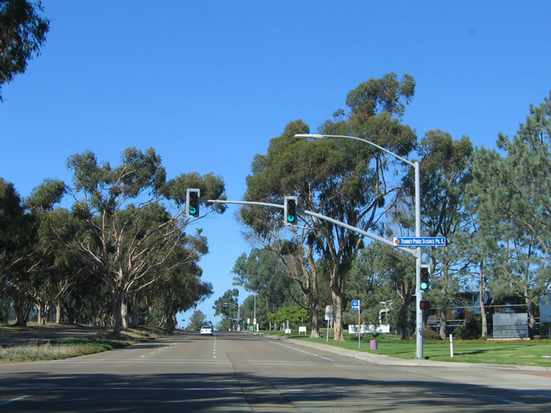
Northbound Historic U.S. 101 (North Torrey Pines Road) approaches Science Park Road and the Hilton Hotel Driveway. Biotech firms flourish on Torrey Pines Mesa and benefit from their proximity to the University of California at San Diego. Photo taken 01/20/11. |
|
The next interchange along Historic U.S. 101 (North Torrey Pines Road) north is with Callan Road. An exit onto the off-ramp connects to Callan Road east to business parks and biotechnical firms. Use the middle lane to connect to Torrey Pines Golf Course, home of the 2008 U.S. Open. Photo taken 01/20/11. |
|
Northbound Historic U.S. 101 (North Torrey Pines Road) meets the off-ramp to eastbound Callan Road. The second right connects to Callan Road west to Torrey Pines Golf Course. Photo taken 01/20/11. |
|
A 1944 bridge carries Historic U.S. 101 over Callan Road. This interchange, built to connect U.S. 101 to former Camp Callan and now Torrey Pines Golf Course, which is owned and operated by the city of San Diego. Camp Callan operated during World War II as a U.S. Army anti-aircraft artillery replacement training center between 1940 and 1945. Photo taken 01/20/11. |
|
|
|
The second ramp in the Callan Road interchange connects Historic U.S. 101 (North Torrey Pines Road) (San Diego County S-21) north with Callan Road west to Torrey Pines Golf Course. The guide sign here was replaced in 2008 prior to the U.S. Open. Photos taken 01/20/11, 12/28/10, and 10/29/05. |
|
Traffic from Callan Road merges onto northbound Historic U.S. 101 (North Torrey Pines Road). Photo taken 01/20/11. |
|
Shortly thereafter, the next signalized intersection along Historic U.S. 101 (North Torrey Pines Road) north is with Torrey Pines Science Park South. Photo taken 10/29/05. |
|
Northbound Historic U.S. 101 (North Torrey Pines Road) again has three lanes as it proceeds north between Torrey Pines Science Park South and North. On the east side of the road are several biotech firms, while on the west side is Torrey Pines Golf Course. Photo taken 01/20/11. |
|
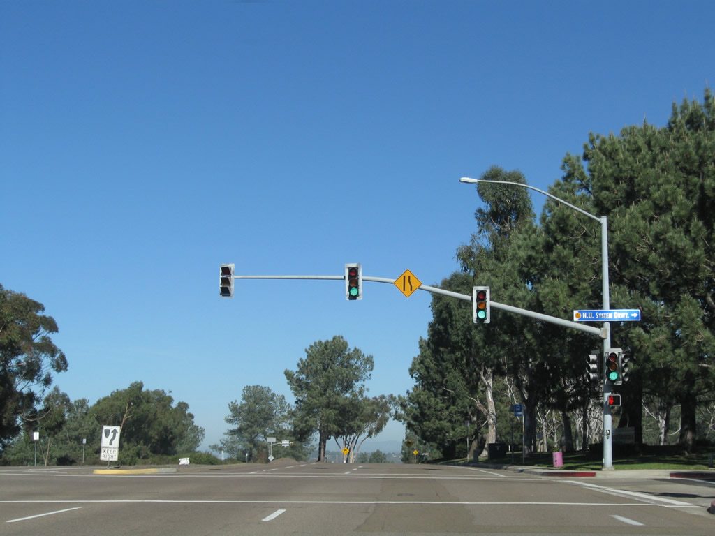
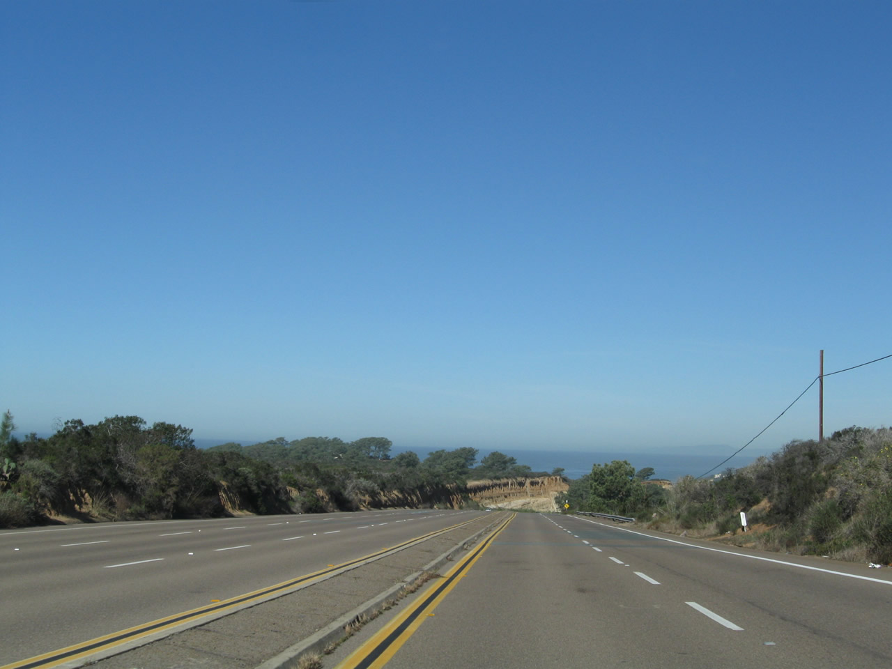
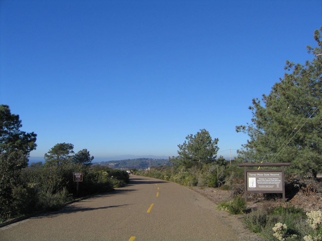
The next traffic signal along northbound Historic U.S. 101 (North Torrey Pines Road) serves Torrey Pines Science Park North (N.U. System Driveway). This is the last intersection before North Torrey Pines Road enters Torrey Pines State Reserve and descends from Torrey Pines Mesa to cross Peñasquitos Lagoon. Around this point, the oldest and original U.S. 101 alignment diverges to the northwest; pictures of this are provided in a separate series below. Photo taken 01/20/11. |
|
|
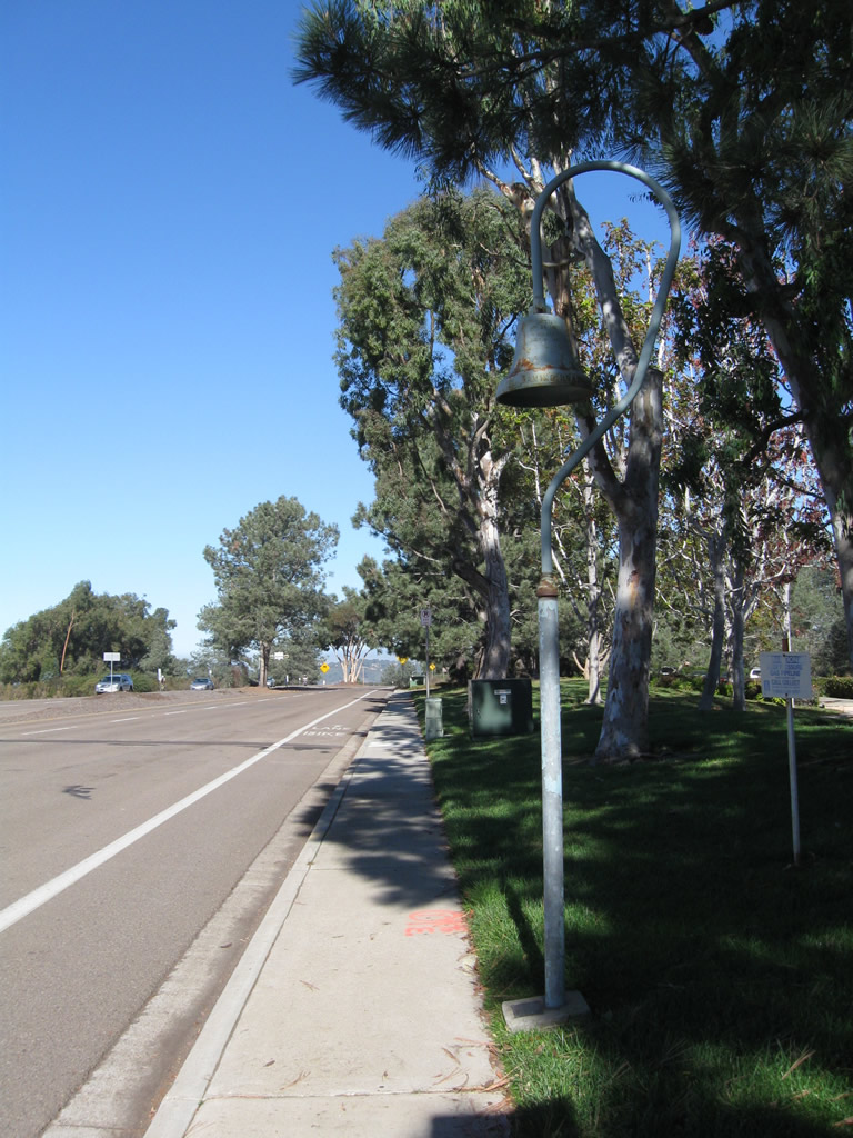
An El Camino Real mission bell highway marker is posted after the Torrey Pines Science Park North (N.U. System Driveway) intersection. Replica mission bells like this are posted along the current and historic corridors of U.S. 101 from San Diego north to San Francisco. Photos taken 12/28/10. |
|
|
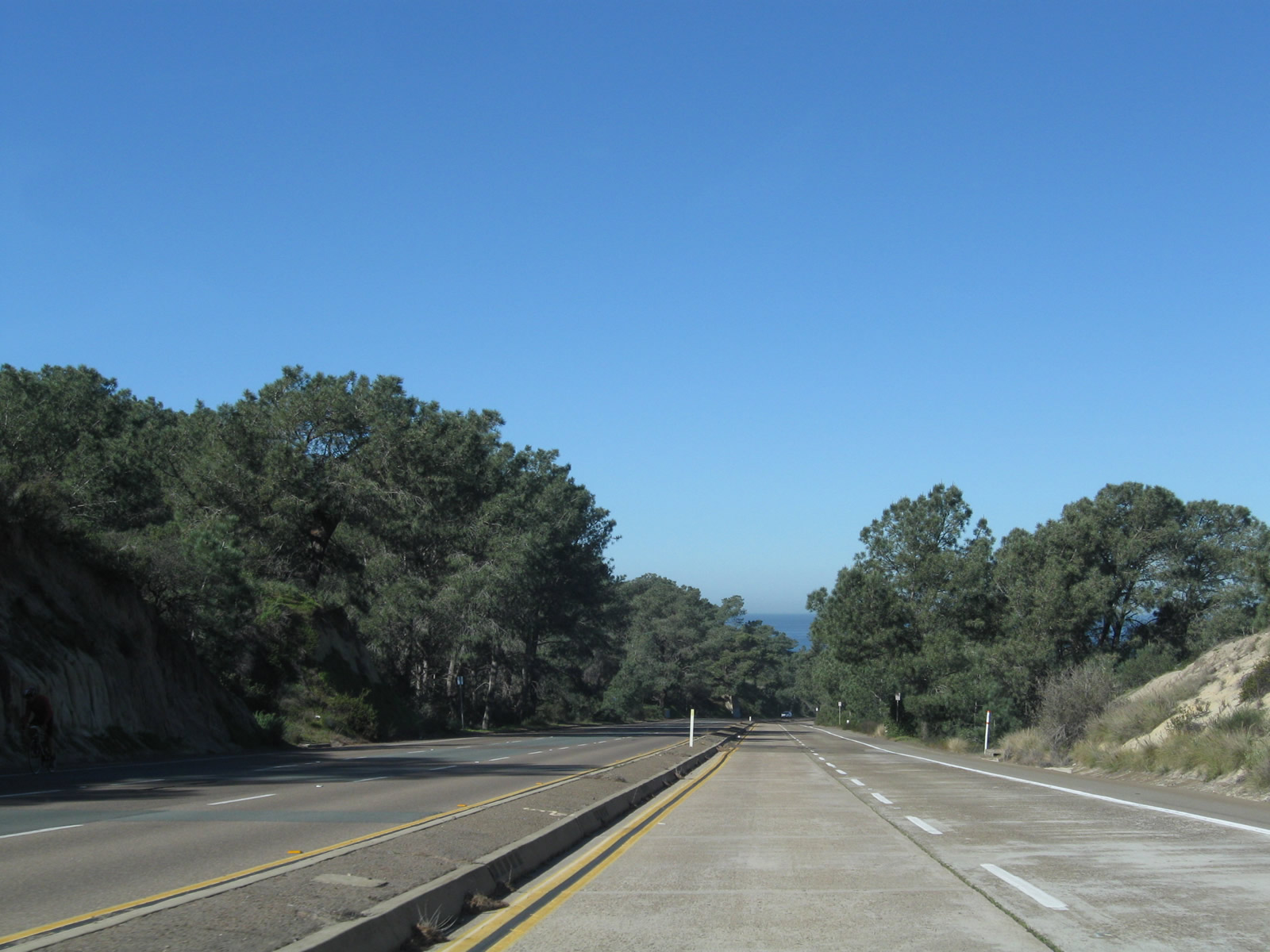
Historic U.S. 101 enters Torrey Pines State Reserve. This state park is best known for the rare Torrey Pine tree, which only grows in rare coastal environments in Southern California. A large concentration of the trees exists here. Not only does the park include hiking and beaches, it also contains an extensive section of the original Torrey Pines Grade, which preceded this section of U.S. 101. Photos taken 01/20/11 and 10/29/05. |
|
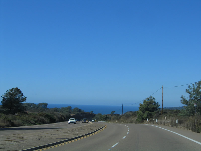
The Pacific Ocean comes into view as Historic U.S. 101 north begins its gradual descent from Torrey Pines Mesa to Los Peñasquitos Lagoon. The highway retains at least four lanes for the grade down to the lagoon, but it shifts to one lane in each direction once it approaches the city of Del Mar. Photo taken 01/20/11. |
|
|
|
The original route through what is now Torrey Pines State Reserve was a single-slab concrete roadway that was constructed in 1915. Due to its many twists and turns, U.S. 101 was rerouted from this early coastal road to this alignment, which carries U.S. 101 over four lanes of pavement from Torrey Pines Mesa north to Los Peñasquitos Lagoon. The expressway was built in the 1930s as a three-lane highway (with a suicide lane). By 1941, U.S. 101 was complete with five lanes, with three southbound lanes and two northbound lanes. Of course, in 1966, Interstate 5 was constructed further inland to bypass North Torrey Pines Road. In the valley below the highway is Los Peñasquitos Lagoon, a marshy area that is fed by Peñasquitos Creek from the east and natural tidal influences from the ocean. Historic U.S. 101 will cross over the creek mouth. Photos taken 01/20/11. |
|
|
|
|
|
|
|
|
|
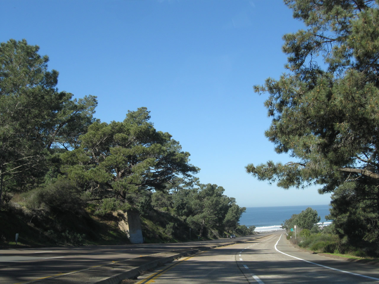
Several Torrey Pine trees grace U.S. 101 as the expressway continues northwest toward the beach and Pacific Ocean. Warm reds and tans make the sandstone cliffs especially impressive during the morning. Divoted curbing lines the median strip, owing to the road's original construction. The highway remains in the state reserve, which offers ample hiking and sightseeing opportunities. Hiking trails at the top of the mesa (via park road, next left) connect the reserve's visitor center with the expansive beach isolated by towering cliffs from the rest of the city. This beach is known as Black's Beach. Photos taken 01/20/11. |
|
|
|
|
|
|
|
|
|
|
|
|
The first turn off along northbound since leaving the mesa is the connection to the main entrance to Torrey Pines State Reserve, which includes Torrey Pines Beach adjacent to Los Peñasquitos Lagoon. Free parking is available on the left side of the highway facing the ocean; paid parking with ample space including several lots is located within the state reserve after paying the day-use fee. The road that leads from this entrance to the visitors center and museum is the original route of U.S. 101 that was bypassed by North Torrey Pines Road. Photos taken 01/20/11. |
|
|
|
|
|
|
After the state reserve entrance, Historic U.S. 101 (North Torrey Pines Road) threads a narrow strip of land between the Pacific Ocean and the Lagoon. Since there is no charge to park along North Torrey Pines Road where the diagonal slots connect directly to the highway, plenty of people have taken up the opportunity on this cool winter's day. Look to the right to see the railroad, which crosses the lagoon at a diagonal trajectory and will pass under U.S. 101 at the southern city limits of Del Mar. Photos taken 01/21/11. |
|
Historic U.S. 101 prepares to narrow to one through lane in each direction prior to crossing over the Peñasquitos Creek bridge. The hill in the distance is partially within the state reserve, although portions of it are developed with houses and residential development. This smaller section of reserve is surrounded by the city of Del Mar on the west and the Torrey Pines community planning area of the city of San Diego on the other sides. Photo taken 01/21/11. |
|
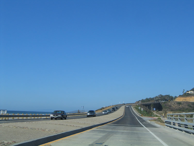
The bridge over Peñasquitos Creek was replaced in 2004. While the old bridge has historical qualities (since it was built in the 1930s), the new bridge is more environmentally friendly with only two piers that are located in the water. This facilities better water flow in and out of the adjacent lagoon east of old U.S. 101. Photo taken 10/29/05. |
|
Originally, plans by the city of San Diego called for this bridge to be constructed with four lanes. However, the city of Del Mar did not plan to widen its railroad bridge to a similar width. As a result, the bridge over Peñasquitos Creek has extra wide median barriers that were not originally intended to be there. Photo taken 10/29/05. |
|
Climbing away from the bridge over the creek, Historic U.S. 101 (North Torrey Pines Road) next approaches the railroad bridge, which is wholly owned by the city of Del Mar. Photo taken 10/29/05. |
|
|
These views of northbound Peñasquitos Creek bridge are taken from the western sidewalk on the bridge over the creek. Photos taken 10/29/05. |
| Historic U.S. 101 (Pacific Highway) (Torrey Pines State Reserve Original Segment) north |
|
|
|
|
|
|
|
|
|
|
|
|
|
|
|
|
|
|
|
|
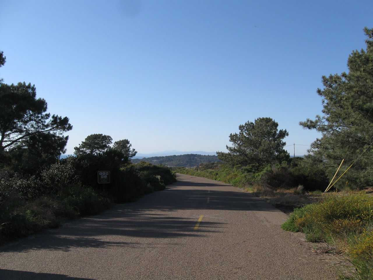
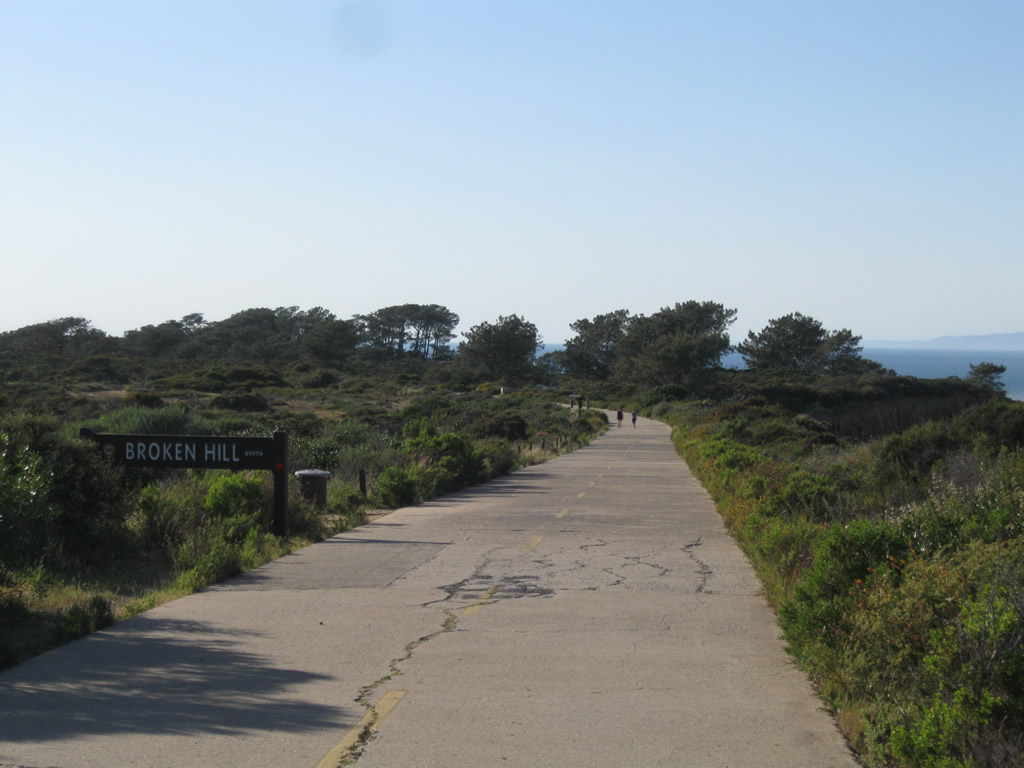
| This series of pictures shows the original alignment of U.S. 101 walking north through Torrey Pines State Reserve. This alignment is no longer open to vehicular traffic, but hikers and bicyclists may use the concrete road as a trail that connects the north end of Torrey Pines Golf Course with the state reserve visitors center. Originally paved in 1915, this concrete became part of U.S. 101 when the U.S. Highway System was designated in 1926 (signs designating the route were erected by the Automobile Club of Southern California thereafter). Photos taken 05/01/11. |
|
|
The oldest alignment of U.S. 101 from Torrey Pines Mesa north to Los Peñasquitos Lagoon runs through Torrey Pines State Reserve. Old single-slab concrete still remains in place in the park, offering pedestrians and bicyclists the opportunity to see some original state highway that is still intact. Most of this segment is not used for motorized traffic (other than official vehicles). Photos taken 12/11/04. |
|
|
| La Jolla Boulevard scenes |
|
This view looks west along Bird Rock past the La Jolla Boulevard roundabout toward the Pacific Ocean. On this clear morning, the blue ocean shimmered in the distance. Photo taken 01/21/11. |
Page Updated December 9, 2012.