| Historic U.S. 101 (Pacific Highway) (Torrey Pines State Reserve Original Segment) south |
|---|
|
|
|
|
|
|
|
|
|
|
|
|
|
|
|
|
|
|
|
|
|
|
|
|
|
|
|
|
|
|
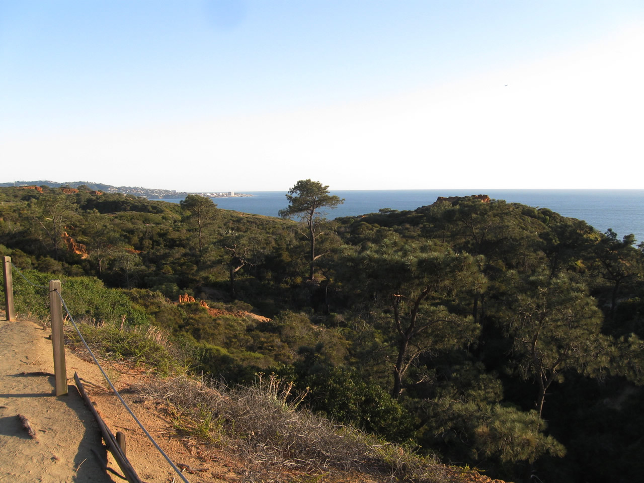
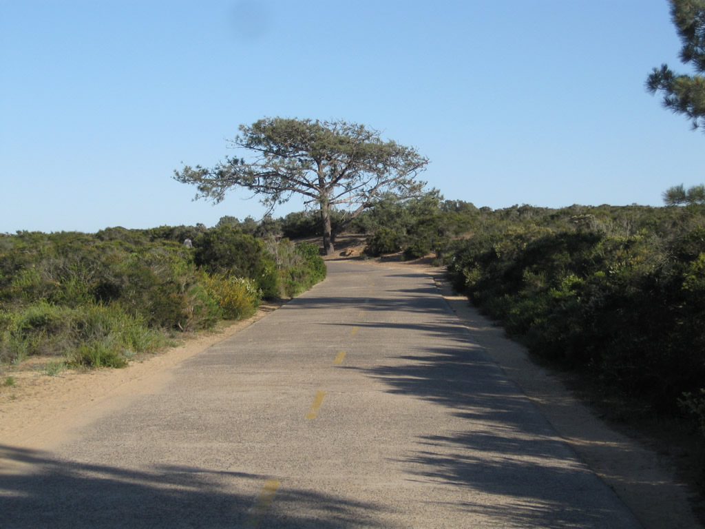
| This series of pictures shows the original alignment of U.S. 101 walking south through Torrey Pines State Reserve. This alignment is no longer open to vehicular traffic, but hikers and bicyclists may use the concrete road as a trail that connects the north end of Torrey Pines Golf Course with the state reserve visitors center. Originally paved in 1915, this concrete became part of U.S. 101 when the U.S. Highway System was designated in 1926 (signs designating the route were erected by the Automobile Club of Southern California thereafter). At the southern end of the old alignment is Torrey Pines Golf Course. Remnant white striping remains on the asphalt section adjacent to the golf course. The old road merges directly onto the North Torrey Pines Road sidewalk. Photos taken 05/01/11. |
| Historic U.S. 101 (North Torrey Pines Road) south |
|
Now back on the motor route traveling south, Torrey Pines State Beach spreads out to the west of Historic U.S. 101 (North Torrey Pines Road). Photo taken 10/29/05. |
|
Torrey Pines Mesa sits in the distance. Parking areas for the state reserve are located near the base of the mesa. Photo taken 10/29/05. |
|
|
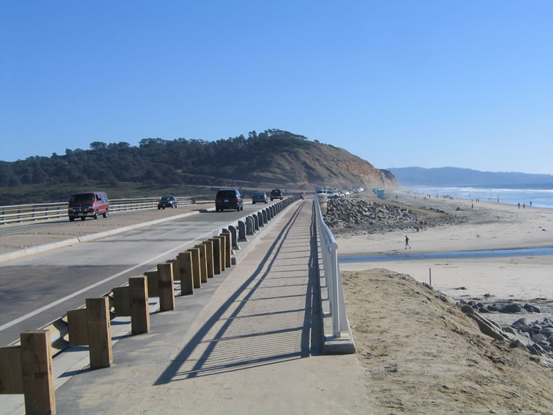
A pedestrian sidewalk allows for access on the west side of the Peñasquitos Creek bridge only. There is no companion sidewalk on the east side of the bridge. Photo taken 10/29/05. |
|
|
Roadside parking is allowed on the west side of North Torrey Pines Road. Photo taken 10/29/05. |
|
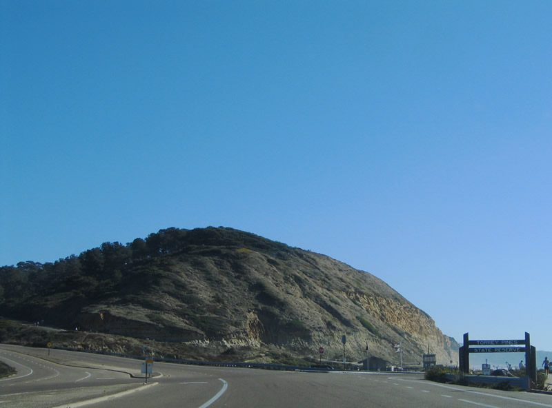
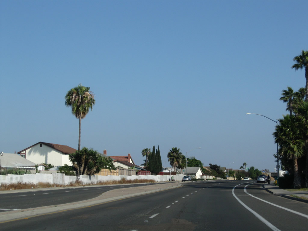
Southbound Historic U.S. 101 (North Torrey Pines Road) meets the entrance to Torrey Pines State Reserve. Photo taken 10/29/05. |
|
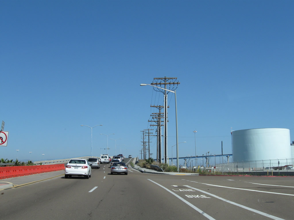
On southbound U.S. 101, there are three lanes (the third lane is a climbing lane). Photo taken 10/29/05. |
|
Torrey pines come into view along U.S. 101 as the highway ascends to the top of Torrey Pines Mesa. Photo taken 10/29/05. |
|
|
|
|
This suite of photos follows U.S. 101 south as the highway continues up the Torrey Pines Grade toward the Torrey Pines Golf Course. Look for divots in the concrete median, which tells the age of this stretch of roadway. Photos taken 10/29/05 and 03/26/10. |
|
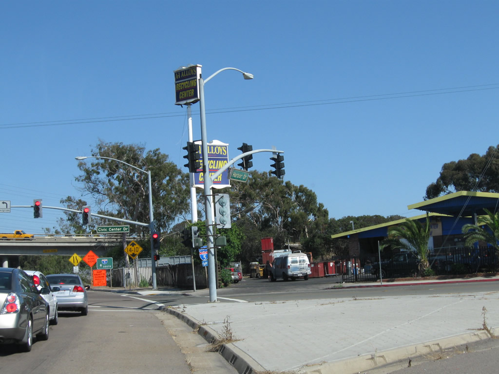
The first traffic signal along southbound North Torrey Pines Road connects with Torrey Pines Science Park North; this is the first intersection since leaving the state reserve area. Photo taken 10/29/05. |
|
The next traffic signal is with Torrey Pines Science Park South, followed by an off-ramp to Callan Road and Torrey Pines Golf Course. This sign was posted between Torrey Pines Science Park North and South; it was removed by 2008. Photo taken 12/11/04. |
|
This view looks east from North Torrey Pines Road toward the Torrey Pines Golf Course. Photo taken 05/01/11. |
|
|
A final reassurance shield for San Diego County S-21 is located prior to the traffic signal for Torrey Pines Science Park North. This route marker was still in place as of May 2011. Photos taken 05/01/11 and 12/11/04. |
|
|
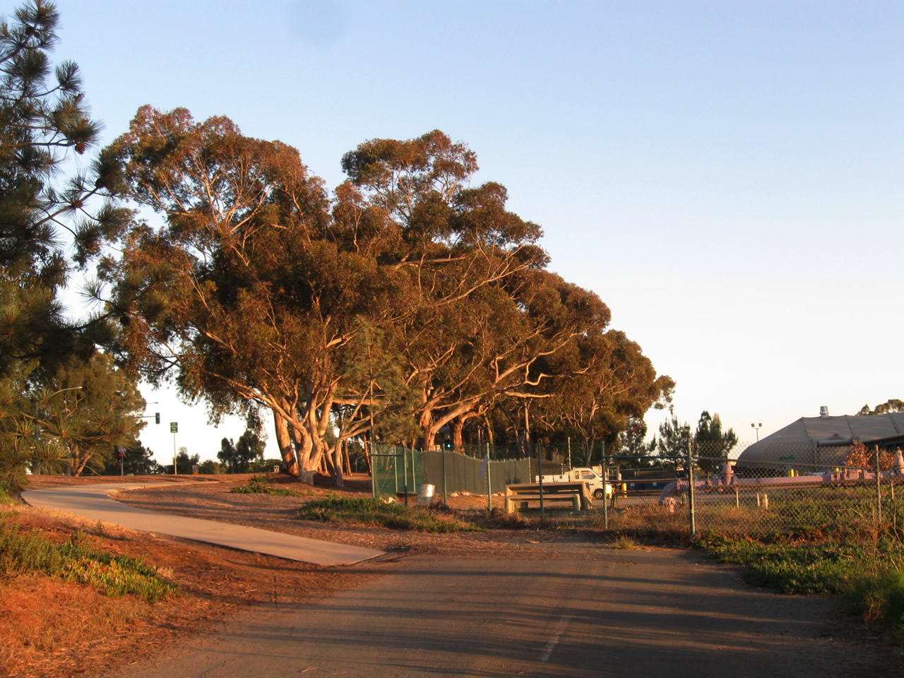
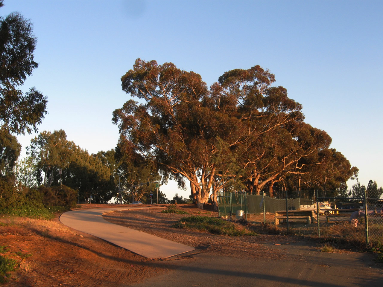
This view looks south along North Torrey Pines Road alongside the Torrey Pines Golf Course parking lot near the driving range. Eucalyptus trees and Torrey pine trees line the roadway. The eucalyptus trees were planted when the highway was constructed. Photos taken 05/01/11. |
|
|
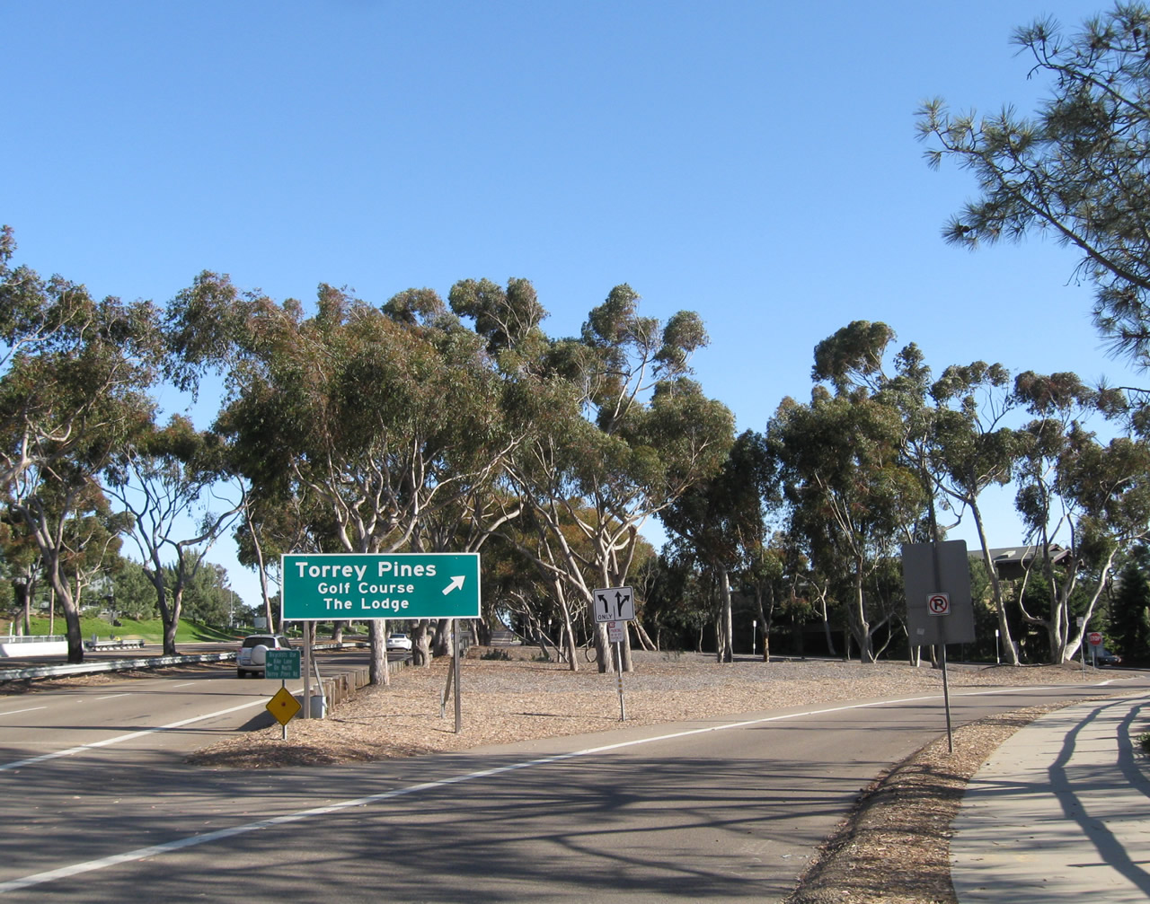
This off-ramp connects southbound North Torrey Pines Road with the Torrey Pines Golf Course, one of the most famous municipal golf courses in the country. The golf course served as the home of the 2008 U.S. Open. The green guide sign for southbound traffic was replaced in 2008. Photos taken 10/29/05, 05/01/11, and 12/11/04. |
|
|
|
The next traffic signal serves the Torrey Pines Hilton and eastbound Science Park Road. Photo taken 10/29/05. |
|
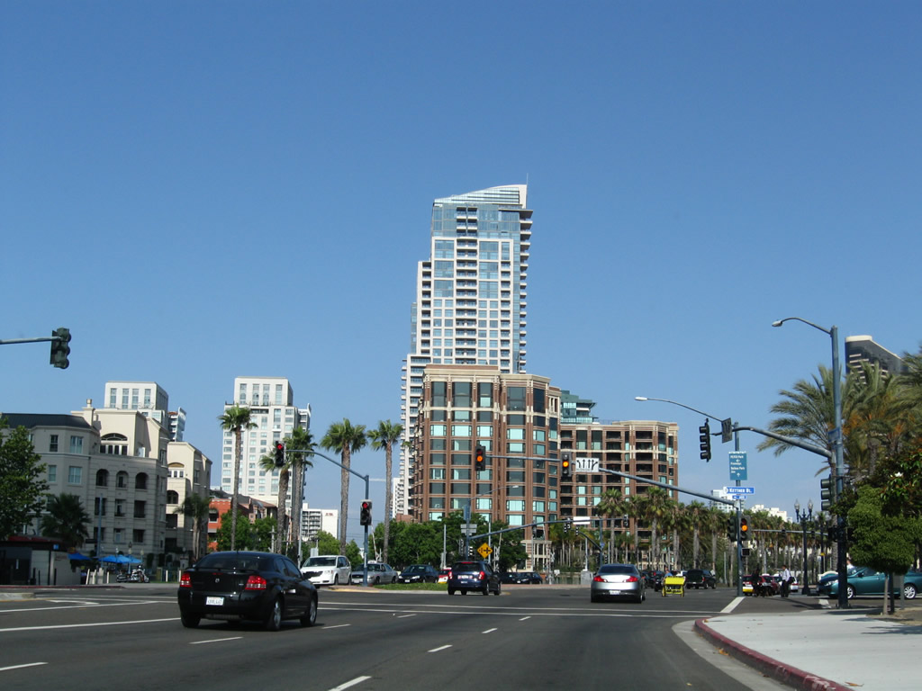
At this intersection, the old alignment U.S. 101 disappears, since the old road was plowed under when the University of California at San Diego (UCSD) was constructed in the 1960s. Genesee Avenue carries traffic back to Interstate 5, but it was never part of U.S. 101. To the southwest, North Torrey Pines Road continues, but it no longer follows Old U.S. 101. The next extant section of U.S. 101 is on Gilman Drive south of La Jolla Village Drive and UCSD. Photo taken 10/29/05. |
| U.S. 101/Gilman Avenue south |
| U.S. 101/Mission Bay Drive (Business Loop I-5) south |
|
This old U.S. 101 bridge (currently designated as part of Business Loop I-5 (Mission Bay Drive) in Pacific Beach) crosses Rose Canyon Creek, a tributary to Mission Bay. The date stamp is located on the west side of the bridge on southbound Business 5/Mission Bay Drive; the date stamp was altered from its original 1938 to 1988. Photo taken 05/15/08. |
|
This view looks south from the west sidewalk on the Rose Canyon Creek Bridge. Several businesses, including gas stations, car dealerships, and restaurants line Mission Bay Drive as it travels south through the east end of Pacific Beach. Photo taken 05/15/08. |
|
Southbound Mission Bay Drive approaches Damon Avenue at the next traffic signal at the south end of the bridge over Rose Canyon Creek. The original bridge railing is still in place, as well as sidewalks. Photo taken 05/15/08. |
| U.S. 101/Morena Boulevard south |
|
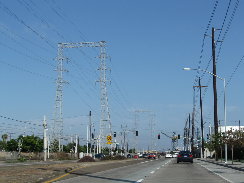
In the Morena District, southbound Morena Boulevard (Historic U.S. 101) approaches Sherman Street near the Linda Vista Road intersection. The point where Morena Boulevard and Linda Vista Road intersect was the original intersection between U.S. 101 and U.S. 395. Both routes have since been retracted out of San Diego County. The Sherman Street sign is unique as it dates back to the at least the 1950s, is black porcelain enamel, and has button copy. Photo taken 06/06/11. |
|
|
|
|
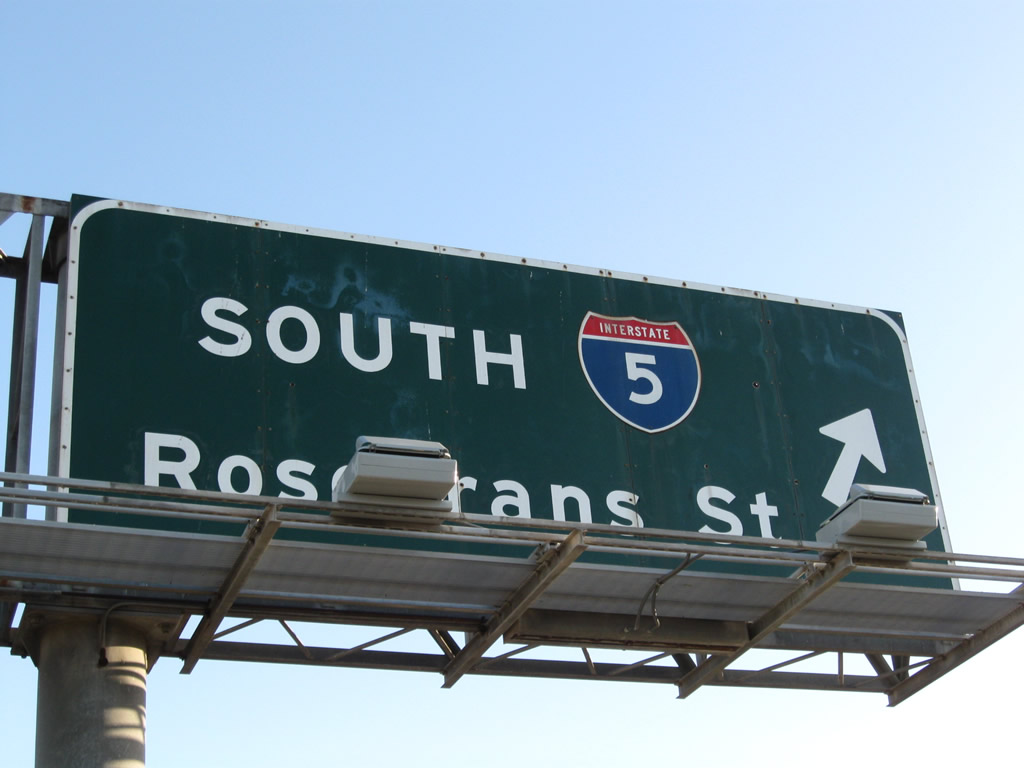
Southbound Morena Boulevard meets the on-ramp to Interstate 5 south to downtown San Diego and former California 209/Rosecrans Street south to Point Loma; the next right turn is to Interstate 8 east to Mission Valley and El Centro. Photos taken 03/18/09. |
|
|
After the ramp to Interstate 5 south, southbound Morena Boulevard passes under Interstate 8 then enters Old Town San Diego. Photos taken 03/18/09. |
|
|
Southbound Morena Boulevard meets the ramp to Interstate 8 east to Mission Valley, the eastern suburbs of San Diego, and El Centro. Continue straight ahead to Old Town San Diego and Taylor Street, the southern terminus of Morena Boulevard. Photos taken 03/18/09. |
| Historic U.S. 101 (Pacific Highway) south |
|---|
|
|
|
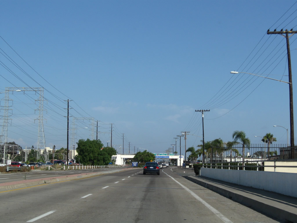
We begin by showing Pacific Highway southbound between Sea World Drive and Rosecrans Street. The bridge that carries Pacific Highway over Interstate 5 was not part of Historic U.S. 101, but it becomes part of the historic route upon meeting Anna Avenue next to the California Highway Patrol Station. Turn left on Anna Avenue to an extant section of old U.S. 101 including a 1933 bridge that today serves as a service road to several nearby businesses. Photos taken 06/29/11. |
|
|
|
|
|
|
An older bridge carries Pacific Highway (former U.S. 101) over Friars Road and the San Diego River. This bridge used to sport white wooden bridge railing, but it was modernized to its current configuration in the early 2000s. In the distance ahead, Interstate 8 and its connecting ramps to Interstate 5 tower above Pacific Highway. Photos taken 06/29/11. |
|
The first ramp to pass overhead is the transition between Interstate 8 west and Interstate 5 north. Above that is the ramp from Interstate 8 west to Camino del Rio (former California 209) south and Interstate 5 south. Photos taken 06/29/11. |
|
|
After passing under the Interstate 8 mainline, the transition ramp from Interstate 5 north to Interstate 8 east comes into view. Photos taken 06/29/11. |
|
|
|
Southbound Pacific Highway (U.S. 101) next approaches its intersection with Taylor Street east and Rosecrans Street south. Turn left to Old Town (including the original route of U.S. 101, which used to follow Morena Boulevard and San Diego Avenue through Old Town) or right to the Midway District. After this intersection, Pacific Highway passes under Interstate 5 and approaches the left turn into the Old Town Transit Center. Photos taken 06/29/11. |
|
|
|
This series of pictures follows southbound Pacific Highway (former U.S. 101) between the Old Town Transit Center and the Enterprise Street traffic signal near the SPAWAR complex. After passing under Interstate 5, Pacific Highway widens to six lanes (three in each direction) plus auxiliary lanes. Photos taken 06/24/11. |
|
|
Southbound Pacific Highway (former U.S. 101) passes under a pedestrian bridge and meets Enterprise Street at this traffic signal. After this signal, Pacific Highway becomes a city-maintained freeway that briefly served as Interstate 5 before the mainline was shifted to the east side of the railroad tracks along a path that parallels India Street and Hancock Street/Kettner Boulevard through the Five Points and Middletown neighborhoods. Photos taken 06/24/11. |
|
|
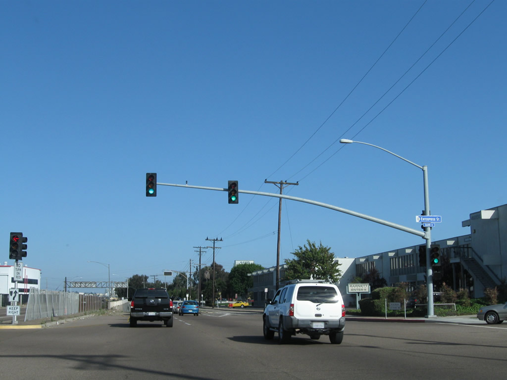
U.S. 101 used to follow Pacific Highway from Old Town south into downtown San Diego. A portion of this alignment remains a city-maintained section of freeway. Here, southbound Historic U.S. 101 meets Barnett Avenue (former Legislative Route 12/Camino del Cabrillo, briefly served as part of U.S. 80 in the early 1940s during World War II), which travels west to Point Loma and Cabrillo National Monument. The freeway drops into a subway built in 1942; this was one of the first freeway structures to be built in San Diego. Note the "Subway Flooded" overhead sign that is posted near the gore point with Barnett Avenue. Only two lanes of U.S. 101 south proceed through the subway. The right lane exits only to Barnett Avenue west. Photos taken 09/23/06 and 06/24/11. |
|
|
White wooden guardrail that dates back to the initial construction of the Historic U.S. 101 (Pacific Highway) interchange with Barnett Avenue lines the southbound lanes as they travel below grade. The bridge carries traffic from northbound U.S. 101 onto westbound Barnett Avenue. The frontage road on the right provides the connection from southbound U.S. 101 to westbound Barnett Avenue. Photos taken 06/24/11 and 09/23/06. |
|
|
The southbound lanes of Pacific Highway travel below the ramp connecting Pacific Highway north to Barnett Avenue west. Ahead, traffic from eastbound Barnett Avenue will merge onto Pacific Highway south. There is no direct access from Barnett Avenue east to Pacific Highway north. Stay right for the connection to the Marine Corps Recruit Depot, which is located immediately after the Barnett Avenue merge. Photos taken 06/24/11. |
|
A 1970s-era speed limit ends sign represents the transition from a 45-mile-per-hour zone to a 55-mile-per-hour maximum speed. It is likely this sign was city-installed after Pacific Highway was transferred from the state of California to the city of San Diego. Photo taken 06/24/11. |
|
Near the speed limit ends sign, an off-ramp connects to the Marine Corps Recruit Depot, which is sandwiched between Pacific Highway on the east and San Diego International Airport (Lindbergh Field) on the west. There is no exit sign here. Photo taken 09/23/06. |
|
Crossing over Witherby Street/Marine Corps Recruit Depot, a small ventilation house for the concrete subway is located next to a prominent date stamp of 1942. Photo taken 09/23/06. |
|
|
Immediately after crossing Witherby Street, southbound Pacific Highway (Historic U.S. 101) connects to the loop ramp to Witherby Street eastbound. Use Witherby Street east to the Pacific Highway Frontage Road, which allows access to businesses on the east side of the freeway. From here, Pacific Highway carries three southbound lanes toward downtown San Diego. Much of the traffic here is related to the military base as well as commuter traffic to and from Point Loma. Photos taken 06/24/11 and 09/23/06. |
|
|
Between Witherby Street and Washington Street, southbound Pacific Highway widens to four through lanes. San Diego International Airport comes into view on the southwest side of Pacific Highway, while the skyscrapers of downtown San Diego come into view in the distance ahead. The right lane will become exit only for Washington Street, although no advance signs indicate this. Photos taken 06/24/11. |
|
Southbound Pacific Highway meets the off-ramp to Washington Street, which travels east through Five Points into Mission Hills, Hillcrest, and University Heights before linking with El Cajon Boulevard en route to North Park and City Heights. Three lanes continue along Pacific Highway south. Photo taken 06/24/11. |
|
|
Passing over Washington Street, southbound Pacific Highway will again split. Stay left for Interstate 5 south or right for Pacific Highway south. To Balboa Park, follow Pacific Highway south to Laurel Street east. To the Embarcadero, follow Pacific Highway south to Broadway west. To the San Diego Padres Ballpark, follow Interstate 5 south to Tenth Avenue south for the fastest route (although one could continue south on Pacific Highway to Harbor Drive if desired). Photos taken 06/24/11. |
|
|
Proceeding south, the freeway connector from Pacific Highway to Interstate 5 comes into view. Stay right for Historic U.S. 101 south to Balboa Park, the Embarcadero, Seaport Village, and points south via Harbor Drive (including the San Diego Convention Center). Photos taken 06/24/11. |
|
|
Pacific Highway splits at this gore point. The left two lanes will connect to Interstate 5 (San Diego Freeway), while the right two lanes will continue south on Pacific Highway. Photos taken 06/24/11. |
|
Looking back a few years, the left lanes of Pacific Highway south will merge onto Interstate 5 (San Diego Freeway) south. These nonreflective signs (which surprisingly did not have any button copy and were never retrofitted with buttons) were replaced with reflective signs in early 2003 (as shown in the previous photobox). Photo taken 06/99. |
|
|
|
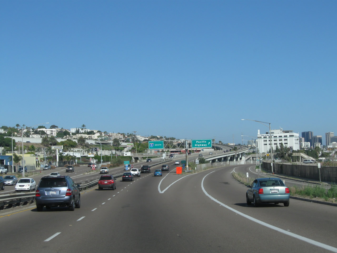
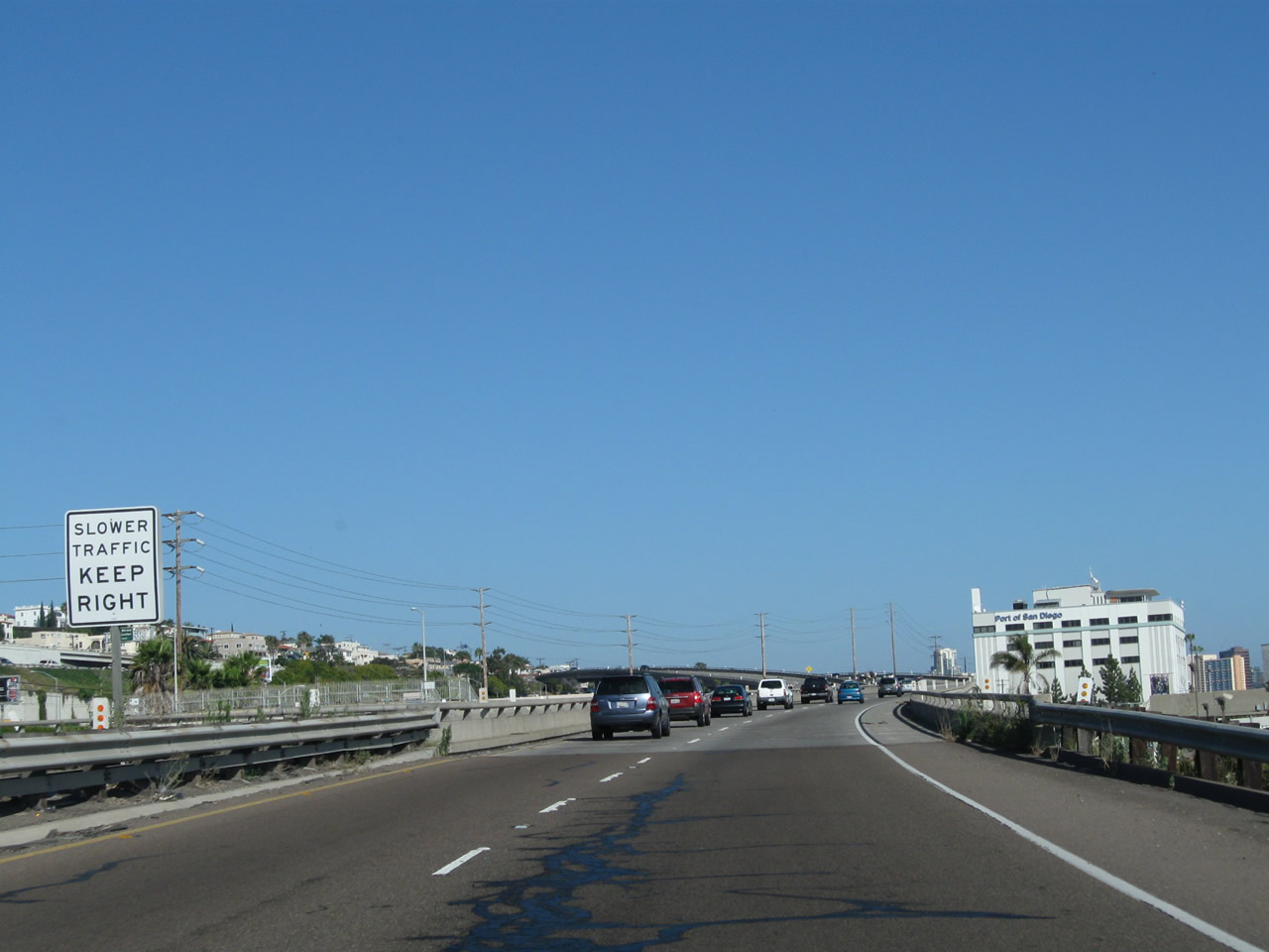
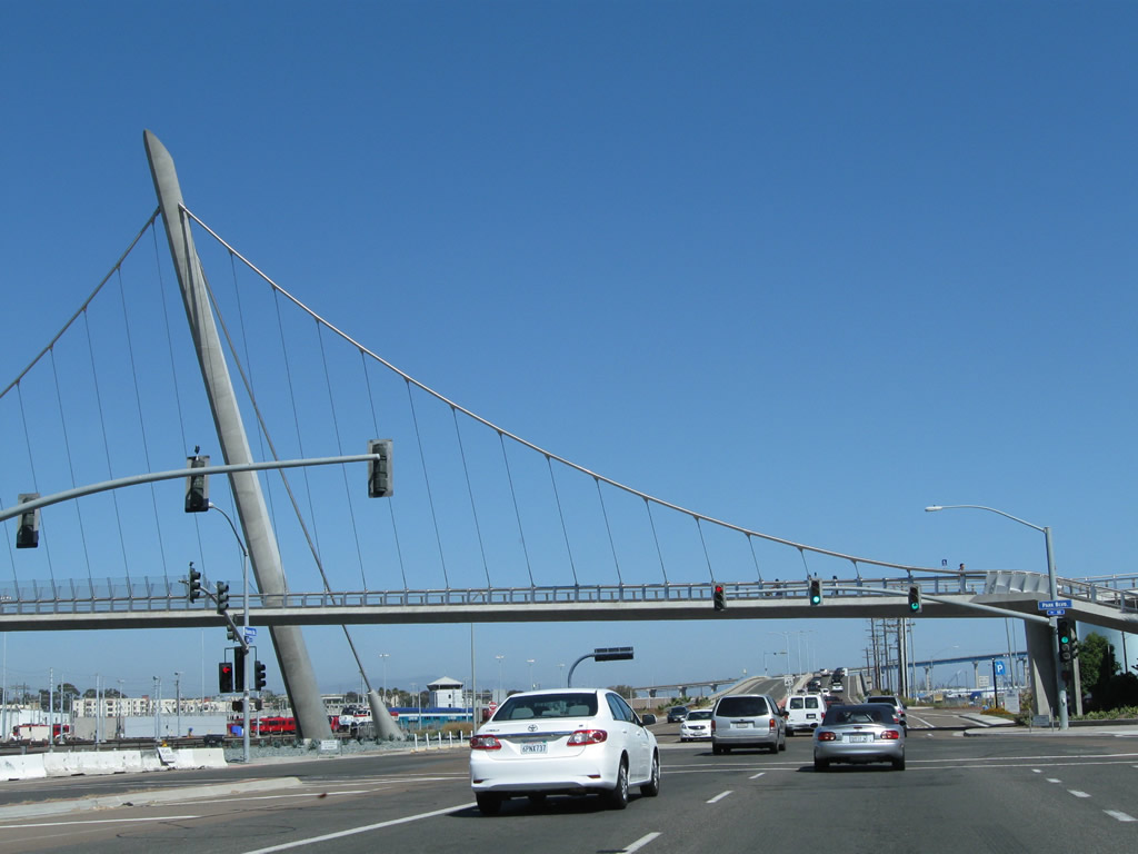
This collection of pictures showcases the ramp from Pacific Highway south to Interstate 5 south. As an on-ramp to the freeway, it is maintained by the state of California. The elevated ramp passes over Kettner Boulevard and the railroad to make the connection to Interstate 5. Prior to merging with the freeway, the connecting ramp reduces from two lanes to one lane. Downtown San Diego comes into view as the elevated ramp makes the freeway connection. During evening commuting hours, this ramp can be congested due to ample traffic traveling south on Interstate 5 between Old Town, Downtown, and National City. Although Interstate 5 was briefly signed along Pacific Highway prior to the construction of the modern freeway, this freeway connection was not part of that designation; Interstate 5 instead used to temporarily end as Pacific Highway approached downtown. Photos taken 06/24/11. |
|
|
|
|
|
|
|
|
|
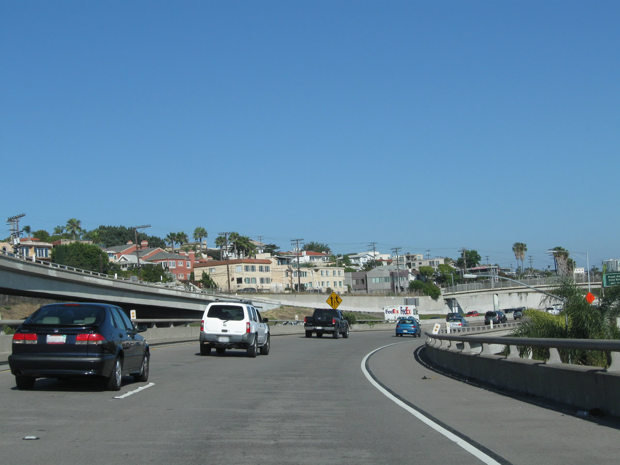
Back on the mainline, southbound Pacific Highway loses its freeway configuration and downgrades to a six-lane conventional city street. From here, Pacific Highway travels due south toward the County Administration Building and Seaport Village. Photos taken 06/16/09 and 06/29/11. |
|
The first traffic signal since Enterprise Street along southbound Pacific Highway is with Sassafras Street. The street blade was converted from a green to blue sign in 2010. Photo taken 06/29/11. |
|
A pedestrian overpass connects a parking lot on the west side of the highway with the Port of San Diego building on the east side of Pacific Highway. Photo taken 06/16/09. |
|
The next traffic signal connects Pacific Highway with Palm Street. Photo taken 06/29/11. |
|
Southbound Pacific Highway meets Palm Street at this signalized intersection. For airport access, continue south to Laurel Street. Photo taken 06/29/11. |
|
Several blocks ahead, southbound Pacific Highway meets Laurel Street. Turn left here for Laurel Street east to Little Italy and Balboa Park; turn right here for Laurel Street west to Harbor Drive northwest to San Diego International Airport. Continue straight ahead for downtown San Diego, the Embarcadero, Seaport Village, and Convention Center. Photo taken 06/16/09. |
|
Southbound Pacific Highway next approaches Juniper Street at this traffic signal. Photo taken 06/16/09. |
|
The skyline of downtown San Diego glistens in the late afternoon summer sunlight as Pacific Highway meets Hawthorn Street at this traffic signal. Turn right here for Hawthorn Street west to Harbor Drive en route to the airport and North Embarcadero. Photo taken 06/16/09. |
|
Southbound Pacific Highway meets Grape Street, which travels east to Little Italy, Interstate 5, and Bankers Hill. Photo taken 06/16/09. |
|
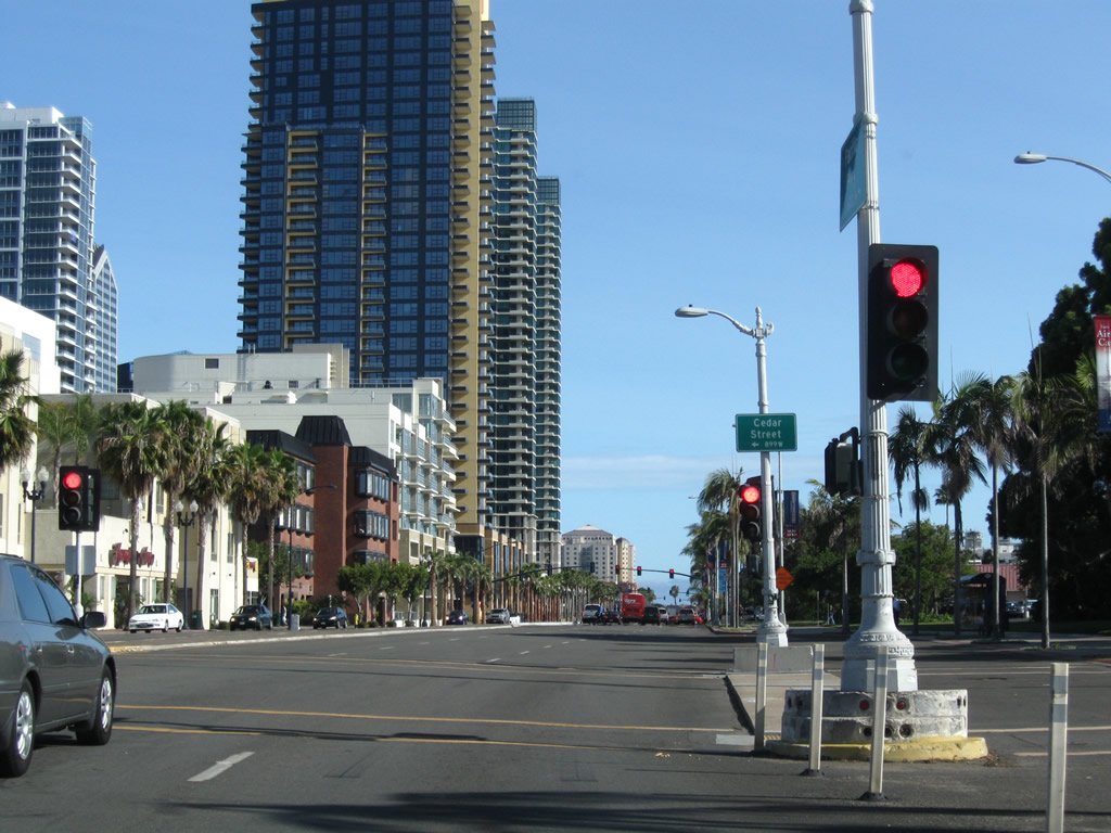
Next to the County Administration Building, southbound Historic U.S. 101 (Pacific Highway) meets Cedar Street. Note the old style traffic signal mount and inlaid reflectors. Photo taken 06/16/09. |
|
A wayfinder sign points the way to the Star of India and Cruise Ship Terminal by turning right (west) on Ash Street, which is the next right turn. For Seaport Village and the Convention Center, continue south on Pacific Highway. Photo taken 06/16/09. |
|
Southbound Pacific Highway next approaches Broadway at this traffic signal near the U.S. Navy complex. Photo taken 06/17/09. |
|
Pacific Highway sees a long stretch without traffic signals between Broadway and Harbor Drive. Photo taken 06/17/09. |
|
The next traffic signal along Pacific Highway south is with Harbor Drive. Turn right (north) on Harbor Drive to the North Embarcadero or left to continue southeast on Historic U.S. 101. Originally, U.S. 101 proceeded south into the Seaport Village parking lot, then met U.S. 80-395 there (and partially under the location of the northern Hyatt tower). With the realignment of roads to accommodate Seaport Village, the best way to approximate the route of U.S. 101 today is to turn left here on Harbor Drive. Photo taken 06/17/09. |
|
Southbound Pacific Highway meets Harbor Drive at this traffic signal. Photo taken 06/29/11. |
| Harbor Drive (Historic U.S. 101) south |
|
After leaving Pacific Highway, southbound motorists are immediately greeted by the skyline of downtown San Diego. A significant number of high rise condominiums line Market Street east of here, making for a dramatic scene here. Photo taken 06/17/09. |
|
|
|
Southbound Pacific Highway approaches and meets Kettner Boulevard, which travels south into Seaport Village. Ahead, Harbor Drive aims southeast to meet Market Street, which is old U.S. 80-395. Photos taken 06/17/09. |
|
Harbor Drive (Historic U.S. 101) south meets U.S. 80-395/Market Street. At this intersection, Historic U.S. 101 continues south on Harbor Drive toward Barrio Logan and National City, while U.S. 80 and U.S. 395 travel east on Market Street. This intersection served as the eastern and southern terminus of U.S. 80 and U.S. 395 after U.S. 101 was realigned onto Harbor Drive. Photo taken 06/17/09. |
|
This major intersection is the best approximation of the original meeting place of U.S. 80, 101, and 395. Historic U.S. 80 and U.S. 395 travel together through the Marina District and Gaslamp Quarter before turning north on Park Boulevard (12th Avenue) toward Balboa Park and University Heights. In 1948, the two routes were realigned to turn north on 11th Avenue to follow the Cabrillo Freeway north into Hillcrest, dividing at the U.S. 80/Washington Street interchange in Hillcrest. The Harbor Drive/Market Street intersection was the western end of U.S. 80 until June 1953, when U.S. 80 was rerouted onto Mission Valley Road (later Mission Valley Freeway) to end at U.S. 101 near Mission Bay Park. The Harbor Drive/Market Street intersection remained as the southern terminus of U.S. 395 until 1972 or 1973, when the route was retracted to its current terminus in San Bernardino County. California 163, which was designated in 1969 and cosigned with U.S. 395 for about three or four years, was briefly signed to end here, but the state relinquished Market Street thereafter. Photo taken 02/27/11. |
|
At the Market Street intersection, the San Diego Trolley and companion railroad curve southeast to parallel Harbor Drive southeast toward Barrio Logan and National City. Photo taken 02/27/11. |
|
Back on the mainline, Harbor Drive (Historic U.S. 101) proceeds south through a palm-lined promenade parallel to the railroad tracks. Photo taken 06/20/11. |
|
Southbound Harbor Drive (Historic U.S. 101) meets Front Street at this traffic signal. The convention center comes into view on the west side of Harbor Drive. Photo taken 06/20/11. |
|
At the First Avenue intersection, a ramp leads into the convention center. Turn left here for First Avenue north to the Civic Center and Interstate 5. Photo taken 06/17/09. |
|
|
|
Southbound Pacific Highway passes by the sprawling San Diego Convention Center between First Avenue and Park Boulevard. The huge structure handles major conventions throughout the year. An underground parking garage is available by turning right at this traffic signal. Photos taken 06/20/11. |
|
|
|
The next traffic signal is with Fifth Avenue. Turn left (north) on Fifth Avenue for the Gaslamp Quarter and Petco Park, home of Major League Baseball's San Diego Padres. The convention center continues to dominate the southwest side of Harbor Drive. Photos taken 06/20/11. |
|
|
|
Nearing the intersection with Park Boulevard, the Harbor Drive Pedestrian Bridge comes into view. This bridge allows pedestrians to cross over Harbor Drive and the railroad without having to wait for cross traffic. A suspension tower and nighttime illumination help define this unique structure. Photos taken 06/20/11. |
|
Southbound Harbor Drive (Historic U.S. 101) meets Park Boulevard at this traffic signal, with the pedestrian bridge visible in the background. Photo taken 06/20/11. |
|
|
|
Harbor Drive (Historic U.S. 101) proceeds south over a bridge and then settles into an expressway alignment, with two lanes in each direction separated by a median barrier. Formerly U.S. 101 and briefly Business Loop I-5 in the 1970s-1980s, Harbor Drive today is the most recognized historic route for U.S. 101, although this was built as a bypass of the original U.S. 101 route on Main Street. Photos taken 06/17/09 and 06/20/11. |
|
|
|
The San Diego-Coronado Bridge (California 75) comes into view as Harbor Drive proceeds southeast alongside the bayfront. The bayfront becomes more industrial as we approach the shipyards, ports/loading docks, and related maritime industries. Turn left on Cesar Chavez Parkway (former Crosby Street) to both Interstate 5 and California 75 west to Coronado. Photos taken 06/17/09 and 06/20/11. |
|
|
|
Harbor Drive (Historic U.S. 101) passes under the San Diego-Coronado Bridge (California 75) just south of Cesar Chavez Parkway (former Crosby Street). Photos taken 06/17/09 and 06/20/11. |
|
|
|
A variety of San Diego Gas and Electric power lines seemingly emerge from nowhere and criss-cross Harbor Drive. A substation is located at Sampson Street. Many of these lines reach into downtown, but have their final distance underground. Photos taken 06/17/09 and 06/20/11. |
|
|
|
Southbound Harbor Drive (Historic U.S. 101) approaches Schley Street in the Barrio Logan community of San Diego. Photos taken 06/17/09 and 06/20/11. |
|
|
|
An especially tall electrical tower straddles the railroad and parallels U.S. 101 as we pass by the shipyards and port facilities. This line carries two 230kV circuits and three 138 kV circuits. Photos taken 06/17/09 and 06/20/11. |
|
|
|
Southbound Harbor Drive (Historic U.S. 101) continues south with glimpses of original expressway concrete. Railroad tracks cross over the pavement to connect the industrial areas with the mainline railroad. At 28th Street, turn left (north) to Interstate 5 nad Logan Heights. Photos taken 06/17/09 and 06/20/11. |
|
|
|
Southbound Harbor Drive (Historic U.S. 101) approaches Belt Street, then proceeds to cross over Chollas Creek. Photos taken 06/17/09 and 06/20/11. |
|
|
|
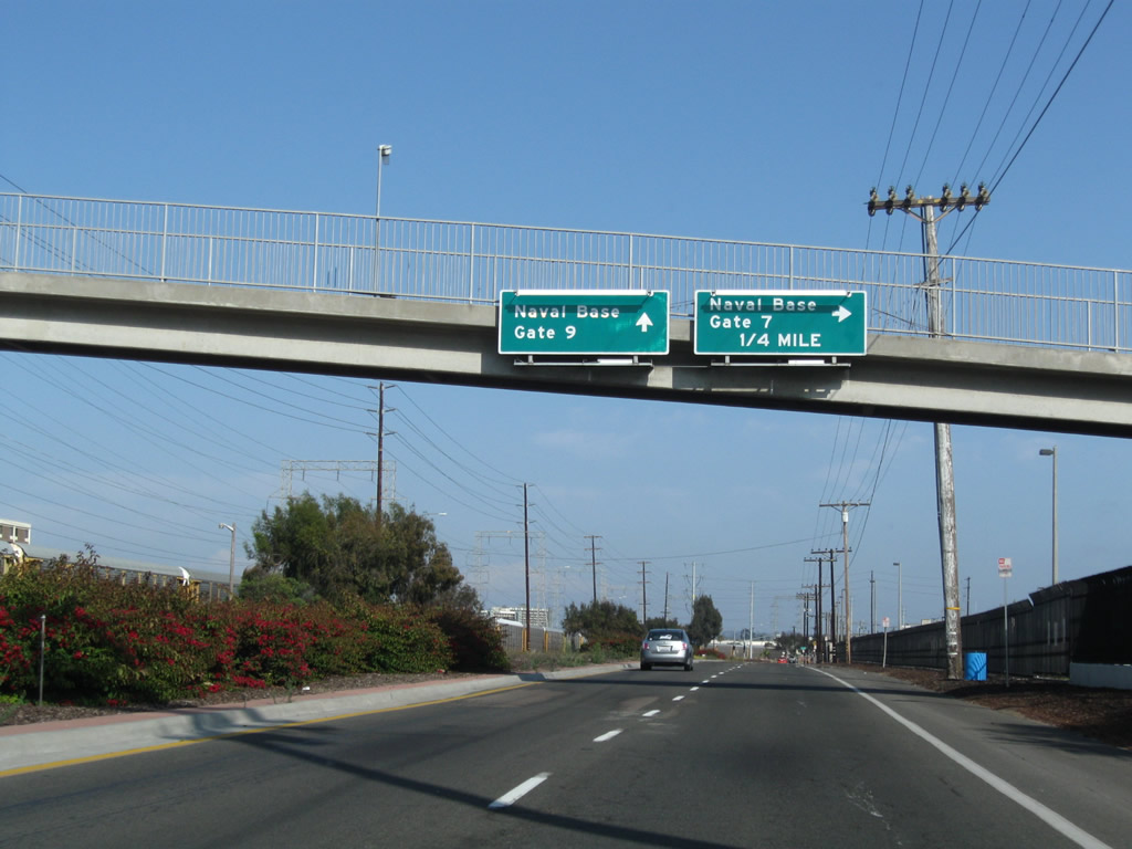
Continuing south, Harbor Drive (Historic U.S. 101) next approaches its intersection with 32nd Street. Turn right on 32nd Street south to the Naval Base San Diego (Gate 6), or turn left on 32nd Street north to California 15 north to Interstate 15. Photos taken 06/17/09, 02/19/05, and 06/20/11. |
|
Southbound Harbor Drive (Historic U.S. 101) (former Business Loop I-5) meets 32nd Street. Turn left here to connect to Interstate 15 (Escondido Freeway) north; turn right to enter the U.S. Naval Reservation San Diego. Photo taken 06/17/09. |
|
Another set of overheads points the way to Gate 7 (next right via Vesta Street) and Gate 9. Photo taken 06/17/09. |
|
|
|
Harbor Drive (Historic U.S. 101) next approaches Vesta Street. Photos taken 06/17/09 and 06/20/11. |
|
|
|
Shortly thereafter, Harbor Drive (Historic U.S. 101) leaves San Diego and enters National City. At the city limits, the pavement changes back to reveal the original concrete roadway. The next turnoff connects to Gate 9. Photos taken 06/17/09 and 06/20/11. |
|
|
|
Southbound Harbor Drive (Historic U.S. 101) approaches Eighth Street. Turn left here to follow Eighth Street east into downtown National City; continue south on Harbor Drive to Interstate 5 south. Photos taken 06/17/09 and 06/20/11. |
|
|
|
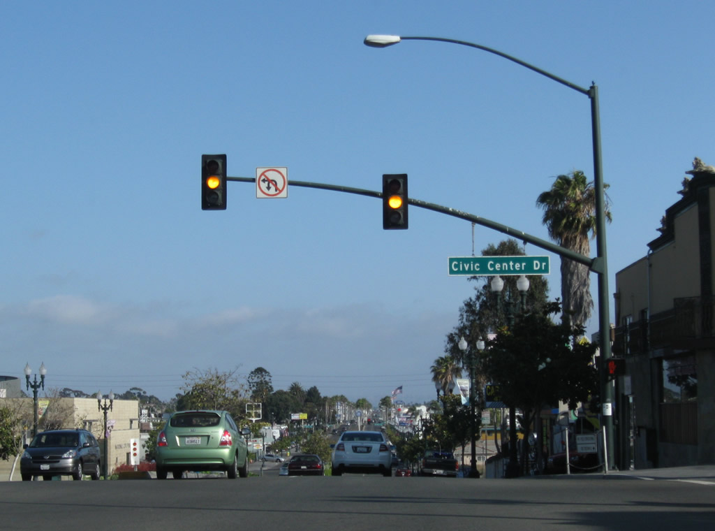
At Civic Center Drive, Harbor Drive is absorbed into Interstate 5 (Montgomery Freeway) south. However, this is not the end of Historic U.S. 101. To meet up with the National City Boulevard segment of old U.S. 101, follow Civic Center Drive east by turning left at this traffic signal. Photos taken 06/17/09 and 06/20/11. |
|
Traffic transitions from Harbor Drive south to Interstate 5 south. Photo taken 06/20/11. |
| U.S. 101/National City Boulevard south |
|
National City Boulevard begins at Interstate 5 and travels south through downtown National City. Part of the original alignment of U.S. 101, traffic along southbound U.S. 101 can follow the historic route from Main Street directly onto National City Boulevard. A later realignment moved U.S. 101 to Harbor Drive, and then U.S. 101 reconnected to National City Boulevard via 8th Street or Civic Center Drive. This sign is posted at the end of the loop off-ramp from Interstate 5 north to Exit 12. Traffic from southbound Osborn Street also merges just before meeting Division Street. Ahead, southbound National City Boulevard will proceed toward downtown National City. Photo taken 06/17/09. |
|
Southbound National City Boulevard meets Main Street and First Street. Main Street is the original alignment of U.S. 101 and travels northeast from here through Barrio Logan toward downtown San Diego. Photo taken 06/17/09. |
|
|
A Historic U.S. 101 sign is posted in front of the former Bay Theatre. This sign was in place in 2009 but gone by 2011. Note the theatre marquee, which at that time announced a church service in Spanish. Photos taken 06/17/09. |
|
Southbound National City Boulevard meets Fourth Street at this traffic signal. Photo taken 06/17/09. |
|
A few blocks later, southbound National City Boulevard enters downtown National City and passes between several high rise towers. The next traffic signal is with Eighth Street; turn right to connect to Harbor Drive (Historic U.S. 101) north or continue south on Historic U.S. 101/National City Boulevard. Photo taken 06/17/09. |
|
Southbound National City Boulevard meets Eighth Street. Photo taken 06/18/09. |
|
A colorful portal offers an unusual signalized pedestrian crossing. Photo taken 06/17/09. |
|
Southbound National City Boulevard meets Plaza Boulevard at this traffic signal. Photo taken 06/17/09. |
|
The next signalized intersection along National City Boulevard south is with 12th Street. Photo taken 06/17/09. |
|
Southbound National City Boulevard meets Civic Center Drive at this traffic signal. National city's Civic Center is on the east side of National City Boulevard; continue south toward the Mile of Cars and Chula Vista. Turn right (west) here to connect to the south end of Harbor Drive. Photo taken 06/17/09. |
|
This is a nice, expansive view looking south along National City Boulevard prior to 16th Street. Photo taken 06/17/09. |
|
Southbound U.S. 101/National City Boulevard meets 16th Street at this traffic signal. For awhile through the 1970s and 1980s, this stretch of National City Boulevard was designated Business Loop I-5. Photo taken 06/17/09. |
|
After the 18th Street intersection, southbound National City Boulevard enters the Mile of Cars ... the next mile is lined with car dealerships on both sides of old U.S. 101. Photo taken 06/17/09. |
|
|
|
|
|
| This series of pictures follows National City Boulevard through the Mile of Cars. Dealerships line both sides of the road. At the traffic signal with Mile of Cars Way (24th Street), turn right (west) to return to Interstate 5 (Montgomery Freeway). Photos taken 06/17/09. |
|
At the 26th Street intersection, another Historic U.S. 101 route marker is posted. Similar to the sign posted near the Bay Theatre, it reinforces the historic nature of National City Boulevard through the Mile of Cars. Photo taken 06/17/09. |
|
Southbound Historic U.S. 101/National City Boulevard approaches 30th Street in the Mile of Cars. Photo taken 06/17/09. |
|
National City Boulevard leaves the Mile of Cars just before the California 54 (Filipino-American Highway) (South Bay Freeway) interchange. Photo taken 06/17/09. |
|
There is no access from National City Boulevard south to California 54 west. After crossing the bridge, a right turn connects to a loop ramp to California 54 east. Photo taken 06/17/09. |
|
Southbound National City Boulevard crosses over both California 54 and the Sweetwater River on this long bridge. At the south end of the bridge, U.S. 101 leaves National City and enters Chula Vista. Photo taken 06/17/09. |
|
After crossing the bridge, National City Boulevard meets the loop ramp onto California 54 east. Photo taken 06/17/09. |
|
Southbound National City Boulevard meets 35th Street just before reaching the Sweetwater River overflow bridge. Photo taken 06/17/09. |
| U.S. 101/Broadway south |
|
After crossing the second bridge and reaching C Street, southbound National City Boulevard transitions directly onto Broadway. U.S. 101 leaves National City and enters the city of Chula Vista. Photo taken 06/17/09. |
|
Southbound U.S. 101/Broadway approaches D Street in Chula Vista. Photo taken 06/17/09. |
|
Soon thereafter, southbound Broadway approaches Flower Street. Photo taken 06/17/09. |
|
And shortly thereafter, Broadway meets San Diego County S-17/E Street. Turn left to follow S-17 to Bonita and Spring Valley or right to follow S-17 to Interstate 5. Photo taken 06/17/09. |
|
This view looks south along Broadway between F Street and G Street in Chula Vista. Photo taken 06/18/09. |
|
Southbound Broadway approaches H Street near the Chula Vista Center shopping mall. Photo taken 06/18/09. |
|
One block south is this intersection with I Street. Photo taken 06/18/09. |
|
Several blocks south, Broadway approaches and meets Palomar Street. Photo taken 06/18/09. |
|
|
|
A set of San Diego Gas & Electric power lines cross over Broadway near Palomar Street. The monopole tower carries electricity at 230kV, while the steel lattice tower carries electricity at 138kV. Photos taken 06/18/09. |
|
Southbound U.S. 101/Broadway proceeds south after the Palomar Street intersection in Chula Vista. Photo taken 06/18/09. |
|
Soon thereafter, U.S. 101/Broadway south approaches Anita Street. Photo taken 06/18/09. |
|
The next major intersection along U.S. 101/Broadway south is with Main Street. Photo taken 06/18/09. |
|
Southbound U.S. 101/Broadway enters Otay Valley Regional Park and approaches the city limits between Chula Vista and San Diego. Although U.S. 101 already passed through central and northern San Diego, it reenters San Diego's southern tier upon crossing the Otay River. Photo taken 06/18/09. |
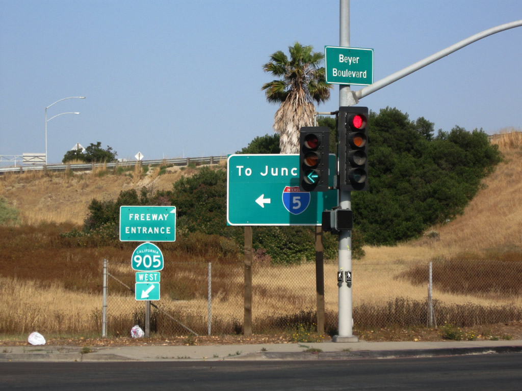
| U.S. 101/Beyer Boulevard south |
|
Leaving Chula Vista and reentering San Diego, U.S. 101 changes names from Broadway to Beyer Boulevard. From here, U.S. 101 will proceed south along Beyer Boulevard, intersecting California 905/Otay Mesa Freeway before entering San Ysidro near the international border with Mexico. The border serves as the southern terminus of U.S. 101. Ahead is the community of Otay-Nestor. Photo taken 06/18/09. |
|
This signal allows pedestrian, equestrians, and bicyclists to cross Beyer Boulevard via the Otay Valley Regional Park trail. A ranger station for the park and trailahead are ahead on the right. Photo taken 06/18/09. |
|
Leaving Otay Valley Regional Park, southbound U.S. 101/Beyer Boulevard meets Palm Avenue. Turn right here for Palm Avenue west to California 75 to Imperial Beach and the Silver Strand. Photo taken 06/18/09. |
|
|
|
South of Palm Avenue, Beyer Boulevard proceeds south along the western edge of Montgomery Waller Community Park. This park is dedicated to aviation pioneer John J. Montgomery, and a larger airplane wing (mounted vertically) near the recreation center is visible from Beyer Boulevard. The hill in the distance is in Tijuana, Baja California, Mexico, which creates a true international view for southbound travelers on U.S. 101. Photos taken 06/18/09. |
|
Southbound U.S. 101/Beyer Boulevard approaches Coronado Avenue (not shown), then meets Del Sol Boulevard. Photo taken 06/18/09. |
|
Houses line both sides of U.S. 101/Beyer Boulevard south of Del Sol Boulevard in Otay-Nestor. Photo taken 06/18/09. |
|
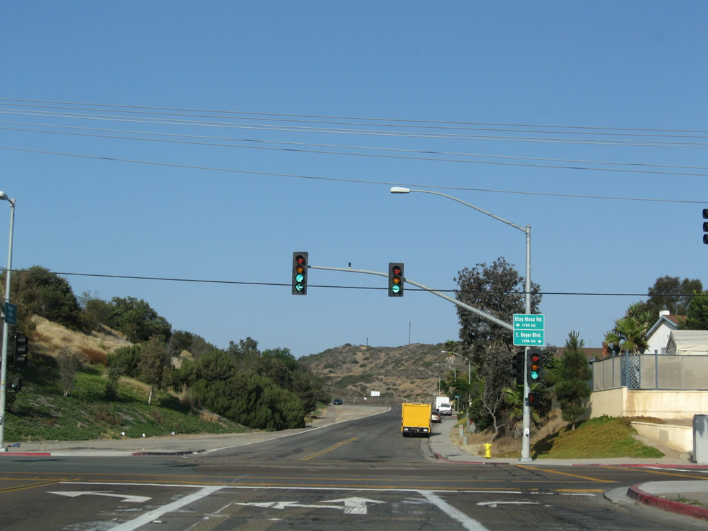
Southbound U.S. 101/Beyer Boulevard next approaches the interchange with California 905 (Future Interstate 905). At this interchange, turn left at the first traffic signal to connect to California 905 west to Interstate 5 north/south and Tocayo Drive. Photo taken 06/18/09. |
|
|
|
The next left turn connects Beyer Boulevard south with California 905 west. After this signal, Beyer Boulevard passes under California 905. Photos taken 06/18/09. |
|
|
|
Southbound U.S. 101/Beyer Boulevard next approaches Dairy Mart Road. Turn left here to connect to California 905 east to Interstate 805 north/south and the Otay Mesa Port of Entry/Border Crossing. The San Diego Trolley and the railroad parallel Beyer Boulevard on the west side; we last saw the trolley in close proximity along Harbor Drive in the Barrio Logan community of San Diego. Photos taken 06/18/09. |
|
Southbound U.S. 101/Beyer Boulevard meets Del Sur Boulevard. Photo taken 06/18/09. |
|
Continuing south, U.S. 101/Beyer Boulevard approaches Smythe Avenue. Photo taken 06/18/09. |
|
Curving east, southbound U.S. 101/Beyer Boulevard meets Caminito de los Ni-os. Photo taken 06/18/09. |
|
At the next intersection, U.S. 101/Beyer Boulevard meets West Park. Turn right to follow former U.S. 101 Business into the San Ysidro central business district or continue straight ahead for the bypass route via Beyer Boulevard and East Beyer Boulevard. Photo taken 06/18/09. |
|
Southbound U.S. 101/Beyer Boulevard meets West Park. Photo taken 06/18/09. |
|
U.S. 101/Beyer Boulevard crosses over Interstate 805. After this bridge, stay right for the continuation of U.S. 101/East Beyer Boulevard. Photo taken 06/18/09. |
|
Immediately thereafter, Beyer Boulevard meets Old Otay Mesa Road and East Beyer Boulevard. Turn right (south) on East Beyer Boulevard to continue along Historic U.S. 101. Turn left to follow Old Otay Mesa Road to Otay Mesa and California 905 east. Photo taken 06/18/09. |
|
|
|
This series of pictures follows East Beyer Boulevard (Historic U.S. 101) as it proceeds south. It avoids the central business district and will connect directly with Camino de la Plaza. Photos taken 06/18/09. |
|
|
|
U.S. 101/East Beyer Boulevard continues south through a residential area in San Ysidro. Photos taken 06/18/09. |
|
|
|
|
|
| The San Diego Trolley parallels U.S. 101/East Beyer Boulevard on the east side as it continues toward the United States-Mexico border. Some parking areas are located along the road we approach the intersection with San Ysidro Boulevard and Camino de la Plaza. Photos taken 06/18/09. |
|
East Beyer Boulevard meets Camino de la Plaza (continue straight ahead) and San Ysidro Boulevard (turn left or right). Turn left here for U.S. 101/San Ysidro Boulevard south to the former southern terminus of U.S. 101. Continue straight along Camino de la Plaza to the vehicle crossing via Interstate 5 south. More parking is available via Camino de la Plaza for pedestrians wishing to cross into Mexico. Photo taken 06/18/09. |
| U.S. 101 Business/San Ysidro Boulevard south |
|
Now looking at San Ysidro Boulevard, we pass through the San Ysidro business district and avoids the bypass route along Beyer Boulevard. Photo taken 06/17/09. |
|
The colorful cars of the San Diego Trolley come into view as we come closer to the border. Photo taken 06/17/09. |
|
This sign welcomes visitors to San Ysidro ("Commerce without Borders"). Photo taken 06/17/09. |
|
Southbound San Ysidro Boulevard approaches East Beyer Boulevard and Camino de la Plaza. Historic U.S. 101's mainline merges with San Ysidro Boulevard, and the historic route will proceed south on San Ysidro Boulevard for the final distance to the international border. Turn right on Camino de la Plaza west to Interstate 5 south to the international border. Photo taken 06/17/09. |
|
Reaching East Beyer Boulevard and Camino de la Plaza, Historic U.S. 101 turns from East Beyer Boulevard onto San Ysidro Boulevard south. U.S. 101 will proceed south just for a short distance, until we meet the international border. Photo taken 06/17/09. |
| U.S. 101/San Ysidro Boulevard south |
|
U.S. 101 follows San Ysidro Boulevard briefly before meeting the on-ramp to Interstate 5 and Interstate 805 north (next right). After this intersection, San Ysidro Boulevard will meet a cul-de-sac representing the end of the line for it and U.S. 101. Photo taken 06/17/09. |
|
U.S. 101 reaches its southern terminus upon at its approach to the United State-Mexico International Border. Unlike Interstate 5, with offers a portal into Mexico, Historic U.S. 101 ends here at a cul-de-sac. Through traffic to Mexico should use Camino de la Plaza west to Interstate 5 south to cross into Mexico or park in the lots and walk across the border. Ahead, a right turn connects to Interstate 5 and Interstate 805 north. The San Diego Trolley also terminates here, as it does not extend all the way to downtown Tijuana. All southbound traffic (pedestrian and vehicular) must pass through the Port of Entry. No end sign is posted for the southern terminus of Historic U.S. 101. Photo taken 06/17/09. |
| U.S. 101: National City Overhead |
|
An elevated walkway connects two high rise buildings above Eighth Street in downtown National City next to National City Boulevard (former U.S. 101). Photo taken 06/17/09. |
|
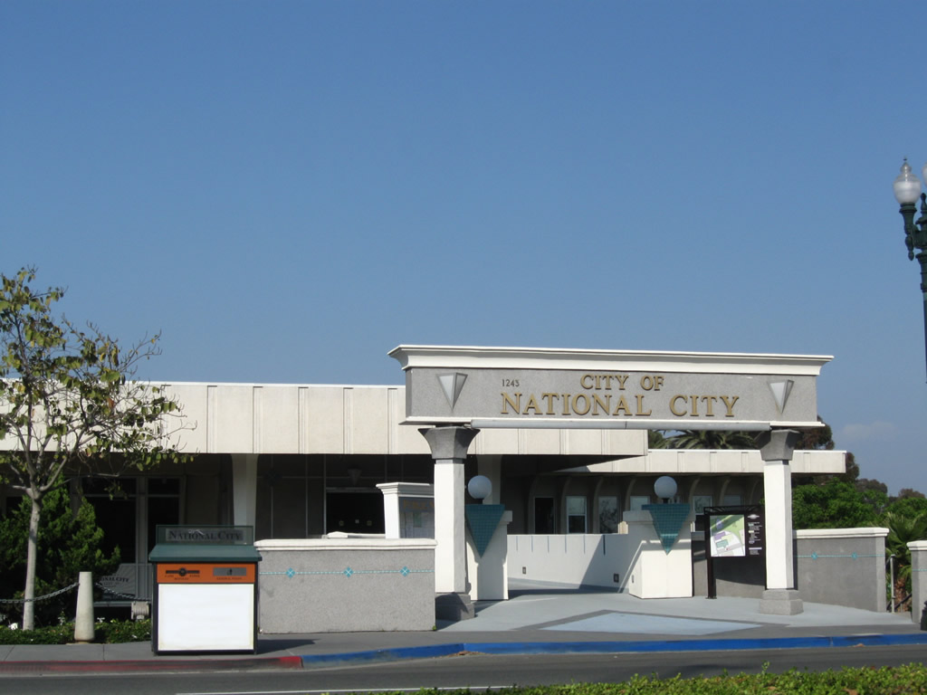
The National City Civic Center is located on the east side of National City Boulevard near the Civic Center Drive intersection. Photo taken 06/17/09. |
Page Updated July 20, 2011.